Total Days: 6 1/2
Total Kilometres: 90 kilometres
Total Portages: 20
Total Portage Length: 15.460 kilometres
Longest Portage: 3.570 kilometres (along the Little Madawaska River between Philip Lake and Radiant Lake)
Average Daytime High: 16.9 degrees Celsius
Average Nighttime Low: 4.1 degrees Celsius
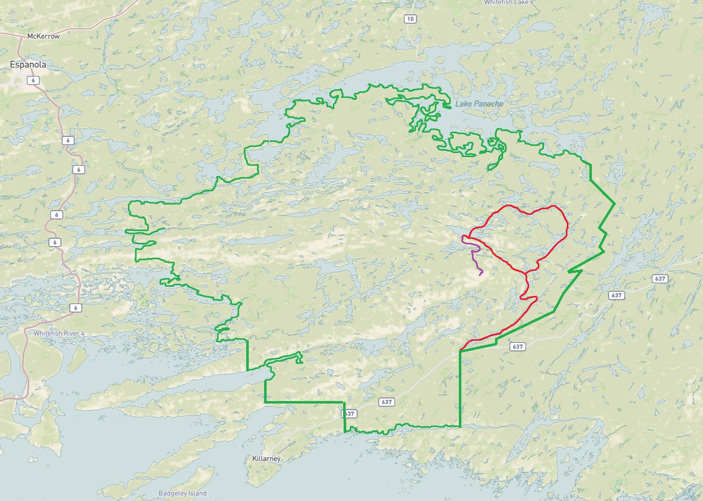
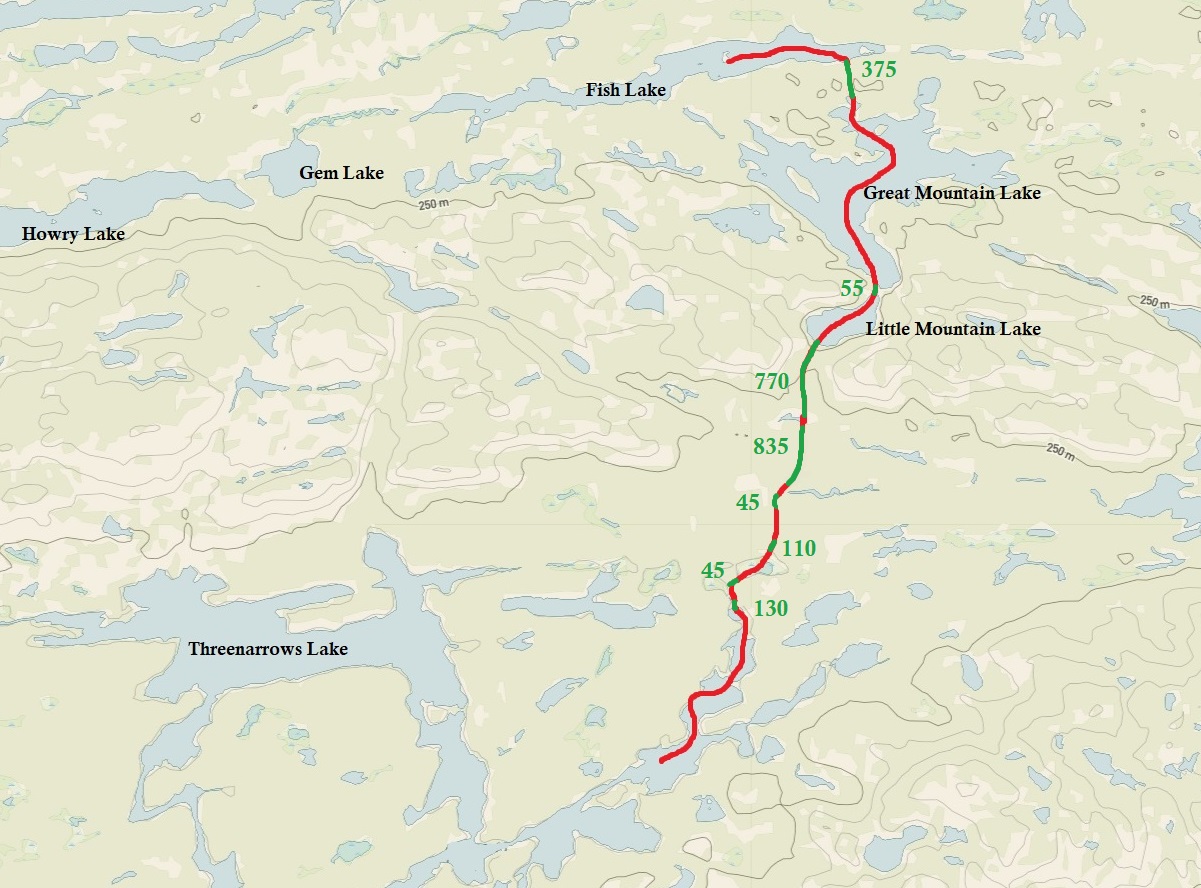
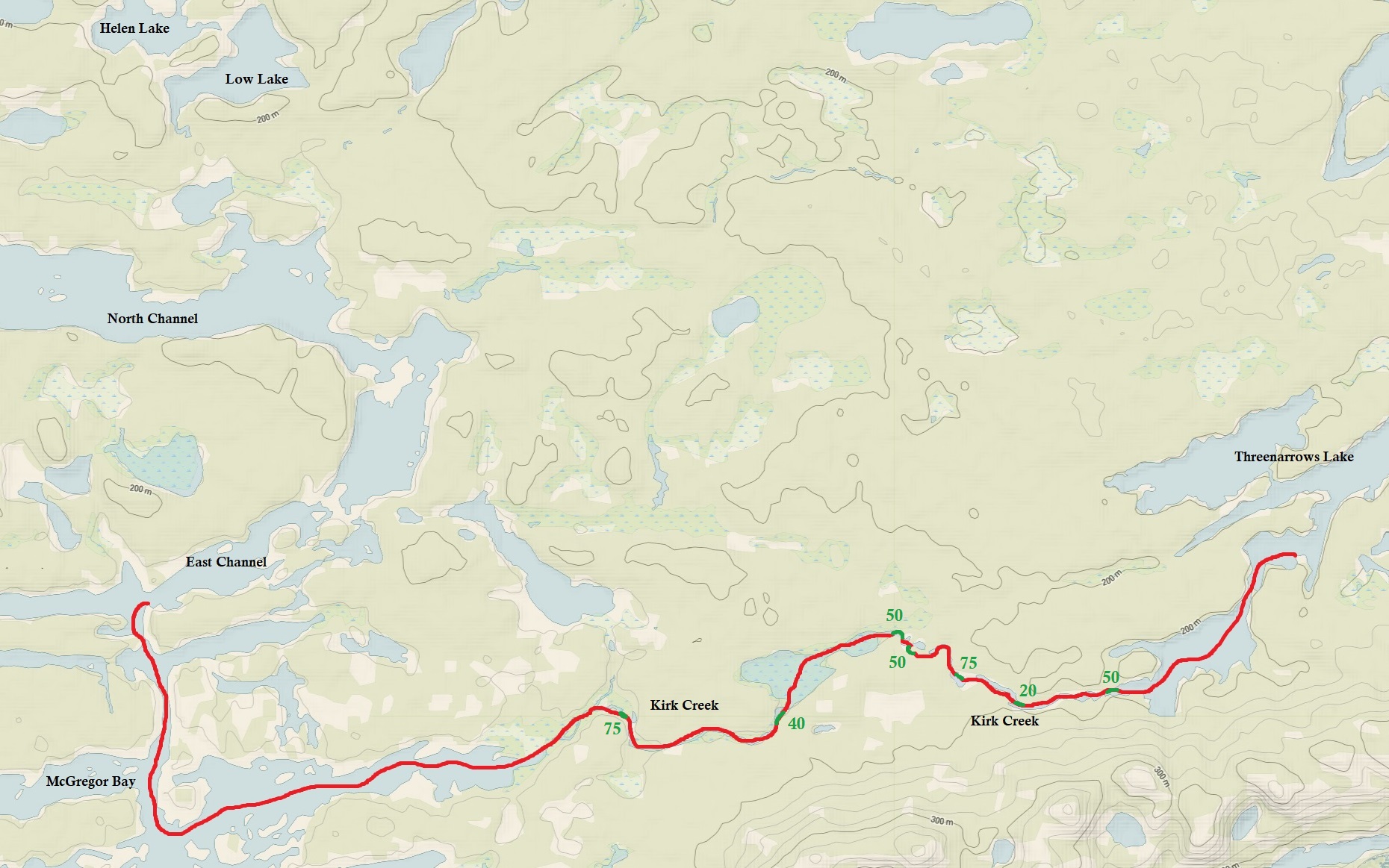
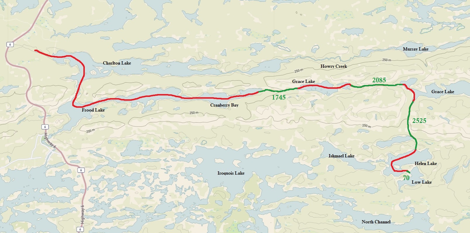
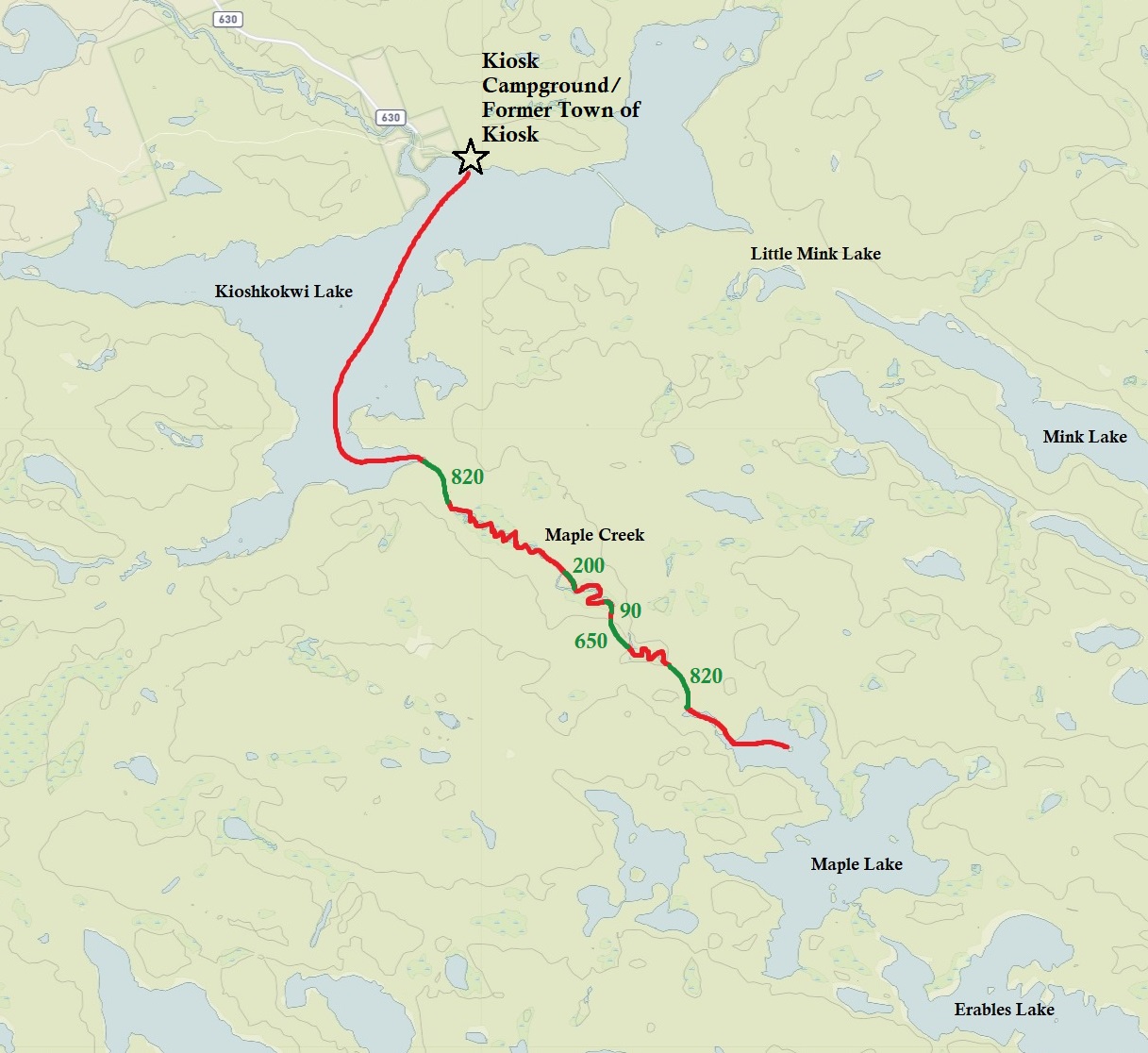
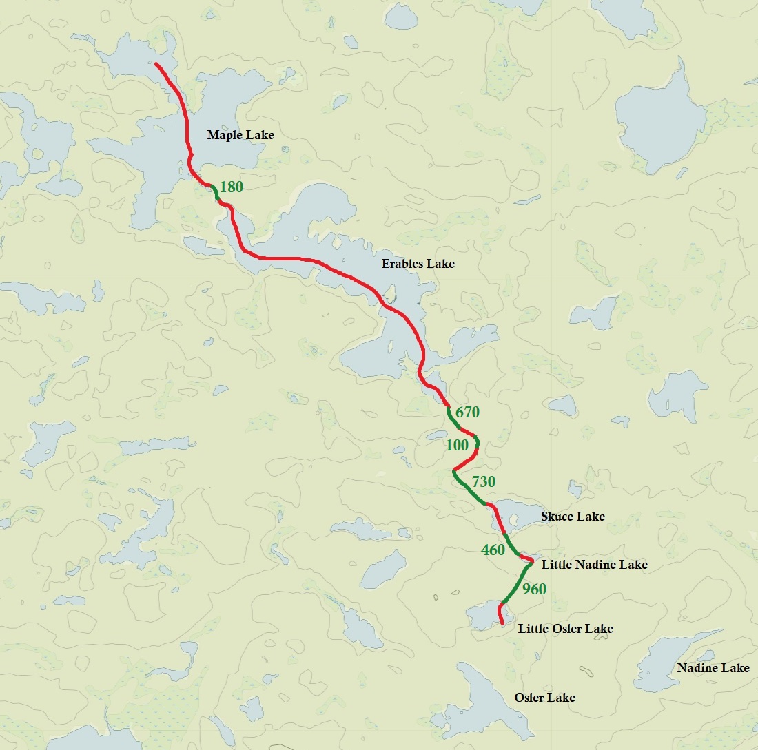
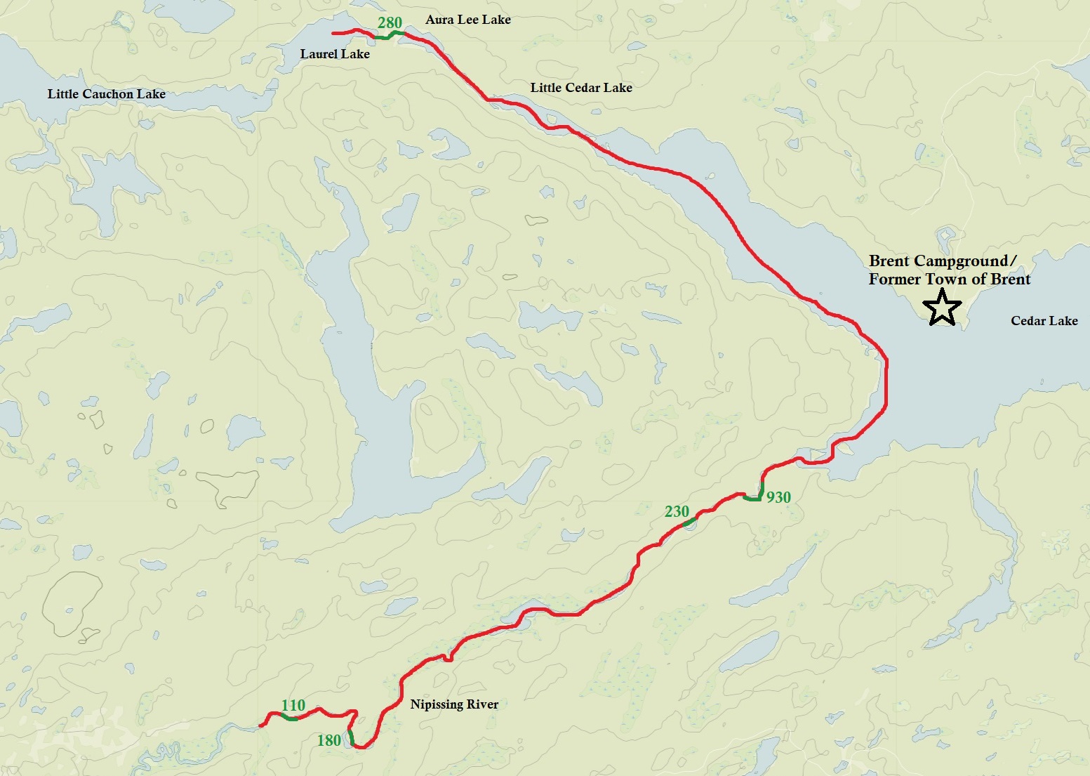
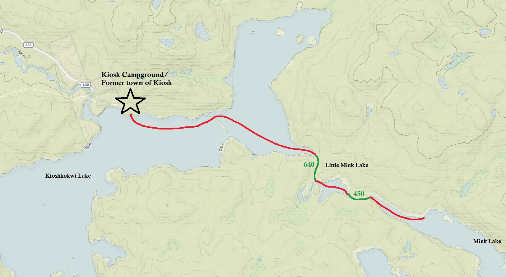
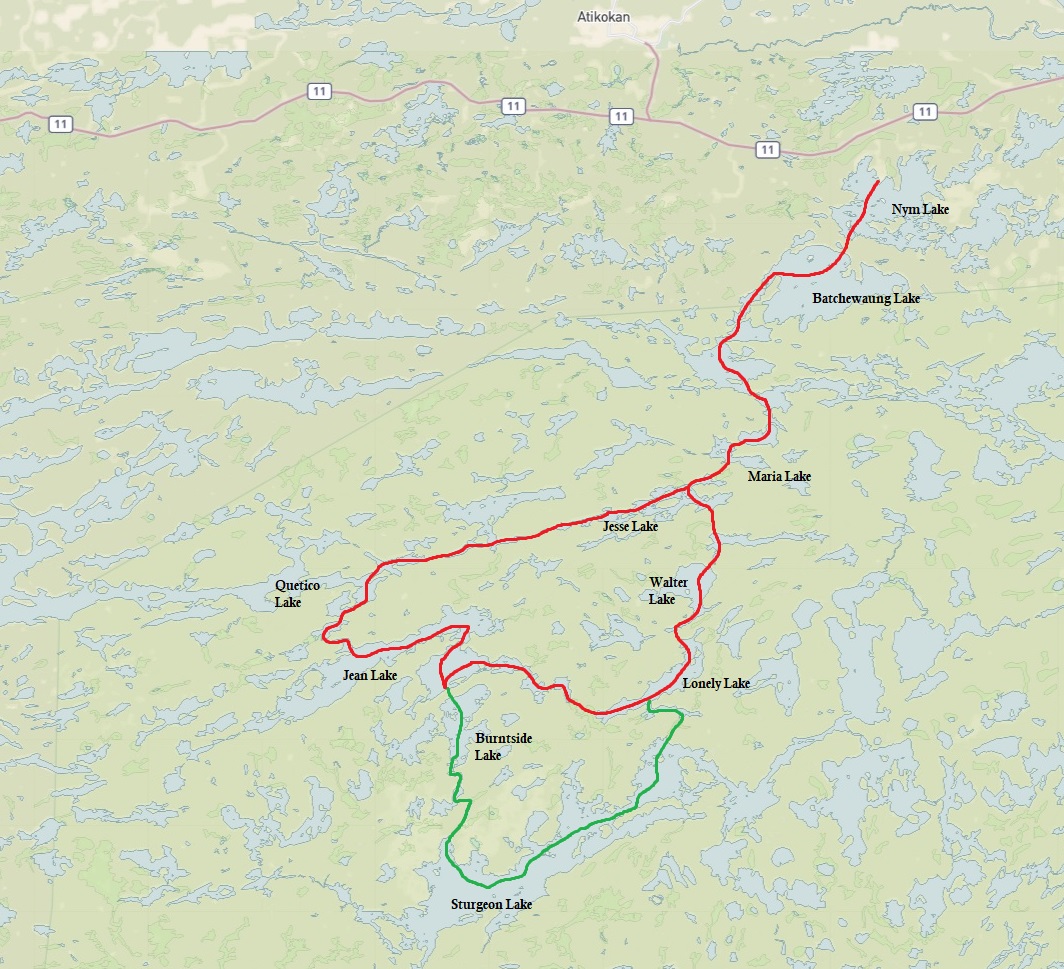
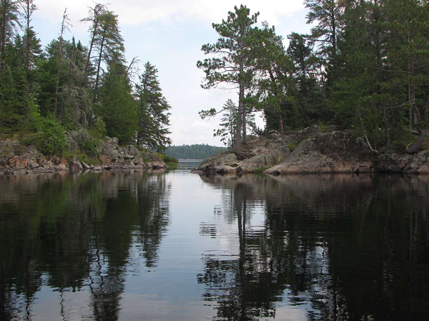
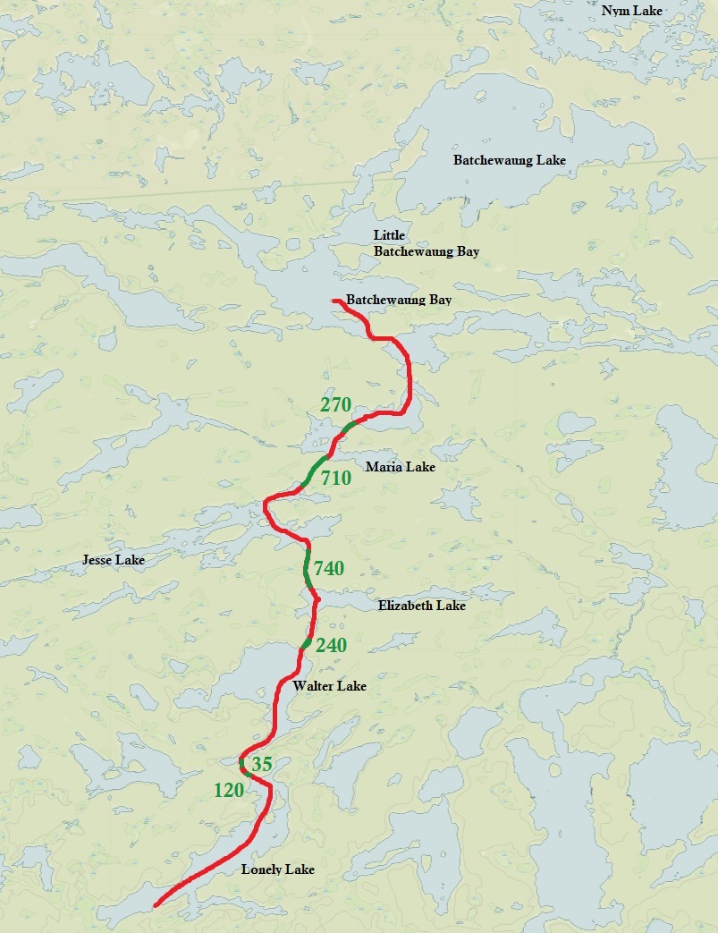
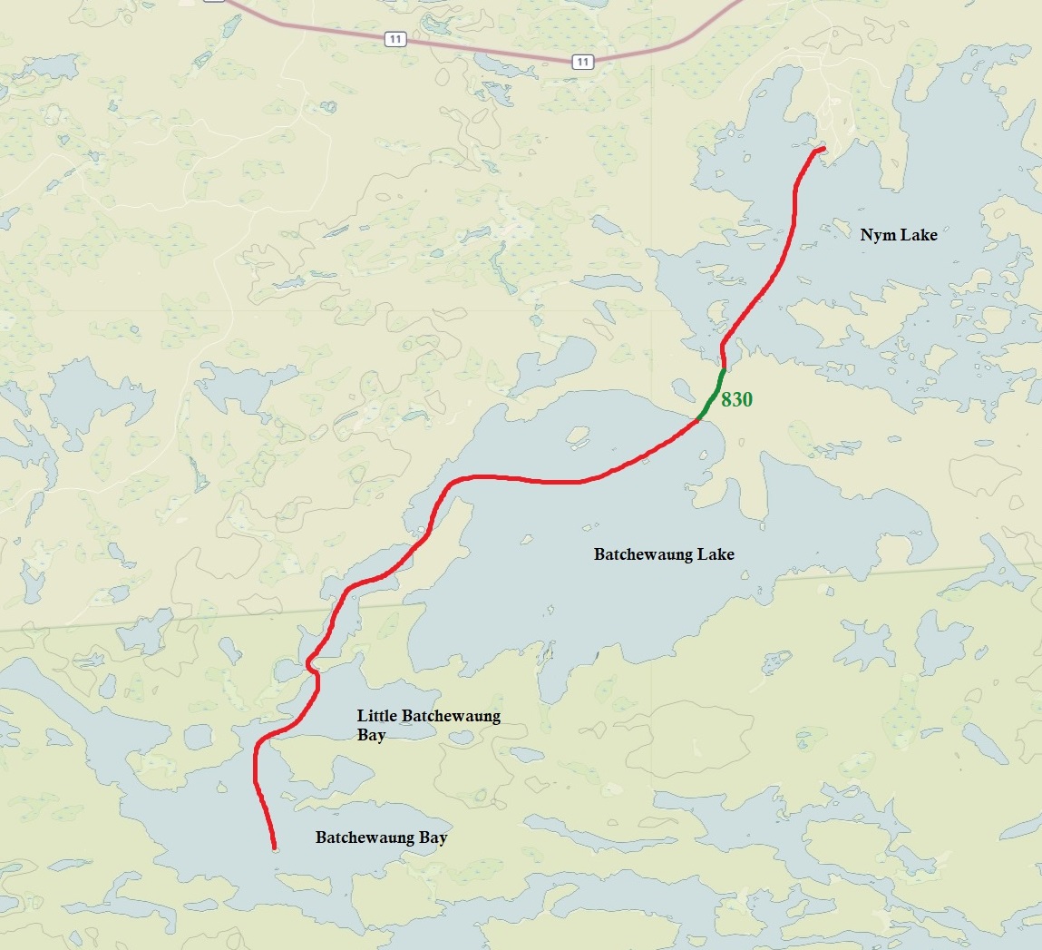
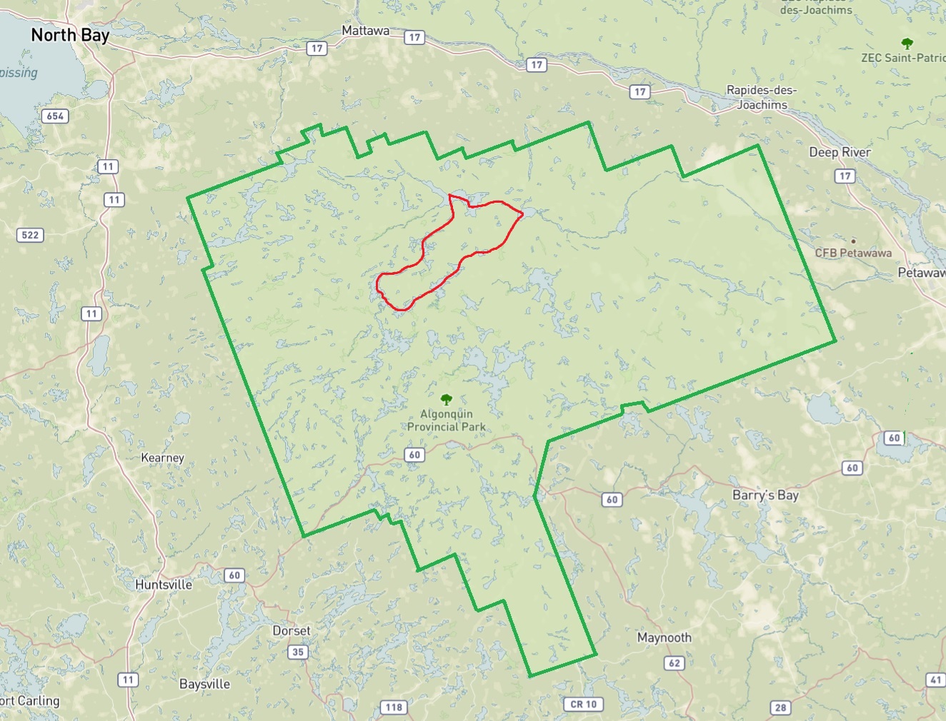
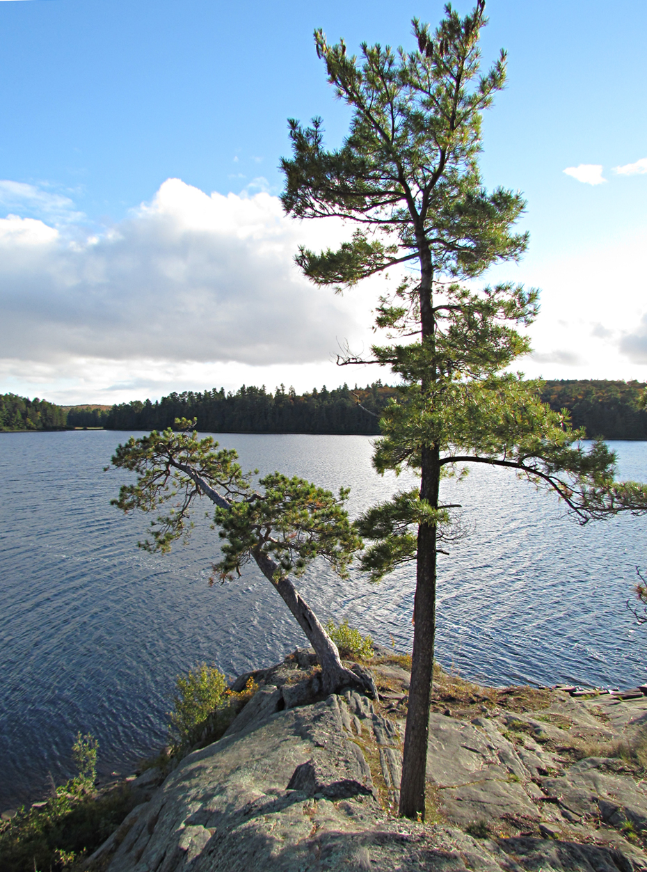
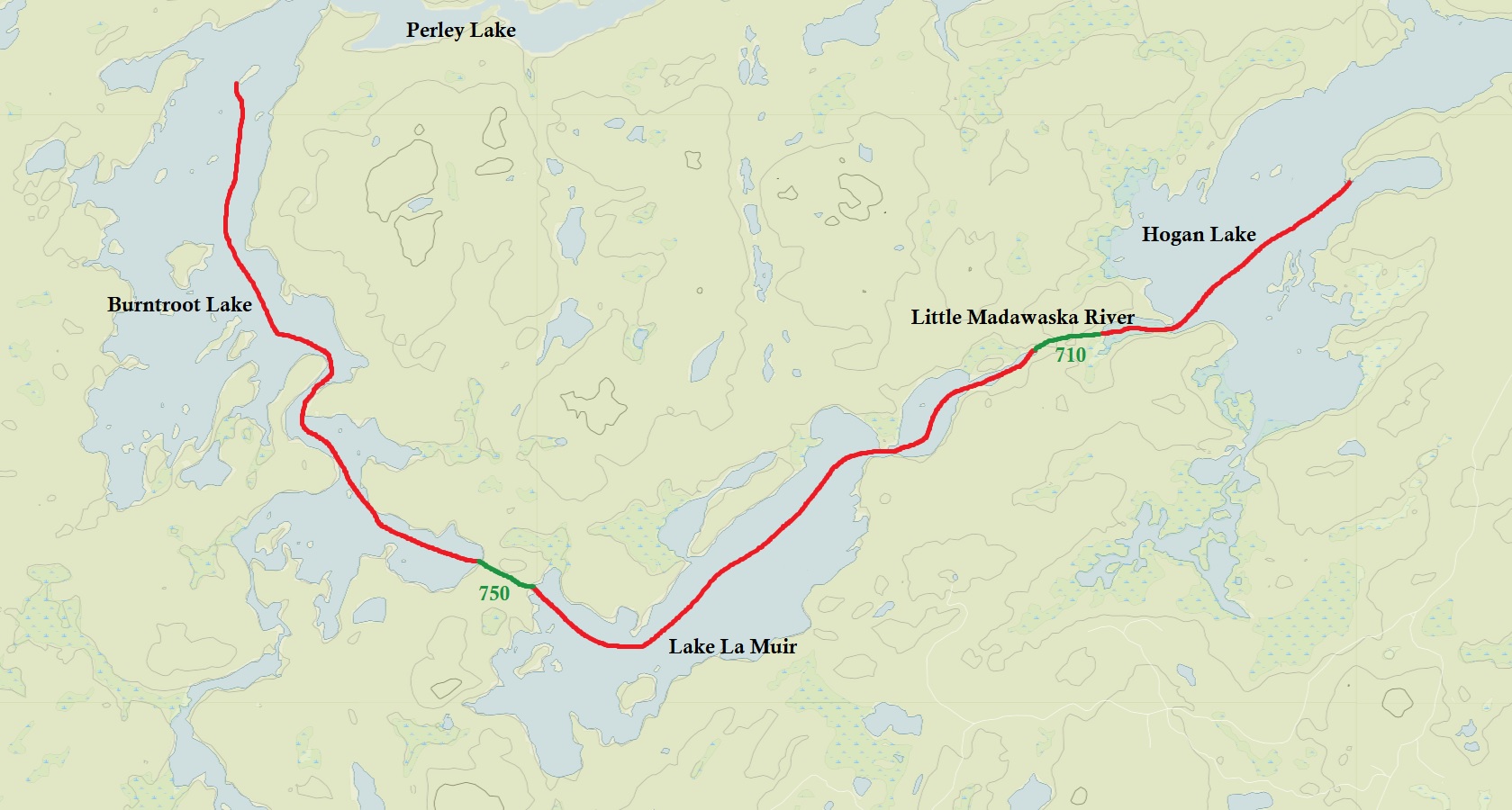
Route: Cedar Lake – Petawawa River – Narrowbag River – Catfish Lake – Petawawa River – Perley Lake – Burntroot Lake – Red Pine Bay – Lake la Muir – Little Madawaska River – Hogan Lake – Parks Bay – Little Madawaska River – Philip Lake – Little Madawaska River – Radiant Lake – Petawawa River – Cedar Lake
Maps Used: Chrismar Algonquin 1 (Corridor North), Algonquin 2 (Northwest), Algonquin 4 (Central North). Friends of Algonquin Park Algonquin Canoe Routes (2012-2013)
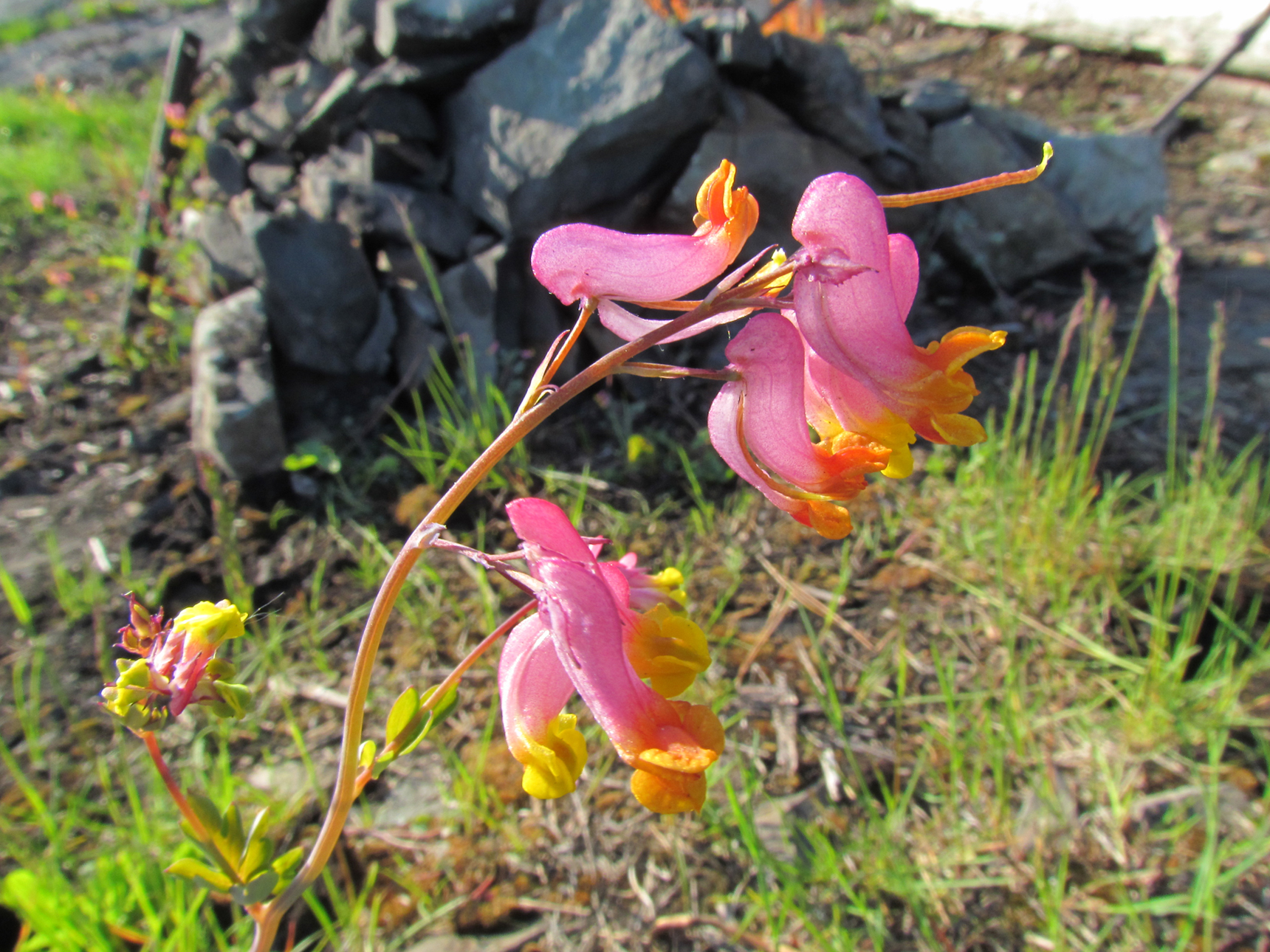
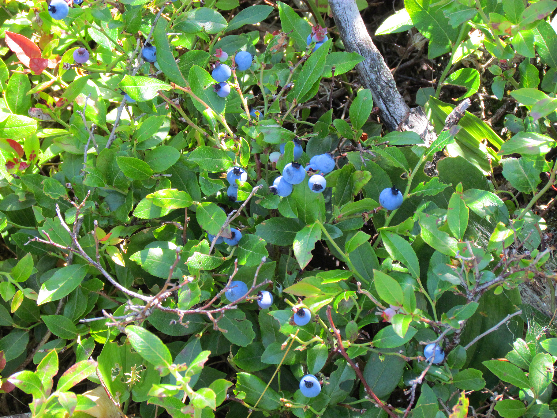
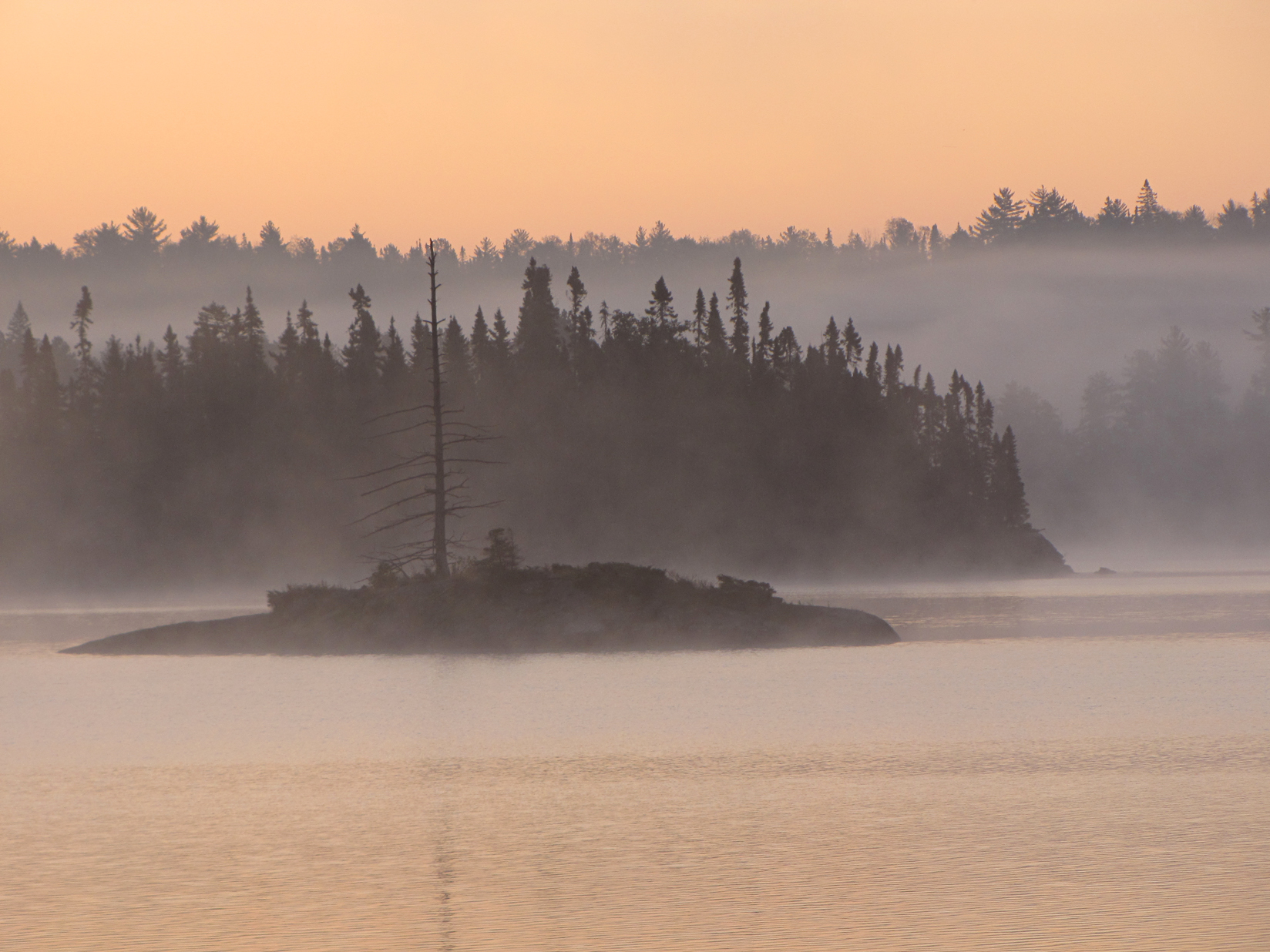
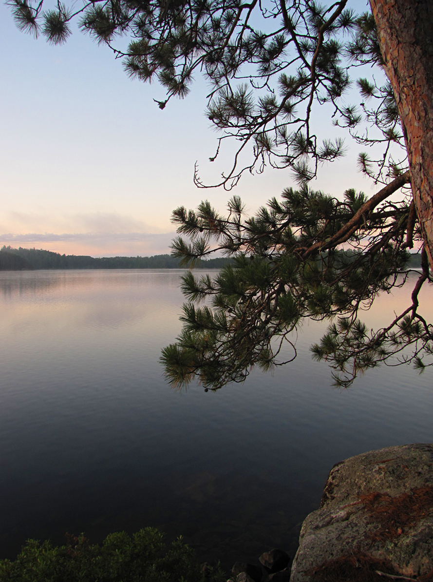
For us, fall camping is definitely where it’s at! Cooler days, cooler nights, fewer bugs, fewer people, beautiful fall colours….what more could you ask for? Sure you may have some mornings with frost, and the chance for rain increases, but the pros totally outweigh the cons.
To make up for our lousy spring camping trip we decided to return to Algonquin Provincial Park’s north end, far away from the park’s main highway that has the most canoe traffic. We paddled a loop known as the “Hogan Lake Loop”, adding a few extra lakes including Philip Lake and Radiant Lake.
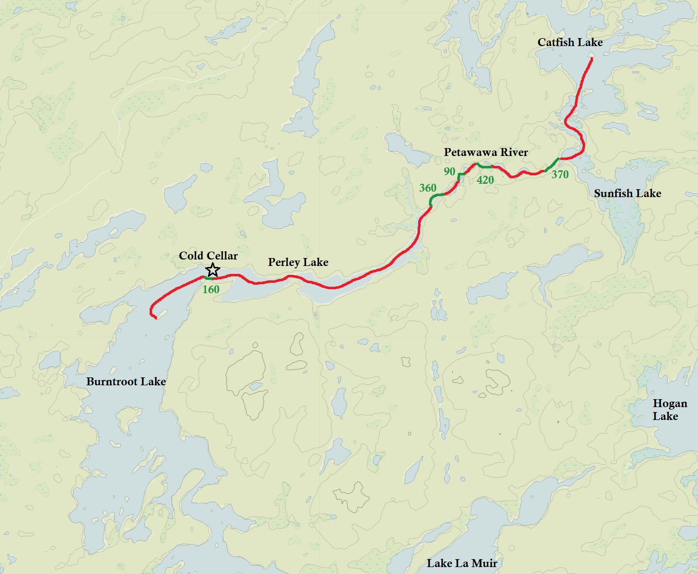
DAY # 1: Brent Campground
Weather: Rain. High: 15 C Low: 6 C
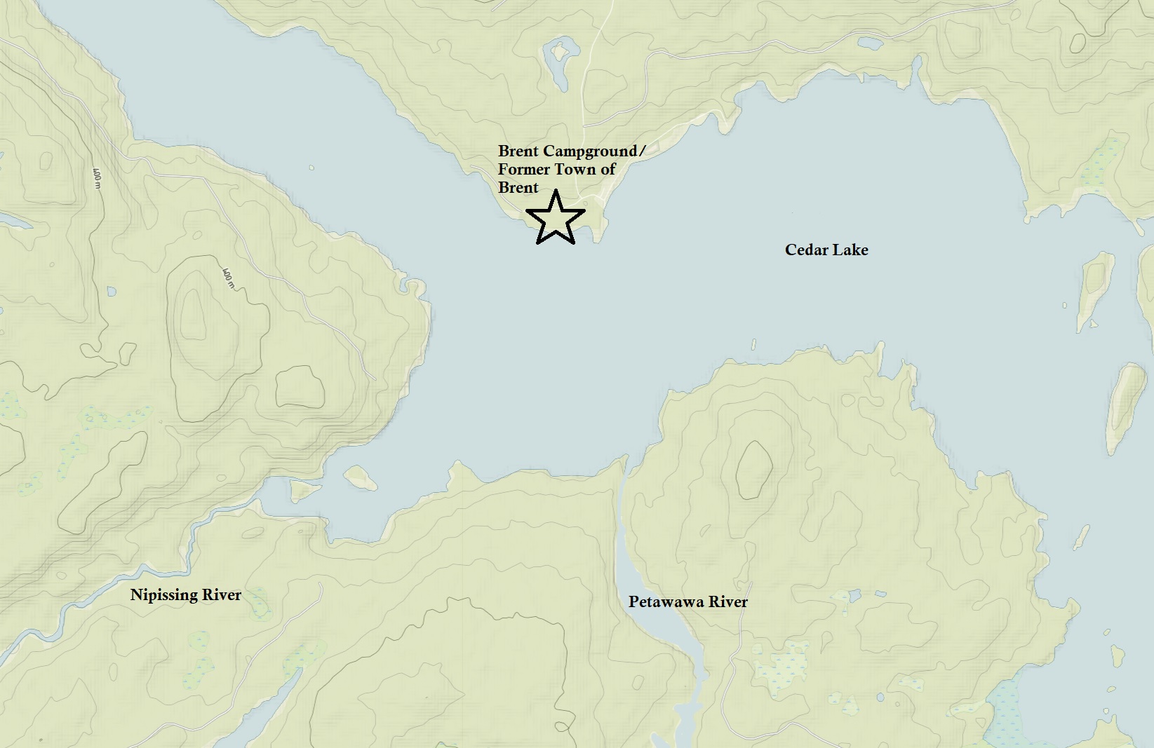
After exploring the town of Huntsville in the light rain, we drove north and then east onto highway 17, eventually turning south down the 40 kilometre stretch of gravel road known as the Brent Road. The road is known to be a washboard, though our drive wasn’t bad at all. Today the now ghost town of Brent has a store run by the Algonquin Outfitters, some cottages, a small campground, and a launch. The former Canadian Northern Railway/Canadian National Railway once passed through Brent, though the train has not gone though since 1995 and the track is now gone. Construction of the railway began in 1912, completed in 1915, and stretched 130 kilometres through the park’s interior. The town of Brent, one of the stations along the rail line, was an overnight stop and divisional point on the CNR. As the years went on after the construction of the railway, Brent’s population increased with added homes, a post office, bunkhouses for those that worked for the rail, a restaurant, general store, and even a school at one point. At it’s heyday generators supplied the town with power, but today what’s left is no longer connected to the power grid, with no cellphone service either.
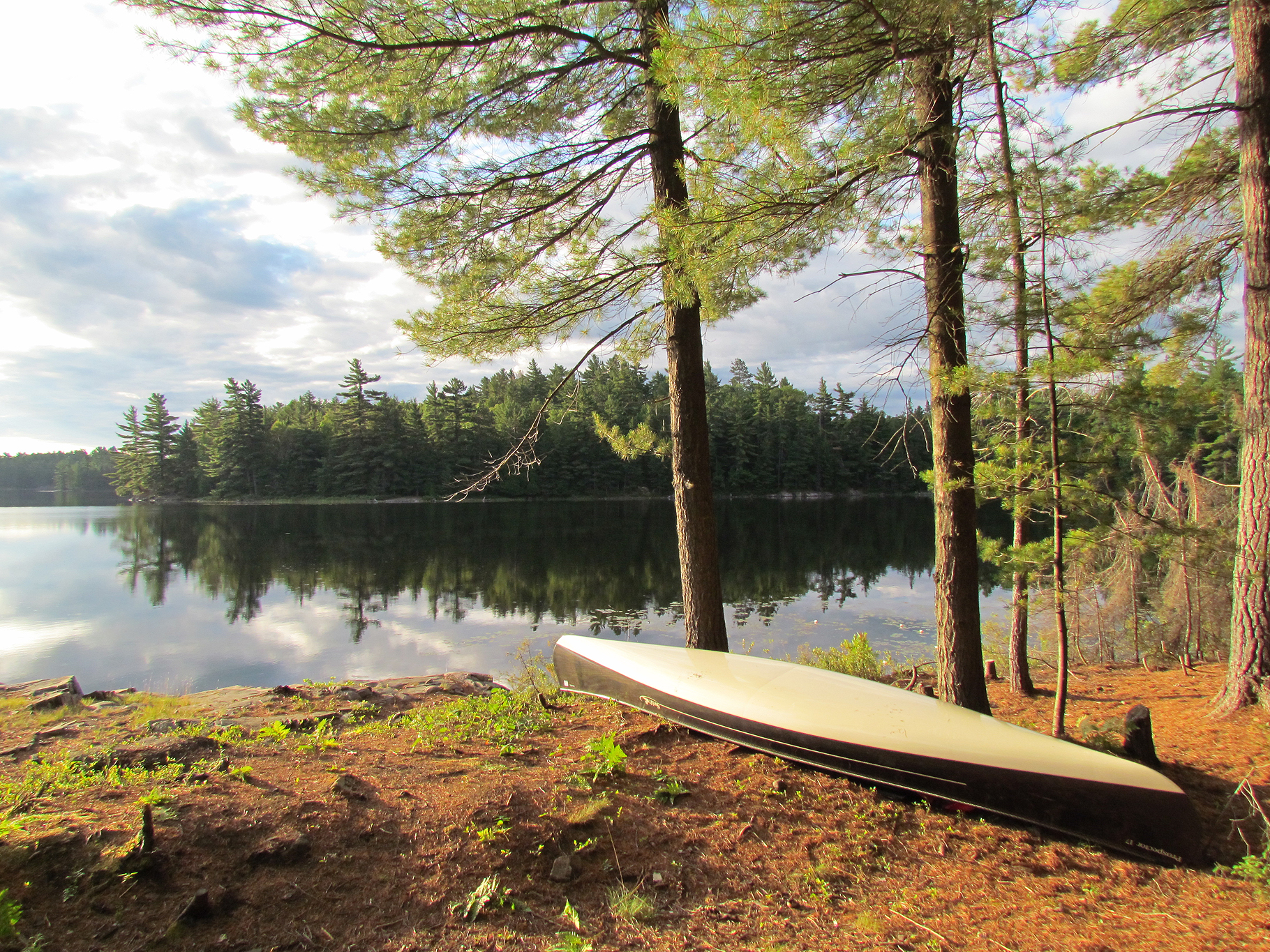
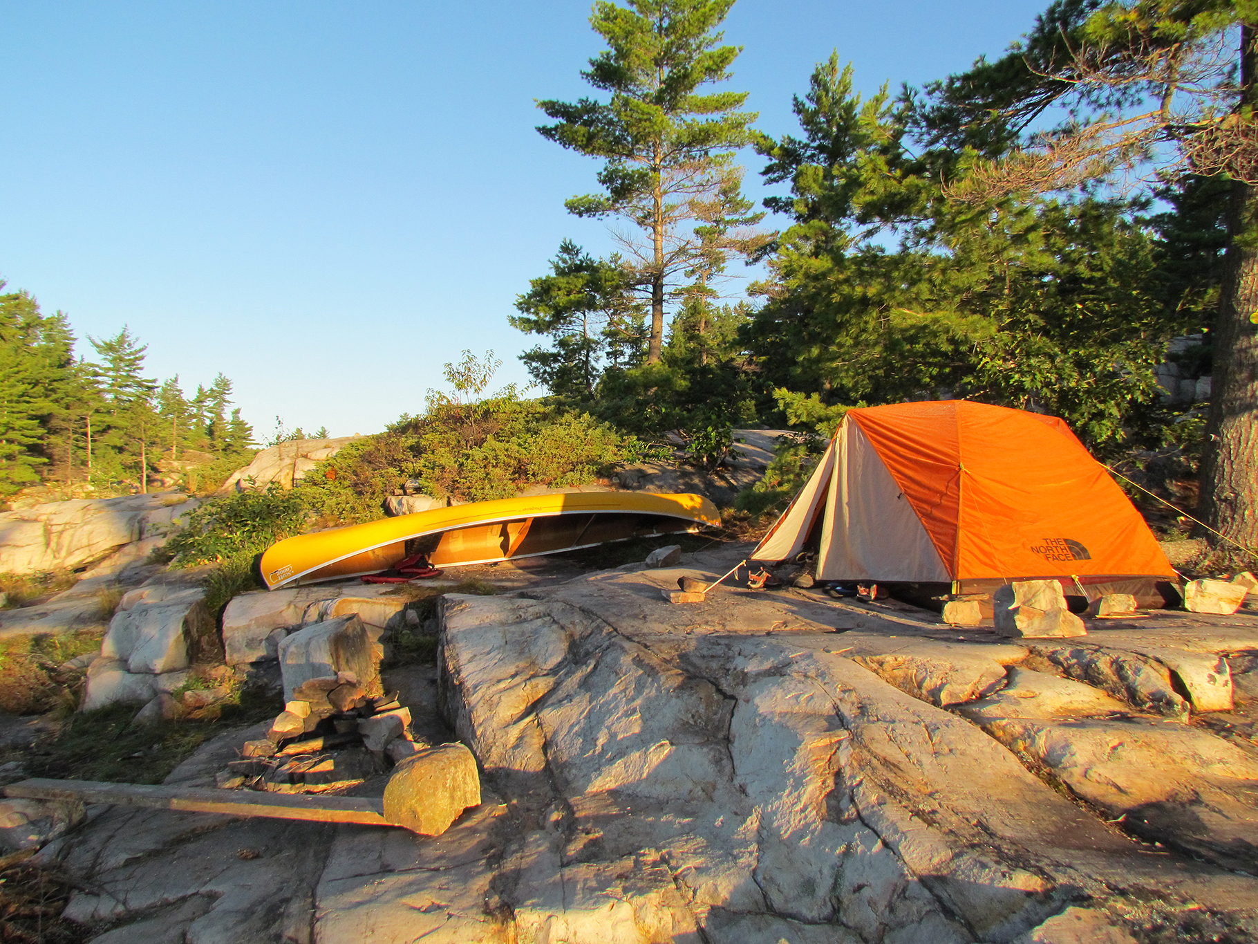
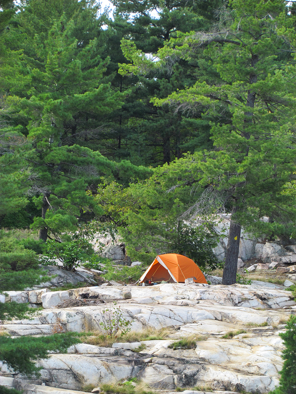
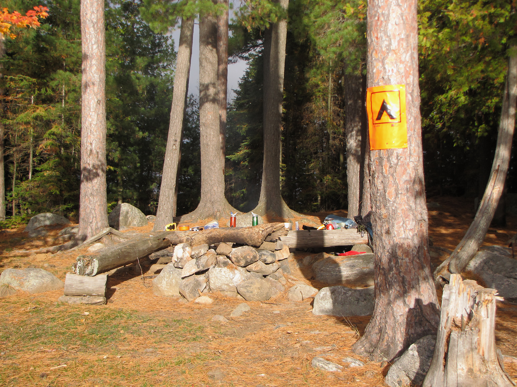
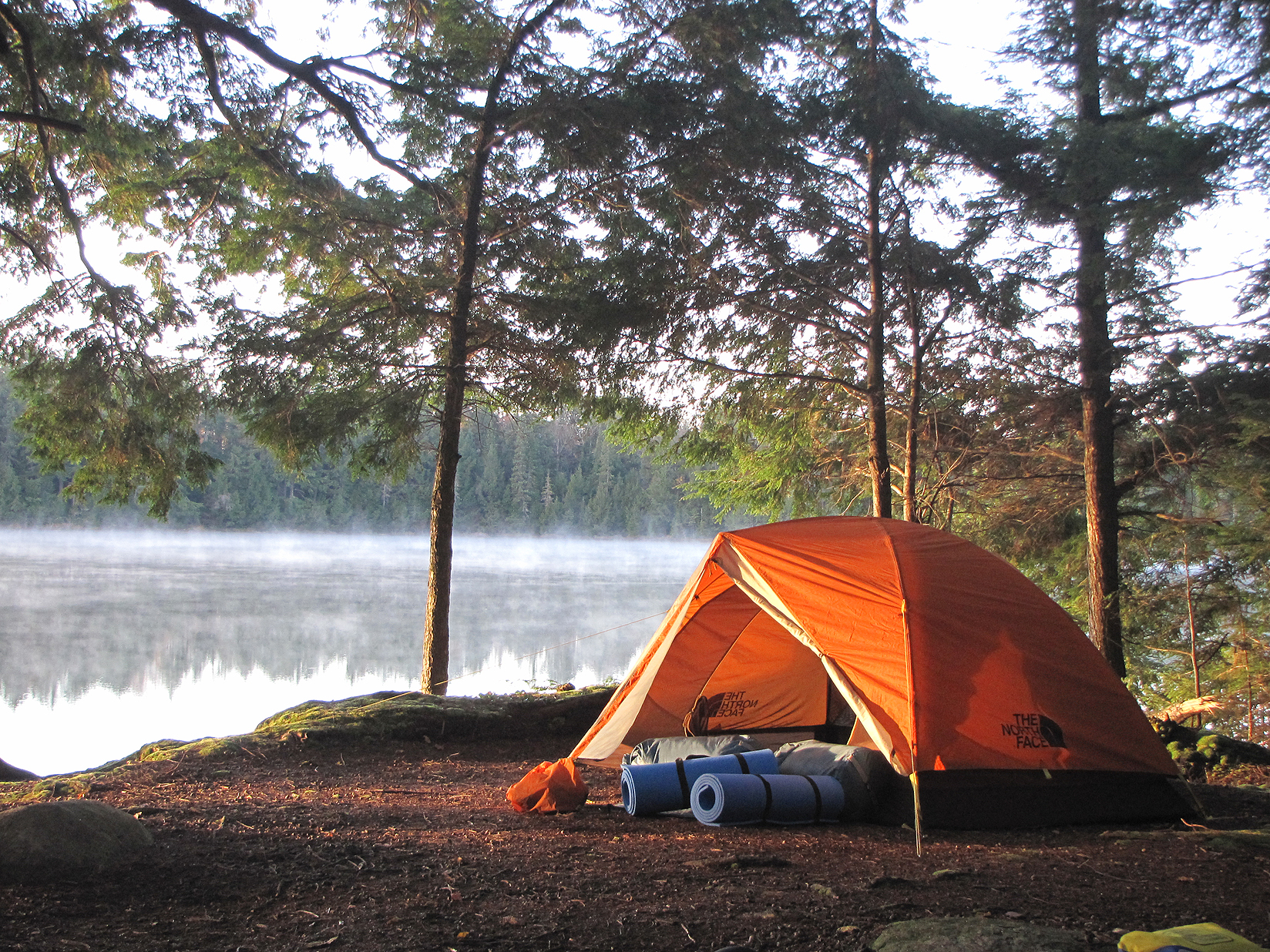
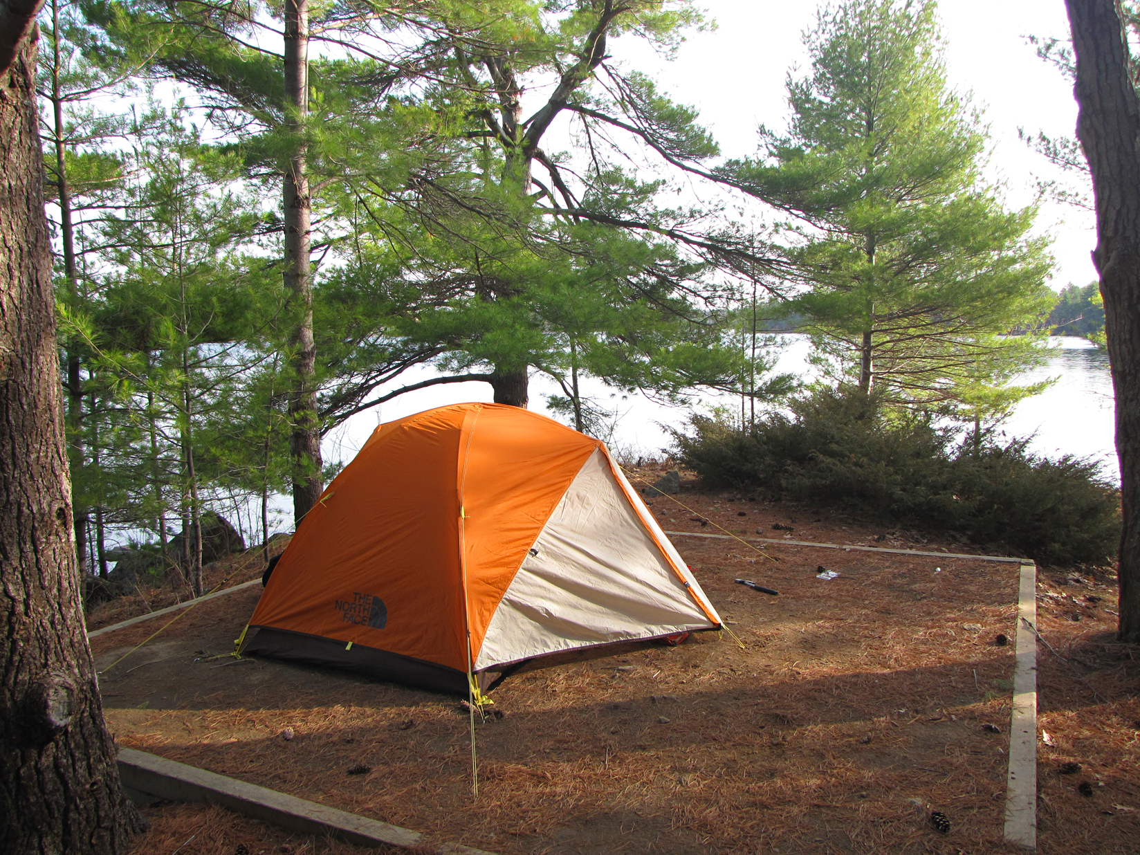
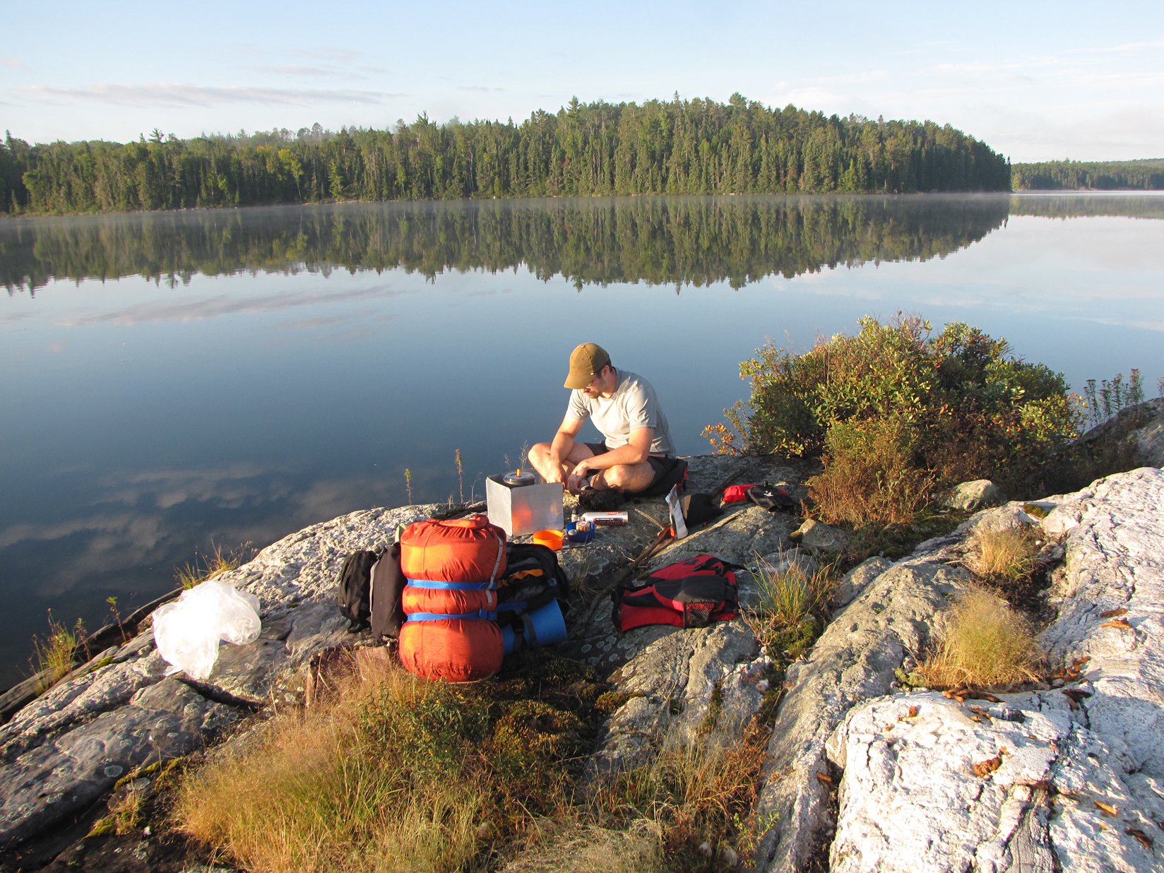
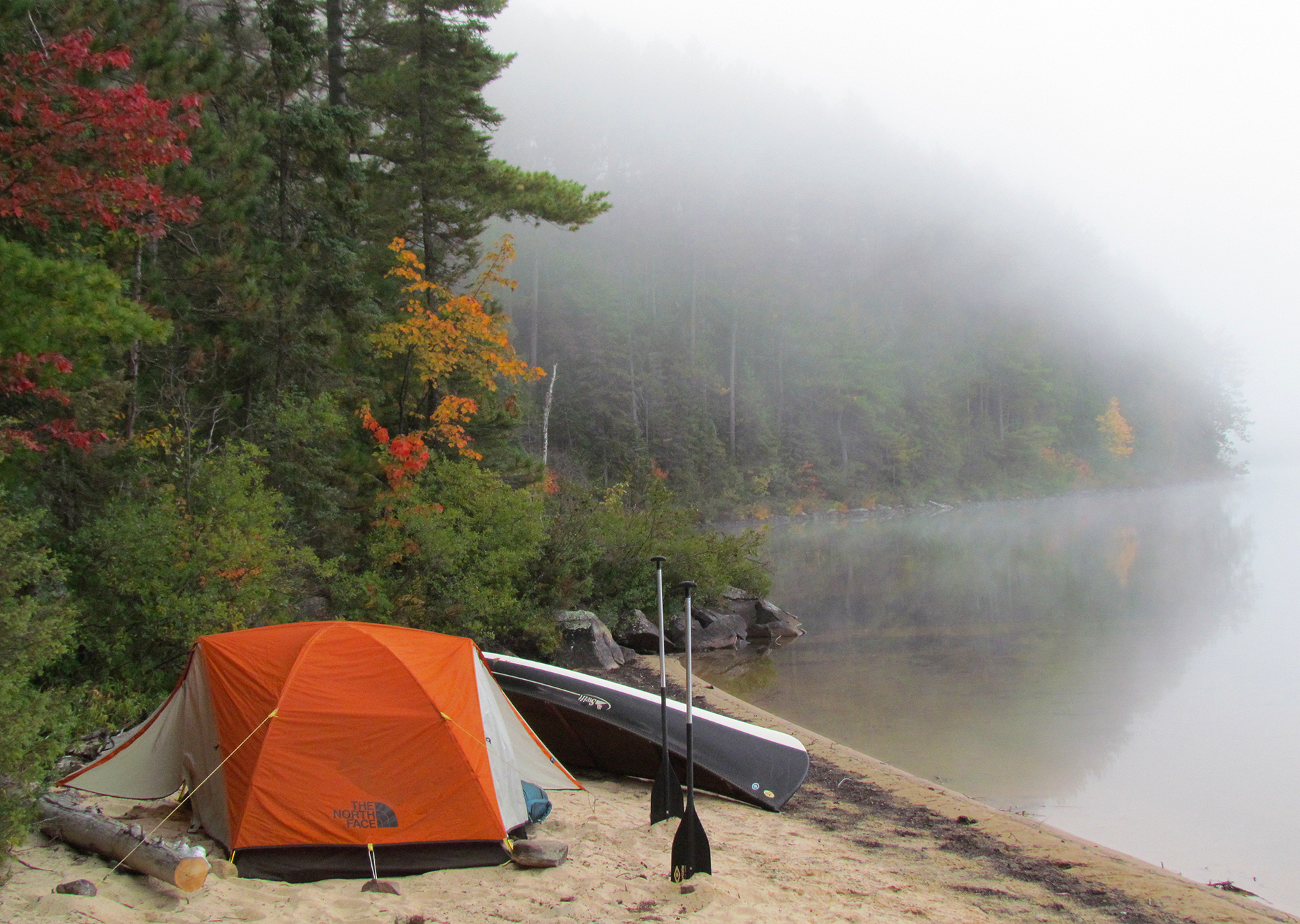
We arrived just after 4pm, and as it started to rain more steadily, we got soaked while setting up the tent. Our site is a Jump Off Site #2. Jump Off sites are only available to those setting out into the backcountry. The site is small though beautiful Cedar Lake was right beside us. As evening approached and the temperature really started to drop to near 6 degrees Celsius, we decided to have our homemade spaghetti in the car with the heat on as we were still quite damp.
Tomorrow we will make our way onto Cedar Lake, a lake we visited on our last canoe trip to Algonquin, though this time we will be on a different stretch of this big lake. Hopefully the rain will let up by tomorrow because we have a steep 2,370 metre portage to attempt!
Wildlife Sightings: Blue Jay, Common Raven, American Crow, Frogs, Eastern Chipmunk, People.
Remember to: Have rain gear handy for the drive up when rain is predicted instead of having it buried in the packs.
DAY # 2: Cedar Lake to Catfish Lake
Weather: A mix of sun, clouds, showers, and wind. High: 10 C Low: 4 C
The morning was quite chilly when we woke up. After having a breakfast of Bob’s Red Mill: Mighty Tasty Cereal topped with brown sugar, we had a hot tea to warm us up. It was then time to get our gear out of the car, organize it all, and drive to the launch. It was at this point it began to rain. In fact the whole day consisted of rain, followed by sun, then clouds, and more rain. We will take rain with cool weather over the heat and mosquitoes any day!
Launching onto Cedar Lake the wind picked up a little, but the waves were maneuverable. At the southern end of the lake we portaged 720 metres arriving on the Petawawa River. At the beginning of our next portage at 260 metres we came across some tent poles in a bag. Of course it is best to leave them alone as the owner will most likely realize they are missing and head back to retrieve them. Shortly after we met two guys in a canoe who asked us if we had seen some poles. Unfortunately for them, they didn’t realize their tent poles were missing until the end of Catfish Lake, and they had to sleep with the tarp over their canoes last night. Lucky for them the rain held off.

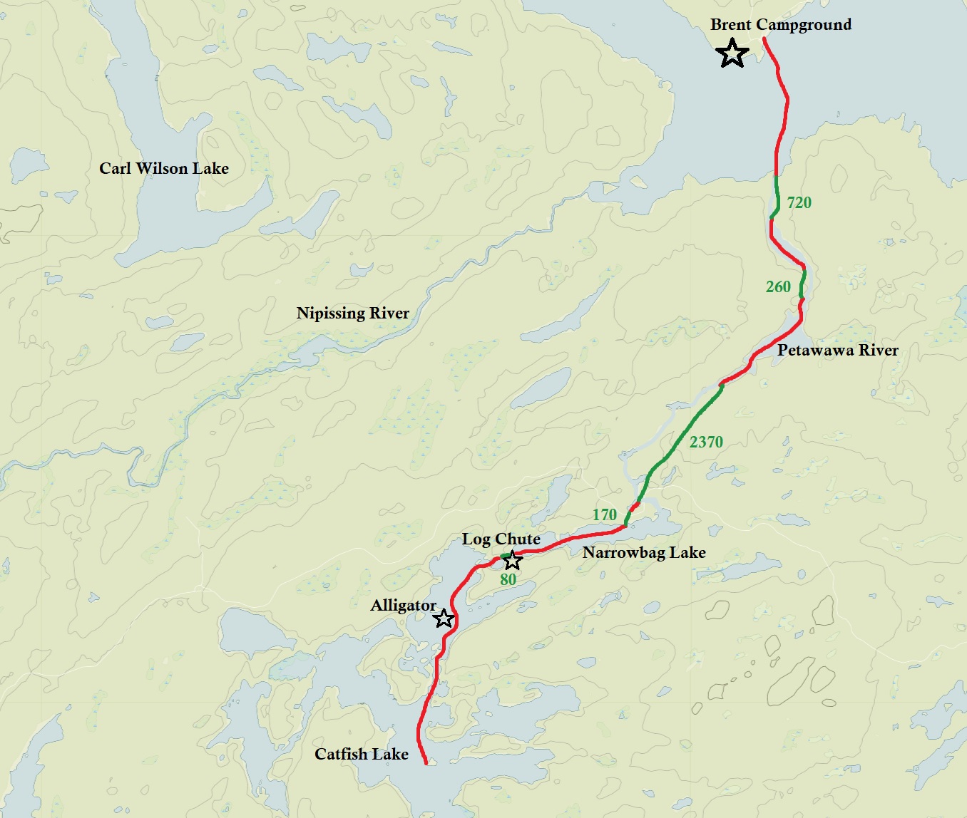
The 2,370 metre portage was not as bad as we thought it was going to be with only one steep section. During the rest of our paddle we portaged over an old abandoned road, saw the remains of an old log chute, and the remains of an alligator tug that used to haul logs during the logging era. If you ever want to see what an alligator tug looked like, there is a replica at the Algonquin Logging Museum Trail near the park’s east gate.
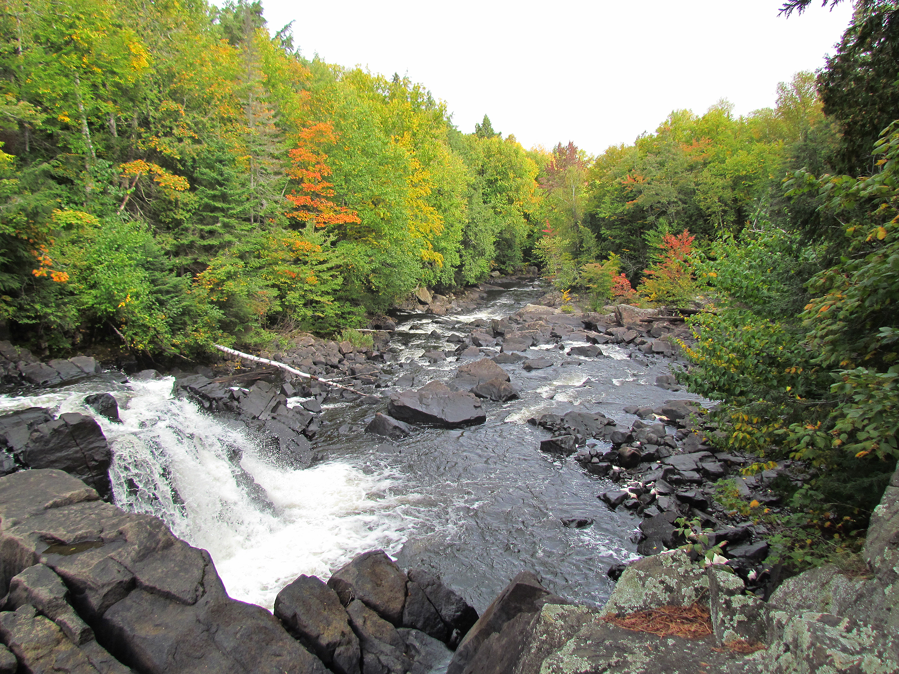
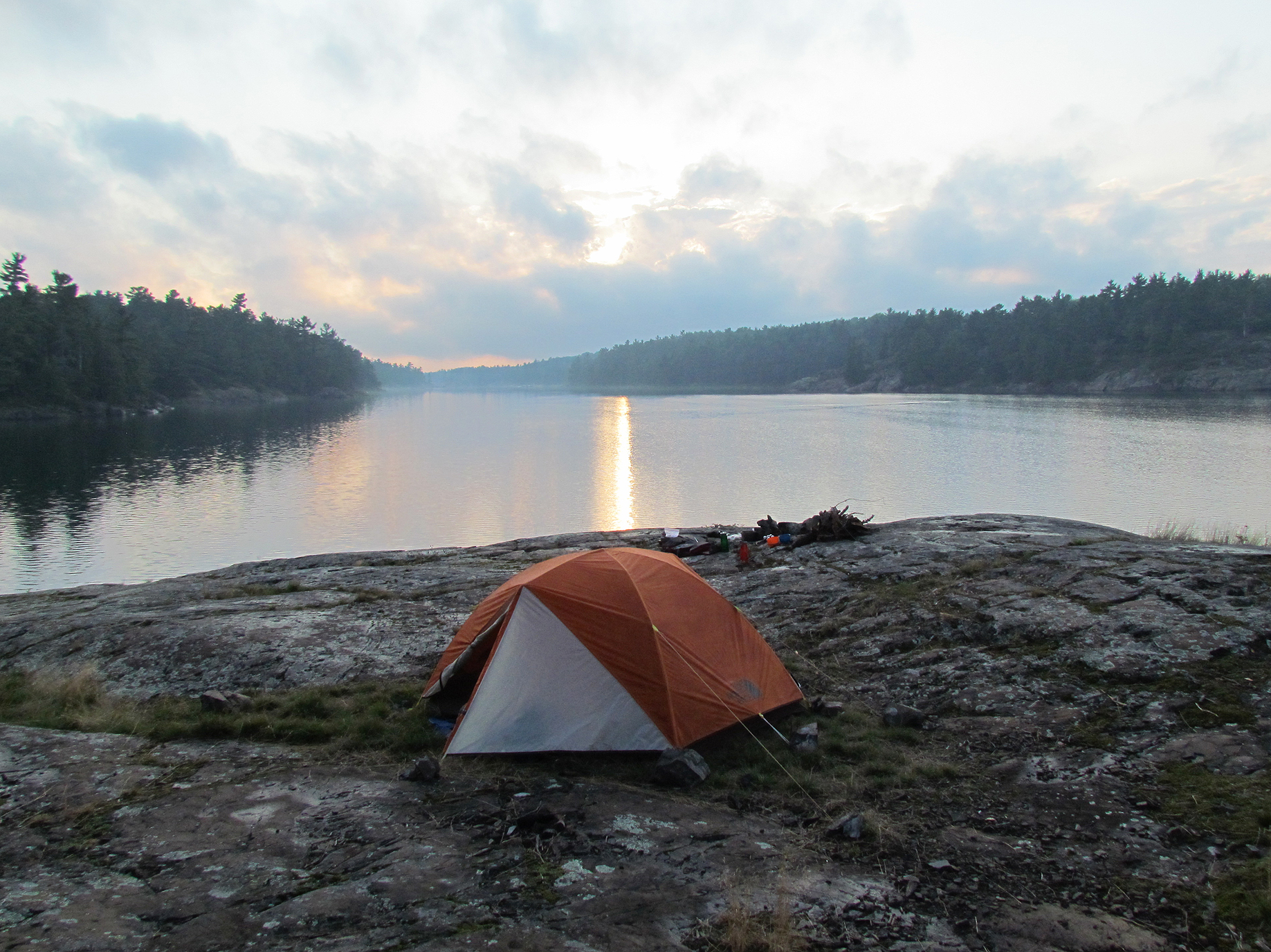
As we made our way onto Catfish Lake we were delighted to get the island campsite we were hoping we would get! We had a nice fire tonight which felt good on the legs and face.
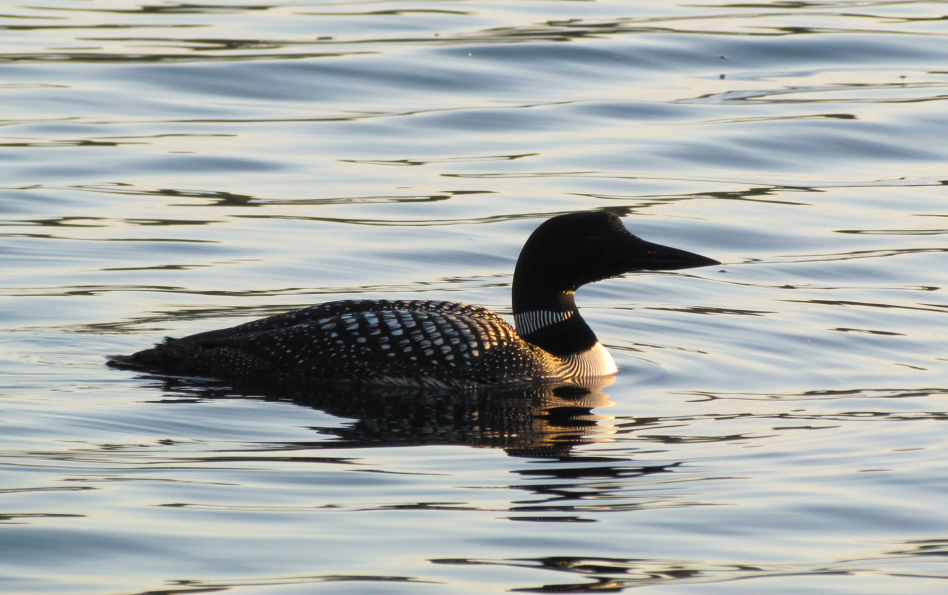
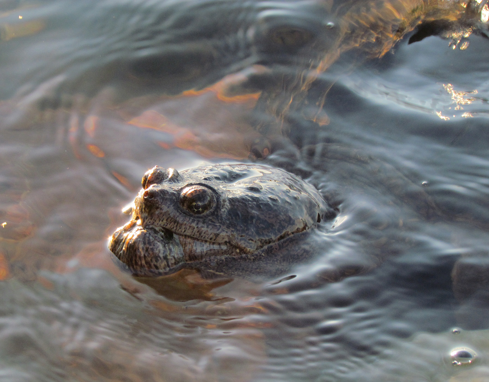
Wildlife Sightings: Common Loon, Grey Jay, Hairy Woodpecker, Black-throated Blue Warbler, Black-capped Chickadee, Dark-eyed Junco, American Crow, Common Raven, American Black Duck, Mallard, American Pipits, People.
Remember to: Bring a toque to wear to bed on these cold nights.
DAY # 3: Catfish Lake to Burntroot Lake
Weather: Cloudy in the morning, giving way to sunny skies in the afternoon. High: 9 C Low: 3 C
It was quite chilly when we woke. We just wanted to hide in our warm sleeping bags so we had a late start. Eventually we made it out onto the water after 10:30 am.
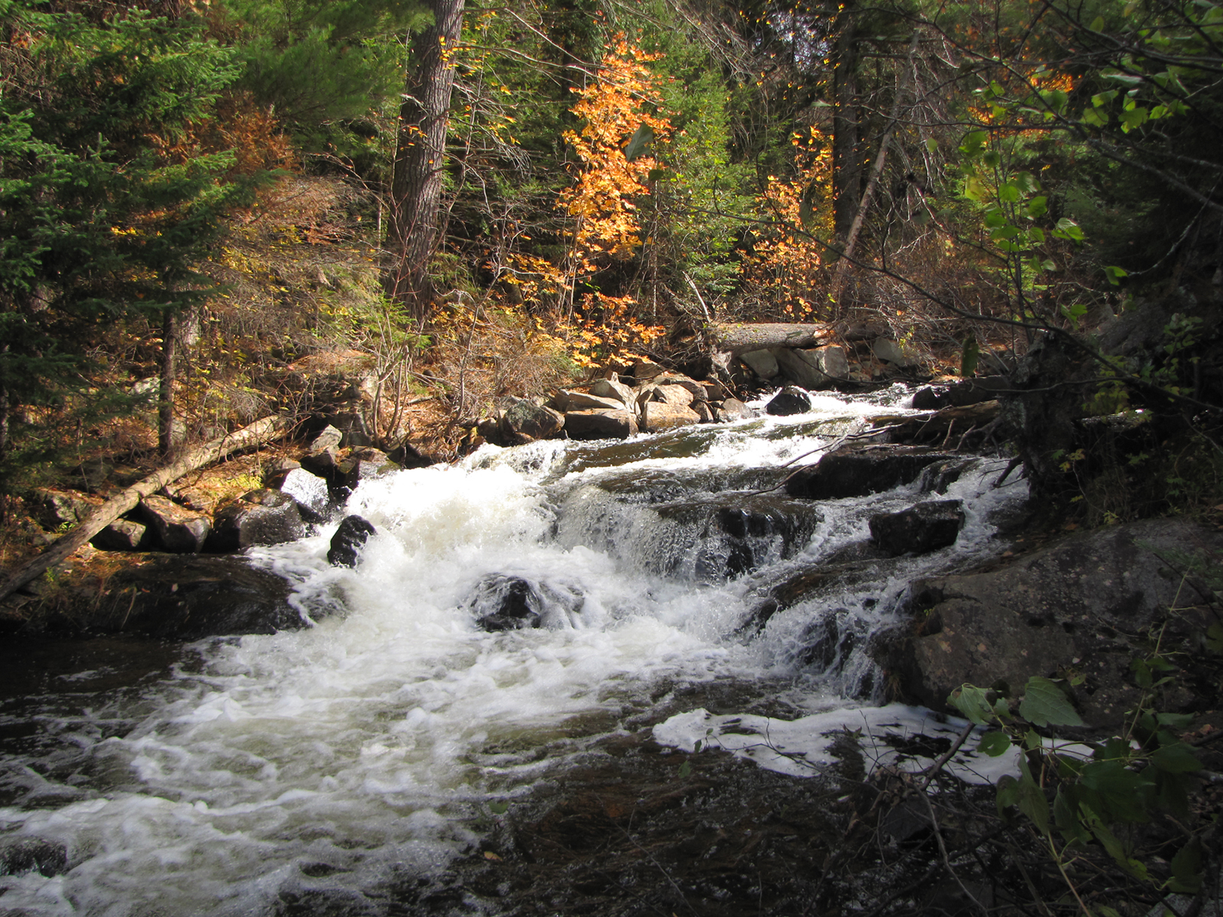
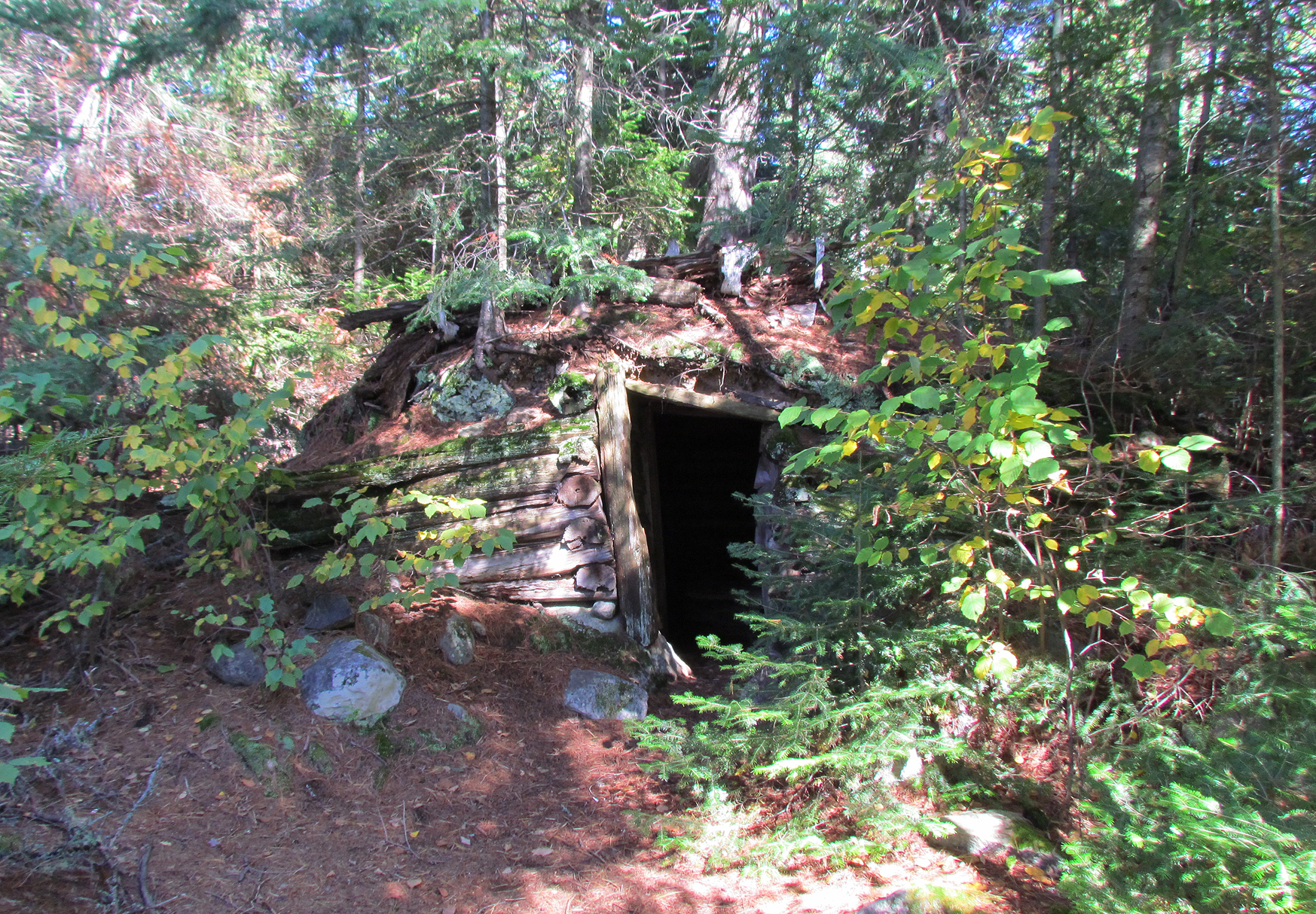
We had a lot of little portages today including a 370 metre, a 320 metre, a 90 metre, and a 430 metre, all around rapids of the Petawawa River. Our spirits were lifted when the sun broke through the clouds and remained with us for the rest of the day. Before we got to Burntroot Lake we we explored a root cellar made of cedar logs at the end of Perley Lake. It was built into the earth, had a table inside, and even a vent.

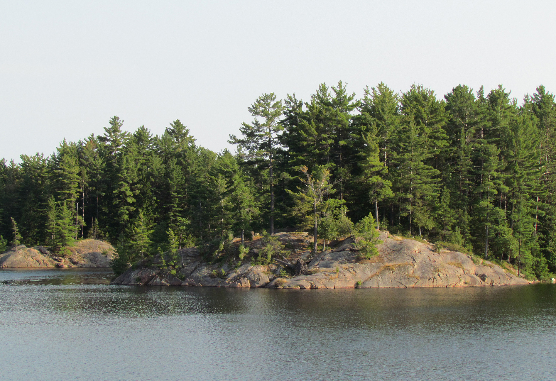
When we got to our island campsite on Burntroot Lake we took a quick jump in the lake as the sun was out. For the rest of the afternoon we relaxed at our site, and later went out in the canoe to pump water. Pumping water was a little more difficult today because we lost the weight and prefilter yesterday on Cedar Lake. It probably remains at the bottom of the lake to this very day.
Wildlife Sightings: American Pipits, Red Squirrel, Blue Jay, Common Loon, Ring-billed Gull, Herring Gull, Hairy Woodpecker, Canada Goose, Common Merganser, Mallard, Red-breasted Nuthatch, Black-capped Chickadee
Remember to: Add beef jerky and parmesan cheese to our food list at home. We forgot to pack both this trip.
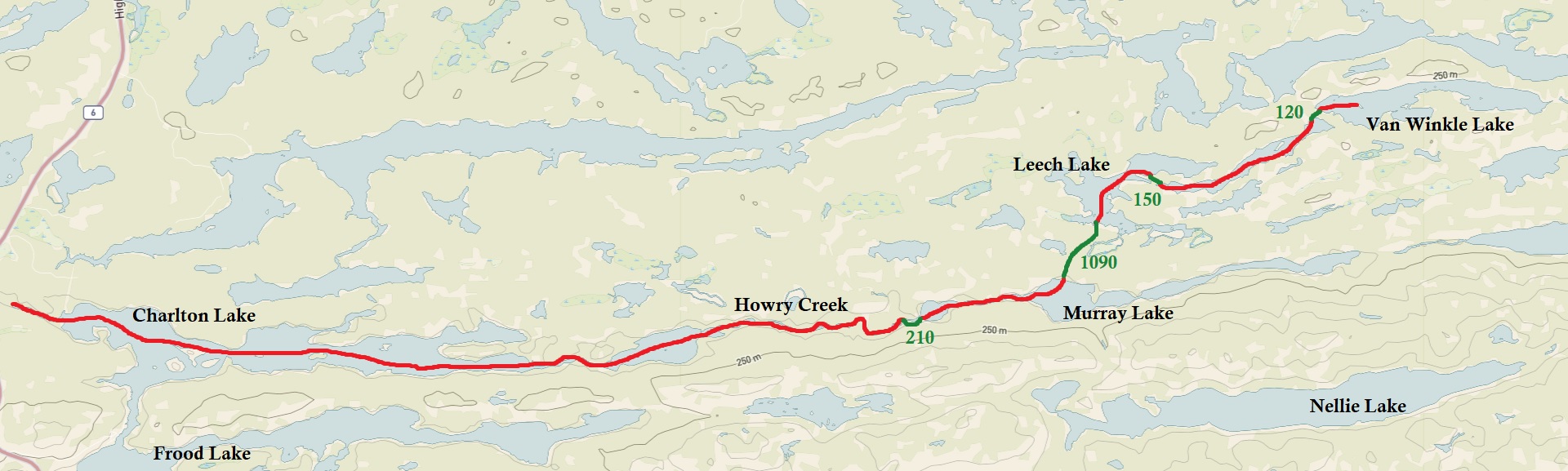
DAY # 4: Burntroot Lake to Hogan Lake
Weather: Foggy in the morning with sun for the rest of the day. High: 17 C Low: 2 C
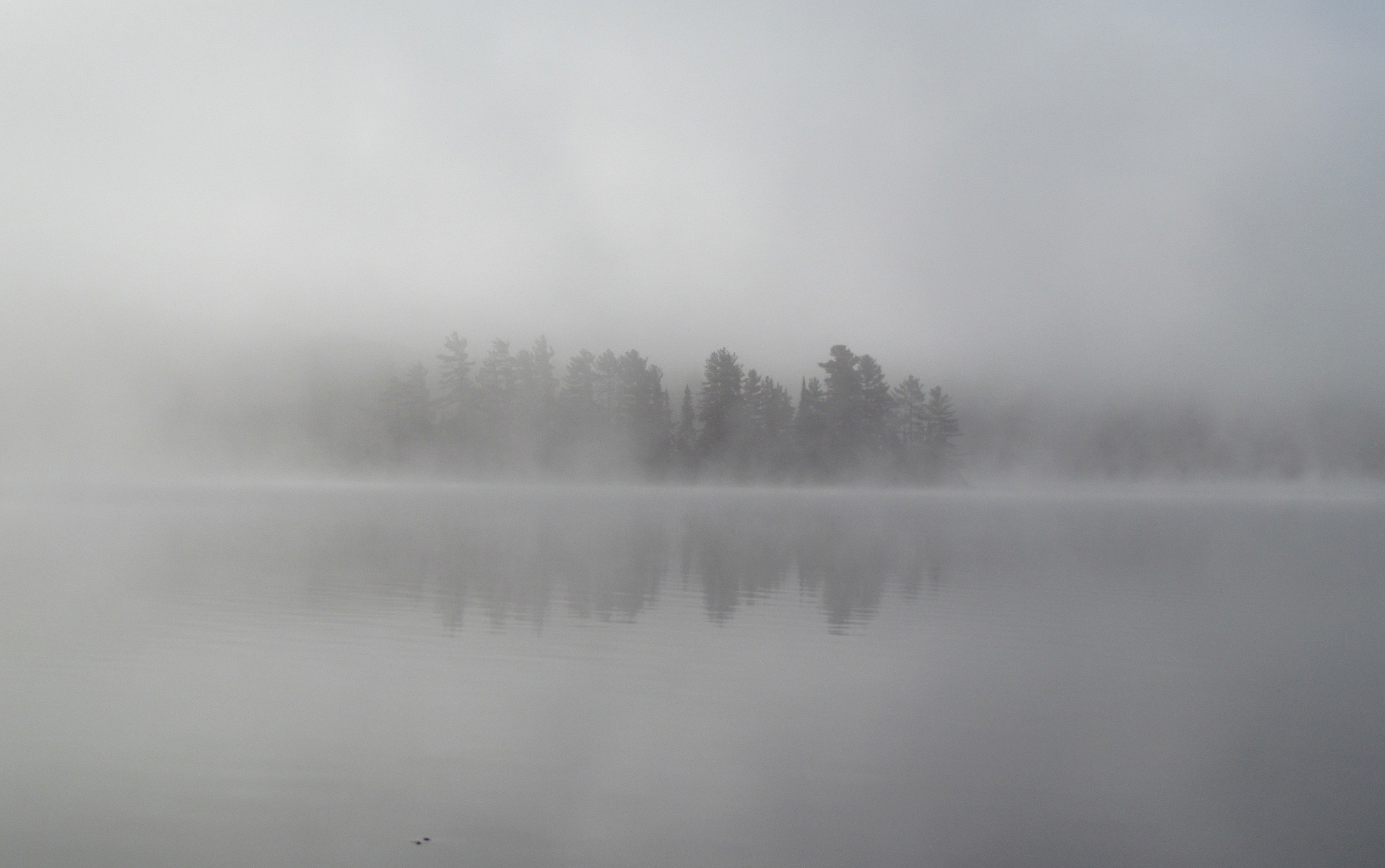
Though there was a frost warning last night, we awoke instead to thick fog and a chilly 2 degrees Celsius. We decided to start the day off right with a homemade pancake prepared over hot coals, along with a hot tea to warm our bellies.

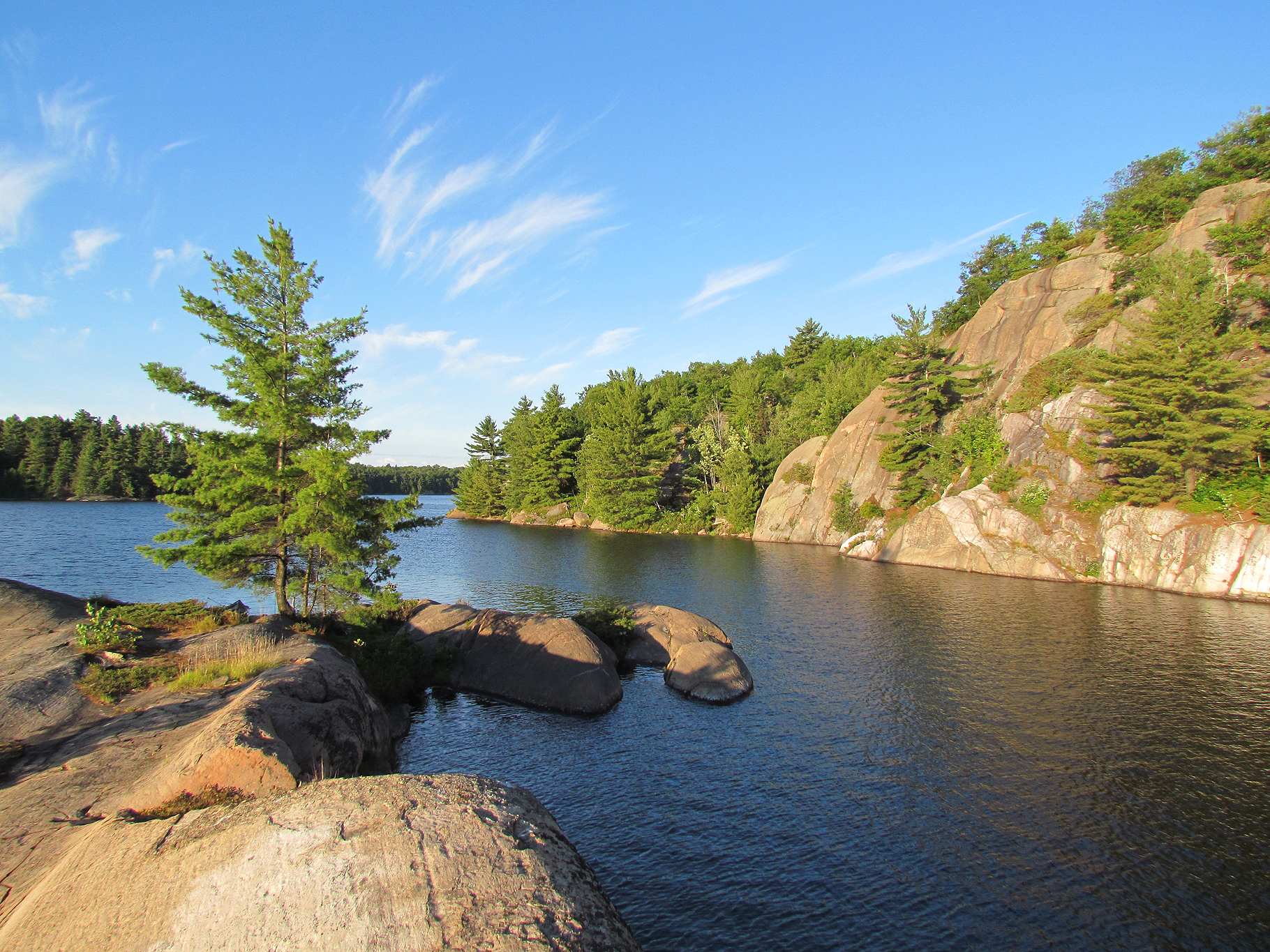
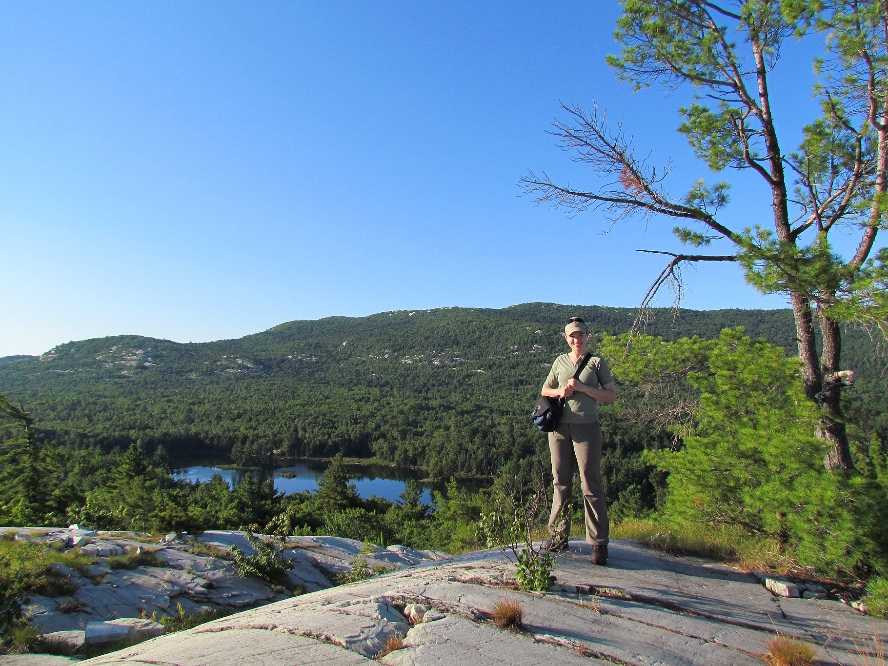
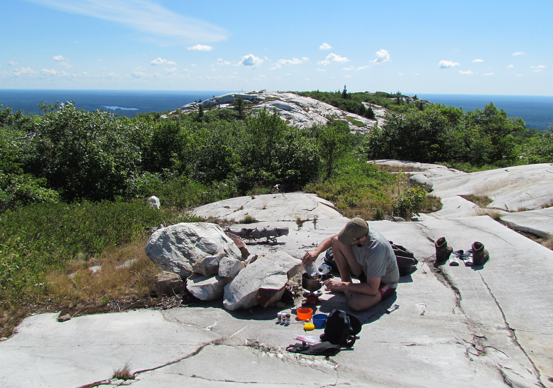
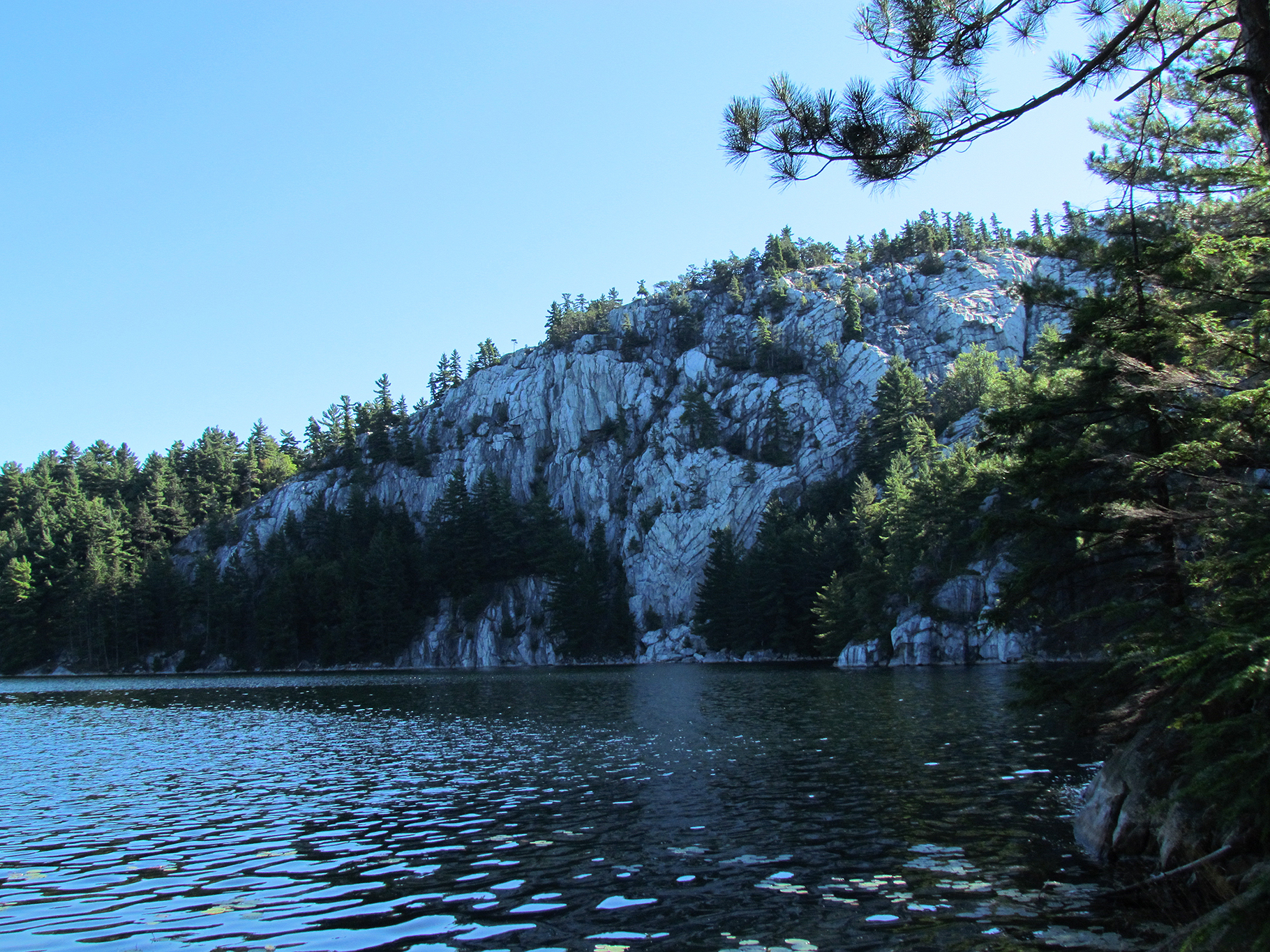
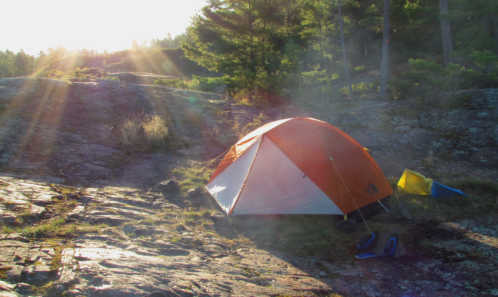
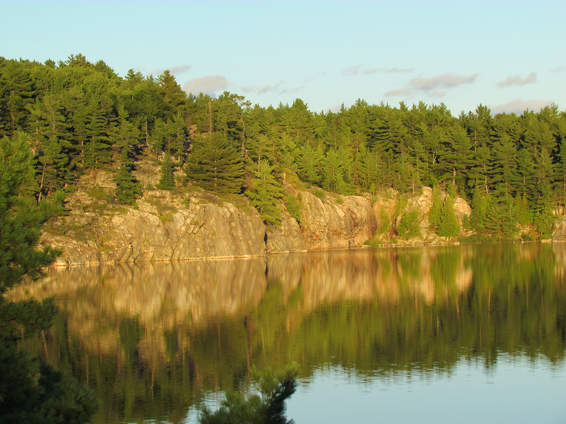
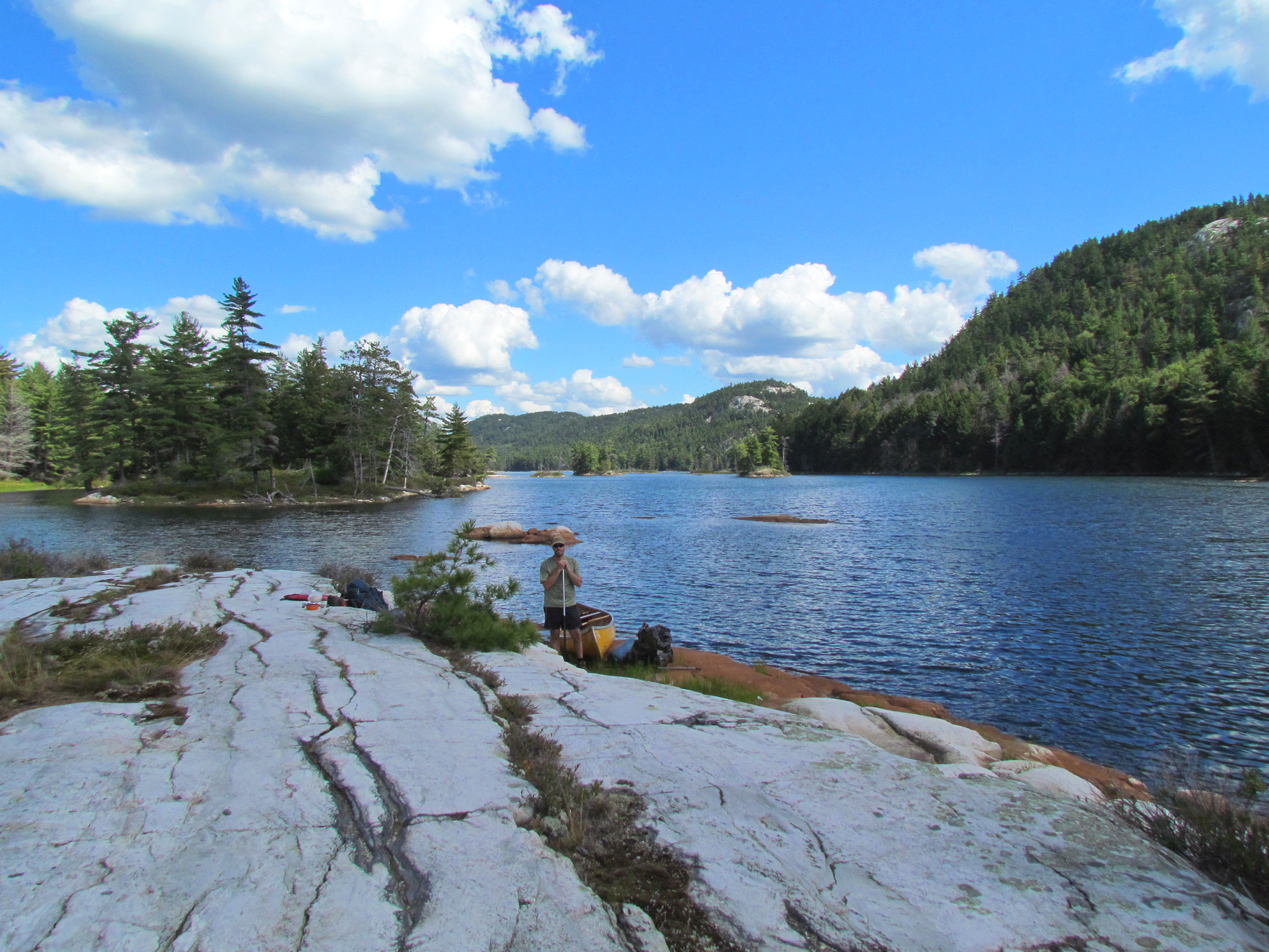
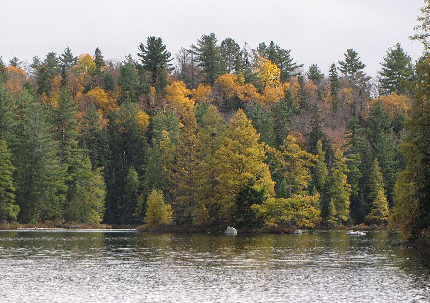
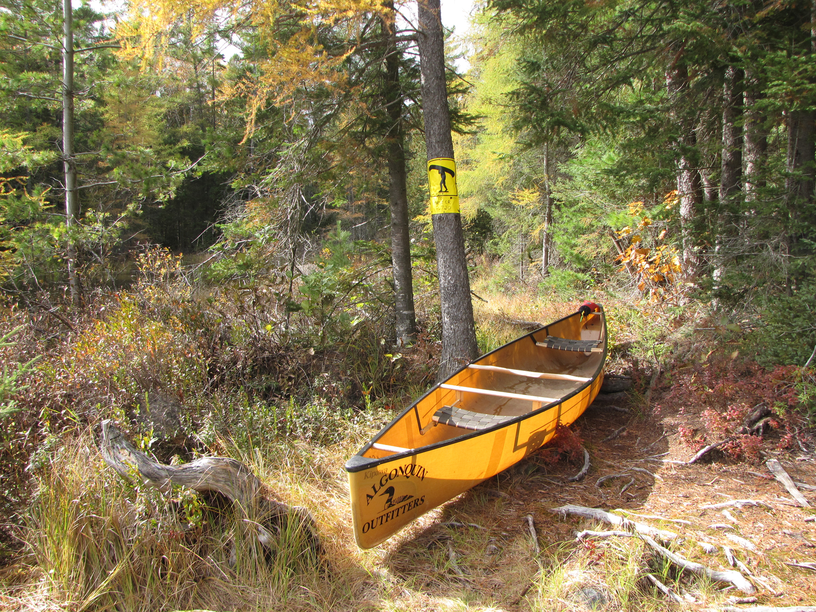
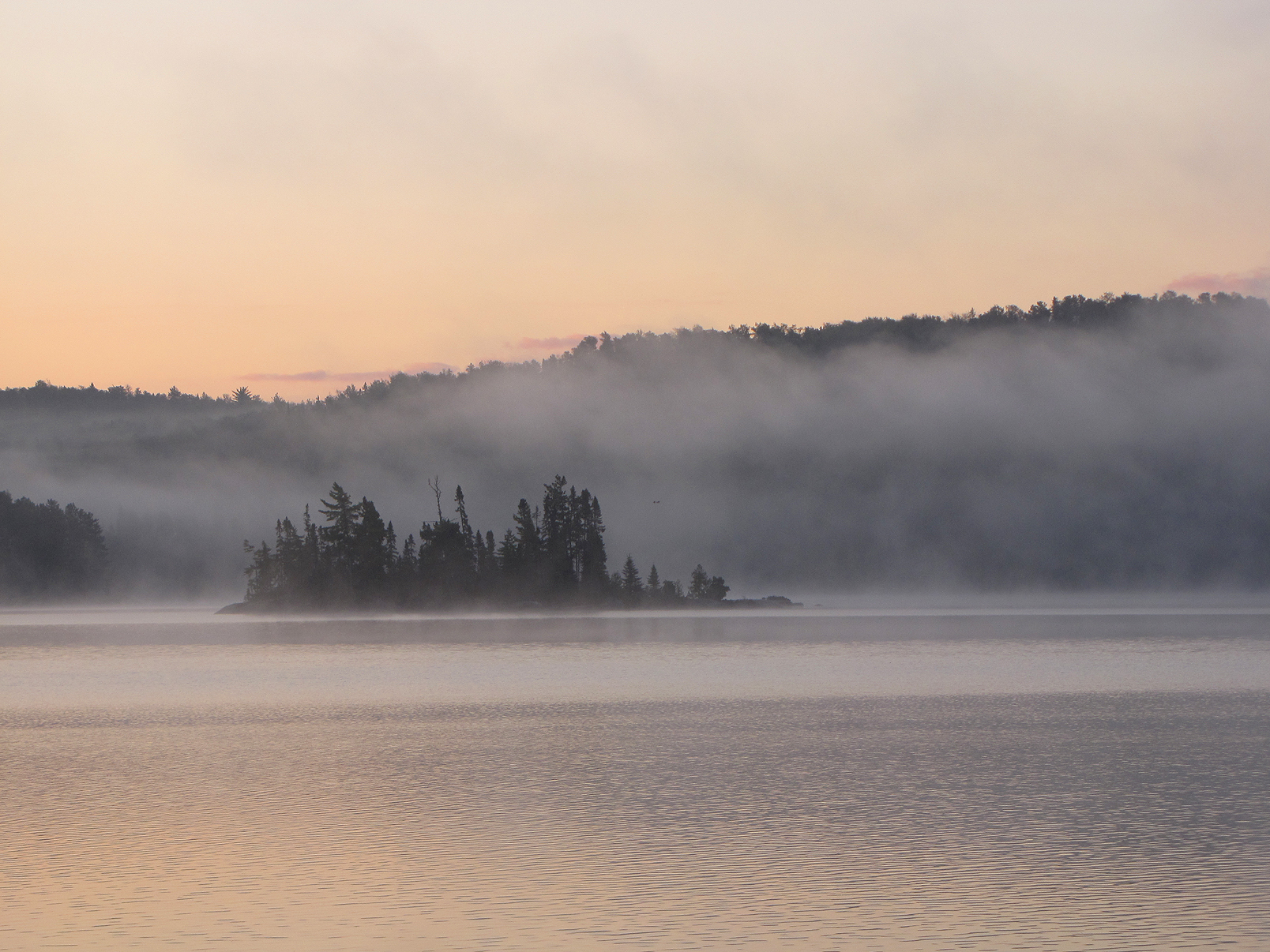
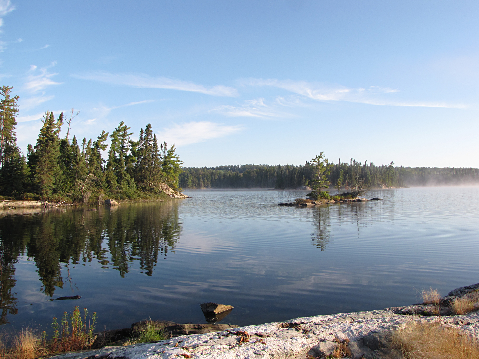
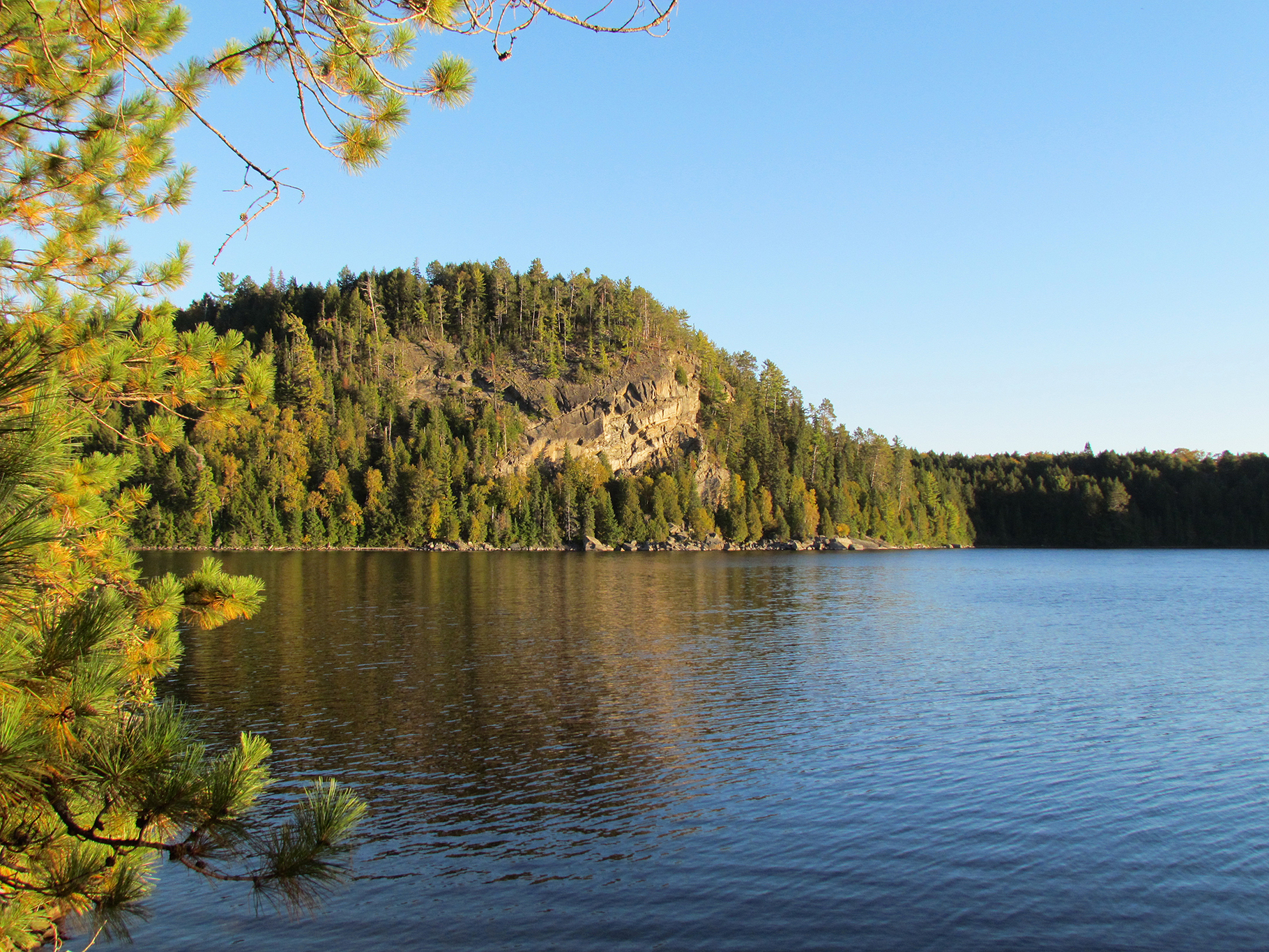
Out onto Burntroot Lake we began our morning paddle through some veils of fog. Today we only had two portages to tangle with. The first was a rocky 750 metres from Red Pine Bay to Lake La Muir. Fallen red maples leaves dotting some of today’s portages made us thankful to be in Algonquin during this time of year as the park begins to reveal it’s autumn splendor of reds, oranges and yellows. Lake La Muir is one of Algonquin’s longer, larger lakes. As we paddled towards its eastern shore where the Little Madawaska River began it got very shallow and our paddles kept stirring up (and sometimes lifting up) muck, and we hoped we wouldn’t have to switch to our pool shoes to drag the canoe. Luckily we made it okay to the 710 metre portage along the Madawaska River before entering the western end of Hogan Lake. We arrived at our campsite, a peninsula with great views of a scenic cliff across the lake. The rest of our sunny afternoon was for setting up camp and enjoying the scenery.
Wildlife Sightings: Common Loon, Red Squirrel, Eastern Chipmunk, Common Merganser, Ruffed Grouse, Bald Eagle, Yellow-rumped Warbler, Red-breasted Merganser, Herring Gull, Blue Jay, Black-capped Chickadee, American Pipit
Remember to: Add less water to sugar crystals when making pancake syrup so it isn’t so runny in the frying pan. – Raingear keeps a lot of heat in as an extra blanket when laying it on top of the sleeping bags. -Consume our homemade dehydes within the month after preparing them back at home.
DAY # 5 Hogan Lake to Philip Lake
Weather: Fog giving way to sunny skies. High: 23 C Low: 5 C
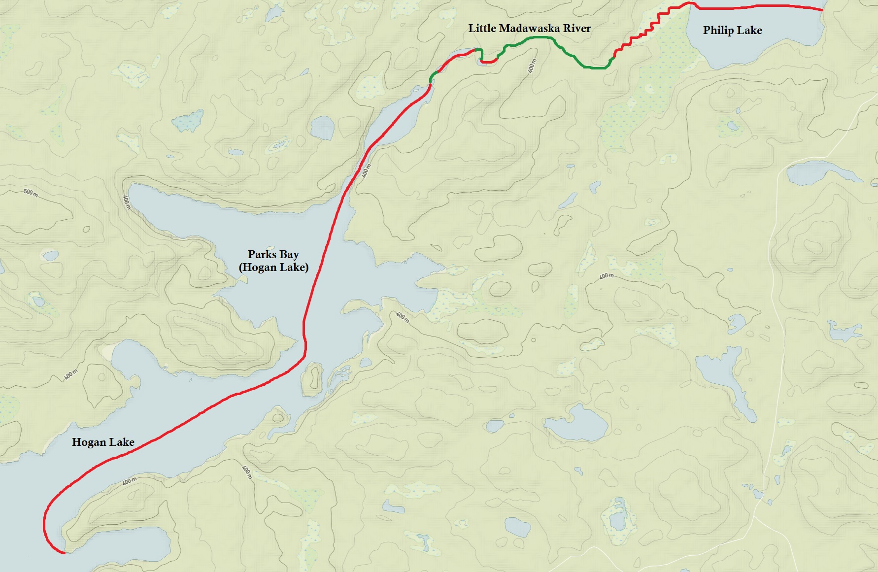
Fog greeted us again this morning as we looked out of the tent. The morning felt a little warmer but we kept our layers on as we launched the canoe and continued to paddle Hogan Lake. By the time we arrived at Parks Bay the layers began to come off which is always a nice feeling.
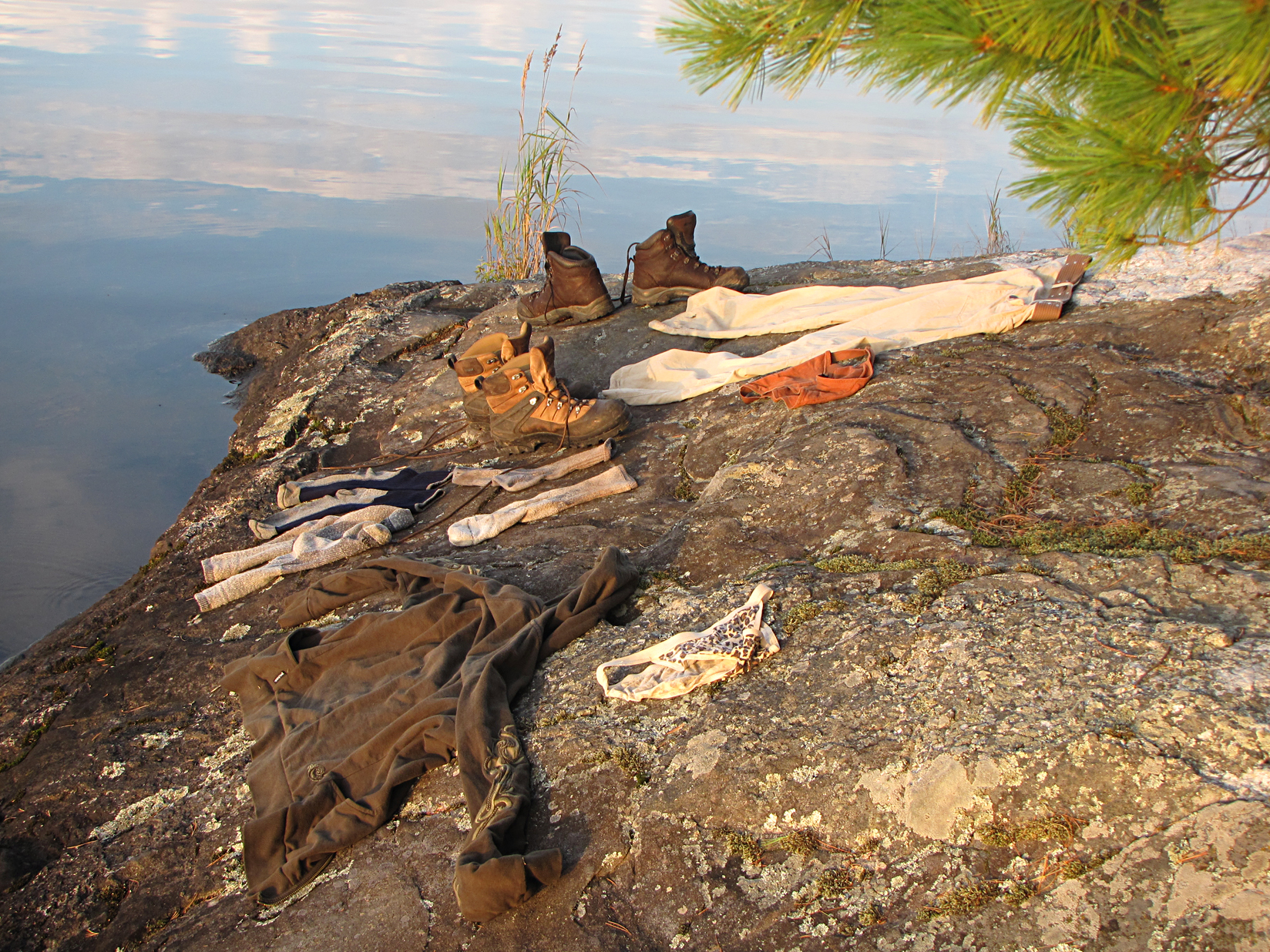
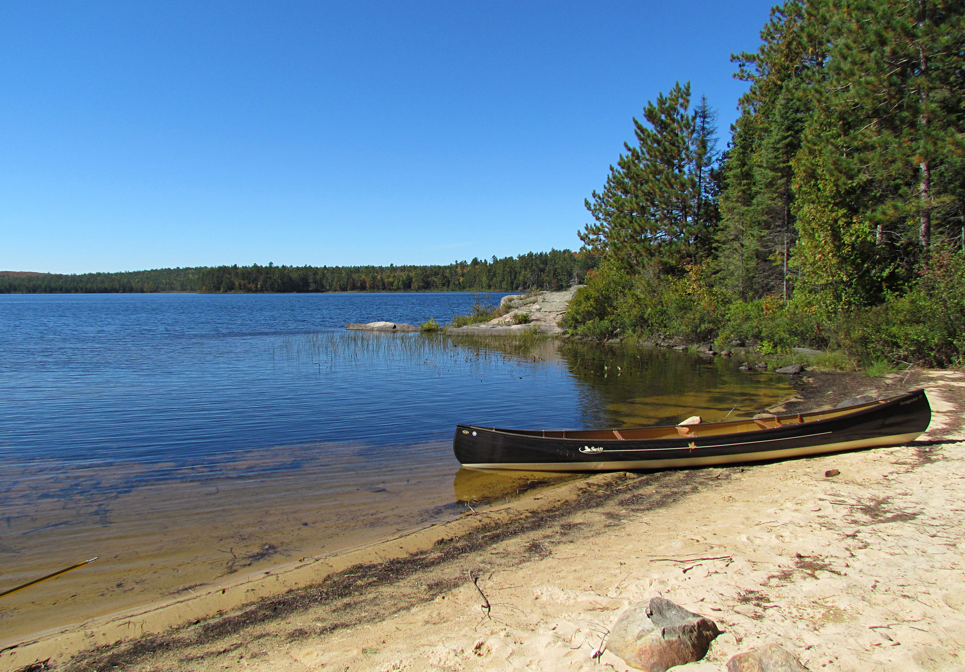
Our first portage was a 220 metre into the Little Madawaska River, followed by an easy 110 metre. After paddling through a small section of marsh we approached a 1,510 metre portage. This one was rocky, steep and muddy, all the ingredients for a fun portage! After paddling through a marsh, along with a lift over a beaver dam, we made our way onto Philip Lake, which was a nice little lake surrounded by rolling hills. Our campsite was along a sandy beach shoreline, and we set up the tent right next to shore. As the sand soaked up the heat of the sun we had to retreat to the shade of our tent to cool off. This was quite a change from a couple of days ago when we had a frost warning!
Wildlife Sightings: Common Raven, Wilson’s Snipe, Common Loon, Eastern Chipmunk, Red Squirrel, Double-crested Cormorant, Red-breasted Nuthatch, Blue Jay, American Pipit, American Black Duck, Wood Duck, Common Merganser, Herring Gull, Garter Snake, Black-capped Chickadee
Remember to: Buy no more Detour Bars. We don’t like them
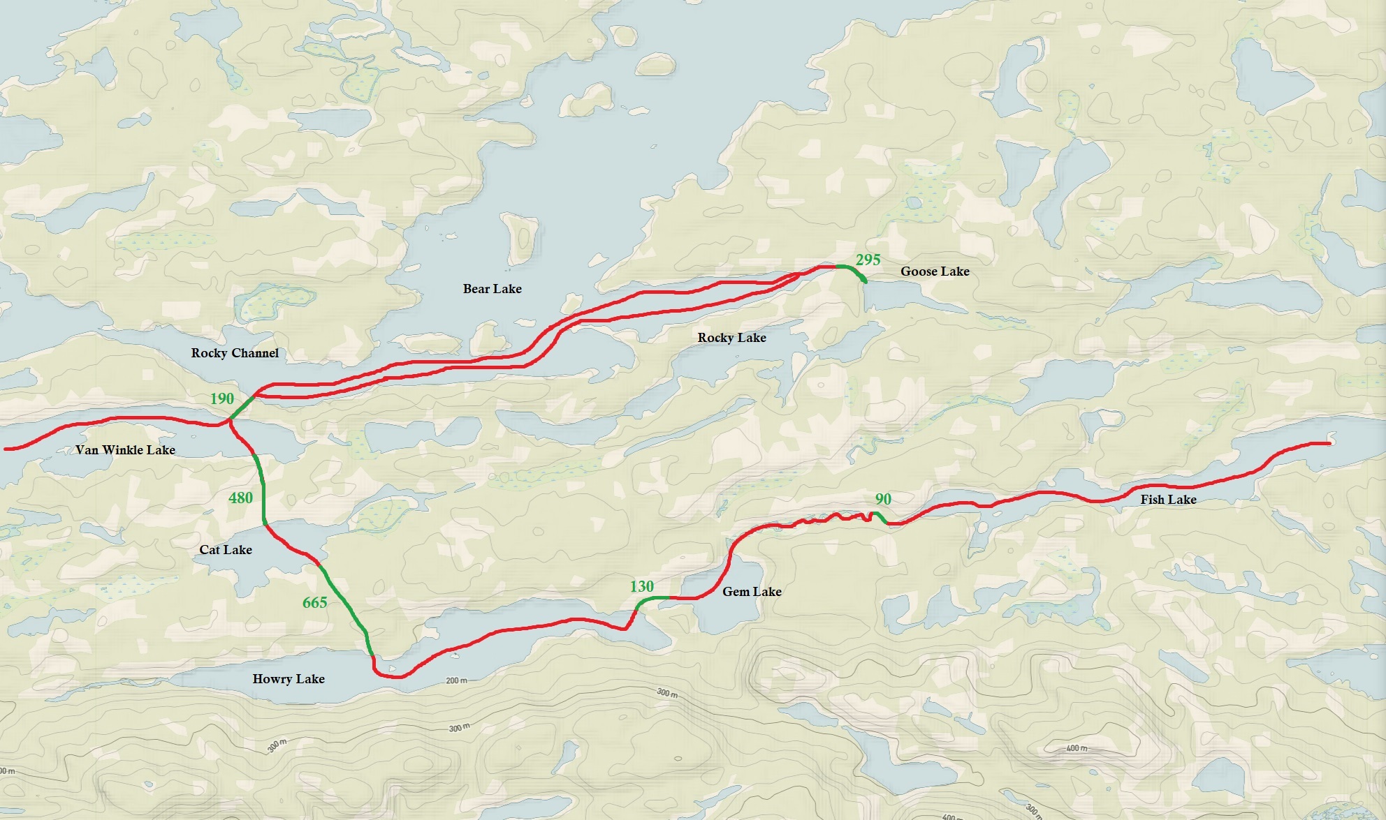
DAY # 6 Philip Lake to Radiant Lake
Weather: Foggy in the morning with sunny skies for the day. High: 21 C Low: 3 C
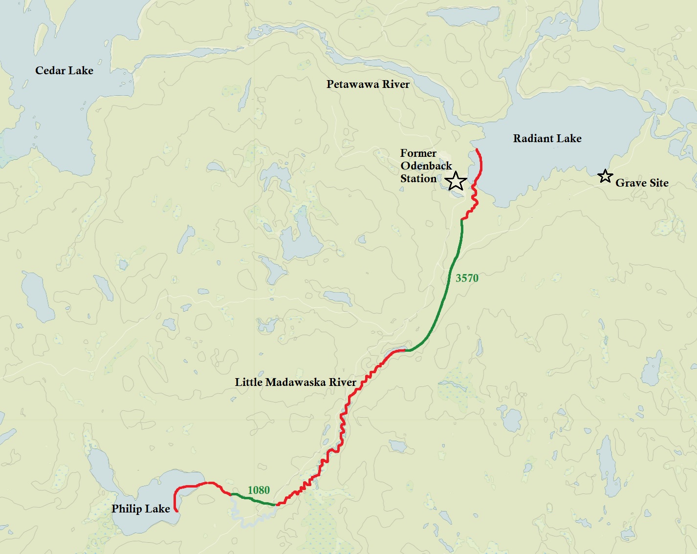
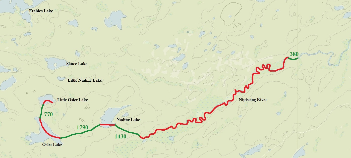
This morning fog and 3 degrees Celsius greeted us at our beachside home that no longer felt like Florida. We launched onto the lake just after 9:00 am and started to paddle down the Little Madawaska River again. As we approached our first portage of 1,080 metres and got ready with our packs we heard branches snapping in the bush! We quickly threw our packs back into the canoe as we though it might be a horny bull moose charging towards us down the trail. Instead it turned out to be a truck backing down the portage, snapping branches as they went along. Two guys came out of the truck and greeted us saying that they were going fishing. It was a little awkward but we smiled and wished them luck as we carried our packs and canoe down the portage that felt like an old laneway. Along the portage we went over an old logging road.
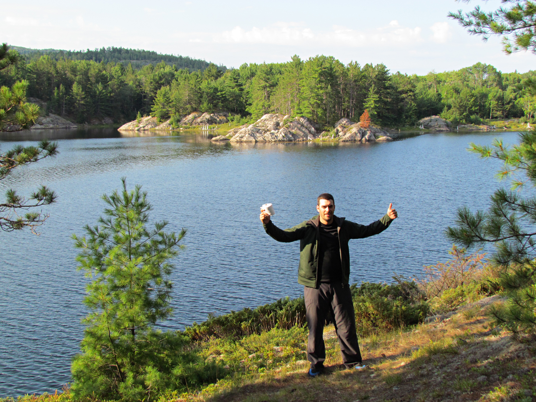
Back on the Madawaska River we continued with the rest of the day’s paddle that was pretty smooth going as we went through a winding marsh that reminded us of the Nipissing River from our previous Algonquin trip. Our last portage was 3,570 metres that we had to double over as it was too long, and it was getting quite warm out again. Lucky for us 70% of the portage was flat. After getting back into the canoe and maneuvering around some logs (and bumping into one) on the Little Madawaska, we arrived on Radiant Lake which was shaped like a big oval. This lake was a little buggy with black flies. We had our bug nets but our bug spray was back in the car. There was a cottage near our campsite but nobody appeared to be home. The abandoned CNR railway line hugged the southern shore of Radiant Lake with the now abandoned Odenback Station close to the western shore of the lake. We didn’t check out Odenback to see if anything remained. We will have to make a trip back to Radiant Lake at some point because there are a few things we wish we checked out here including and old abandoned lumber site, the remains of a depot farm, and a grave site.
While having supper we discovered that our site had Wood Roaches that tried to get in our packs and were even attracted to the light from our headlamps. This was one weird campsite!
Wildlife Sightings: Wilson’s Snipe, Red Squirrel, Ruffed Grouse, Wood Duck, Mallard, Hairy Woodpecker, Common Loon, Double-crested Cormorant, Herring gull, Common Raven, American Pipit, Red-breasted Nuthatch, Black-capped Chickadee, Blackflies, Wood Roaches, People.
Remember to: Don’t leave bug spray in the car, even if you think you won’t need it.
DAY # 7: Radiant Lake to Cedar Lake
Weather: Fog, with sunny skies for the rest of the day. High: 23 C Low: 6 C
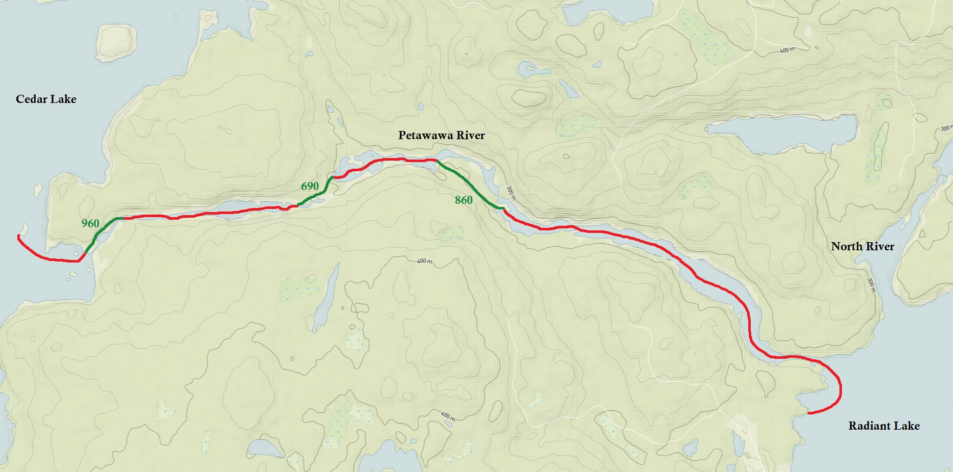
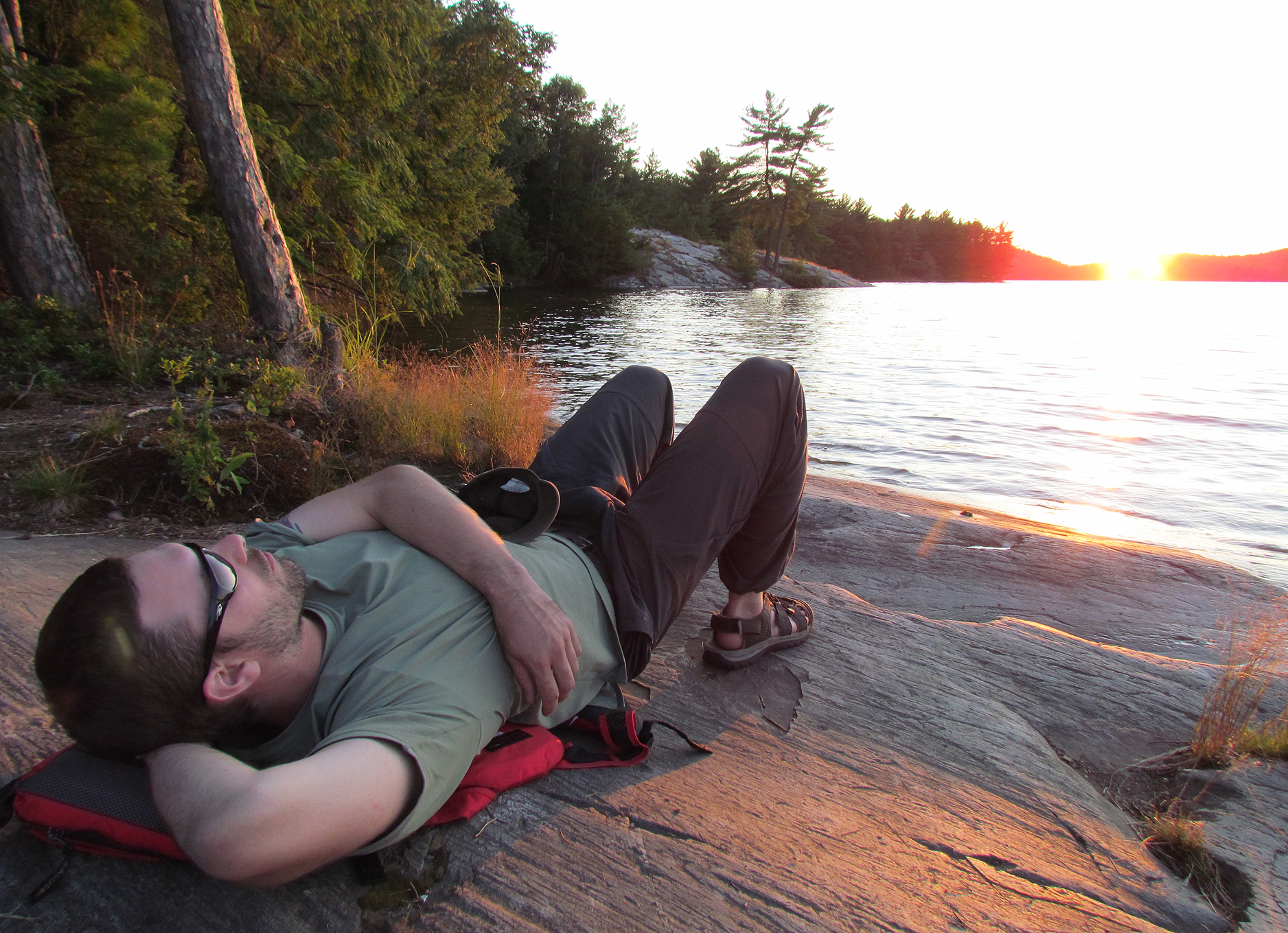
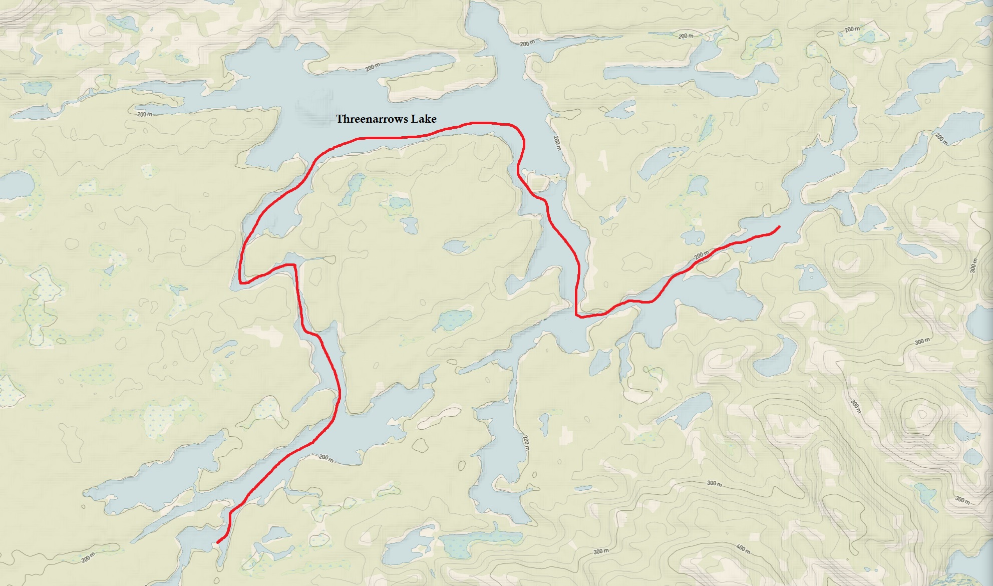
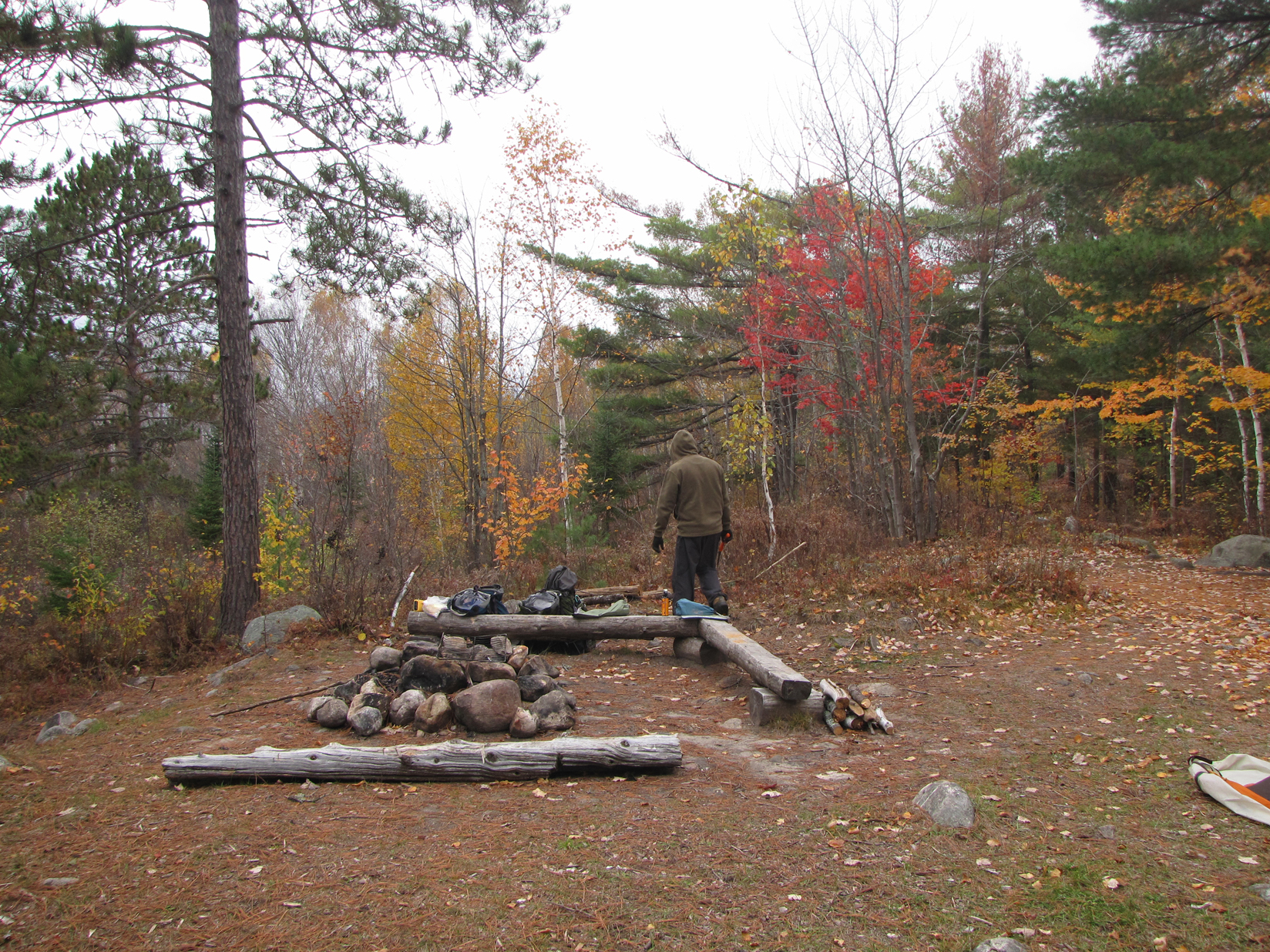
Fog was on repeat once again this morning. Another weird thing about Radiant Lake that we noticed by morning was that there were no loons. It seems like every lake in Algonquin has a loon, if not a pair of loons, but not Radiant Lake. In the distance we heard the beeping sound of a large truck backing up. We were gradually getting closer to the launch at Brent so we wonder if there was logging going on nearby. After stuffing our packs and finding a few more Wood Roaches, we were soon back in the canoe. Unfortunately, we paddled the wrong direction for awhile and instead of going up the Petawawa River we entered the North River. When we saw the portage sign for “Menona Lake” we knew we veered a little off course. We turned around and eventually made our way back to the Petawawa River again. Fall colours were quite pretty in this section making for a scenic paddle. The abandoned CNR railway was often visible along the western shore. Our first portage to get around some of the rapids along the river was an 860 metre which included portaging on the railbed. We even got to walk on a railway bridge and gaze down between the rails upon the rushing waters of the Petawawa River! After a 690 metre portage we paddled our last stretch of the Petawawa River and arrived at our last portage of the trip, a 960 metre that had some very steep sections at the beginning. After the portage we arrived again at Cedar Lake all sweaty in the 23 degree Celsius heat. We paddled our way to the first island campsite that had two sites on it. It was an okay site but the previous users left a whole bunch of garbage in the firepit including a half a head of lettuce, while the fire pit itself was destroyed! After jumping in the lake to cool off we had lunch, and Aaron perfected the firepit. Probably the greatest thing at this site was the fact that it had two folding chairs! Wow luxury!
Tonight was our last night in Algonquin as we take in the sounds of the Petawawa River behind us as while loons wail over the lake.
Remember to: Bring homemade GORP on our next camping trip.
DAY # 8: Cedar Lake to Brent Launch
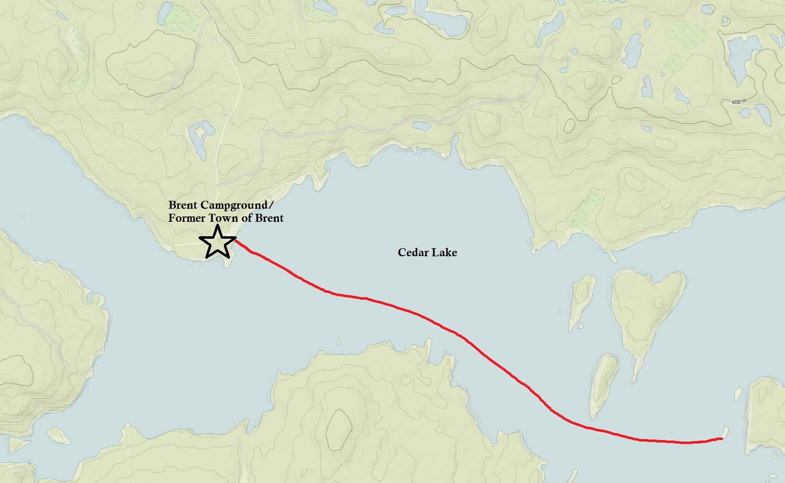
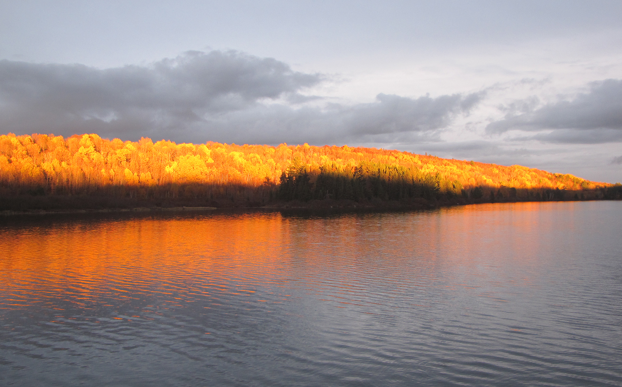
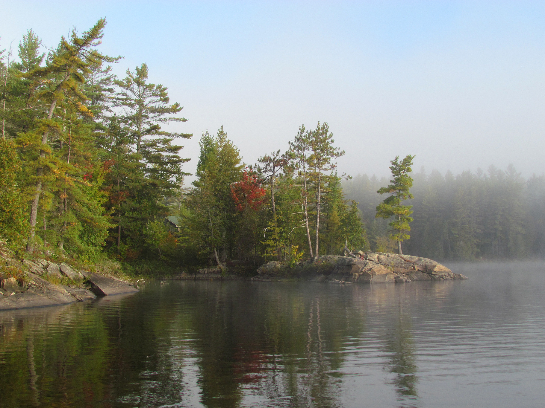
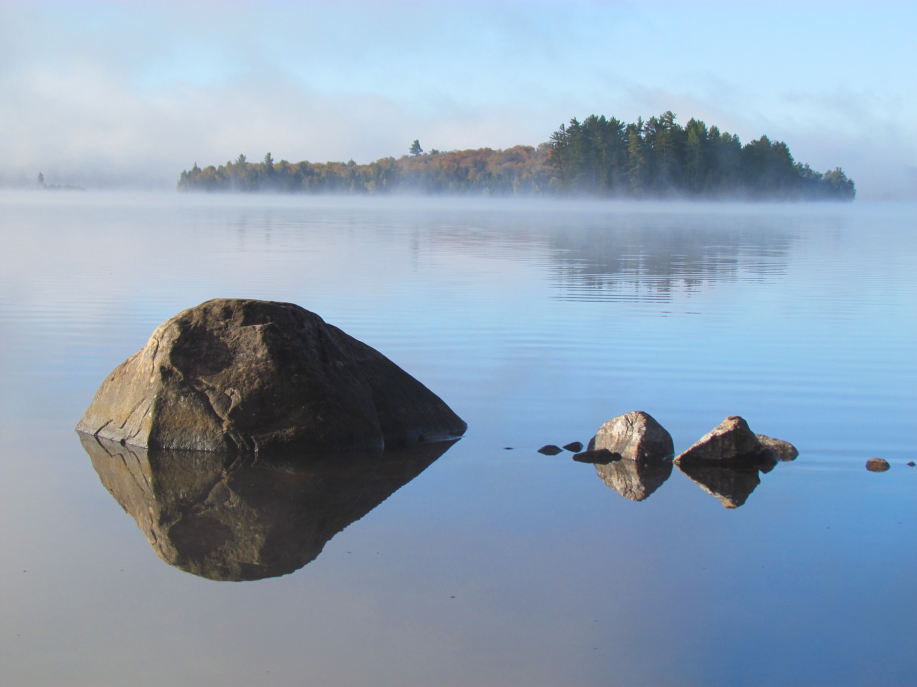
Another mild morning and fog greeted us as we stepped out of the tent. As with every camping trip we had trouble sleeping our last night out. After oatmeal and hot tea for breakfast, we loaded up the canoe and paddled into the thick fog. When the sun came out the fog slowly swept away revealing some brilliant fall colours as they have been progressing ever since we began our trip. As we approached Brent we heard and eventually viewed people through the fog heading out on their motorized boats, or in canoes. Perhaps some were just heading out on their own backcountry trips.
We may not have seen as much wildlife on this trip as we did the last fall canoe trip in Algonquin, but it was nice to get out in the woods with less biting insects than we had in spring in Temagami!
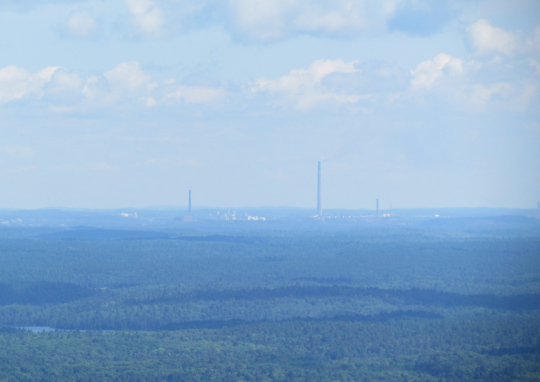
On our way back down the gravely Brent Road we pulled over to walk up an observation tower to gaze upon the Brent Crater. Unfortunately, you wouldn’t even know you were looking at a crater from this height. The Brent Crater is the world’s largest known bowl shaped crater at 3.8 kilometres wide, and was discovered in 1951 by aerial photos. The meteor itself was thought to be about 150 metres in diameter, and created a hole 600 metres deep along with a rim that is 100 metres higher than the surrounding land! There is a trail that barely enters the area of the crater which we didn’t hike. It looks like the real way to view the Brent Crater is to portage with your canoe as you can paddle both Gilmour and Tecumseh Lake that lie inside the crater.
After two northern Algonquin canoe trips, and a weekend trip at the eastern end in Achray, we still have areas off the highway 60 corridor, as well as the southern and western ends of the park to explore. We probably won’t be back to Algonquin next year, but we will be back!
Click The Link For More Trip Reports: http://www.backcountrybalkwills.com