The Nokomis Trail in Lake Superior Provincial Park. (click image to enlarge).
Aaron had a couple of surgeries this summer, so we had to forego our annual backcountry canoe trip for this year (first time since 2008!). When we debated where we wanted to go instead, the conversation quickly landed on what is arguably the most beautiful spot in the whole province of Ontario – The north shore of Lake Superior!
We have travelled the Trans-Canada/Highway 17 before but only to pass through, or drive by, the signs to Lake Superior Provincial Park, Neys Provincial Park, Sleeping Giant Provincial Park, and Pukaskwa National Park just to name a few. We were always on our way to Quetico Provincial Park for a backcountry canoe trip.
We had two full weeks in September, and with a cooler full of food we decide to travel to the north shore of Lake Superior through Ontario all the way from down here in Essex County. The most logical and time saving way would be to drive up through Michigan, as driving through Ontario adds five and a half hours to our drive each way. We were in no hurry however, and we didn’t want to deal with any potential border issues. In the end we came up with a loose itinerary that included the following stops for day hikes and camping:
Chutes Provincial Park, Batchawana Bay Provincial Park, Pancake Bay Provincial Park, Lake Superior Provincial Park (camped), Potholes Provincial Park, White Lake Provincial Park, Neys Provincial Park (camped), Pukaskwa National Park (camped).
Google Map outlining the Provincial Parks and National Park we visited. (click image to enlarge)
Unfortunately, we had to omit Sleeping Giant Provincial Park from our list which is a big shame! That’s okay though, it gives us a reason to tour this area again! The north shore of Lake Superior has a lot to explore, and even after 2 weeks we only scratched the surface of what this beautiful region has to offer!
We booked our campsites and day passes on the Ontario Parks website, while Pukaskwa National Park was on Parks Canada’s website. All sites were easy to book online, as long as you book 5 months in advance to ensure you get the site you want with Ontario Park’s. Unfortunately, the Ontario Park’s reservation page left out a couple of important notes in the “details” section in regard to the location of a couple of the sites we stayed at…More on that shortly.
So how did we like 2 weeks of driving, hiking, and camping along the north shore of Lake Superior? It was fantastic! If you haven’t visited Lake Superior, especially if you are from Ontario, you really should! Unlike our other great lakes, Lake Superior is in a class of its own. “Gitchigami” as the name given by the Ojibwe and used in the famous song “The Wreck of the Edmund Fitzgerald” by Gordon Lightfoot, Superior is the largest freshwater lake in the world by surface area. Over 200 rivers empty into this massive body of water, while its +4,000 kilometre long coast makes it more like a sea than a lake. The average water temperature of Superior is around 5 Celsius, though waters near the shore can be tolerable in the summer months if you know the right spots to go for a dip. During times of strong gales waves are known to exceed over 20 feet! Kayaking along the coast is popular, though one should pay attention to the Marine forecast regularly as being windbound is to be expected and conditions can change quickly. Lake Superior is linked to the Canadian Sheild, which has some of the oldest rocks on the planet! Forest here is comprised of both the Boreal Forest and the Great Lakes St. Lawrence Forest. Black Bear, Moose, White-tailed Deer, and Wolf, are some of the larger mammals you may observe, with Canada Lynx and Woodland Caribou also being a rare possibility. Traversing along Superior’s rocky shoreline, sandy beaches, lush forests, wetlands, waterfalls, and rugged/rolling hills offers almost endless opportunities to observe plants and wildlife.
Take your time when exploring the trails. Many animals, such as this female Spruce Grouse blend into the flora of the Boreal Forest where you could easily walk by it! (click image to enlarge)
This is one of the few accessible areas in the province of Ontario that has had little change in the way of urban sprawl in the last 100 years. Conservation is always at the forefront when it comes to management and activities along the shore of Lake Superior, and there are many options for those into frontcountry and/or backcountry camping.
We are normally backcountry travelers. In fact, we can both admit that we have become “backcountry snobs” to the point that having another person within hearing range, let alone in view from our campsite, takes the shine off the “wilderness experience”. The sound of someone’s barking dog, screaming kids, and party goers are sacrilege in the backcountry to us, and over the last few years we have had to go deeper and deeper into the woods to find solitude.
So how did a couple of snobs manage frontcountry camping with the possibility of barking dogs, screaming kids, party goers, trailers with generators, and the sound of traffic? We actually managed okay and we even discovered a few pros to go along with some cons as listed below:
Frontcountry Camping (Pros):
Showers: though jumping in the lake feels refreshing after a hard day of portaging, being able to shower with soap and warm water does make you feel a whole lot cleaner! The comfort stations at Lake Superior Provincial Park, and Pukaskwa National Park were nice and clean, while the comfort station at Neys Provincial Park had the added bonus of a very large Black Bear grazing on the grass adjacent to the park’s comfort station during our stay.
Large Black Bear eating long grass in what looks to be a weeping bed at Neys Provincial Park. This particular bear was monitored for a few days as it was at the comfort station between the Area 1 and Area 2 campgrounds. The morning we left there was a large animal trap waiting for it. (click image to enlarge)
Being able to eat cold and perishable food on a daily basis: Having a cooler with the luxury of cold milk, and fresh fruits and vegetables is living the high life over those freeze dried/dehydrated meals we pack on our backcountry canoe trips.
More comfort items: Though we wouldn’t call bringing more stuff a good thing, it was nice to have some extra blankets in the tent, and to wear pajamas to bed. It was also nice to have a pillow in the tent as opposed to the clothing bag we usually use as a pillow.
Frontcountry Camping (Cons):
People: This is not to sound rude in anyway, but the whole reason we go backcountry camping is to be by ourselves, surrounded by nature as we try to blend in with its rhythm. This doesn’t include barking dogs, loud partyers, or screaming kids. We were very fortunate that out of those three annoyances, we had barking dogs on only one night out of all the days we camped! The privacy of the backcountry also means we can have conversations without having to worry about anyone overhearing, and walk around in as very few clothes as we want without having to worry about getting arrested.
Man Made Noise: When we booked our first site at the Agawa Bay Campground in Lake Superior Provincial Park, there was nowhere on the Ontario Parks reservation page that stated our site was right beside the Trans-Canada Highway… The online campground map showed a highway nearby, but under the description “Adjacent to” it only stated the “water tap”. As soon as we arrived at our site and put up our tent a semi-truck went by, to which we just stared at each other all bug-eyed and said at the same time “is that the highway!?” The highway was within view of our site. We did manage to sleep the nights we camped there, only waking up briefly and falling back to sleep as vehicles travelled the road both day and night.
Our site at the Agawa Bay Campground in Lake Superior Provincial Park. You can see the Trans-Canada Highway in the background. (click image to enlarge)
Camping close to the Trans-Canada wasn’t bad, but camping just over 1 kilometre away from a train track is on a whole other level! At Neys Provincial Park our site was not only near the train track, but it was also one of the closest to the train track! Once again, on the Ontario Parks reservation page there was no mention of our site being beside the train track. In fact, it doesn’t even show the track on the reservation map! With up to four freight trains per night that can even shake the ground, we definitely would’ve booked a different site. The tradeoff was that the campground we were at (Area 4) had very few people, so we did have privacy. We also weren’t anywhere near that large Black Bear that was frequenting the comfort station at the other campground. In the future we will just have to do more research when booking a campsite by using Google Maps to see what’s nearby, such as a road or railway.
Rail bridge in Neys Provincial Park over the Little Pic River. (click image to enlarge)
Too Much “Stuff”: You know when you go on a family vacation and you feel like half of what you have in your house is in/on your vehicle? You can’t even roll down the windows in the back seat as there will be stuff puking out the sides of the car, and good luck seeing out that rearview window! That is what this vacation felt like. Usually, it’s just our two backpacks, a small day bag, a camera bag and a small suitcase for the road. This trip was a cooler, two clothes baskets of groceries along with cutlery, a suitcase, a tent, two camping chairs, a shelter, two pillows, along with a few other miscellaneous items. We even had to go to a Canadian Tire in the town of Wawa to buy even more stuff in the way of plastic sealable containers to put some of our food stuff in as a mouse got into our car while we were at the Rabbit Blanket Campground in Lake Superior Provincial Park. The only good thing about that was that we got to explore the Canadian Tire in Wawa. It’s neat!
So, do the pros outweigh the cons? Depends on what you want, and what you can tolerate when it comes to either frontcountry or backcountry camping. Frontcountry is nice, but we still prefer the backcountry. To put this in perspective, we did smell a lot better during the duration of this trip, but we also have never seen this many bears in all of our backcountry trips as we did on this single trip while camping and travelling! Seeing Black Bears isn’t a bad thing, and there were a lot more bear sightings this fall than usual in the area. There was a sign up in Wawa at the tourist office stating a bear in the area, and we met a local in the town of Marathon who informed us that bears were recently roaming the streets. As for us, we saw a dead bear on the highway, a little bear along the highway, and two bears in Neys Provincial Park. That’s more bears that we saw on this trip than all the trips we have ever taken in the backcountry! While we were in Pukaskwa National Park we heard on our radio of a bear that entered a home and injured a couple in the nearby town of Nipigon when they let their dog out. The reason for so many bear sightings this fall was that with a poor summer berry crop they were now struggling as they search for food as they fatten up for the winter months.
Little Black Bear we saw along the highway. We pulled over to take a photo, and luckily he was scared of us and went back into the forest. Not lucky for us, but lucky for him. (click image to enlarge)
Our main focus on this trip was to hike some park trails. We visited 8 parks altogether. 7 being Ontario Parks, and the other being a National Park. The following is our rating of each park and what we explored while visiting there.
Chutes Provincial Park: 8/10
Beside the town of Massey, just off of highway 17, Chutes Provincial Park is a smaller sized park that surrounds the Aux Sables River. The Twin Bridges Trail offers great views along the river, while the campground within the park is pretty nice! In fact, even us backcountry snobs saw some sites that we would like to stay at for a weekend during the off season. The park is named after the large chute that went around the falls and rapids during the logging days a hundred years ago. The town of Massey is right next door to the park, and if we had more time, it would have been neat to explore the museum there to learn more about the history of the area.
The Aux Sables River as it runs through Chutes Provincial Park. (click image to enlarge)
Batchewana Bay Provincial Park: 5/10
Like Port Bruce Provincial Park in Southwestern Ontario, Batchewana Bay Provincial Park is a day use area that includes picnic tables and beach. The water here is some of the warmest in all of Lake Superior, so if you are looking for a day trip to go swimming and chill on the beach, this may be a good spot. There is a large parking lot, park office with a small store, and washrooms. For us, Batchewana Bay Provincial Park was a spot for a quick pitstop and to stretch our legs. Nothing else here interested us.
Pancake Bay Provincial Park: 6/10
The campground at this provincial park is right beside the Trans-Canada Highway, and we mean right beside the highway! There are some sites so close to the highway that if a vehicle were to go wildly out of control we wouldn’t be surprised if it made it to a camp site! We were interested in a series of trails on the other side of the highway known as the Edmund Fitzgerald Trails. We hiked the Sentier Look Out Trail, which included a lookout over Lake Superior/Pancake Bay. This is near the location where the Edmund Fitzgerald met its fate on November 10th, 1975. We also hiked the Sentier Pancake Falls Trail which had views of the Pancake River Falls, and there was hike down a section of forest road. Pancake Bay Provincial Park is a nice day visit with a beautiful beach, but we can’t ever see ourselves camping a baseball’s throw away from the highway!
View of Lake Superior and the “Graveyard of the Great Lakes” where the Edmund Fitzgerald met its fate. (click image to enlarge)
Lake Superior Provincial Park: 10/10
While we have Algonquin Provincial Park here in southern Ontario, northern Ontario has Lake Superior Provincial Park. Established in 1944, at 160,810 ha, this larger Ontario provincial park is like a smaller version of Algonquin with car camping, backcountry sites for both paddling and hiking, a beautiful visitor centre, good trout fishing, and many hiking trails ranging from easy to very demanding. We spent just shy of 4 days in this park, and we barely scratched the surface of what this park has to offer. The park lies in a transitional zone between the Great Lakes St. Lawrence Lowlands Forest and the Boreal Forest, so you can observe trees from both of these forest zones with certain areas of the park being dominated more by one zone over the other.
Our first two nights were at the Agawa Bay Campground. This is the same area where the park’s visitor centre is located. Some sites at this campground are close to the lake, though we chose a site further away from the lake so not to be as exposed in our two-person tent. The tradeoff was that we were pretty close to the Trans-Canada highway, so we didn’t sleep the greatest. It rained a bit while we were at this campground, and we wanted to visit the nearby Agawa Bay pictographs. The pictographs are located on a rockface right along the sloped rocky shoreline, and with the wind and rain we had to forego this little excursion as the pictographs should only be accessed on days with calm winds and no waves.
Overcast and a slight breeze along the Superior Coast at the Agawa Bay Campground. Some sites at this campground are only steps away from the beautiful beach. (click image to enlarge)
We originally planned to hike 5 of the 11 trails in Lake Superior Provincial Park. With the one rain day we had we only ended up doing 2. We hiked in the light rain along the Trapper’s Trail. This easy 1.5 kilometre loop along the shoreline of Rustle Lake included sections of floating boardwalk. There was a Momma Loon still feeding her clingy young offspring on the lake, and we saw some Ring-necked Ducks and quite a few Yellow-rumped Warblers.
Wet boardwalk along the Trapper’s Trail. (click image to enlarge)
The other campground we stayed at for two nights was the Rabbit Blanket campground. This campground is at the northern end of the park, and to us is the preferred between the two campgrounds as it is not next to the highway. Our site was pretty good for a front country site as it was barely within view of the neighbouring site, and you had to walk down some steps from your car to access the site, giving it even more privacy. The only downside of this site was the mouse that got into our car at night, breaking into some of our dry foods, and a dog at a nearby site that would bark whenever anyone walked by. Then there was the firewood that we bought from the park store. Ontario Parks is known to have really crappy firewood. The bag we bought was wet and we had a hell of a time burning it… at least the smoke kept the bugs away.
The other hike we did was the 5 kilometre Nokomis Trail. Access to this trail is at the Old Woman Bay day use area, a beautiful spot in itself and well worth the stop if you are driving through the park, though it does fill up fast. This trail through the Boreal Forest is fantastic with much to see in the way of flora, along with some scenic lookouts. The highlight is the view at nearly 200 metres above Old Women Bay.
View of Old Woman Bay along the Nokomis Trail, Lake Superior Provincial Park. (click image to enlarge)
After our four nights in Lake Superior Provincial Park it is clear that we will have to come back to hike some more trails! Perhaps some backcountry canoe trips will be in our future as well.
Potholes Provincial Park: 9/10
Located about a 40 minute drive east of Wawa along highway 101, this Provincial Park doesn’t even come up on a Google Map search when you type it in. Instead, it directs you to the now non-operating Shoals Provincial Park. This is not the same park and is not in the same location. All you have to do is drive on highway 101 east of Wawa and look for the Ontario Parks sign on the right side of the road and you have arrived.
Glacial erosion and Boreal Forest splendor in Potholes Provincial Park. (click image to enlarge)
There were no other vehicles in the parking lot when we arrived, and there was no one there when we left. We had the whole place to ourselves! The claim to fame along the 350 metre hiking trail are the “potholes” that were formed in the bedrock by glacial melt that carried rocks and other debris, continually rolling them into the bedrock creating the round vertical caverns you observe where the Kinniwbi River continues to run through. The landscape is rugged Boreal Forest. There are no facilities at this Provincial Park, just a vault toilet. It is definitely worth the out of the way drive east of Wawa, and we even saw a small Black Bear just off the highway on our drive.
One of the Potholes in Potholes Provincial Park. (click image to enlarge)
White Lake Provincial Park: 6/10
West of the town of White River, along the southern end of White Lake, this provincial park has trails and a campground with beaches. We hiked the Tiny Bog Trail at 4.5 kilomtres, and the Deer Lake Trail at 2.5 kilometres. Perhaps we were spoiled in Lake Superior Provincial Park, as we found these trails “okay” overall. For us it was a nice way to stretch our legs and go for a stroll through the Boreal Forest while observing our first Boreal Chickadee and Spruce Grouse for the trip. There is a separate road to the campground area in this park which we did not check out as we were on our way to Neys Provincial Park that afternoon.
Male Spruce Grouse. The Spruce Grouse is more approachable than the Ruffed Grouse. Case in point, this image was taken with a cellphone. (click image to enlarge)
Neys Provincial Park: 8/10
Neys Provincial Park was established in 1965. Like many areas along this side of Lake Superior, Neys boasts beautiful sunsets along a lovely sandy beach. One thing we noticed while travelling along the shores of Lake Superior is that ALL the beaches we visited had absolutely zero garbage! There were no dead fish, and not even the tiniest trace of the usual plastics! We are from the north shore of Lake Erie where plastic along the shoreline is just part of the landscape, so witnessing a pristine beach was a breath of fresh air! Here at Neys Provincial Park we buried our chairs in the sand and just watched the stunning sunsets.
Lake Superior sunset at Neys Provincial Park. (click image to enlarge)
Perhaps the most interesting feature to Neys Provincial Park isn’t its flora, or it’s fauna, or even its geology, it may in fact be the human history, particularly during the Second World War. Today, now hidden underneath the plantation of towering red pines, slowly being swallowed up by forest floor is Camp 100. This was a POW camp that was originally used for German prisoners of war. In fact, there were a few POW camps in Ontario, as well as other parts of the country during World War II. To read a brief history of Camp 100, including a few photos, please click on the following link:
We were lucky enough to run into a gentleman that often visited Neys Provincial Park who showed us around where the remains of the POW camp once stood. Mainly foundations and some scattered small pieces of coal that was used to power generators.
Foundation of Camp 100, Neys Provincial Park. (click image to enlarge)
Valve for the water tower? (click image to enlarge)
Barbed wire. (click image to enlarge)
We stayed at the Area 4 campground which were all non electrical sites. It was nice to be away from the more crowded electrical sites near Lake Superior, as well as the large Black Bear that was hanging around the comfort station in that area. We couldn’t even see any one of our neighbours, and the only people that ever went by were those on bicycles, or the occasional car. The firewood here was a huge step up from that of the Rabbit Blanket Campground, and we enjoyed a fire a couple of nights. The only drawback was the freight train track that was just over a kilometre from our site. It goes by any time of day or night, and you can even feel the rumbling of the train on the ground. We didn’t sleep well at Neys.
We hiked a good deal during our three days at Neys Provincial Park. Every day involved an evening at the coast, where Marianne saw a Least Chipmunk, and warblers were quite active as they fueled up before heading south.
The 1 kilometre Point Trail and the 2.5 kilometre Under the Volcano Trail run along the coast of Neys Provincial Park once you leave the beautiful sandy beach near the campground. The rocks along here include eroded glacial striations, and leftover volcanic rock from an ancient magma chamber, evidence of a volcano several billion years ago!
Neys coastline where crystal clear waters, and ancient geological history transformed the beauty of the Lake Superior shore. (click image to enlarge).
At the beginning of the Point Trail are the remains of some wooden boats. Located near Prisoner’s Cove, these boats were once owned by the Pigeon River Timber Company and were used in the mid 1940s to haul workers and supplies to the lumber camps up the Pic and Little Pic Rivers. Much of the labour for these lumber camps were from the POW camps in the area. Having paid work instead of just being stuck in the camp all day was probably a nice change for those in Camp 100.
One of the boats still remaining from the Pigeon River Company along Point Trail in Neys Provincial Park. (click image to enlarge)
Another trail we hiked was the 1.3 kilometre Dune Trail, which was a nice easy walk after breakfast as it was a relatively flat loop through the dune ecosystem of the park.
Right near our campsite was the Lookout Trail. This 1.6 kilomtere moderate trail had different elevations that included a couple nice lookouts, and we even got up to the railbed. There is a lookout where you can view Lake Superior as you look down at the park. You can easily observe where the trees were planted after the POW camp was taken down.
View behind our campsite from atop the hill along the Lookout Trail. Closer to the lake where all the trees look the same height is where Camp 100 was once located. These are all Red Pine trees that were planted by the Boy Scouts after the camp was removed. Red Pines are not native here with very limited plant growth underneath them. (click image to enlarge)
Out of all the Provincial Parks we camped at, only Neys felt like we accomplished much of what the park had to offer in one visit. A return in the summer months though may be a good idea for a return hike along the Under The Volcano Trail. Instead of focusing on the spectacular views along Lake Superior, it would be fun to piece together the over billion year old story of those ancient rocks! Along this trail (and along Lake Superior in general) are species of plants that you would normally find in the Tundra. Thanks to the Lake’s microclimate these plants continue to thrive along the shoreline. This includes the Bird’s-eye Primrose and Common Butterwort to name only a couple. It would be neat to see some of these disjunct arctic-alpine plants in bloom.
Pukaskwa National Park: 9/10
Pukaskwa National Park is 1 of only 6 National Parks we have in the province of Ontario. Established in 1978 the park was created in agreement between the Federal Government and the indigenous communities within the traditional territory of the Robinson Superior Treaty Group, who continue to work collaboratively in both park management and planning. The park covers around 187,800 hectares of Boreal Forest and Lake Superior Shoreline. For those visiting Pukaskwa there are three main areas of interest, all of them pretty much centered along the Superior coast. At the end of the only road into the park is the main campground at Hattie Cove that includes amenities of frontcountry camping, along with some day hikes. For the more adventurous there are overnight hiking trails that include the linear Coastal Hiking Trail (approx. 60 km) and the Mdaabii Miikna loop (approx. 24km). For those into paddling there is the 135 km Coastal Paddling Route. Backcountry reservations for overnight paddling and hiking trips here require a mandatory safety orientation before you start on your adventure. There are also shuttle services and guided trips available if you are doing the coastal paddling route. Remember Lake Superior is more like a sea than a lake so always include windbound days into your itinerary.
We only had 2 days in Pukaskwa, and since it was at the end of our trip we decided to try out one of the park’s oTENTiks. An oTENTik is like a beefed up yurt and the interior comes with electricity, bunk beds, a table with chairs, and a wood stove. There is a deck with plastic Muskoka style chairs right outside the door, a gas barbeque, picnic table, and a food locker to put your food in to keep out the bears. The oTENTik was a new experience for us, but we still prefer a tent.
OTENTik in Pukaskwa National Park. Notice the food bin as no food is allowed to be stored inside as to keep out the large critters. (click image to enlarge).
With only two days we barely had enough time to hike the day trails here. There are four trails in the area that surround the Hattie Cove Campground. Ranging from 2 to 3.7 kilometres in length we chose the Manito Miikana Trail at 2.0 kilometres on the day we arrived. The trail starts at the Horseshoe Beach. It was a nice trail with views of lovely beaches to the north, beautiful Boreal Forest flora, a ravine, and spectacular views of the crystal-clear waters and the rugged shoreline of the Superior coast.
Lake Superior coast in Pukaskwa Provincial Park. Absolutely gorgeous! (click image to enlarge)
Our next full day was for hiking to the White River suspension bridge. This is a 9 kilometre LINEAR hike, so it is 18 kilometres in total. We started this hike just before 9 am. The trail is part of the near 60 kilometre coastal hiking trail. Near the beginning of the trail was a section where there was a prescribed burn. There is also a boardwalk through a marshy section closer to the beginning of trail. Here we observed our first and only Moose for the whole trip. It was in the distance on the opposite shore. We began to sneak quietly down the boardwalk hoping to get a better view until we heard some dumb moron from a rental canoe yell “OH MY GOD IS THAT A F@CKIN MOOSE!? A F@CKIN MOOSE!!! Here moosey moosey moosey…” So much for that……ahhh front country camping….ughhh….
The hike to the White River suspension bridge goes by a hike-in campsite, and we crossed paths with those on their way to the suspension bridge, and overnight hiking trips. One guy had a little dog off leash that he said was not fully trained yet….ummm is that a good idea out here? ….
Approaching Playter Harbour, we sat along the shoreline for a break. We were lucky that today was cloudy, as it was a warm 17 degrees Celsius out. The trail has some elevation to it, and we were glad to have some level terrain to cool off as we finally approached the suspension bridge.
The bridge takes you across a 30 metre wide gorge and the height of the bridge is roughly 23 metres above the powerful rushing White River at Chigamiwinigum Falls. The sun came out here for a bit which lit up the area offering some good photo opportunities.
Bridge across the White River, Pukaskwa Provincial park. (click image toe nlarge)
Looking in one direction of the falls from the suspension bridge. (click image to enlarge)
Looking the other direction from the suspension bridge. Can you spot the blue hiking barrel stuck in the rocks in the rushing water? (click image to enlarge)
We probably spent a solid 15 minutes here before beginning the long hike back. We stopped off at Playter Harbour again for some Backpackers Panty freezed dried Pad Thai for lunch. Fog was now starting to come in at this point. The hike back felt longer than the hike in, and in the last two kilometres we could really start to feel it in our ankles and knees. We were a couple of sweaty hikers when we returned to our oTENTik, so it was off to the showers, followed by a celebratory whiskey. Our Lake Superior trip was coming to a close.
Fog at Playter Harbour along the Coastal Hiking Trail. (click image to enlarge)
So would we do frontcountry camping again? If we do it would most likely still be in the month of September when campgrounds are less crowded by that time of year. Lake Superior Provincial Park is a must as there are many hikes we still haven’t done yet, and there are also some shorter overnight backcountry canoe trip opportunities there as well. For our next frontcountry trip we will probably return to Lake Superior Provincial Park for a few days, followed by a few days in Sleeping Giant Provincial Park to hike some of the trails there as well. We will definitely be back!
Until we meet again Lake Superior. (click image to enlarge)
Portage signs in Algonquin Provincial Park are bright yellow and usually easy to spot from the lake. (click image to enlarge)
What is there to do in Algonquin Provincial Park? Perhaps the shortest, and most direct answer could be the following:
“Algonquin Provincial Park is a semi wilderness area, offering many opportunities to anyone who enjoys being outdoors in nature”.
For the long answer…… It really depends on what you are looking for. If you want comfort, a stay at one of the lodges just off of the highway 60 corridor may be what you desire. If you are looking for front country camping with electrical sites/showers/laundry, the park boasts 8 separate campgrounds just off the same highway. If backcountry camping is more your style, you have plenty of options from overnight to multiple days/weeks worth of lakes and portages to cross. For a nature walk or hike, you have your choice of over 20 trails, including those with overnight backcountry camping. If you are a cyclist, there are 3 bike trails within the park. For the angler, Algonquin offers some great trout fishing, especially in more isolated waters. As for the winter enthusiast, you have winter camping, cross country skiing, snowshoeing, and dog sleighing just to name a few activities. If you enjoy human history, the Algonquin Provincial Park Visitor Centre, and Logging Museum are both worth the visit. If you want to explore on your own, the remains of human settlement and activity are scattered throughout the park’s 7,635 square kilometres. Algonquin Provincial Park has all this and so much more for anyone who enjoys the outdoors. Even if you live in another country you can watch a live webcam of the bird feeders in the winter, and the view from the deck at the Visitor Centre from the comfort of your own home.
For us we enjoy Algonquin Provincial Park for the hiking trails, backcountry camping, and looking for ruins and signs of human activity from the early to mid-20th century. Much of the settlement and activity within Algonquin Provincial Park has been extensively documented, and with a little bit of research beforehand you can find remnants of the logging industry, hotels, an airfield, World War II POW camps, cemeteries, farms, and even areas where entire communities once stood! Of course, we also love observing the wildlife of Algonquin, especially when we get to see a Moose!
This year we had 14 and a half days of canoeing/portaging in the park. To avoid the potential bumper to bumper canoe traffic from access points near highway 60, we decided to start our trip from the north end of the park. We bounced back and forth as to which access point we wanted to launch from as we wanted to explore some new areas, while also revisiting familiar lakes we enjoyed on previous trips. In the end we decided to launch from Wendigo Lake, and complete a loop that traversed 21 lakes, 53 portages, and 4 different rivers.
Total Days: 14.5
Total Kilometres: approx. 160 kilometres
Total Portage Length: 30,060 metres (approx. 30 kilometres)
Longest Portage: 3570 metres (up the Little Madawaska River between Radiant Lake and Philip Lake)
Average Daytime High: 20.9 Celsius
Average Nighttime Low: 10.8 Celsius
Route: Wendigo Lake – Allan Lake – North Depot Lake – North River – Clamshell Lake – Shoal Lake – North River – Radiant Lake – Little Madawaska River – Philip Lake – Little Madawaska River – Hogan Lake – Little Madawaska River – Lake La Muir – Big Trout Lake – Merchant Lake – Happy Isle Lake – Redrock Lake – Crow River – Little Crow Lake – Big Crow Lake – Crow River – Crow Bay – Lake Lavieille – Crow River – Mallic Lake – Crow River – Lavaque Lake – Crow River – Petawawa River – Kildeer Lake – Francis Lake – Petawawa River – Plover Lake – Mudcat Lake – Snipe Lake – Radiant Lake – North River – Shoal Lake – Clamshell Lake – North River – North Depot Lake – Allan Lake – Wendigo Lake
Maps Used: Chrismar Maps – Algonquin 1, and Algonquin 4, Maps by Jeff – Central Algonquin, and North Algonquin
Algonquin Provincial Park with our route outlined in red. (click image to enlarge). topoView USGS
DAY #1: Wendigo Lake Access to North Depot Lake
Weather:Rain and drizzle with a slight breeze. High: 9C Low: 4C
(click image to enlarge) (topoView USGS)
After staying the night before at the Welcome Inn near Mattawa, we were soon on the road in the light rain as we made our way east on highway 17. It was after driving through the town of Mattawa that we realized we forgot to return the room key (DOH!). We turned around and made our way back, though not without one last coffee before heading into the backcountry.
What a beautiful morning for a paddle! (click image to enlarge)
Shortly after turning down the Brent Road we stopped into the Ontario Parks office to get our yellow plastic Ontario Parks garbage bag (they’re back!). The Brent Road is an unpaved road that is also used by those in the forest industry, and despite what you may have heard, almost any sized car can manage it. The road has some rough patches, the odd small washout section, and you do have to keep in mind that logging trucks also use the road. Attached to the Brent Road are smaller, even less maintained forest roads including the one we took, as we made a left turn and found ourselves going down what was more like a long one lane driveway towards the access point.
The Wendigo Lake Access Point (Access Point #25) had 6 cars in the small parking lot when we arrived, which made it about half full. Wendigo Lake sits on crownland and is just outside of the park’s boundaries. After double checking to make sure we had everything, we launched in a misting rain at 10:20am. Luckily it wasn’t that cold out, and we made pretty good time paddling south down the lake.
Looking at a map of Ontario you may find that there are a few “Wendigo Lakes”. The Wendigo is an evil spirit of Algonquian lore, and perhaps the most feared as it is associated with winter, famine, starvation, and cannibalism. Though central and northern Ontario can be stunningly beautiful, the winters are incredibly harsh, and survival for some may have led them down some dark paths.
Oh what a beautiful morning for a paddle! The Wendigo Lake access point. (click image to enlarge)
We only had two small portages today, a relief on a rainy day. The first, at only 180 metres, had one small steep rocky section. Paddling into Allan Lake we entered into the park proper, though you would never know it unless you looked down at your map as there was no signage. Rain was a bit heavier on Allan Lake and we observed someone’s tent and canoe at a site on the eastern shore. No doubt they were either in their tent or shelter staying dry.
The 260 metre portage into North Depot Lake was pretty flat and goes around some small rapids. The rain let up a little bit as we paddled on North Depot Lake. Before rail was layed in the north end of the park in the early 20th century there was a supply depot on this lake for the lumber camps. Supplies arrived from the communities along the Ottawa River to the north and were transported down via a wagon road to Wendigo Lake, North Depot Lake, and Radiant Lake.
According to the Ontario Parks reservation system’s website, North Depot Lake was supposed to be fully booked tonight. Continuing south down the lake however we didn’t see a single site occupied. After paddling past 2 vacant sites on an island we pulled up on a nice sandy beach on the western side of the lake to check out a site. Marianne got out of the canoe and hiked up to see if it checked off all the boxes. Flat spot for a tent (check), good seating area around firepit (check), easy take out and put in (check), sheltered with trees to tie up tarp (check). This will do quite nicely!
It’s customary to leave your canoe out so other paddlers can see from the lake that a site is occupied. (click image to enlarge)
Though it was lightly raining the towering Red Pines acted as a nice umbrella, so we barely got wet as we put up the tent. Right after the tent it was time to put up the tarp, followed by probably 15 minutes’ worth of readjusting the tarp until we were satisfied with its placement above the tent. Slightly chilled we had hot soupy spaghetti and a pot of tea under the tarp. After pumping water at the lake, thus getting our immediate chores done, we hid in the tent out of the rain. By this time it was 4pm and still not even a single canoe paddled by our site. Perhaps the rain deterred people from heading out today.
Staying dry under the tarp while keeping your hands warm with the heat from the portable stove. Camping is always fun! We also purchased a new tent for this trip, the North Face Stormbreak 2. (click image to enlarge)
No campfire tonight so we decided to break into the trail mix for a quick supper. The rest of the evening was spent listening to the light rain hitting the tarp, along with the sound of a nice calm breeze blowing through the Red Pines.
Besides buying a new tent this year we also purchased another new item, a pair of personal alarms, the same kind you would attach to your purse. The alarms are attached to the ropes we tie our packs up with when we stash them under a tree or bush for the night. If something large was to pull on our packs the alarm would go off, and boy is it loud!
After securing our packs we settled in the tent for our first night under gloomy skies in Algonquin Provincial Park. Not a bad day for only a two hour paddle!
Our site at North Depot Lake. (click image to enlarge)
Wildlife Sightings:Ruffed Grouse, Eastern Chipmunk, Red Squirrel, People, Common Loon, Blue Jay, Dark-eyed Junco, Canada Geese, Great Blue Heron.
Remember to:In order to keep our paddling gloves completely dry, put them in a plastic bag before putting them in the waist pocket of our packs
DAY #2: North Depot Lake to Radiant Lake
Weather:Cloudy with some misty rain. Breezy. High: 11 C Low: 6C
(click image to enlarge) topoView USGS
Not the greatest sleep last night with the rain hitting (and dumping) off the tarp. We were up at 7am to the sound of some misting rain. Our tarp did the trick though and our tent stayed dry.
“Magitarp used repel! It’s super effective!” If you know anything about Pokemon than you would understand 🙂 (click image to enlarge)
Breakfast was a quick meal of oatmeal with some walnuts, rehydrated apples, and brown sugar. Of course we had to have our “Morale Tea” (Twinings Irish Breakfast Tea). We prefer tea over coffee on our canoe trips, as it warms you to your core and doesn’t seem to give us acid gut like coffee sometimes does. Some outdoor survival gurus even recommend stocking tea in your backcountry first aid kit.
Around 9:20 am we were back in the canoe, slightly chilled even with our rain gear on. The light misty rain continued as we headed south down the North River. There was a breeze this morning, but by sheer dumb luck we managed to avoid it for the most part while out on the water. We had a series of portages today (6 in total) that went around falls and/or rapids. Almost all of the portages had sections of wet slippery rocks and/or roots where extra caution was warranted. We met only two other people along these portages.
Small falls and rapids along the North River. (click image to enlarge)
As we entered a very shallow Shoal Lake, we had to negotiate around some mud flats so as not to get stuck in the muck. The breeze was really starting to pick up now and we were a little bit nervous as to what the open waters of Radiant Lake would be like. It was also around this time a helicopter was circling back behind us very low over the trees. It actually came around a few times, almost like they were looking for someone! As we rounded one last corner the waters of Radiant Lake immediately opened up before us, and we were pleasantly surprised (and relieved) that there wasn’t much wind at all! Whoot!
Radiant Lake is one of the more popular lakes at the north end of Algonquin Provincial Park. Oval shaped with the Petawawa River running through it there are 7 sites in total for backcountry reservations. The most popular are the beach sites on the north shore of the lake. The Bissett Creek Road runs along the east and south side of the lake and is an access road for lucky leaseholders, as well as those in the forest industry. Boat motors of 10 horsepower or less are allowed on the lake. If you think that seeing four cottages and the sound of boat motors spoil the whole “wilderness experience”, then hop in your time machine and step back to the events of the early 20th century. Completed in 1915, The Canadian Northern (later National) Railway ran along the south shore of Radiant Lake, with two stations along the lake that included Radiant, and Odenback Station. Along this section of the lake there were once logging camps, sawmills, and even depot farms that supplied the neighbouring logging camps in the early half of the 20th century. Add tourists and leaseholders to this mix and Radiant Lake must’ve been quite the busy place! To view some historical photographs of Radiant Lake, including images of the Gilles Depot, Hawkesbury Depot, and some leaseholds, please click on the link below from the Algonquin Park archives: (there is even a photo of a cow!)
As we all know, nothing lasts forever. The last train to go through Algonquin Provincial Park was in November of 1995, and a few decades before that many of the depot farms were abandoned. Today Radiant Lake has four remaining leaseholds, and only a bed of slag where the train tracks were. As mentioned earlier the Bissett Creek Road runs along the east and south side of the lake. Odenback Station was once the site of a sawmill and today the area is still used as a permanent work camp and concentration yard for selective lumbering in the park. As for those Depot Farms that had the surrounding land cleared, they are now completely overgrown. If we had GPS coordinates it would have been fun to bushwhack to search for possible remains of these historical locations. Maybe someday we will be back.
We decided to forego the beach sites on Radiant Lake, as they were located on the opposite shore of where we would be heading tomorrow. We paddled over to see if our old site from 2013 was vacant, near where the Petawawa lazily empties into Radiant Lake. We paddled past two cottages, the narrow opening of the Petawawa River, and one last cottage before arriving at our site which was not occupied! Hooray!
This site lies on a peninsula on the western shore of the lake. Getting in and out of the canoe can be a bit tricky here as there are just large slabs of rock. After climbing up on a small ledge it’s a brief hike up to the site which has multiple flat spots for a tent, though keep an eye out for the few window makers. The seating area is at the top of the site which offers a clear view of the lake. One item that was a pleasant surprise, and was not here on our last trip, was a wooden bench! WOAH!!
Our Radiant Lake Site. (click image to enlarge)
A brief shower of light misting rain ended just in time as we set up the tent and tarp. We had a late lunch/early supper of Chili, which was complemented by blue Gatorade crystals mixed in a bottle of lake water. During the afternoon some canoeists paddled by our site, which included a pair wearing helmets. We figured they must be running rapids down the Petawawa River, which is something us strictly flatwater canoeists can only dream about. We also observed a guy in a boat with an outboard motor go from one cottage to another. We’d like to think that they were a couple of buddies meeting up for some afternoon beers 🙂
One ritual we always like to perform when arriving at any site is to check the thunderbox. This isn’t some weird fetish, but to see if anyone “dumped” their food scraps inside which may attract unwanted wildlife. The thunderbox here was a little bit of a hike away from the site which is always a plus. However, when Marianne looked into the thunderbox she was shocked as she has never EVER seen one so full of poop and toilet paper! Like it was getting close to the top!! Hopefully by next year this thunderbox will be moved to a new spot, which in our experience is usually right next to the old one.
As evening set in the breeze died down completely and we had a small fire. We also had our first visit from the local mosquito and blackfly population, but they were only a minor nuisance. The sun also made a brief appearance, though only of five minutes, before it tucked in behind a blanket of grey clouds. Retreating to the tent for the night we heard the little pitter patter/scurrying sounds of a few mice. We hope they stay out of our packs.
From our site on Radiant Lake. Just out of view is a cottage, and around the corner is the Petawawa River. (click image to enlarge)
Wildlife Sightings: Common Loon, Great Blue Heron, Northern Flicker, People, Red Squirrel, Eastern Chipmunk, Hooded Merganser, American Pipit, Deer Mouse
Remember to:Re-apply gelcoat to the bottom of the canoe before our next trip
DAY #3:Radiant Lake to Philip Lake
Weather: Brief sprinkle in the morning, with a mix of sun and clouds for the rest of the day. High: 17C Low: 8C
(click image to enlarge) topoView USGS
Got up around 6am this morning. Luckily no mice got into our packs last night. While enjoying a bowl of Pumpkin Flax Cereal with a side of tea we heard the distant sound of heavy machinery, most likely that of nearby forest operations. (We later learned that this area was scheduled for fall forestry management.) It may be a surprise to some, but forestry does continue to this day in Algonquin Provincial Park, though this is done in a more sustainable way. Gone are the days of clear cuts, chip yards, logging runs, and onsite sawmills. Today tree harvesting is performed with less machinery, and with minimal impact on the forest (around 1% of the park per year). Forest management also tries to mimic the natural succession of fire, critical to a healthy forest, that is suppressed in the park. Though the park was founded in 1893, logging in the area began way before that in the 1830s. Though many of us today are familiar to the theme in the news and media of “deforestation vs. environmentalism”, the loggers of the area that would become Algonquin Provincial Park actually welcomed and pushed the idea of the area being a Forest Reserve and Park! This would mean that their timber limits and the headwaters that lay within the area would be preserved from those that would rather see it cleared for settlement. If it wasn’t for those in the logging industry, “Algonquin Park” may have become just another extension of cottage country, with all privately owned land, resorts for the rich and famous etc…..Who knows what may have been?
Every morning, afternoon, and evening, Marianne writes in the camping book. If we don’t write it down we would have a hard time remembering all our adventures! (click image to enlarge)
Though the sun was up when we first crawled out of the tent, clouds started to roll in during breakfast, and a light rain started to fall just before we left our site at around 8:50am. Today we were traveling up our second river for the trip, the Little Madawaska River. Paddling towards the river we passed a couple of cottages, and even some trailers. The Little Madawaska River was barely noticeable where it empties into Radiant Lake, as there was barely a visible current. Flanked by trees on both sides, we had a short winding paddle up the river as we approached the old CNR rail bridge.
Approaching the rail bridge along the Little Madawaska River. (click image to enlarge)
As we paddled under the rail bridge, the faint smell of creosote hovering in the air, we brought the canoe ashore and climbed up to view the railbed. Now only a bed of slag we walked down the railbed to where Odenback Station used to be. In the slag we observed a few predated turtle nests, only their eggshells now remained. We also found old dried up animal scat, and a single railway anchor.
A predated turtle nest in the slag and dirt along the old railbed. (click image to enlarge)
Soon the Bissett Creek Road came up beside us, along with an open field where Odenback used to be. During the early to mid 20th century Odenback Station used to have a logging camp, some sawmills, and a staff house to name a few structures. Today the area of Odenback may still be used as a concentration yard for forestry. We wanted to explore the open area a bit but there appeared to be some people working up the road a ways, so we chose instead to make our way back to the canoe and continue on as we had a very long portage ahead of us.
The Bissett Creek Road and a clearing where Odenback used to be. A station, logging camp, and various sawmills have all been present here at one time or another. The road is also used for the cottagers on this lake. (click image to enlarge).
Back in the canoe we continued up the river until we arrived at our first, and unfortunately, longest portage for the trip at 3,570m. Unfortunate because it’s only our third day of the trip, our packs were still very heavy, and we haven’t yet achieved that natural paddle/portage groove yet. It’s usually around day five that we get into that natural rhythm where everything becomes second nature, so any trip less than 5 days never feels like a real canoe trip. Added to this is we always perform a double carry on almost every portage, so this one will be a total 10,710 metres! That’s almost 11 kilometres! Luckily we have done this portage in the past, so we know that it’s relatively flat.
The Little Madawaka River. (click image to enlarge)
Aaron’s pack felt unreasonably heavy along the portage, while Marianne’s was lighter than usual. Even after this realization, Aaron refused to give up some of the weight in his pack. With a double carry the portage ended up being a four hour slog, with a few nuisance mosquitoes along the way. At the end of it all, Aaron carrying the canoe, and Marianne with the day pack, we collapsed on the ground to rest beside the put in. We shared an apple, some beef jerky, an energy bar, and some much needed water! It was now 2pm and Marianne was wondering how things were back at home as there was a memorial for a couple of her relatives at this very moment. Wonder what they would have thought of these two sweaty people trudging 11 kilometres in the bush with packs and a canoe? Hopefully they would’ve been happy that we were doing something we enjoyed…though even we had to admit this portage kinda sucked!
Put in at the end of the 3570 metre portage. Thank goodness it was an easy put in. No rocks. (click image to enlarge)
After drying off a bit it was time to continue up the Little Madawaska River. River travel in a canoe, especially a calm marshy river, is a treat as the opportunities for viewing wildlife outweigh that of what you would see on larger lakes. Waterfowl, herptiles, beaver, and if you’re lucky you may even encounter a moose! However, it’s the rivers that are ever winding, to the point that you feel like you aren’t making any headway whatsoever that can be a tad annoying. This is especially true when you only have so many hours of daylight left. This stretch of the Little Madawaska River, at just over 4 kilometres as the crow flies, was a two hour winding river paddle. There were three beaver dam liftovers, including one that was one of the larger beaver dams we have encountered thus far on any trip. Along the river we observed dragonflies, geese, ducks, and cormorants, while to the distance in the southeast we saw some beautiful cliffs adorned with what looked to be a mix of both pine and spruce. As we paddled towards our last portage we heard three vehicles go down the forest road beside us. Perhaps they were done work for the day out in the bush.
Our final portage of the day was at 1080 metres. This included crossing over that same forest road where we heard the vehicles, so of course we looked both ways before crossing. As for the portage itself it looked like a long abandoned forest road, which may still be used for 4 x 4 vehicles? It was flat for almost the entire way with barely any elevation change, or rocks/tree roots to negotiate. It was along here that we flushed a Pine Marten, a mammal in the weasel family, that climbed up a tree to about our height and looked back at us.
It was around 5pm when we arrived at the end of the portage. There is a campsite located here, but unless you are in a situation where you absolutely have to, we wouldn’t recommend it as it had the appearance of being cleared recently by some sort of machinery.
We soon entered the last leg of the Little Madawaska River, which included paddling near an old, decommissioned bridge, and an old dam. Before the Algonquin Park was established, and continuing into the early 1890s, the Philip’s Depot Farm was a major supply location for the logging camps. The ruins of this depot farm are just to the north of where we were now paddling. It would have been neat to go explore and locate what’s left. From what we have seen online it looks like there are some ruins/relics still remaining, along with a lot of bramble bushes that have moved into the area that was once cleared, now abandoned. Unfortunately, time was against us this trip to go explore this area, so we continued on our current path.
Old bridge along the Little Madawaska River. (click image to enlarge)
We finally entered Philip Lake, a neat little lake, and we were pretty sure we had it all to ourselves. We paddled passed the first beach site that we stayed at back in 2013, and then around a point to the next site that also had a nice beach. As we approached the shore we flushed a Bald Eagle that was using the beach as a spot to have its evening meal. It was around 6pm now and we were tired and sweaty. After unloading the canoe we stripped down and ran down the soft sandy beach and into the lake for our first bath of the trip, and man does it feel amazing!
Beach site at Philip Lake. (click image to enlarge)
With only a couple of hours of daylight left we didn’t have much time to relax in the sun, as we still had to set up the tent and make supper. Our site included a flat spot for the tent, an okay seating area, and a descent fire pit. However, one thing that this site had was rodents, in particular this one annoying chipmunk! As soon as we placed our yellow day bag on the bench this little bugger was up, then on, and then INTO it!! Luckily Marianne caught him in the act before he ate through our smell proof bag to get at our trail mix. This particular chipmunk was clearly fed by people in the past, and as such has learned that people + packs = food. It took both of us to swipe at it a few times before he buggered off, and we even had to hang the day bag up in a tree while we were setting up camp.
Don’t let this cute face fool you, these guys can be a pain in the ass when they become habituated to campers! Please don’t feed the wildlife in the backcountry. (click image to enlarge)
Tonight’s supper was macaroni and cheese with tuna and rehydrated broccoli. We had a quick fire tonight, and as we gathered up our stuff around the firepit we observed a couple of mice scurrying around. This site clearly has a rodent problem!
Just after dark we were finally in the tent. Lying flat on our backs felt amazing after a very long day of what should be our hardest day of portaging and paddling for the entire trip. As we drifted off to dreamland we heard some migrating Canada Geese, while a distant Barred Owl announced that the night shift has started.
Wildlife Sightings:Broad-winged Hawk, Yellow-rumped Warbler, Blue Jay, People, Pine Marten, Eastern Chipmunk, Red Squirrel, Canada Geese, Duck species, Black-capped Chickadee, dragonfly species, Northern Raven, Song Sparrow, Common Yellowthroat, Pileated Woodpecker, Double-crested Cormorant, Barred Owl
Remember to: Replace the water bladder….it now leaks.
DAY #4 Philip Lake to Hogan Lake (Parks Bay)
Weather:Fog with sun in the morning, along with sunny skies and a breeze in the afternoon. High: 18C Low: 4C
(click image to enlarge) topoView USGS
We had a really good sleep last night. This was probably due to the fact that we were exhausted from yesterday. When we unzipped the tent we were met with a heavy fog out on the lake. On a rock just offshore from our site perched a group of Double-crested Cormorants, along with a few Hering Gulls. Like us they were hanging out until the fog cleared.
Double-crested Cormorants and Herring Gulls waiting out the fog. (click image to enlarge)
A few years ago we got into the habit of placing the next day’s breakfast in the yellow day bag right before going to bed. This is super convenient as we just have to grab this small bag the next morning instead of digging though both our main backpacks looking for ingredients. Unfortunately, as we began the last stage of packing up this morning, by stuffing everything into our backpacks, Aaron noticed that a critter got into the bottom compartment of his pack. Further investigation revealed that it got into one of our freeze dried meals (Mountain House Beef Stew). We then had to empty everything out of his pack, shake it out over the fire to burn the spilled food, and clean his pack with water. This delayed us a bit and we finally got on the water by 10am. By this point the fog, along with the gulls and cormorants, were long gone when we pushed the canoe off the sandy beach under bright and sunny skies. We said “goodbye” to our site and wished the critter that went into our pack a happy life of sodium overdose.
After a leisurely paddle across Philip Lake, which we still had all to ourselves, we had a short paddle back up the Little Madawaska River as we approached our first portage of the day at 1510 metres. This portage felt long and had some elevation to it. After dropping off the packs at the end of the first carry, the walk back for the canoe and day pack felt like a nice walk in the woods. Also a nice treat was the lack of blackflies and mosquitoes along this portage.
Back onto the Little Madawaska River we approached what would be an easy 110 metre portage, though the put in was a little bit of a rocky mess. After another brief paddle on the river, including a couple of lift overs along the way, we arrived at the 220 metre portage that included an old dam. It was also somewhere between these two portages that one of the two thwarts blew out the bolt holes that attached it to the canoe.
We now entered Hogan Lake, more specifically Parks Bay, at around 1pm. Initially, we considered paddling to the end of Hogan Lake, but with that unexpected late start we were now hungry, and Aaron wanted to “Mcgeyver” the thwart with what few items we had. We paddled to the first available site to check it out.
Another small sandy beach greeted us. The site was okay with a great firepit, though there were a few fallen trees. We managed to find a flat spot for the tent between the firepit and the lake. After a quick lunch of Backpackers Pantry Pad Thai, Aaron went to work on the thwart and fixed it with some cordage. We just relaxed for the rest of the afternoon, and when the breeze died down we bathed in the lake. Supper tonight was Sheppard’s Pie with stuffing.
Aaron fixing the thwart by drilling a hole through it and fixing it to the gunwale with cordage.
We didn’t see any people today. There was a large flock of around 100 Double-crested Cormorants quite a ways out towards the opposite shoreline. In the calm of the evening we heard them calling to each other in a series of grunts, croaks, and gargles. We also thought we heard what may have been people, including someone singing, in that general direction as well??? Scanning with the binoculars we failed to observe any signs of people. Could it just be the cormorants??? What was in that Sheppard’s Pie???
The seating area at our site on Hogan Lake. (click image to enlarge)
Wildlife Sightings: Herring Gull, Double-crested Cormorant, Common Loon, Northern Flicker, Great Blue Heron, Frog species, Dragonfly species, American Toads, Black-capped Chickadees, Yellow-rumped Warblers, Hairy Woodpecker, Fish species, Eastern Chipmunk, Red Squirrel, duck species, flycatcher species, Northern Raven, American Robin.
Remember to:Replace thwarts on canoe when we get home
DAY #5: Hogan Lake to Big Trout Lake
Weather:Sun and clouds with a slight breeze. High: 20C Low: 10C
(click image to enlarge) topoView USGS
We were a little behind where we wanted to be, so we set the alarm for 5:15 am and got on the water under bright calm skies at 7:20am. Luckily no fog covered the lake this morning as we had a couple of long paddles/portages today. We paddled the whole length of Hogan Lake and passed one other site that was occupied. On Hogan’s calm waters we observed both Common Loons and Double-crested Cormorants. As we approached the end of Hogan Lake the water got marshy and very shallow as we entered a small portion of the Little Madawaska River again. Luckily the water got a little deeper as we neared the portage.
At the takeout to the 690 metre portage. (click image to enlarge)
At 690 metres this portage started off steep, and towards the end it split into two sperate trails before joining together again. The most interesting feature was right before the end of the portage where it transformed from your typical rocks and roots into a nice boardwalk that lasted for about 50 feet in length. This was the perfect spot to take a break, and we relaxed for a bit before entering the Little Madawaska River one last time.
Already in t-shirts on a beautiful morning at a posh portage. (click image to enlarge)
It was a slow go on the Little Madawaska River as it was both shallow and wide in this section of the river. We even met a couple coming from the opposite direction that described it as “paddling in molasses.” We couldn’t have said it better ourselves! What was with this stretch of river?!
Once we entered the deeper waters of Lac La Muir we felt like we were making headway again. We observed a few canoes, and even a boat with an outboard motor which is allowed on this lake. We took a quick lunch break at the last site before the 2590 metre portage, and before getting back in the canoe we made sure to pump enough water for the long walk ahead.
The 2590 metre portage had a good take out, and while the portage was really long, the majority of it felt flat. There were some boardwalk sections, an old beaver dam, and there were some sections that felt like it could have been part of a long abandoned forest road. Yellow Birch was one of the dominant tree species along the portage. This is one of our favourite trees we encounter on our canoe trips. Though the Yellow Birch doesn’t catch your eye as much as the White Birch, in our minds they seem to have more character. The ruffled/tattered looking bark gives older Yellow Birch trees more of a “scruffy backwoodsmen look”. As a hardwood tree, the Yellow Birch is an important tree for both animals, birds, and people. During the early 1940s Yellow Birch in Algonquin Park was harvested and shipped to England to build De Havilland Mosquito Bombers during World War II.
Old Yellow Birch at Mowat Cemetary near Canoe Lake, Algonquin Provincial Park. Not from this canoe trip. (click image to enlarge)
Along this portage we also met a group of 4 canoeists, all of whom had European accents. Though we exchanged pleasantries, they like us were on a mission, and we didn’t stop and chat, though we did see them give each other all high 5s when they got to the end of the portage. For us we still had the last carry of the canoe and the day pack before we arrived at our final lake for the day, the beautiful Big Trout Lake. We were a sweaty mess when we reached the end of the portage, and a clear view of the skies at the lake revealed grey clouds coming in that threatened rain. Luckily we only received a light sprinkle as we loaded the canoe after a much needed break and drink of water.
One of our maps (Maps by Jeff) indicated that there may be the remains of a logging camp at the first site located on a peninsula, so we went to check it out. We wandered around the site and we couldn’t find anything that remotely looked to be the remains of anything at all! The site itself was large with part of it being cleared, so perhaps that was where the logging camp used to be? Or maybe this was just your typical overused campsite? Regardless, this site definitely ticked off all the boxes to be worthy of a 2 day stay, so we brought up all our gear and started to gather firewood for supper over the fire. Tonight’s supper was a new one for us being ‘Mexican’ Couscous. We are getting tired of the Sheppard’s Pie so this may be its replacement.
The seating area and fire pit at our site on Big Trout site. (click image to enlarge)
Though we had some light sprinkles of rain this evening there was a lot of tree cover at this site (mainly hemlock) so we barely noticed any rain. However, with all this tree cover it also got dark a lot sooner, and already by 7:30pm we had our headlamps on. We wanted to be out a bit later tonight to enjoy a fire, but the rain intensified and the no-see-ums found us, so we retreated to the tent a little earlier tonight. That’s okay because we have all day tomorrow to enjoy our site!
We are now on day five of our trip, the day when we find ourselves getting into a good rhythm. Everything from here on for the rest of the trip becomes second nature, while the stress of the world back home slides off your once tense shoulders like water off a duck’s back. Nature doesn’t care about human interests, and when humans change the landscape, nature adapts in what way it can with what resources still remain. We are on nature’s time now, and we just adapt with what resources we have and what we carry with us.
Wildlife Sightings:Double-crested Cormorant, Herring Gull, Common Loon, Black-throated Blue Warbler, Black-throated Green Warbler, Black-capped Chickadee, Red-breasted Nuthatch, Northern Raven, People, Eastern Chipmunk, Red Squirrel, Frog species, slugs, fish species, Belted Kingfisher, duck species, no-see-ums.
Remember to: Install Garmin App on our phones when we get home.
DAY #6: Big Trout Lake
Weather:Sunny with some clouds. A slight breeze. High: 22C Low: 14C
(click image to enlarge) topoView USGS
After that unexpected critter encounter in one of our packs, we had the brain wave before we went to bed last night to set our packs with the rain covers on inside the canoe which we turned upright. Unfortunately, we woke up to the sound of rain last night, and if you’re in a tent that is below the trees like we were, you really can’t tell how hard it is raining vs. what is dripping off the trees. Fearing that the bottom of the canoe may become a puddle, we put on our headlamps and went to check out the situation. There was no sign of a puddle, and we threw the tarp over the canoe….which in hindsight would have been a good idea to begin with…Derp…
Today was one of two scheduled rest days for the trip so it was nice to sleep in a bit. There was a heck of a lot of Red Squirrels at this site, and by 7:30 am they dropped hemlock cones like little torpedoes, including those that hit the tent. The Red Squirrels seemed to have a morning routine: wake up and chatter, drop cones from the trees, and collect them. Luckily the squirrels ignored us as they went about their daily ritual, though some of those dropped hemlocks seemed personal.
We rolled out of the tent at around 8:30am to a mix of sun and clouds. A very brief sprinkle of rain passed over, but our umbrella of hemlocks protected us completely. Breakfast this morning was what we always look forward to the most on any backcountry canoe trip….Pancake with peanut butter & jam!
Melting the peanut butter on our strawberry pancake. Yes we know what it looks like. (click image to enlarge)
We put up a clothesline to air out the stuff from the tent, took a bath, did laundry, gathered wood for a fire, and just relaxed at the site. We spotted a few canoes out on the lake, while way across the lake we saw that we had some new neighbours. Sites on Big Trout Lake are spaced out really well, so our new neighbours were barely audible from our site, and only visible with a pair of binoculars.
Laundry day. (click image to enlarge)
Very calm waters this afternoon. Marianne explored around the site, desperately trying to find any signs of it once being a logging camp, but she couldn’t find anything.
Drying wet clothes in the sun on the canoe is great when your clothesline is in the shade. (click image to enlarge)
Bannock was for supper tonight with our homemade black bean hummus from black turtle beans grown from our garden.
We had a nice fire tonight with supper and relaxed for the rest of the evening. Off in the far distance, across two separate sides of the lake, we observed the faint glow of head lamps from other campers.
Wildlife Sightings:Eastern Chipmunk, Red Squirrel, Common Loon, Golden-crowned Kinglets, Blue Jay, Northern Raven, People, Red-breasted Nuthatch, Herring Gull, dragonfly species, Pileated Woodpecker, Sharp-shinned Hawk
Remember to:No remember to today!
DAY #7: Big Trout Lake to Redrock Lake
Weather:Clear and sunny. High: 24C Low: 15C
(click image to enlarge). topoView USGS
We actually woke up feeling too warm last night, which doesn’t happen very often on any of our fall trips. The alarm was set for 5am (Vacation yay!) as we had around 17km of travel, which included a couple of longer portages. We managed to get out on the water by 7am, and right before the torpedoes started to fall which was an added bonus.
We launched on a calm mirrored lake, along with a sun that was a perfect orange circle you could almost stare at. Yesterday’s evening sun was similar, along with last night’s moon when it was lower to the horizon. Though we weren’t certain, this seemed to be the telltale signs of smoke in the atmosphere from wildfires. Wildfires are becoming more common in the summer in our country, and smoke can travel hundreds of miles away from its source.
Silently we paddled east across Big Trout Lake. Right after sunrise is a great time of day to paddle, as many animals now begin their morning routine. Within the first half hour of paddling Aaron spotted a cow moose along the shore, her possible suiter calling just out of view behind her.
Cow Moose, Big Trout Lake. (click image to enlarge)
Towards the eastern end of Big Trout Lake the water got shallow and marshy. The sun was now angled in the sky just right to see the morning dew all aglow on the countless spiderwebs on the reeds and any other plants sticking up out of the water. It was literally like we were paddling through a spiderweb city! There were webs just above the water, and even some webs high above the water on the trees. We wondered which spiders had the more desirable location for catching a meal among all these condominiums. Do the spiders have a class system where the more aggressive spiders have their webs in the better locations, while the weaker spiders are pushed to the areas with the less desirable real estate? One thing is for sure, if you have a fear of spiders, you probably wouldn’t want to paddle in this spot after dark!
Soon we arrived at the 1830 metre portage leading into Merchant Lake. It was your typical longer portage with some elevation to it, along with a little tricky put in at the end. Merchant Lake was like glass, which has its advantages and disadvantages. Advantages include that it makes for an easy paddle, and a calm lake is just so serene. The disadvantage is that being out in the sun without a breath of wind can get hot! Here on Merchant Lake we crossed paths with our first paddlers of the day and we both exchanged smiles and salutations.
Along the 330m portage into Happy Isle Lake we observed a group of paddlers, their two dogs, and for some reason they had to have music playing while crossing the portage. I guess some generations just can’t disconnect. We were now in an area nearer to the access points off highway 60, so we may be entering into the realm of where the weekend warriors and backcountry diehards connect….or clash…you decide.
Happy Isle Lake, like Merchant Lake, was like glass with barely a ripple to be seen except by the blade of a paddle. We passed by two occupied sites as we paddled along the northern shore and waved to a couple sitting out on lawn chairs enjoying the morning sun from their site. Up in the sky a couple of Monarch Butterflies took full advantage of the calm air to migrate over the lake. As they flap and glide with their delicate wings, these two tiny creatures have nearly 3,500 kilometres more to go before reaching their wintering sites in Mexico…..and here we were earlier complaining about a 3 kilometre portage!
All the lakes today looked smooth as glass. Happy Isle Lake. (click image to enlarge)
It was around noon when we arrived at the 1330 metre portage to Redrock Lake which had a nice beach take out. We had a quick lunch of Mountain House Pasta Primavera, while taking advantage of the shade to cool off. Though long, the portage was mainly flat, and we caught a glimpse of a Garter Snake and some American Toads. For herptiles it’s a great day to soak up some sun!
All we could think about while we paddled on Redrock Lake was to just get to a site, strip down, and get into the water as we were warm! We arrived at the site on a large peninsula on the southern side of the lake at around 2:30 pm. The site had a good flat spot for a tent, good seating area, and a good spot to bath. The one let down is that the site was probably in better shape 10 years ago as it now looked pretty worn out. Though the seating area was good, the firepit was meh at best. As soon as the tent went up it was naked time with a quick bath in the lake which felt amazing! After this it was time for some much needed rest in the shade. Aaron had a nap while Marianne explored the site.
Fish Tracking Study Sign. (click image to enlarge)
We were now at the most southern part, and therefore halfway through our loop, as we would now be slowing making our way back to the access point. So far on this trip we have yet to see a high water mark on the rocks on any of the lakes we have travelled. High water over low water levels is always appreciated.
Another calm evening tonight. As we pumped water we heard our neighbours a fair distance away from the other site across the lake. They were out fishing earlier and were just returning back with cheers of joy. Sounds like they caught a whooper!!
Wildlife Sightings: Common Loon, gull, Red Squirrel, Moose, Common Mergansers, Blue Jay, Sharp-shinned Hawks, People, Dogs, Black-throated Blue Warbler, Winter Wren, American Toads, Garter Snake, Ducks, Wood Duck, Pileated Woodpecker, Red-breasted Nuthatch, Yellow-bellied Sapsucker, Canada Geese, Northern Raven, Hairy Woodpecker, Monarch Butterfly, Barred Owl
Remember to:No remember to today! Woot!
DAY #8: Redrock Lake to Big Crow Lake
Weather:Sunny with a few clouds. High: 24C Low: 15C
(click image to enlarge.) topoView USGS
Under another calm morning of mirrored lakes we said “farewell” to our site on Redrock Lake at around 7:20am. We were both well rested from a good night’s sleep, even after a late night visit in the form of a Barred Owl. It called “WHO…WHO COOKS FOR YOU ALLLLLLL!” right above our tent.
We paddled to the end of the lake and arrived at our first portage for the day at 3,080metres. Though this portage was long with some elevations, we now were in a rhythm of paddling and portaging, and our packs were beginning to feel a lot lighter as we slowly depleted our food.
Early morning mist and clear glass lakes would become daily rituals for us. (click image to enlarge)
As each day now rolled by it has been getting noticeably warmer, and by the end of this first portage we were in need of a rest, water, and to cool off. It was also time to head down our third river for the trip, the Crow River. This particular section of the Crow River lazily cuts through a wide marsh which is supposed to be good spot to see a moose. We doubt we would see one as it was already past mid morning and quite warm out. What also didn’t help was that when we entered the Crow River we observed three kayakers coming up behind us playing music on some sort of device. Luckily, we stayed in front of them as we paddled through what is arguably the most scenic section of the Crow River. There was a beautiful hill in the distance to the west which had fall colours at around 10% leaf change. We ended up Mooseless as we exited the Crow River and enter Little Crow Lake.
The Crow River. (click image to enlarge)
Canoe traffic picked up as we met two canoes heading in the opposite direction, and as we entered Big Crow Lake we saw even more canoes and even some kayaks. It was now time to for us to find another site to stay at for the next two days, except now it’s on a weekend within a day’s paddle of the Opeongo Lake access point. There better not be any squatters on this lake! If you like the privacy of backcountry camping like we do then this is NOT where you want to be. The reason we chose Big Crow Lake is because we wanted to check out Algonquin Provincial Park’s last standing fire tower (minus the cupola) which we missed out on when we were here last back in 2017. No doubt Big Crow Lake would fully booked for tonight, and the possibility of a squatter is always something to consider in the back of your mind. This has happened to us twice in Killarney Provincial Park, and it’s a pain in the butt when people stay on a lake they did not book….aside from injury or dangerous winds/weather, there’s no good reason to do this.
The first site we checked out on the south shore did not have a place to bath, while the site we had the last time was already taken. The site at the base of the hill to the fire tower was mediocre at best, so we took our chances and headed towards the far southeast end of the lake which had one lone campsite. As we paddled towards a small bay and small sandy beach we could see that it wasn’t occupied. Hooray! The site itself was okay and better than the other two we just checked out. There were multiple flat spots for a tent, good seating area, and a massive firepit. The small sandy beach to launch from was also just the right size for bathing. We had a few mosquitoes at this site, but no bug spray was needed.
Our site at Big Crow Lake shares similar characteristics to sites in the interior of Algonquin Provincial Park that are near access points. This includes an extensively cleared ground, manmade table, and a collection of grates. (click image to emlarge)
After lunch we relaxed at our site and observed the canoe and kayak traffic on the lake. Algonquin Provincial Park has 14 ranger cabins you can rent (both front country and backcountry) and the Big Crow Lake ranger cabin’s dock is barely visible from our site. All afternoon we observed people in canoes arriving and departing from its dock. Behind the ranger cabin there is the trailhead to hike up to the fire tower which will be our destination for tomorrow morning.
Hill on Big Crow Lake with the fire tower visible from the top. (click image to enlarge)Zoomed in image of the Fire Tower. The Cupola, which is no longer present, was struck by lightning and burned off. (click image to enlarge)
By mid afternoon we were eager for a bath but now an oily layer of film was on the surface in the shallows at our tiny beach, which made us forego bathing for a while. We decided instead to hop into the canoe and pump water away from shore. A nice feature on this end of the lake is a small rocky island that is about a 5 minute paddle from our site, while a collection of guano painted rocks towards the opposite shore west of our site seemed to be the local Cormorant hang out. By 5pm the oily film at our tiny beach went away and we had the most glorious bath in the lake, feeling like a million bucks after drying off. Around this time we observed a group of paddlers arrive and unload their stuff at the distant dock where the ranger cabin is. They were clearly the group that reserved the cabin.
Cute tiny island near our site. (click image to enlarge)
After cleaning up around the site we decided to enjoy some time around the firepit. We didn’t stay out too long as the mosquitoes here were a bit annoying. Soon it was into the tent and a long game of cards before we finally tucked ourselves into our sleeping bags.
Calm sunset at Big Crow Lake. At the top of the hill you can just see the fire tower, our destination for tomorrow. (click image to enlarge)
Wildlife Sightings: Barred Owl, Red Squirrel, Yellow-rumped Warbler, Black-and-white Warbler, Nashville Warbler, Double-crested Cormorant, Common Loon, White-throated sparrow, Lots of people, Red-breasted Nuthatch, Green Frog, American Toads, Dragonfly species, American Robin, Northern Parula, Winter Wren.
Remember to:Glue the bottom of the paddles as they are filling up with water. Add powered potato and parmesan cheese to our homemade Tomato Egg noodle as a thickener.
DAY #9: Big Crow Lake
Weather: Sunny skies. High: 24C Low: 14C
(click image to enlarge.) topoview USGS
Sunny skies and a lake of glass were on repeat this morning as they have been for the last few days. After a breakfast pancake we loaded up the canoe with our daypack of water, snacks, and a first aid kit. Soon we were on the water as we paddled over to the ranger cabin to climb up the hill and visit the old fire tower.
Lucky for us the four gentlemen that were renting the cabin were out on the deck enjoying their morning coffee (or tea? or booze?) when we asked them (as is customary) if we could pass through the site to access the trail. We didn’t get any photos of the Ranger Cabin, which was built in 1956. Here are a few photos, including inside the cabin, from Tour du Park’s website:
The trail head is just behind the ranger cabin and though it is a short climb (maybe 20 minutes?) there are a few sections that are quite steep. As you may have already guessed, the cabin was for the fire ranger manning the tower. Steel fire towers were used to detect forest fires in Algonquin Provincial Park in the early 1920s to the mid 1970s. Though not as romantic, planes were also used during, and after this time period as well. There were a few fire towers scattered throughout the park, but since their dismissal from service they have been dismantled. Known as the Freswick Tower, the fire tower on Big Crow Lake was spared the fate of all the other fire towers and remained to stand tall high on a cliff overlooking the lake. Since its abandonment the bottom rung of the 80 foot steel tower has been removed to deter people from climbing up to the cupola, though it wouldn’t surprise us that those determined still get to the top. However, even the proud looking steel fire tower, which has stood up to the elements since the 1950s, was no match when it was struck by lightning in 2011. The wooden cupola burned completely, leaving only the metal structure. Now a former shell of itself, the lonely tower continues to prevail, proudly standing on its four bolted feet. Perhaps one day it will be dismantled, possibly due to its structural integrity as a safety concern. We hope not.
Looking up at the Feswick fire tower. The bottom rung of the ladder removed. (click image to enlarge)
A short path goes behind the tower to a lookout over a cliff. What a beautiful view as we gazed out over the blue waters, and the start of the fall colours that stretched all the way to the north end of the lake. We also observed a couple of teeny tiny canoes below us on the lake. Our Garmin indicated the elevation at 1759 feet. High points are great for getting a phone signal and we managed to get two bars on Marianne’s phone to check the weather forecast. Looks like great weather for the rest of our trip with only a 30% to 40% of showers this coming Wednesday.
View from the lookout at Big Crow Lake. Worth the climb. (click image to enlarge)
We arrived back to our site before noon and had another bath (it never gets old on this trip), washed a few clothes, and hung them to dry. A nice light breeze kept the mosquitoes away, and in the distance we could just make out melodious grunting and croaking of our cormorant neighbours on their rocks. Canoe/kayak traffic was a little slower today as well.
Ason Big Trout Lake, the local Red Squirrels harvested hemlock cones and proceeded to drop them like little torpedoes around our site. Luckily neither of us were ever in the direct path as a green hemlock cone to the noggin would probably hurt at least a little. Aaron took a nap this afternoon, while Marianne tried to stay awake by looking over maps, collect firewood, and moved our drying clothes around the site to ensure they stayed in the sunlight.
Another Bannock over the fire tonight. We also went for a nice evening paddle on the lake to pump some water for tomorrow. Another beautiful calm evening in Algonquin Provincial Park, and to think that over a week ago our first day was chilly with rain. It feels so long ago now!
Wildlife Sightings: Black-capped Chickadee, Common Loon, Yellow-rumped Warbler, Red Squirrel, Red-breasted Nuthatch, Black-throated Blue Warbler, People, Purple Finch, Ruby-crowned Kinglet, gull species, Green Frog, dragonfly species, Double-crested Cormorant
Remember to:Bring a different radio next rip. This radio fades in and out, which might just be the reception out here.
DAY #10: Big Crow Lake to Lake Lavielle
Weather: Sunny with a few clouds. Some breeze. High: 27 C Low: 15C
(click image to enlarge.) topoView USGS
We set the alarm for 5am today. Today would consist of paddling and portaging the Crow River, and it’s hard to figure out how long it should take to traverse a winding river by just looking at your map. Sure, you can go on Google Maps and plot out the distance, but there may be some additional obstacles such as swifts, beaver dams, and even the possibility of getting out and lining (or dragging) the canoe depending on the water level. We also wanted to get to our next site before it got too hot, a theme which has been playing out the last few days. In fact, we even had moments where we ACTUALLY wished for some head winds to just cool off!
Calm morning Big Crow Lake. (click image to enlarge)
We slid the canoe into the calm waters of Big Crow Lake at 6:45 am and paddled towards the Crow River. We silently drifted by two occupied sites just before the Crow River and it seemed that no one was awake yet at either site. Immediately upon entering the Crow River the temperature dropped significantly and we were chilled. After a brief paddle we soon arrived at the 240 metre portage. Getting our gear out of the canoe we soon explored around the area and located the remains of an old dam.
Remains of old dam or bridge along the Crow River. (click image to enlarge)
The remnants of a McLachlin Brothers logging camp is located right along the portage. We couldn’t find any of history of this particular logging camp, and besides some items (metal rings) that people hung on some trees along the portage, you would have no idea that there were ever any structures here. Marianne bushwacked off the portage and located some old wooden foundations, now almost completely swallowed up by the earth. Also near this location is a side trip to hike to a stand of old growth white pines that were protected from logging back in the 1930s. Some of these trees are over 300 years old. We forego the hike.
Remains of the McLachlin Brothers logging camp, now almost overtaken by nature. (click image to enlarge)Metal rings found hanging off a tree along the portage from the McLachlin Brothers logging camp. (click image to enlarge)
Back on the Crow River we scrapped the bottom of the canoe in a few areas of low water. Any shallower and we woulda had to get out and drag the canoe.
Today was a portage/paddle/portage/paddle kind of day and we’ll spare the details of all 7 portages, which totaled 2.5 kilometres. Surprisingly, there was only a single beaver dam along this whole stretch of river! There was also a section where we saw some Jackpine, the only ones we noticed on our whole trip. Portages varied with some takeouts/put ins being easier than others, with the 1220 metre portage along the Crow River included going over a forest road. It was the very last portage of the day which gave us a bit of a problem. We took out at the portage sign and as we started the first carry with our packs, the trail just disappeared….?….We wandered around trying to find the real portage, and Aaron caught his leg and took a tumble, with a now hurt thumb and ripped pants. We eventually ended up locating the portage and walked back to the canoe. It was then that we noticed the faint arrow drawn on the portage sign that pointed to the location of the real portage. We were clearly not the first individuals to make this mistake, as the real portage is just out of view of the put in.
Back on the Crow River we continued to paddle in the bright sun and it was getting quite warm. Marianne leaned back on her canoe seat to pass Aaron the water bottle, and with her weight no longer in the centre of the seat there was a “CRUNCH” and the seat shifted a bit. Now we might have a thwart and a seat to fix when we get home. As we entered the open waters of the Crow Bay we had a welcomed breeze in the form of a headwind.
Our original plan was to paddle into Lake Lavielle and find a site, but it was already close to 2:30pm and we were warm and ready to chill for the rest of the afternoon. We ended up at a site up on a huge rocky peninsula where the land pinched right before it opened up into the wide expanse of Lake Lavielle. Our site is located on the north peninsula with a good put in/take out, good seating area, and a good flat spot for the tent. We also saw a trail which we originally thought was to get a better view of Lake Lavielle. As we followed the trail, flushing a pair of Ruffed Grouse in the process, we soon discovered that this was actually a double site! This site was also not occupied and had a way better spot to bath, so we went back down the trail to our site to grab everything we needed to take a bath. We were almost halfway done stripping down when we heard voices, and we had just enough time to put our shirts back on when two people in a canoe came around the peninsula. We waved to each other and waited for them to get a fair distance out on Lake Lavielle before it was naked time again. After putting on “clean” clothes we walked backed to our site which had the afternoon sun, along with a much needed light breeze.
Tiny island to the east of our site. (click image to enlarge)
Under the Algonquin Park Management Plan there are 7 different zones of management within the entire park. At 90,475 hectares, one of these zones is known as the “Wilderness Zone”. There are 4 areas in the park that make up this particular zone with Lake Lavielle, along with Dickson Lake to the south, comprising of 25,365 hectares (28%) of this zone. Wilderness Zones are managed to protect the ecological state of an entire landscape, with no logging, no rail lines, no power lines, and no buildings. In particular, the Lavielle-Dickson Wilderness Land Zones has some of the best remote backcountry camping in the entire park, with the land being undisturbed (apart from portages and campsites) for over 70 years! 21% of the park’s old growth Red and White Pines are in this area. From our site we observed some nice red and white pines, and way across to the other side of the lake we could see the odd White Pines towering above the rest of the trees. If all of Algonquin Provincial Park was like this it would be fantastic!
We had a late supper of spaghetti tonight over the fire. The rehydrated tomato sauce is incredibly rich so it’s great to have some Gatorade to compliment it. We had a full moon tonight which is always nice in the backcountry! It was quite warm tonight as we crawled into the tent.
Wildlife Sightings:Black-capped Chickadee, Pileated Woodpeckers, Common Loon, Red Squirrel, People, Beaver, River Otter, American Toads, frog species, Red-breasted Nuthatch, American Robin, dragonfly species, fish species, Great Blue Heron, Wood Duck, Black Duck, Black-throated Blue Warbler, Barred Owl, Golden-crowned Kinglet, Yellow-rumped Warbler, Ruffed Grouse, mosquitos, hoverflies.
Remember to:Stop in at Swift Canoe on the way home in regard to the repairs we now need on the canoe.
DAY #11: Lake Lavielle to Lavaque Lake
Weather:Sunny skies with a few light clouds. High: 23C Low: 13C
(click image to enlarge.) topoView USGS
With a shorter travel day of about 11 kilometres, we slept in a bit this morning and enjoyed a nice relaxing breakfast at the other site which offered a beautiful view of the sunrise. We had another clear and calm morning which never gets old!
Pre dawn Lake Lavielle. (click image to enlarge)
While pumping water Aaron spotted a huge leech in the water. It was the biggest leech we have ever seen in our lives! Patrolling the rocky shoreline, it was around 4 inches long!
North American Medicinal Leech patrolling the shoreline. (click image to enlarge)
We launched at around 8:50 am and paddled across the wide, and thankfully calm waters of Lake Lavielle. We definitely felt like we were in a more remote section of Algonquin Provincial Park. There are a few islands on the lake, the largest has a stand of old hemlocks that are said to be over 250 years old. We observed a few of these hemlocks from the canoe, though they are not the towering giants like a Red or White Pine of the same age. The rest of the paddle across Lake Lavielle was peaceful, and we didn’t see another soul.
The rest of the morning and into the afternoon consisted of paddling and portaging as we connected to the Crow River again. We had 8 portages along the Crow River today, totaling about 4.5 kilometres. The first, at 190 metres, had a modern day dam at the end of it, complete with large red warning signs and buoys. A solar panel was also located nearby. Perhaps there is a monitoring station here?
Chain at the beginning of the portage along the Crow River. (click image to enlarge)
Take outs and put ins varied today, and most consisted of rocks that required some fancy foot work. We were approaching the most remote section of our trip now, and with nothing but river travel for the next couple of days we just took our time at these portages. Due to a series of shallow rapids there was an extended trail at the third 90 metre portage, and at the takeout at the fifth portage we had to get out the rope and tie it to the canoe as it was a very rocky takeout, along with a strong current and rapids right beside us. This was our first day where we had to contend with low water levels, and we saw some of our first high water marks for the whole trip. Perhaps it had something to do with the dam earlier? The last portage at 580 metres was an interesting walk as it went from almost strictly coniferous trees to an immediate change of just deciduous trees, and then right back to coniferous trees again. For a moment you felt like you were teleported to a different park!
Portage along the Crow River. (click image to enlarge)
At the end of the portage we reached Lavaque Lake, and we could see and hear the Crow River beside us as it emptied into it as a light babbling stream. There is a campsite at the end of the portage, but it was mediocre at best as it was only a wide patch of cleared ground, a firepit, and no seating area. One of our maps stated that the two other sites on this tiny lake were supposedly overgrown, so we contemplated to just set up camp here. Portages are not only used by people, they are also used by animals, and even with the white noise of the river at night we didn’t want to hear anything walk by our tent. We decided to drop our packs, hop in the canoe, and quickly check out the other two sites on this very small lake. The first site was at the top of a small hill, with a spot just wide enough to put a tent, and two tiny stumps to use as stools. The second site was taken over by a family of beavers with their lodge hugging the shoreline. We decided on the site up on the small hill, and after a short paddle back to the portage to grab our packs, we arrived and were set up by 2:00pm.
Our site on Lavaque Lake was just large enough for 2 people. (click image to enlarge)
It ended up being a cozy little site. Aaron improved the put in a bit at the shoreline to make it easier for the next person to bring up a canoe. Bathing at this site was a challenge as this was a shallower, marshy lake. We worked things out by taking turns standing on a rock at the shoreline, while the other passed the pot full of lake water back and forth. The rest of the afternoon was spent trying to stay cool as it was yet another warm day. We dragged the canoe up to the top of our site, flipped it upside down, and placed our stinky clothes and sweaty socks on it to dry off. A pair of Canada Geese fed along the shallows right beside our site, not caring in the least about our presence. A Great Blue Heron also stalked the shoreline in search of a meal. Today was the first day on our whole entire trip that we didn’t see another person, unless you include the helicopter we saw fly over earlier in the day.
The small and marshy, but beautiful, Lavaque Lake. (click image to enlarge)
Supper tonight was Sheppard’s Pie, and we both groaned in dissatisfaction when we pulled this particular meal out of the pack. Not sure if it’s the texture of the rehydrated powdered potatoes (which we improved on recent trips by adding instant stuffing), but we now find that we don’t enjoy it anymore as it leaves you both full, and somehow empty, at the same time.
After sunset the pair of Canada Geese took flight to go find a safe place for the night. Another full moon is on the rise though we don’t stay out long tonight. The shallow waters of Lavaque Lake bring with it a local population of mosquitoes, and we don’t feel like putting on bug spray tonight. We haven’t yet this whole trip!
What’s nice about sites deep in the interior of the park is that they are not as trampled down by human footprints. This lets you see more flora. (click image to enlarge)
Wildlife Sightings:Pine Warbler, American Pipit, Common Loon, Song Sparrow, Red-breasted Nuthatch, Gulls, Yellow-rumped Warbler, Common Mergansers, Canada Goose, mosquitoes, no-see-ums, Red Squirrel, Double-crested Cormorant, North American Medicinal Leech, fish, dragonfly species, hoverflies, Great Blue Heron, Belted Kingfishers
Remember to:Consider replacing Sheppard’s Pie with something that doesn’t leave us empty inside.
DAY #12: Lavaque Lake to Kildeer Lake
Weather:Sunny skies. High: 27C Low: 10 C
(click image to enlarge) topoView USGS
The full moon was still out when we rolled out of the tent at around 6am. After some cold pumpkin flax cereal and a pot of morale tea, we were back on the water at 7:45 am.
Moon over Lavaque Lake in the pre dawn hour. (click image to enlarge)
Saying “good morning” to the pair of Canada Geese, it was a brief paddle before our last long portages of the entire trip. This consisted of a 1200 metre and a 2460 metre portage that were back-to-back along the Crow River. The 1200 metre portage had some incline to it, but with the cool morning air, and our packs being a lot lighter, it was a nice walk. At the end of this portage we arrived at “The Forks”, where the White Partridge Creek joins the Crow River. Here we had a very short 30 foot paddle before the next portage. It actually took us longer to get in and out of the canoe than to actually paddle! Where’s a bridge when you need it?
The 2460 metre portage was long and felt longer than what’s labelled on the map. Thankfully it was pretty flat as we traversed right beside the Crow River. Though the river has been calm and meandering for the most part during our travels, here we had a section that also included a rushing torrent. It was also along this portage that Aaron bumped the end cap off the canoe, which we conveniently placed in the day pack. That’s now three repairs……Everything only happens in threes, right?
The view right beside the 2460 metre portage. At some spots you really had to pay attention to your footing. (click image to enlarge)
It was around 11:30 am that we were already hot and sweaty when we arrived at the end of the portage. We took a good break here and looked at the put in. It was shallow….too shallow. We had to take off our hiking boots and get on our closed toed sandals to wade with the canoe until the water was deep enough to get back in. Though a minor annoyance the cold water felt great!
Continuing our paddle down the now calm Crow River, we arrived at the 30 metre portage which we actually considered skipping with the intent of just wading through the rapids with the canoe. In the end we decided to just suck it up and get out of the canoe for a brief portage and to stretch our legs. This was probably a better idea over unnecessarily scrapping the bottom of the canoe….or stub a toe.
After a very short paddle we arrived at our next portage at 510 metres, but due to low water levels it was extended a little longer past the original put in on the river.
As we neared the end of the Crow River the forest changed from what was once dominantly coniferous trees to more deciduous species. The next portage at 140 metres took us around some medium sized cascades that include the picturesque Blueberry Falls.
Blueberry Falls. (click image to enlarge)
The last leg of the Crow River consisted of some twists and turns and soon we found ourselves in a race against some freshly fallen maple leaves that quickly flowed downstream. Some of the leaves got hung up on some fallen debris in the river, while others avoided the obstacles altogether and made it to the finish line, the Petawawa River. We entered the Petawawa River as well, our fourth and final river of our canoe trip, unitl we rejoin the North River again on our way out in a few days.
You would think that there would be a drastic change in the flow of water as one exited, and then automatically entered another river, especially the mighty Petawawa! However, the Petawawa River is lazy here, and as we paddled upstream, we barely felt a current.
After a brief 170 metre portage we arrived at the small Kildeer Lake. Though clearly there are two separate sites on this lake, the Ontario Parks reservation system only allows for one, so we had our pick. Both sites are not great as they are on bare rock with barely a tree. We chose the site on a rocky peninsula with a flat spot just wide enough for our tent, a poor seating area, and a fire pit on a rock. Just off to the east is the now abandoned CNR railbed lined with birch trees.
View of the abandoned CNR railbed beside our site. (click image to enlarge)
It was hot all afternoon and we wanted to bath. The rocks at the shoreline were really slimy/slippery so once again we took turns and assisted each other in taking a bath using our pot. It felt amazing getting drenched by the cool water of the Petawawa River! We hung up a clothesline to dry out our clothes which we also sloshed around in the water to get some of the stink out.
Our site at Kildeer Lake with the firepit at the top, clothesline, and a semi flat spot for the tent. (click image to enlarge)
A portage sign is visible from our site, and we saw a group of three guys enter the lake and paddle past our site. Good thing we timed our bath right or they would’ve been blinded by the bright reflection of the sun off of two very white naked people.
By evening it began to cool off. We had a fire and made some mac & cheese with tuna and broccoli for supper. As we started the fire a mouse ran out from underneath the rocks, while a Sawyer Beetle munched away in the pile of wood left over from a previous camper. Turning over the wood we observed the little piles of sawdust underneath, so we left that particular piece of wood alone.
Evening fire. (click image to enlarge)
No mosquitoes out tonight as we enjoyed the evening fire and the cool air. A Whip-poor-will called from the opposite side of the Lake. Tomorrow’s destination is Radiant Lake where we will complete our loop before heading back up the North River. Hard to believe our trip was almost coming to an end. Tonight our site is bathed in the light of a full moon as we drifted off to sleep with the calming white noise of river rapids in the distance. We would be portaging around these tomorrow.
Rapids from the view of our campsite on Kildeer Lake. (click image to enlarge)
Wildlife Sightings:Red-eyed Vireo, Herring Gull, Canada Geese, Yellow-rumped Warbler, Hairy Woodpecker, frogs, dragonfly, Belted Kingfisher, people, Blue Jay, Black-capped Chickadee, Red-breasted Nuthatch, Golden-crowned Kinglet, Whip-poor-will, mouse, toad, fish – looked to be bass.
Remember to: Replace brown string on the tent – Aaron broke it with just using a rock to anchor down the tent. Seems to be of poor quality.
DAY #13: Kildeer Lake to Radiant Lake
Weather:Sunny. High: 24 C Low: 12 C
(click image to enlarge.) topoView USGS
We were met with fog and a wet tent as we climbed out this morning. After a breakfast of oatmeal and tea, we pumped some water and were back on the Petawawa River by 7:55am. After only a few short strokes of the paddle we arrived at the 140 metre portage that went around the series of rapids visible from our site. At the end of the portage is Francis Lake. As we paddled the length of Francis Lake we think we would have preferred these sites over what we had last night on Kildeer Lake.
At the end of Francis Lake our map stated a 180 metre portage around some rapids, but we didn’t see them, or even a portage sign. After a short paddle, the railbed now visible to our right, we reached the 500 metre portage on our left. This portage was very rocky and had a couple of wet spots. When we got to the end of it we could tell that most people “took the train” instead. You could clearly see a trail up to the railbed. Wish we thought of that!
After a brief 70 metre portage around some small rapids, we reached our longest portage of the day at 700 metres. At the beginning there is a small climb up a hill to go over the rail bed. Here we placed down the canoe and hid our packs underneath it. We then walked down the railbed, camera in hand as it was only a short walk to a rail bridge over the rushing waters of the Petawawa River.
Rail bridge over the Petawawa River. (click image to enlarge)
Rail was first laid down in Algonquin Provincial Park in 1895. The first railway to go through the park was known as The Ottawa, Arnprior and Parry Sound Railway, created by the great Canadian, John Rudolphus Booth. The last section of this track was used in 1959. Logs, tourists, grain, deer meat, and soldiers during World War I are just a sampling of the items and individuals that traveled through this section of rail. Visitors to the park today can still locate remnants of this line just off the highway 60 corridor, and along the Track and Tower Trail. The Old Railway Bike Trail from Rock Lake to near Cache Lake is also part of this old line. The bridge we were now standing on over the Petawawa River is that of a separate northern set of rail that went through Algonquin Provincial Park. The Canadian Northern Railway (later the Canadian National Railway) was completed in 1915. Both passengers and freight used the line from Pembroke to North Bay. Within the park’s boundaries, was a stopover and division point at a site called Brent. Brent, and the neighbouring site known as Kiosk, became communities whose populations peaked around the mid 20th century. Both towns had a train station, sawmill, post office, a school, and hydro to name a few services. The last train to go through the northern section of the park was in 1995. The track was promptly removed two years later with only the slag and rail bridges remaining today. As for the communities of Brent and Kiosk they too are gone, now turned into The Brent campground and the Kiosk campground. Both campgrounds have no cellphone service and no electrical hook ups. If you enjoy the history of ghost towns, a little bit of research beforehand is all you need before going out to explore either of these campgrounds. As you walk around them it will not take you long before you find the remnants of a not too distant past. The campgrounds are also a lot more peaceful than those along the highway 60 corridor.
View of the Petawawa River from the rail bridge. (click image to enlarge)
After getting some photos we walked back to the canoe and traversed the rest of the portage. It was nearing 11 am by this point and, as it has been the last few days, we were getting hot.
After our last portage for the day at 240 metres, it wasn’t long before that we observed a bridge that’s still being used today as part of the Bisset Creek Road. After paddling under the bridge, we entered a sharp little pinch in the Petawawa River. With barely a current to be seen in the water we arrived back at Radiant Lake. It was quite shallow at this end of the lake, and for a short time we even had to dig our paddles in the sand and push to get any forward momentum. We headed to the south side of Radiant Lake. It was time to do some exploring!
The Bissett Creek Road going over the Petawawa River. (click image to enlarge)
There is one site at the southern end of the lake, and man it is a mess! There’s a fallen tree right into the site, and if you like the sound of traffic, you could hear it on the Bissett Creek Road from here. The vehicles we heard this afternoon sounded pretty large, like they were hauling something. After a shared lunch of Mountain House Beef Stew and some GORP, we walked along the beach with our GPS to find the location of a logger’s grave site. There is a rock with some old tools on top that were dragged out of the bush. There is also a plack attached that reads the following:
“In this enclosure are buried the bodies of more than twenty riverman drown in the nearby waters before 1916, when the railroad was completed. To designate this spot as their final resting place this tablet is placed here in loving memory of F/O Donald Mervyn Eastman, killed overseas. 9th June 1945.”
Rock with plaque and some misilanneous items found in the bush around Radiant Lake. (click image to enlarge)Not sure what this is. (click image to enlarge)
Walking a faint trail into the bush we came to an area where it was not as closed in with trees, though we could not locate any other markers that would indicate a grave site. We also found what may have been some animal trails, and we located an empty drum. The Gilles Brothers Depot Farm is supposed to be nearby, but we didn’t go bushwhacking in an attempt to find it. If we had GPS coordinates it may have been worth it, but seeing how it was abandoned in the 1930s, it could have been a very hard find, perhaps surrounded by trees with very little left to even see.
View from the beach at the south site on Radiant Lake. (click image to enlarge)
There was barely a breadth of wind when we returned back to the canoe and onto to Radiant Lake. We observed someone in a boat with an outboard motor, and a couple of red canoes that were heading towards the beach sites along the north shore. We made a bee line to the site we stayed at over a week ago, the one on a peninsula with that awesome bench! As we made our way across Radiant Lake we heard more large vehicles in the direction of the Bissett Creek Road, and we could see clouds of dust rising from the trees in the distance. We guessed that today must be the day to haul logs out of the bush after harvest.
We were glad that our site wasn’t taken when we arrived in the heat of the day at around 2:15pm. Someone has definitely camped at this site since we were last here, as some cigarette butts were littered around the site. After cooling off in the lake Aaron retreated to the tent while Marianne relaxed on the bench at the top of the site and gazed out over the calm lake. Towards the general direction where the Little Madawaska River empties into Radiant Lake the fall colours have progressed a little since we were last here.
Supper was chili and Gatorade which is always a great combo! We pumped water a little later than usual this evening, and the mosquitoes and no-see-ums were the most annoying they have been the whole trip! We quickly retreated to the tent that night.
We have now finished the loop portion of our trip. As we stepped out of the tent at around 10pm we observed another full moon as it lit up the whole area around the lake, while the reflection of the moon twinkled off the water. Tomorrow we were to head back up the North River for one last night in Algonquin Provincial Park. Where did the time go?!
Wildlife Sightings: Common Merganser, American Crow, White-throated Sparrow, Yellow-rumped Warblers, Great Blue Heron, Red Squirrel, Hairy Woodpecker, Toad, Bald Eagle, Pine Warbler, People, Fish, Ducks, Canada Goose, Red-breasted Nuthatch, Red-eyed Vireo, Purple Finch, American Pipit, Belted Kingfisher, Double-crested Cormorant, Brown Creeper, Dark-eyed Junco
Remember to:Get longer side tie down ropes for the tent
DAY #14: Radiant Lake to North Depot Lake
Weather:Heavy fog in the morning with sunny skies and a slight breeze in the afternoon. Clouds moving in by evening. High: 23 C Low: 11C
(click image to enlarge.) topoView USGS
At around 6 am we already heard the sound of vehicles going down the Bissett Creek Road, which changed into a constant distant noise of heavy machinery while we had breakfast. Wonder what the surrounding cottage owners think of it all?
Another thing that greeted us this morning was a heavy blanket of fog. It didn’t matter to us as we were heading out fog or no fog! At 7: 50 am we paddled the short distance across the lake and then hugged the shoreline. Eventually we found our way out of Radiant Lake and back to the portages we visited two weeks ago. This time we would be going up stream on the North River.
View from the canoe exiting Radiant Lake. Just take it nice and slow. (click image to enlarge)
It was still foggy when we got to the 20 metre portage into Shoal Lake which was just as shallow as it was two weeks ago. There were the mudflats to negotiate around, and we flushed up some wading waterfowl. It was also still foggy when we arrived at the 150 metre portage into Clamshell Lake. The single site which we heard was supposed to be nice (and also includes a rope swing) didn’t appear to be occupied.
When we returned from our first carry over at the 330m portage we met four people in two red Swift canoes. They were the 2 same canoes the day before on Radiant Lake that we observed heading towards the beach sites. We had a nice chat as they were heading out of the park after a 4 day trip. It seems that most of the people we talk to in Algonquin Park usually have trips that last at most 4 to 5 days.
Soon we arrived at the 330m, followed by the 370 m portage that go around small cascades and falls, though this time we feel like the water flow is down. By the time we got to the 770 metre portage it was mid to late morning, and we were getting our sweat on. At the end of this portage we met a couple out for 4 days. Today was their first night in the park, and they were looking forward to a campfire with a nice steak!
Not a breath of wind as we entered North Depot Lake. We decided that we would stay at the site we had on day one, as it was sheltered and had a decent sized beach to bath in. As we approached the site we were happy that it wasn’t occupied. Just within view to the north is an island that has two sites on it. We could barely make out the sounds of children playing in the water. We could also just make out something bright pink in the water with them. With the aid of binoculars we saw that it was a blow up pink flamingo floaty.
Looking north at the site that had a family with a pink flamingo floaty. (click image to enlarge)
After setting up camp and pumping water we went for a bath in the lake. We attracted the local little fish and they nibbled at our toes and ankles. The rest of the day was reserved for just relaxing. As the breeze picked up the surrounding Red Pines swayed gently and dropped a few needles. As Marianne went to the thunderbox she caught a glimpse of something sticking up from the ground just beyond it. Unfortunately, it was junk in the form of abandoned camping equipment that included pots, camp chairs, and coolers. Probably campers that couldn’t be bothered to drag out what they portaged in.
We had a smokey fire tonight to keep the mosquitoes away as we enjoyed our last evening in Algonquin Provincial Park. Clouds were in the sky tonight for the first time in days, and it felt like a change in weather may finally be on the way.
Wildlife Sightings:Common Loon, American Crow, Yellow-rumped Warbler, Black-capped Chickadee, Red-breasted Nuthatch, Blue Jay, People, fish, toads, Canada Goose, Common Merganser, Red-eyed Vireo, Red Squirrel
Remember to:Bring the Pelican Case (which has our car keys/credit cards) into the tent at night. All these years we have been leaving them in the packs outside the tent.
DAY #15: North Depot Lake to Lake Wendigo access point
Weather:Cloudy in the morning. 16 C
(click image to enlarge.) topoView USGS
We got up at 5:15am and thankfully there was no fog as it was cloudy. In the predawn light we had our last breakfast of pumpkin flax cereal, a spot of tea, and took down camp one last time. We launched at 7am under cloudy skies and we hope it doesn’t rain.
We paddled quietly, barely saying a word as we passed by the island site. It appeared like no one was awake yet. The pink flamingo floaty was still in the water, now accompanied by a yellow duck floaty. I guess they are buddies.
The 260 metre portage into Allan Lake was easy going. While on Allan Lake we observed a few people including a soloist fishing from their canoe, and another family just breaking camp. One last portage of 180 metres and we entered Wendigo Lake and thus exited Algonquin Provincial Park. It was still cloudy at this point and we had a nice light tailwind. By 9am we arrived at the launch and it’s a busy place! There were people out on boats with outboard motors, and around 15 cars were in the parking lot, a stark contrast to the only 6 cars when we launched from here just 2 weeks ago.
After taking out the canoe it was time to unlock the car, and oh boy just like that it was plain to see (and unfortunately smell) that we caught two mice in our traps. Maybe we will rethink this strategy next year. We also met a gentleman from Alberta who was just ready to start his own two week trip. At around 10:30 am we were ready to roll and made our way back onto the Brent Road, followed by a left onto highway 17. Now began our drive back home to boring old southwestern Ontario. The fall colours were probably around 30% leaf change as we drove down highway 17.
This was our seventh backcountry canoe trip in Algonquin Provincial Park. Even though we have now paddled/portaged around 800 kilometres within its borders, there are still A LOT of new lakes to paddle, new portages to traverse, more flora and fauna to observe, and new historical sites to explore! We’ll be back Algonquin!!
Wildlife Sightings:People, Common Loon, American Toads, Red Squirrel, Amercian Robin
Remember to:Rethink setting mouse traps. When we got home there was even a mouse that was starting to build a nest in the cabin filter. If anyone has any ideas in how to make a car mouse proof, please let us know!
Breakfast at Lake Lavielle. (click image to enlarge)
The ruggedness of the Temagami landscape is both beautiful and a challenge to the backcountry camper. (click image to enlarge)
We had such a great and challenging trip last year in the Temagami wilderness that we couldn’t resist coming back again for our fall 2023 canoe trip! After spending the majority of the winter months researching maps, online forums/trip reports etc., we came up with a route that would focus on exploring Temagami’s more iconic and well known sites. We had three areas in particular we hoped to visit on our trip. Maple Mountain, which is Ontario’s 17th highest peak, was a definite must for us. The rugged falls, chutes, and rapids of the north and south channels of the Lady Evelyn River would probably be the most challenging, and perhaps the most scenic portion of our trip. There was also the Wakimika Old Growth Forest, one of the world’s largest remaining tracts of both Red and White Pine. Added to all this was the prospect of exploring three separate, now long abandoned lumber mill sites. In the end we managed to cram all this into a two week itinerary. (12 days + 2 wind bound/weather days if needed).
A crude outline of the Temagami region in northeastern Ontario, with the general area of our route outlined in red. (click image to enlarge). topoView USGS.
The Temagami region in northeastern Ontario has been called the “heart of canoe country” and “a paddlers paradise”. At 16,000 square kilometres, (Algonquin Provincial Park is around 7,653) this vast area is comprised of crown land, 16 provincial parks, 26 Conservation Reserves, and almost 50 trails! Temagami has something to offer for all outdoor enthusiasts whether it be camping, boating, hiking, hunting, fishing, cottaging, you name it! The flora and fauna of the region is that of a transitional forest consisting of both the Boreal Forest to the north, and the Great Lakes-St.Lawrence to the south. Human interest in the area dates back thousands of years. In fact, some of the very portages (nastawagan) on our route included those used by the Teme Augama Anishnabai over 5,000 years ago. In the last 100+ years, like other areas in Ontario’s north, logging was and continues today albeit not without controversy.
Though the Temagami paddling area has lots of crownland opportunities, all the sites we wanted to check out were within 2 provincial parks, that being Obabika River Provincial Park and Lady Evelyn Smoothwater Provincial Park. Obabika P.P. was created in 1989 as a waterway park, while Lady Evelyn River P.P. was created in 1973 as a wilderness park. Like the other Temagami cluster of provincial parks, backcountry sites are on a first come first serve basis. You also don’t book lakes like you would other provincial parks like Algonquin, but instead you inform Ontario Parks of your access point, and which provincial parks/crownland areas you will be spending your nights on.
Total Days: 12 (did not need to use those +2 windbound/weather days)
Total Kilometres: 139 kilometres
Total Portages: 31
Total Portage Length: 10.1 kilometres
Longest Portage: 1.2 kilometres (Bob Lake to Diamond Lake)
Average Daytime High: 16.1 Celsius
Average Nighttime Low: 8 Celsius
Route: Sandy Inlet (Lake Temagami) – North Arm (Lake Temagami) – Sharp Rock Inlet (Lake Temagami) – Diamond Lake – Lady Evelyn Lake – Willow Island Lake – Sucker Gut Lake – Willow Island Creek – Hobart Lake – Tupper Lake – Hobart Lake – Willow Island Creek – Sucker Gut Lake – Lady Evelyn River North Channel – Katherine Lake – Lady Evelyn River South Channel – Willow Island Lake – Lady Evelyn Lake – Diamond Lake – Lain Lake – Pencil Lake – Wakimika Lake – Wikimika River – Obabika Lake – Chee-skon Lake – Mud Lake – Bob Lake – Diamond Lake – Sharp Rock Inlet (Lake Temagami) – North Arm (Lake Temagami) – Sandy Inlet (Lake Temagami)
Books Used: Temagami A Wilderness Paradise by Hap Wilson
Our route outlined in red with some of the bodies of water labelled. (click image to enlarge). topoView USGS.
On the Friday before our trip we drove up from the heart of southwestern Ontario, had a quick supper in North Bay, and arrived before 7pm at the Smoothwater Outfitters. At this highly recommended accommodation just off of highway 11 we spent the night in one of their smaller rooms. It was quaint, cozy, and just perfect for that one last shower before heading out into the bush.
After an 8 hour drive you just wanna……… (click image to enlarge)
DAY #1: Smoothwater Outfitters to Lady Evelyn Lake, Obabika River Provincial Park
Weather:Sunny with fog in the morning. High: 17 C Low: 3 C
(click image to enlarge) topoView USGS.
The next morning was a chilly 3 degrees Celsius and very foggy! Driving south through the fog on highway 11 we turned down the Red Squirrel Road. For a forest road it was pretty decent with only a bit of washboard, along with some sections that have seen some recent washout. Driving through crownland we observed the occasional cleared patch of land. Usually located beside a body of water these cleared spots had trailers, trucks, 4 x 4s etc. These are crownland campsites, and if you are a Canadian citizen this means free camping! The only catch is you have to move 100 feet after every 21 days. We wonder if some people just trade sites back and forth throughout the summer so they can practically live there. The one drawback about camping right beside a forest road is the noise and dust from motorized vehicles driving past.
After driving for 28 kilometres we turned south to the “parking lots” to access the Sandy Bay Inlet access point. There are two areas of parking, and this section of what can only be vaguely described as a road is ROUGH! We parked in the first area, but not before dropping into a huge puddle that sent water rushing over the hood of the car! A few days prior to our arrival the area did receive a lot of rain, so we decided that it would be best to park the car and just portage to the second lot. We were so glad we did because the puddles after the area where we parked were ridiculously deep! Some even had car parts beside them! We did see a few cars, trucks, and SUVS parked along this section, and in the second lot, and we wondered if they arrived before all the rain as some of the smaller cars look like they would have a hell of a time getting out if they were leaving today.
Portaging around the deep bottomless craters that make up the drive to the put in at Sandy Inlet.(click image to enlarge)
After the second lot is the 330 metre portage to Sandy Inlet at the very north end of Lake Temagami. It was an easy carry and greeting us at the end was a sandy beach with calm waters. This is always a welcome sign on the first day of any trip when our paddling muscles are still weak.
We paddled out onto the calm waters of Lake Temagami and before too long we heard the distant sound of a motorboat. It’s Saturday so a lot of people were enjoying what may be the last few nice weekends of fall. We had a nice leisurely paddle towards our first portage for the trip. Rising out of the water beside the portage is beautiful Napolean Mountain. No issues at the takeout though you do have to tilt your head back to get a view of the steep portage. After the initial climb, this 760 metre portage was your typical run of the mill well used portage with some rocky sections. At the put in we had a well deserved slug of water and some energy bars to snack on.
Napolean Mountain on Lake Temagami.There is a trail leading up to a lookout which we didn’t hike.We will be returning in just over a week so maybe we will check it out then.(click image to enlarge)
We now arrived in the North Arm of Lake Temagami. Lake Temagami is a huge lake, with a length of around 50 kilometres from north to south, and at 35 kilometres from east to west. Branching out in all directions it is a very odd shaped lake. You could easily have a week long (if not more!) canoe trip just exploring Lake Temagami, the perfect trip if you hate portaging!
As we continued to paddle on smooth water under beautiful sunny skies we observed a few more motorboats, along with our first sets of cottages. These cottages look similar to cottages you see in Algonquin, not those mansions you see in the Muskokas.
We decided to check out some local history as we paddled our way towards the remains of the Lady Evelyn Hotel. At three stories tall with close to a hundred beds, this was a pretty big operation between 1904 and 1912. It’s interesting to think that during this timed period there was up to three hotels on Lake Temagami. Arriving by steamboat you would arrive to your destination with all the comforts you would expect from a fine hotel. The unfortunate fate of the Lady Evelyn Hotel was that it was completely destroyed by fire. What remains today is a campsite on the immediate shore, perhaps the spot where former guests of the hotel would lounge at the lake. We pulled up on shore and walked back further behind the site where we found signs of plumbing, some bathtubs, and some metal bed frames among the trees.
One of a couple of bathtubs we found at what little remains of the Lady Evelyn Hotel.(click image to enlarge)A bed frame at what was the Lady Evelyn Hotel.(click image to enlarge)
Continuing into the Upper Narrows of Lake Temagami we paddled our way into what is known as the Sharp Rock Inlet where we observed more cottages and motorboats. We soon arrived at the Sharp Rock Portage, and at the take out we saw a boat that has seen better days, now abandoned in the bush. The 75 metre portage goes over the Red Squirrel Road with a Provincial Park sign to greet you on the west side of the road.
We have now entered into Obabika River Provincial Park. Covering over 20,000 hectares, this classified waterway park was established in 1989, a time when tensions were running pretty hot between those staking claim to the Temagami wilderness. Obabika River Provincial Park protects some of the largest stands of old growth pine in the world, has many abandoned lumber camps to explore, and some of Ontario’s oldest known portages at over 5,000 years old.
The park boundary sign where crownland ends and Obabika River Provincial Park begins.Also great for target practice it seems.(click image to enlarge)
The rest of the short portage had some rocks to negotiate around, and if you take some time to explore the area here you will find some faint signs of where there was once a Jack ladder. This would aid in lifting logs out of Diamond Lake into Lake Temagami during the 1940s and 1950s. In our haste to get to Diamond Lake we only observed a few remains on the ground. We will be coming back through this area on our way out so we will have another chance to explore more thoroughly.
The put in into Diamond Lake is rocky, and right at the shore we see a couple of tied up boats labelled with Ontario Parks stickers. On the stickers were written warnings that if the boats were not cleared out of there in one year they would become property of the crown! As we negotiated the rocks at the put in we met a group of canoeists that were just on their way out. We had a nice conversation and we learned that our routes were pretty much identical. Sounds like we have a great trip ahead of us!
Heading west we now entered Diamond Lake, aptly named as it is quite the jewel of a lake with islands dotting its beautiful waters. Looking down at the map it appeared that every island has a campsite on it. We won’t be staying here tonight, instead we only have a brief paddle on Diamond Lake as we headed north towards our next portage.
As the land narrows we paddled up to a rock face on the western shoreline that has a series of excellent pictographs. Some look similar to the images we have seen in Quetico including what appears to be people sitting in a canoe, a series of lines, and what may be a heron, or perhaps a goose. Other images look to be bird tracks, and what appears to be a moose. One image that seemed to be apparent is that of the Horned Snake, a creature (or perhaps a spirit) that appears on native rock art in other locations in North America.
Rock face with the pictographs on Diamond Lake.(click image to enlarge)Detail of Diamond Lake pictograph.The middle image could be two individuals in a canoe.(click image to enlarge)Detail of what may be a moose and some “tally marks”. (click image to enlarge)Detail of a bird (heron, goose or loon?) and what may be bird tracks.Also a very large Striped Fishing Spider, commonly known as a Dock Spider.(click photo to enlarge)Horned Snake pictograph.(click image to enlarge)
Just north of the pictographs we come to the short 30 metre portage at the small Lady Evelyn Falls where Diamond Lake and Lady Evelyn Lake meet. There is a campsite on the opposite side of the shoreline and we wave to a couple that are just setting up camp for the night. We should also be looking for a spot to set up camp as it was now approaching 4pm. After a brief paddle we came up to a nice big site on the western shoreline. This site had multiple flat spots for a tent, an easy put in/take out, and even a table and “chair”. Talk about luxury! Surprisingly the one thing we couldn’t find was a thunderbox, but this was just a minor setback. While Aaron had a nap, Marianne went on a quest to collect firewood for supper. Sheppard’s Pie over the fire was on tonight’s menu. A grill left behind by another camper is always a nice item to find at a site as it makes cooking over the fire easier. After supper we tidied up camp and relaxed by the fire.
We had a great first day in Temagami under sunny skies, and calm waters. Let’s hope the weather keeps this up!
Our site at Lady Evelyn Lake that even had a table!(click image to enlarge)
Wildlife Sightings:Dragonfly sp., People, Raven, Common Loon, Red Squirrel, Common Merganser, American Toad, Ruffed Grouse, Golden-crowned Kinglet, American Pipit, Yellow-rumped Warbler, Small-mouthed Bass, Pileated Woodpecker, Belted Kingfisher, Mosquitoes, Leopard Frog, Canada Goose, Barred Owl
Remember to:Drill holes in our new canoe paddles to drain out the water when we get home. Check large puddles BEFORE we drive through them.
DAY #2: Lady Evelyn Lake to Hobart Lake (Obabika River Provincial Park to Lady Evelyn Smoothwater Provincial Park)
Weather:Sun with clouds during the day. Clouds by evening. High: 20 C Low: 6C
(Click image to enlarge) topoView USGS.
We crawled out of the tent just after 6:00am to get the fire going for a breakfast of oatmeal and our “Morale Tea” which is Twinning’s Irish Breakfast Tea. By 8:00am we were all packed up and ready for adventure except the fog, which was not even an issue until that moment, decided to do a big ‘ol belly flop and cover the entire area.
FOG!!!(click image to enlarge)
After a half hour of waiting we lost our patience and decided to get out the GPS. Before our trip we put our route in the GPS so Aaron had the brilliant idea to follow the line that was drawn to aid us through the fog. We entered into the thick fog and began paddling north at a snail’s pace since not only could we see nothing around us, but we also couldn’t see any rocks ahead of us. By the time we arrived to where the Lady Evelyn Lake widened the fog had almost all lifted. This was perfect timing because motorboats are allowed on this lake and in no time did we start observing those out enjoying the day. Lady Evelyn Lake is a pretty big lake. Notorious among paddlers for having big winds and waves, the possibility of getting wind bound should be on anyone’s itinerary if travelling though the wide expanse of this lake. Lucky for us it was a calm morning, and our route avoided the larger section of the lake as we made a sharp left, now heading towards our first two (and only) portages for the day.
The first portage at 310 metres was a little annoying at the beginning as there were some boulders over a stream. This was followed by a section where they rerouted the portage a bit to avoid some marshy sections. Along the stream Marianne scared a medium sized mammal, only capturing a glimpse of it as in ran up a slope into the woods. It looked to be a Fisher.
Portaging over a rocky stream.(click image to enlarge)
The next portage at 420 metres was a bit muddy but was definitely the easier portage between the two. Entering Willow Island Lake we paddled north and took a break for lunch at a campsite before entering Sucker Gut Lake. Lunch was a homemade creation of mac n’ cheese which consisted of egg noodles, powdered cheese, dehydrated broccoli, and a pack of tuna.
After sliding back into the water we continued to paddle north. Soon we caught a glimpse of the land rising to our west and viewed Maple Mountain, our destination for tomorrow. Probably another hour of paddling goes by when Aaron noticed something was a little bit….off.
Looking down at the map, the compass, and then looking around he soon stopped paddling. Marianne also noticed that he stopped paddling.
“What’s up?”
“This island shouldn’t be here”
After shaking the compass a few times the needle pointed north again. As for us, we discovered that we were heading southwest, pretty much the opposite direction of where we wanted to be, and with that about 3 kilometres off course! We wanted to go north/northwest, towards Hobart Lake. We righted ourselves and after almost an hour of back tracking we got back to where we wanted to be.
Paddling the northern section of Sucker Gut Lake is interesting. There are dead trees a fair distance offshore in the water that showed signs that they were burned at one point. Water levels used to be a lot lower here before the Madawaska dam was built to the northeast, and the charred trees are reminders of when the land was cleared. We soon entered a very narrow section of water before entering Hobart Lake. Here we met three canoes with six travelers, and as we entered into Hobart Lake we also met a couple in a canoe out for a paddle with no gear. Perhaps they took a day trip up to Maple Mountain.
We grabbed a large site on the east side of Hobart Lake. It is a heavily used site with multiple flat spots for a tent, though the takeout isn’t the most ideal as it is just a smooth rock, so probably slippery when wet. Wandering around the site we picked up garbage including two apple cores and a single self-serve oatmeal package. Marianne also has a weird tradition of always checking the thunderbox. This is not due to a weird fascination with how high the mountain of poop/toilet paper is, but to look and see if anyone dumped leftover food in it… yes this is a thing. Luckily the thunderbox was devoid of undigested food, though the apple cores thrown about was a bit concerning. We had a small fire tonight, mainly to burn the apple cores and a few other things left over in the fire pit. While collecting wood we scared a Garter Snake which quickly slithered its way into the undergrowth.
Looking in the distance at Maple Mountain from our site on Hobart Lake, while a trio of Common Mergansers float by.(click image to enlarge)
Common Loons are a regular site on any lake in northern Ontario, and as we had a quick supper of tea and energy bars by the fire we watched a parent Loon still feeding its clingy offspring. The young loon, donning a brown and white plumage was almost the same size as Momma/Dadda Loon.
Clear in the distance from our site is Maple Mountain, our destination for tomorrow. We hope it doesn’t rain!
Maple Mountain with the fire tower at its summit.(click image to enlarge)Zoomed in fire tower at the summit of Maple Mountain.(click image to enlarge)
Wildlife sightings:Barred Owl, Red Squirrel, Sandhill Crane, American Pipit, Pine Siskins, Red-breasted Nuthatch, American Robin, White-throated Sparrow, Yellow-rumped Warbler, Pileated Woodpecker, Red Crossbill, People, Common Loon, American Toad, Northern Flicker, Bass sp, Hairy Woodpecker, Fisher, floatplane, Garter Snake.
Remember to: No remember to today!
DAY # 3: Maple Mountain (Lady Evelyn Smoothwater Provincial Park)
Weather:Cloudy with light drizzle in the morning and the evening. High: 17 C Low: 13C
(click image to enlarge). topoView USGS.
No fog this morning, but instead we were greeted with clouds and very light sprinkles of rain as we got out of the tent. Luckily the rain held off for breakfast. While Aaron pumped water, Marianne flipped over the punky log in the fire pit, added some dry twigs, and with a single flick of the lighter it was go time! After getting some coals going it was time for our favourite breakfast, a pancake topped with melted peanut butter and jam 🙂
A zoomed in photo of what may have been a recent burn just north of Maple Mountain. This may have been North Bay Fire 72 from 2018. (click image to enlarge)
More sprinkles of rain returned when we began the paddle towards Tupper Lake, with only one quick lift over a beaver dam. Tupper Lake was quite the marshy looking lake, especially as you near its northern and western shores. Located on the eastern, less marshy side of Tupper Lake are two campsites. Both sites were vacant as we paddled by, and from the view of a canoe they didn’t look particularly inviting.
The take out for the hike up Maple Mountain was really muddy, and we avoided the mud by stepping where others have trampled down the long grass. Hiding the canoe out of site and well out of the way, we grabbed our day pack to begin our hike, but not without first checking out the relics of the fire ranger’s cabin. All that remains today is some structure and the frame of a bunk bed.
The remains of the fire rangers’ cabin at the base of Maple Mountain on Tupper Lake.(click image to enlarge)
A 4.3 kilometre hike with a 351 metre elevation change, the hike up Maple Mountain was one of the most challenging mountain climbs with have ever done in Ontario. It is definitely more challenging than Ishpatina Ridge, the highest peak in Ontario, which is also located in Temagami. What makes Maple Mountain the more strenuous between the two is that it has more of a vertical rise. In fact Maple Mountain ranks number 1 in vertical rise in Ontario. As for height it is 17th highest in the province.
The hike up Maple Mountain begins easy enough as it is relatively flat with a section of makeshift boardwalks to avoid getting a soaker if the surrounding bog has high water. After you get about halfway up the mountain there are some pretty steep sections, and after Halfway Lake it gets ever steeper, and we found ourselves taking frequent breaks. At last we arrived right up against a rock face, and we could tell we were almost to the top with only a couple more obstacles in our way. The first of those being the Hillary Step. This is the name of a “ladder” though it is only made up of 1 inch gas pipe with EMT in between. The ladder is not attached to the cliff, only leaning up against this steep incline and crooked at that. No turning back now!
The “Hillary Step”.A group we met earlier in the trip mentioned that they saw park staff rerouting the trail to avoid the ladder altogether. We didn’t come across any signage or flagging tape indicating a new trail in the works.(click photo to enlarge)
Marianne went first (don’t turn around and look down!), and Aaron came up behind with the pack. At the top of the ladder you have one more obstacle in that you have to shuffle your body to a small stable patch of rock, followed by a brief walk along the edge of the cliff (do not slip or you’re in trouble) before you finally make it to the top on more stable ground. From here we soon caught a glimpse of the 100 foot fire tower and made our way towards it. This fire tower is in better shape than the one on top of Ishpatina Ridge in that it isn’t showing signs of crumbling at any of its four bases. Just like the tower at Ishpatina the bottom rung of the ladder has been removed, and there is a sign that says to not climb the tower.
The fire tower at Maple Mountain.(click image to enlarge)
The view at the top of Maple Mountain is an excellent one! Looking east we can easily see Tupper Lake, Hobart Lake (including our site!) and Sucker Gut Lake. The great view is thanks to the fire ranger’s kids playing with matches and burning the top of the mountain. Thank you! 🙂
View looking east from Maple Mountain.The closest lake is Tupper Lake, followed by Hobart Lake with our site. Further east is Sucker Gut Lake.(click image to enlarge)
To the west we weren’t sure what lakes we were looking at as we didn’t bring a map covering that area. Way far off in the distance there are some rolling hills and we wondered if one of those is in fact Ishpatina Ridge as it is only a mere 32 kilometres from where we were. While on the mountain we got out Marianne’s cellphone as we can actually get a signal from way up here. We texted her Mom, her friend Jeremy, and got the weather report. Looks like we are in for a lot of rain tomorrow!
We had a prepackaged freeze dried lunch at the base of the tower and gave ourselves a chance to dry off as we were quite sweaty from the climb. A flock of Canada Geese flew by, almost at eye level which was an odd sight as they were migrating at their normal height. We even had a couple of Red Crossbills land at the base of the tower. Oh to be a bird! They make it look so easy!
Lunch underneath the tower.In the background you can see cables attached to the tower, probably to help people get up to a cupula. There is also a memorial, and an Ontario Parks sign stating to not climb the tower.(click image to enlarge)
The hike up Maple Mountain took around 1 hour and 45 minutes. Of course going down was a lot quicker, though going down that ladder was a lot harder than going up it! We were very fortunate that it didn’t rain during the whole time we were hiking up the mountain, or the paddle out. As we paddled back to Hobart Lake we met four guys in two canoes that were just on their way to hike to the top. They grabbed the site just to the north of ours on Hobert Lake.
Why is coming down always harder (and sometimes scarier) than going up?(click image to enlarge)
We put up Magitarp (yes, we named our tarp) when we got back to our site as the forecast called for rain. We also made the decision to use tomorrow as one of our layover days, not just for the weather but because our bodies need a day to recoup from that hike. While Aaron took a nap, Marianne collected wood for tonight’s fire. Tonight’s menu is chili over the fire. We soon realized that we forgot our chili powder, and instead we added some dehydrated black bean hummus which was just as good. Momma (or Dadda) Loon, along with clingy teenage Loon were back again this evening as we sat at the shore pumping water for tomorrow.
Our new neighbours returned from Maple Mountain at around 7pm, and we could hear them enjoying the evening as we settled in for the night in our snug sleeping bags, the sound of light rain hitting the tarp.
View from our site with Maple Mountain in the distance, the tower just barely visible.To the upper right of the photo you can see the mountain that had a recent burn.(click image to enlarge)
Wildlife Sightings:Common Loon, Merlin, Spruce Grouse, Pine Siskins, Red Crossbill, Great Blue Heron, People, American Pipit, Canada Goose, White-throated Sparrow, Red Squirrel, Red-breasted Nuthatch, People, Black-capped Chickadee, Mallard.
Remember to:Check each ingredient for our meals before we pack.
DAY #4: Hobart Lake (Lady Evelyn Smoothwater Provincial Park)
Weather: Light rain on and off during the day. Slight breeze in the evening. High: 12 C Low: 12C
Despite the light rain hitting the tarp, along with the sound of small mammals scurrying and chattering around the tent, we had a really good sleep last night! We slept in until 8:00am as we listened to the continuing sound of light rain. Breakfast was cold cereal and hot tea which we enjoyed under Magitarp and vestibule. By mid morning the rain stopped for a bit, and we waved to our neighbours as they paddled past our site making their way out of Hobart Lake.
Magitarp used repel; It’s super effective! ……If you know anything about Pokemon you will understand. LOL (click image to enlarge)
Though it was cooler today there wasn’t much of a breeze, and by noon it was clear that we were definitely NOT getting all the rain that was forecasted. In fact, Environment Canada had our region under a rainfall warning, and you know you can always count on Environment Canada for the most accurate forecasts….That was typed sarcasm. 😦
For the most part the day consisted of overcast skies with the occasional misty rain. Through the clouds and mist we would once in a while catch a glimpse of the top of Maple Mountain and the fire tower. Known as Chee-bay-jing to the Anishnabe people, Maple Mountain is a sacred site to them. In the 1970s there were talks to turn Maple Mountain into a ski resort complete with hotels and everything! Luckily this never came to pass, and with the creation of Lady Evelyn Smoothwater Provincial Park Chee-bay-jing, the “Ghost Mountain” remains the sacred ancient burial site of the Temagami first people.
Although this photo doesn’t show it…..we are having fun! 🙂 (click image to enlarge)
We took a chance in trying to have a fire tonight. This involved taking a long walk in search of some wood as most of the area surrounding the site had been picked clean. Though this is not a “rule” it is a good idea to not collect wood right beside your campsite as this keeps the site in more of a natural state. A common practice that we notice in all areas we camp is the cutting down of greenwood. Not only is this frowned upon, but it doesn’t even burn! We salvaged enough wood to get another fire going, and luckily the rain stayed away so as to get some hot coals going to make some Bannock. Of course, we had to add some parmesan cheese on top to make it taste something like Little Cesar’s Crazy Bread!
Good ol bannock, always a staple.(click image to enlarge)
The rest of the late afternoon involved getting our stuff in a pile because tomorrow we are leaving rain or shine! Our plan is to get to the North Channel of the Lady Evelyn River, and how wet the rocks are along that section of portages will dictate how far we get tomorrow.
Wildlife Sightings:Common Loon, People, Northern Raven, Black-capped Chickadee, Mallard, Red Squirrel, American Toad, Pine Siskin, American Pipit, American Crow, People
Remember to:Melt the ends of our cut rope. Add a little more salt to the bannock powder.
DAY 5#: Hobart Lake to Helen Falls (Lady Evelyn Smoothwater Provincial Park)
Weather:Cloudy with mist in the morning and into the afternoon. High: 10 C Low: 10C
(click image to enlarge) topoView USGS.
Hot breakfast cereal with a pot of morale tea under the vestibule was the order for breakfast this morning under a sky of misting rain. Donning our rain gear we left our site just before 9:00am. Paddling into Sucker Gut Lake we observed a solo paddler in a canoe, while heading south on Sucker Gut Lake we noticed someone at the island site.Itwas only around 10:30 am when we got to Frank Falls and the beginning (or rather end) of the North Lady Evelyn River. We originally thought that this was going to be as far as we got today, but with no rain and dry rocks we decided to go for it.
Frank Falls and the end of the North Lady Evelyn River.The takeout is at the far left of the photo.(click image to enlarge)
Frank Falls was the first set of falls we would see over the course of the next few days. The takeout here is not too difficult, and the 120 metre portage was just over a series of dry rocks around the falls.
A view of Frank Falls along the portage.(click image to enlarge)
After a short paddle it wasn’t long before we heard the distant roar of the next set of falls known as Centre Falls. At 420 metres, the portage around the falls starts out easy enough up to the point where there is a campsite along the portage. Having a site right beside the falls is fantastic, but the sound of the roaring falls is so loud we almost have to yell to talk to each other. We also wonder if one could even sleep at night? In the end it was the time of day that made the decision for us as it was only noon, so we took a few photos and continued on.
A section of Centre Falls from the view of the campsite.(click image to enlarge)Another section of Centre Falls.Couldn’t get it all in one photo 🙂 (click image to enlarge)
It is right after this site that the portage got a little weird. It looked like park staff created a new portage to go around a very steep incline, which perhaps may have been the so-called “golden staircase” we heard about? This new section, though possibly easier than the original, was a bit tricky for us as it was not worn down yet, making for some tricky footwork. The put in was a little rocky, including some rocks that were wet and slick. After another brief paddle we had to get out on the rocks yet again to get around some rapids by taking a 170 metre portage.
It started to mist rain when we approached the take out for the 340 metre portage around Helen Falls, and we were beginning to feel slightly chilled as we no longer had our rain gear on. Though it sounds silly, sometimes it is better to be slightly chilled from the air than to be soaked in sweat from rain gear that doesn’t breathe, especially when the air is cool. Nothing is worse than being cold and damp to the bone from wet skin!
Marianne checked out a site right before the portage, but it didn’t offer much in the way of shelter, nor a flat spot for a tent, so we decided to attempt the portage.
A small rock cairn marked the take out to the portage around Helen Falls. (click image to enlarge)
The beginning of the portage consists of a climb up a hill and soon we came to a site right along the portage. It was close to 3pm now and with the misting rain we decided that this would be our home for the night. Marianne did take the time to walk ahead along the portage to check it out. There were large slippery rocks in the next section, so we were thankful that this site exists!
We quickly set up the tent and went inside to get out of the cold and mist to warm up. Being so damp outside we spent the rest of the afternoon inside the tent and played cards. Supper was a light affair of just GORP and some bars. We only had enough water for brushing our teeth along with a spot of tea for tomorrow morning as neither of us felt like climbing back down the slippery hill to pump water at the lake.
Our dampest site of the whole trip was along this portage.(click image to enlarge)
All cozy in the tent tonight we listened to the distant sound of the falls farther down the portage. This is a nice white noise to fall asleep with, instead of the near absolute silence of fall when even the bugs no longer sing at night.
Wildlife Sightings:Common Loon, American Pipit, Northern Raven, Broad-winged Hawk, People, Black-capped Chickadee, Red Squirrel, People.
Remember to:No remember to today! Yeah!
DAY #6: Helen Falls to Katherine Lake (Lady Evelyn Smoothwater Provincial Park)
Weather:Sunny with sun and clouds and a slight breeze in the afternoon. Clearing and calm by evening. High: 16C Low: 8C
(click image to enlarge) topoView USGS.
The site along the portage where we spent last night is not well used, and with the area being overgrown and damp it shouldn’t have been a surprise to either of us that there were two slugs crawling up the side of our tent this morning. After a quick breakfast of tea and bars we packed up to continue along the portage, but not before knocking one more slug off one of our packs. There were still some sections along the portage that consisted of damp rocks, but not as bad as it was yesterday.
Along the portage that takes you around Helen Falls.(click image to enlarge)
The put in was an easy one which is nice after such a rocky portage, and before we knew it we were in the canoe again, and then out of the canoe again to portage around some more rapids. At 270 metres the takeout here was quite precarious as it was just a bunch of boulders. Luckily, the day before Aaron tied the rope to the canoe. While Marianne held onto the rope, Aaron grabbed our gear and leapt from rock to rock with all the grace of a Mountain Goat, while Marianne hobbled along like a drunken giraffe. Though this take out may have been one of the most difficult of the entire trip, the put in was easy-peesy and flat!
Not gonna lie, this take out kinda sucked….(click image to enlarge)
Back in the north channel of the Lady Evelyn River we had just enough time to shift the packs to stabilize the canoe when it was time to get out yet again for another portage around a series of rapids. At a short 170 metres this portage wasn’t bad at all, that is until the boulder field in the middle of it which required some tricky footwork. The put in was very nice, as was the campsite at the end of the portage at Katherine Lake. There was a nice flat spot for a tent, a nice spot to bath, and a descent firepit! Though it was only 11 am in the morning we couldn’t pass up such a nice site after last night’s damp scruffy portage site! It was sunny, the temperature was nice, and with a damp tent and towels to dry out we hung up a clothesline, and pumped water for lunch. Lunch consisted of spaghetti and a drink of blue Gatorade. While relaxing along the shoreline we noticed a canoe at the opposite shore heading down the South Channel of the Lady Evelyn River. Its occupants were two adults and what we assumed was a kid….or a dog.
Putting up the clothesline to dry and air out a few things.(click image to enlarge)
After lunch we decided to bathe. The water was cold, and of course the breeze decided to pick up during this time, but man you feel great afterwards! The rest of the day involved just chilling at our site. While Aaron had another afternoon nap, Marianne kept herself busy by looking over maps, and gathered some wood for tonight’s fire. While we were at the shoreline pumping water for supper we heard something coming down the portage. It was a Swift Kewatin canoe with a guy underneath it carrying a kayak paddle. It was the same soloist we saw the other day while at Sucker Gut Lake. We had a nice conversation and we found out that he also hiked Maple Mountain, and like us was going down the Lady Evelyn River tomorrow.
Evening calm along the shores of Katherine Lake from our site.(click image to enlarge)
When the breeze died down this evening a few blackflies showed up just in time for supper. Lucky for us they were just annoying and not biting. As soon as we made a smoky fire they buggered off. Just a nice hot meal of chicken noodle soup tonight as the cool night air quickly arrived after the sun went down.
Chicken noodle soup.Just egg noodles, low sodium chicken soup base, dehydrated corn, and dehydrated vegetable soup mix.(click image to enlarge)
Wildlife sightings:Northern Raven, Blue Jay, American Pipits, People, Red Squirrel, Bald Eagle
Remember to:Bulk Barn minestrone soup base is better than their chicken noodle soup base, HOWEVER it needs more noodles, along with less soup mix to water ratio to make it not as salty.
DAY #7: Katherine Lake to Willow Island Lake (Obabika River Provincial Park)
Weather:A mix of sun and clouds. Slight breeze in the afternoon. High: 18C Low: 4 C
(click image to enlarge) topoView USGS.
We got up at 5:30 am hoping to get an early start on the Lady Evelyn River, but somehow we didn’t get on the water until 8:45 am. We have a total of eight portages today and though they are short, a couple of them have a reputation of being very challenging as well as treacherous.
All we had to do was launch from our site and go around a point of land before getting out of the canoe for our first portage for the day, a 200 metre around some rapids. The highlight was a very tame Spruce Grouse (and of course no camera at the ready). We went first with our packs down the portage, and we could see we were in for a tricky put in at the end as it was just a pile of rocks along the river. While going back for the canoe we met the solo paddler at the takeout. Returning back to the put in with the canoe we ended up getting stuck on a rock when we both got in and had to shimmy back and forth to get the canoe into the river. Take outs and put ins varied in level of difficulty along this section of the Lady Evelyn River, and though constantly getting in and out of the canoe with our gear along a river can be a minor pain in the butt, the view of these northern falls was well worth it!
After another portage around some rapids we reached the take out to Cabin Falls, also known as Twin Falls. While getting our packs out of the canoe the legend himself, Hap Wilson, along with his wife Andrea showed up from their ecolodge at Cabin Falls.
Hap and Andrea Wilson’s Ecolodge at Cabin Falls.I can’t imagine having such an amazing property out in the wilderness! (click image to enlarge)
An insert in this trip report regarding what Hap and Andrea have done for conservation, among other achievements would be more than just a segue but a separate post in itself. Instead, here is a link to Hap’s website:
The portage along Cabin Falls wasn’t bad except for the last section where there was some awkward foot work around roots and rocks.
After another brief paddle we soon made it to the 220 metre portage around Bridal Veil falls, arguably the most impressive falls along the Lady Evelyn River. At the beginning of the portage we met a couple, their young son, along with their small dog. They were the same group we viewed the day before in a canoe from our site on Katherine Lake. After salutations we learned that they got flown into Florence Lake (we observed a low flying floatplane a couple of days ago) and were making their way towards Lake Temagami. It’s so awesome to see young kids out here in the wilderness instead of being glued to their devices!
The Bridal Veil Falls from the view of the portage.This photo doesn’t do it justice!(click image to enlarge)
The falls along this section of portage were just spectacular! Overall the portage was not that challenging, that is until we came up to what may have been the most precarious section of portage we have ever come up against! Towards the end after the falls there is a rockface with a sheer drop down to the river that luckily also has some shallow rocks along the shoreline. You have two options here. Option #1 is to walk almost tight rope like on a stick that was placed out at the top of the rockface. It was maybe 15 feet in length from what we can remember, and we did manage to cross it with just our packs. Aaron did it no problem on two feet, but Marianne, knowing that one slip would mean falling around 12 feet to either broken bones or possible death, went on all fours. As for the 17 foot canoe there was no way we were going to attempt this! This led us to Option #2. Both ourselves, and our portage companions that later met up with us, decided to drop the canoes via a rope down the neighbouring slope to the river. After this you would proceed by going along the rocks hugging the shore and soon connect back to the portage and to the put in.
Canoes at the bottom waiting to be portaged along the loose rocks to the put in.(click image to enlarge)
We were glad when this was all over and we got ready to get back into the river and on our way. Of course we had to have one last look at the beautiful roaring falls behind us as we slowly made our way with the current.
A view of the Bridal Veil Falls from the put in.(click image to enlarge)
We had a little bit of a paddle now, and we observed some interesting geographical features right after leaving Bridal Veil Falls in the form of some loose gravel along the river bank. Good thing we don’t have to portage up it!
Loose gravel along the south channel of the Lady Evelyn River.(click image to enlarge)
As noon approached we arrived at the longest portage of the day at 670 metres around a series of rapids. Albeit a boulder garden at the beginning of the portage it was easy going, feeling more like a well-used Algonquin Provincial Park portage. In fact, this was probably the easiest portage of the whole day! As we arrived back in the river it was a quick and smooth paddle up to the takeout at Fat Man’s chutes. We pulled the canoe ashore and found a nice flat spot to have lunch. There is a small fire pit here, and a flat spot for a tent if one wanted to camp here.
Take out at Fat Man’s Chutes.You can see the current to the left.(click image to enlarge)
Fat Man’s portage wasn’t too difficult, and we chose to go around the “Fat Man’s Squeeze”, a cut in the rock just wide enough to fit an average canoe. The put in at the end of this portage was ridiculous to put it mildly. It was steep, made up of some large (and sometimes loose) piles of rock, and there was no good spot to even put the canoe into the river. We had to tip the canoe on a 60 degree angle while using the aids of ropes to lower it down to the river. After getting it stable in the water we had to gently toss our gear, and later ourselves in which went better than expected. It was nice to get that one over with!
Looking back at Fat Man’s Falls after the put in.The arrow is pointing to the yellow portage sign.We think it would have been A LOT more difficult as a take out than a put in!!!!(click image to enlarge)
After a couple small portages around some rapids it was time to take our boots off and put on our close toed sandals. For one reason or another there is a section of rapids at around 100 metres in length that actually does not have a portage. Your option is to either run or line the canoe instead. Looking at the rapids there was no way we were going to run our carbon fibre canoe! We are no experts in the art of lining a canoe, and though we did a decent job on last year’s trip in shallow water, the river this time was wide and a lot faster! Walking along the shoreline was a bit of a challenge as we waded in what was at first ankle deep, and later almost knee deep water, all the while carefully moving our feet between rocks that you couldn’t really see due to the fast moving current. We took it slow, each of us holding a rope and giving a lot of slack for the canoe to bob in the water while not losing control of it. Eventually the rapids calmed down and the water got deep enough so we could get back into the canoe again. According to the map there was supposed to be one last portage after this, but we completely missed it (if it was even there?), and instead we ran some swifts with no issues. We gave a sigh of relief as we were now done the series of portages, rapids, and waterfalls along the Lady Evelyn River.
On the right side of the river we pulled onto shore where there was a camp site to dry off our feet and put our hiking boots back on. This was a pretty poor campsite but we had no intention of staying here. It was time to go explore as there were supposed to be remnants of a logging camp here. It wasn’t too long before we saw the remains of the old Depot Lumber Camp that was used in the 1950s. Here were some remains of some sort of building, along with some other items, but the highlight was an old truck! Curiously the steering wheel was on the right side.
Some structural remains. (click image to enlarge)Perhaps the opening of a fireplace?(click image to enlarge)Old World War 2 army vehicle (Ford F-15?) with the steering wheel on the right side.Perhaps the perfect vehicle to work out in the bush with? (click image to enlarge)Let’s Gooooooo!(click image to enlarge)
Back in the canoe the Lady Evelyn River continued to widen, and as it did it no longer felt like a river as it emptied into Willow Island Lake. It was nice to be on big water again, and what was even better was that we had a tailwind!! Whoot!!! After checking out a site on the eastern shore that didn’t tickle our fancy we turned and paddled west, settling on the island campsite in the middle of the lake. The site had an okay take out, and a flat spot for a tent. What was lacking was a seating area around what was a pretty poor firepit. It didn’t matter though as it was just after 5:00pm and we were just glad to be off the water. The north end of the island consisted of a nice flat rock with a beautiful glacial groove to just lay back and relax on. From this vantage point on the island there was a nice view of the lake and surrounding land with Maple Mountain just barely visible in the northwest. With the aid of binoculars we could even see the fire tower. After a supper of Backpackers Pantry Pad Thai and a fresh apple from home, we stretched out on our backs on the flat rock and stared up at the sky. One by one the stars began to twinkle after the sun set behind the forested hills. Aaron even observed something similar to a shooting star, but it was fiery red instead of the usual white so maybe a meteor?
The north end of the island on Willow Island Lake had a nice smooth rock to lay back and take in the evening calm.On the left side of the photo, far in the distance you can see a blue blob behind the trees.That is Maple Mountain.(click image to enlarge)
Today was both challenging and very rewarding for us with perhaps the most technical portages we have ever traversed, and some of the most scenic, rugged falls we have ever encountered in Ontario! Tomorrow should be an easier day as we would begin to back track through the now familiar Lady Evelyn Lake on our way back to Diamond Lake.
Wildlife Sightings:Red Squirrel, Raven, People, American Black Duck, American Pipit, White-throated Sparrow, Pileated Woodpecker, Red Crossbill, Pine Siskins, Blue Jay, Spruce Grouse.
Remember to:No remember to today! Ya!!!
DAY #8: Willow Island Lake to Diamond Lake (Obabika River Provincial Park)
Weather:A mix of sun and clouds. Windy by the afternoon. High: 20C Low: 13C
(click image to enlarge) topoView USGS.
You would think that after such a long day of portaging we would have slept in a bit, but instead we were up in the predawn hour at 5:30 am. After some cold pumpkin flax cereal and a spot of “Morale Tea”, we were back on the water again by 7:50 am, paddling our way north on beautiful Willow Island Lake. We were now doing a bit of back tracking, heading into Lady Evelyn Lake via the two portages we travelled almost a week ago, as we would make our way back to Diamond Lake for the night.
Today was also our very first day of experiencing head winds which was just unfreakinbelievable because it seems like EVERY trip we have ever been on involved multiple days of headwinds! It was on Lady Evelyn Lake where we encountered them, and we were fortunate to be at the smaller south end of the lake as we probably would have been wind bound if we were in the larger section of it.
We decided to have lunch at the portage along the Lady Evelyn Falls, and to also explore the immediate area which we didn’t do on our first day in. During the early 1940s the A.J. Murphy Lumber Company had a log dam constructed here to haul logs from Diamond Lake to Lady Evelyn Lake, and then down the Montreal River to the town of Latchford. Logs were also floated over from Lake Temagami until around 1960. The MNR blew up the dam in 1973. If it wasn’t for blowing up the dam we would have had a hard time seeing the Diamond Lake pictographs we saw earlier on the trip as the dam raised the water levels. As we explored the area where the dam once stood it didn’t take long before we discovered some remnants in the form of cables and anchors.
For a write up about this spot and what the damn used to look like please see the following link:
Winch cable found at Lady Evelyn Falls.(click image to enlarge)
Sunny skies were forecasted for the day, though once again Environment Canada was a little off in their ability to read weather models, as it was mainly cloudy until the sun finally made a welcomed appearance in the afternoon.
Back in the canoe we paddled in the narrows, before turning west and entered the main body of Diamond Lake. Diamond Lake lives up to its name as this jewel of a lake is very scenic, including many small islands. We really wanted to get to the west end of the lake, but the headwinds had other plans for us, and we made it as far as the group of islands in the middle of the lake. It was only around 3:00pm at this point but we really didn’t feel like working out our arms any longer.
The island site we chose is a well used site. The takeout/put in was okay, there was a good seating area around the firepit, and a flat spot for the tent. There was also a decent spot to bath which we took full advantage of as we haven’t bathed in a few days. After setting up camp we relaxed and explored around the site.
A Pink Lady’s Slipper in the month of September.Though not as vivid as it would be in spring, it still has a delicate beauty to it.(click image to enlarge)
Diamond Lake is located in the more heavily traversed area in the Temagami region, and unfortunately we do notice some negative human impact here. At this site it was clear that someone got bored and decided to hack away at a couple of Red Pine.
One of the Red Pines that someone decided to take an axe to.Why!? (click image to enlarge)
Also disappointing was the Environment Canada forecast. With no rain called for today we had a lot of our gear out around the fire pit as we got a smokey fire going to get rid of the no-see-ums. Just as we sat down for supper it began to rain and we had to quickly grab all our stuff and flee into the tent. After we got into the tent, got everything organized and comfortable, Aaron felt a repeated biting sensation on his leg. He rolled up his pants and there was a huge black and yellow coloured wasp! We smacked it a few times but smacking something on top of a fluffy sleeping bag doesn’t work so well. To avoid pissing it off even more, Aaron caught it in his mid-weight and flung it outside. That’s enough excitement for one day thank you!
Sunset Diamond Lake with rain clouds in the distance.(click image to enlarge)
Wildlife Sightings:Red Squirrel, People, Red Crossbill, Common Loon, Common Raven, Red-breasted Nuthatch, Pine Siskins, Pileated Woodpecker, American Crow, Mosquitoes, No-see-ums.
Remember to:Fix the campsuds lid…it’s cracked and is now leaking.
DAY #9: Diamond Lake to Wakimika Lake (Obabika River Provincial Park)
Weather:Cloudy with light showers in the morning. Clouds and peaks of sun in the afternoon with a slight breeze. High: 16C Low: 12 C
(click image to enlarge) topoView USGS.
Environment Canada forecasted 60% chance of rain today, along with a chance of a thunderstorm to the south of us. With this bit of information, we decided to go as far as Wakimika Lake today, as the prospect of getting stuck on the Wakimika River in a thunderstorm didn’t sound appealing.
We left our Diamond Lake site under cloudy skies, and it was very calm. It was like we were on a totally different lake than the windy lake we were on yesterday. At the west end of Diamond Lake is an old logging camp. As we approached the shore there was what looked like what can only be described as a break wall of rocks offshore, which we assume was manmade? As we paddled towards the shore we saw a couple of tires in the water. Pulling the canoe up we located a bit of a clearing in the trees and walked down a well defined path. Before we knew it there were logging remnants all around us including carts, a sled, buckets, remnants of a building, along with other items that we had no idea what they were. This extensive logging camp was used from the 1940s into the 1950s. Not sure if it was run by the A.J. Murphy Lumber Company that also had the dam built at the Lady Evelyn Lake lift over, but it looked like at one point it may have been an impressive operation!
What looks to be a fire barrel/oven (click image to enlarge)A chassis off of what was probably a wagon. (click image to enlarge)Skidding sleighs, and lots of ’em! (click image to enlarge)“Truck you’re drunk…..Go home” (click image to enlarge)“Truck you’re still drunk….Go home” (click image to enlarge)
As we continued to explore some sprinkles of rain started to fall which continued on and off throughout the morning. We probably spent a good half hour exploring the site. It would be neat to find some photos of what this area was like when it was up and running. We got the impression that people not only worked here but maybe even settled here for a while, as the site including buildings that have long since collapsed, now slowly being swallowed up by the earth.
We had two portages today. The first one at 310 metres towards Lain Lake was a little annoying. The rocks along the portage were spaced so that you could not easily hop from one rock to another, but instead we had to alternate between climbing up, or going around them. There was also a section where we carefully walked along a wet and somewhat slippery ledge of rock. Thankfully, waiting for us at the end of the portage was a nice flat rock right at the put in.
Nothing beats a nice put in on a trip.(click image to enlarge)
A very short paddle later and we were at our last portage for the day. At 390 metres it included a short walk down the now abandoned Red Squirrel Road. Boy does this section of road have some history to it! Ever since the mid 1980s there were plans to extend this logging road into the Temagami wilderness, and in 1988 the OMNR approved its extension. This extension also included land that belonged to the Anishinabe and they, along with local environmentalists among others that didn’t want to see the forest logged, took to protesting in Temagami and at other locations in the province of Ontario. The clearing of the Temagami wilderness, including stands of virgin forest, made national news headlines. A lot of people saw what appeared to be the injustice of the clearing of forests, with little say from the concerns and interests of its citizens. There was even a benefit concert featuring musicians like Gordon Lightfoot among others that raised money for the Temagami Wilderness Society. From September to November 1989 on the stretch of proposed road towards Wakimika Lake there was a protest that lasted for over 50 days, with the base camp located along a nice stretch of beach on Wakimika Lake just to the south of the road extension. The police came in and made multiple (over 100!) arrests during that time. The first arrests on September 18th included that of Bob Rae, who a year later would become the Premier of Ontario, and now sits as our current ambassador to the United Nations.
For photos of the protest including Bob Rae’s mugshot, click on the following link:
Portaging down the now historical Red Squirrel Road. Back in 1989 there were multiple arrests along this stretch of road.(click image to enlarge)
After portaging along Red Squirrel Road we had only a short paddle in Pencil Lake until reaching the beach at Wakimika Lake. No lines of tents like that of the protesters back in 1989, as we were the only souls here. We debated camping here, but honestly the beach didn’t look that inviting to us. The wind was still calm, though there were some ominous looking clouds growing in the north, so we decided to paddle close to the north shore until we arrived at a site with a bit of a tricky take out. We took our packs out of the canoe, but as we explored around the site we couldn’t for the life of us find one flat spot for the tent! No way we were staying here!
The breeze was now picking up so we threw our stuff back in the canoe and made a bee line towards the western shore. We picked the second site on the western shore that had a sandy take out which was so nice! There was a nice little hike up to the top of the site. The site was barely used with a flat spot just wide enough for our tent. We also set up Magitarp right away as we expected rain. As we were organizing our stuff Marianne spotted a couple in a canoe heading north into the head winds…we felt their pain.
The view of incoming dark clouds from our site on Wakimika Lake. (click image to enlarge)
Aaron had a nap while Marianne perched herself on a nice flat rock at the top of the site and watched the lake and clouds. Jack Pine was the dominate tree here including some growing right out of the rocks, and we wondered how old some of them are? Rumbles of thunder and darker skies built up to the south of us. Winding up our little weather radio and getting the local weatherband we learned that there were not only storms, but a rainfall warning for North Bay. It can stay there, please.
Magitarp all set up and ready to go incase it rains. (click image to enlarge)
High up in the sky there were a few lines of Canada Geese migrating south this evening, including a few flocks even after sunset. Fall is on its way.
Wildlife Sightings:Common Loon, Red Squirrel, Red-breasted Nuthatch, People, Yellow-rumped Warbler, Northern Raven, Canada Jay, Pine Siskins, Common Merganser, American Toad, Bald Eagle, Canada Goose, American Pipit, People.
Remember to:No remember to today! Yay!
DAY #10: Wakimika Lake to Chee-Skon Lake (Obabika River Provincial Park)
Weather:Mix of sun and clouds in the morning, with sun in the afternoon. Slight breeze. High: 15 C Low: 10 C
(click image to enlarge) topoView USGS.
We weren’t sure what kind of day we would have today as it included some river travel this morning, so we set the alarm for 5:00 am with only bars and tea for breakfast. We took the tarp down in the dark and were on the water by 7:15 am under mainly cloudy skies and some choppy water. Some flagging tape signaled the beginning of the Wakimika River, and we thank the person who tied it as it would have been a tricky spot to find from the canoe. We were hoping to finally see our first moose for the trip out here, but it was not to be. In fact, we have barely seen any signs of moose on our whole trip thus far! Only maybe a couple of piles of moose droppings and we haven’t even located any tracks along portages, or at takeouts/put ins.
The Wakimika River winded mainly through an area surrounded by trees with only a small stretch of marsh. The water also appeared to be high, and so we had no lift overs to contend with. We had a quick portage around an old, decommissioned logging bridge, where we had a quick break/snack. A short paddle later and we arrived at Obabika Lake which is a big, long lake, and we were relieved that the water was only slightly choppy. We only had a short paddle along the north shore of Obabikia Lake as we made our way towards the 760 metre portage. A nice beach take out met us and we observed a tent set up on shore nearby.
Decommissioned bridge along the Wakimika River.(click image to enlarge)
We started out on the portage and before too long we met a lovely lady who was the owner of the tent we just observed. She stated that she was out for a week long trip, specifically on the lookout for mushrooms. She also mentioned that she heard the portage to Mud Lake was impassable. We would be attempting that trail either today or tomorrow, so we hope she is mistaken on its condition.
After parting ways we continued on the 770 metre portage. This section of Temagami may have been what could only be described as the most magical place we have ever been in the province of Ontario! We were now in the Wakimika Triangle Old Growth Forest Trails, a network of trails of old growth forest now protected as a conservation preserve. There were huge White Pine and towering Red Pines along the trail! The forest floor was also very lush as well, and we wish we knew more about botany etc. because we could have had a field day just exploring the local flora. Honestly the area had an almost fairy tale like aura surrounding it as there were more birds singing here than anywhere else on our trip! In essence it was like we stepped back in time, a time before the land was altered for human interests.
Towering Red Pines that you had to bend your head back to see.(click image to enlarge)
We soon got to the end of the portage and onto Chee-Skon Lake which was windy. An impressive white rock face soon met us on our right side. This, known as Chee-skon-abikong, “place of the huge rock” is a spiritual place of healing to the indigenous people of the region and is still used today. On maps you will see it labelled as “Spirit Rock”.
We hoped that by arriving early enough the single site on this lake would not be occupied. As we paddled closer to the site we smelled the faint scent of a campfire, but lucky for us it was the leftover smoke from a fire that was just put out, and the site was ours! Whoot!
The BEST SITE on the whole trip!Right across from Spirit Rock. (click image to enlarge)
After we set up our tent and had a quick lunch it was time to grab our day pack and explore more of the Wakimika Old Growth Forest Trails. We also went to check out the portage to Mud Lake to see if it was indeed impassable. It was definitely doable, but it was going to be a sloppy mess!
Big White Pine along the Wakimika Old Growth Forest trail.(click image to enlarge)
Back at our site it was time to enjoy the rest of the afternoon by relaxing out in the sun next to the water. While laying back Marianne heard a splash and soon she spotted a Black Bear on the other side of the lake, slowly making its way along the shoreline. He rarely paid attention to us, just looking up once and kept on going about its business. Later we collected some firewood for tonight as well as for tomorrow.
Black Bear watching his footing across from our site.(click image to enlarge)
We stayed out as late as possible tonight, until the fire waned and it got a little chilly. It’s supposed to go down to 0C overnight, and there was definitely that chill in the air as we retreated to the tent for the night.
Evening at our site.(click image to enlarge)
Wildlife Sightings:Red Squirrel, Red-eyed Vireo, People, Common Loon, Pine Siskin, Red Crossbill, Northern Raven, Red-breasted Nuthatch, Yellow-rumped Warbler, Pine Warbler, Winter Wren, Canada Geese, Downy Woodpecker, Wood Duck, Black Bear, White-throated Sparrow, Frog, Bat sp.
Remember to:No remember to today! Whoot!
DAY #11: Chee-skon Lake to Diamond Lake (Obabika River Provincial Park)
Weather: Cloudy in the morning with a mix of sun and cloud in the afternoon. Breezy. High: 14C Low: 2 C
(click image to enlarge) topoView USGS.
It was chilly this morning, making it more of a challenge to get out of the warm sleeping bag and out of the tent. During the pre-dawn hours we heard the faint “toots” of a Saw-whet Owl. We got out of the tent around 6:30am and warmed ourselves up by gathering a bit more firewood for a breakfast pancake over the coals.
Spirit rock with some light fog. (click image to enlarge)
We really didn’t want to leave such a great site, but our canoe trip was coming to an end soon. Wearing a few layers as it was just above freezing out, we slid the canoe into the calm waters of Chee-skon Lake and departed this almost surreal piece of paradise.
I want to stay forever! (click image to enlarge)
Getting out of the canoe we began to warm up a bit along the portage to Mud Lake. The last length of this 760 metre portage was the muddy mess we saw the day prior, so we just took our time and watched our footing as we tried to stay on the logs that were placed out by previous travelers. At the very end of the portage at the put in you had to really watch not to step in the mud unless you wanted to go above your ankles…..or maybe even your knees? We didn’t want to find out. After a short paddle we arrived to a 260 metre portage which, from the vantage of sitting low in a canoe, was a little bit tricky to locate the take out along the shoreline.
Going around the mud and muck along the portagetowards Mud Lake. (click image to enlarge)
After a quick portage we arrived on Bob Lake, and we were now in the Bob Lake Conservation Area. This is crownland so if we were to camp here it would be free for us Canadian citizens, but we were only passing through. Paddling north we observed someone camped at the site along the eastern shoreline. After a paddle into some headwinds we stopped off at a site along the western shore that once held a logging camp. Now a camp site the vegetation here was quite scruffy due to it being cleared decades ago, and if we had to choose we wouldn’t want to camp here. Wandering around we saw a few items, but not as much as at the other two sites we visited. We heard a rumble in the distance and soon recognized the sound of what was probably a large truck as the forest road is nearby.
The logging remnants at this site were not nearly as cool as the previous two. (click image to enlarge)
Back into the canoe we paddled north to the 1210 metre portage, the longest for the whole trip, that would take us back to Diamond Lake. We had no idea what to expect with this lengthy portage, so we decided to have lunch here before tackling it.
We began the portage with just our packs and we were pleasantly surprised that it was one of the easiest portages of the whole trip! For the most part it was flat, and it looked like it used to be (or at least part of it was) an old logging road. There was one section that was all birch, perhaps signs of succession if this area was once logged, or maybe even a forest fire. We eventually crossed over the Red Squirrel Road yet again, and what may have been a road from quite a while ago, now all overgrown.
The portage eventually descends down towards Diamond Lake and as we approached the put in there was a nice sandy beach. Back on Diamond Lake there was a little bit of a chop to the water but nothing too annoying. While paddling we heard a tree fall in the distance, perhaps taking out a few of its buddies in the process. We also observed a motorboat, and a short time later we saw a single canoe. A Bald Eagle called and flew off its nearby perch as we made our way towards the eastern end of the lake. Fall colours, something we haven’t noticed yet on this trip, were now starting to appear with pops of yellow birch leaves dotting the dominant green foliage. We settled for the site at the eastern end of Diamond Lake that is located on a peninsula. There is an okay put-in, and a couple of flat spots for a tent. Though the rocks at the water’s edge were extremely slippery, Aaron managed to slide in for a quick bath.
The one unfortunate thing at this site was that someone decided to move the firepit right beside the best flat spot for our tent. It was also at an inappropriate spot as it wasn’t on rock but located on an organic dirt surface with trees. We cleaned it up and dumped what little contents there were in the other firepit located on exposed rock. Clouds dominated the sky all day, but eventually the sun came out in the late afternoon, and the breeze calmed down making it an enjoyable late afternoon/evening.
American Pipits and Horned Larks are two species of songbirds that are on their fall migration, and both paid a visit to our site this afternoon. This included one extremely cooperative Horned Lark that didn’t mind our presence whatsoever. Breeding up in the high north perhaps we were the first humans it has ever interacted with?
The American Pipit has other known English names that includes Water Pipit. Perhaps a more appropriate name?(click image to enlarge)We played hide and seek with this Horned Lark for the better part of an hour.This may be a young bird in its first pre-basic molt of the northern subspecies of the Horned Lark, so it lacks the “horns” that is its namesake.(click image to enlarge)
During the calm of the evening we tried to improve our new menu item for our camping trips, that being Minestrone soup. This time we added some dried soup mix, along with some dehydrated zucchini which helped it out a lot! We’ll have to remember this recipe for the future as it is a warm quick prep meal when you don’t feel particularly hungry.
We are within a day’s paddle back to the car, but we definitely don’t want to leave yet! The weather has been in our favour for almost the entire length of the trip, and we have travelled to so many beautiful spots and interesting locations that we just want to keep exploring!
Like the previous evening it cooled off pretty fast after sunset and we didn’t bother with a fire tonight as we weren’t sure if the winds were going to calm down enough, so instead we retreated to the tent to play cards until lights out. Tomorrow we will continue to retrace our steps back to Lake Temagami for our last night! Nooo! 😦
Wildlife Sightings:White-throated Sparrow, Pine Warbler, Red-eyed Vireo, Ruby-crowned Kinglet, Hairy Woodpecker, Golden-crowned Kinglet, Red-breasted Nuthatch, Pine Siskins, Red Crossbill, American Pipit, Horned Lark, Bald Eagle, People, Common Loon, Common Raven, Frog (Green), Black-capped Chickadee, Canada Goose, Pileated Woodpecker
Remember to:No remember to today ya!
DAY #12 Diamond Lake to Sandy Inlet – Lake Temagami
Weather:Sunny skies High: 18 C Low: 3C
(click image to enlarge) topoView USGS.
Because we didn’t have far to go today we let ourselves sleep in until 6:30am. We were also close to a forest road and we could hear the rumble of a large truck in the distance.
The location of our tent at our site on Diamond Lake was quite sheltered. (click image to enlarge)
A little bit of fog this morning as we had our tea and oatmeal for breakfast, but as the sun rose so did the fog off of the lake. We launched onto Diamond Lake’s calm waters and made our way back to the now familiar Sharp Rock portage, so aptly named as the rocks you step on and over are actually quite sharp. The pair of boats with the Ontario Parks stickers telling them to move them out of the area were still there. We tried to find the remains of the Jack Ladder again which was used to haul logs into Lake Temagami from Diamond Lake. We found some metal slabs, some foundations, what looked to be some kind of metal shoot, and some wood strewn about. We portaged over the Red Squirrel Road and arrived back to the Sharp Rock Inlet of Lake Temagami. The boat at the edge of the water was still there….and will probably be for a long time.
The boat on crownland on the other side of the Red Squirrel Road has seen better days, but it looks like it could still float!(click image to enlarge)
Paddling east on Lake Temagami it was a picture-perfect day. The water was calm and the sun was shining. There were others out enjoying the day as well as we observed others out on motorboats. Just before we arrived at our last and final portage for the trip we stopped off at a site to stretch our legs and have some GORP.
We didn’t hike Napolean Mountain on day one of our trip so we decided that we would give it a go today. While hiking along the portage we couldn’t find a well-defined trail so we decided to forego this little excursion. At the put in is a really nice sign to tell others to be aware of posion ivy which we did see along the shoreline.
Located at the east end of the 760 metre portage is probably the nicest sign for poison ivy we have ever seen!(click image to enlarge)
Back on Lake Temagami we were debating whether to camp at the beach sites beside the launch or take one of the campsites on the opposite shore. We decide on the beach sites as we would get the sun all day, a fitting end for our trip on a picture perfect fall day!
The beach site was large, and even though there was some litter it was still fairly clean. There wasn’t much of a firepit and no seating area, just sand. Instead of a thunderbox there was an outhouse which looked really sketch! Wandering around towards the back of the site we saw that others chose to not use the scary outhouse as there were some toilet paper bombs strewn about. It was far enough back from the site that we didn’t care, plus we would be spending the rest of the day relaxing on the beach. No worries for finding a spot to pitch a tent. Everywhere was a flat spot 🙂
Nothing but sand!(click image to enlarge)
As Aaron made a spaghetti lunch a Black-backed Woodpecker, the only one we observed for the whole trip, arrived on a nearby tree. After lunch we decided to take a hike along the portage that led back to the car. We were curious to see if it would start, and if any of the water went down in those huge puddles. We were happy to see that the water had in fact gone down quite a bit. This was a bit of relief as we were seriously thinking about how we might take some of the water out of the puddles so as not to have it go over the hood of the car again! We were also relieved that we kept the inside of the car clean enough that no mice made it in, an issue we have had in the past when leaving our car at a launch for almost two weeks straight. Besides any leftover food, mice love to shred toilet paper, so we had everything in containers. We also left mouse traps in the car and none were snapped.
On the hike back to our beach site we met a couple in a Swift canoe that were just getting ready to head out on a four day trip. When we told them that we were staying at the beach site for the night they asked us if we knew about the “nuisance bear” that was known to frequent the area. This wasn’t a complete surprise to us as the beach site is located in an area of crownland that sees a lot of human visitors/campers. Looking at the time it was around 2:30pm, and the prospect of having a bear stumblebum around our site on our last night didn’t sound all that appealing. Arriving back at our beach site we debated on paddling to one of the sites across the lake, or just pack it in. In the end we decided to take down the tent, pack up the car, and head out. Of course this was not without one last look over the beautiful blue waters of Lake Temagami.
We had a great trip! This was our favourite trip yet to the Temagami wilderness and we will definitely be back again as this area has so much to see and explore!
Wildlife Sightings:Grouse species, Horned Lark, Common Loon, Red Squirrel, American Pipit, Blue Jay, Pine Siskins, Dark-eyed Junco, White-throated Sparrow, White-crowned Sparrow, Golden-crowned Kinglet, People, Frog, Fish, Pileated Woodpecker, Black-backed Woodpecker.
Remember to:Return to Temagami again!
Our site at Katherine Lake (click image to enlarge)
Temagami is the heart of canoe country in Ontario. (click image to enlarge)
The Temagami area in northeastern Ontario has been called the “heart of canoe country” and “a paddlers paradise”. At 16,000 square kilometres, (Algonquin Provincial Park is around 7,653) this vast area includes crown land, 16 provincial parks, 26 Conservation Reserves, and almost 50 trails in the backcountry! Temagami seems to offer something for all outdoor enthusiasts whether it be camping, boating, hiking, hunting, fishing, cottaging, you name it! The area lies in what is known as a transitional forest area with the Boreal Forest to the north and the Great Lakes-St. Lawrence Forest area to the south. The area is rich in both natural and cultural heritage. Portages, including those on our route have been used for thousands of years by the native people of the area. Like other areas in Ontario’s north, logging continues its legacy here. This was made very clear to all Ontarians back in the 1980s and 1990s when individuals protested, some for months, in both the Temagami wilderness and at Queen’s Park. People blocked logging roads, tied themselves to trees, and camped out to try to stop workers form entering. Arrests were made, including former NDP leader Bob Rae who rallied behind the protesters.
Logging companies, environmentalists, local Temagami First Nations, canoeists, cottagers, fishing guides, lodge operators, and other locals from the town of Temagami, we all continue to have a stake in the natural world where we live, work, and play in. Temagami may be 16,000 square kilometres but to please everyone it almost feels like it could never be big enough.
A section of Ontario with a crude outline of the Temagami region in green. Within the red outline is the general area of our canoe trip. A mere drop in the bucket. (click image to enlarge) topoView USGS.
For some reason we have never been successful in completing a planned canoe trip in Temagami. Our first trip was back in June of 2013 which was cut short due to nearly being destroyed by mosquitoes and blackflies. With the locals commenting on how bad the bugs were that particular year we didn’t feel too guilty in bailing out early. We also left early on our last trip to Temagami in September of 2020 due to foul weather, and the added discovery that our rain gear was no longer waterproof. Well we are proud to say that third time’s the charm as we actually finished our planned route in what would turn out to be our most challenging trip to date! In 11 days we portaged and paddled within three provincial parks (Lady Evelyn Smoothwater, Sturgeon River, and Solace) as well as in the Yorston Conservation Reserve. We had beautiful lakes with some virgin forest, rapids, steep rocky portages, boot sucking bogs, sandy beaches, gorges to portage, along with head winds, tailwinds, torrential rains and thunderstorms. If that doesn’t make a successful canoe trip then we don’t know what does!
There is a saying that if you’ve paddled Algonquin, Killarney, and the Boundary Waters/Quetico, then you are ready to paddle Temagami. We can definitely attest that this saying is true! This place is both stunning and rugged, and we will be returning for more on future canoe trips!
As stated, Temagami is made up of different provincial parks, crownland and conservation reserves. If you are a Canadian citizen you can stay up to 21 days at no charge at the same site on crownland. What isn’t so great is the price for staying in the provincial parks that make up the “Temagami Cluster”, at a whopping $36.73 per night! Not so great if you are a couple, or especially a soloist! Just to put this into context it’s $12.43 per person for backcountry in Algonquin Provincial Park. Booking online with Ontario Parks is also different; This is one of the few parks where you don’t book 5 months before your start date, but rather a mere 2 weeks. You also don’t book the lakes you intend to camp at but rather your entry point, followed by what area you will be spending that night in, whether it be a provincial park (fee) or crownland/conservation reserves (no fee if Canadian).
Compared to other provincial parks we have travelled, the feeling of remoteness is up there with Quetico, though some sections we were in felt more isolated than anywhere we have been before. We saw one other group of canoeists three separate times on our whole trip, and if it wasn’t for them we wouldn’t have seen any other paddlers after our first day in! This worked out great for us as the risk of running into a site that is already taken is extremely low, and sites can be few and far between in some areas. We ended up being able to stay at all the sites we had our eyes on, though going during the month of September probably also had something to do with it.
We can’t say for sure if all of Temagami has portage and campsite signs and we were glad that our route had them, especially since some take outs were more obscure than others. All but one of our sites had a thunderbox, and that was the one on crownland.
Total Days: 11
Total Kilometres: approx. 125 kilometres
Total Portages: 36
Total Portage Length: 20 kilometres
Longest Portage: 3.130 kilometres (Gamble Lake to Junction Lake)
Average Daytime High: 18.5 Celsius
Average Nighttime Low: 14.5 Celsius
Route: Montreal River Launch – Montreal River – Lady Dufferin Lake – Montreal River – Smoothwater Lake – Apex Lake – Unnamed Lakes (3) – McCullough Lake – Mihell Lake – Scarecrow Lake – Woods Lake – Scarecrow Creek – Little Scarecrow Lake – Hamlow Lake – Regan Lake – Melanson Lake – Tooth Lake – Carrying Bar Lake – Broadbent Lake – Biscuit Lake – Einer Lake – Solace Lake – Samson Lake – Bill Lake – Pilgrim Lake – Rodd Lake – Benner Lake – Bluesucker Lake – Florence Lake – Florence River – Duff Lake – Jack’s Lake – South Lady Evelyn River – Dees Lake – North Lady Evelyn River – Chance Lake – Gamble Lake – Junction Lake – Unnamed Lake – Sunnywater Lake – Wilderness Lake – Marina Lake – Smoothwater Lake – Montreal River – Lady Dufferin Lake – Montreal River – Montreal River Launch
Maps Used: Chrismar Temagami 4 (Northwest and Sturgeon River). Jeff’s Map Temagami (North). Ottertooth Maps (Smoothwater, Ishpatina, Solace, Upper Yorston, Florence, Tretheway). A Wilderness Paradise by Hap Wilson
Books Used: A Wilderness Paradise By Hap Wilson
Map with our route outlined in red with some of the lakes labelled. (click image to enlarge).
DAY # 1: Montreal River launch to Smoothwater Lake (crownland to Lady Evelyn Smoothwater Provincial Park)
Weather: Sunny with some clouds, breezy. High: 27C Low: 14C
topoView USGS. (click image to enlarge)
After staying overnight in Timiskaming Shores we were on the road just before sunrise, driving west with the canoe strapped on the roof of our car. Our first stop was a McDonald’s for a BLT bagel, hashbrown, and our last coffee for the next 12 days. Leaving Timiskaming Shores it’s an interesting drive as you travel through the wide open farmland of cash crops and cattle, a stark contrast to the trees and rocks that have flanked Highway 11 since north of Lake Simcoe. The view of farmland is short lived with the transition back to trees, rocks, and rivers. Turning down Beauty Lake Road the landscape changes yet again as you go from a paved highway to a gravel logging road with different stages of clear cut on both sides, along with stretches of road that require both hands on the steering wheel.
Shortly after flushing a Spruce Grouse we arrived at the launch next to a bridge that goes over the Montreal River. We were not the only ones here as there was a group of hunters staying at the site located beside the launch, along with a couple of guys having breakfast before heading out for a weekend canoe trip. Around 8:30 am we slid our canoe into the water and we were on our way under sunny skies!
The launch at the Montreal River down Beauty Lake Road. From here it is into the Temagami wilderness! (click image to enlarge)
Paddling up the Montreal River we approached our first man made landmark for the trip, the remains of where an old road used to cross over the river. We can only assume it was once a logging road. We also observed a few species of birds including a group of Common Mergansers, a bird that more often prefers to scurry in front of the canoe instead of just flying away. A couple of Solitary Sandpipers patrolled the shoreline, searching for invertebrates as they fuel up for their migration south. There was also a Bald Eagle, the most common raptor we would see on our trip, perched at the top of a high tree right beside the river.
As we paddled through watershield and gently waving maiden’s hair we soon found ourselves on Lady Dufferin Lake. As the lake widened we had a little bit of headwind, though this time it was a welcomed relief as it was getting warm out. Gazing to the east we spotted a cottage among the trees. This is the same area where a brothel once stood between the 1930s and the 1960s, and whether this is the same building, or perhaps someone bought the property and rebuilt, we don’t know. The water splits here, and we drift to the right as we continued up the Montreal River crossing over the invisible park boundary into Lady Evelyn Smoothwater Provincial Park. A short paddle later we reached Smoothwater Lake, a beautiful clear lake surrounded by rolling hills, and the head waters of the Montreal River.
Smoothwater Lake, one of the most beautiful lakes we have ever paddled on in Ontario, has crystal clear water and a beach on the eastern shore. (click image to enlarge)
This afternoon Smoothwater Lake did not take after its namesake, with some small swells that slowed us down a bit. Eventually we arrived with a nice smooth landing at the first beach site on the eastern shore. Getting out of the canoe we stretched our legs and our arms to get the most out of the welcomed breeze. We have never been to this side of Smoothwater Lake before, and we looked over the first out of the handful of sites that dot the shore. This one was decent enough as it had a fire pit, and of course being a beach there was the obvious flat spot for a tent. With no other people around we decided to walk down the beach to check out the next beach site, followed by the one towards the end of the beach that sits next to a portage. The one next to the portage is like a 5-star resort in the backcountry!! There is a wide beach, a perfect flat spot for a tent, the sound of a small stream to help you sleep, and oh my gosh a picnic table!!?? We quickly walked back, grabbed our canoe and packs, and paddled over to claim the spot!
The view from our site on Smoothwater Lake. Nothing beats a private beach and beautiful sunny skies! (Click image to enlarge)
At such a 5-star site there was also a good fire pit with a grill, and we made a spaghetti lunch here. Marianne also found a journal stashed away that was like a guest book and she signed it. Continuing to explore the site we located the thunderbox which was a good distance back from the site, and two separate memorial placques on a couple of trees. This must’ve been a special place for many paddlers and just by looking around we can see why.
The main area at the site on Smoothwater Lake. Awesome firepit, a chair, and a picnic table. (click image to enlarge)
After setting up the tent we walked down the 120 metre portage to Marina Lake, a cute little lake which, if everything goes well, we will be entering from the other end in 10 days or so. A Belted Kingfisher seemed to like the stream behind our tent and chattered away as he landed on a nearby branch. Aaron also liked the stream, and he played in it where it meets the lake at the beach.
Marina Lake. Note the excellent takeout/put in. If only they were all like that in Temagami! (click image to enlarge)
As the afternoon continued the two other beach sites became occupied. The first one by the two guys we met earlier out for the weekend, while at the other one we could make out three red and white Swift canoes. After pumping water for tomorrow we hung our packs, not for bears but for mice that (according to the notebook left here) like to come out at night and go through your stuff. As evening approached the breeze calmed and we sat on the beach to watch the sunset behind the hills until the first few stars came out. Walking back to the tent to turn in for the night we heard something small shuffling in the leaf litter. Thinking it’s a mouse we directed the light from our headlamps, but instead of a mouse we found a toad. Curling up in our sleeping bags for our first night in Temagami we were lulled to sleep by the gentle sound of the little stream.
Sunset at Smoothwater Lake. (click image to enlarge)
Wildlife Sightings: Red Squirrel, Spruce Grouse, Common Loon, People, Bald Eagle, Black-capped Chickadee, Golden-crowned Kinglet, American Toad, Cooper’s Hawk, Solitary Sandpiper, Northern Flicker, Herring Gull, Belted Kingfisher, Common Merganser, Deer Fly, Mosquitoes, Canada Goose
Remember to: No remember to today! Yeah!
DAY # 2: Smoothwater Lake to Mihell Lake (Lady Evelyn Smoothwater Provincial Park)
Weather: Cloudy with foggy mist in the morning and clouds in the afternoon. High: 19 C Low: 18 C
topoView USGS. (click image to enlarge)
We had cloudy skies with low hanging fog for our first full day in beautiful Lady Evelyn Smoothwater Provincial Park. The park’s namesake is a combination of both the Lady Evelyn River and Smoothwater Lake, two main water bodies that are located within the park’s boundaries. Smoothwater Lake is also the headwater of the Montreal River which eventually winds its way to Lake Timiskaming. Established in 1973 as a “wilderness park”, Lady Evelyn Smoothwater Provincial Park is the largest Provincial Park in the Temagami region. Within its boundaries lay clear lakes, rivers, and a rugged landscape of forest that includes some old growth. Perhaps the biggest claim to fame within the park is that it is the location of Ontario’s highest peak, Ishpatina Ridge at 693 metres. We hiked the trail to Ishpatina that starts from Scarecrow Lake a few years ago and if the weather is cooperating, is definitely worth the climb! As for Lady Evelyn herself, she was Lady Evelyn Campbell, the sister of former Governor General Sir John Douglas Campbell. Surveyor Robert Bell named a lake, and presumably the Lady Evelyn River, after her in the 1880s.
We were on the water by 8:00 am after a relaxing breakfast of cold cereal and a hot tea at the picnic table. It was cloudy with a misty fog as we departed from our beachside resort. Smoothwater Lake was actually smooth this morning and it was greatly appreciated. Paddling quietly close to shore we flushed an American Pipit which flew ahead of us only to land at the shore again. A migrant from the arctic tundra, now on its way to the southern United States and Mexico, this pint-sized songbird gets to see all sorts of beautiful landforms along its journey. We feel privileged to be able to experience even just a fragment of this beautiful area that the Pipit so easily traverses.
It was a paddle and portage kind of day today, and being out of practice we took it fairly easy by only tackling six portages, at a total of 2,250 metres. Of course we always double over all portages, so in reality that’s almost 7 kilometres…..Vacation Ya!
Foggy morning portage. (click image to enlarge)
The first out of the six, a 740 metre into Apex Lake, had the most elevation compared to the others. After a short paddle you come to a 1,120 metre portage that actually feels shorter than the 720 metre, but that’s probably because it’s a lot flatter. It was along here that we had a slight drizzle of rain but not enough to have to dig out the rain gear. After an even shorter paddle we reached the 70 metre portage. As soon as you get out of the canoe you see a trail to your left and another straight ahead that goes up a small hill. We accidently started to take the one to the left, a 1,000 metre portage which would have taken us to the South Lady Evelyn River. A quick back track and we quickly finished the 70 metre portage. At the end of this portage we decided to take our first break and boiled up some water on our stove for some Backpackers Pantry Pad Thai. Aaron got the brilliant idea to use the time that it takes for the meal to rehydrate to load up the canoe, paddle to the next portage, and just finish that one at a mere 30 metres. The 30 metre portage is a neat one as it is incredibly flat and also includes a cute archway of trees through it. Here we now sat down to enjoy our lunch that was now properly rehydrated. After another short paddle we approached the 170 metre portage that takes us to McCullough Lake. This lake is quite clear, similar to those that we see in Killarney. We wonder if the lake is naturally this clear due to the geology of the lake, or perhaps had some adverse affects of acid rain from the 1960s and 1970s.
Our last portage of the day was a 120 metres which had a camp site at the beginning of it. The site looked good to use in a pinch, but not inviting enough for us to consider staying there. By this point it was after lunch and we decided that if it was available we would take the site on Mihell Lake which was our next destination. The put in to Mihell was very shallow and we had to shuffle in the canoe a bit to get mobile, followed by a quick lift over, one of the very few we had for the whole trip. While paddling out in the open waters of Mihell Lake we noticed that we actually had some tailwind! Whoot!!! We arrived at the one site marked on our map which we stayed at a couple of years ago. It has an okay put in/take out, the widow maker next to the fire pit was still standing, and new this time was a brand spanking new thunderbox! WOAH! Aaron had a power nap after we got everything on shore, and later we had what barely classified as a bath (mainly two grown adults flailing and shivering).
Vacation. (click image to enlarge)
Sheppard’s Pie with stuffing (basically instant potatoes with veg and stuffing) was on the menu over the fire tonight. While getting things ready for supper the party from Smoothwater Lake in the three red and white canoes arrived to greet us, and we kind of got the idea that they wanted this site. We thought maybe they would turn around and go back to the portage site, but instead they kept going to Scarecrow Lake? Maybe we will see them tomorrow.
All in all it was a good day’s paddle for our first full day in the Temagami wilderness. Portages were fine, a few mosquitoes were out but not to the point you had to put on bug spray, and though it was cloudy it was a warm day for the month of September.
Mihell Lake from our site. All coniferous trees it seems like. (click image to enlarge)
Wildlife Sightings: Red Squirrel, Common Loon, People, American Toad, Black-capped Chickadee, Pileated Woodpecker, Golden-crowned Kinglet, dragonflies, mosquitoes, American Pipit, American Redstart, Dark-eyed Junco, White-throated Sparrow.
Remember to: No remember to today. YA!
DAY # 3: Mihell Lake to Regan Lake (Lady Evelyn Smoothwater Provincial Park to Yorston Conservation Reserve)
Weather: Foggy in the morning with clouds in the afternoon. High: 23C Low: 17C
topoView USGS. (click image to enlarge)
Got the fire going again for breakfast. This time it was that good ol’ classic of the bush, oatmeal. We add quite a bit of extras to ours including dehydrated apples, dried cranberries, walnuts, and globs of brown sugar! On the water by 8:00 am we had a cloudy/foggy, but also a calm morning paddle as we came to a short 130 metre portage, followed by the long but thankfully flat 1,290 metre portage that takes you to Scarecrow Lake. A nice beach greets you at the end of this portage, and we loaded the canoe with ease as we entered Scarecrow Lake with a lovely tailwind. Scarecrow Lake is where paddlers access Ishpatina Ridge, Ontario’s highest peak at 693 metres. At its summit is the decommissioned Ellis tower, a fire tower that was used from 1930 to 1968 after which aerial detection of forest fires became standard. At the base of the trail up to Ishpatina is a campsite that also used to be the fireman’s cabin site. We stayed at this site two years ago and with a little bit of searching you can still see some foundation from the cabin that once stood there. We’ve done the hike up Ishpatina Ridge before, and with today’s fog there was no point in climbing a mountain with no views from the top. This time we paddled through the center of the lake and off in the distance at the old fireman’s cabin site we could see a few overturned canoes, the telltale sign that a site is taken. The island site was also occupied by the party with the three red and white canoes, and we could smell them cooking bacon when we were almost at the southern end of the lake!
A foggy morning on Scarecrow Lake. No hiking up Ishpatina Ridge today. (click image to enlarge)
Exiting Scarecrow Lake we crossed over another invisible park boundary from Lady Evelyn Smoothwater Provincial Park into Sturgeon River Provincial Park. This park was formed in 1989 and is classified as a “waterway park”. At 7,985 hectares, the park includes rapids, fast moving water, and some scenic waterfalls to name a few natural attractions. Looking at a map it looks like it would probably take a week to paddle the entire river within the park’s boundaries. Like many other rivers in Ontario’s north, it was part of the romantic but also very dangerous history of the river drives, with logs floating down to mills. This included all the way down to Lake Nippissing, where the Sturgeon River ends its 230 kilometre journey.
Though we were within the boundaries of Sturgeon River Provincial Park we were not on the river itself (nor would we be) but instead we were on Woods Lake. Woods Lake is a nice lake but the campsites, or at least from the view of the canoe, didn’t look that great. Our next take out at a 140 metre portage was all rocks that took a little bit of foot work, but thankfully the put in at the other end was easy. We soon heard the sound of moving water as we approached our fist rapids for the trip. We almost made it through the first set with only minor scratches to the canoe, but looking ahead it was clear to see that it was time to ditch the hiking boots, put on closed toed sandals, and prep the canoe with rope to line. Lining a canoe was a new experience for us and whether we performed it correctly we have no idea. We had a single rope that we made sure we could pull from both ends with Marianne at the bow end while Aaron had the stern. The current was strong enough that you could feel it push you forward as you waded, though the water never got above knee height. Eventually we made it out of the rapids, along with the clams and crayfish that also call that section home. We were now on Little Scarecrow Lake where we had to perform a lift over at an old wooden bridge, followed by dragging the canoe through a shallow section where an ATV trail crosses into the river.
Getting ready to line the canoe. Note the stuff in the canoe. That is everything we bring with us. (click image to enlarge)
As we entered Hamlow Lake the sun decided to make a brief but welcomed appearance as we approached a launch where we saw an overturned boat, along with a parked truck and trailer. Coming ashore we stretched our legs and had a quick lunch of bars and GORP. There is a campsite here at the launch which would be great in a pinch. We took a quick walk around the immediate area to see if we could find any signs of the Portelance sawmill site that was here between 1953 to 1979, but we didn’t find anything, nor did we go to great lengths to look either. You know what else we had a hard time finding? The actual portage!
We were now out of Sturgeon River Provincial Park and into the North Yorston Conservation Reserve. Here we observed a few ATV trails that branched out in separate directions, including those not marked on our map. We began to hike down a trail which we thought would eventually lead us to Regan Lake, but after a short time we knew we were heading in the wrong direction. It was time to get out the GPS and figure out where we were supposed to go, and in no time we were on the right track (or rather trail) again. Though our map states this portage/ATV trail is 1,180 metres, there is NO WAY it feels that short! For the first carry over with only our packs we encountered both flat and hilly sections. It was along the hilly section that Marianne secretly hoped that someone, like a prince charming in camo gear, would come by on an ATV and give us a lift. The trail leading to the site we wanted at Regan Lake is a narrow one that leads off the main ATV trail. We were relieved that no one was there when we arrived as the next site on Reagan Lake was only marked on one out of our three separate maps. So maybe it no longer exists?
Our site for tonight was basically a flat spot for a tent, a fire pit, no seating area, and no thunderbox. Walking back behind the site there was a little bit of garbage but no food items that we could see. Though the site was mediocre, Regan Lake sure was pretty when we paddled out to pump water for the evening. We observed a River Otter and heard a couple of ATVS on the trail behind our site while we slowly paddled out on the lake.
Regan Lake crownland site. (click image to enlarge)
Supper tonight was a big ol’ bowl of chili with blue Gatorade to help wash it down. We have a big day of paddling/portaging tomorrow, so we set the alarm for 5:05am as we want to get as far as Solace Lake.
Wildlife Sightings: Northern Raven, Common Loon, River Otter, Bald Eagle, People, Red Squirrel, American Toad, Frog (Green or Mink), Black-capped Chickadee, Pileated Woodpecker, White-throated Sparrow, mosquitoes, Canada Goose, Belted Kingfisher, Hooded Merganser.
Remember to: Next time we make tomato leathers don’t make them so thick as they take too long to rehydrate.
DAY # 4: Reagan Lake to Einer Lake (North Yorston Conservation Reserve to Solace Provincial Park)
Weather: Cloudy with light showers in the morning and afternoon, clearing some by evening. High: 23 C Low: 18C
topoView USGS. (click image to enlarge)
Even though we set the alarm for 5:05 am we were a little slow in getting mobile this morning as there was a light drizzle of rain. It wasn’t until 7:45 am under cloudy skies that we entered a very calm Regan Lake. When the drizzle let up for a bit the lake was like glass and it was very quiet all around us. There is a pretty neat cottage on the north shore of the lake which still appeared to be in use for the season with chairs and other items out on their dock. At the end of the lake we located the portage sign. At 1,100 metres in length it had a very steep climb at the beginning before it connected back to the ATV trail. You have to pay attention here because once again there are a few trails to choose from, though this time we had no problems. The put in at the end of the portage was in a very shallow area just deep enough to float the canoe, our gear, and us.
Calm morning Regan Lake. (click image to enlarge)
We are now on Melanson Lake, a narrow lake that we briefly paddled until we got to a shallow and rocky take out. Two out of our three maps state that this portage was supposed to be in poor shape as you basically walk along a creek until it’s deep enough to float a canoe. Unfortunately the creek was so low that we had to walk through the marsh all the way to the end at Tooth Lake, making this 120 metre portage more like a 300 metre one. Thankfully the marsh was pretty solid, and we had no problem walking on it. If it was a squishy muck marsh we would’ve had a hell of a go!
Sometimes you have to make your own portage. (click image to enlarge)The carnivorous Pitcher Plant was a common site along the portage. (click image to enlarge)
We had a mix of all sorts of portages, along with take outs and put ins, to sort through today. Some were easy, but there was this one put in that had so much boot sucking muck that we had to lay down logs to balance on in order to get back into the canoe! If memory serves right this may have been the one between Tooth Lake and Carrying Bar Lake.
After the 500 metre portage we entered Broadbent Lake and Solace Provincial Park. This park was created in 1989 and is designated as a “Waterway Park”. At 5,943 hectares it consists of narrow lakes connected by portages. It’s a pretty remote park with no road access and like other areas we have traversed so far on this trip, consists almost exclusively of coniferous trees that include Red and White Pine, Jack Pine, and Black Spruce to name a few. Portages are known to be rugged in Solace P.P., and both the 150 metre portage takeout at Broadbent Lake, along with the 350m portage takeout at Biscuit Lake, had boulders you had to balance on while exiting the canoe. This is always a pain in the butt as you try not to scratch the canoe…or twist an ankle…or drop a pack into the lake.
Entering Einer Lake from a 370 metre portage we were welcomed by a headwind to aid in drying off some of the sweat from all the portaging we have done so far today. It was now well into the afternoon and we could feel the humidity in the air. As we paddled past the one and only site on this lake a distant rumble of thunder made us come to a complete halt. Looking at the map we debated to continue to the 220m portage into Solace Lake, or should we just take the site on Einer Lake. Another rumble of thunder decided this for us and we turned around and grabbed the site. It’s a small site with only a single level spot for a small tent at the top of a small hill, a difficult put in /take out, a small fire pit, and a thunder box not too far back from the site. Being up on a small hill you do get a great view of the lake!
Our site at Einer Lake. (click image to enlarge)
After putting up the tent we quickly bathed to get the stink off just in case a storm came in. We also rigged a clothesline to hang our pants as they were slightly damp with perspiration due to the fact we wore our rain pants all day. We never did hear another rumble of thunder and judging by the clouds it looked like the storms were remaining more to the south. As evening approached it was very calm and we enjoyed ourselves by the fire. For tonight’s backcountry cuisine we treated ourselves to one of our favourites, macaroni and cheese with tuna and rehydrated broccoli!
Mac n’ cheese with tuna. The broccoli is from our garden at home. (click image to enlarge)
The weather must be changing in the near future as lines of Canada Geese began to migrate over us this evening. This continued well after we went to bed around 9pm.
Wildlife Sightings: Red Squirrel, Hairy Woodpecker, Red Crossbill, American Toad, Frogs, Black-capped Chickadee, Common Loon, mosquitoes, Belted Kingfisher, Northern Raven, Canada Geese, Spruce Grouse.
Remember to: Check the fire pit before using it! It may be in a bad spot!
Our “Remember to” for today: Check to make sure the fire pit hasn’t been moved to an inappropriate spot. We were naive to think that all fire pits you find in the backcountry are in the proper location, and we didn’t notice until the next morning that this fire pit was probably moved recently. Digging down you could see 18 inches or more of duff and tree roots which is a recipe for a potential root fire. After discovering this the following morning, we dug far down and drowned whatever heat was left. In hindsight we should have moved the fire pit to a better mineral base location. (click image to enlarge)
DAY # 5: Einer Lake to Solace Lake (Solace Provincial Park)
Weather: Cloudy in the morning with a mix of sun and clouds in the afternoon. Breezy. High: 16 C Low: 14C
topoView USGS. (click image to enlarge)
We woke up to cooler temperatures along with a wind out of the north. The Canada Geese were absolutely right, a change was coming as it is beginning to feel more like fall. We decided that we still wanted to stay on Solace Lake like we originally planned so we packed things up, and with a nice tailwind we paddled to the 220 metre portage into Solace Lake. The clouds looked a little ominous when we got to the end of the portage so we opened our packs and took out our rain gear to wear.
The first thing you may notice when entering Solace Lake from the portage is a little island with a cottage on it. This is a beautiful lake and seems aptly named as well, so whoever owned this cottage was really lucky to practically have this whole lake all to themselves! With its few scattered islands and rolling topography it’s our favourite lake within Solace Provincial Park. This morning the lake was breezy, but we had the benefit of a tailwind (how are we actually getting so many of these!?) as we paddled south. Eventually we made it to the most southern island site and it’s a really nice spot! It has a seating area with a firepit, good put-in/take out, and a flat spot for the tent which is located at the back of the site and is quite sheltered. The thunderbox is a good distance away from the site as well.
Solace Lake from our site. (click image to enlarge)
By noon the sun began to come out and we got a fire going to boil water for lunch. This time we had Backpackers Pantry Three Sisters Stew, a new freeze dry for us that received an 8.5/10 on the Aaron and Marianne Tasty Meter!
The rest of the afternoon was spent chilling at the site. Out of the wind we relaxed in the sun on a wide smooth rock along the shoreline. Lying motionless we had some close encounters with some local wildlife. This included a loon that drifted just offshore, while a pair of American Pipits flew in and even walked right up to us before figuring out there were two humans there.
Firepit and seating area at our Solace Lake site. (click image to enlarge)
This evening we got out the fry pan and over the fire we had Bannock with parmesan (if you can call it that) sprinkled on top like Little Caesars Crazy Bread. To dunk the Bannock in is black bean hummus which we rehydrated from the black turtle beans we grew at home. This is one of our favourite meals while camping and is so simple to make! We also managed to get the weather band on our little wind up radio and unfortunately we have rain in the forecast. We have been lucky with the weather so far, and being out here for more than a week it should be expected that we would have a little bit of unwelcomed rain and wind.
Bannock with black bean hummus. It tastes better than it looks we promise!! (click image to enlarge)
In the evening we organized our packs, and after sunset it was time to gather things up to turn in for the night. Wearing her headlamp while walking back to the tent, Marianne spotted a wooden heart on the ground with the words “Take me with U” on it. Unfortunately her hands were full at the time and she didn’t come across the wooden heart the next morning to spark her memory from the previous night’s discovery. It was when we got home that she discovered that these hearts, four in total, were placed in the Temagami wilderness in memory of Daniel Trask. A lover of the outdoors, Daniel went missing in the Temagami wilderness in late fall of 2011, with his remains found in 2015. Looking back on it now, even if she did know the story behind the hearts, she would have left it so others could find such a special token of remembrance.
Wildlife Sightings: Common Loon, Red Squirrel, White-throated Sparrow, Black-capped Chickadee, People, Spotted Sandpiper, American Pipit, Northern Raven, Canada Goose, Dark-eyed Junco, Yellow-rumped Warbler.
Remember to: Backpackers Pantry Three Sisters stew actually feeds two people. 162.40 is the weather band for the Temagami area.
DAY # 6: Solace Lake to Bluesucker Lake (Solace Provincial Park)
Weather: A mix of sun and clouds, rain by the evening. High: 16 C Low: 8C
A big bowl of oatmeal and a spot of tea to warm us up was on the breakfast menu as fog enveloped the entire area. Luckily we passed this morning’s portage yesterday, so we were confident enough to paddle the calm waters through the thick fog towards it. It was a slow paddle as it was difficult to observe the rocks that may want to “kiss” the bow of the canoe.
Foggy morning Solace Lake. (click image to enlarge)
Our first portage of the day was a 240 metre into Samson Lake and this one, along with the 80 metre into Bill Lake, were easy-peesy. It was the next two portages, a 730 metre into Maggie Lake, and the 940 metre into Pilgrim Lake, that were more difficult with steep climbs, and moss covered rocks to negotiate in some sections. We observed a pair of Canada Jays, our only ones on the trip, along the portage to Pilgrim Lake.
Perhaps the only neat thing about a muddy take out/put in is it’s a great area to look for animal tracks. We observed moose tracks on this trip along with this big canine print, either from a large dog or a wolf. (click image to enlarge)
Maggie Lake is a long, narrow, and picturesque lake which we thought would be our favourite lake for the day, that is until we hit Pilgrim Lake which was by far the most scenic!
Pilgrim Lake from the end of the portage out of Maggie Lake. (click image to enlarge)
As advertised, Solace Provincial Park is noted for its rugged portages, and this includes the take outs and put ins. The put in after the 100m into Rodd Lake was probably the worse with a lot of boulders. We joked about how different the portages of Temagami are compared to Algonquin Provincial Park. In Algonquin they have board walks over some swampy sections, while in the more heavily traversed areas there are even some docks at the take outs/put ins! None of those luxuries seem to exist out here as you carefully take steps along some portages, and also hope you don’t scratch the canoe too much at take outs/put ins. Sometimes the best spot to put in is where you see painted rocks, the battle scars from different coloured canoes.
The portage from Maggie to Pilgrim Lake was steep at the beginning but not as bad as we thought. (click image to enlarge)
After the 320 metre into Benner Lake we saw that the sky was coming blue from the northwest. Marianne read online that the site at the end of the lake was supposed to be decent. On approach the site was anything but, which included some dead pines right over where you would put the tent. Hopefully the rain would hold off for a little longer as we now had to do the 230 metre portage into Bluesucker Lake. It was an easy portage and as usual the first go is with our packs, dropping them off at the put in, then turn around and go back for the canoe, camera bag, and day pack. It was along this portage that we observed some deciduous trees and with them some fall colours. We haven’t encountered any fall colours (let alone leaves) for awhile now as almost every tree has been pine, spruce etc. When getting back to the put in with the canoe and day packs we notice some fresh and rather large mammal scat right beside our backpacks! Good thing we pack our food in plastic bags, which goes in a smell proof bag, which goes into another bag, before it gets into our packs.
We quickly got into the canoe and paddled to the site right across from the portage on Bluesucker Lake to have lunch. It was 2:30 pm by this time and we were hungry! This site was okay but only being mid afternoon we wanted to check out our options so we paddled south. We passed a cottage that was all closed up for the season. This is a very interesting place to see a cottage as we don’t see any ATV trails on our maps. Does that mean they portaged all this stuff in? Paddling towards the southeast end of the lake we noticed quite a few dead Red Pines. We chose the site on the lake’s southeastern shore which had a beach, a seating area around the fire pit, and a good flat spot for the tent. We got the impression that this site would have been epic years ago, but now with some fallen dead Pines, along with dead ones still standing, the area felt kinda spooky for some reason. Maybe the overcast skies also had something to do with this ambiance?
Our site may have been a little spooky but at least it was sheltered. (click image to enlarge)
After pumping water we stripped to have a quick “bath” in the lake. The water was cold and we just flailed around like a couple of goof balls. It was shortly after that the forecasted rains arrived and we retreated to the tent. After having such a big day of portaging and paddling we wanted a celebratory pancake dinner over the fire. Now supper was reduced to standing outside with a couple of energy bars and tea while wearing our rain gear…Not quite the same is it? We also decided to put up the tarp, something we actually don’t do too often, and boy do we need more practice! We must’ve modified it three times before we were satisfied. The rain never let up and we played the card game war in the tent until it was lights out after 9pm.
Gloomy skies on Bluesucker Lake. You can see a cottage in the background. We don’t see any “roads” on any of our maps so did they portage all that in? (click image to enlarge)
Wildlife Sightings: Common Loon, Black-capped chickadee, Northern Flicker, Red Squirrel, Yellow-bellied Sapsucker, Golden-crowned Kinglet, Canada Goose, Canada Jay, Bald Eagle.
Remember to: Practice tying a tarp more.
DAY # 7: Bluesucker Lake to Florence Lake (Solace Provincial Park to Lady Evelyn Smoothwater Provincial Park)
Weather: Cloudy with a slight breeze. High: 15 C Low: 13C
topoView USGS. (click image to enlarge)
Our tarp did its job as we woke up to a light mist. We got onto the water under grey skies just after 7:40am. Paddling north we approached a site with the same group of people that we met at Mihell Lake a few days prior. They were just having breakfast and like us, were on their way to Florence Lake for today.
We only had three portages today along with some paddling covering around 10 kilometres in total, though we knew going in that these portages were not run of the mill. At 910 metres our first portage had some elevation to it, but the highlight was definitely the dried up river bed with huge round boulders that we had to cross. With the canoe over his head Aaron went from rock to rock like a Billy Goat, while Marianne was more like a newborn baby giraffe trying to get its footing. You could see some water moving in between the rocks, but it was only a mere trickle. At first we thought that there must be a lot of water that flows during the spring thaw, however looking along the bank of the river there is no sign of a high water line, and undisturbed cedars are clearly growing out and over the sides of the river. The only conclusion we could now perhaps come to is that this river hasn’t flowed in a very very long time. Could this be the remnants of a glacial stream from thousands of years ago? Or perhaps there is a manmade dam somewhere that diverted the water?
Portaging on an old and possibly ancient riverbed. (click image to enlarge)
The view at the end of this portage was very scenic, though the put in was rocky and very tricky. We soon found ourselves paddling a creek that felt like you were in a narrow valley as rock rose up on both sides. Our next take out was at a very sturdy beaver dam at a 210 metre portage. This portage had some scenic sections with some small falls including one that had a natural jacuzzi to it.
The end of our first portage for the day before some creek paddling. That may be Florence Mountain off in the distance. This was probably one of the most scenic take outs we had on the whole trip and felt like true wilderness isolation for us. (click image to enlarge)
After another brief paddle things got real at the 1,470 metre portage to Florence Lake. This portage threw everything at us! Steep sections, slippery rocks, and a bog where we really had to watch our footing as not to get knee deep in sucking muck. By this time the group we talked to earlier caught up to us for their first carry as we were coming back for the canoe.
All this toil is definitely worth the struggle because after paddling a few more shallow sections the lake opens up and we finally arrived at Florence Lake, and wow what a lake! It’s a fairly large lake with islands, beautiful rolling hills, and escarpments that include some old growth. Unfortunately it was a bit breezy today so no photos were taken as we paddled from the south end of the lake (the most scenic section) to where we ended up near its north end. We did stop for a few photos at a sand bar while we stretched our legs and went exploring.
View of Florence Lake looking south from a sand bar. This photo doesn’t even come close to capturing how beautiful this lake is! (click image to enlarge)
The sand bar is also the location of where some people decided to build a cabin back in the mid 1950s. The roof has since fallen in, but you can tell that this was once a well-built structure. There is even a name inscribed on it, “The Good Tent”, as posted above the door.
The “Good Tent” (click image to enlarge)
Inside the good tent is a pretty sweet stove. (click image to enlarge)
We decided to stay at the site at the northeastern end of Florence Lake. It’s a pretty nice site with an okay take in/put out, a few flat spots for a tent, and a lackluster seating area at the firepit. The best part of the site was the view at a high point from up on a smooth bare rock. As soon as we arrived it was time to put up the tent and tarp. By this point it was almost 3pm so we had a lunch/supper of tomato egg noodle, and a well-deserved camping pancake with peanut butter and jam!
All set up at Florence Lake. (click image to enlarge)
We organized our packs and picked out what food to put in our day pack for tomorrow, as we are going to have a layover day tomorrow. We originally planned to spend the whole day exploring Florence Lake, but we shall see what the forecast has in store for us.
Wildlife Sightings: Common Loon, Black-backed Woodpecker, Spruce Grouse, People, Bald Eagle, Dark-eyed Junco, White-throated Sparrow, Black-capped Chickadee, American Robin, Yellow-rumped Warbler, Mosquito, American Pipit.
Remember to: Marianne tuck your pants into your socks when wearing your rain gear so as not to get the bottom of your pants wet
Calm evening as viewed from one of the highpoints at our site on Florence Lake. (click image to enlarge)
DAY # 8: Florence Lake (Lady Evelyn Smoothwater Provincial Park)
Weather: Cloudy with fog. Mist in the morning and evening.
topoView USGS. (click image to enlarge)
A little bit of light rain and fog this morning as we enjoyed a hot tea with breakfast under the tarp/vestibule. The weather band on our windup radio stated 15mm – 25mm of rain was on its way so we were glad to use today as a layover day, though it looks like we won’t be getting out on the lake much. In the early hours of the morning Marianne sat still under the vestibule to observe the local wildlife. A few juncos and White-crowned Sparrows scoured the open ground at our site, while a Red Squirrel with attitude ran right through them just so it could get to what looked like a Jack Pine cone. Aaron spent the morning listening to the radio and reading the SAS Survival Guide, which he seems to do every canoe trip.
Our canoe also earned a well deserved day off as well. (click image to enlarge)
In the end the rain held off for most of the day, though a slight breeze and the ever-present fog made for lousy photography, a shame because Florence Lake is absolutely gorgeous! In more ideal conditions we would have spent the day exploring all of Florence Lake, with the scenic view from Florence Mountain being the highlight. In the end we just had to settle for relaxing around our site. This is okay because it gives us more reason to come back to Florence Lake on another canoe trip!
View from our site at Florence Lake, taken yesterday before the rain and fog. (click image to enlarge)
We collected some firewood this afternoon, but it was so damp we had to use our camp stove to get it going. Supper tonight was chili with a side of blue Gatorade. Showers returned tonight and we wondered if we actually missed all the rain that was forecasted. Listening to the weather band on our windup radio the heavy rains were now forecasted for tomorrow. Environment Canada….you’re fired!
All snuggled up in the tent for the night we managed to get a local radio station in and we listened to a live recording of Queen at a concert which was really neat! There were songs we have never heard before, and we learned that Freddy Mercury may have been a huge Elvis fan because he did A LOT of cover songs.
Wildlife Sightings: Common Loon, Common Merganser, Dark-eyed Junco, Red Squirrel, Yellow-rumped warbler, White-crowned Sparrow, Water Pipits, Northern Raven, American Crow.
Remember to: No remember to today! Yeah!
DAY # 9: Florence Lake to Gamble Lake (Lady Evelyn Smoothwater Provincial Park)
Weather: Rain in the morning with cloudy skies for the rest of the day. High: 17 C Low: 15 C
topoView USGS. (click image to enlarge)
In the middle of the night we heard distant rumbles of thunder in the north which thankfully stayed there. We also heard a Great Blue Heron fly over our site, repeatedly calling as it travelled down the length of the lake. The air was so calm that it was well over a minute before it’s call faded completely into the darkness of the night.
After having breakfast under the tarp, we packed up in the rain and were back on the lake before 8:00 am on our way to the Florence River. It was time to say “so long” to Florence Lake.
Along the Florence River we were on the lookout for moose but we ended up moose-less. A slight breeze met us on Duff Lake, and we stopped off at a site located on its western shore for a quick GORP break. Getting out of the canoe and just standing around in our rain gear we actually felt slightly chilled. As soon as we got back into the canoe and continued to paddle we were warm again. The topography began to change as we now were on the South Lady Evelyn River, and we soon see the Duff Ridge in a veil of fog.
Paddling the South Lady Evelyn River gets very scenic with the Duff Ridge, though for us today it was covered in fog . (click image to enlarge)
The river narrows as we approached our first set of rapids for the day. Known as the “White Rock Rapids” we managed to run all but one set as it was too shallow, and it had quite the 90 degree turn that we didn’t want to attempt. We pulled off to the side where there were a lot of small loose rocks and portaged over to where it was deep enough to get in again after the rapids.
The last section of the White Rock Rapids was definitely a no go in the running department for us. (click image to enlarge)
Thankfully the rain had pretty much ended by this point as we arrived at one of only two portages for the day. The first was an easy 430 metre into Dees Lake go, as was the 1,020 metre out of Dees. While on this portage we crossed over what can only be presumed to be an old logging road, now slowly being reclaimed by the forest.
Lunch at the beginning of the 1,020 metre portage next to a marsh. A mooseless marsh unfortunately.
After the portage out of Dees Lake we entered the North Lady Evelyn River and began to paddle against a light current. Before too long we approached the remains of an old bridge that was removed in 2016. Looking at our map it was part of the same road that we crossed over earlier on the last portage. Continuing up the river we encountered some marshy sections that had some waterfowl, along with a couple of Great Blue Heron. Unfortunately, no moose.
Approaching an old, dismantled bridge on the North Lady Evelyn River. (click image to enlarge)
Right before Chance Lake there were some rapids that gives you the option to either wade, run, or portage. Going against the current there was no way to run them as we could actually see an elevation change where the rapids were. Walking on the loose rocks to get around the rapids was a little tricky as they were loose, and there were some deeper water sections we had to pay attention to as well so not to fill our hiking boots.
Before the next set of rapids known as “The Gravel Chutes” Aaron considered we get out and do the portage/road that goes from Chance Lake to Gamble Lake. Marianne assured him that we would have no issues wading while lining the canoe so we got out the rope, tied it to the canoe, and changed from our boots to our close toed sandals. The water was a little chilly and we had no problems.
Still under grey skies we eventually arrived at Gamble Lake. In the distance we could see the Gamble Lake launch and a pickup truck with its occupants relaxing at the lake. Maybe they could smell us coming as we haven’t had a descent bath since the beginning of the trip, because they took off as we paddled towards them.
We got out of the canoe at the Gamble Lake launch to stretch our legs. It’s a descent sized area for parking and also includes a site with a picnic table. We are not fans of camping at access points so we dried off our wet feet, put our boots back on, and paddled over to the site near the western end of the lake.
The area surrounding Gamble Lake is noticeably different than Florence Lake as we now observed more deciduous trees and cedars. Perhaps this area once once logged, or maybe even had a fire at one point?
Our campsite on Gamble Lake was a downgrade from our site on Florence Lake as it was a large heavily used campsite with multiple flat spots for a tent with an easy put in/take out. A lot of branches were recently cut and thrown into piles which was kind of strange but not as strange as the overturned thunderbox! Looking down the now exposed deep hole of brown liquid there was no toilet paper which was probably the strangest thing of all! If this site is haunted by a toilet paper eating bear we were too tired to care at this point and we rolled the thunderbox back over the hole. It was then time to put up the tarp and tent in case it decided to rain again. After going out on the lake to pump water we had a quick supper of GORP, our second last fresh apple we’ve been saving, and a hot tea. Making a fire was easy with all these cut branches, and we decided to stay out late tonight and enjoy it!
The used and worn site at Gamble Lake, a stark contrast to the epic Florence Lake site. (click image to enlarge)
Wildlife Sightings: Blue Jay, People, Belted Kingfisher, Frog (Mink or Green), Bald Eagle, Herring Gull, Red Squirrel, Common Merganser, Blue Heron, American Pipits, Pileated Woodpecker, Winter Wren, Golden-crowned Kinglet, Black-capped Chickadee, Rusty Blackbird, People.
Remember to: No remember to today. Yeah!
DAY # 10: Gamble Lake to Sunnywater Lake (Lady Evelyn Smoothwater Provincial Park)
Weather: Rain in the morning with clouds and mist by late afternoon. High: 18C Low: 15C.
topoView USGS. (click image to enlarge)
All the rain that was forecasted a couple of days ago decided to show up last night with thunderstorms and heavy rains that started around 2:30 am, lasting what felt like forever as we eventually fell back asleep when the thunder rumbled every ten minutes instead of every two. We woke up around 6:00 am to the sound of water droplets hitting the tarp from the surrounding trees. As dawn approached we saw that our tarp did a great job as we had no water around the tent! After getting dressed we grabbed our packs from under the flipped over canoe and brought them under the tarp to grab breakfast which was an easy prep of oatmeal. As soon as we were done eating and began to pack up our sleeping bags it began to rain, and then it just poured. The last 8 hours must have seen inches or rain fall. The only thing to do now was lay on our backs, our legs hanging out the opening of the tent, and have a cat nap until the rain stopped.
We have never used the tarp so much until this trip, so we gave it a nickname: Magitarp. (click image to enlarge)
Around 9:00am the rain stopped and we were back on the water at 10:15am under cloudy skies. (forecast was for sun). After a short paddle we reached the longest portage for the trip at just over 3 kilometres in length.
We honestly can’t remember a more difficult portage than this one! It wasn’t the length that made it hard as we have done long portages before, but rather what the portage threw at us that made it challenging. Honestly if we saw a kitchen sink along the portage we wouldn’t have been surprised! When it was all said and done we never wanted to do it again! Though we did say the same thing about “Heart Attack Hill” in Algonquin Provincial Park, and we’ve done it twice….
The portage starts out routinely enough with your typical rocky sections but soon the surrounding landscape changed completely as we found ourselves out in a very shallow marsh. This wasn’t so bad since all we had to do was watch our step so as not to get a soaker. Aaron decided at this point that maybe we should do this portage in stages instead of all in one go since we have to go back for the canoe each time as we always double over. After returning to the marsh with the canoe we can say that Stage #1: Normal portage plus marsh section is complete!
The marshy section close to the beginning of our portage. (click image to enlarge)
Right after the marsh we were back on a typical portage consisting of trees and rocks until we came to a wet area that was so wide and deep that we had to drop our packs and go back to grab the canoe. The water over the portage was so deep here that we actually paddled the portage! Stage: 2 Deep water portage/paddle complete!
Getting out of the canoe and putting our packs back on to continue the portage things returned to a little more normalcy with some incline among the rocks and roots, but once again we were confronted with another wet section. This one covered about 100 metres worth of the portage where you literally had to watch every single step so as to not get a soaker. There were some logs put down to walk on but even so Marianne did fill her one boot. We were also in a low spot so we wondered if the water was this high due to last night’s torrential rains? Reaching a higher elevation that was dry we decided to drop off our packs and go back for the canoe, but not before having a quick lunch of GORP, our last apple, and some beef jerky. Coming back with the canoe was interesting and when we approached the water sections Aaron would take the canoe off of his shoulders, place it right side up in the water, and push it across the water, down the portage for about 30 feet. Unfortunately even he couldn’t avoid getting a soaker when he bumped into a tree with the canoe over his head forcing him off balance and going up over his knee in muck. Stage #3: Wet sections complete!
After both getting soakers it was back to more of just trees and rocks for quite some time which was nice. As we continued with just our packs we soon heard the sound of running water. We knew that there was a creek to cross over but when we finally got there it was more like a turbulent stream! The only way to cross without getting the soaker of your life was to hop across, a width of about 4 feet. Even with the pack, Aaron the billygoat had no problem, but Marianne with already both feet soaked didn’t care and just waded across, the water going up to about her knees. After this it was time to drop the packs and go back for the canoe yet again. To get the canoe across the creek, Aaron hopped over the creek and then Marianne would pass him the canoe. Stage #4: Creek crossing complete!
The “creek” was moving pretty fast!You can see yellow and red flagging tape where to cross. You can also see in the background our packs covered up in blue rain covers up the portage a bit. (click image to enlarge)
Next it was on to the main event, the 102 metre elevation change for about the last 600 metres of the portage. This section was quite steep, reminding us of other fond memories of portages past such as “Heart Attack Hill”, but at least that portage wasn’t done with soaked hiking boots feeling like weights on your feet! Dropping our packs off at the end of the portage we turned around and walked downhill back to the canoe, followed by the uphill climb yet again. Finally we completed Stage #5: The hill climb, as we got our packs, the 17 foot long canoe, and our sweaty asses to the very end of this monstrous portage! It took us four and a half hours and we were so happy it was done!
Portage sign, we couldn’t have said it better ourselves! (click image to enlarge)
We were now at Junction Lake, a tiny lake which was kind of a pain in the butt because it probably took us longer to get all our stuff in and out of the canoe than the actual time it took to paddle to the next portage at 220 metres. Of course why do this once when you can do this twice as we crossed yet another tiny lake for another portage at 380 metres. Luckily these two portages were a lot more “humane”. Reaching the end of the 380 metre portage we spotted a site that wasn’t marked on any map. We seriously contemplated staying here, that is until Marianne saw the dead birch tree precariously still standing above the only flat spot for a tent, with some chunks that have already fallen. It was only 4:00pm in the afternoon so we still had time to paddle the length of Sunnywater Lake to see if the one site on the entire lake was occupied. We entered Sunnywater Lake with a slight breeze along with an annoying misty precipitation.
With Junction Lake to the east, and Wilderness Lake to the west, we were now at the highest elevation of canoe travel in all of Temagami. Sunnywater Lake is definitely the clearest lake that we have ever seen in Temagami, easily as clear as Nellie Lake in Killarney Provincial Park where you can see almost 30 feet down to the bottom. Unfortunately the cloudy and misty rain didn’t allow us clear views of the bottom, though the lake was a deep blue as if someone poured in a bottle of Windex. Around 5:30 pm we rounded a corner to discover that the only site was thankfully not occupied, and we quickly got everything out of the canoe, put up the tarp and tent, and went inside to change into dryer clothes (and dry socks!) to warm up!
The crystal clear waters of Sunnywater Lake from our site. It’s so clear that it is hard to tell where the water meets the shore! This lake would be neat (but maybe even a little spooky) lake to go swimming in with goggles! (click image to enlarge)
We pumped water along the shoreline during the last few hours of daylight. We really wanted a bath as we smell pretty bad, but the misty rain and cool breeze discouraged us. Unfazed by the weather, a Moose (probably a cow) called not too far away from our site. Definitely a good night to snuggle with someone to stay warm.
Besides being damp, our site had a great take out/put in, though the firepit and seating area was extremely exposed being right at the lake on a smooth rock. There are multiple flat spots for a tent, while the thunderbox was a fair distance away. Supper tonight was another Backpackers Pantry Pad Thai which we obviously made on our camp stove, as having a fire was completely out of the question. While having supper in the dark under the tarp, Marianne shined her headlamp on a young Spotted Salamander which was about the length of her pinky finger. Completely undeterred by our presence we wondered if we were the first humans it has ever encountered. Maybe we will be the only humans it will ever see in its lifetime!
We had a heck of a day today and went to bed with the sound of water droplets hitting the tarp, a nice white noise instead of having dead silence when trying to fall asleep in the backcountry. We have more portaging tomorrow as we slowly make our way back to Smoothwater Lake with its lovely beaches. We REALLY hope to take a good jump in the lake there!
Wildlife Sightings: American Crow, Golden-crowned Kinglet, Common Loon, Common Merganser, Red Squirrel, Belted Kingfisher, Wood Duck, Spotted Salamander, Moose, Rusty blackbird.
Remember to: Never do the 3Km portage from Gamble Lake to Junction Lake again!
DAY # 11: Sunnywater Lake to Montreal River Access (Lady Evelyn Smoothwater to Crownland)
Weather: Cloudy in the morning with mainly sunny skies by the afternoon. High: 16 C Low: 13 C
topoView USGS. (click image to enlarge)
With forecasted rains and thunderstorms for tomorrow we decided to forego staying one more night on Smoothwater Lake, choosing instead to reluctantly head back to the launch and the car. This would cut our trip by only half a day which isn’t so bad.
While having cold cereal under the tarp in the predawn hour we were serenaded by our moose again. The annoying misty precipitation returned while we were packing everything up and we were on the water again before 8:00 am under cloudy skies. Approaching the portage we could easily see the bottom of this acidic lake which was both neat and eerie.
Damp morning at our Sunnywater site. (click image to enlarge)
Our first portage of the day was a short up and down of 270 metres that brought us to Wilderness Lake. After a very short paddle we arrived at the 1,050 metre portage to Whitepine Lake. While our portage from yesterday included a 100 metre uphill climb, this portage had a 52 metre downhill descent. Though not nearly as rough as yesterday’s portage this one included some technical sections such as portaging along the top of a rocky gulch that had fast moving water passing through. This portage is definitely easier going east to west as the steep section is at the western end and going downhill with the packs is easier than climbing up. What’s also nice is that our packs were a lot lighter now as most of our food is gone. Thankfully this portage, plus the long one from yesterday was towards the END of our trip! It would have been a lot more difficult if they were our first portages for the trip, especially with full packs! This is why we planned this loop to go counterclockwise right from the start. What we didn’t plan for was how bad we smelled right now. Man do we stink!
At the end of the portage to Whitepine Lake we see a No Fishing sign. This lake is the home of a rare form (or even subspecies) of Brook Trout known as the Aurora Trout. This pretty fish, which is dark olive green on top with a rosy-orange belly, was “discovered” in the 1920s at one of these high elevation lakes. Whether it is a subspecies or not, this may be one of the rarest, if not THE rarest fish in Ontario. Perhaps never really abundant to begin with, numbers were drastically reduced due to acid rain from smelting emissions in neighbouring Sudbury around the middle of the 20th century. For the backcountry canoeist that has visited Killarney Provincial Park, the sight of these crystal-clear dead lakes with no vegetation, and therefore no life, are a common site thanks to a combination of both acid rain and a topography of inert rock such as quartzite. A drop in pH means no food for fish and the Aurora Trout of Temagami was thought to be extirpated. Thankfully, back in 1958, 3 females and 6 males were collected for a local hatchery, and the species was brought back from the brink. But how do you reintroduce a species of fish in lakes with a pH that can no longer sustain them? In 1989, powdered calcite was added in both Whitepine and neighbouring Whirlygig Lake to raise the pH for the hatchery stock of Aurora Trout that were reintroduced beginning the following year. Over the years there have been a few other lakes in Northeastern Ontario that have also been (and continue to be) restocked with Aurora Trout, but to date it seems that only Whitepine and Whirlygig Lake holds the world’s only self-sustaining population. Thanks to emissions regulations, the fact that these two lakes are quite isolated to begin with, and being located within a provincial park, hopefully this continues to be a successful fish story!
A No Fishing sign at Wilderness Lake for the rare Aurora Trout. (click image to enlarge)
After a very short paddle we arrived at our second last portage for the day, a 660 metre into Marina Lake. One last paddle and we arrived at the portage campsite we were at 11 days ago on Smoothwater Lake and there was nobody there! YEAH!
Smoothwater Lake was like glass and we stripped down on the sandy beach and went in the lake to bath, which felt absolutely amazing!! Changing into drier clean clothes, we made a lunch of Mac n Cheese with tuna at the picnic table, and for dessert we had Backpackers Pantry Creme Brulee. Yum!
By this point the sun came out and it felt so good on your face! We didn’t want to leave such a beautiful site but we weren’t up to paddling in north winds, rain, and potential thunderstorms tomorrow, so we reluctantly packed up and began to head out under warm sunny skies.
Sandy beach and shallow calm clear waters….How can we leave this?? (click image to enlarge)
We soon paddled out of Smoothwater Lake and we were on the Montreal River heading north back to the launch. We observed the Donovan Fire Tower way off in the distance on a hill to the west, and we met a couple out trolling for fish. After a warm lazy paddle we made it back to the car around 3:30 pm with only one other vehicle besides ours parked at the launch. A few ATVS go by as we loaded the canoe onto the car. Our stinky boots were thrown into the back seat and it doesn’t take long to smell them. Luckily there were no mice in our car this time. On our last trip here we returned back to this launch to find that mice moved in and it was kind of a mess! This time we had toilet paper in a container, no food wrappers, and even a couple of live mouse traps with an arrowroot cookie place inside. Checking out the two traps we saw that one cookie was partially chewed while the other one was gone! Oh well, I guess it saved us the time to dispose of mice.
Driving back down Beauty Lake Road we intended to stay in Timiskaming Shores for the night but everything was booked so we had to go as far as North Bay. We spent the last few days of our vacation in cottage country checking out shops, going out to dinner, and arrived home just in time to come down with Covid-19 right before going back to work that Monday. At least we didn’t catch it BEFORE going into the bush!
This was by far our most difficult, and perhaps one of the more rewarding canoe trips we have ever had! Temagami is definitely more rugged and more isolated than Algonquin, Killarney, and maybe even Quetico? If it wasn’t for running into that one group a few times, plus others near/at access points, we wouldn’t have seen another soul for the whole duration of our trip!
We will definitely be returning to Temagami, maybe even as soon as next year, as there is so much more to explore here in the heart of canoe country in Ontario!
Wildlife sightings: Moose, Blue Jay, Ruffed Grouse, People, Black-throated Blue Warbler, Dark-eyed Junco, Herring Gull, Blue Heron, Common Loon, Red Squirrel, Black-capped Chickadee, Pileated Woodpecker, Downy Woodpecker, White-throated Sparrow.
Remember to: Update our backcountry list at home to “a minimum of 10 aqua tabs per day for water purification.”
Calm waters along the Canard River. (click image to enlarge)
The Canard River is a tributary and watershed of the Detroit River located at the western end of Essex County in southwestern Ontario. Hugging the shoulders of the river is the town of River Canard, an early 18th century French colonial settlement and historically known for the location of “The Battle of River Canard”, a series of skirmishes that took place during the very early days of the War of 1812. Today the town of River Canard has a population of around 500 with noticeable features that include an arch shaped bridge, the beautiful St. Joseph Catholic Church, and for us a free public launch.
Map of Essex County with the location of the Detroit River and the Canard River. (click image to enlarge)Detail showing the location of the town of River Canard and the Canard River. We paddled east away from the Detroit River and then south/southeast. (click image to enlarge)
We decided to take our canoe out for a morning paddle with the plan to head east and then south/southeast as far as the river would allow us. It was a sunny and cool morning for mid July with a slight breeze out of the east. Lathering up on sunscreen we started from the public launch at River Canard Park. Turning the canoe east in a slight but refreshing headwind, we paddled under the arch shaped bridge, leaning back as far as we could as to not hit our heads.
The town of River Canard. (click image to enlarge)
Like all of Essex County, the river is shouldered by developed land including both houses and open farmland. If you think you’re in for a secluded paddle with no signs of people you will not find it along this stretch of the Canard River. As we paddled east out of town we see a road along the north shore, and soon the sound and sight of a low flying plane as we are close to an airport. Even with all these distractions we could still hear the sound of a paddle slicing through the water which in itself is therapeutic from the constructed reality that immediately surrounds us.
As for wildlife, along the first stretch of the river we located a few basking turtles and some Canada Geese just chilling along the shoreline next to Canard Drive. With their large dinner plate leaves, a big patch of American Lotus was a neat find, though no flowers were in bloom. Once in a while we would flush a Spotted Sandpiper and with a high pitched “peet weet!” it would land further up along the shore, bobbing its tail as it continued to stalk for invertebrates in the muddy shallows.
American Lotus. (click image to enlarge)
After a big S curve we began to paddle south and southeast. Here the river gradually narrows and eventually we loose sight of the road, though we do go under a few bridges, both public roads and private ones that lead to private property. Speaking of private property, the entire stretch of river we were on had its fair share of “private property” signs and we saw some pretty impressive homes.
The most impressive “home” we observed was one not of a human, but of a Bald Eagle with 2 young eaglets. This was a massive nest and the young were out on neighbouring branches. Pretty soon they will test their wings and later patrol the skies beyond their temporary home.
Two young Bald Eagles out of their massive nest. (click image to enlarge).
Another highlight was a basking Northern Watersnake which allowed us to take some photos before retreating to the water.
A Northern Watersnake basking in the sun. (click image to enlarge)
Perhaps the oddest fauna we encountered were a pair of Pekin Ducks where the river continued to narrow. Besides a group of Wood Duck ducklings that didn’t seem to have either parents nearby, this was the only other duck we saw during our whole paddle!
The canards of the Canard River?(click image to enlarge)
After entertaining ourselves with the canards, which seemed to think we were going to give them a handout, we continued on our way. As the river narrowed it also got shallower and our paddles hit bottom a few times. Rounding corner after corner we soon came up to a big blowdown, a sure sign its peanut butter jelly time – good thing we brought some. We have been out for about two hours now, and on our last water bottle, so we decided to forego the lift over and made our way back towards River Canard.
The paddle back was a warm one. The breeze was no longer in our faces and the sun felt hot. The call of an Osprey flying over head lead our eyes to the direction of its nest which looked to be a cellphone tower along Malden Road just east of town. As we got closer to River Canard we saw many people out in kayaks. Between the canoeists and the kayakers that frequent the waters of Essex County, we are definitely the minority in the canoe. Come to think of it, we are probably the minority around here if you include standup paddleboards as well.
Leaning back as we paddled under the bridge again we eventually returned to the launch to finish our near three and a half hour paddle. Strapping the canoe back on the car, we went out for lunch and some ice cream!
Though you don’t get quite the solitude along the Canard River like you would in other places in Essex County such as Big Creek, its always nice to be able to get out on the water for a morning paddle.
Though the brilliant reds and oranges of the maples are done, the yellows of birch and tamaracks in October are just as beautiful! Rock Lake, Algonquin Park. (click image to enlarge)
In the near north the month of October is a flip of the coin of either pleasant cooler weather, or winter like conditions of sleet and even snow. This can occur in the same week or even within 24 hours if a major cold front comes through.
We were fortunate in the weather department that the week we took off in October was pleasant, and using the family cottage as our base camp we had many day trips that included Algonquin Provincial Park. Here we hiked some trails and paddled on a couple of lakes just off the highway 60 corridor.
On October 18th we slid our canoe into the water from the Canoe Lake launch and went in search of the Mowat Cemetery and the abandoned Omanique sawmill. A few years ago we saw some concrete remains of the sawmill along the shore, plus what remained of a bridge leading over to the former property. Back then we had no idea that through the trees just to the right of us were structural remains. We had to check this out!
The landmark for finding the old sawmill along Potter Creek is the concrete remains of the chip burner which is located right along the west shore. (click image to enlarge).
There was a bit of a northerly breeze on Canoe Lake, and with only a day pack and not a lot of weight in the canoe, steering was a bit more difficult. We paddled to and along the western shoreline looking for landmarks from info we found online, the main one being a culvert signifying the location of the “road”. This road was once a spur off of the former CPR rail line that used to run from Parry Sound to Arnprior, and in Algonquin Provincial Park the trains made many stops that included the nearby former townsite of Mowat. Unless you know this little bit of history you would have no idea while looking around the lake today that either once existed. Mowat evolved into a town after the Gilmour Lumber Company sawmill was built in 1896, and eventually the town reached a population of over 600 that included a school, hospital, and a lodge just to name a few! However, like many other towns in Ontario that depended on lumber mills and/or rail lines for employment, the population dwindled once those booms busted, and Mowat became another ghost town after the rail line ceased altogether around the middle of the 20th century.
Map of Canoe Lake showing points of interest including some we visited this paddle. (click image to enlarge) topoView USGS.
Like many towns, Mowat also had a cemetery and that was our first destination for today. The reason why we are looking for such a morbid place is because the Mowat Cemetery was (and still is?) the resting place of Tom Thomson. Unless you’re a Canadian you’ve probably never heard of the famed painter. He was part of an art movement in Canada in the early 20th century to portray the Canadian landscape with an interesting style that often included thick brushstrokes. Thomson loved Algonquin Provincial Park and some of Canada’s most well known paintings were inspired from this location . (“The Jack Pine”, “The West Wind”). Thomson was probably on his way to becoming a member of The Group of Seven, a circle of men that painted the Canadian wilderness, rural settings, and even the trauma that took place on the front during World War I. Some of the more famous works from The Group of Seven have become part of the Canadian identity, up there with hockey and maple syrup. The reason why Thomson never became a member of this clique of artists was that he met his end on Canoe Lake. His boat and later his body was found after he went missing back in July of 1917.
Thomson was known to be quite skilled at handling a canoe, as well as a good angler and outdoorsmen. With no witnesses of his demise various rumors on how he met his fate on that summer day soon surfaced. The most common (and probably the most reasonable?) was that he had an accident and bumped his head (trauma was found on his head) and drowned. Another rumour claimed that when his body was recovered there was a fishing line wrapped around him. There were also rumors that Tom was sweet on a lady nearby and a jealous man wasn’t having any of it and murdered him! Whatever the cause of death we may never know, but the story takes a weird turn after his body was recovered.
We located the culvert and paddled towards Canoe Lake’s northwestern shore, the water just deep enough for us to land the canoe. We rolled the canoe over off the road and walked south until we located a path in the grass to which we began the short hike through the woods to the Mowat cemetery, which is appropriately located up on a hill.
Along the road just north of the former town of Mowat. You would have no idea there was ever a town here from where we were standing. Notice the hydro (or telephone wire) and poles in the background for the cottages that remain on the lake. The water level as you can see is very shallow here. This is where the Gilmour Lumber Company Sawmill dumped slabs and inferior pieces of wood into the lake back in the late 1800s. So much was dumped that it created its own surface which came to be known as “the chip yard”. Remnants of wood can still be seen today as you paddle these mucky shallows. (click image to enlarge).
Cemeteries are eerie in general but this tiny cemetery was probably one of the eeriest places we have ever been! There is a white picket fence around it (not the original), and a few head stones. An old birch grows in the cemetery, its sprawling branches made it look like we were on the set of some macabre movie directed by Tim Burton. To add to the ambience were the recently fallen leaves and bare branches, amplifying the white of the birch and the picket fence. Lying just outside of the picket fence is a distinct white cross. This is where Tom Thomson was originally buried a few days after his body was found on Canoe Lake. But is he still here?
There are two headstones in the cemetery at Mowat. The larger one was for a James Watson who died at the nearby Gilmour Lumber Company Mill in 1897, the smaller headstone to the left is for Alexander Hayhurst who died at the age of eight from diphtheria in 1915. (click image to enlarge).
An old Yellow Birch in the middle of the tiny cemetery. (click image to enlarge)
After his body was recovered Tom Thomson was buried at the Mowat Cemetery and that is an undisputed fact. What is also a fact is that his family wanted him exhumed and brought to a family plot in Leith, Ontario. This is where the story gets really weird as there is conflicting evidence whether this was actually done, or if his family received an empty casket (or one full of dirt/rocks)? There was word that the undertaker didn’t dig up Thomson as some of the locals from Mowat claimed the hole was too shallow. Perhaps the biggest twist to this mystery was when a group of men dug up a skull in 1956 in Thomson’s supposedly empty grave. The skull appeared to have the same injury that Thomson had. The skull was reburied but only after it was taken in for analysis that “proved” it was not Thomson but the skull of a native, though former townspeople of Mowat claim that they never buried a native there. After this incident the mystery of Tom Thomson, both in his death and where he is buried, became one of Canadian lore, and as the years ticked by it was later almost forgotten by the general public. That is until a few years back when a facial reconstruction by a forensic artist recreated an image that looked nearly identical to Canada’s most famous artist! The forensic artist was said to have no knowledge whose skull it was when they were given photos of the very skull that was unearthed back in 1956. There are videos online of this step by step process which is quite interesting in itself, and the finished product of whose face it is……you be the judge.
What you wish and want to believe around this mystery is up for you to decide, but here we were now at the white cross and final resting place where someone was buried almost 100 years ago. Next to the white cross in a resealable bag was a book called “Canoe Lake Memories” which we didn’t open.
A white cross just outside of the main cemetery. Could this be the final resting place of Tom Thomson? (click image to enlarge)
After a few walks around the cemetery we hiked back to the canoe for a quick lunch of a homemade dehyde that we had left over from our trip back in September. We actually saw a vehicle start to come down the road but it ended up turning around.
Good thing the train doesn’t go by here anymore. (click image to enlarge)
Back in the canoe and paddling north we searched for our next stop, the remains of the Omanique Lumber mill. Along the shoreline we soon observed some concrete, the foundation of the original sawdust burner. We pulled the canoe up onto the shore and walked into the bush. It didn’t take long and there were the remains right in front of us!
What remains of the mill looking back towards Canoe Lake, which is just out of sight. (click image to enlarge).
Some kind of frame leaning up against the inside of the mill site. (click image to enlarge)
Trees now growing up inside. (click image to enlarge).
Looking up what may be some kind of chimney (?). Unfortunately there is a lot of graffiti as well. (click on image to enlarge)
Back in 1926 the Canoe Lake Lumber Company arrived, taking over the former Gilmour lumbering rights, and built the sawmill at the end of Potter Creek. Unfortunately for the Canoe Lake Lumber Company, hauling hardwood logs from Tea Lake and Smoke Lake up to Canoe Lake didn’t work out the way they planned, and the site was abandoned a few years later. A man by the name of Joe Omanique then bought the rights in 1939 and operations resumed. Joe also built a road extension out to highway 60, and a wooden trestle bridge which partially remains to this day just to the northeast of the mill site. Not sure how long the mill was in operation for but it sounds like at least into the 1940s. It would have been something to see a bunch of logs floating on the Canoe Lake, though the noise from a mill may be a little less inviting. Wonder what the locals who had cottages on the lake thought of having a sawmill as a neighbour? Our guess is no one cried when they left.
What remains of the wooden bridge just north of the mill site. (click image to enlarge).
Aaron had the idea earlier to bring the tarp to make a sail. We had some headwinds on our way over so maybe we could use a sail for an easy paddle back. Unfortunately the winds shifted and our sail wasn’t working. We did meet another paddler on the lake, one that was heading north into the head winds. It was actually nice to be the ones with a tail wind for once!
Rigging a sail out of our tarp. (click on image to enlarge).
A few days later we headed back to Algonquin Park, and with the canoe on the car we went to Rock Lake. You can get an incredible view of the lake from the Booth’s Rock Trail, and the Rock Lake campground is located here has well. We launched from the Rock Lake launch site at the Madawaska River and paddled by the quiet and now closed for the season campground. Shortly there after we saw something bright orange along the shoreline. It was a soccer ball! We paddled up to it and saw that it was still inflated so we threw it into the canoe to take home as a souvenir.
Map of Rock Lake including some points of interest we visited. (click on image to enlarge. topoView USGS.
The Rock Lake Campground was once part of Rock Lake Station, a stop along the the former Ottaway, Arnprior and Parry Sound Railway. Operating from the late 1890s until it’s demise with only sections running into the late 1950s, this railway was once one of the busiest in all of Canada! Hauling timber, grain, tourists, and even troops during the first world war. It was built from the entrepreneur vision of a lumber baron by the name of John Rudolphus Booth, who had a lot of timber rights in central Ontario, along with one of the world’s largest sawmill operations in Ottawa. Booth initially built the railroad as an easier means of transportation to haul his lumber. If you hike the Booth’s Rock Trail, or paddle past the campground while hugging Rock Lake’s eastern shore, you will see where the railroad once was, along with some foundations and remains of a dock/boathouse. These are some of the remains of the George Barclay estate, a relative of Booths. The estate, built at some point around the the turn of the 20th century, eventually had a boat house, gardens, and even a stable! The property was sold back to the government in 1953, and demolished in 1957. If you want to see what the property looked like back in it’s heyday, click the following link, followed by the “Photos” tab to search in Algonquin Park Archives: https://algonquinpark.catalogaccess.com/
Foundations and what remains of the boathouse/dock at the Barclay estate on Rock Lake. (click on image to enlarge).
Rock Lake also has some quaint looking cottages! Some of the nicest ones we have seen thus far on our trips into the Algonquin interior. Many of these cottages, on lease with the park, have been passed down through families for years. There remains an ongoing debate of whether or not the park should just end the leases instead of always extending them. If they ended the leases the cottages would be taken down leaving the park to a more “natural” state. We would like to believe that the lease holders respect and have a connection to the park as much (maybe even more) as those that camp and day trip here.
Paddling south we checked out a dam at the southeast end of Rock Lake where the Madawaska River meets Galeairy Lake. There is a 100 metre portage here where we had a break and took some photos of the dam.
Dam at the eastern end of Rock Lake. The town of Whitney is due east about 9 kilometres away. (click image to enlarge).
Heading back west we paddled to the southern end of Rock Lake and saw some more cute modest looking cottages. We made it to the 380 metre portage that goes to Pen Lake and we went to check out some fast moving water along here. We soon met a group of backcountry campers that were enjoying this beautiful stretch of weather before mother nature remembers that it’s actually mid October, not September.
Along the Rock Lake portage to Pen Lake. (click image to enlarge).
Paddling north along the western shoreline we located the 2,900 metre portage that takes you to Lake Louisa, and we see the marshy area around Louisa Creek. Glad we didn’t have any long portages today, though we would love to go to Lake Louisa one of these days!
Rock Lake has some pretty impressive cliffs (perhaps it’s namesake?) and along the cliff at the western shoreline is a pictograph. This is the only pictograph we know of in the park. The first image we found were of lines. There is also the image of a figure which could be of a Nanabush, a half human half spirit creature.
Cliff where the pictographs are located on Rock Lake. (click image to enlarge).
One of the Rock Lake pictographs. (click image to enlarge).
By this point in the day the breeze was starting to pick up and the water was beginning to get choppy. Clouds were also coming in and they looked somewhat ominous. Paddling back north we decided to paddle past the launch and go up the Madawaska River to the old rail bridge (now part of the Old Railway Bike Trail) into Whitefish Lake. There are quite a few cottages along this stretch of the river and along the south side of Whitefish Lake. Looking on the map there was once a lumber camp nearby just north of where we currently were on the western shoreline, but it was beginning to get late and we wanted to get back to the cottage before dark, so we foregoed that particular search.
Old rail bridge where the Madawaska River meets Whitefish Lake. (click on image to enlarge).
Driving west down Highway 60 we saw quite a few cars pulled over and we pretty much knew right away what was going on. A big male moose was feeding in the shallows of a marsh just off the road, giving photographers and tourists excellent views of this iconic animal of the Canadian wilderness. We didn’t pull over. One being that highway 60 is a major road, and two…..we wanted a shower, some food, and a whiskey!
Oure site at Little Cauchon Lake in beautiful Algonquin Provincial Park. (Click image to enlarge)
After last fall’s disappointing canoe trip, and an even more disappointing hiking trip, we were ready for redemption in 2021! We debated over a repeat of our Temagami canoe trip with finally visiting the more remote Solace Provincial Park, or maybe go all the way to Quetico Provincial Park again? Unfortunately, three separate events happened during the course of 2021 that narrowed the selection down to one in a hurry. First and foremost was that the Covid-19 pandemic was far from over. Though a Quetico canoe trip was possible, the American border remained closed due to the pandemic which would save us 10 hours of driving crossing the bridge in Detroit and at Sault Ste. Marie. The final nail in the coffin for a Quetico trip was that there were fires in northwestern Ontario including Quetico Provincial Park, forcing that park to even close for a while.
Location of the fires in Quetico Provincial park during the height of the burn in 2021. Areas within the red outline range from slightly charred to almost completely burned. It will be interesting to see what next year’s paddling season will be like. (click image to enlarge) Map copyright is held by the Queen’s Printer for Ontario.
We also wanted to complete our Temagami loop from last year since we only paddled/portaged about 25% of our planned route. Unfortunately Aaron pulled his shoulder out in spring, and by late summer it wasn’t completely healed. Perhaps going deep into Solace Provincial Park wasn’t the best option?
In the end we decided to stay closer to home and in an area we could paddle comfortably while not being as remote as we would be in Temagami. This of course is Ontario’s oldest provincial park, Algonquin. As usual, we wanted to be away from the more crowded highway 60 corridor so we took out the maps covering Algonquin’s north end.
This was actually a hard route to plan. We have paddled a good chunk of Algonquin’s north, and trying to make a 2 week trip to explore new lakes and portages was actually a little difficult. In the end we decided to launch from Brent with a route that was a combination of new lakes along with some familiar ones. Finding old relics from the past was also a must and the park is full of neat human history! Before we knew it we had a route. It was a shorter route than what we were used to, especially the distances travelled each day, so maybe we would get some more down time at our site?
Route
Total Days: 10 1/2
Total Kilometres: 124 kilometres
Total Portage Length: 17.58 kilometres
Longest Portage: 1.72 kilometres (Mouse Link to Mink Creek)
Average Daytime High: 20.7 Celsius
Average Nighttime Low: 11.6 Celsius
Route: Cedar Lake – Little Cedar Lake – Aura Lee Lake- Laurel Lake – Little Cauchon Lake – Cauchon Lake – Club Lake – Mouse Lake – Mink Creek – Big Thunder Lake – Erables Lake – Maple Lake – Ratrap Lake – Dahinda Lake – Boggy Lake – North Sylvia Lake – Three Mile Lake – Upper Kawa Lake – Kawa Lake – Sinclair Lake – Biggar Lake – Hornbeam Lake – Mangotasi Lake – North Tea Lake – Manitou Lake – Amable Du Fond River – Kioshkokwi Lake – Little Mink Lake – Mink Lake – Cauchon Lake – Little Cauchon Lake – Laurel Lake – Aura Lee Lake – Little Cedar Lake – Cedar Lake
Maps Used: Chrismar Algonquin 2 Northwest Map. Jeff’s Map – Western -. Friends of Algonquin Provincial Park Algonquin Park Canoe Routes.
Algonquin Provincial Park with our route outlined in red. For a two week trip it wasn’t a long route. (click image to enlarge) topoView USGS.
Day # 1: Brent Campground
Weather: A mix of sun and clouds with wind in the afternoon. Showers and a brief thunderstorm in the evening. High: 23 C Low: 19 C
topoView USGS. (Click image to enlarge)
Turning down the Brent Road from Highway 17 we were both excited and also a bit nervous as you never know what to expect from this 40 kilometre gravel road that’s also used as a logging road. In the end it was a piece of cake with only a few washboard sections. We arrived at the Brent Campground around 11:30 am, too early to check in but we knew that rain was in the forecast for this afternoon so we wanted to get there as soon as we could. We also knew from looking online that both jump off sites were not occupied last night, while both were reserved for tonight so we got first dibs and picked site J2. J2 is the more isolated of the two jump off sites, though further away from the launch than J1. There are two jump off sites in Brent, though none of them are right at the water like at Kiosk where you can literally “jump off” to begin your backcountry canoe trip. Jump off sites are also only reserved for those who are backcountry camping, they are not a car camping site.
Our jump off site may have been the most isolated site in all of Brent! (click image to enlarge)
After setting up the tent and organizing some of our stuff we drove back north up the Brent Road to the Brent Crater Trail. The trail is an easy to moderate 2 km loop taking you down into the Brent Crater and Tecumseh Lake. The crater is the result of a meteorite that crashed into earth 450 million years ago. Hiking down the wall of the crater to Tecumseh Lake there is no feeling at all like you are walking down to where a huge meteorite smashed into earth. When you are at the lookout beside the Brent Road you kind of get the sense you are in fact looking at a large crater. It wasn’t until 1951 that the crater was even discovered so don’t feel bad if it only feels like any other nature trail.
View from the look out overlooking the Brent Crater. Hard to tell from this photo that you are looking into a crater but signs are there. You can just barely see Tecumseh Lake in this photo. (Click Image to enlarge)
We had a mix of sun and clouds this afternoon, but as the afternoon wore on the clouds started to get those signature blue bottoms that looked like it could storm. We decided to go for a walk and check out the short Limestone Trail and what remained of the town of Brent. Like Kiosk to the west Brent is now a ghost town along the now abandoned Canadian National Railway that was built in 1915. Both these towns thrived during the logging era with lumber mills operating during the late 19th and well into the mid 20th centuries. The town of Brent was also a division point along the railroad. In it’s heyday with a population of nearly 300 Brent also had a sawmill, homes, general store, school and church. However just like Kiosk the later half of the 20th century saw dramatic changes for this remote town, and not in favour for the residents of Brent. The last train went through in 1995 and later the Brent Road, the only way out by land, was closed during the winter months. Today this now ghost town has no permanent residents. Buildings that remain include cottages under lease with the park, the Brent Store which is now run by Algonquin Outfitters, and an old non-operational hotel to name a few. Of course there is also the Brent Campground with its 30 non electrical sites, along with 2 ranger cabins that you can also reserve. There are no flush toilets, no showers, no hydro, and no cellphone service at Brent. If you like more of a quiet camping experience and don’t mind not having these few luxuries then give the Brent campground a try. Dogs are allowed here and boy were there a few yappie ones when we were there.
The Brent Store. Built sometime in the early 20th century, it is now run by the Algonquin Outfitters. Due to the Covid-19 pandemic we unfortunately saw a “Closed” sign on the door. (click image to enlarge)Hotel Brent. Currently not taking reservations….ever. (click image to enlarge)Those employed in logging drive in Ontario’s north were no strangers to the possibility of injury or even tragic deaths. This is one of the more visible gravesites in Algonquin Park located right next to the campground. Back in the day when bodies were recovered out of the water they were often buried near where they died, a white cross marking where they lay, along with their boots tacked to a tree. How many of these graves have we crossed while travelling in the backcountry as these sites have pretty much all but disappeared into the bush? (click image to enlarge)
Around 6:00pm the winds shifted and we had a light drizzle. We made it back to our tent and thunder rolled in the distance around 7:30pm. We were ready for tomorrow and hoped that the weather will be nice for our first day!
Wildlife Sightings: Red Squirrel, Eastern Chipmunk, Common Raven, American Crow, Ring-billed Gull, Canada Goose, Common Loon, People, Mosquitoes.
Remember to: Check our Garmin InReach mini when we get back home. For some reason it’s at 47% battery life.
Day # 2: Brent Campground to Cedar Lake
Weather: Cloudy with sunny breaks. Windy. High: 18 C Low: 15 C
topoView USGS. Our first day of canoeing just got us around the corner from the Brent campground. (click image to enlarge)
A hard rain fell sometime during the night though we did sleep okay for the most part. Breakfast consisted of little apple pies that we bought at the grocery store along with what was left in a carton of milk. Say goodbye to those luxeries!
Calm waters at the Brent launch on Cedar Lake. It wouldn’t last. (click image to enlarge)
It’s been an unusually wet summer so we had the company of both mosquitoes and no-see-ums as we had breakfast, though they were just a minor nuisance. We got to the launch at Cedar Lake by 8:00am, sliding the canoe into it’s calm waters. We had a great paddle at first but as soon as we rounded the corner turning the canoe in a northwestern direction we ran into headwinds. This was not the way we wanted to start our first day! Cedar Lake is a big lake, well known for it’s big winds and we had this lake booked for tonight because of this. What we didn’t plan for was that we would be searching for a site only 20 minutes into our whole trip! We grabbed the first site along the shore just west of the Brent Campground and a small scattering of cottages. At only 8:30 in the morning today’s challenge would be to not get bored and nap all day!
Sometimes you just gotta bite the bullet and bail. We really wanted to get as far as you can see down the lake in this photo, but Cedar Lake had other plans. (click image to enlarge)
Lucky for us it wasn’t raining and we pulled out the wet tent from last night to dry and began the process of searching for firewood. While exploring around the site we saw that someone left an old newspaper (the Ottawa Citizen) in a Ziploc bag next to the firepit. The firepit itself is okay by backcountry standards and there is a nice flat spot for the tent which is always a plus. There was a little bit of a breeze coming through the site off the lake so hopefully this would keep the bugs away for the duration of the day. Though the abandoned railbed was behind our site, closed in vegetation made it difficult to get to it so we didn’t bother. We wondered what it must have been like to camp at this site when the train used to go through. I’m sure someone out there must have woken up in the middle of the night with the ground shaking!
Exploring away from the site we did find old glass bottles and other old household items. Perhaps there was once a cottage located here, or people just dumped some of their old junk.
Preparing our first meal in the backcountry. Spaghetti with dehydrated mushrooms and tomato leathers. (click image to enlarge)The finished product! It is tastier than it looks! (click image to enlarge)
While Aaron took an afternoon nap, Marianne watched a couple of kayakers go by along with a boat with an outboard motor, both having the luxury of a tail wind. Outboard motors are allowed on Cedar Lake but only up to a maximum of 20 Horsepower. By evening the wind completely died down feeling like the nicest part of the day! We had lunch and supper over the fire and sawed up enough wood to have a relaxing night by the fire on our first night in the backcountry. By 9:00 pm the sky cleared with a nice quarter moon. Pretty chill for our first day!
Wildlife Sightings: Red Squirrel, Eastern Chipmunk, Black-capped Chickadee, Common Loon, American Crow, Common Raven, Ring-billed Gull, People, No-see-ums, Mosquitoes, Blue Jay, White-throated Sparrow
Remember to: No remember to today! YA!
Day # 3: Cedar Lake to Little Cauchon Lake
Weather: A mix of sun and clouds with a slight breeze. High: 20 C Low: 9 C
topoView USGS. (click image to enlarge)
Last night we woke up to the sounds of chattering along with the “pitter pattering” of little feet as a group of critters made their way towards our site and even sniffed around our tent. A quick “Mwaa haa haaa” from Aaron made them scurry away in a hurry. We figured they were probably raccoons on their way to pub crawl around some cottages and the Brent campground. Perhaps these were the same bandits that were stealing shoes from Kiosk a couple of years ago when we camped there. Whatever it was they sounded like they were ready for a night of mischief when they came through.
As dawn broke, Cedar Lake looked like a completely different lake as it was nice and calm. Some sporadic low lying fog was in the area but it would not hinder us at all. After a bowl of honey granola cereal with a side of morale tea (Twinning’s Irish Breakfast Tea), we launched just after 8:00 am. We felt refreshed and ready to go exploring!
Calm morning Cedar Lake. (click image to enlarge)
Paddling northwest we were on our way to find the remains of the Kish Kaduk Lodge. Two years ago we failed to find its location and only came up with a cold store and some old junk. This time we put the location into our GPS so it should be a go this time around. Luckily no one was staying at the site that’s the perfect landing spot to begin your search for the old lodge and we were a foot walking various trails. The first trail lead us to the cold store again. Walking down a different path we located the standing chimney. The rest of the lodge looked like it was slowly being swallowed up by the earth with vegetation growing out of its collapsed structure.
Cold store. Didn’t walk inside. (click image to enlarge)
Not sure what this is. (click image to enlarge)
Chimney and ruins from the Kish Kaduk Lodge. (click image to enlarge)
The Kish Kaduk Lodge was started in 1927 and was owned and run by the family of Edwin Thomas, who was employed by the CNR, for around 50 years. It was beside the Government Park railway station where tourists would be dropped off. With a quick online search you can find images of what the lodge looked like when it was up and running. Lodges were a common site in Algonquin after the railways were built. There was no road into the park at that time and lodges and hotels were nice accommodations for those getting off the train. When you think about it hotels and lodges were the beginning of a new era for Algonquin Provincial Park. Before then people came to Algonquin to work cutting down trees, now people were coming for leisure. Today both activities continue.
Remains of the Kish Kaduk Lodge. (click image to enlarge)
Returning to Cedar Lake we paddled to the island site that presumably had a cottage on it with only the chimney remaining. This site was also vacant and Marianne went to check it out and use the thunderbox. Though a chimney is a nice touch to have at your site, we would only ever consider this site if we knew it was going to be a calm day on a lake that is notorious for being windy.
A chimney is the only structure on this tiny island on Cedar Lake…..and a thunderbox. (click image to enlarge)
It was a chilly paddle this morning as the sun played hide in seek behind a mostly cloudy sky. Paddling out of Cedar Lake and into Little Cedar Lake we made it to Aura Lee Lake. Named after the Aura Lee Club, a boys club from Toronto that frequented the lake in the early 1900s, this neat narrow little lake has 2 sites. We soon paddled under the rail bridge that marked its centennial this year as it was built in 1921. We clambered up the side of its bank to stretch our legs at the top. We have never stayed on Aura Lee Lake but we did have it booked for our last night. We glanced at both sites as we paddled by to get a first look. From the lake they both look pretty small.
Old railbridge as you enter Aura Lee Lake. You can see the year “1921” carved into it. (click image to enlarge)
We soon arrived at the rocky take out at the 280m portage to Laurel Lake. This portage is pretty flat but there is a rocky section that requires you to watch where you are stepping. The put in at the Laurel end can be tricky in low water but lucky for us the water was a little bit higher than the last time we were here in 2019.
Laurel Lake is a nice lake with rolling hills. We viewed a couple of kayakers out for a paddle. There are 5 sites on this small lake with one being an island site that we stayed at back in 2010. It probably has the most scenic thunderbox in the whole park as it is pretty much at the highest peak on the island. Paddling past the island and to the end of the lake we made it to the 140m portage into Little Cauchon Lake. This portage is steep at the Laurel Lake end but given the short length it’s just a minor pain in the butt.
Going under the rail bridge yet again we entered Little Cauchon Lake and began to search for a site as we continued to paddle west. We settled for the one on a small point along the southern shoreline before the portage to Gouinlock Lake. There is a big sloping rock leading to the lake with the flat spot for our tent at the top of a hill. The only downside to the site was when we wandered back towards the thunderbox and found exposed toilet paper bombs with some “remnants” remaining. Part of this may be due to the fact that the thunderbox looks like it hasn’t been replaced since the 1970s and was completely covered in moss. Still if you are not going to use the thunderbox than at least bury your toilet paper, burn it, or pack it out!
There were a few mosquitoes around as we enjoyed a quick lunch of our first freeze dried meal of the trip, Backbackers Pantry Pad Thai. This is one of the few freeze dried meals that actually feels like it serves two people, unlike the many others that states two servings but really just one real hungry person.
Nice seating area against a rock at our site on Little Cauchon Lake. (click image to enlarge)
After lunch it was exploring time! We hopped into the canoe and made our way to the 330 metre portage into Windermere Lake on Little Cauchon’s southern shore. On the opposite shoreline we caught a glimpse of the former town of Daventry, hearing a generator and a pontoon boat with an outboard motor. Daventry is another station along the abandoned CNR railway. Like Kiosk and Brent, Daventry was once a thriving town along the railway benefitting from logging, the rail, and tourism. A couple of years ago we visited the rubble of a one room school house here. What makes Daventry different from Kiosk and Brent is that it doesn’t have an operating campground or a main road leading to the few cottages that dot the former town. The way to Daventry is down a rough road to the Brain Lake access point followed by a gate down another logging road. There is no public access past this gate. We have never been down the road to the Brain Lake access point but it sounds like Daventry may be one of the coolest gated communities out there!
Beside the portage to Windermere Lake is a really nice cottage though it is a little odd that it has a front lawn. We land the canoe at the portage and hiked until we hear the sound of running water. We soon see a small waterfall and found what we were looking for, the remains of an old power generating house that has completely collapsed. It would have been really cool to see what it looked like while it was operating.
What remains of the Powerhouse along the Windermere portage. (click image to enlarge)
More remains at the Power House along the Windermere portage. (click image to enlarge)
Back in the canoe we returned to our site and pumped water for tonight and tomorrow morning. At 20 degrees Celsius it felt quite warm and we see a group of people float by on a pontoon boat with fishing rods. Looking for firewood back behind our site we found more toilet paper bombs including some fairly close to our tent. We hope this is the only site for the whole trip that has this much poop.
Tonight’s meal is Sheppard’s Pie made from dehydrated ingredients over the campfire. We made a smoky fire tonight to ward of the mosquitoes and it worked pretty well.
Remember to: Don’t bring anymore Love Good Fats bars with us. They crumble in our packs.
Day # 4: Little Cauchon Lake to Mouse Lake
Weather: Mainly cloudy with wind and some showers into the afternoon. Severe thunderstorms and wind in the evening. High: 20 C Low: 8 C
topoView USGS. (click image to enlarge)
Calm waters with a bit of light fog greeted us as we got out of the tent this morning. After oatmeal topped with apples and strawberries we slid the canoe into the calm waters of Little Cauchon Lake at 8:15 am.
Looking west down Little Cauchon Lake from our site. (click image to enlarge)
Within the hour it began to cloud over and the breeze picked up. Paddling under two more bridges we entered Cauchon Lake and the gently rolling hills that surround it. It’s these hills that win us over as we prefer Cauchon Lake to it’s “little” counterpart. Looking at the map however you’d almost think that Little Cauchon Lake may be a bit larger than Cauchon Lake….maybe?
There is a really nice single cottage, perhaps the only one on the lake, located on Cauchon’s southern shore. As Cauchon Lake narrows we eventually arrived to the 460 metre portage into Mink Lake. This is a pretty straight forward portage and you go over the railbed. This will be the last time we play hide and seek with the railbed until we return in about a week from now.
After a very short paddle along the southeast end of Mink Lake we arrived at our first new portage for the trip, a 1,150 metre into Club Lake. Though it was lengthy it turned out to be a nice morning walk in the woods. It was along here that we met Wayne, a soloist from Ottawa who was paddling Algonquin from west to east in about 20 days! We also meet another couple from Barrie who like us were heading to Mouse Lake for the night.
At the end of the portage we saw a brick and concrete building, or at least what was left of it, along with some mechanical devices including a drive shaft. The building was part of the Richie Brothers sawmill that operated sometime during the 1920s to around the time just before the Second World War. Apparently there was also a narrow rail line here that connected to the old CNR but if there was we couldn’t tell. We may have to come back here on a separate trip and explore more as there are other known structures and remnants of the sawmill around here. Unfortunately for us it was beginning to lightly drizzle and we knew that storms were in the forecast. It was time to get paddling.
Concrete building at the end of the portage into Club Lake. (click image to enlarge)A belt drive shaft beside the concrete structure at Club Lake. (click image to enlarge)
Club Lake is an interesting lake as it feels like two separate lakes connected by a marsh. Maybe it once was two separate lakes until the beavers got busy? As we paddled Club Lake we searched for moose as Wayne mentioned he saw one earlier in the day here but we came up mooseless. We had one lift over on this lake which would actually be the only lift over for the whole trip!
Club Lake as seen from the end of the portage beside the concrete building. (click image to enlarge)
The 620 metre portage into Mouse Lake was easy and flat which is always a nice treat in Algonquin. Mouse Lake is a neat round lake! There are six sites in total on the lake and we picked the one on Mouse’s eastern shore that shared a beach with a neighbouring site. As with almost all beach sites there was a good landing spot and a good spot to bath. Our site is big but also quite protected with a flat spot for the tent.
Whether at a site or at a portage beaches are always nice! (click image to enlarge)
We arrived quite early at just after 1:00pm which was a theme for this trip. We usually paddle until 4:00pm or 5:00pm so this half day of paddling is new for us and so far we were liking it! This also meant we could have a proper lunch instead of a quick meal (or just GORP) along a portage. Today’s lunch was rehydrated chili with blue Gatorade to help wash it down.
It was around 3:00pm that we heard the first rumbles of thunder in the north and we could see some dark blue sky towards the north and northwest. We had the tent already up by this point and we decided to take a quick bath in the lake before the storms arrived. After drying off we went in the tent and tried to get the weather band on our windup radio but we could not get a signal. We did get CBC Radio 1 and we were under a Tornado Watch! Time to tie down the canoe and place rocks on all the hooks around the tent. Aaron also took a strong stick to prop up the vestibule which would give the tent more support just in case shit hit the fan. While we were doing all this there was constant rumbles of thunder in the distance. We couldn’t remember the last time we heard such continuous thunder as it continued well after 5:00pm when we ventured back into the tent to lay flat on our backs to relax. Marianne tuned the radio to CBC again..
“BEE DOO BEE DOO BEE DOO…..Environment Canada has issued a Tornado Warning for North Bay, Powassan, Mattawa, West Nipissing – French River”………
WHAAAAAATTTTT!??!
Now we really weren’t sure what to expect but the constant rumbling and ever darkening skies clearly meant something was finally heading straight towards us. Luckily we picked a pretty sheltered spot with no widowmakers within range of falling on our tent.
Tent at our site on Mouse Lake. (click image to enlarge)
As the storm approached we went out to the beach to view the clouds. A sharp clap of thunder soon told us we better get back into the tent. Supper over the fire wasn’t really an option this evening so we just had GORP. Around 6:30pm, after three and a half hours of constant rumbling, the storm finally arrived with lightning and heavy rain. Thankfully it didn’t get terribly windy. Our ground sheet did the trick and our tent didn’t flood though we did have standing water on two sides of it just outside. The storm continued until around 9:30pm with gusty winds. We were pretty sure we have never heard it thunder for 6 hours straight before.
Storm approaching on Mouse Lake. (click image to enlarge)
Wildlife Sightings: Blue Jay, Black-capped Chickadee, Winter Wren, Hairy Woodpecker, Eastern Chipmunk, Red Squirrel, Ring-billed Gull, Common Loon, Canada Geese, Belted Kingfisher, People, American Robin, Brown Thrasher, Solitary Sandpiper, Bald Eagle, Dark-eyed Junco
Remember to: If there is the threat for rain cover the packs with rain covers while going back for the canoe at the end of a portage.
Day # 5: Mouse Lake to Erables Lake
Weather: A mix of sun and clouds. Breezy. High: 16 C Low: 13 C
topoView USGS. (click image to enlarge)
By morning the winds from last night’s storm died down completely. We set our alarm early so we could have a nice relaxing morning of our favourite camping breakfast, pancake with peanut butter and jam!
We left our site around 8:30 am and made our way across Mouse Lake. Mouse Lake seemed to be the hang out for the local gulls as we saw them both yesterday and this morning.
The 1,720 metre portage out of Mouse Lake was our longest one for the whole trip and an interesting one. It had some uphill to it but overall it was relatively easy going. A bush/logging road crosses through it. We do own a map that illustrates these “roads” that criss-cross through the park. This particular road runs from Daventry to Kiosk.
We soon arrived at Mink Creek. It was wider than we expected given the thin blue squiggly line on our map and we actually had no lift overs!
Ready for some creek paddling. (click image to enlarge)
After Mink Creek it was a quick up and then down a hill that made up the 190 metre portage to Big Thunder Lake. Big Thunder Lake is a nice small lake. Not sure how the lake got its name as even Mouse Lake is bigger and there are no cliffs surrounding it that would make thunder echo (Big Thunder)…?
Our last portage of the day at 1,580 metres was a meandering one that had more roots and rocks than the earlier longer 1,720 metre portage. Because of these few hazards the shorter portage actually felt longer! Along this portage we flushed a couple of Ruffed Grouse. On a calm morning their loud wingbeats can play mind games with you thinking that you flushed something big! At the end of the portage we met up with the couple from Barrie who weathered last night’s storm just as well as we did. We hope our soloist friend Wayne stayed dry as well.
Erables Lake is a familiar lake to us and in our opinion one of the more beautiful lakes in Algonquin’s north. There are some nice island sites but with the breeze picking up we decided on a peninsula site towards the north end of the lake. For the most part we were out of the wind though we had a few light gusts come through. There is a poor landing at this site though the firepit has a nice seating area and there are 3 flat spots to pitch a tent. We could tell that people were here during last night’s storm as trenches were dug next to where there was a tent.
Arriving at our site just after 2:00pm we still had to pump water for lunch which was macaroni and cheese with dehydrated broccoli from our garden. Added to this was a vacuum sealed pack of tuna which we actually found in Canada! For some reason we have only ever found vacuumed packed tuna in the United States. Hopefully we find more in Canada because crossing the border (when it finally opens) for just tuna seems kinda silly.
The site across from ours on Erables Lake. Most sites in Algonquin’s backcountry are spaced just far enough for privacy. (click image to enlarge)
A Red Squirrel spent most of the afternoon chattering away at us in protest that yet another camper has invaded it’s turf. The winds calmed down and we spend the rest of the afternoon looking for and chopping/splitting wood. We don’t bring a hatchet/axe with us into the backcountry as one slip up could be a very bad day and instead we use a collapsible saw that packs away very nicely. Not to say we haven’t had injuries with the saw, but a finger cut is better than an axe to the leg or a splinter in the eye.
Supper was a late one so we split a Mountain House Sweet and Sour Pork, pumped water for tomorrow, organized our packs, and had a nice sit at the fire as night fell.
Wildlife Sightings: Red Squirrel, Eastern Chipmunk, Red-breasted Nuthatch, Golden-crowned Kinglet, Common Loon, Double-crested Cormorant, Herring Gull, Ring-billed Gull, Black-capped Chickadee, People, Ruffed Grouse, Wood Duck, American Toads, White-throated Sparrow
Remember to: No remember to today!
Day # 6: Erables Lake to Three Mile Lake
Weather: A mix of sun and clouds. Slight breeze. High: 21 C Low: 12 C
topoView USGS. (click image to enlarge)
Out of our tent by 5:30 am as we have a busy day of paddling and portaging ahead of us. Breakfast is “Super Awesome 2.0” which is Bob’s Red Mill Rice Breakfast. “Super Awesome 1.0” was the Bob’s Red Mill Mighty Tasty Cereal. We find that the rice breakfast cooks up quicker and doesn’t stick to your teeth, or the pot, as much.
Early dawn Erables Lake. (click image to enlarge)
By 7:55am we were out on the water again. Today we were to explore another section of the park we have never visited before, but first a nice leisurely paddle through one of our favourite lakes in all of Algonquin Park, Maple Lake.
Canada Geese on Maple Lake. (click image to enlarge)
It was the perfect morning for a paddle! After we portaged a short 180 metres where we crossed the logging road again, it was sunny and calm. Fog hugged the lake in some sections but we had nothing but a nice clear view ahead of us.
Logging road between Erables and Maple Lake. I suppose to some roads, signs, and bridges can be a blight on the landscape when in the wilderness, but to us Algonquin really doesn’t quailfy as “true wilderness” so we don’t mind. (click image to enlarge)
Our favourite site on Maple Lake is an island at the lake’s north end though this time we turned west before we even get to that site and soon we arrived at the 400 metre portage to Ratrap Lake. All of today’s portages were pretty easy going with only a few climbs and some rocks to watch out for. Our longest portage of the day was at 1,500 metres between Dahinda and Boggy Lake and it turned out to be a really nice walk in the woods. For the third time we crossed the logging road and we flushed yet another Ruffed Grouse, this one being closer to the portage making Aaron jump.
One of the islands on Maple Lake. (click image to enlarge)
Boggy Lake was not as “boggy” as we thought it would be. We were actually expecting more of what we saw a few years ago at Little Nadine Lake in the park’s interior which felt more like a bog instead of an actual lake. Both Dahinda and Boggy Lake have coniferous trees dominating making it feel more like lakes in Quetico.
Many of today’s lakes had cedar, pine, and I think we remember seeing some tamarack. Marshy sections were also found in these lakes giving them their “boggy” feeling. This is a photo of Dahinda Lake. (click image to enlarge)
At the end of the 660 metre portage from Boggy Lake to North Sylvia Lake we sat down for lunch which was a quick Backpackers Pantry Beef Stroganoff with Egg Noodles and Mushrooms. North Sylvia Lake is a small pretty lake with four sites on it. Paddling through North Sylvia we predict that the lake will look stunning in a few weeks when the fall colours peak. Unlike Dahinda and Boggy Lake, North Sylvia had more hardwood trees. Dipping our hand in North Sylvia’s waters it was actually quite warm!
The trickiest put in today was at Three Mile Lake after the 520 metre portage out of North Sylvia. It was very rocky with no real good way of getting in but as always we managed, though the canoe may have had a new light scratch on it.
Three Mile Lake is a really nice lake! It was our first time here and as soon as we began the paddle we were impressed by its’ rolling hills.
Three Mile Lake. (click image to enlarge)
This seems to be a popular lake as we observed our first people today including three canoes and three kayaks. We had a little bit of a minor annoyance in the form of a headwind but we soon arrived at a nice beach site located south of North Sylvia Creek. Having the luxury of a beach we took full advantage of it and bathed right away, we also washed and hung our clothes on our rope/clothesline.
Laundry day Three Mile Lake. (click image to enlarge)
The site has a great seating area around a small firepit and a couple of flat spots for a tent. There were also a few Compton Tortoiseshell butterflies around our site and Marianne tried for some photos.
Compton Tortoiseshell, a butterfly of both coniferous and deciduous forests. (click image to enlarge)
While looking for wood for tonight’s fire we found a few piles of moose poop. Tonight’s supper was bannock topped with our homemade dehydrated black bean hummus! We had a calm and clear night tonight, a stark contrast from last evening’s storms.
Today we had an excellent day of paddling!
Bannock. (click image to enlarge)
Wildlife Sightings: Common Loon, Yellow-rumped Warbler, Red Squirrel, Red-breasted Nuthatch, Golden-crowned Kinglet, People, Brown Thrush sp., Hairy Woodpecker, Compton Tortoiseshell, Double-crested Cormorant, Common Raven, Ruffed Grouse, Bald Eagle, White-throated Sparrow, Great Blue Heron.
Remember to: We may have to buy a new map case. Ours got an ember on it from the fire. Hopefully just a minor fix.
Day # 7: Three Mile Lake to Bigger Lake
Weather: Mainly sunny with wind by mid day. High: 23 C Low: 13 C
topoView USGS. (click to enlarge)
Last night at around 2:00 am we were treated to the howl of wolves! They sounded like they were on the opposite side of the lake. This was the first time we have ever heard what is now known as the Algonquin Wolf in the park! The howling probably went on for about an hour? Hard to say because we fell in and out of sleep.
Sunrise Three Mile Lake. We gotta come back here one day! (click image to enlarge)
We entered Three Mile’s beautiful waters around 8:00 am. Today was our last day of mainly portaging as we make our way towards Biggar Lake. As usual we were the first people out on the lake.
Overall today’s portages were easier than yesterdays however the lakes were not as enjoyable as they all seemed the same and were somewhat boggy. Along the 510 metre portage from Sinclair Lake to Biggar Lake we flushed yet another Ruffed Grouse and observed some Black Bear scat, our first (and only) sign of bear this whole trip.
Many of the longer portages in Algonquin have canoe rests. (click image to enlarge)
At 11:00am we arrived at Biggar Lake and boy was it windy! Just windy enough to be annoying while giving your arms a work out. Biggar Lake is a really nice lake, almost as nice as Three Mile Lake. Paddling into headwinds it was time to find a site. Unfortunately the site we wanted, a peninsula near the lake’s east end, was already occupied….shoot….Oh well, time for more head winds…
Beautiful Biggar Lake. Beautiful and very windy! Aaron is taking the sleeping bags off of the packs to reduce drag. (click image to enlarge)
As we approached the narrow section of Biggar Lake we passed mediocre site after mediocre site. In the end that’s what we had to settle on, a very worn site along the north shore towards the western end of the lake. The seating area at the lake was pretty poor and it looked like the fire pit was moved, perhaps to an inappropriate spot near some tree roots. One tree root was actually sawed off…What is wrong with people!? We also got the feeling that Biggar Lake has too many sites for the size of the lake.
Our worn and quite messy site on Biggar Lake. Biggar Lake is close to a popular access point at North Tea Lake so it gets more use than other interior sites in the park. (click image to enlarge)
Lunch was egg noodles and veggies with some white cheese powder mixed in to make it creamy. Halfway through our trip now we spent some time dividing up the food evenly between our two packs. As the afternoon continued it got warmer, a little bit of a breeze through our site was much appreciated. As Aaron had an afternoon nap, Marianne sat by the lake watching canoe after canoe go by, all of them heading east. It’s a Friday afternoon and with this much boat traffic we must be in for nice weather this weekend! We haven’t been able to get the weather on our radio to know for sure and seeing so many people is a good sign!
As evening approached the local White-throated Sparrows began to sing, not with their full song of “Oh sweet Canada Canada Canada” but just little murmurings to communicate to each other. Perhaps they were already fall migrants. A Red Squirrel knew that winter was just around the corner and was busy gathering cones. It would climb up a tree, chew off a cone, and let it drop to the ground to gather later…..Except the ones that fell into the lake..
We were still full from lunch so we just had some bars and water for supper. We also had no fire so we had no smoke to keep the mosquitoes and no-see-ums at bay. Around 7:30 pm we retreated to the tent.
Calm and clear this evening. We hoped that tomorrow would be the same as we have two larger lakes to paddle being North Tea and Manitou Lake.
Typical set up of our packs before bed, though not always with the canoe right beside them. We are not fans of hanging our packs and let’s face it, how often do you find the perfect hanging spot? Instead we pack our food in smell proof bags, that go inside a large plastic bag that goes into our packs with the rain covers draped over them. The packs are tied to a big tree through the pack’s shoulder straps. If something large happened to get into our packs at night we also have our paddles sitting on top of our packs which would wake us up when they fell. Of course this is never right beside our tent! (click image to enlarge).
Wildlife Sightings: Ruffed Grouse, Red Squirrel, Common Loon, Double-crested Cormorant, Red-breasted Nuthatch, Golden-crowned Kinglet, American Robin, Yellow-rumped Warbler, Black-throated Blue Warbler, Clack-capped Chickadee, Blue Jay, White-throated Sparrow, Algonquin Wolf (heard), Dark-eyed Junco, Belted Kingfisher, Winter Wren, Hairy Woodpecker, No-see-ums, Mosquitoes.
Remember to: Buy a new ground sheet for the tent. Ours is beginning to split.
Day # 8 Biggar Lake to Manitou Lake
Weather: Mainly sunny with a slight breeze. High: 22 C Low: 12 C
topoView USGS. (click image to enlarge)
We set the alarm for 5:05am this morning. We had some big lakes to cross and we wanted to get as far as we could before the possibility of the winds picking up after sunrise. Just 3 Kind Bars with a tea for breakfast (gotta have that morning morale!) and we left our Biggar site at 7:01am. We made our way to the 140 metre portage around some rapids, followed by some nice little falls at the 50 metre portage into Hornbeam Lake. After a 300 metre portage into Mangotasi Lake it was time to make the long paddle up North Tea Lake.
Early morning mist along a portage. (click image to enlarge)
North Tea Lake is one of the more popular lakes in Algonquin Park and we observed people out on the lake fishing while others were just getting up to have breakfast. Paddling north into the lake’s east arm we had some minor headwinds. Have we had headwinds every day so far?
There are two portages into Manitou Lake, a 420 metre and a 580 metre. The 580 metre is supposed to have some nice falls and rapids so we decided on that one and we were glad that we did because they were great! There is a site along the portage beside the falls. Not sure if we would ever want to stay there as there would be a lot of foot traffic plus the roar of the falls all night.
Falls along the portage between North Tea Lake and Manitou Lake. (click image to enlarge)Fall colours beginning to show at the end of the portage. (click image to enlarge)
At the end of the portage into Manitou Lake we expected more and probably stronger headwinds, but we were surprised and relived to see that it wasn’t bad at all! Hooray!!
Manitou is a big gorgeous lake! There are island sites, beach sites, and we saw a boat with an outboard motor which is allowed on this lake. We hugged the west shore as to avoid any winds but in the end we probably didn’t have to take such extra precautions.. Better safe than sorry I guess.
Beaches were common on Manitou Lake. (click image to enlarge)
We made really good time today and even thought of making it further to Kioshkokwi Lake but the site we stopped for lunch along the north shore of Manitou Lake was way to nice to pass up! It was a beach site with a huge beach, one flat spot for a tent, and an excellent seating area!
Fire pit seating area at our site on Manitou Lake. A huge step up from yesterday’s on Biggar Lake. (click image to enlarge)
As we were having a quick lunch of Backpackers Panty Pad Thai, five young girls ran around the corner. When they saw that we were occupying the site they apologized and went back. They were probably staying at the site around the other side of the peninsula we were on.
In the heat of the afternoon Aaron decided to go into the lake to have a swim, however after he stripped down the little girls came around the corner again, and this time they were in canoes! Aaron had to hide in our own canoe which was sitting on the beach until they left. When we could no longer hear any voices we both decided it was probably safe enough to strip down and take a bath. All the hazards of being in the backcountry I guess.
Our own private beach for only $21.00 per night. Eat your heart out all you tropical resort goers! (click image to enlarge)
The rest of the afternoon was spent relaxing at our site. Looking around it was clear that almost all firewood has been picked clean. Luckily we found a downed cedar tree that would provide us just enough wood for tonight. There was some garbage in the fire pit so we burned it before cooking our supper which was spaghetti with a side of blue Gatorade to help wash down the rich tomato sauce.
Today was the first day of our whole trip that we got the weather band on our wind up radio. Looks like clear skies until Tuesday. We were treated with those clear skies tonight with a near full moon that lit up our site and even inside our tent.
Wildlife Sightings:Canada Geese, Red Squirrel, Blue Jay, Common Loom, People, Belted Kingfisher, Red-breasted Nuthatch, Black-capped Chickadee, Golden-crowned Kinglet, Common Merganser, Ring-billed Gull, Double-crested Cormorant, Snapping Turtle.
Baby Snapping Turtle swimming under the water along the beach. (click image to enlarge)
Remember to: No remember to today! Ya!
Day # 9: Manitou Lake to Kioshkokwi Lake
Weather: Sunny with a slight breeze. High: 21 C Low: 7 C
topoView USGS. (click image to enlarge)
After a big oatmeal breakfast we launched from our private beach site. The bright morning sun was burning off the fog which was a delight to paddle through.
Early morning fog on Manitou Lake. (click image to enlarge)
We had our last two longest portages for the trip today, a 1,360 metre followed by a 1,020 metre around the Amable Du Fond River. Our first portage at the end of Manitou Lake had a nice beach landing. We turned and gave beautiful Manitou Lake one last look. The lake is named after the great spirit Manitou which the descendants of the Dufond’s thought was in the body of a large water snake they observed when they first came to the lake.
Goodbye Manitou Lake. We hope to visit you again! (click image to enlarge)
At the beginning of the portage there is a clearing. This used to be the location of the Dufond Farm and homestead. The homestead was around from the 1880s to 1916. The Dufond’s were a large family of indigenous hunters and farmers that was first noted by the name Amable Dufond way back in 1829 by Alexander Shirreff. The reason Alexander Shirreff was in the park was to explore the land for a potential canal route between Lake Huron and the Rideau Canal, the later which was just being built. Amable Dufond was noted as having a hunting territory around Cedar Lake. The descendants of Amable Dufond had a homestead here at Manitou that had cows, horses and chickens. Perhaps the clearing we were looking at was where they used to grow crops including hay, potatoes, beans, root vegetables like turnips, and oats. Produce was sold to the lumber companies and it sounds like they had a pretty sweet sugar bush operation as well at Kioshkokwi Lake! Stepping things up even more they even had a mining claim back in 1888 somewhere here at Manitou Lake! Sounds like they had a pretty good thing going even before Algonquin became a Provincial Park! In 1916 the Dufonds were compensated for their land as the now established Algonquin Provincial Park didn’t want any permanent residents within the park boundary and the family eventually left.
The Amable Du Fond River is an 84 kilometre river that flows from Pipe Lake to Kawayaymog Lake, entering Algonquin Provincial Park into North Tea Lake, Manitou Lake, flowing into Kioshkokwi Lake, and then up to join the Mattawa River on the south end of Samuel de Champlain Provincial Park. Our first section of the river didn’t feel like a river at all as it got quite wide in this section with very little current.
Ready to enter the Amable Du Fond River. (click image to enlarge)
Finding the next portage was a little bit of a challenge. We couldn’t find the portage sign and there was a series of swifts around exposed rocks. We decided to get out and scout to see where we should paddle as we knew the portage was a little bit further downstream. The only way to go was through the swifts and it looked just wide enough for our canoe. We made it through a-okay with merely a scratch. Paddling upstream it probably would have a been a different story.
If the water is high enough, the 1,020 metre portage along the Amable du Fond River could be split into two shorter portages but that was too much of a bother to get out, onload all your gear, and then get back in again. This portage had some elevation to it and we had some nice views of the river along the way. Once again we crossed over a logging road.
Warm and sunny skies was the metrological recipe for the afternoon as we entered Kioshkokwi Lake and we observed some canoes on the water. A slight breeze was not annoying but a welcome cool off from the hot sun. Paddling east we saw these wooden cribs filled with rocks in the water, perhaps we were paddling a section of the water that may have once had a bridge? A little bit of research when we got home revealed it was in fact bridge foundations from the Staniforth Lumber Camp #1. We couldn’t find any information on when it would have been built though it seemed to be around 1940 at the earliest, around the same time the mill was established at Kiosk.
Paddling northwest on Kioshkokwi we headed for the peninsula site on the south shore we had two years ago, but unfortunately it was just snagged by a couple with their dog as we see them putting up their tent. Oh well. We ended up staying at a site across from Kiosk. It wasn’t a bad site, just a little bit worn as it was up on an eroded hill from so many people climbing it. The seating area was pretty crappy though there was alternate seating in the form of two big rocks. More importantly there was a good flat spot for a tent, two if you really needed it. The best prize that this site offered was a couple of grates that looked liked they were out of someone’s old barbeque. Definitely gonna use them tonight!
The rest of the afternoon was for relaxing while watching canoes go by. We observed what was probably a father fishing with his son from the shoreline, and we also saw those little girls again (with adults this time) paddling their way back to the launch at Kiosk.
As mentioned earlier the Kiosk campground was across from our site and with binoculars we saw people taking canoes, kayaks, and boats with outboard motors out to enjoy this beautiful fall day! It’s actually hard to fathom that back in the 1970s this was a town of around 600 people with a pretty sizable lumber mill that employed over 200 in the town. Unfortunately a fire at the mill on the night of Friday the 13th, 1973 set in motion a series of events that would quickly turn Kiosk into a ghost town by 1994. Coincidence or not, (there was speculation that the fire was deliberately set) a year after the fire occurred Algonquin’s Management Plan came out and it stated that though logging would continue there will be no more lumber mills. As for the residents that called Kiosk their home the park wanted them gone and compensated them for their land. In 1995 the last train went through Kiosk and the railroad was ripped out a few years later. The town was gone with only a few cottages on lease remaining in the area.
A zoomed in view of the distant launch at the former town site of Kiosk. Hard to tell there was a townsite and mill here. (click image to enlarge)
Later in the afternoon we gathered enough firewood to cook supper. Tonight is epic chili with bannock! Aaron even sprinkled some of the parmesan cheese powder on the bannock reminding us of Little Caesar’s Crazy Bread. It was so good! Wish we remembered to take a photo but we will definitely remember to do this again!
There is a large rock on Kioshkokwi Lake and we observed cormorants flying back to it to roost. Their croaking calls are probably one of nature’s least attractive in the avian world, though Marianne loves to imitate it much to Aaron’s disdain.
Campfire, Kisohskokwi Lake. (click image to enlarge)
While enjoying the fire this evening we planned the rest of our trip. We were supposed to get back to Brent by Wednesday, but listening to the weather band it sounded like there was quite the weather system coming in later on Tuesday. It wouldn’t be so bad except that we had to cross Cedar Lake to get back to the launch. Should we bail out a day early so not to risk being wind bound on Cedar Lake? How many days would we be wind bound if we risked staying until Wednesday?
Sunset on Kioshkokwi Lake. (click image to enlarge)
Wildlife Sightings: Red Squirrel, Blue Jay, Black-capped Chickadee, Red-eyed Vireo, Pine Warbler, Common Loon, Double-crested Cormorant, People, Common Raven, Palm Warbler, Dark-eyed Junco, American Crow
Remember to: Adding parmesan cheese powder to bannock is epic!
Day # 10: Kioshkokowi Lake to Laurel Lake
Weather: Mainly sunny with a slight breeze. High: 23 C Low: 8C
topoView USGS. (click image to enlarge)
Having an awesome grill at our site called for an awesome breakfast so pancake with peanut butter and jam was in order! While Aaron was making the pancake, Marianne got the weather band again. No change in the forecast. It was go time!
There were quite a few Inukshuks made along the shoreline of our site on Kioshkokwi Lake. (click image to enlarge).
We were supposed to stay on Cauchon Lake tonight but instead we decided to push on as far as we could without getting too exhausted, like to Laurel Lake or Aura Lee Lake. This would mean that all we would have to do tomorrow is get up early and hopefully paddle Cedar Lake before it gets too windy.
Around 8:00am we paddled our way past Kiosk and underneath the old rail bridge, making our way southeast towards the 640 metre portage into Little Mink Lake.
The old CNR rail bridge. “1921” is carved into the side of the concrete. (click image to enlarge)
Instead of portaging the 640 metre into Little Mink Lake, followed by a 450 metre portage into Mink Lake, we portaged along the old railbed, making us skip Little Mink altogether. Walking along the railbed is nice and level but it’s quite noisy with the sound of loose slag. Here we met a soloist heading north back to Kiosk. Looks like many people prefer to do it this way.
The flatest portages in the park are not even portages. Old CNR railbed. (click image to enlarge)
Pretty descent headwinds when we arrived on Mink Lake and of course everyone else we met were heading in the opposite direction with those blessed tailwinds! Luckily after the 460 metre portage into Cauchon Lake the winds were lighter, probably thanks to the hills surrounding the lake. We saw a single motorboat on the lake, most likely a cottager getting in those last few days before it’s time to close up for winter.
We had a quick freeze dried meal (Mountain House Sweet and Sour Pork) at our Little Cauchon site for lunch. Judging by the firepit it looked like no one has camped here since we were here a week ago.
Around 3:15pm we reached the 140 metre portage into Laurel Lake. From the Little Cauchon end the portage is all downhill to Laurel Lake which is easier on the lungs but harder on the knees. There is a small waterfall at the Laurel Lake end which we paddled to for a closer look. At this point it was close to 4:00 pm and we decided that maybe this should be as far as we go. We grabbed the first site right across from the waterfall/portage. We could just hear the waterfall from the site which is kind of nice as the nights have been real quiet, the type of quiet that a mouse would sound as big as a bear if your imagination go the better of you. The site has a great seating area made up of old rail ties. There is one spot for a tent and it’s a small spot. If you climbed up a hill there is another potential spot for a tent but it’s not as level. The thunderbox was in what we thought an odd location. You would think it would be up the hill as well but surprisingly it was close to the water.
It should be mentioned that we are pretty strict when it comes to staying on your designated lake and we have been burned twice by squatters (in Killarney). Earlier we stated that we had Cauchon Lake reserved for tonight so clearly we were going against what you could call a code of ethics when it comes to the backcountry. If we could make an argument it would be that before our trip we went on the Ontario Park’s reservation site and saw that only one site was booked on Laurel Lake for tonight (there are 5 sites total) with the neighbouring lakes hardly having any reservations. Given the time of year, the date (it’s a Monday), and the forecast calling for crappy weather for the next 3 to 4 days, the chances of us interrupting someone else’s trip was next to none. Arriving at 4:00pm also helps. Most travelers have found a site by this point.
Seating area up on a hill at our site on Laurel Lake. (click image to enlarge)
Having a nice take out/put in at this site we waded into the shallows and took a quick bath right before we saw a canoe in the distance. We wondered if they were paddling our way, either to look at this site or maybe head towards the portage? Instead they took a site on Laurel’s northwestern shore. Later in the evening we could just make out the sound of a guitar.
View of Laurel Lake from behind our site. That little island is actually a site that we stayed at in 2010. (click image to enlarge)
No supper or fire for us tonight, just some GORP and water. We tried our radio again but we cannot get the weather band and we just barely got CBC Radio 1 in. We actually had a Federal election today that was called only 6 weeks ago by Justin Trudeau and the Liberals. When we wake up tomorrow will Trudeau still be Prime Minister of Canada? ……Probably..
Wildlife Sightings: Red Squirrel, People, Common Loon, Common Merganser, Merlin, Double-crested Cormorant, Herring Gull, Red-breasted Nuthatch, Black-capped Chickadee, Dark-eyed Junco, Compton Tortoiseshell, Spotted Sandpiper, Belted Kingfisher.
Remember to:No remember to today! Yeah!
Day # 11: Laurel Lake to Brent
Weather: Cloudy and windy. 20 C
topoView USGS. (click image to enlarge)
Up and out of the tent in the dark with honey oat cereal along with a tea by the light of our headlamps. It was very mild out and we could already hear a slight breeze. Clouds dominated the sky and we are under a rainfall warning.
In the predawn hours with our headlamps on we paddled the calm waters to the other side of Laurel Lake finding the 280 metre portage into Aura Lee Lake. It was still fairly dark out and we left the headlamps on for the first carry. We were glad the portage we were travelling was one we were familiar with as we just hiked it a week ago. We also made sure we were quite vocal this time so not to surprise any wildlife as we sang “Why can’t we be friends” by WAR. As a side note those are the only lyrics we know….or need.
Aura Lee Lake was also very calm. This was the lake we were supposed to camp on tonight, but not this time. Paddling our way into Little Cedar Lake we eventually got to where Cedar Lake opened up and held our breath. Boy were we lucky as it wasn’t bad at all! The winds were out of the southwest so the hills around Cedar Lake protected us as we hugged the west shore on fairly calm waters. In the eagerness of getting back to Brent it felt like a long paddle. As we approached the section where Cedar Lake opens up even wider we could see some waves, along with some white caps towards the direction of the Nipissing River.
After a short break at a site to pee and stretch our legs and arms it was time for the final slog into the waves. We had some swells to deal with which hit our canoe from the side. This made it difficult to get any forward momentum with Aaron doing all the steering and Marianne paddling as hard as her arms could manage. We made it back to the launch by 9:30am.
Packing it in. (click image to enlarge)
While packing our stuff back into the car a floatplane with a canoe attached flew in for a landing. A couple of park wardens were dropped off from doing some backcountry maintenance on Burntroot Lake. Wonder if they were getting out before the bad weather as well? Probably.
Float plane with returning wardens. Best job ever? (click image to enlarge)
For us it was back down the 40 kilometre Brent road for a nice hot shower at Samuel de Champlain Provincial Park, and then back to the cottage to spend the rest of our vacation. Though we bailed out a day early we had an excellent trip! The rainfall warning was also no joke as it rained for 3 days straight starting the night we got out!
Though not our first choice for a backcountry trip we can always count on Algonquin Provincial Park for an enjoyable time in the outdoors! This was our 6th backcountry canoe trip to Algonquin and there are many lakes and portages we haven’t explored yet. We’ll be back again!
Wildlife Sightings: Common Loon, Bald Eagle, Canada Goose, People, Red Squirrel
Remember to: Come back to Algonquin again!
Falls along the portage between North Tea lake and Manitou Lake. (click image to enlarge)
Wind turbines and phragmites are a common site while paddling Big Creek. (click image to enlarge)
Essex, Canada’s most southern county was one of the first counties in the province of Ontario to be settled by Europeans. Today the landscape of Essex County consists mainly of flat farm fields, some sparsely located bush lots, a major city, and other smaller towns and villages. It is one of the hottest and most humid areas in all of Ontario during the summer months, but probably receives the least amount of snow as well. So if you love open spaces, nearby urban areas, hot summers, and not having to drive in snow squalls, Essex County should be on your radar for relocation.
The only problem with Essex County is that if you enjoy backcountry camping you have a LONG drive to get anywhere that will offer a weeks worth of paddling in solitude. Luckily Essex County is blessed with being surrounded on three sides by water. Lake Erie is to the south, the Detroit River to the west, and Lake St. Clair to the north. Mix in some creeks and marshland and you have enough waterways so as to not keep your canoe in storage until your big trip.
Location of Essex County with the Thames River and Big Creek labelled. (click image to enlarge)
One of our favourite spots to paddle is Big Creek which is a tributary of the Thames River. A Canadian Heritage River, the Thames was the location of a pretty significant battle during the war of 1812 (the Battle of the Thames), and at 273 kilometres it is also a great river to paddle. Being a river it has high water levels and low water levels so it’s always a good idea to check conditions before you go.
Map showing the Thames River where it empties into Lake St.Clair at Lighthouse Cove. Other neighbouring creeks include Big Creek, Tilbury Creek, Baptiste Creek, and Jennettes Creek. All of these creeks are accessible by canoe. (click image to enlarge)
A nice starting point to launch along the Big Creek section is at Rowsom’s Tilbury West Conservation Area where there is a small parking lot. The conservation area includes a nice level trail, though be wary of walking through the long grass right beside the parking lot as it has been known for ticks. The launch itself is a small man made dock down the side of the creek near the location of a now decommissioned road bridge. Another spot to launch from is the town of Lighthouse Cove right where the Thames River and Lake St. Clair meet.
Water levels on Big Creek fluctuate with rainfall and the overall water level of Lake St. Clair to the north. For us summer is the best time of year to paddle Big Creek as the current will be gentle and wildlife abounds including various species of nesting birds, turtles, insects, and even Longnose Gar.
On this particular paddle we launched from Lighthouse Cove and paddled as far as the old abandoned CASO railroad south of highway 401 before turning around and heading back. This was also the first time we strapped our canoe on our new car which took the better part of an hour to figure out to the point that it felt firmly secure.
We began our morning with an early breakfast at the 18 Wheeler Restaurant which looked to be the only restaurant in Tilbury to be open by 6:00 am. Yes there is a Tim Horton’s in Tilbury as well but we hardly call that a “restaurant”. By the time we got to Lighthouse Cove it was around 7:15 am. Environment Canada issued a heat warning for the day, but lucky for us there was a thin veil of clouds for most of the morning. We launched at the public boat launch that is opposite the lighthouse. This particular lighthouse at over 200 years old is one of the three oldest lighthouses along the Great Lakes.
The lighthouse at Lighthouse Cove. (click image to enlarge)
Heading east we entered the Thames River which is the busy section of the paddle as we travelled adjacent to the town of Lighthouse Cove and a few boats with outboard motors travelling to Lake St.Clair. Heading south past the Luken Marina and then under the Via Rail bridge we arrived at a fork with Baptiste Creek to the left and Big Creek to the right. Heading right into Big Creek we were soon surrounded by farm fields, the odd wind turbine, and solitude. Continuing the paddle we arrived again to another fork and as before we stayed to the right. The left goes into Tilbury Creek.
Bird life abounds along this section of the creek and the earlier you get out the more your chances of seeing waders such as Great Blue Heron, Great Egret, Green Heron and Black-crowned Night Heron.
Great Blue Heron. (Click image to enlarge)
Having keen knowledge of bird song helps as most of your smaller song birds like to hide in the dense cover surrounding the creek and we heard Common Yellowthroats, Indigo Bunting, and once in a while a Baltimore Oriole would fly up ahead of our canoe giving it’s chattering call. Black-billed Cuckoo seem to hang out more towards the Rowsom’s Conservation Area end where the creek narrows with deeper vegetation. One bird that is always on patrol, readily visible and extremely vocal is the Eastern Kingbird as they often like to perch from the tallest branch of the tree. As you paddle underneath some road bridges you will find Cliff Swallow colonies, their nests built out of mud attached to the bridges as you paddle underneath. Unfortunately, being a July paddle, all the Cliff Swallow nests were vacant with this year’s young already fledged.
Cliff Swallows. This is from a different location. Cliff Swallows often nest in colonies underneath bridges where they attach their nests made of mud. They are similar to the nests of the more familiar Barn Swallow except instead of the Barn Swallow’s cup shaped nest, the Cliff Swallow builds more of a closed in hole. (click image to enlarge)
Aside from your local avian fauna we heard the odd Bullfrog, saw various species of Odonata (dragonflies and damselflies), a couple of muskrats and…cows. Yup we even saw cows in a field just south of the highway 401. You would think that paddling anywhere close to Canada’s busiest highway would sound horrible, but actually with the vantage of being down in a creek, the sound was surprisingly suppressed.
In Essex County we don’t have moose……we have cows. (click image to enlarge)
As we continued to paddle south we observed ripples in the water in the now shallower section of the creek. Upon further investigation we observed some groups of Longnose Gar, one of the more prehistoric species of fish we have in our waterways.
Another notable feature along this, and other stretches of Big Creek is the ever present Phragmites (European Common Reed), an invasive species that is incredibly hard to control. There were stretches where we could tell people were attempting their own methods of control by mowing it down. We even observed someone at Lighthouse Cove trying to burn a big pile of it, a temporary solution at best.
After seeing the old CASO rail bridge it was our landmark to turn around and begin the paddle back. The sun was starting to come out now and being close to noon it was getting hot!
Another man made feature that one cannot miss along Big Creek are the wind turbines, with one of them so close you can hear the blades slicing the wind. Another sound we heard was the sound of a train as we paddled north of highway 401, though one of us was way too chicken to paddle underneath the bridge as the train went over the creek.
Heading back to Lighthouse Cove and the Thames River we observed even more people out on the water in boats with outboard motors; We even got some small wake.
It’s amazing that on such a beautiful day in such lovely calm waters we were (and often are) the only paddlers present along the Big Creek section of the Thames. So if you are looking for a good day paddle that offers solitude, lovely scenery, and some interesting local wildlife, give Big Creek a try!
Canada Jay. One of Algonquin Provincial Park’s earliest nesting birds, its had quite the few name changes over the last century. Examples include the more recent Gray Jay, Whiskey Jack, Meat Bird, and Camp Robber to name a few. (click image to enlarge)
To our knowledge, Algonquin Provincial Park has 18 interpretive trails with all but 2 along the main highway 60 corridor. The trails range from easy to difficult, two are wheel chair accessible, and they vary in length from 1 kilometre to almost 11 kilometres.
For us there is the extra bonus that once we finish a trail we go purchase that trail’s sew on crest! We enjoy hiking the trails in the fall or winter months. In fall we go in October and in the winter we hike the trails that remain open. We have found that September is the worse time to venture out on the trails as there are too many Leafers; This makes even parking somewhat of a nightmare.
Besides getting the chance to see wildlife such as Moose, Spruce Grouse, Black-backed Woodpecker, and Pine Marten, there are also trails that depict the human history of the park.
The Friends of Algonquin Park has interpretive trail booklets that you can take with you on your hike. They are an interesting read on their own and we ended up buying all of them. Also don’t forget those sew on crests!
Algonquin Provincial Park crests. We only allow ourselves to purchase one after we have completed a trail. (click image to enlarge)
For being such a popular park there is actually very little garbage along these trails. This is all thanks to the Adopt-A-Trail program where volunteers walk a trail once a week while cleaning up litter and reporting any sections of the trail that are in need for repair.
So what trail is our favourite so far? It has to be Centennial Ridges. At 10.4 kilometres it’s a challenging trail with elevations that reward us with multiple scenic lookouts.
What trail in Algonquin Provincial Park is your favourite?
Lookout over Whitefish Lake on the Centennial Ridges Trail in 2018. (click image to enlarge)Lookout along the Centennial Ridges Trail in 2018. (click image to enlarge)Lookout along the Centennial Ridges Trail in 2018. (click image to enlarge)
Beaver Pond Trail in 2018. (click image to enlarge)
Barren Canyon Trail in 2005. (click image to enlarge)
Spruce Bog Boardwalk in 2014. (click image to enlarge)Scenic lookout over Rock Lake along Booth’s Rock Trail in 2020. (click image to enlarge)Algonquin Logging Museum in 2014 – Alligator tug. (click image to enlarge)Algonquin Logging Museum in 2014 – Log Chute. (click image to enlarge)Algonquin Logging Museum in 2014- Sawlog camp. (click image to enlarge)Madawaska River along the Track and Tower Trail in 2020. (click image to enlarge)Bat Lake Trail in 2017. (click image to enlarge)Bat Lake Trail in 2017. (Click image to enlarge)Peck Lake Trail in 2017. (click image to enlarge)Mizzy Lake Trail in 2020. (click image to enlarge)
Total Portage Length: 19.535 Kilometres or 19.105 kilometres
Longest Portage: 2.7 kilometres (Gamble Lake to Junction Lake)
Route: Montreal River Launch – Montreal River – Lady Dufferin Lake – Montreal River – SMoothwater Lake – Apex Lake – No Name Lake – No Name Lake – McCollough Lake – Mihell Lake – No Name Lake – Scarecrow Lake – Woods Lake – Little Scarecrow Lake – Regan Lake – Melanson Lake – Tooth Lake – Carrying Bar Lake – Biscuit Lake – Einer Lake – Solace LAke – Samson Lake – Bill Lake – Pilgrim Lake – Benner LAke – Bluesucker Lake – Florence Lake – Florence River – Duff Lake – South Lady Evelyn River – Dees LAke – North Everlyn River – Chance Lake – Gamble Lake – Junction Lake – Sunnywater Lake – Wilderness Lake – Marina Lake – Smoothwater Lake – Montreal River – Lady Dufferin Lake – Montreal River – Motnreal River Launch
Actual Route
Total Days: 6.5
Total Kilometres: 59 kilometres
Total Portages: 16
Total Portage Length: 5.850 kilometres
Longest Portage: 1.210 kilometres (No Name Lake to Scarecrow Lake)
Average Daytime High: 12 Celsius
Average Nightime Low: 4 Celsius
Actual Route: Montreal River Launch – Montreal River – Lady Dufferin Lake – Smoothwater LAke – Apex Lake – No Name Lake – No Name Lake – McCullough Lake – Mihell KLake – no Name Lake – Scarecrow Lake – No Name Lake – Mihell Lake – McCullough Lake – No Name Lake – No Name Lake – Apex Lake -Smoothwater Lake – Lady Dufferin Lake – Montreal River – Montreal River Launch
The Temagami region with the area we planned to paddle in red. (click image to enlarge)Outline of our planned route in red with our actual route in green. (click image to enlarge) topoView USGS.
While we have visited Algonquin Provincial Park multiple times, almost paddled Killarney completely, and even drove the day and a half it takes to get to Quetico, the Temagami canoe area has always been at the bottom of our list. Why? Maybe it was because our first and only trip in mid June of 2013 was miserable as we almost got eaten alive by bugs. Even so that is no reason to never return to one of Ontario’s most epic canoe regions where both flat water and white water abound!
Located in northeastern Ontario the Temagami area is a combination of both crownland and provincial parks including Sturgeon River P.P., Lady Evelyn Smoothwater P.P., Marten River P.P., Obibaka P.P. and Solace P.P. If you are a Canadian resident overnight camping on crownland is free. To camp in one of the Provincial Parks (minus Marten River) it is a whopping $32.50 per night! This makes it kind of expensive for couples and especially for the solo paddler!
For reserving provincial parks in Ontario the standard rule of thumb is to book 5 months ahead of your start date, however for Temagami it is only 2 weeks prior to your start date. Wonder why it is different? For remoteness Temagami is comparable to Quetico, and when you look at the map Temagami may in fact be more remote in some locations. In parks like Algonquin and Killarney your chances of running into another traveler in the backcountry is pretty high, whereas in Temagami there are areas that you may not see people for days. Some sections are also pretty remote so this may be a trip you bring either a satellite phone or some sort of beacon just in case.
Let’s face it, the year 2020 hasn’t been a good year for most people. With the spread of the novel coronavirus Covid- 19, the whole province of Ontario was in lockdown by the month of March. This included not only backcountry camping in Ontario Parks but even on crownland! When the backcountry reopened we hoped that a 2 week canoe trip would be the one experience we could participate in with little to no negative outcomes. Keeping up with the theme of 2020 being a dumpster fire we couldn’t even finish a successful canoe trip. In a combination of crappy weather and failing gear our second trip to Temagami would be listed under the “attempted route” category, just like our first one back in 2013.
Our starting point would be from the Montreal River, located south of the town of Gowganda on crown land. We had three goals for this trip, the first was to hike Ontario’s highest peak, Ishpatina Ridge at 693 metres, the second was to paddle and portage through the more remote Solace Provincial Park, and the third was to camp on Florence Lake, a beautiful lake of virgin forest. We only accomplished one of these, and we did it twice.
Day # 1: Montreal River Launch on crownland to Smoothwater Lake, Lady Evelyn Provincial Park.
Weather:Light rain in the morning. Thunderstorm and winds in the afternoon, tapering off in the evening. High: 17 C Low: 10 C
topoView USGS. (Click image to enlarge)
After staying overnight at the Auberge Inn in Temiskaming Shores, we made our way through surrounding farmland followed by clear cuts of forest as we turned down Beauty Lake Road. After driving by a couple of logging roads we arrived at the public launch beside the Montreal River. Only 5 other vehicles were here when we slid the canoe in the water at 9:15 am. We had a nice leisurely upstream paddle and passed beside what looked to be the foundation of a bridge. Maybe there used to be a bridge to reach tracts of forest to be harvested.
Looking south on the Montreal River from the bridge next to the launch. (click image to enlarge)
A family of four River Otters played hide and seek with us in the water all the while making interesting chirping and hissing sounds that make up their repertoire. Wood Ducks and Common Mergansers were the most common waterfowl we observed. The Common Merganser, one of the most common waterfowl we encounter on any canoe trip, are entertaining to watch as they scudder in front of you instead of taking flight.
Continuing south the Montreal River widens and we entered the small but lengthy Lady Dufferin Lake. Visible on the eastern shore was a cottage. A brothel once stood here during the 1930s to 1960s and whether this is the same building, or someone who bought the property rebuilt here, we don’t know. The only entertainment we were to encounter on Lady Dufferin Lake was head winds though the forecasted rains mainly stayed away with only the occasional light drizzle.
After Lady Dufferin Lake we entered the Montreal River again and we paddled over the invisible park border into Lady Evelyn Smoothwater Provincial Park. Established in 1973, Lady Evelyn Smoothwater Provincial Park is a wilderness park protecting old growth forests including stands of white and red pine, is the location of Ontario’s highest peak, and has a combination of flatwater, whitewater, and scenic waterfalls.
We arrived at our first big lake for the trip, Smoothwater Lake. A campsite with a sandy beach is located where the lake and river meet and we got out here to stretch our legs and check out the site. It looked like someone was recently here as there was a dry imprint on the ground where a tent once stood.
Where the Montreal River and Smoothwater Lake meet. (click image to enlarge)
We initially wanted to paddle to Smoothwater Lake’s eastern shore and stay at the more desirable beach sites, but with west winds and forecasted thunderstorms we decided instead to paddle the western side and aim for a site near this section of the lake.
Located on Smoothwater Lake’s eastern shore and visible from a canoe is a white cross among the trees. The only information we could find regarding this anonymous memorial is that it was erected in memory for three individuals who drowned on Smoothwater Lake.
Memorial cross on Smoothwater Lake. (click to enlarge)
Turning away from the memorial we began our nearly 2 kilometre paddle into the headwinds. A Common Grackle bolted out from the trees along the eastern shoreline with a Merlin in hot pursuit! Luck was with the Grackle and it out flew the mini falcon to the shelter of the trees at the lakes western shore. After witnessing this life and death struggle we soon encountered our own perils as the sky grew dark in the west and before we could even react, a storm was on top of us! It was a nerve-racking experience as we were practically out in the middle of the lake! The rain was pouring down, west winds made any forward momentum a challenge, and with lightening striking nearby we wondered if our names will be synonymous with a white cross if we didn’t find refuge soon! We managed to make it to an island and clambered onto the rocky shore, finding a little bit of shelter in the trees. We did have our rain gear on but it was still a miserable situation. Marianne must’ve been more frightened than she originally thought as her legs were shaking a bit, and Aaron tried to find the campsite that was supposed to be nearby. After Aaron located the spot and the rain tapered off to just light showers, we loaded the canoe again, paddled over to the island, quickly set up the tent, and hid inside. It was just after 1:10pm.
Tent set up at our site on Smoothwater Lake. (click image to enlarge)
While taking her off her rain pants, Marianne noticed that her knee was wet. Her raingear was no longer as waterproof as it once was. As for our first site for the trip, it was small with a pretty poor landing. The spot for the tent was slightly sloped and there was no seating area around the firepit, which really didn’t matter as it was way too wet to burn anything. A brand spanking new thunderbox lit up the site with its fresh wood and shiny new chain!
Great view and the firepit which we never got to use at this site. (click image to enlarge)
Eventually the rain subsided to a light drizzle and by early evening it finally quit, so we got out of our tent to grab some dry clothes out of our dry bags. The sun came out long enough to enjoy a supper of chili and black bean hummus. This supper, like many on our trips, included dehydrated vegetables from our garden. We hung up some of our wet clothes in hopes that they will at least begin to dry. We finally got the the chance to check out our island site, and though this may not be the most desirable site on Smoothwater Lake there was a great view of surrounding rolling hills.
Though we didn’t see any other paddlers today, we could now just barely see three canoes at the beach site on the far eastern shore. Tonight we were in bed before 9:00pm. We definitely had an interesting first day on our trip!
Looking west towards the rolling hills that are typical of the Temagami landscape. (click image to enlarge)
Wildlife Sightings: Ruffed Grouse, Belted Kingfisher, River Otters, Merlin, Common Grackle, Bald Eagle, Red Squirrel, Common Loon, Wood Duck, Mallard, Common mergansers, Mosquitoes, People, Herring Gull, migrating Canada Geese.
Remember to: no remember to today….really?
Day #2: Smoothwater Lake to Mihell Lake
Weather: Cloudy with some sun. Breezy. High: 13 C Low: 4 C
topoView USGS. (click image to enlarge)
We had on and off winds last night with a light breeze dominating when we woke up this morning. The thermometer read 4 degrees Celsius so we wore many layers while having breakfast (oatmeal), pumped water, and took down the tent. We embarked around 8:50 am with a welcomed light tailwind as we paddled to the far south end of Smoothwater Lake.
Beautiful morning from our site on Smoothwater Lake. (click image to enlarge)
Our first portage of the trip was a 640 metre into Apex Lake. Overall it was a fairly easy portage with not much incline to it. After the tiny but scenic Apex Lake, a series of other portages lay ahead including a long 1,220 metre as we made our way towards McCullough Lake. The portages for the most part were relatively flat with the only obstacle being some mud to negotiate around. The 30 metre portage had what looked to be a natural archway to it which was pretty neat. After a 130 metre portage we entered Mihell Lake. Here we got our first view of the Ellis Tower, the decommissioned fire tower at the top of Ishpatina Ridge. This would be our destination tomorrow.
The cute and easy archway portage. (click image to enlarge)
We checked out the site on Mihell Lake to see if it was worth staying at. We were thinking of saving the 1,290 metre portage into Scarecrow Lake for tomorrow if the site here wasn’t taken as well as met our credentials (like a flat spot for the tent). This is the only site on Mihell Lake and it was a large with an okay firepit close to the lake. Unfortunately there was a big dead pine tree near the firepit which made for a sketchy situation. Marianne walked up a small hill past the firepit and found a nice flat spot for the tent with plenty of room to sit nearby. No thunderbox to be found so there was the odd toilet paper bomb way at the back of the site, thankfully away from the tent.
Chilling beside the tent at our Mihell Lake site. (click image to enlarge)
Besides Mihell Lake, most of the lakes we paddled today were quite clear, perhaps due to the effects of acid rain as they had little to no vegetation and no signs of fish. We tried to bath at our site this afternoon but the lake water was so cold that it hurt! Looking across the lake it was clear that coniferous trees pretty much dominated including some large pines. In fact we really didn’t see a deciduous tree within our line of site. While pumping water Aaron observed an inquisitive mouse checking out what he was up to.
Mihell Lake from our site. Count the deciduous trees. (click image to enlarge)
As 5:30pm rolled around the temperature dropped. The last time we checked the forecast it was supposed to drop to 2 degrees Celsius overnight. We didn’t encounter any other canoeists today as we make our way further into beautiful Lady Evelyn Smoothwater Provincial Park.
Evening on Mihell Lake. (click image to enlarge)
Wildlife Sightings: Red Squirrel, Blue Jay, Common Loon, Common Merganser, mouse species, Belted Kingfisher, migrating Canada Geese, Golden-crowned Kinglet, Mallard
Remember to: Buy and sew flannel sheets to replace our light cotton ones.
Day # 3: Mihell Lake to Scarecrow Lake
Weather: Rain with wind and a thunderstorm. High: 10 C Low: 5 C
topoView USGS. (click image to enlarge)
We wanted to get a head start on the day so we set the alarm for 6:00 am. Our plan was to climb Ishpatina Ridge, the highest peak in Ontario at 693 metres. As we left our site just after 8:15 am it began to rain which already put a damper on our plans. After a 120 metre portage into an unammed lake we arrived at the 1,290 metre portage that would take us into Scarecrow Lake. As we approached the portage we observed three canoes and later six guys in total that were out for four days. They told us that all but one day of their trip consisted of rain, and lucky for them that was the day they climbed Ishpatina Ridge. We began to wonder ourselves if we were going to get this climb in today or not.
The 1,290 metre portage was long but quite flat, making for a nice walk in the woods once the rain let up. We dropped off our packs at the end of the portage and went back for the canoe as the rain let up. As we approached the end of the portage again with the canoe we heard rumbles of thunder in the distance. We decided to wedge the canoe in-between two trees, cover it over with our tarp, and hide ourselves and our gear underneath to wait out the storm…and wait we did….for 2 and a half hours. A little chilled we took out our pot and made some tea to warm us up while giving us some much needed morale.
Our canoe “fort” for waiting out the rain. (click image to enlarge)
After what we figured were the last rumbles of thunder, we entered Scarecrow Lake in the light rain. We contemplated heading towards the island site as the group of guys from earlier said they left a lot of firewood there, but with increasing winds we opted instead for the site at the base of the trail to Ishpatina Ridge. This site was the towermain’s cabin site from 1930 to 1968 and you could still see signs of the old foundation. The site has a good landing and a good seating area around the firepit, though the firepit did have garbage in it. There was a great flat spot for the tent which we quickly set up to hunker down from the rain and wind. As for Ishpatina Ridge, we will have to attempt it tomorrow. Getting caught in the rain started to get old for us and we tried to get the weatherband on our windup radio but it wouldn’t come in. One of the guys we met earlier said he did get a cellphone signal up a the the top of Ishpatina Ridge and the weather forecast for tomorrow looked promising for our hike.
All set up at our site on Scarecrow Lake. (click image to enlarge)
Around 6:00 pm we ventured out of the tent and hung up a few clothes on a clothesline that was conveniently left here. We also took the time to wander around and collect firewood to have our first fire for the trip. Luckily there was a lot of fallen birch trees and their stripped bark is always a good fire starter. While looking for wood we also found the thunderbox up the hill and far out of view of the immediate site which is always a plus. What wasn’t nice around our site was that you could tell people hacked down young trees, presumably to make a fire. This action has always been a head scratcher for us as green wood doesn’t burn well at all. Aaron fixed up the fire pit and once we got a fire going we warmed up with Sheppard’s Pie and instant stuffing for supper. The rain held off while we had supper and the wind died down as well. We managed to get a local radio station in and it sounded like there was the chance for showers tomorrow. Hopefully they stay away from our immediate area.
Sheppard’s Pie with stuffing was on the menu for tonight. (click image to enlarge)
Wildlife Sightings: Red Squirrel, Black-capped Chickadee, Common Loon, Canada Goose, White-throated Sparrow, fish sp,. Common Raven, people.
Remember to: (1) Get two more tent pegs. (2) We are noticing our rain pants are not as waterproof as they once were. (3) 1 pack of powdered potatoes and stuffing makes two servings.
Day # 4: Scarecrow Lake
Weather: Rain in the morning, with mainly cloudy skies in the afternoon. Light rain in the evening. High: 14 C Low: 10 C
topoView USGS. (click image to enlarge)
Around 6:30 am we unzipped the tent to cloudy skies yet again. We gathered birch bark and wood to make a fire just big enough to heat up water for tea. Listening to CBC Radio North showers were in the forecast for today. Though the conditions were not ideal, we decided to make the climb up to Ishpatina Ridge in hopes that the rain will hold off long enough to give us a descent view from the top. We also wanted to check the extended forecast on our cellphone while at the summit as we can get a signal up there.
We had this cute White-spotted Sawyer Beetle at our site this morning! What a beautiful insect! (click image to enlarge)
We grabbed our day bag and began the hike up. As far as hikes go this one was a moderate climb with level areas, a few steep climbs, and some mud to be negotiated. We flushed a couple of Ruffed Grouse with one that showed off its black ruffs, while a Black-throated Blue Warbler also greeted us in song. There was even a stream we had to cross over that was not difficult. The hike included three small lakes, with the first one having a rock boardwalk along the shoreline that was built by fire rangers. The last lake near the top, called Dick Lake, we can only assume is Ontario’s highest lake. Believe it or not we couldn’t verify this with a quick search online for “Ontario’s highest lake”.
You would think that the fire tower would be in view as you near the summit, however you don’t see it until you are pretty much at the top. When we arrived at the summit it was quite foggy with a light rain as we gazed up at the decommissioned fire tower. Even though the bottom section of ladder has been removed from the tower someone had the guts to climb and place a Canadian flag in the nest box. The tower, known as the Ellis Tower, is 100 feet tall and made of steal. It was used between 1930 and 1968 to scan for forest fires until this was replaced by the less romantic use of aerial detection that continues to this day.
Approaching the Ellis fire tower through a veil of fog and mist at Ontario’s highest Peak. (click image to enlarge)
Albeit the fog we had an okay view of the North Peak to the northeast, which is the third highest peak in Ontario. Exploring around the tower site we located the remains of the old 80 foot tower that was taken down in 1930. The current tower isn’t in the best of shape either with the foundation beginning to crumble and the supports at the base of the tower were flexible enough to shake the tower with one hand. Probably due to liability issues it sounds like all of these decommissioned towers will be dismantled which is really a shame. Aaron also found an ammo bin that contained a notebook, waterproof matches, a small white container, and a photo of someone. There were also two water bottles full of notes that people left for those who made it to the top. Unfortunately there was no pen so we couldn’t write our own message to add to the bottles.
A faded Danger Sign attached to the tower where people signed their achievements of climbing Ishpatina Ridge. (click image to enlarge)
After attempting some photos and checking the forecast on our phone we began the descent down. It rained a little harder on the hike back and we had to huddle underneath a tree, our rain gear still damp from the storm on day one. Aaron also discovered that his hiking boots we no longer as waterproof.
Once we got back to camp we hid in the tent until the rain let up, then we were out and about gathering fire wood for a late lunch. Once we got a fire going we attempted to dry Aaron’s boots as well.
These boots don’t smell to good. (click image to enlarge)
For the rest of the day we scoured the area for any deadfall as we really wanted a pancake for breakfast tomorrow. The sun also made a brief appearance so we stripped and ran down to the lake to have a quick bath, all the while keeping an eye out for leeches, including the 6 inch long monster that Marianne saw yesterday! It looked like we were going to have a day without seeing another paddler, but around 6:00 pm we observed two soloists and a dog heading south. They were probably aiming for the island site.
As for the weather forecast that we got from the summit it looked pretty good with sunshine for the next few days, though we were supposed to have some cold nights.
Scarecrow Lake. (click image to enlarge)
Wildlife Sightings: Red Squirrel, Common Merganser, leeches, Common Loon, White-throated Sparrow, Ruffed Grouse, mosquitoes, toads, Black-capped Chickadee, Red-breasted Nuthatch, Black-throated Blue Warbler, Golden-crowned Kinglet, Common Raven, people, dog.
Remember to: Aaron’s boots are no longer waterproof. He needs to buy new ones.
Day # 5: Scarecrow Lake
Weather: Sunny skies with a few clouds. High: 11 C Low: 0C
topoView USGS. (click image to enlarge)
The alarm went off at 6:00 am and we could feel that the temperature dropped last night so we were not that eager to get up. We also made the tough decision that we will not paddle and portage into Solace Provincial Park, or even Florence Lake as the rains have left too many of our clothes damp, most importantly our rain gear and Aaron’s hiking boots. The below freezing temperatures that were forecasted wouldn’t do us any favours either. In the end we decided to climb Ishpatina Ridge again today, and then starting tomorrow we would slowly make our way back to the launch. We may even spend a couple of days at the beach site back on Smoothwater Lake and maybe do a day hike into Sunnywater Lake. Sunnywater Lake is known as a “windex lake” as it is a clear blue acidic lake and is part of the area in Temagami that has the highest elevation for both portage and canoe traffic.
Our site at Scarecrow Lake. It’s like a second home to us now! (click image to enlarge)
First thing on the agenda for today was a camping pancake with peanut butter and jam melted on top! We also brought a new beverage with us on this trip, a coffee substitute called Inka. We actually never bring coffee, or alcohol for that matter, when backcountry camping. Our go to hot beverage is Twinnings Irish Breakfast Tea, a black tea that gives us our morale. In fact this is even stated in the SAS Survival guide that tea should be in your emergency pack for that very reason. In the end Inka wasn’t bad, but by no means will replace our tea which warms us to the core.
Our first and only pancake for the trip. (click image to enlarge)
While we were having breakfast, a pair of canoes docked at the trailhead to Ishpatina that lies in a little bay just north of our site. By the time we tidied up our site, pumped water, and gathered more firewood, the two solo canoeists returned and even stopped by our site to have a chat. We had the feeling that they wanted to camp at our site tonight as they asked us how long we were staying. Aaron had an interesting encounter with nature this morning while pumping water. A chipmunk chased and caught a grasshopper near the shoreline, chewing the insect the same way it would if you gave it a whole peanut.
Around 11:30am we packed a lunch in Marianne’s hiking pack and began the climb to the Elis Fire Tower again, though this time it was under sunny skies! At the top we had excellent views all around us! Marianne took photos while Aaron prepared lunch which consisted of one of our favourite freeze dried meals, Backpackers Pantry Pad Thai.
Way better photo of the Ellis Fire tower today. (click image to enlarge)
Lunch time at Ontario’s highest peak. (click image to enlarge)Looking north from Ontario’s highest peak. (click image to enlarge)Looking towards north Peak. At 677 metres this is Ontario’s third highest peak. (click image to enlarge)
We also brought a pen this time so we could add our names with all the notes in the water bottles. Marianne explored inside the ammo box this time and Aaron remarked that the white container held the ashes of the person whose photo was also in the box. We carefully placed the box back to where it was sitting before, at the highest little spot here at the summit. We figured that this individual must’ve had a special connection to this area.
Remains of the old fire tower. (click image to enlarge)Looking up from the ground. (click image to enlarge)
After relaxing in the sun’s glorious warmth we eventually made the descent down and returned to our site around 3:30pm. The rest of the afternoon involved organizing our packs and picking out tonight’s supper and tomorrow’s breakfast. Around 6:00pm while preparing the coals in the fire for bannock, a couple and their dog paddled to our site and asked if this was a group camping site? Not wanting to be rude we stated that there may be another spot to put up a tent, or there was also the island site just to the south. They said they would try for the island site and began the paddle south, though later we saw them paddle back north. We wondered where they were staying for the night as there were no other sites between us and the last portage.
As for us we had bannock with homemade black bean hummus that we prepared over the coals of the fire which was wonderful! The fire also felt great as you could feel the temperature dropping. Tonight it was forecasted to go down to freezing and we wished we brought our toques to wear to bed.
Wildlife Sightings: Eastern Chipmunk, Red Squirrel, Common Raven, Golden-crowned Kinglet, Red-breasted Nuthatch, Black -capped Chickadee, Common Loon, Mallard, Belted Kingfisher, People, Garter Snakes, Mourning Cloak, Compton’s Tortoiseshell, Comma Sp.
Remember to: (1) Switch out the USB cable on the windup radio to charge our cell phones for our next trip. (2) “Morale tea” is superior to Inka in the backcountry.
Day # 6: Scarecrow Lake to Smoothwater Lake
Weather: Mainly cloudy skies. High: 8 C Low: 0 C
topoView USGS. (click image to enlarge)
It was -1 Celsius on a cold clear morning when we got out of the tent. To keep ourselves warm we put on all our layers and kept ourselves busy by moving around. Once we got morale tea in us it got a lot easier. After oatmeal with rehydrated strawberries and apples, we broke camp and left our site on Scarecrow Lake at 8:45 am.
Early morning at Scarecrow Lake. (click image to enlarge)
We paddled south to check out the island site and it was occupied by a couple and their dog which barked at us. Turing back north we began the paddle back to the 1,210 metre portage with the Ellis fire tower visible to the west. While trying to locate the portage we also saw the couple and their dog from last evening. In the end they found a flat spot to spend last night along the shore near the portage. They were just packing up when we paddled past.
View of the Ellis tower from our canoe. (click image to enlarge)
We must’ve been the first human travelers along the portage this morning as we flushed a Spruce Grouse that flew up to a branch just above our heads. Spruce Grouse seem to be a lot less wary than the more common Ruffed Grouse. After dropping off our packs at the end of the portage and going back for the canoe we met the island couple and their dog. They were on their way to Smoothwater Lake for the night. It was a chilly morning and with the clouds now coming in it felt even colder as we hiked back to grab the canoe and the day bag. As we approached the end of the portage with the canoe we saw another couple gathering their gear to begin the portage. Marianne noticed that the lady was clutching something in her arms. It was a cat! A tabby cat! We had a chat with the couple and met Gary the cat who has become accustomed to being outdoors on a leash and even being in a canoe! They were heading to Scarecrow Lake and Ishpatina Ridge today. Would Gary be the first cat to reach the highest peak in Ontario?
Paddling north we met a slight breeze which gave us a bit of a chill and we left our warmer clothes and gloves on. We could also see that the fall colours have progressed since the last time we paddled through this section a few days ago. We were also convinced that the 1,100 metre portage into Apex Lake is actually way longer than the 1,210 metre into Scarecrow Lake.
Still under cloudy skies we arrived at Smoothwater Lake around 4:00pm. Even though it was 8 Celsius a north breeze left us slightly chilled all day. With the forecasted low of -3 Celsius for tonight we debated whether we should just paddle out today. Also, where the hell were the sunny skies we were supposed to have today? We can’t remember the last trip we had that was so damp and grey!
Headwinds met us on Smoothwater Lake as we paddled north. Even though grey clouds were all around the beauty of the fall colours lifted our spirits. As we paddled close to the western end of the lake we hid behind two peninsulas to allow our arms a break from the headwinds. An hour and fifteen minutes later we arrived at the mouth of the Montreal River at 5:15pm. It was definitely too late in the day to paddle back to the car so we went to the site we checked out on our first day, the one with a beach landing where the lake met the river.
The site itself was an average. A sandy beach landing is always welcome along with a level spot for the tent. No seating area at the mediocre fire pit but there was a new thunderbox quite a ways back from the site. Another bonus was that the site was sheltered.
Our second site on Smoothwater Lake. (click to enlarge)
The sun finally made an appearance and we took full advantage of the last bit of daylight to gather firewood, pump water, and start a fire. A beaver swam past our site and slapped it’s tail on the water. Sitting on the ground next to our little fire we cooked up some pasta with rehydrated veggies and we even tried a new dessert, Backpackers Pantry Creme Brule. We were a little skeptical with this one but it was actually really good! The only downside was that it was a sticky in our bowls while the pack the sugar bits came in required a knife to rip open.
Pumping water with the welcome setting sun. (click image to enlarge)
We had a chilly night and we hoped to sleep well. We also contemplated heading back to the car tomorrow since we were so close to the launch.
Evening on the Montreal River. (click image to enlarge)
Wildlife Sightings: Spruce Grouse, Red Squirrel, Red-breasted Nuthatch, Winter Wren, Common Loon, migrating Canada Geese, Black-throated Blue Warbler, Beaver, people, dogs, a cat.
Remember to: (1) Buy new dry bags for our clothes as Marianne’s is no longer as waterproof with slightly damp clothes in it. (2) Check all our gear at home.
Day # 7: Monteral River to launch
Weather: Clouds with light rain showers. 3 C
topoView USGS. (click image to enlarge)
Around 7:00am we got out of the tent, not to the forecasted sun but instead to a blanket of grey clouds. Our thermometer read 3 Celsius and probably thanks to these clouds it didn’t get down to the forecasted -3 Celsius last night.
We got another small fire going and we enjoyed a big pot of oatmeal and tea which made us warm and happy. What didn’t make us happy were the light rain showers that began to fall as we took down the tent….What the heck is up with this weather?!
Our last day in Temagami is a grey day. (click image to enlarge)
We left our site wearing our raingear and our packs covered as we paddled north on the Montreal River. We met the couple with their dog again from the Scarecrow Lake island site who also stated that they were not impressed with this weather. Paddling out of Lady Evelyn Smoothwater Provincial Park we returned to Lady Dufferin Lake and view another fire tower off to the far northwest. This is the Donovan Tower that is located near Okiniada Lake and from afar it seemed like another 100 foot steel tower. Continuing our paddle north we got really close to a group of Common Mergansers that eventually scurried away. Before too long the showers let up and the sun tried to peak out from behind a cloud, though a veil of rain was just to the west of us. When the sun did manage to kick a cloud out of the way the fall colours of reds and oranges brilliantly popped against the drab backdrop of low dark clouds. We really didn’t want to leave but being this close to the launch we were well beyond the point of changing our minds.
Arriving back to the launch we saw some people getting ready to fish and another gentleman with a gun looking for grouse. After unlocking the car we discovered that the toilet paper and tissues in the back seat were shredded with mouse poop also found! We are going to have to clean this up when we get back to civilization.
We were a little disappointed that we bailed out early on our trip though we’re glad that we discovered what gear needs to be replaced before our next trip in October which will be a backpacking trip in Killarney Provincial Park. We will definitely return to Temagami again! The area is beautiful and rugged and we have to have at least one successful trip here!
Wildlife Sightings: Belted Kingfisher, Red Squirrel, Common Loon, Common Merganser, People, dog, Golden-crowned Kinglet.
Remember to: Put anything that a mouse would shred in your vehicle in a container, and set up traps. This is the second time we have found mice in our car when coming back from the backcountry.

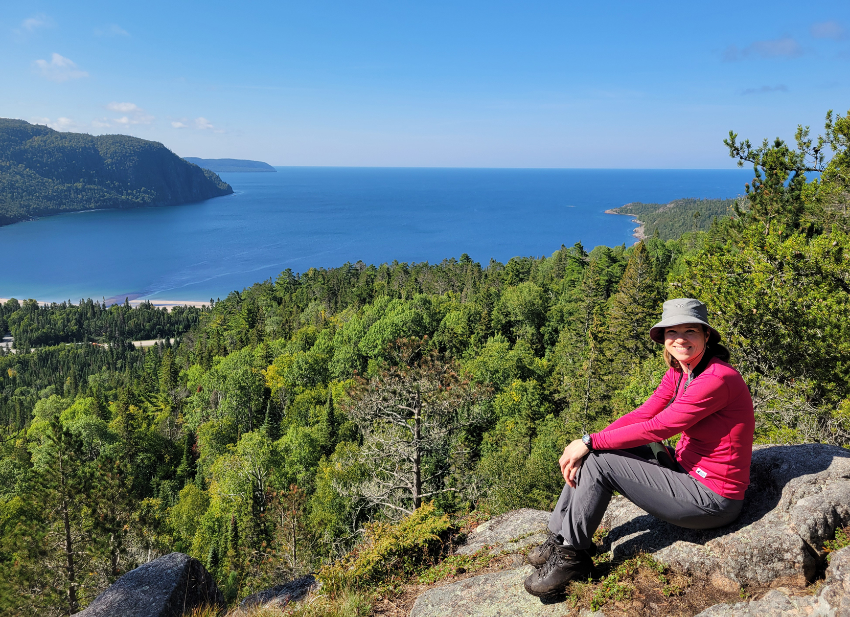
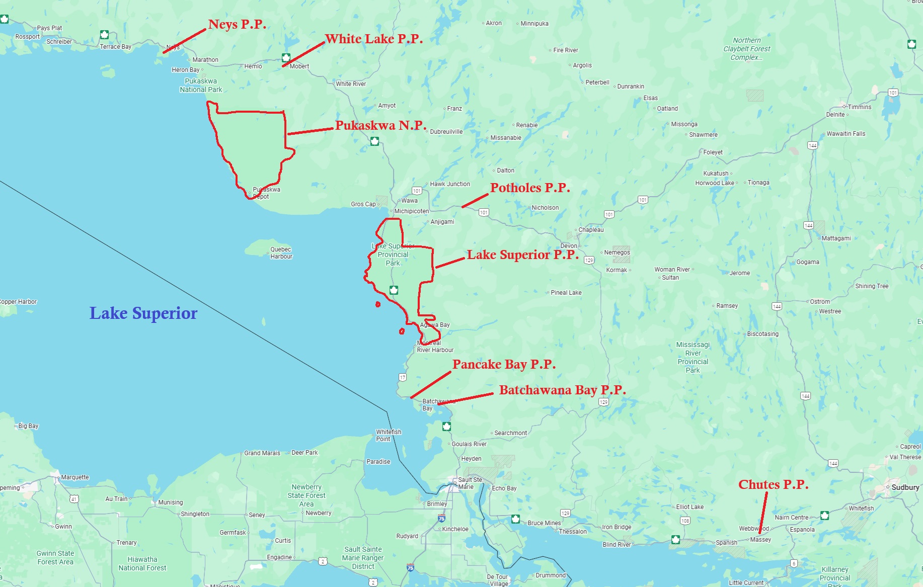
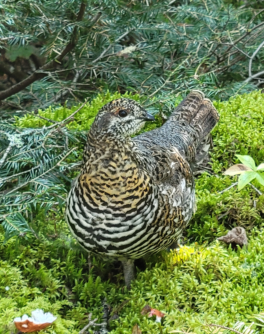
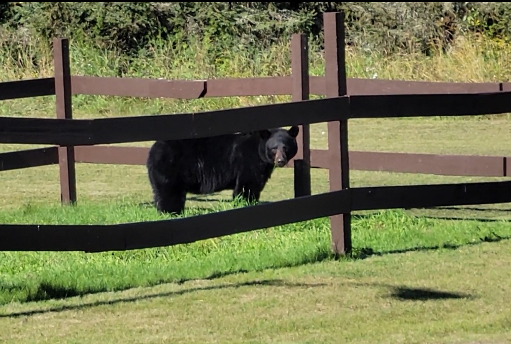
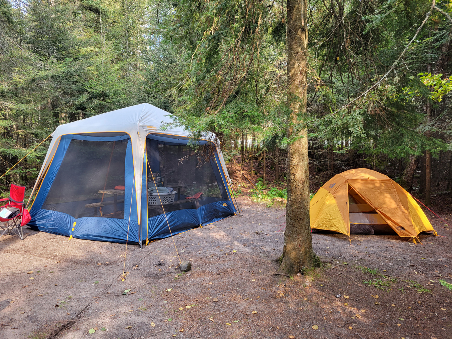
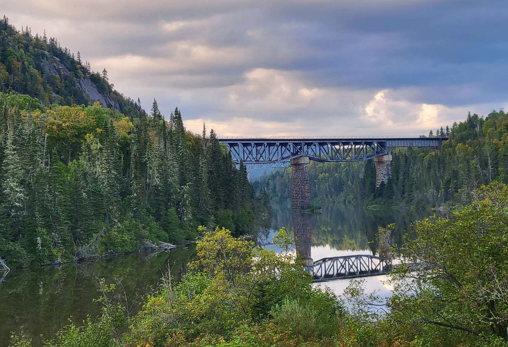
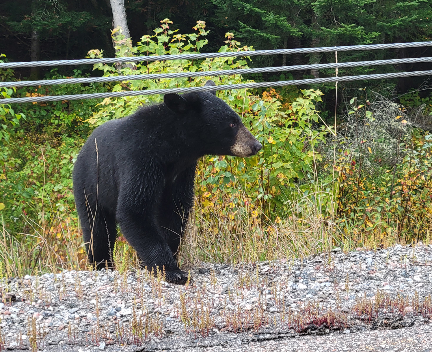
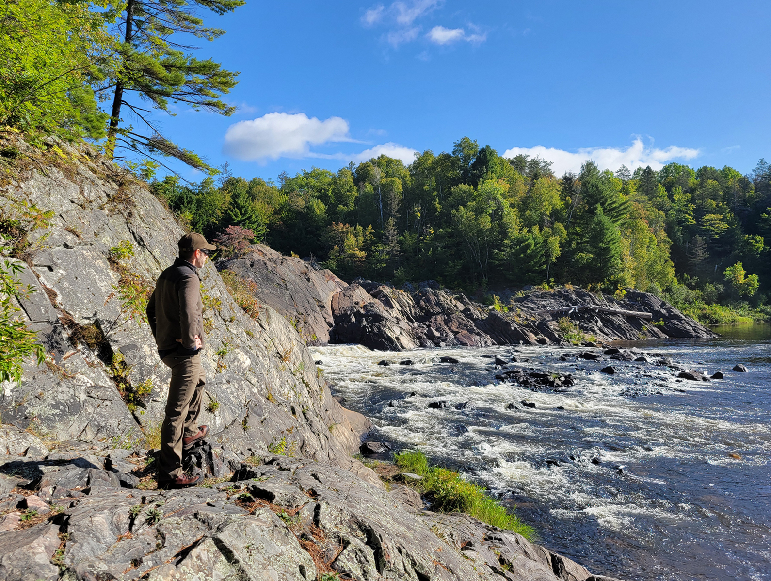
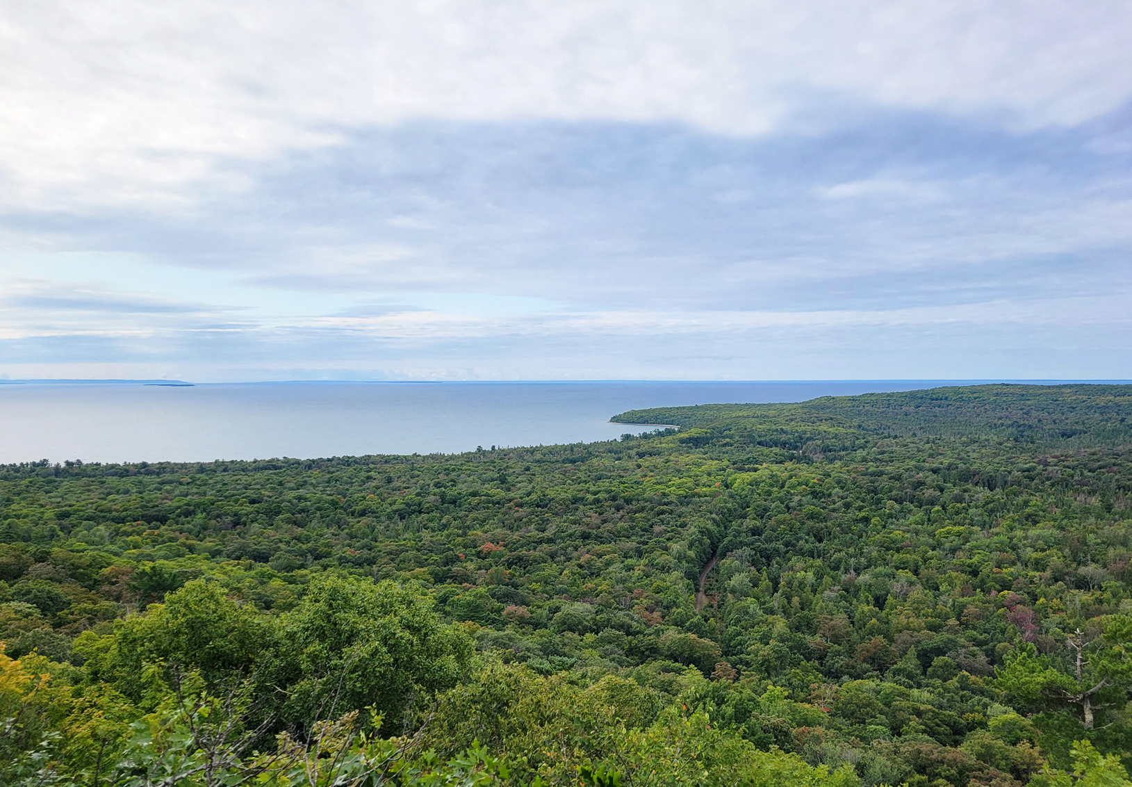
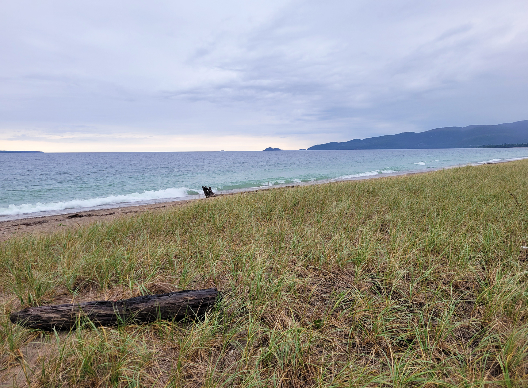
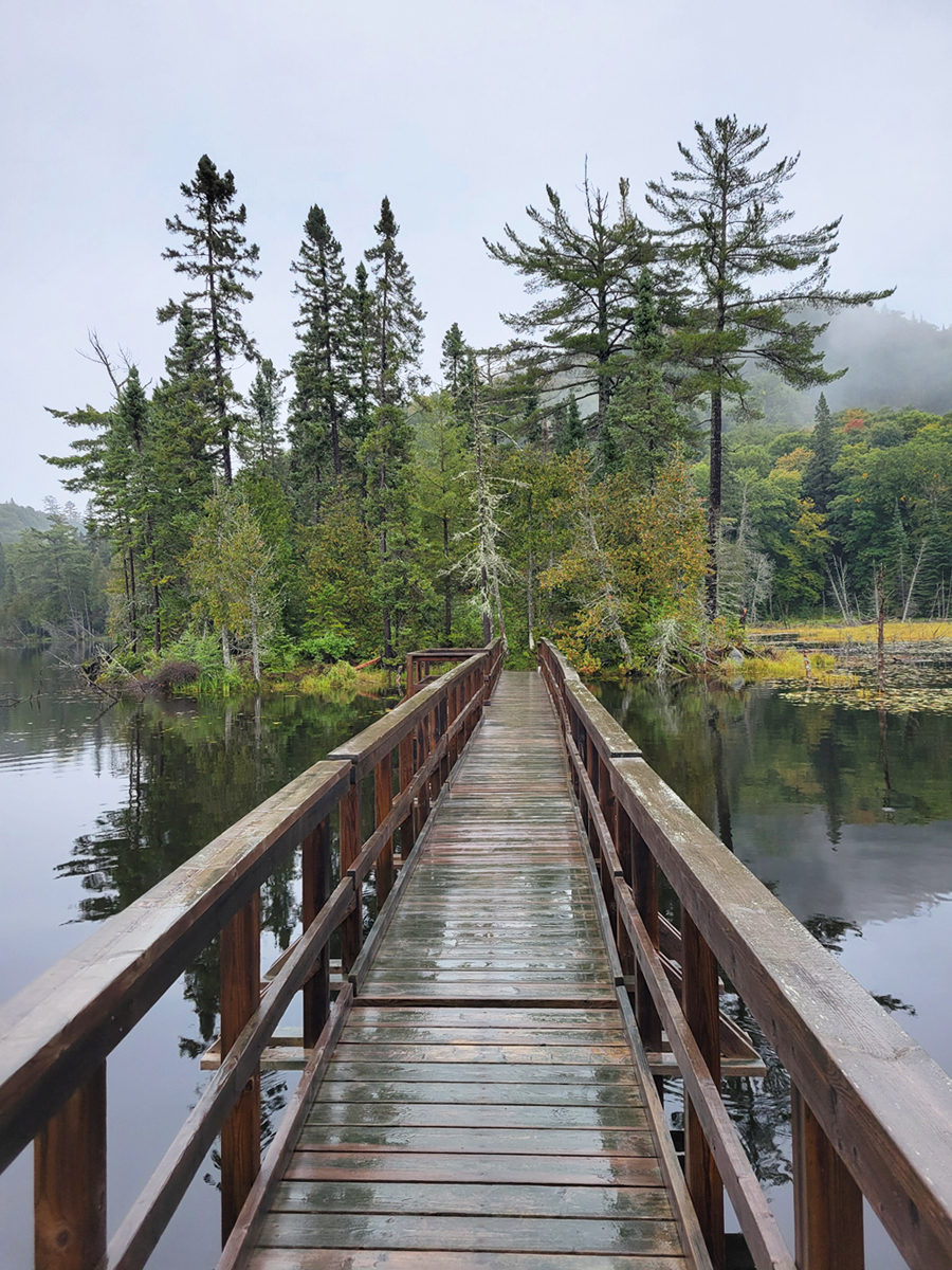
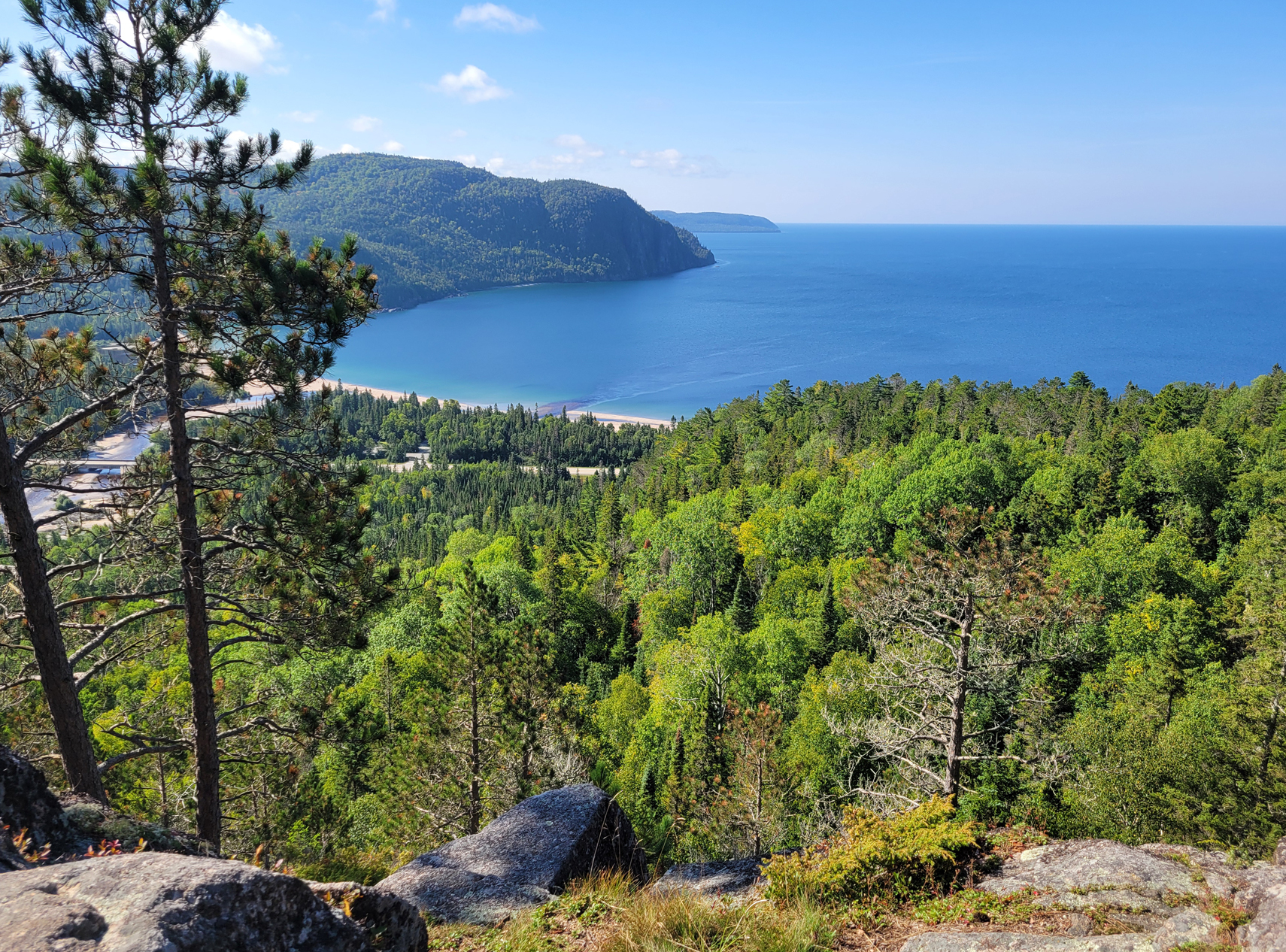
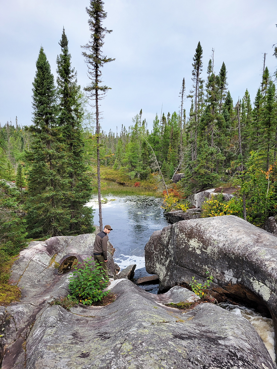
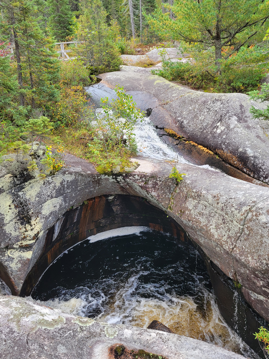
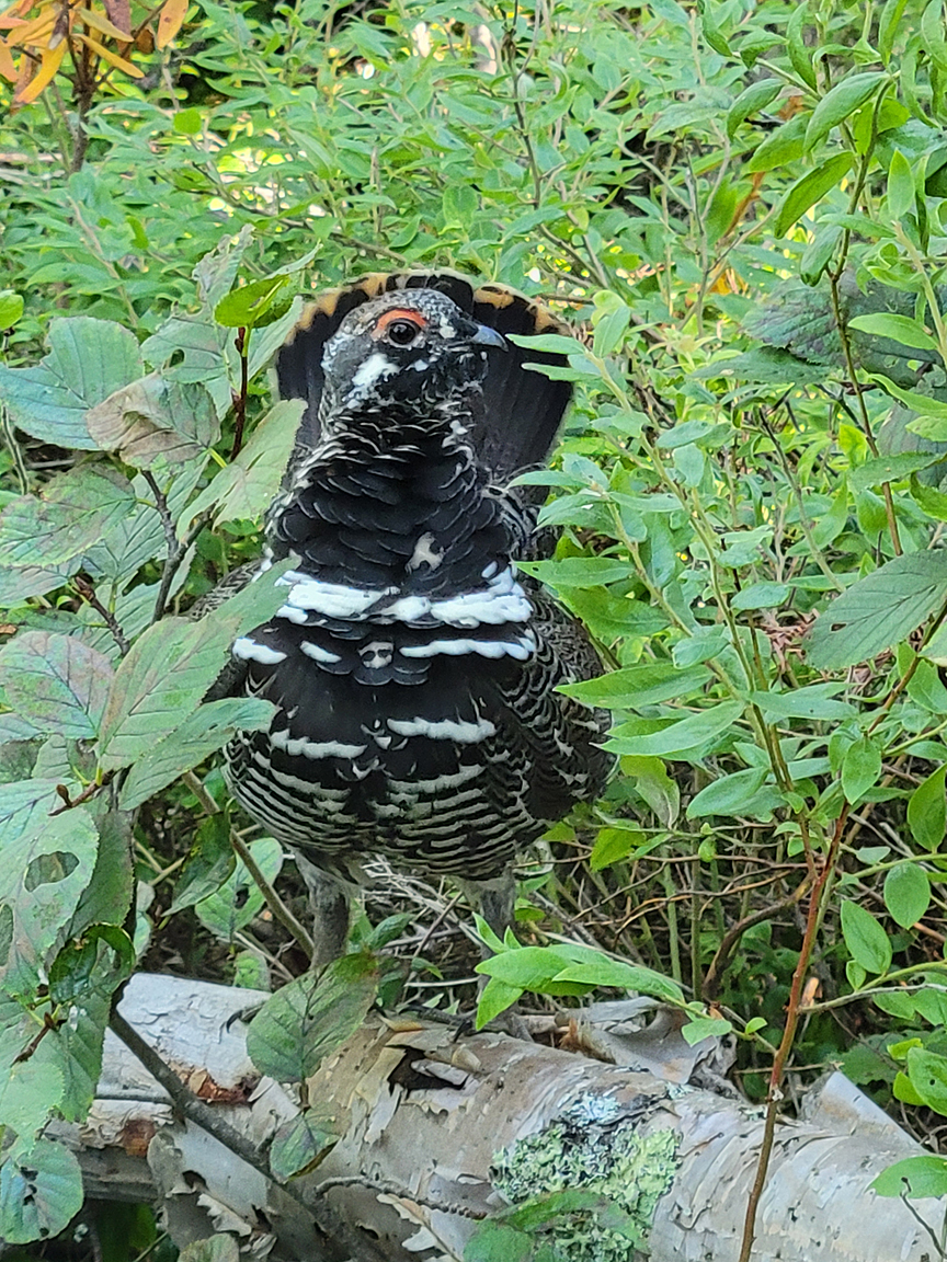
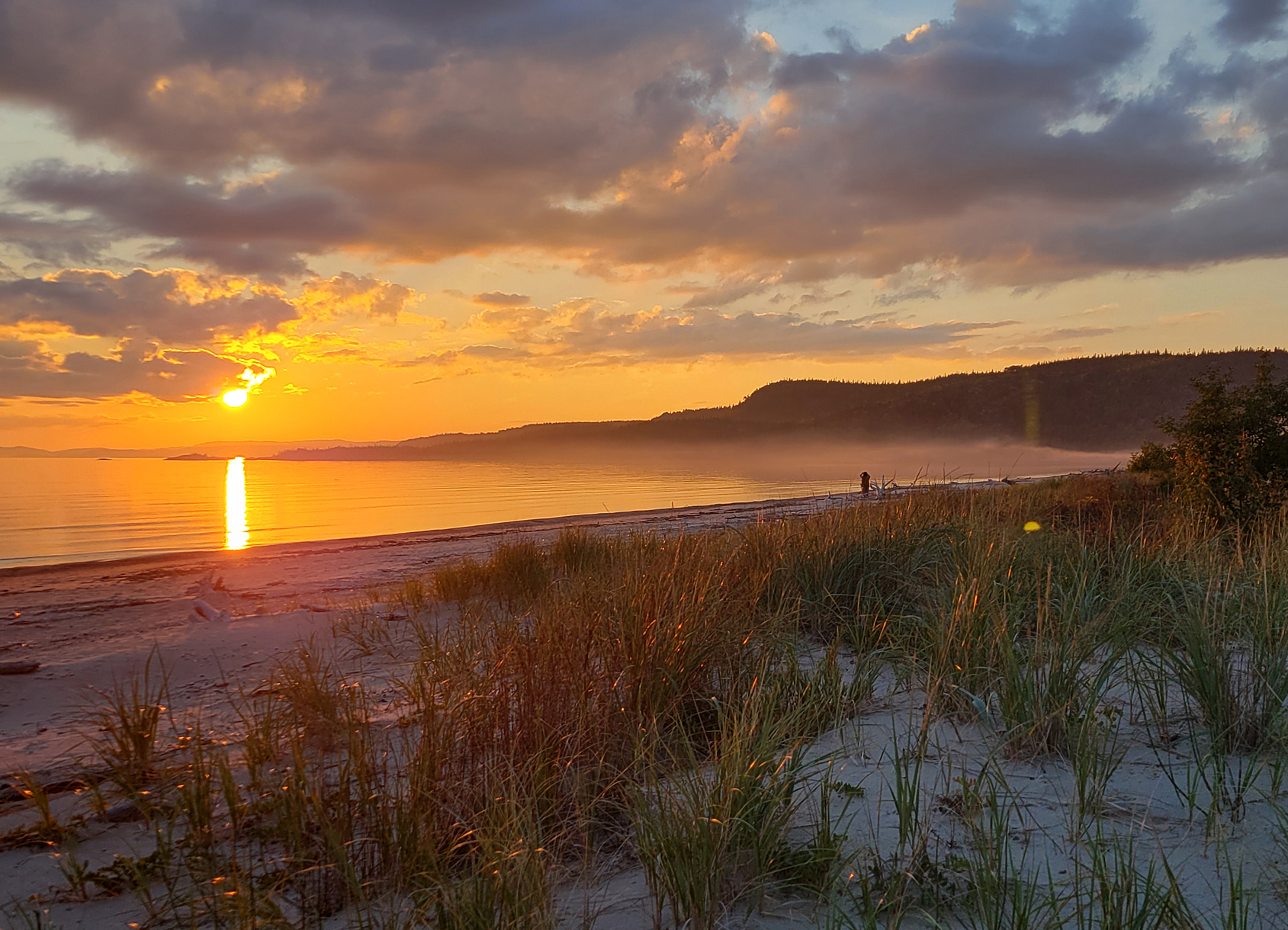
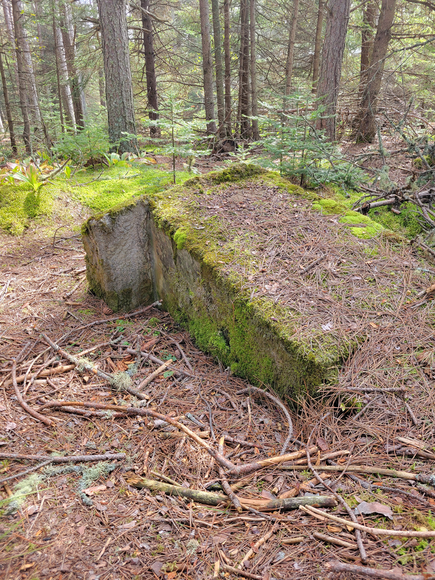
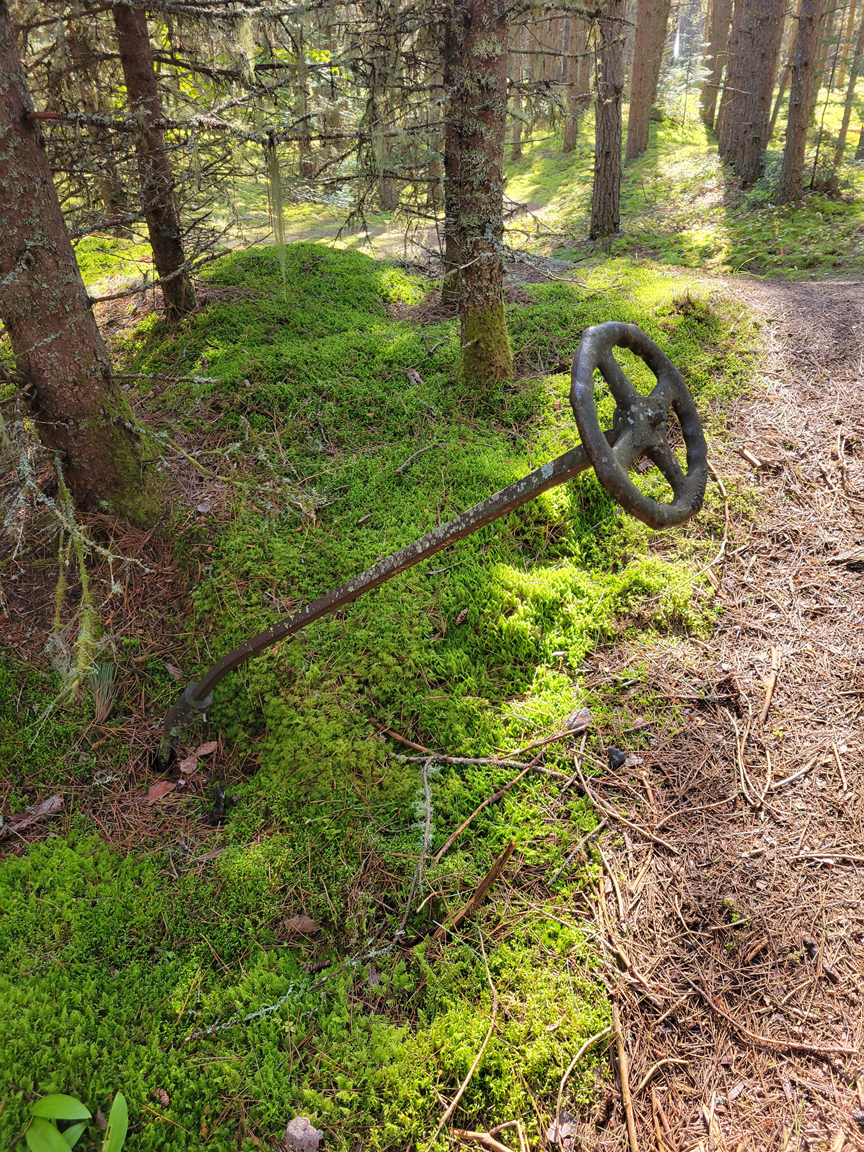
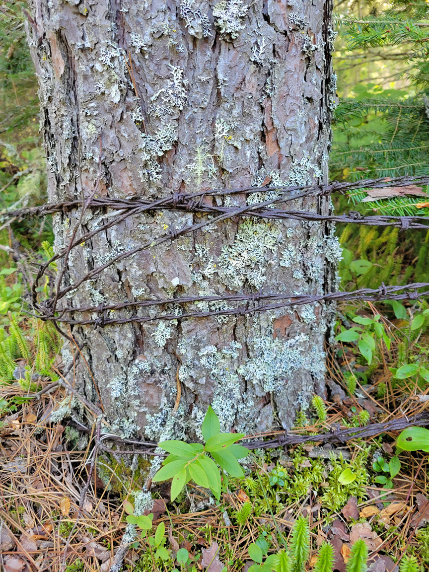
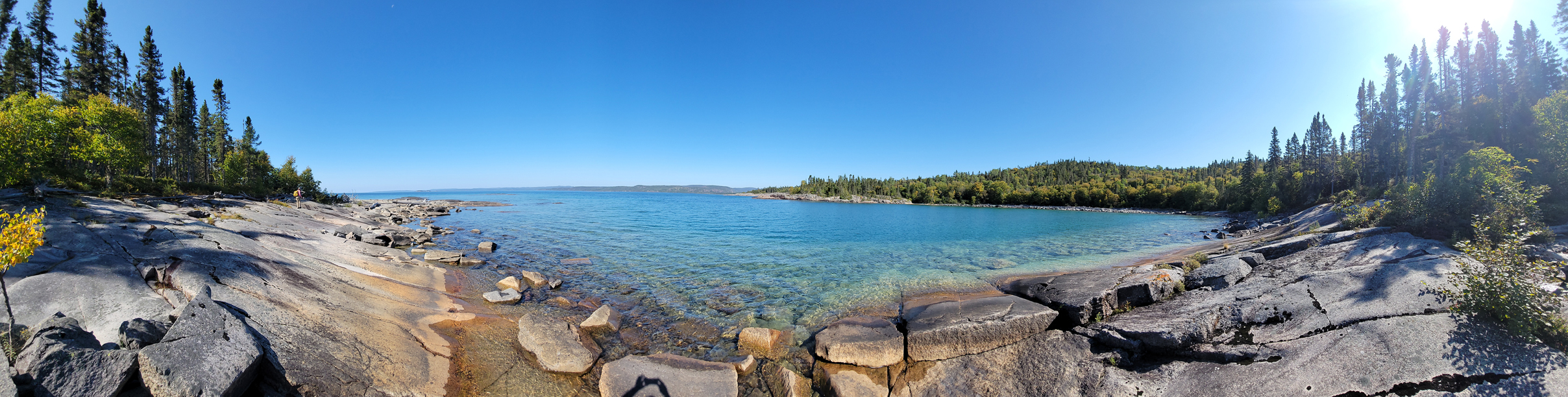
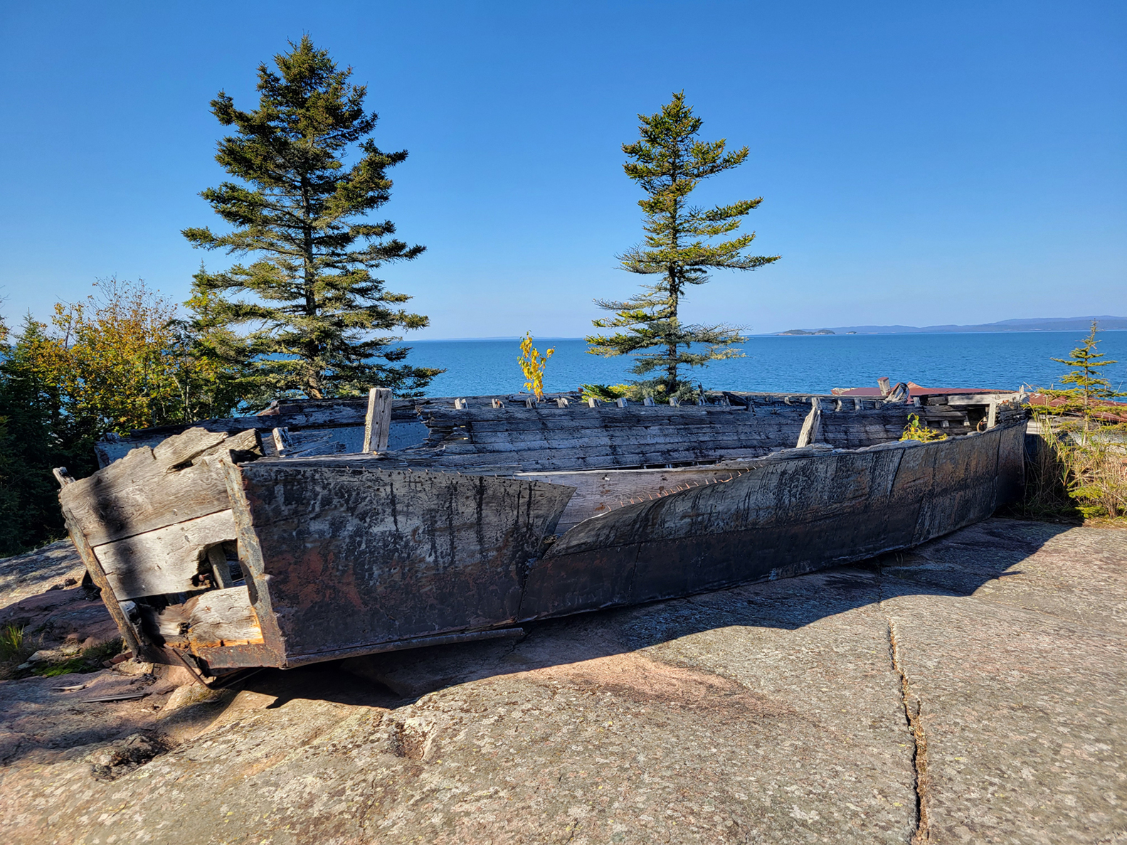
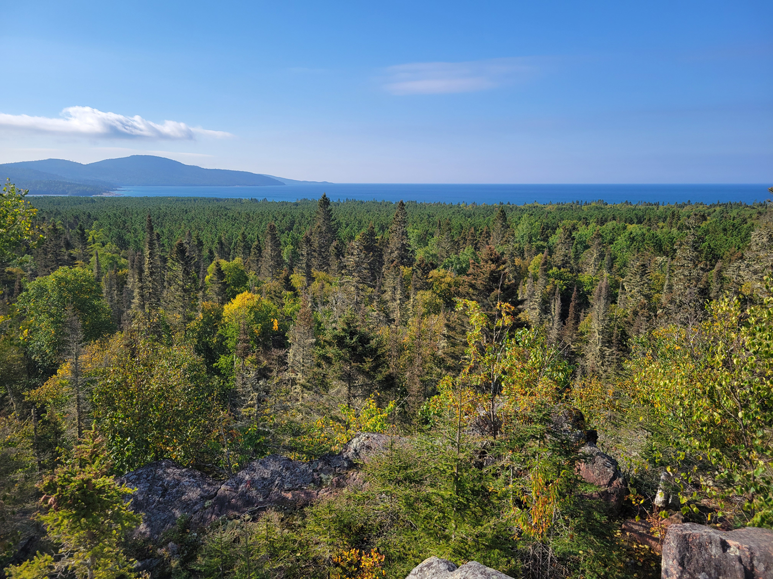
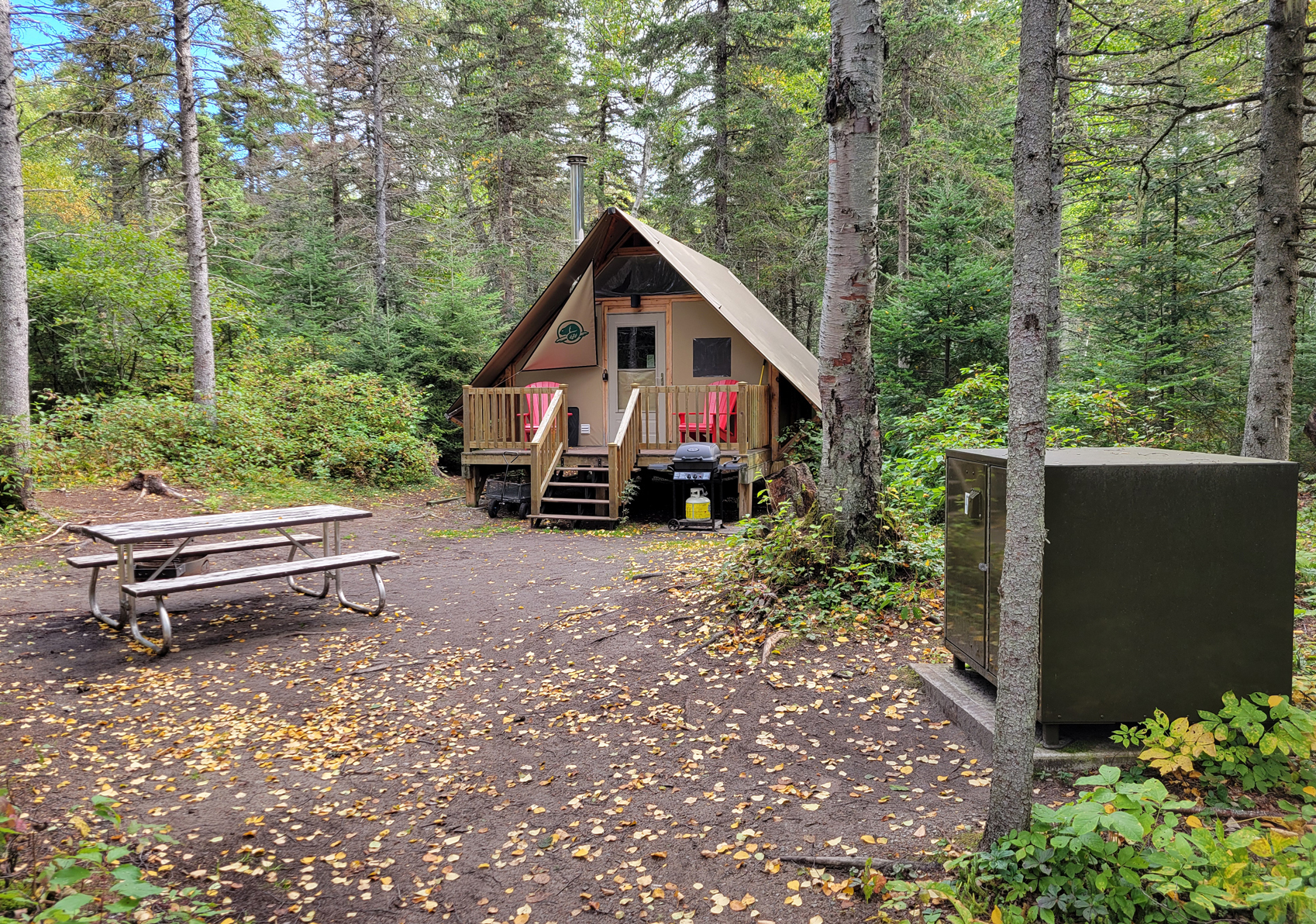
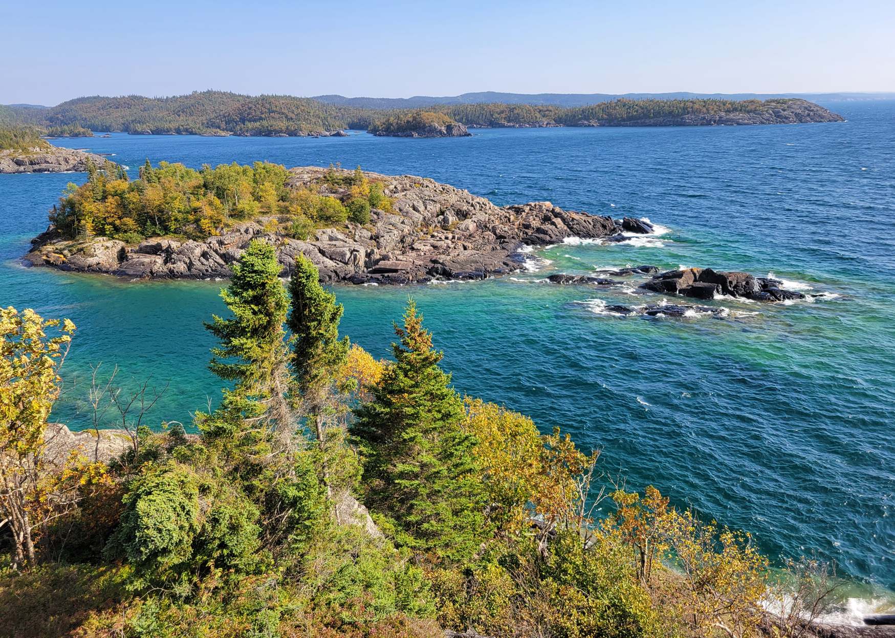
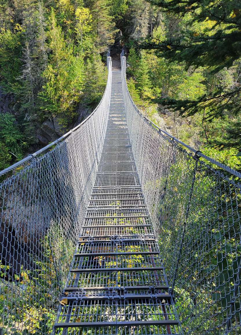
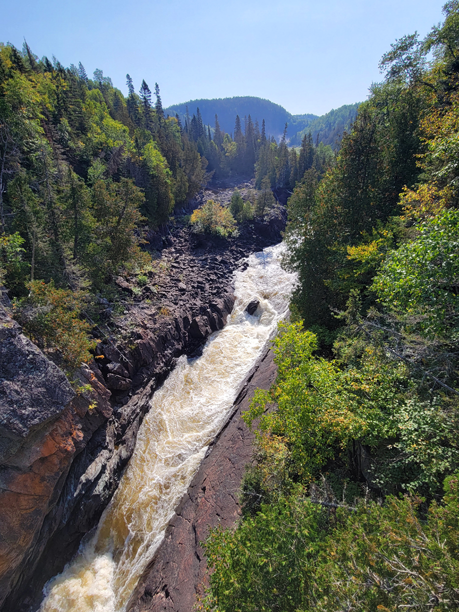
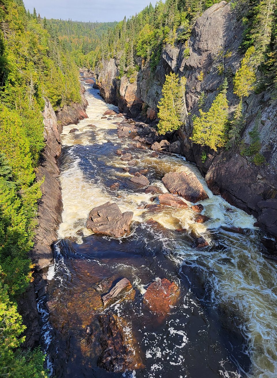
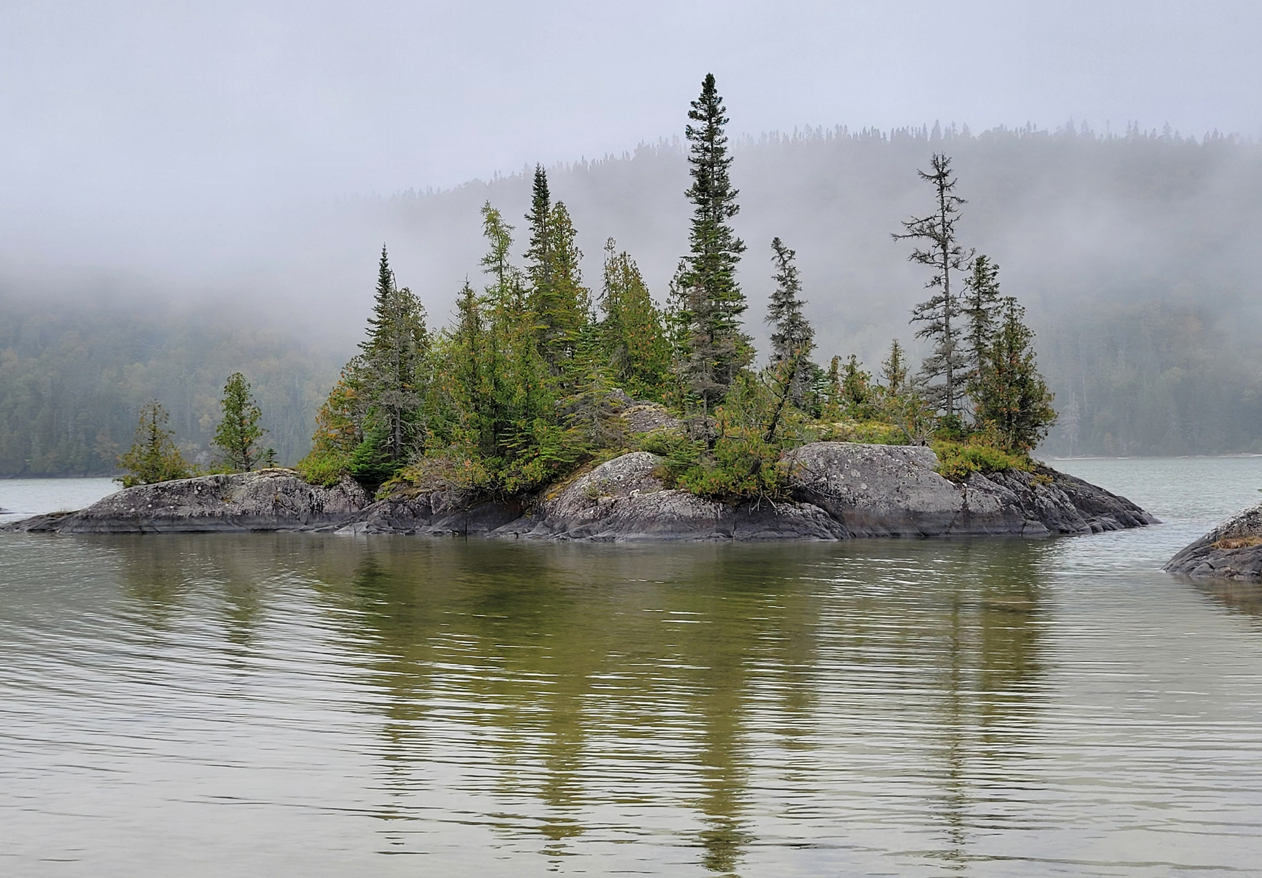
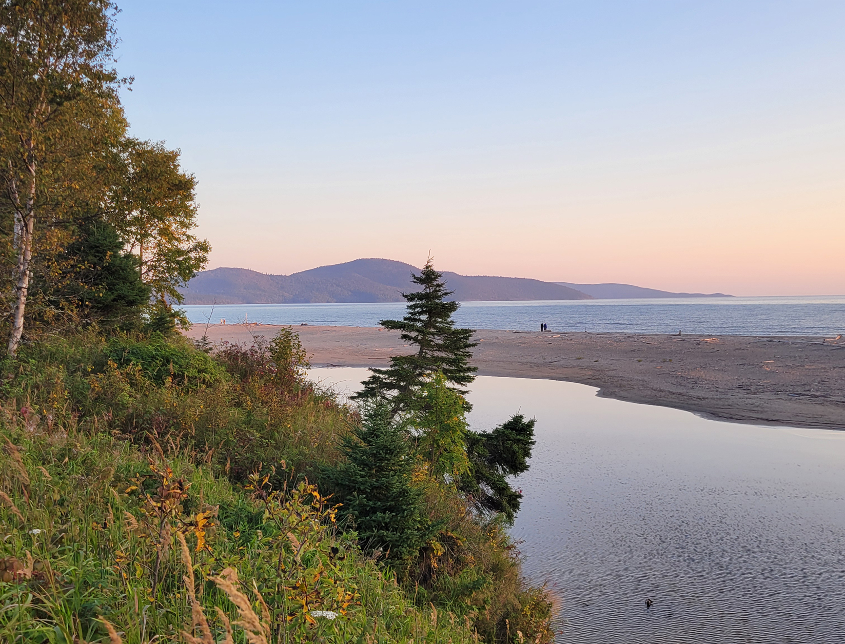
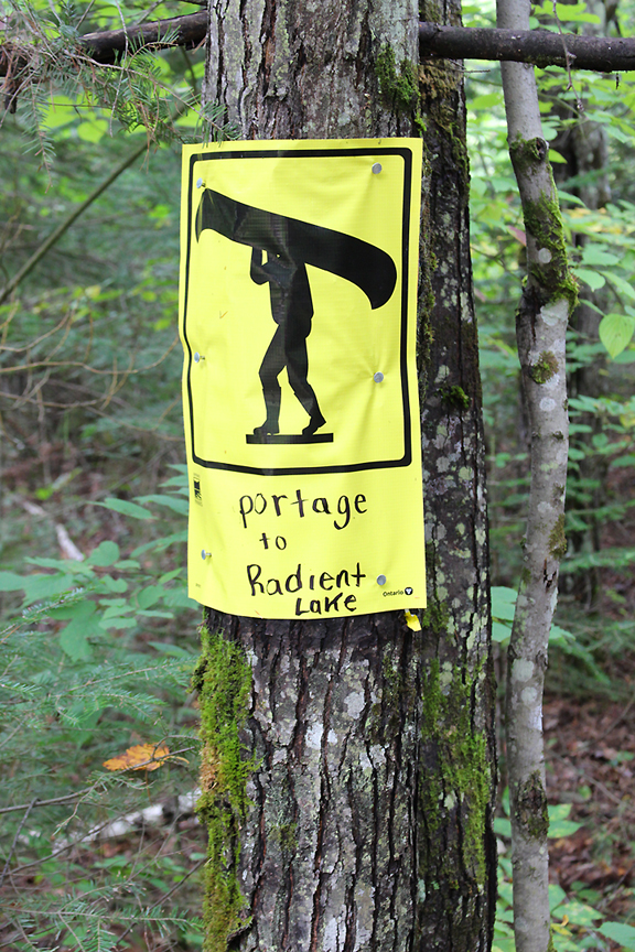
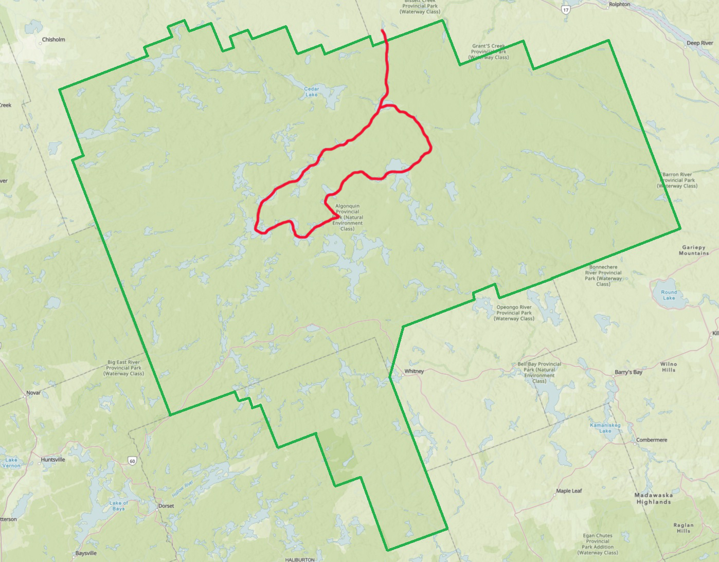
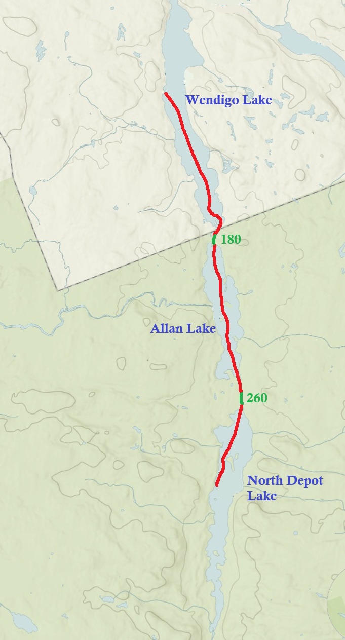
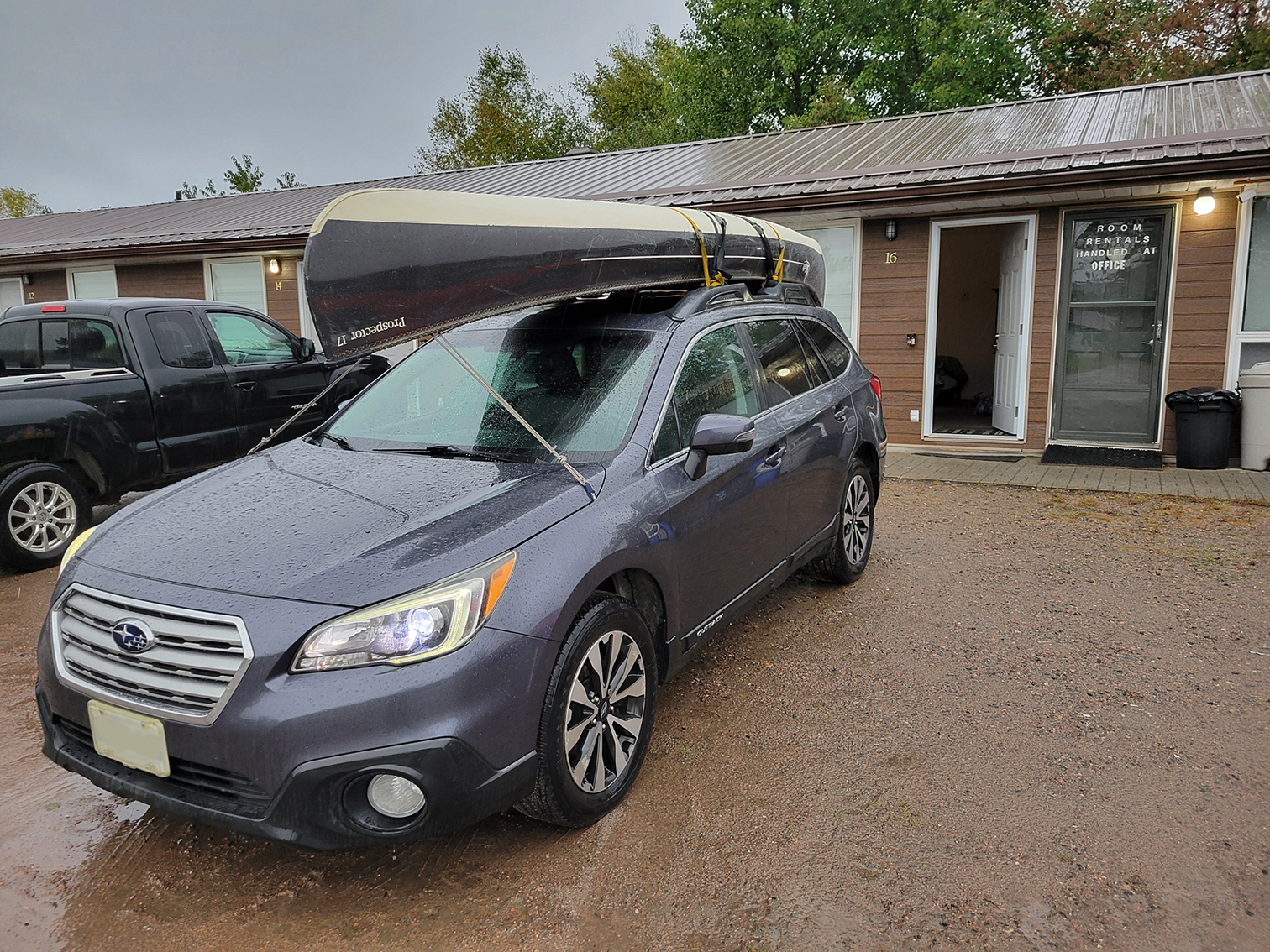
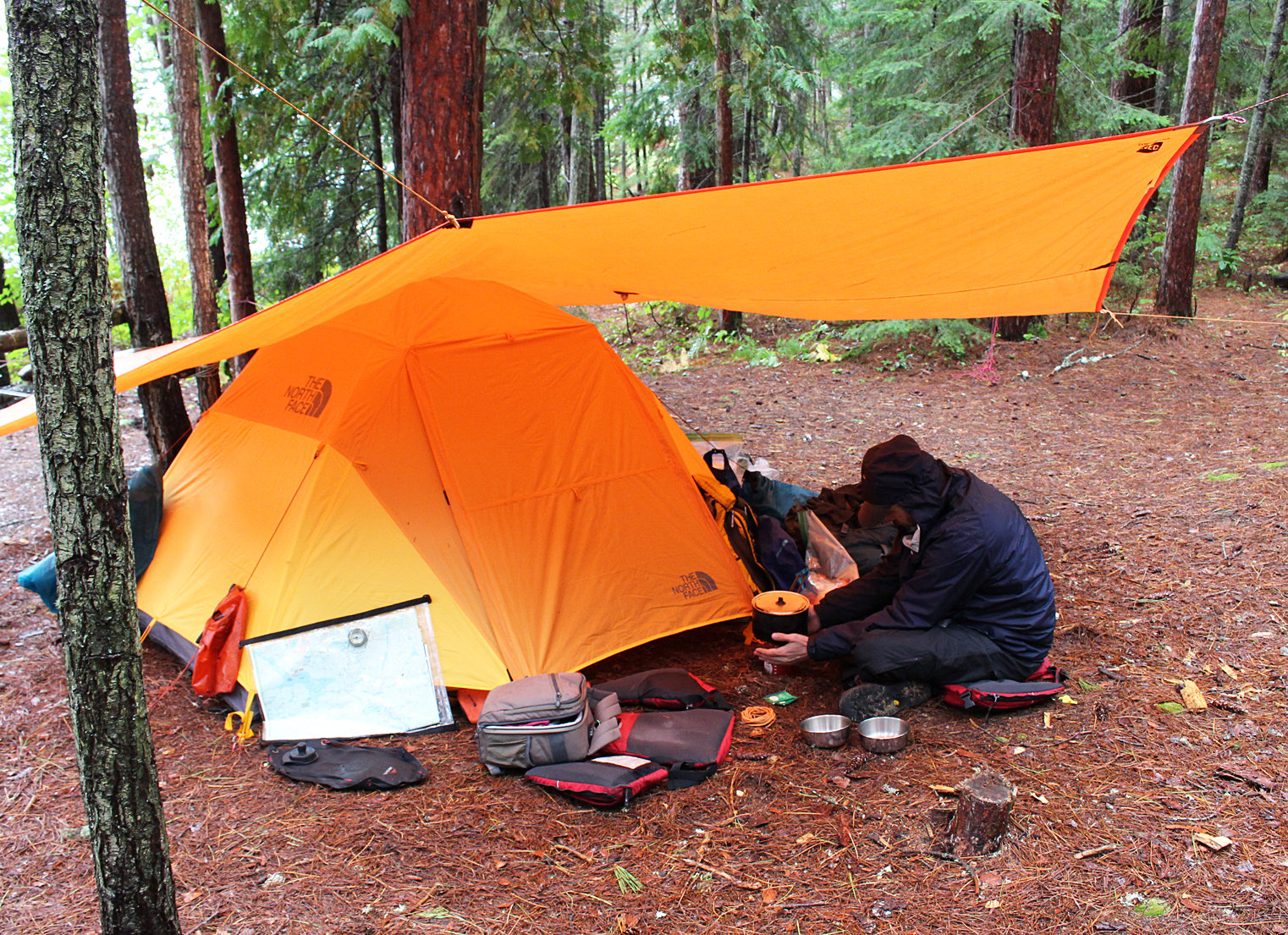
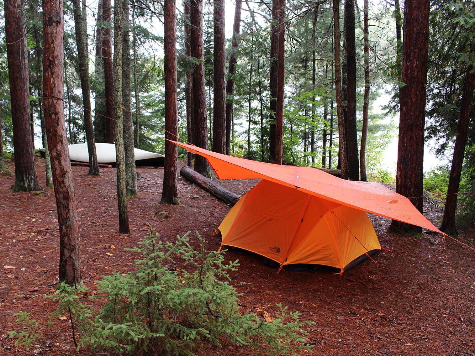

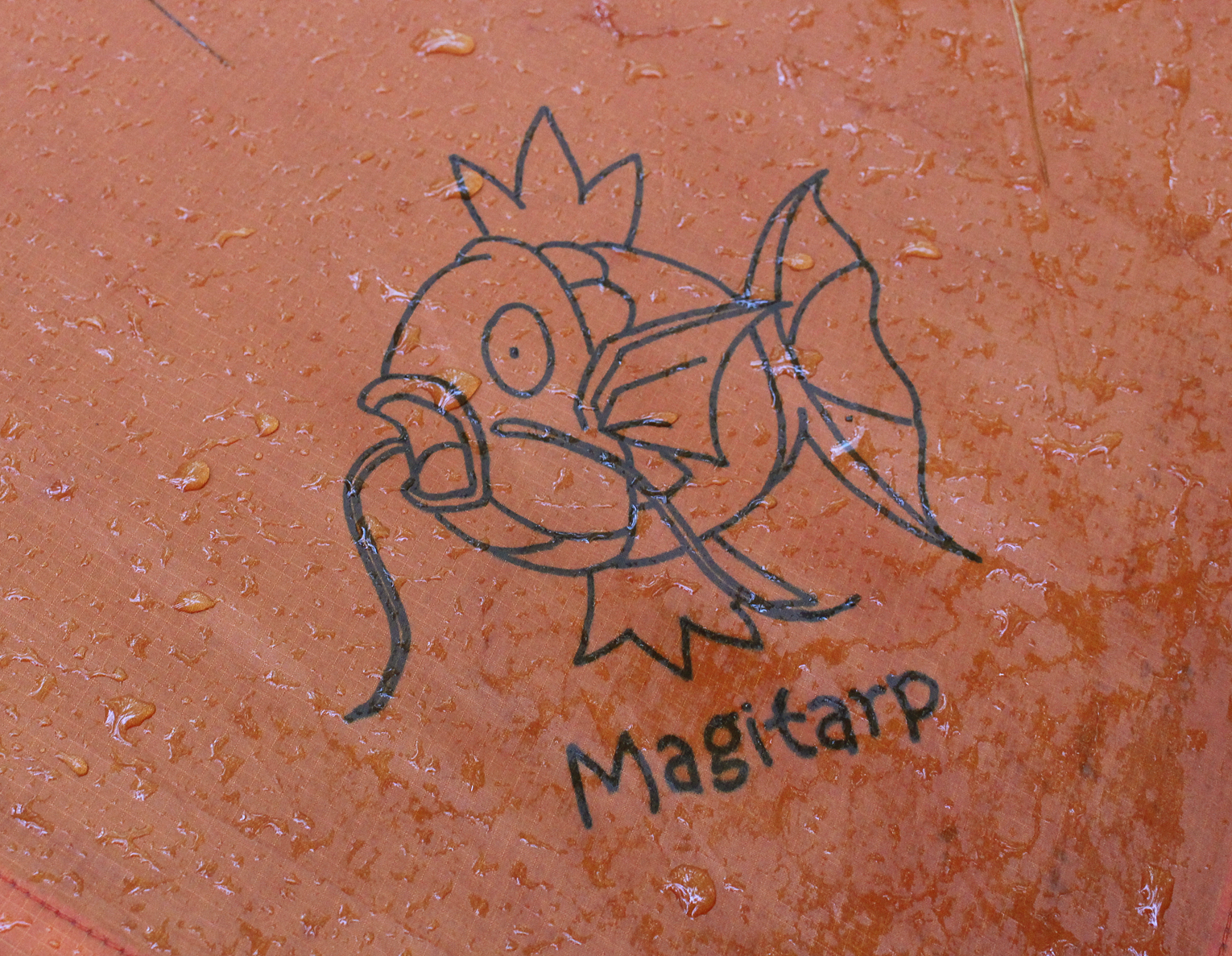


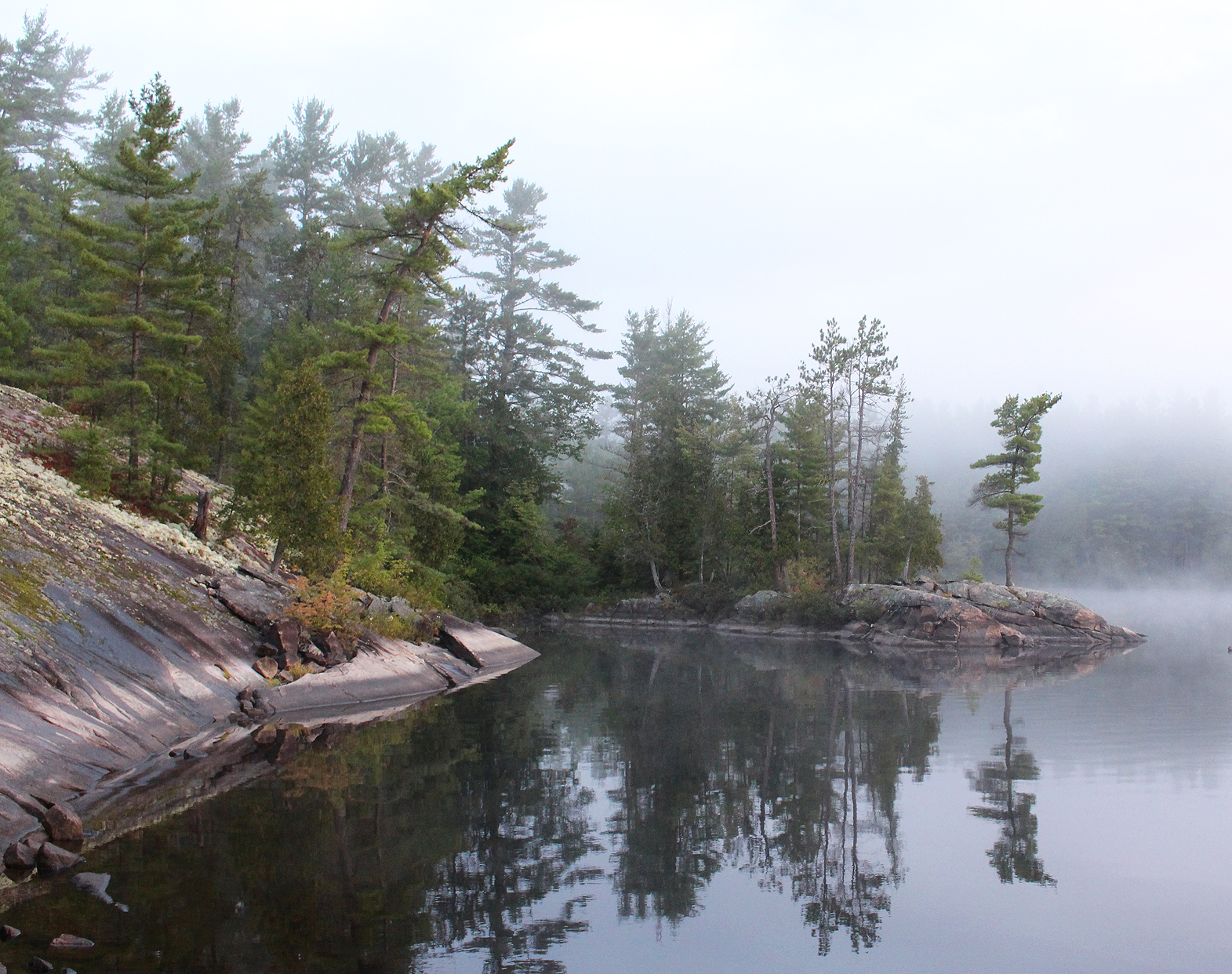

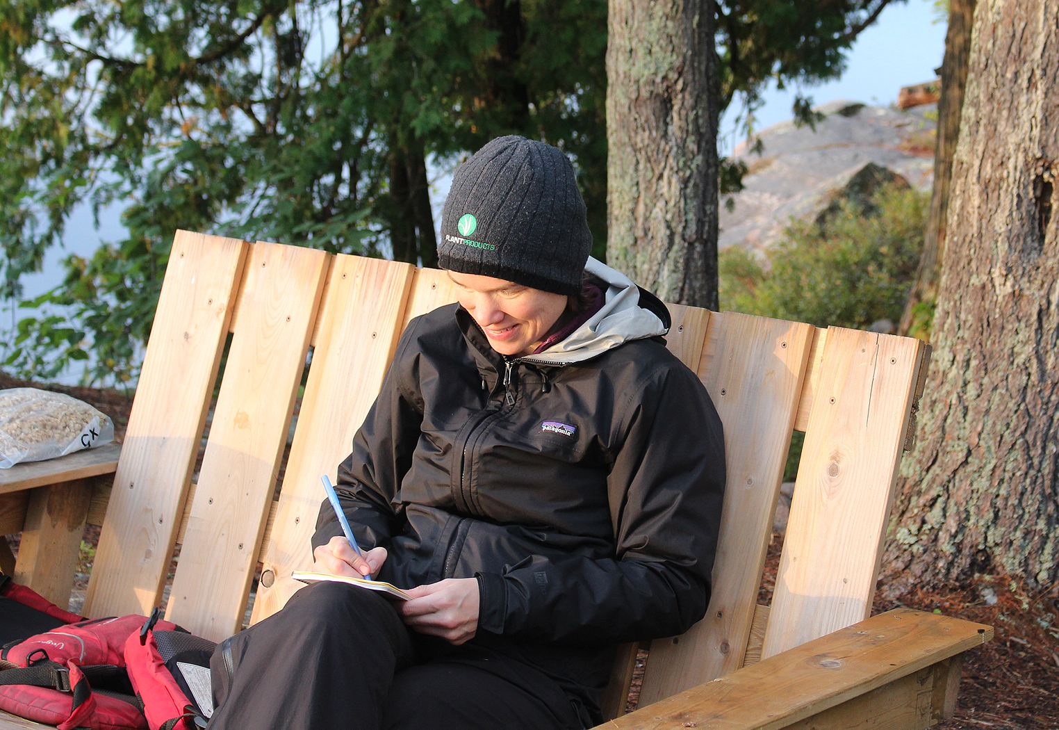
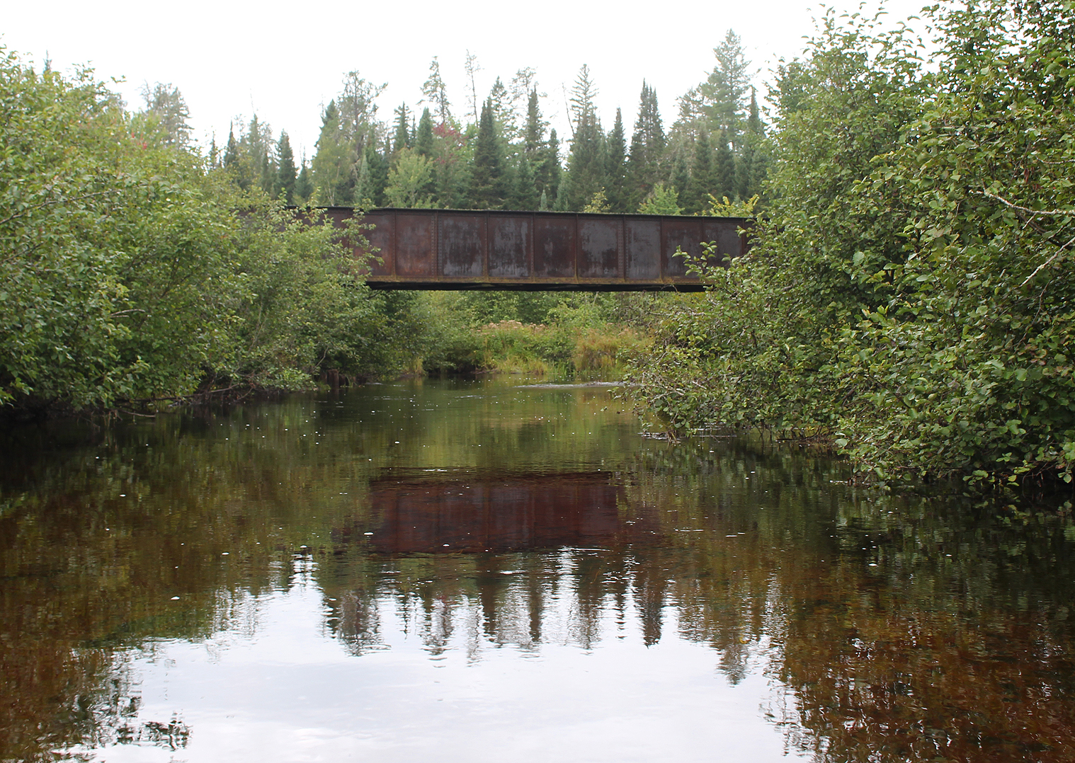
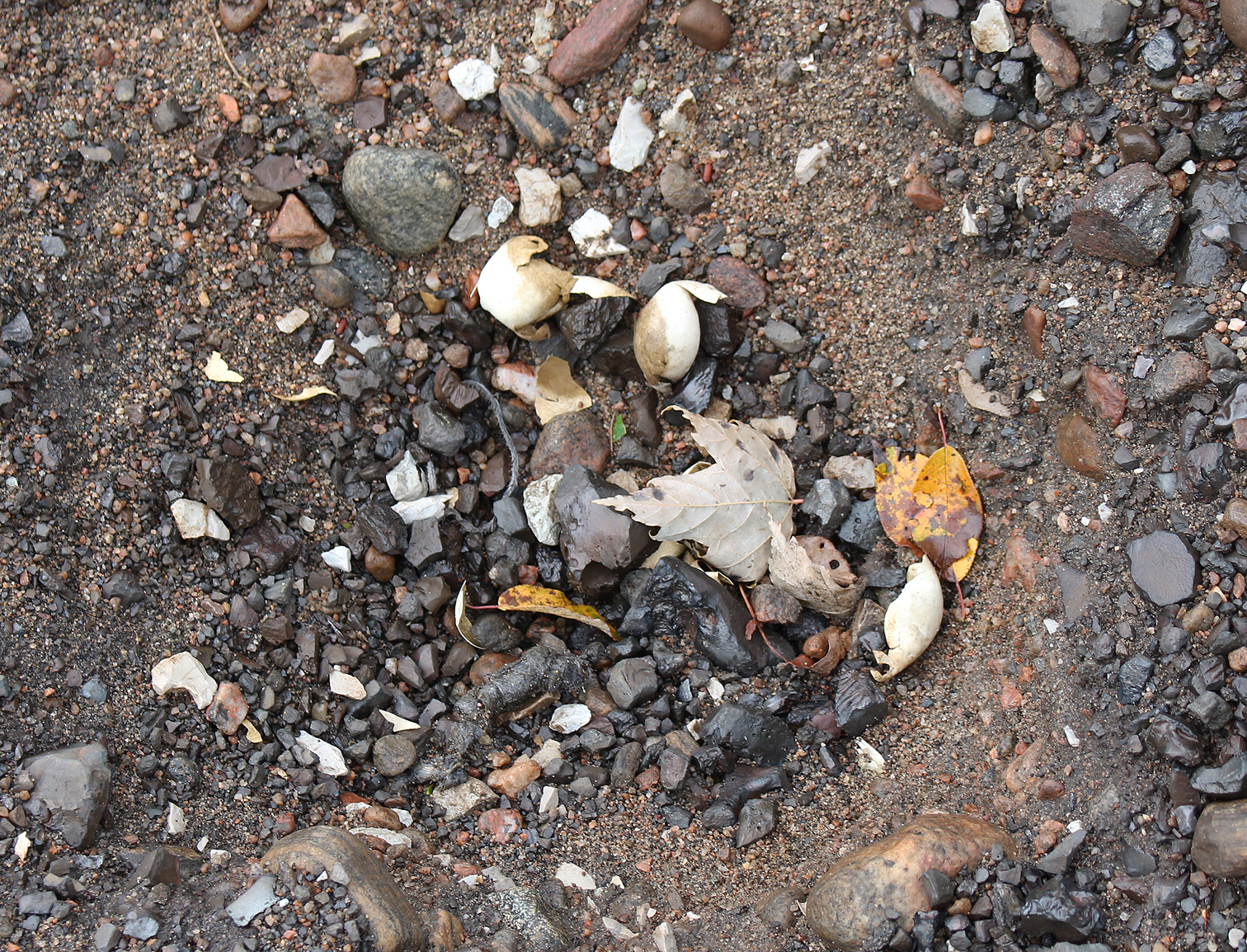
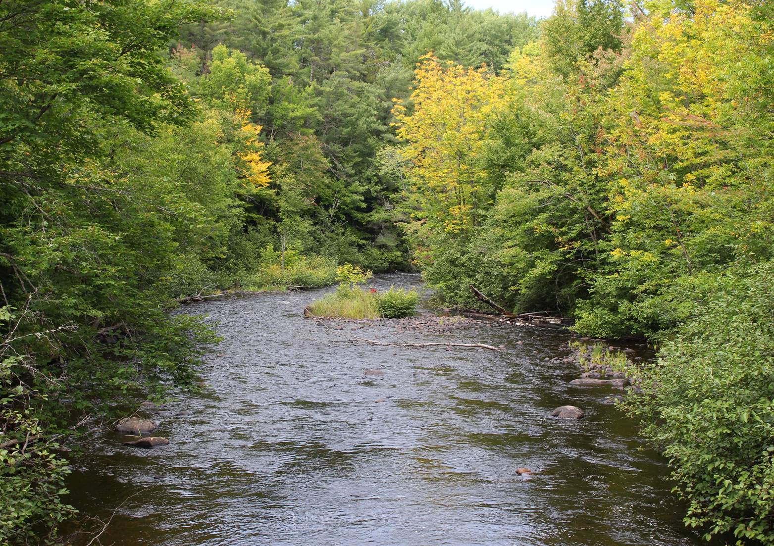
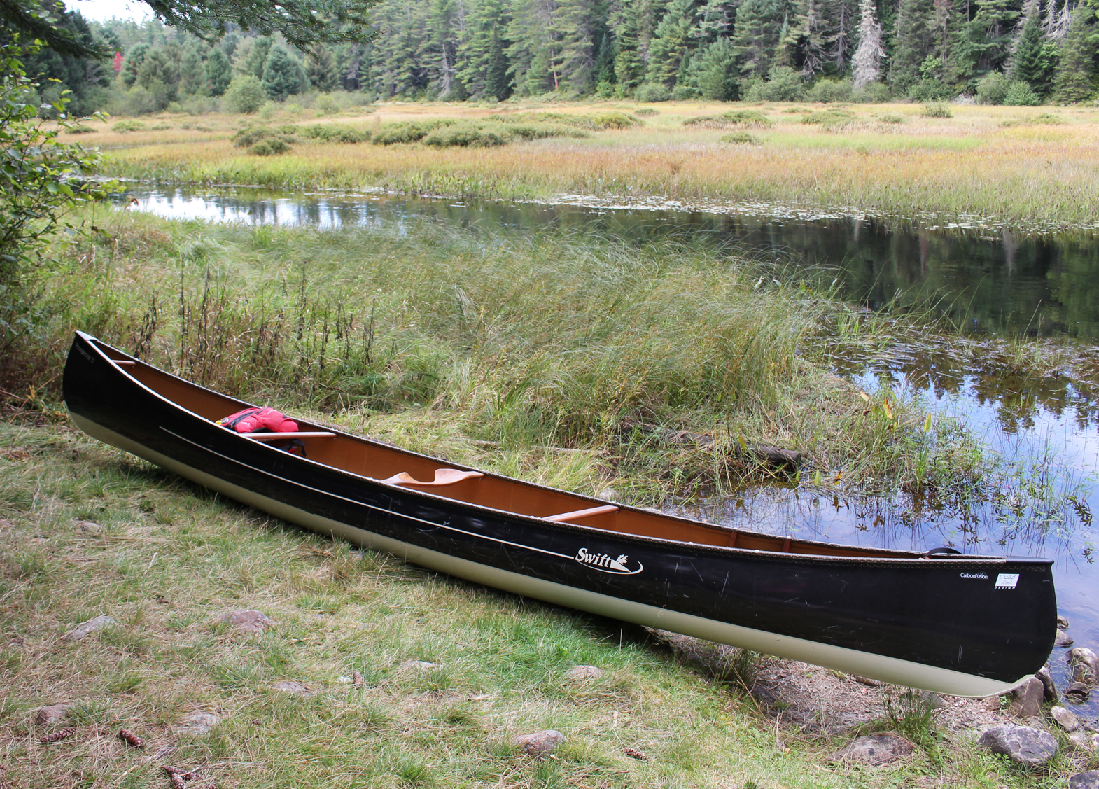
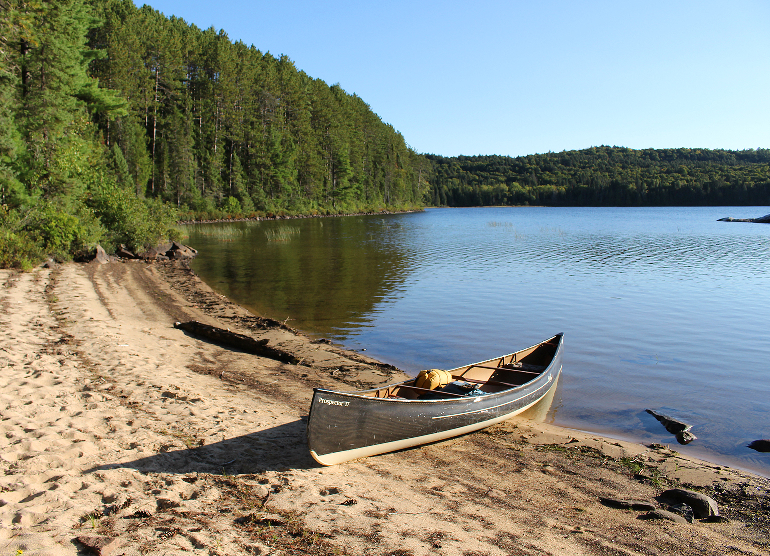

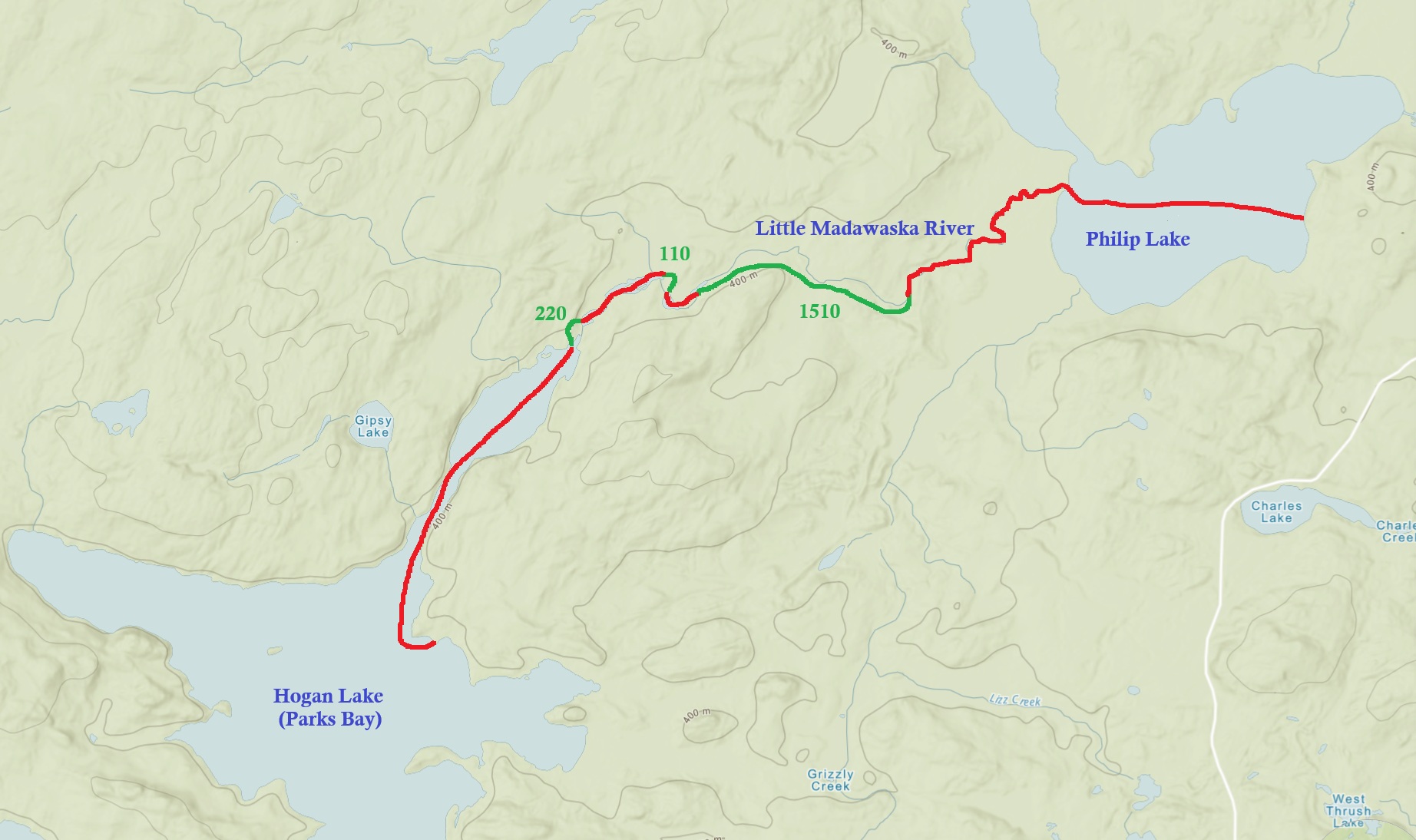
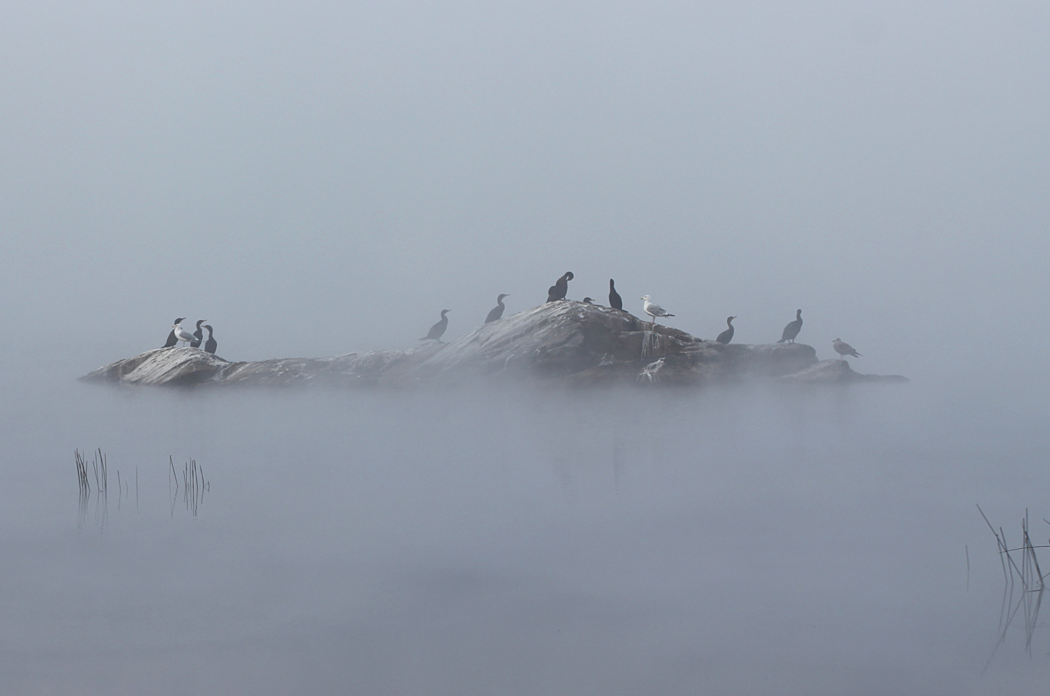

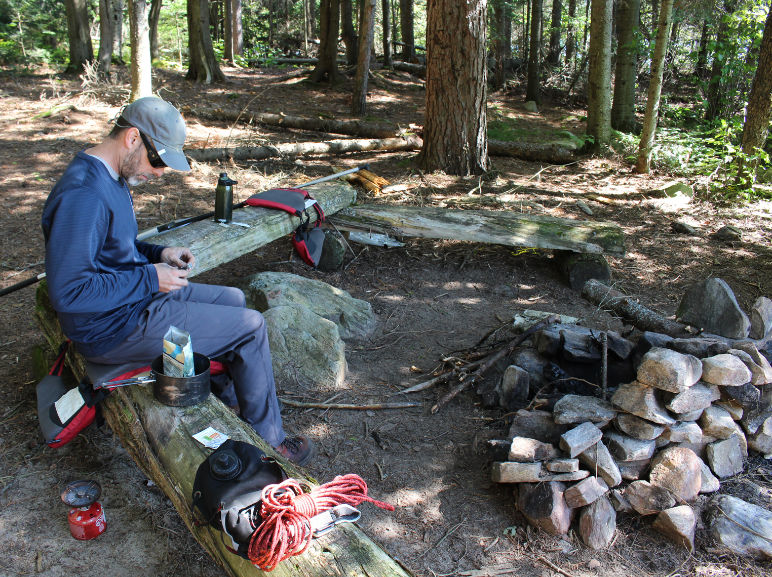
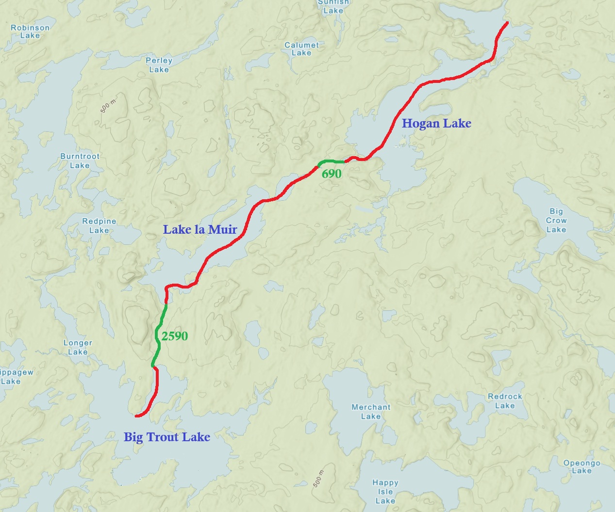
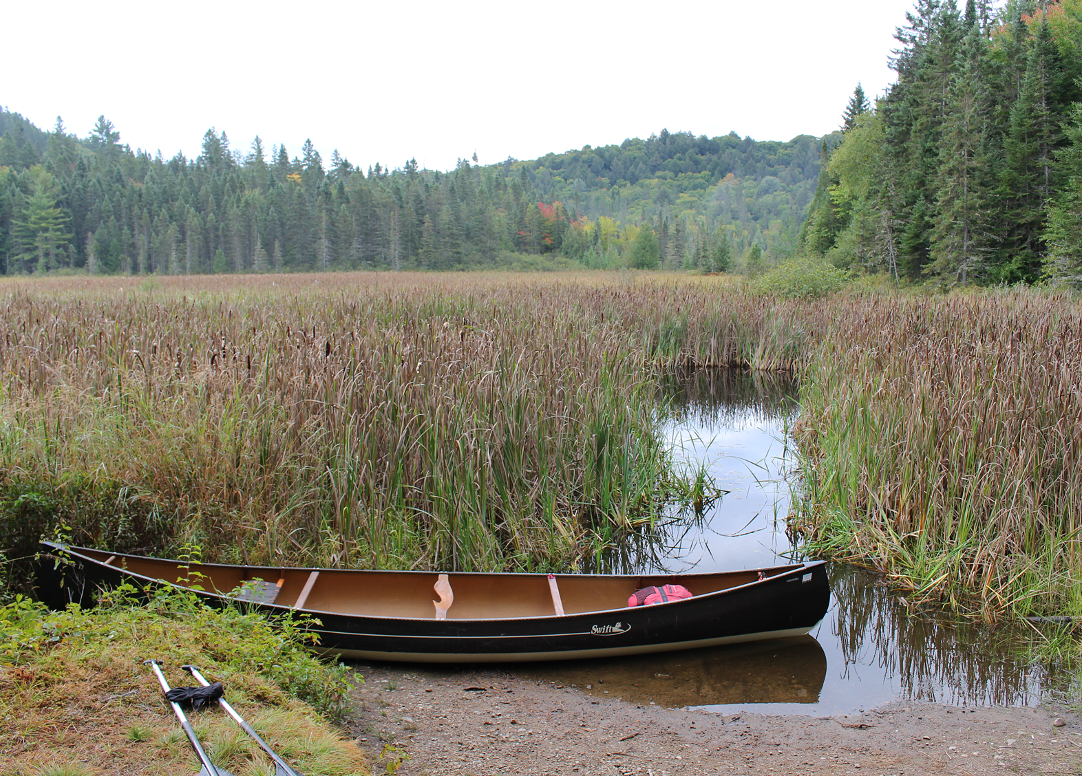
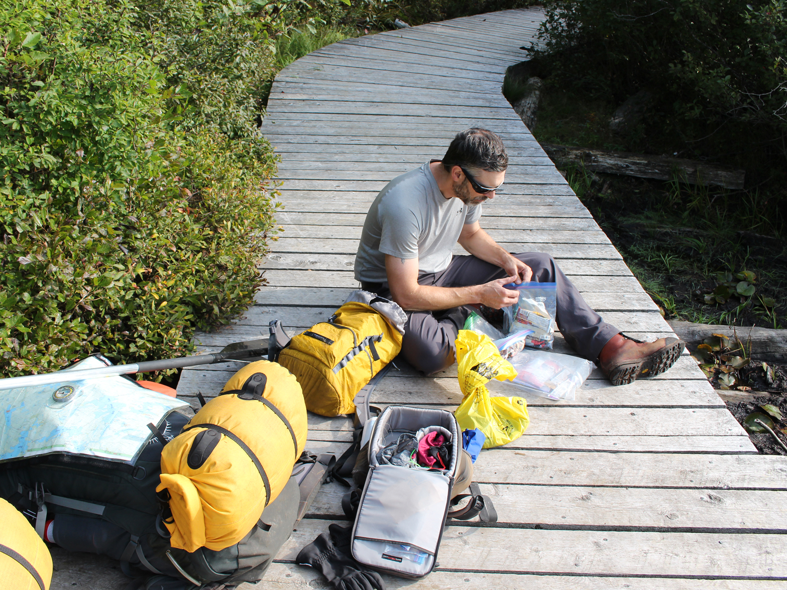
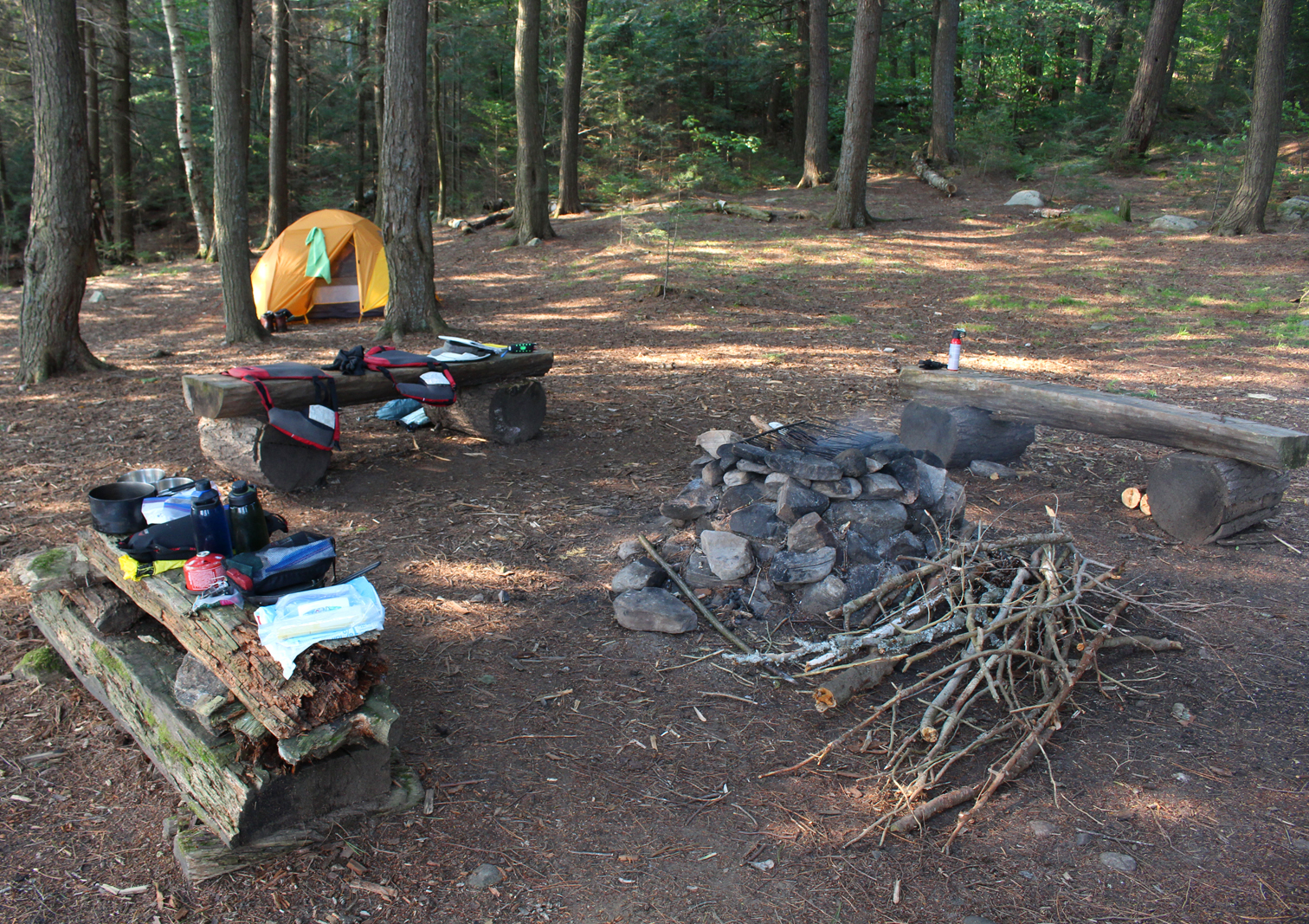
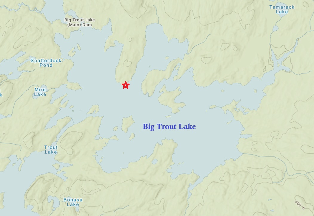
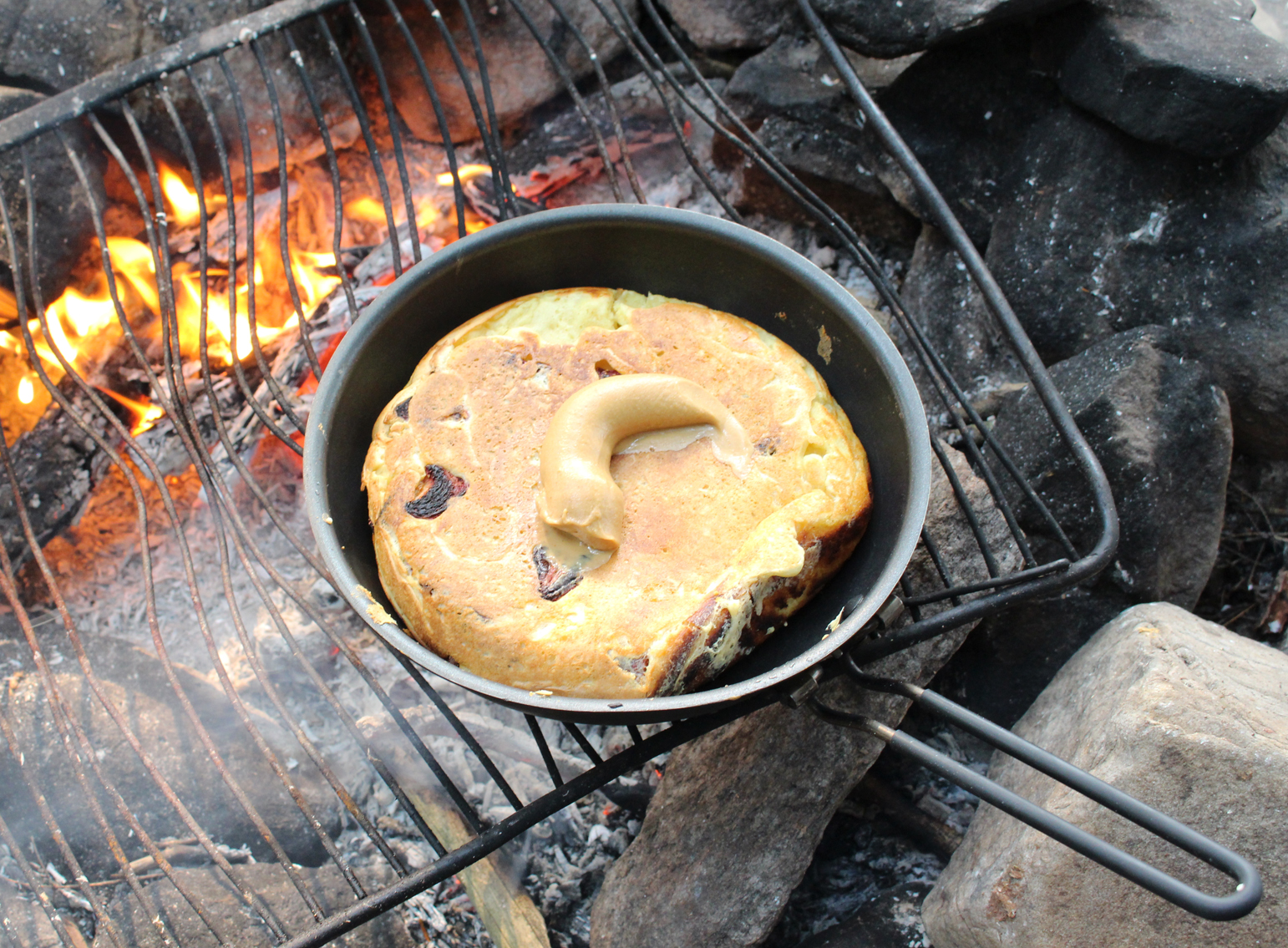
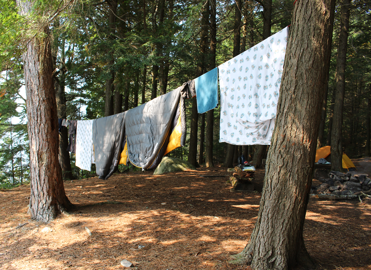
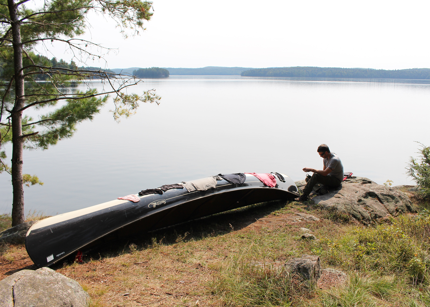
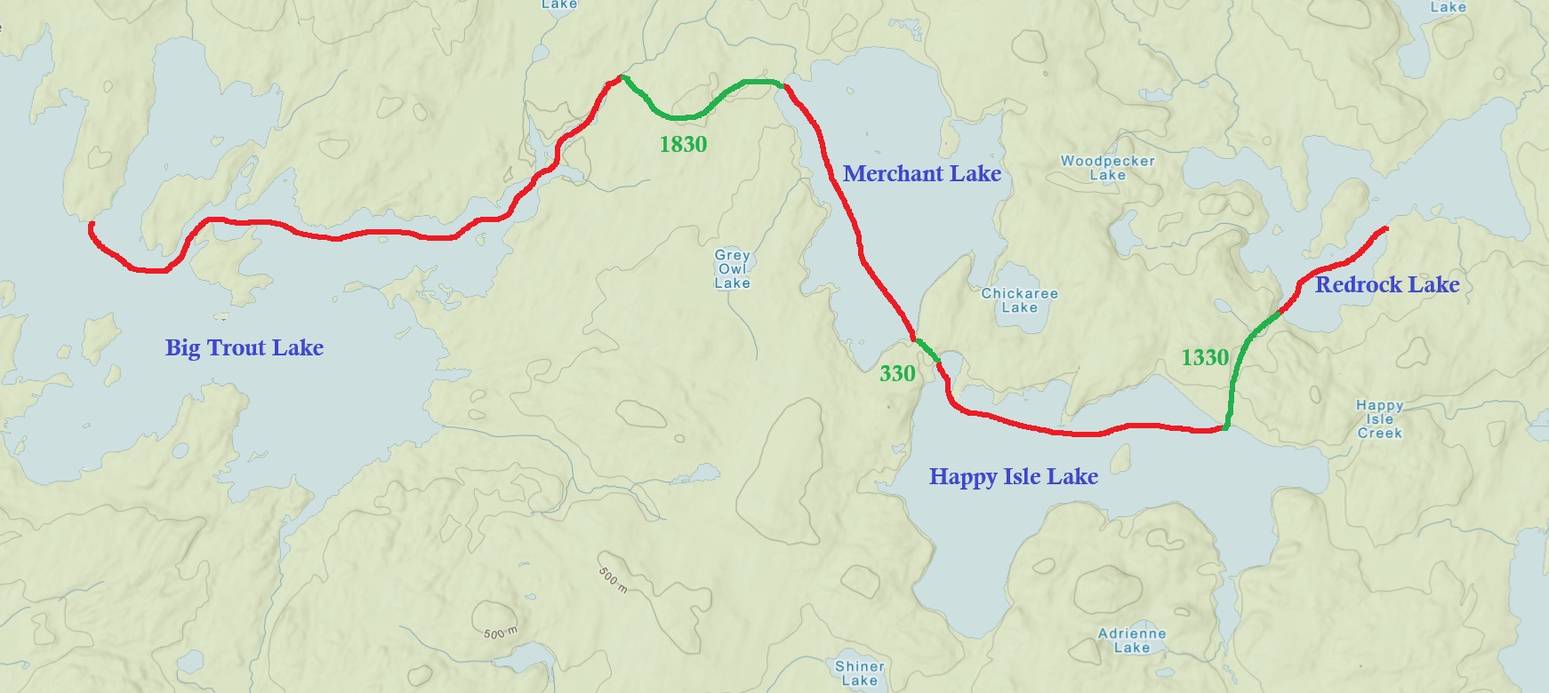
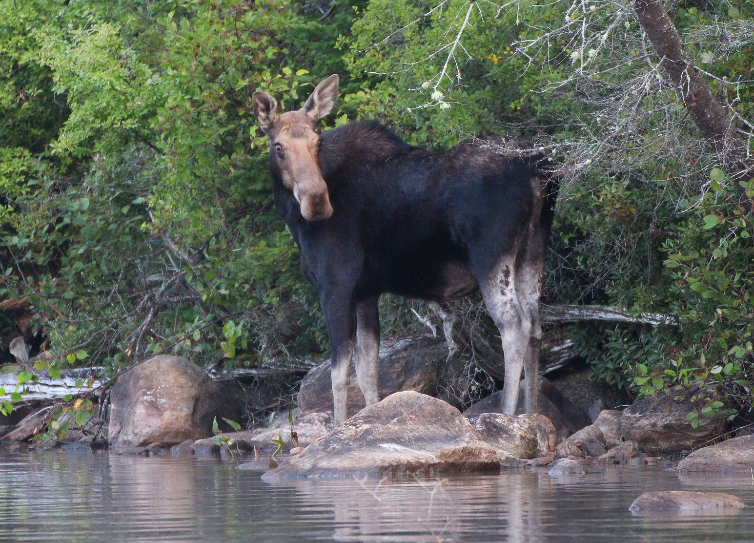
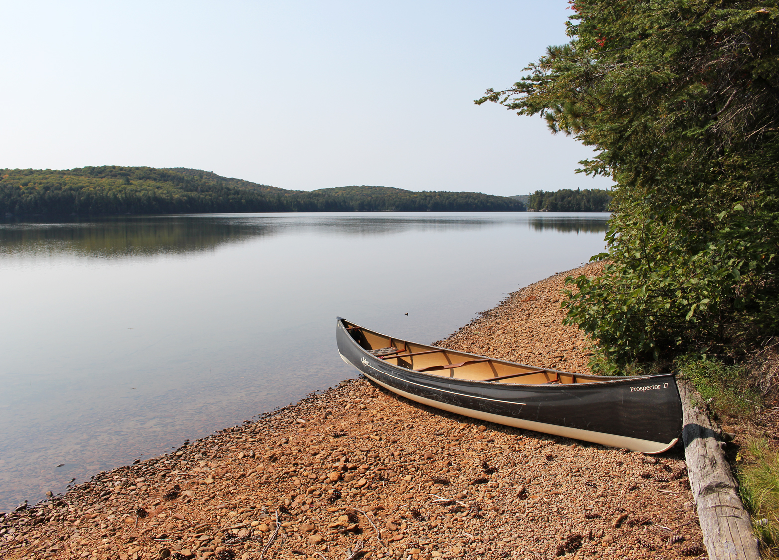
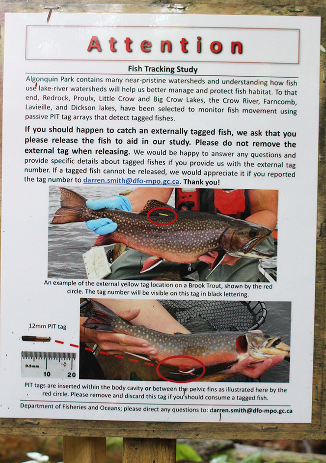
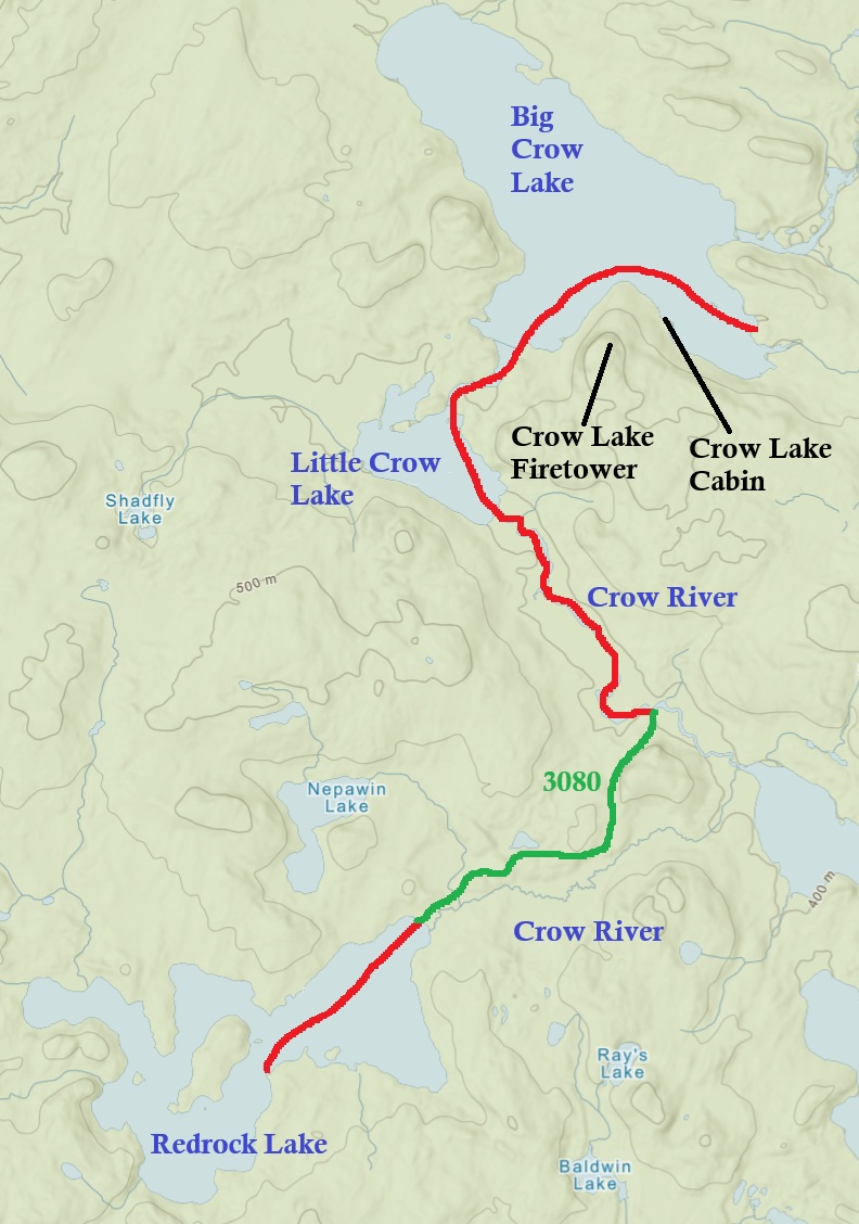
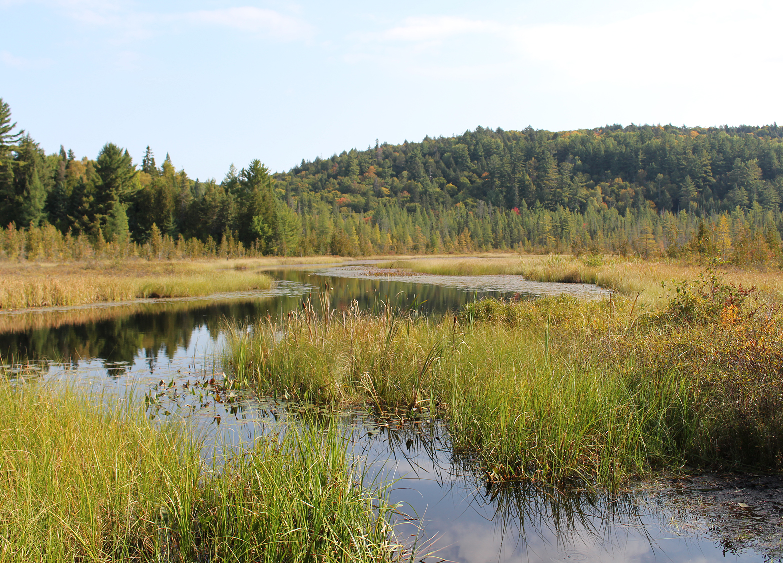


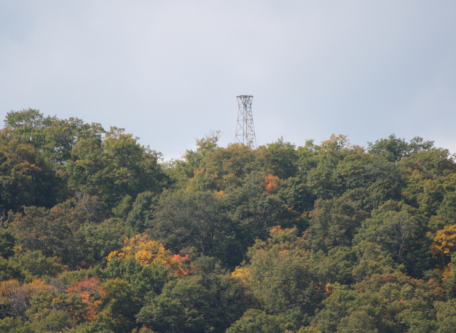
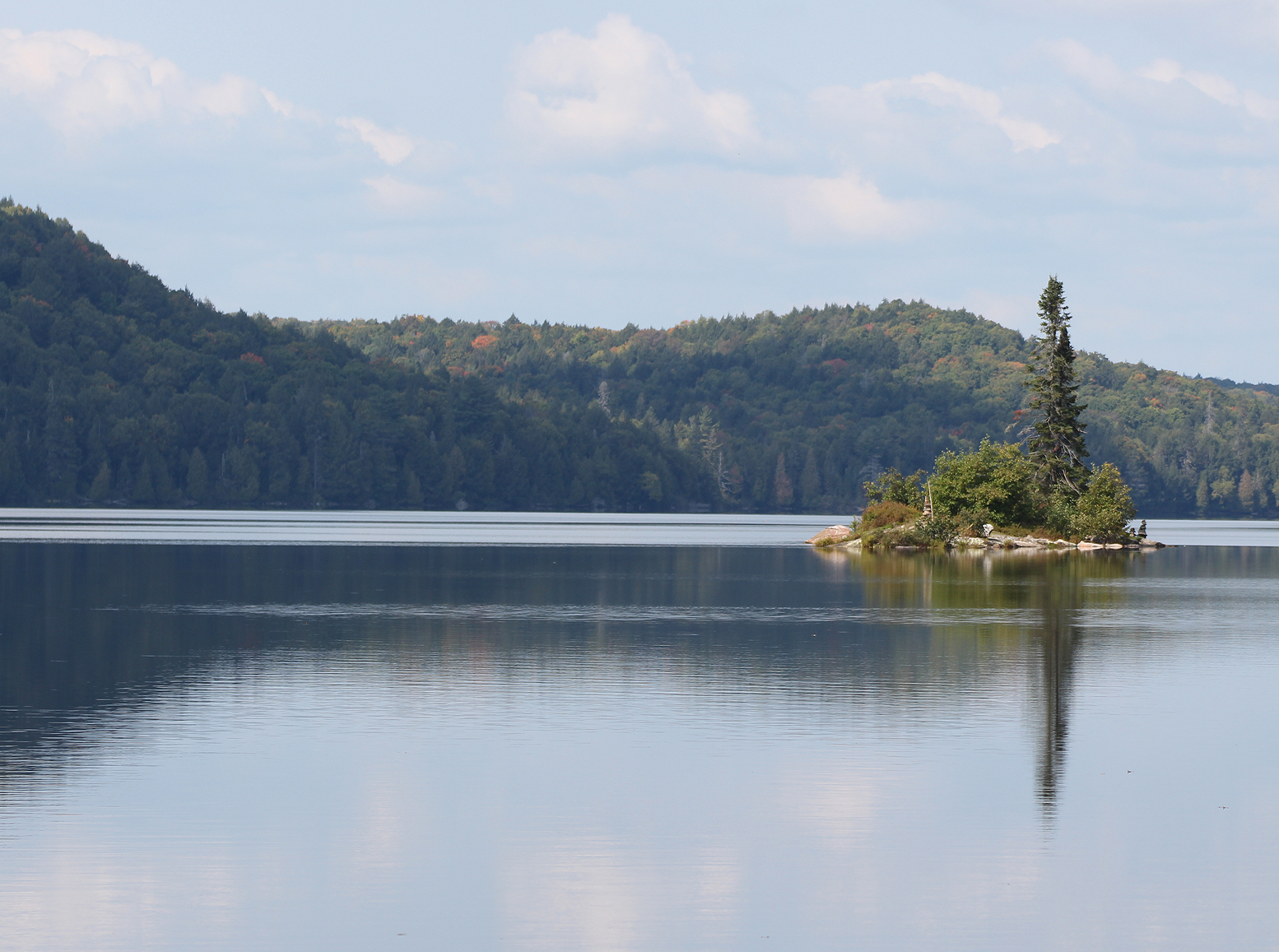

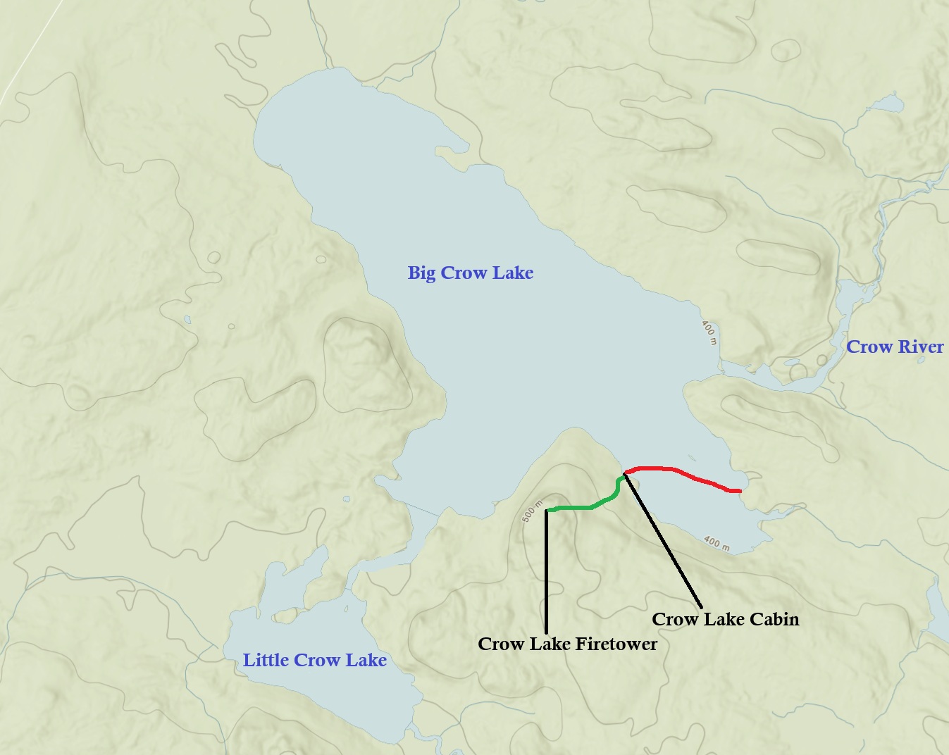

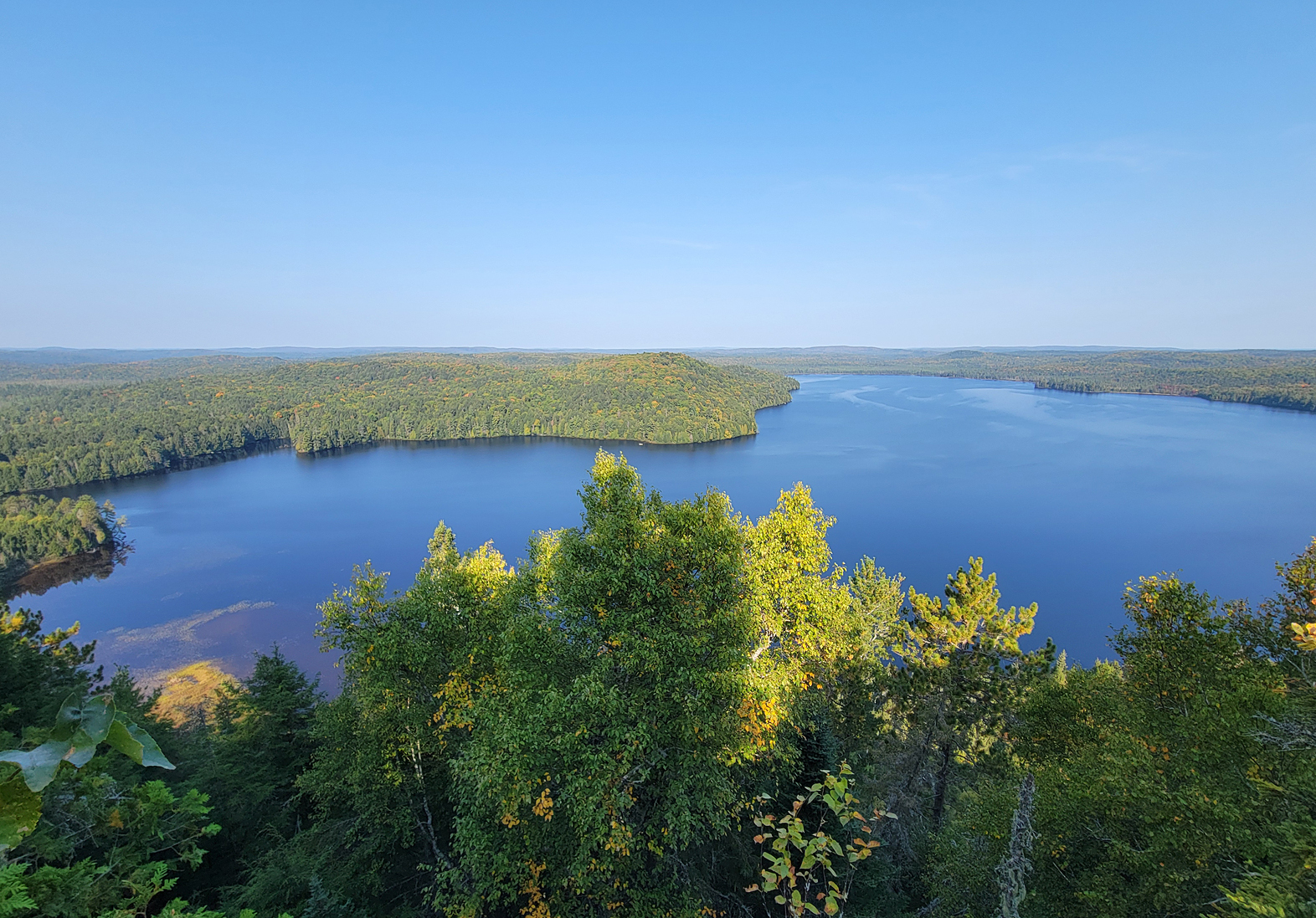
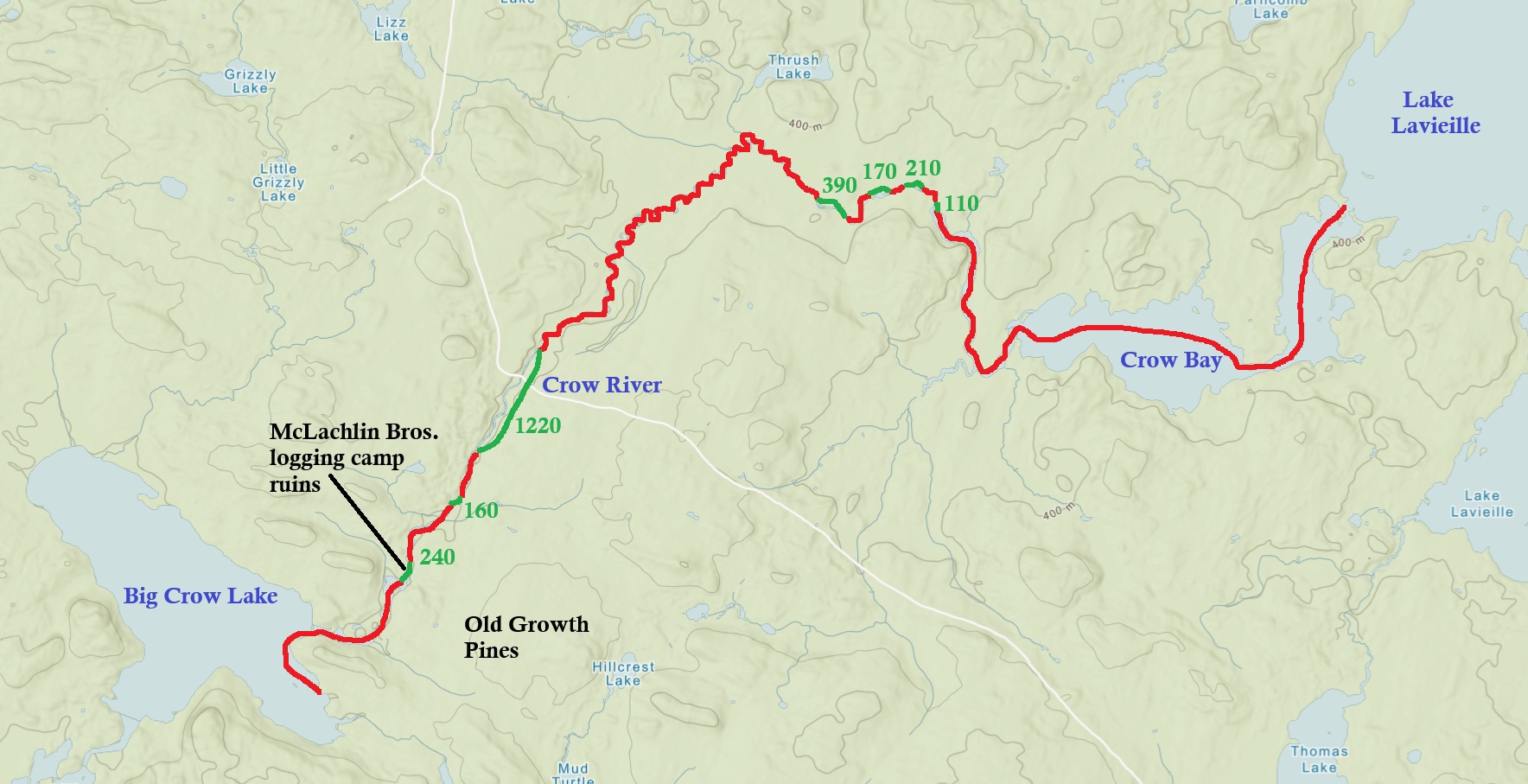
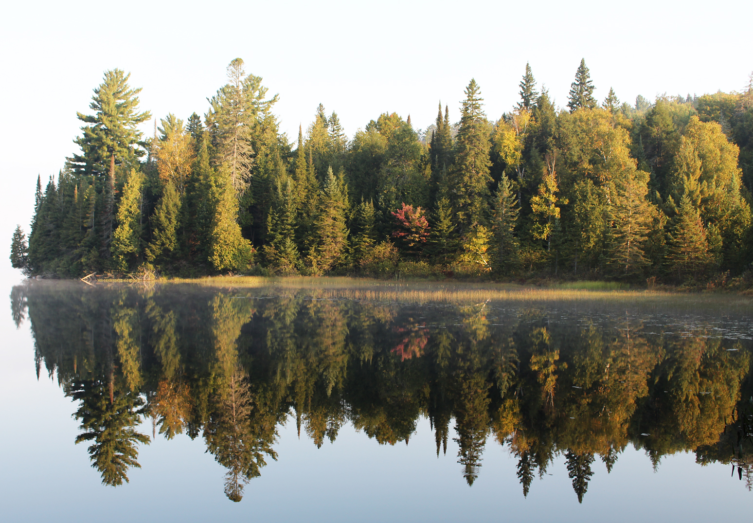
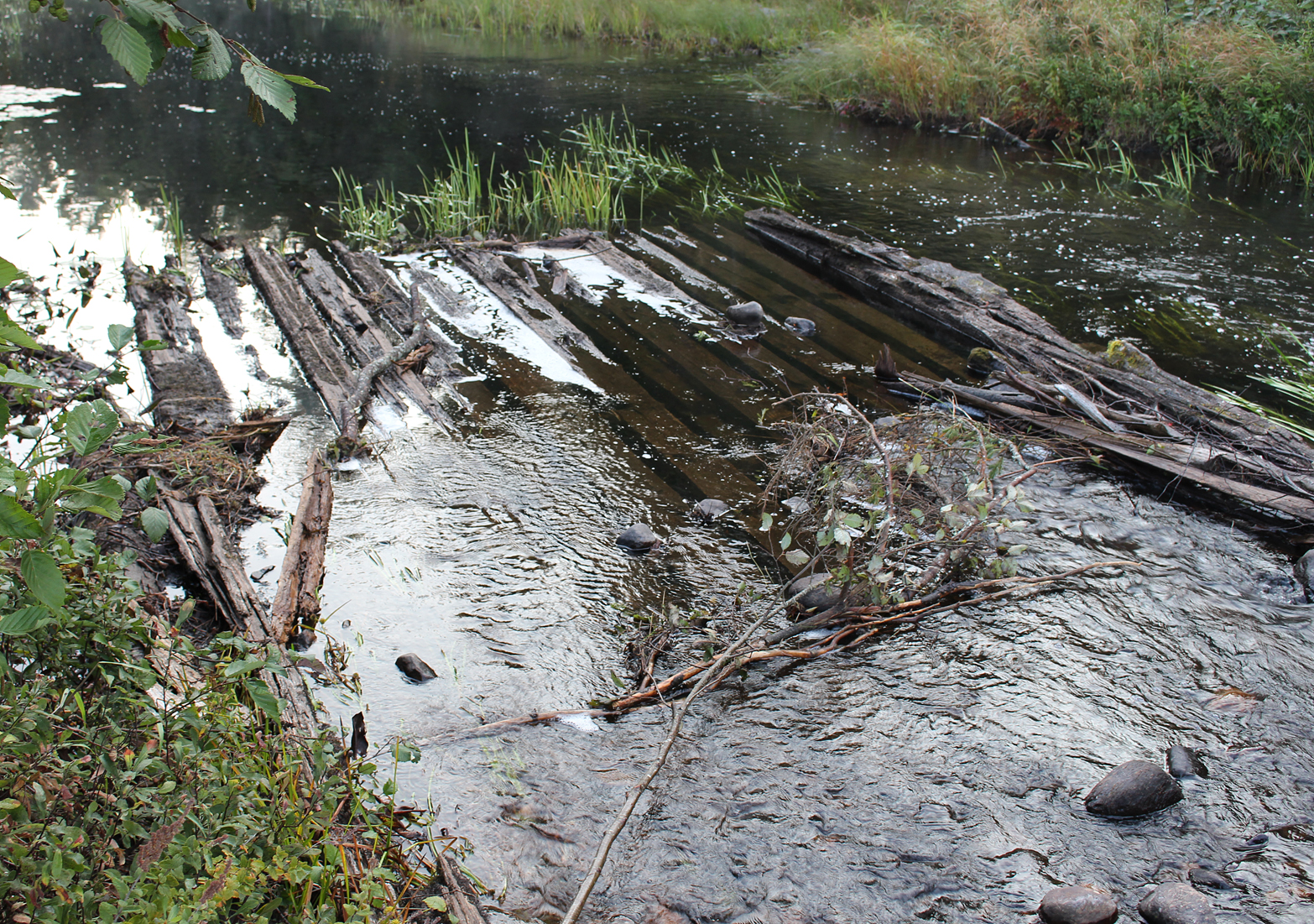
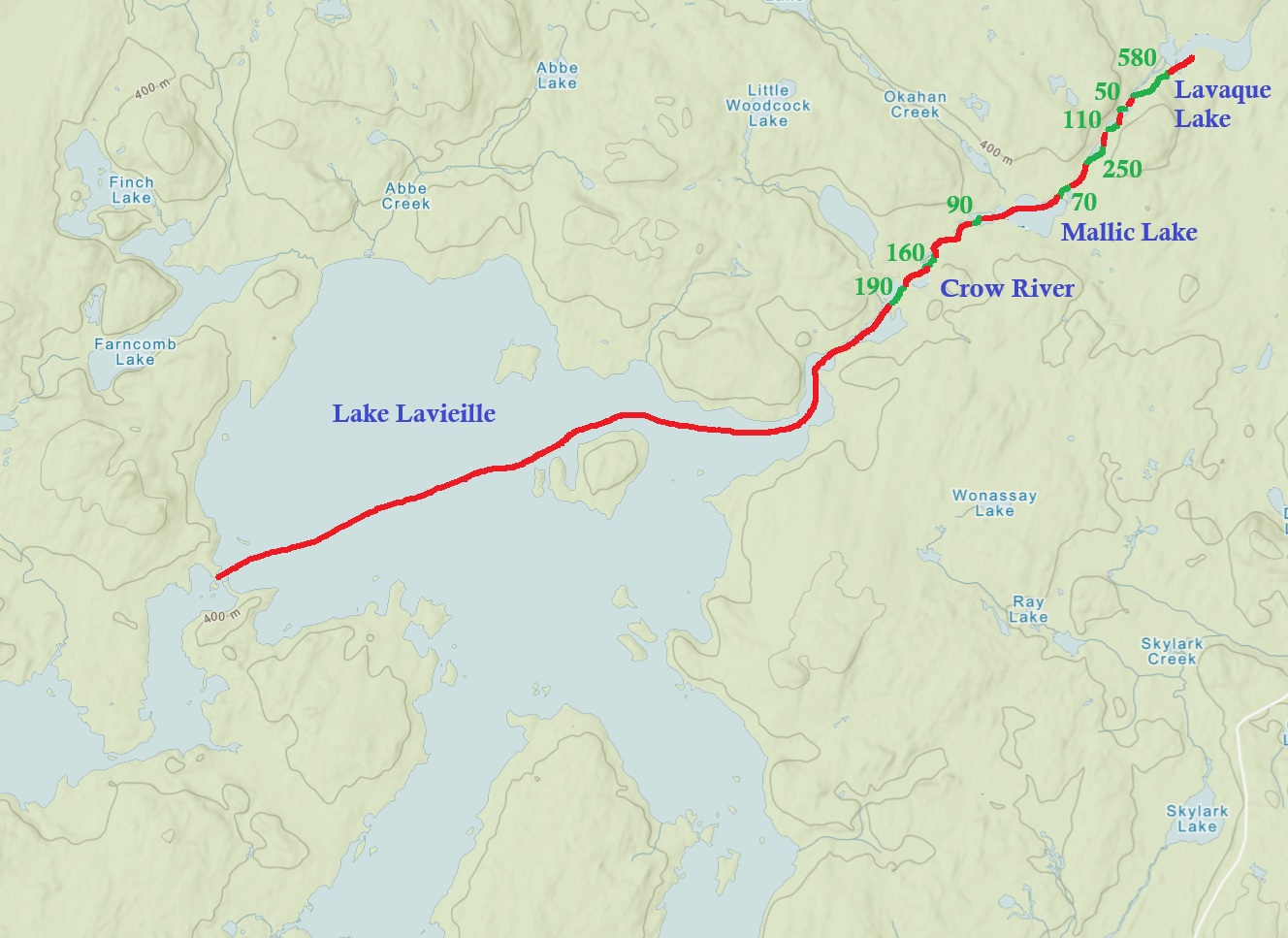

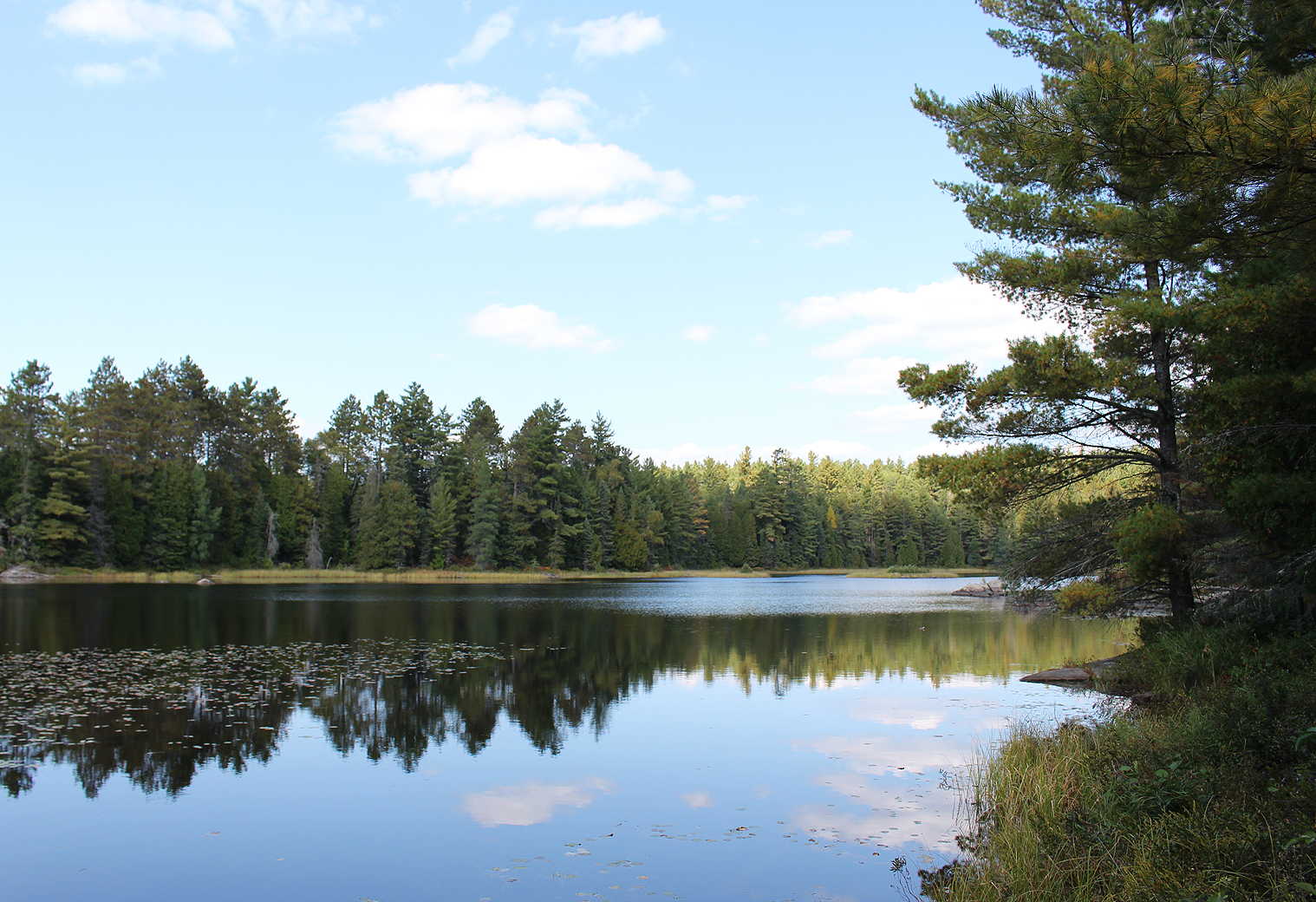

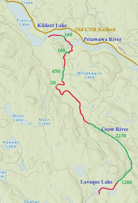

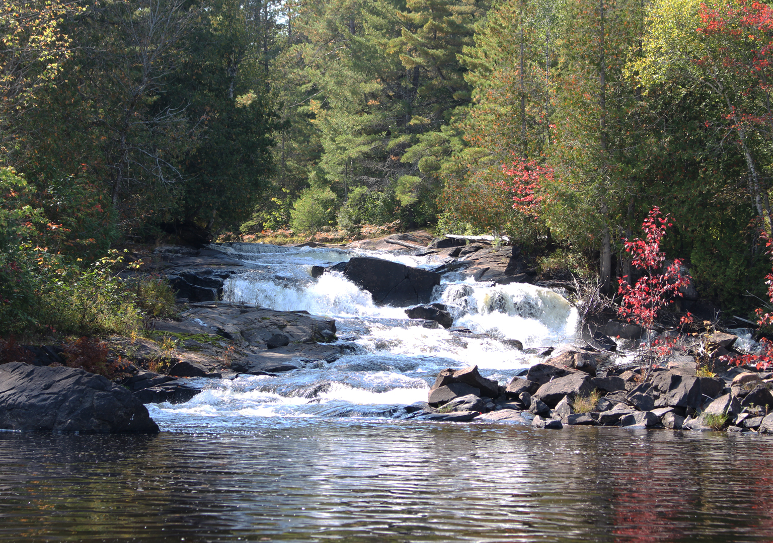
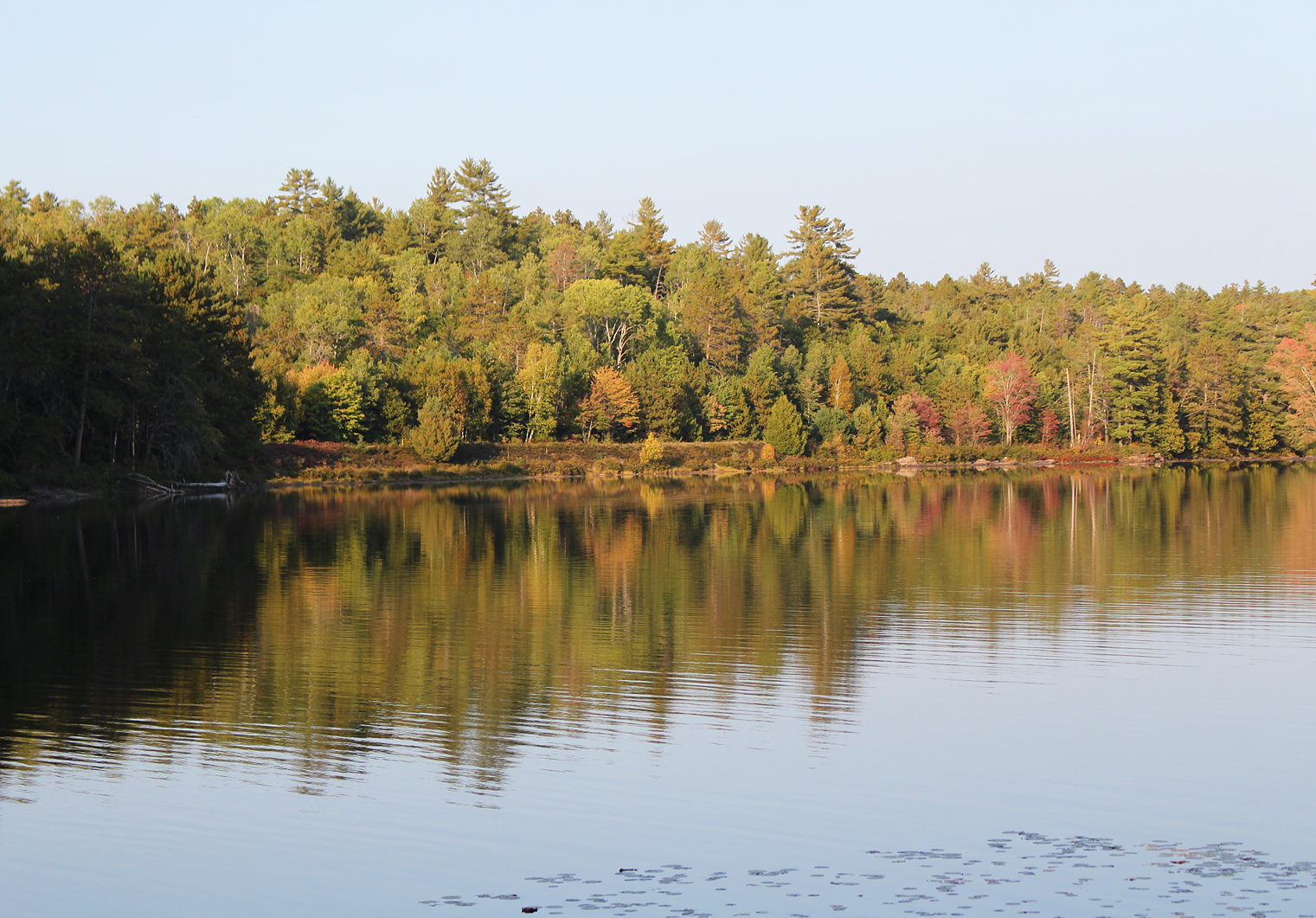
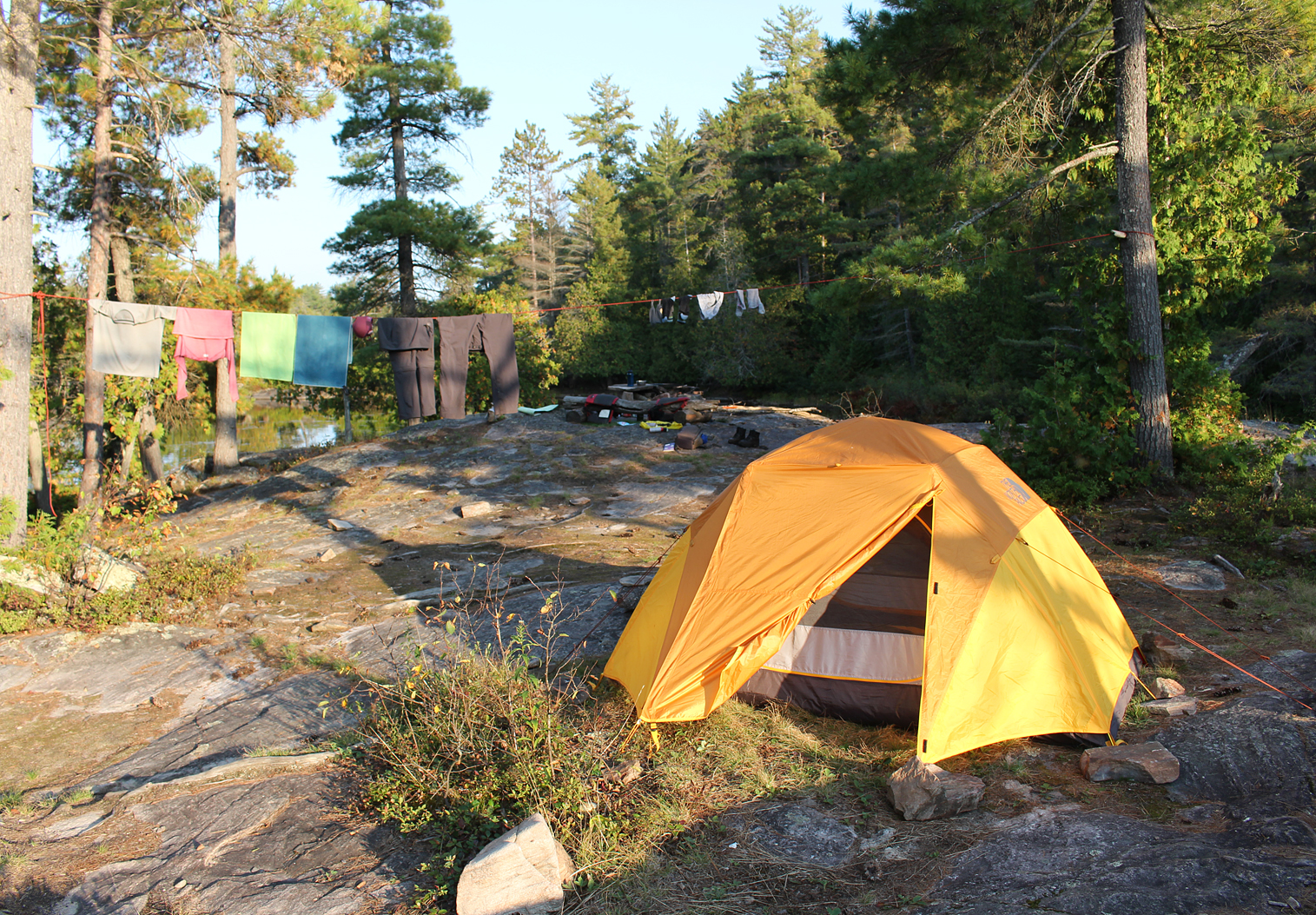

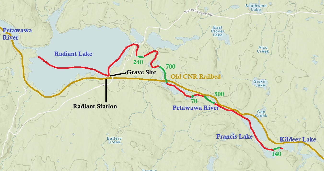
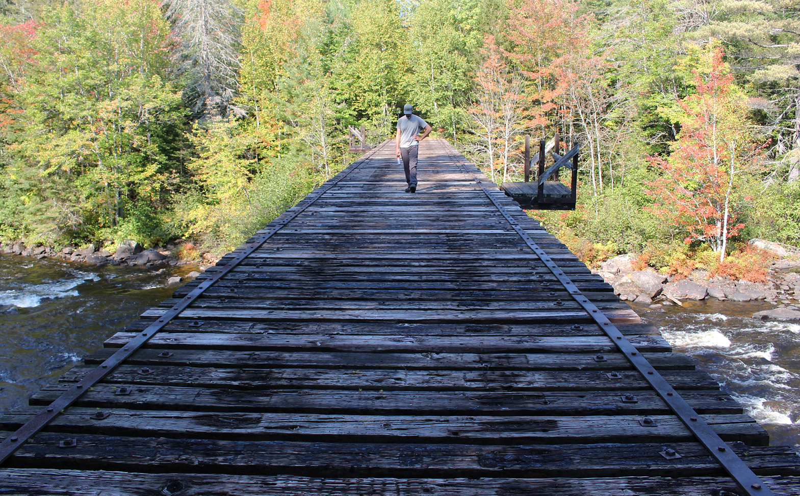


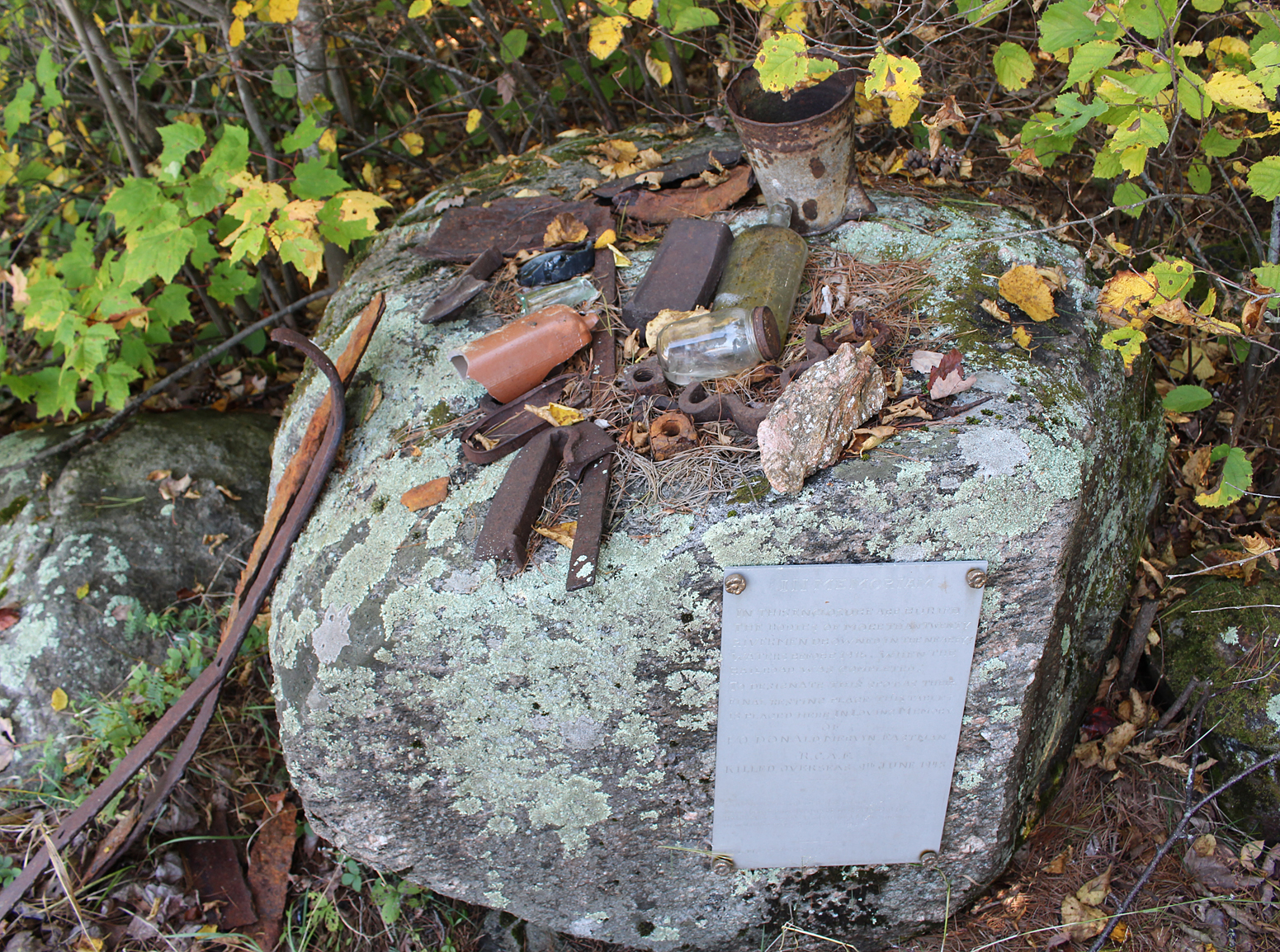

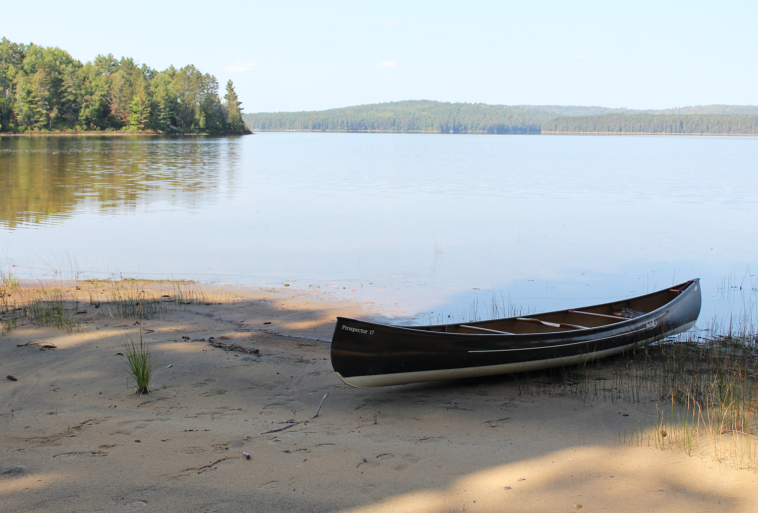
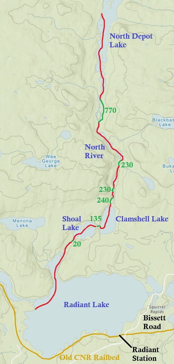
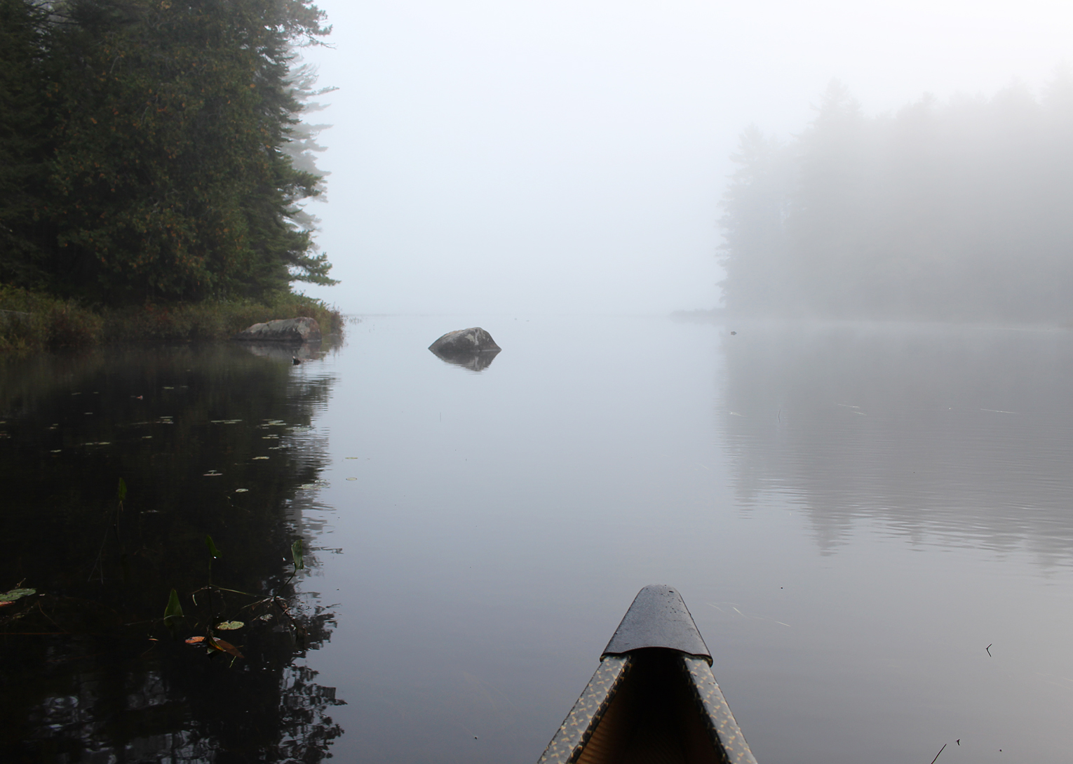
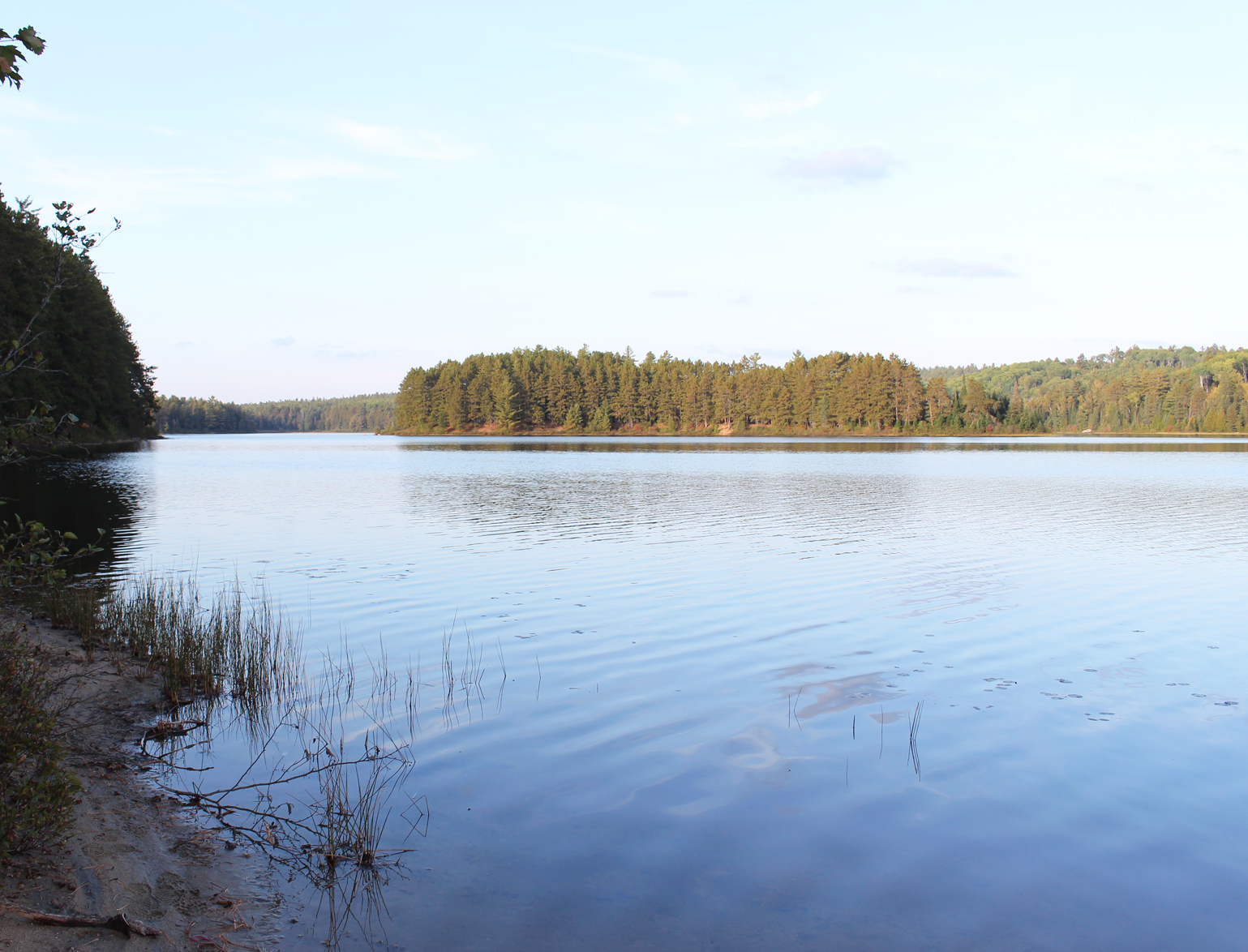

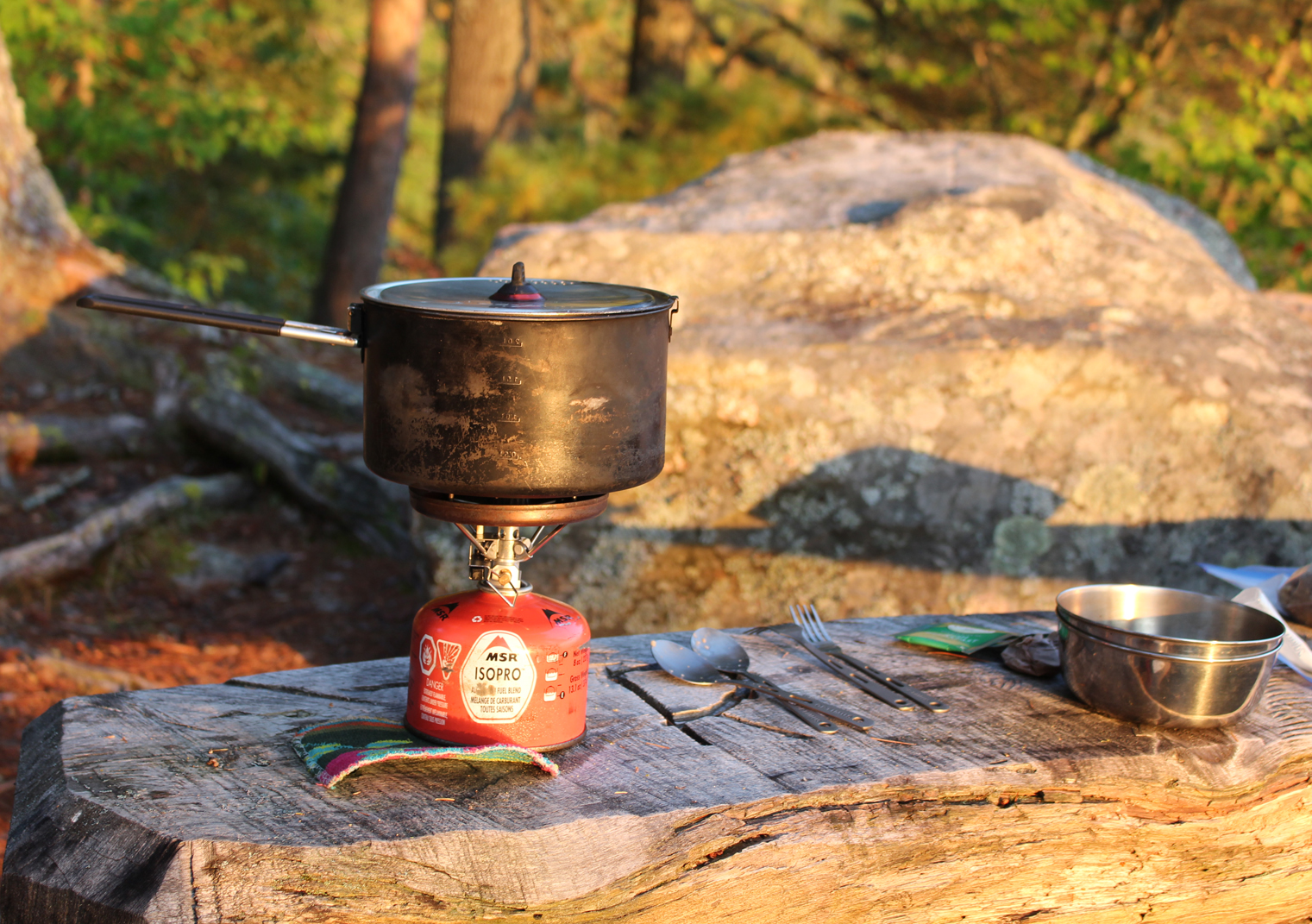
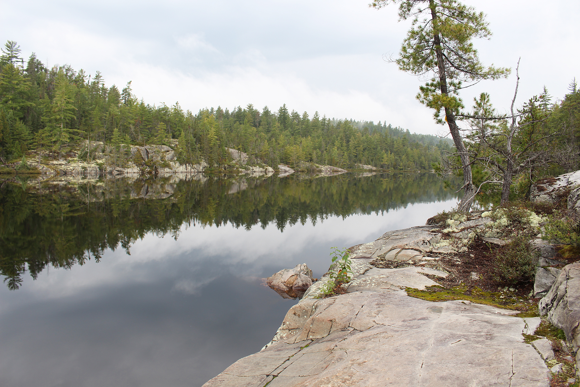


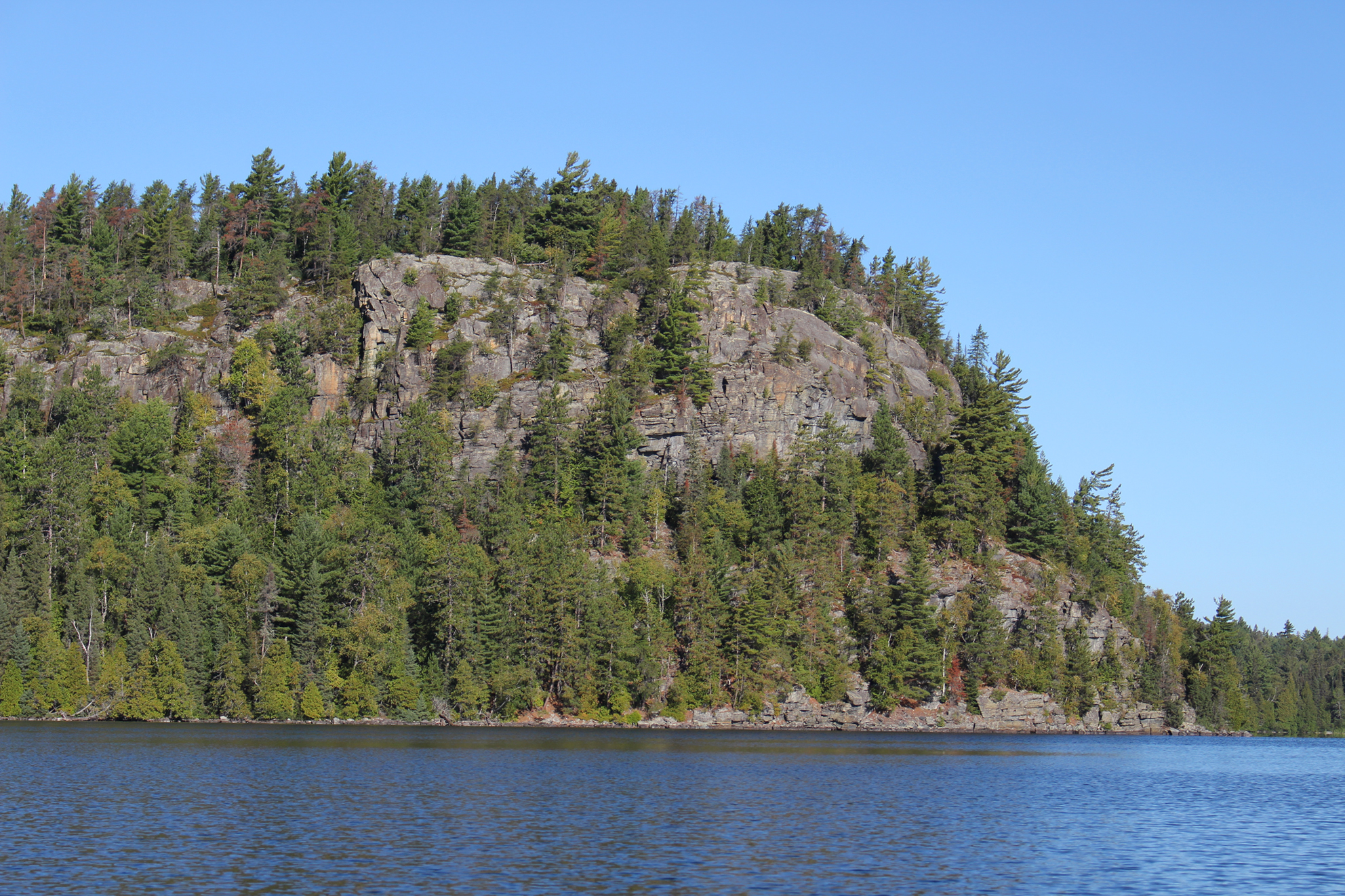


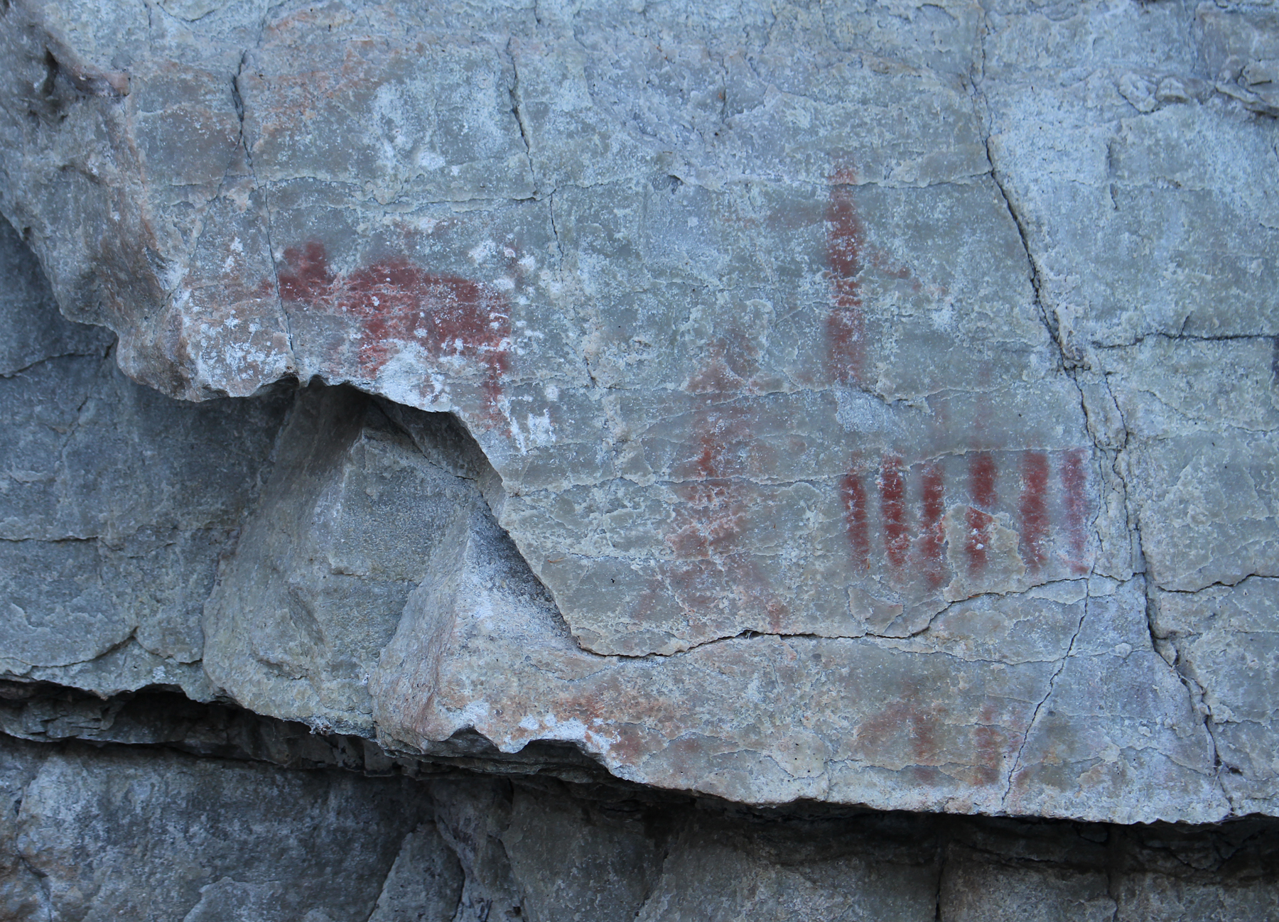


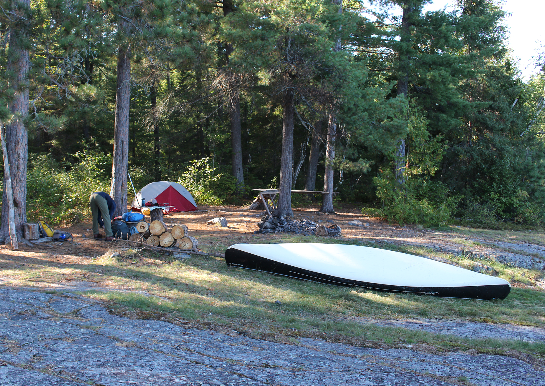

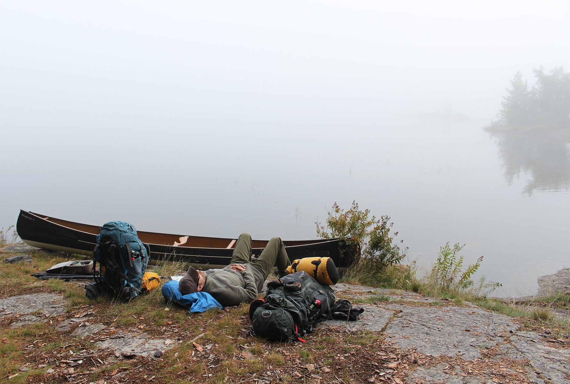


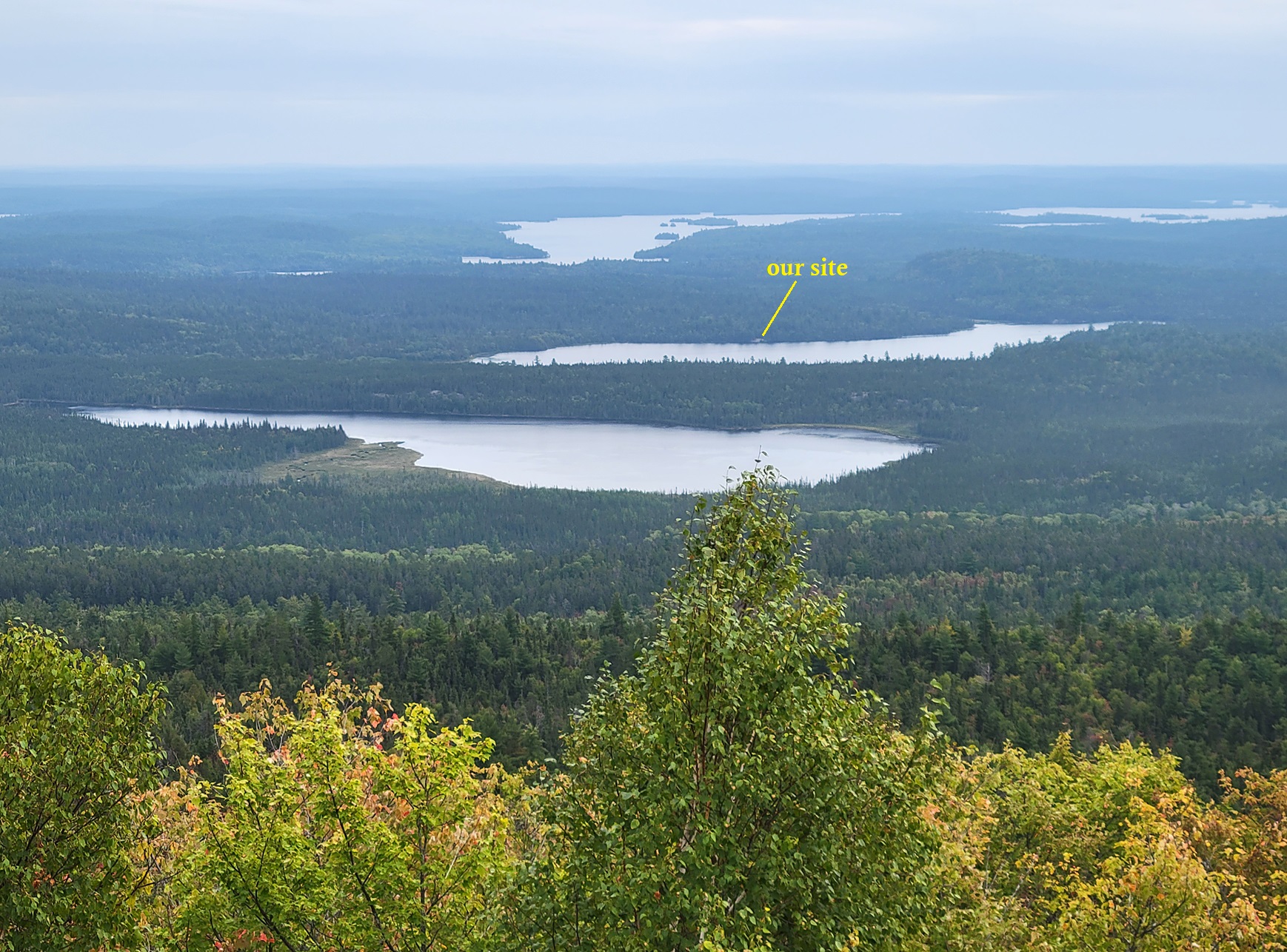


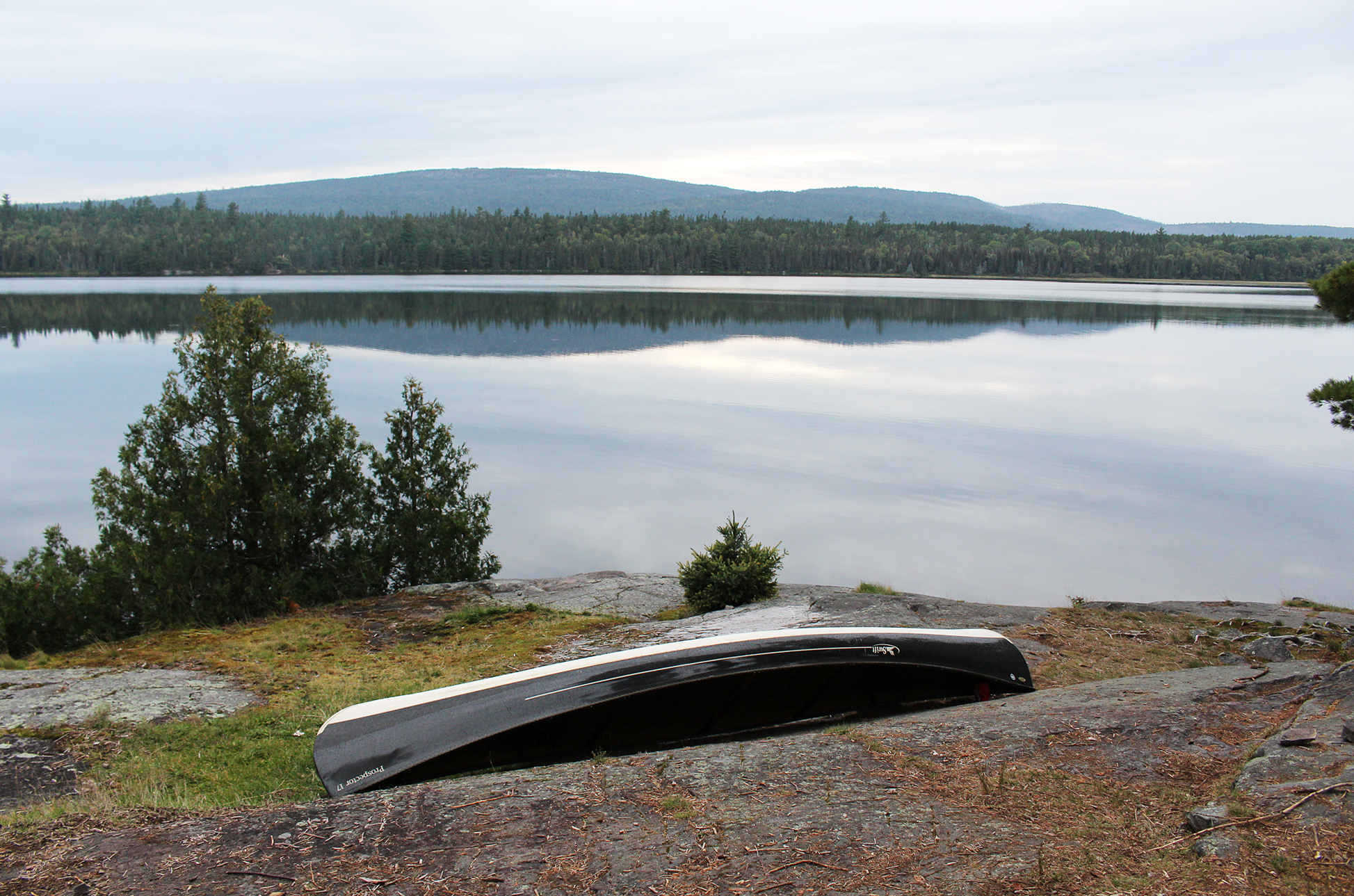


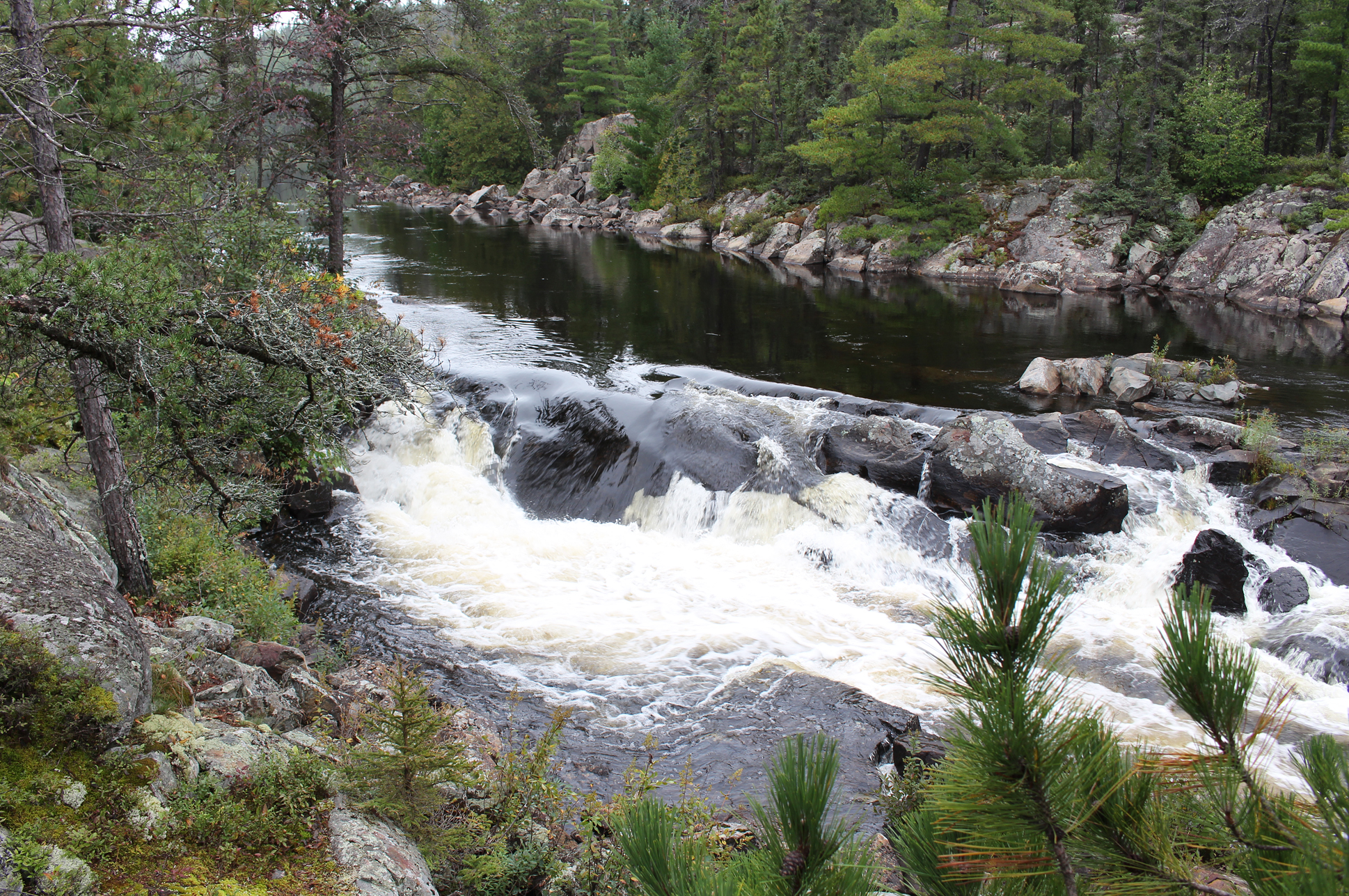
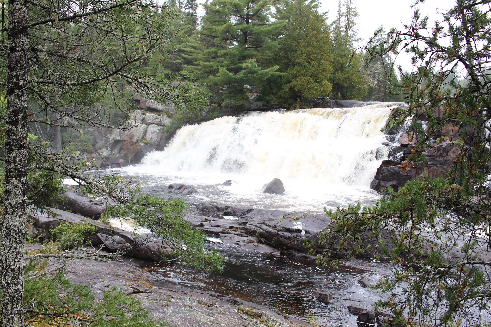


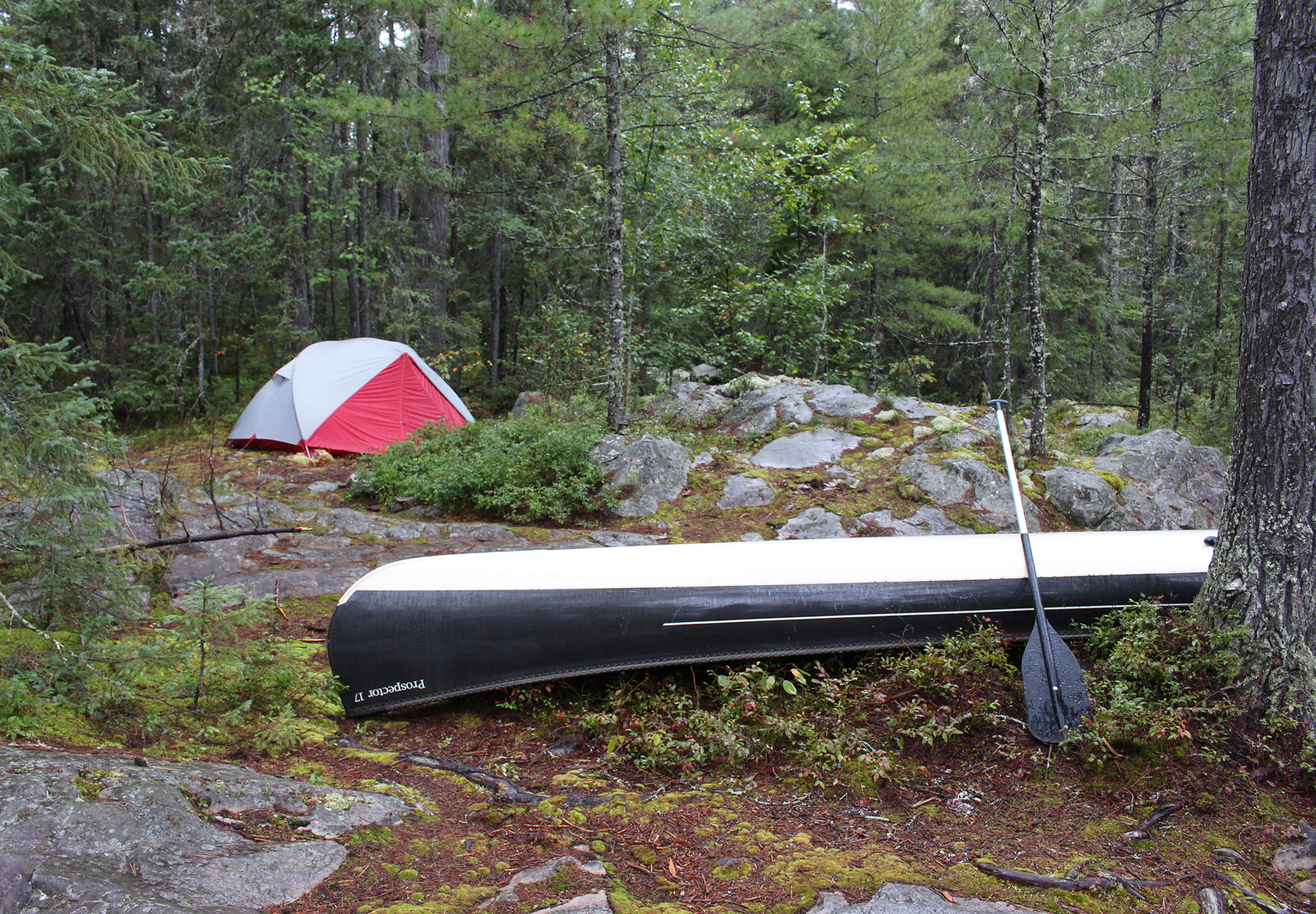


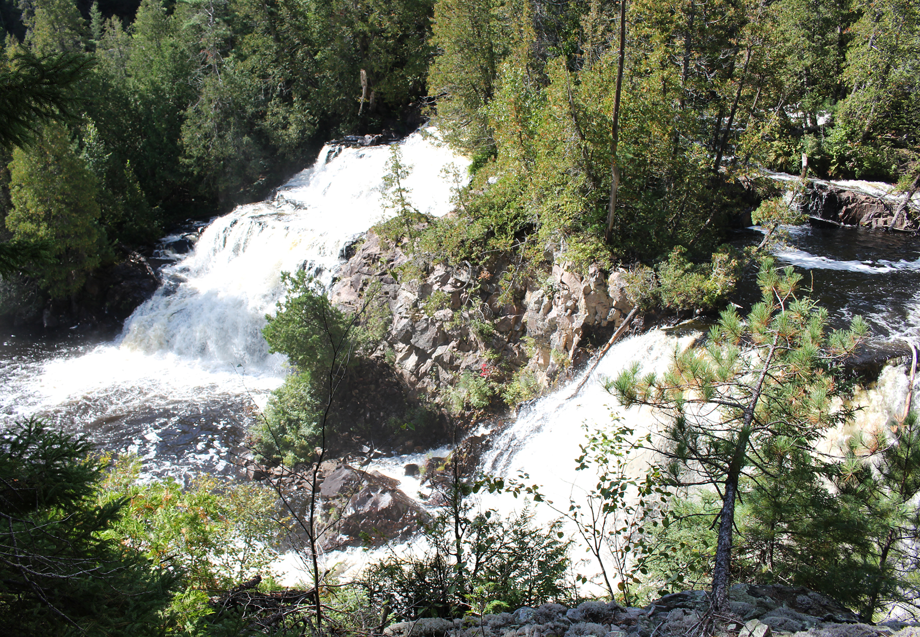


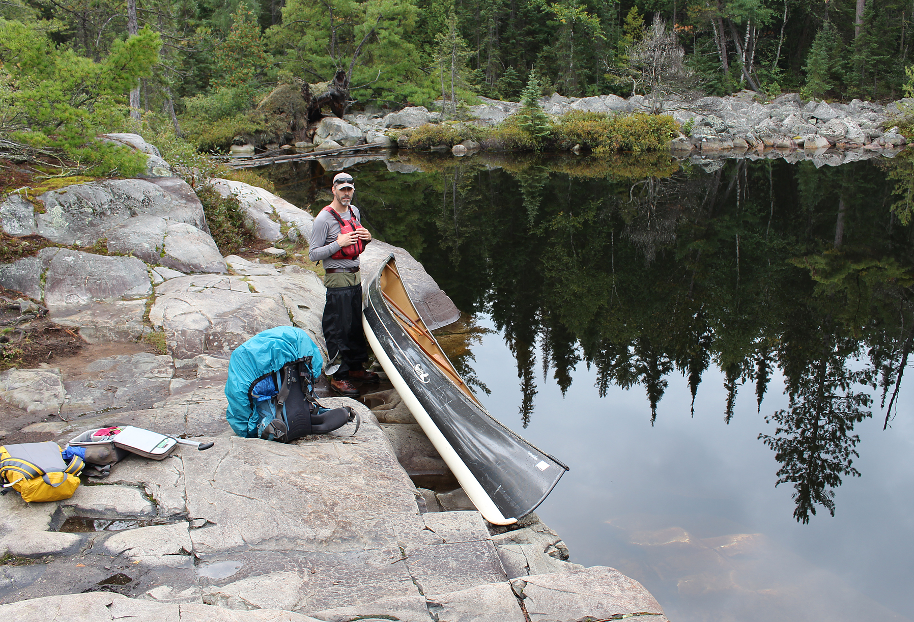

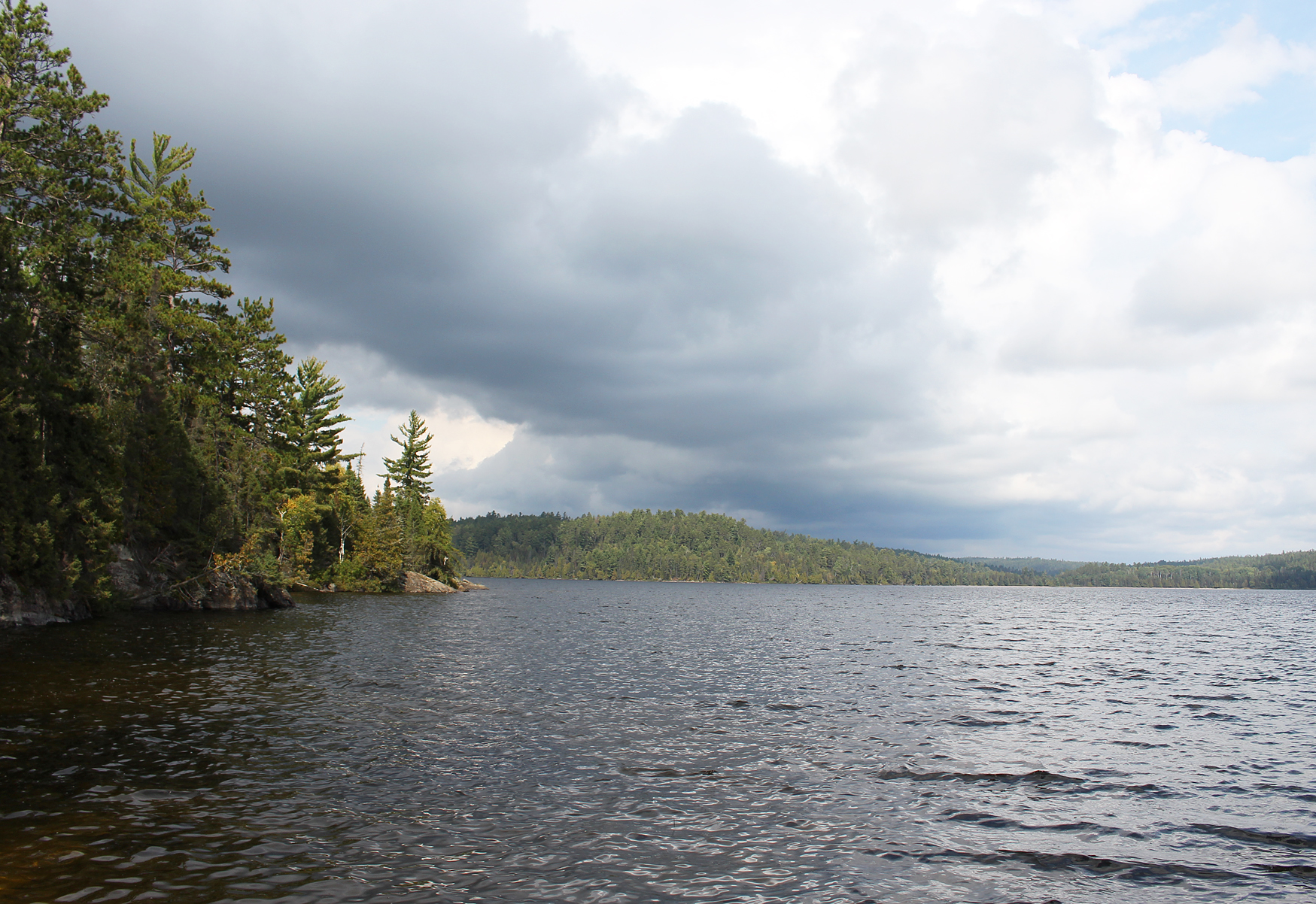


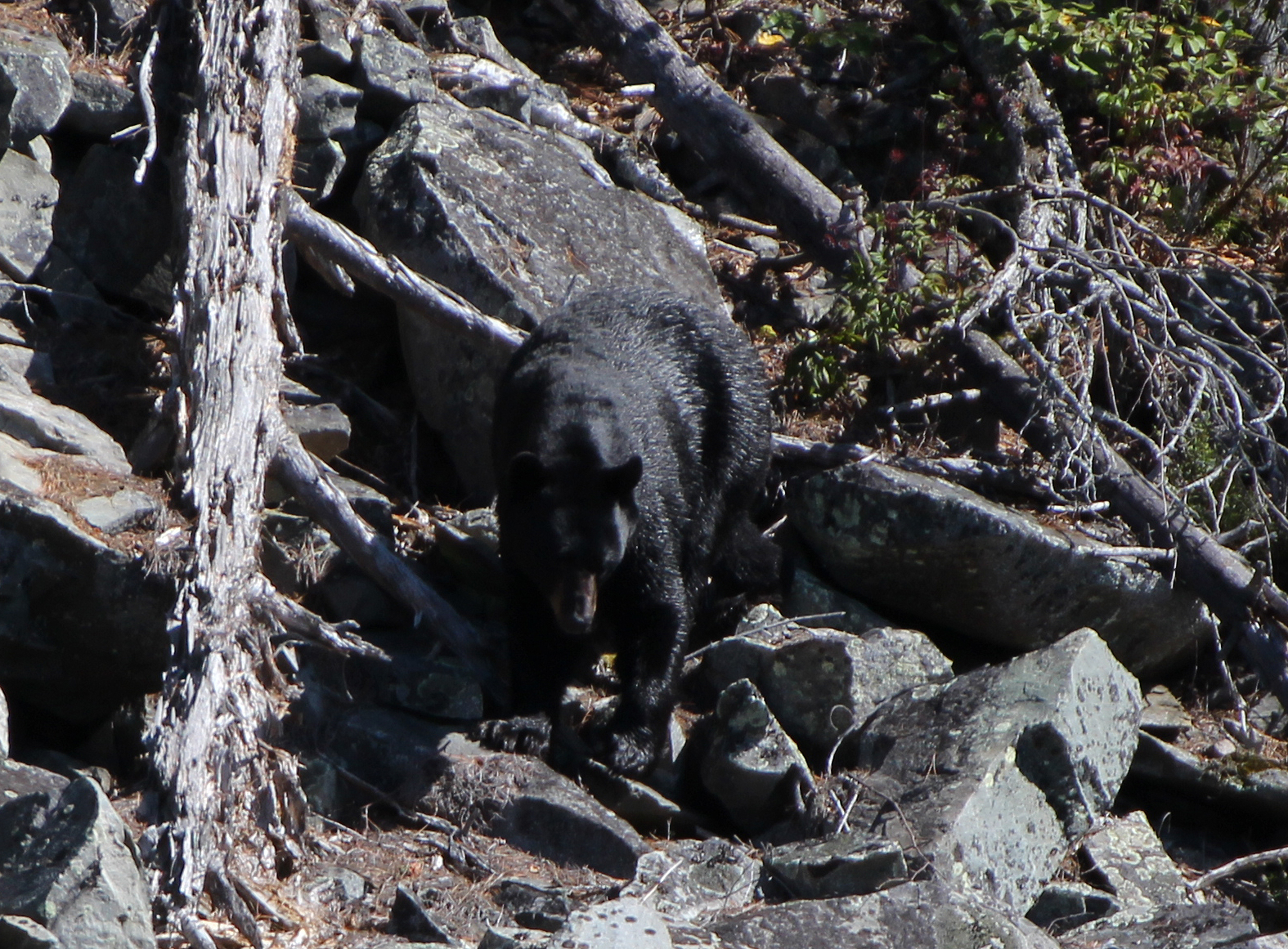


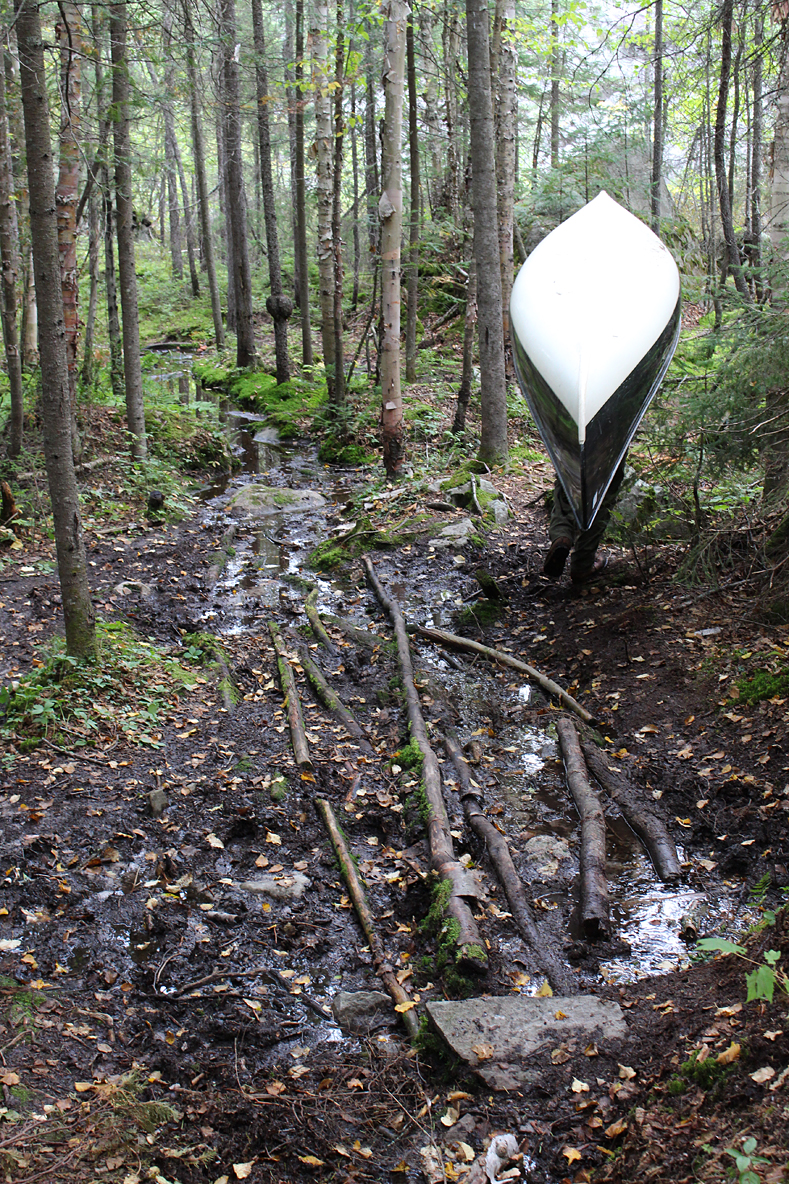


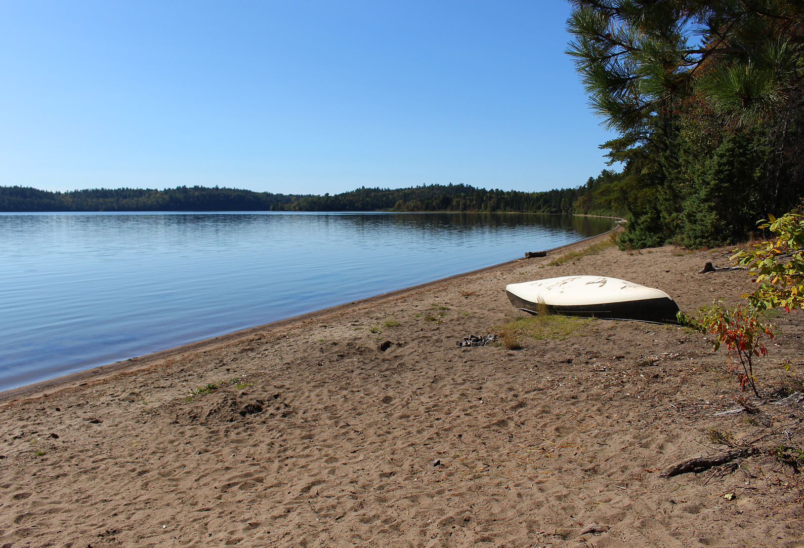


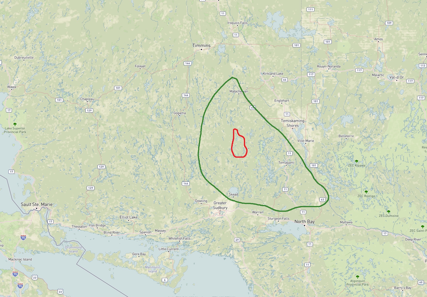


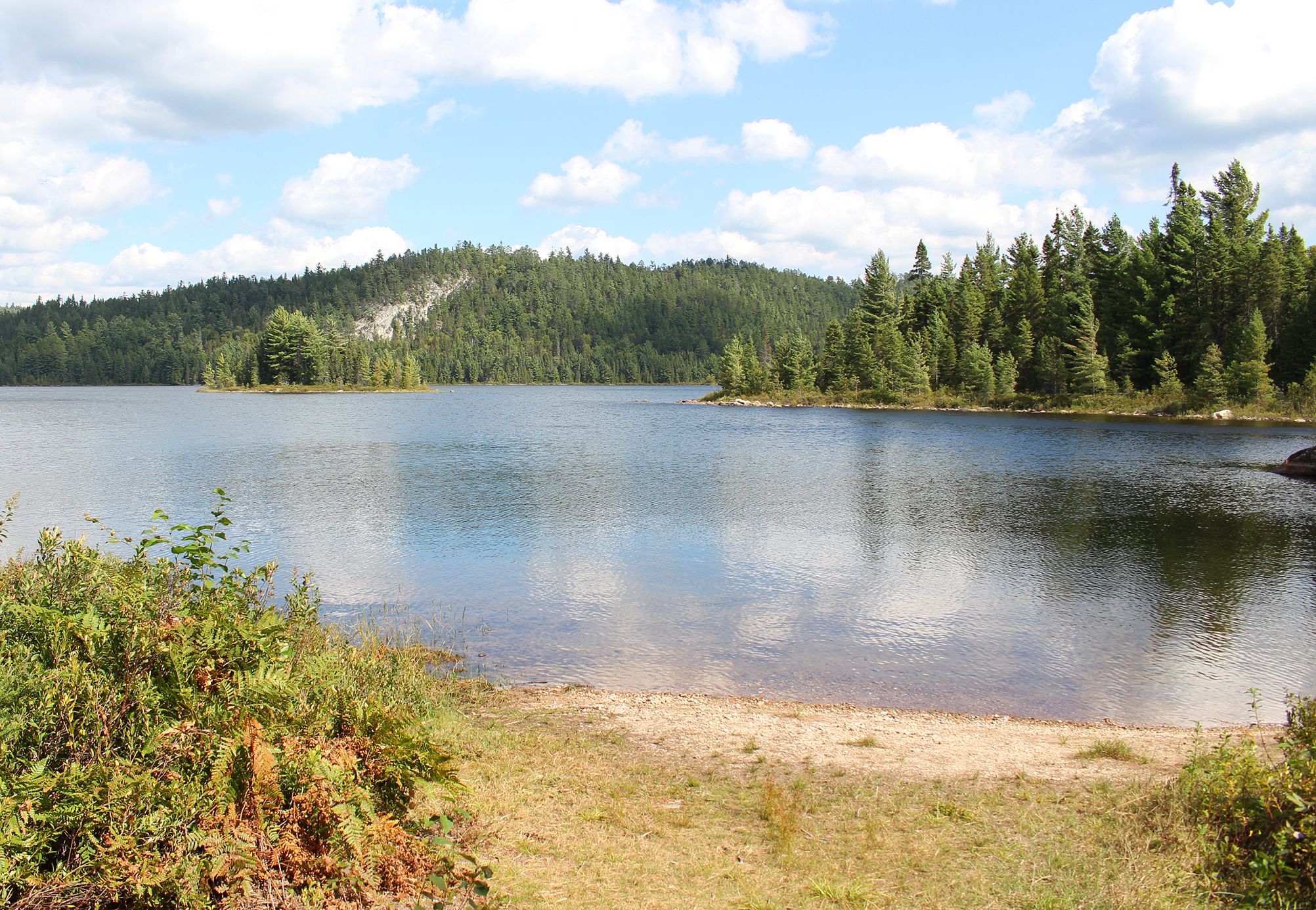


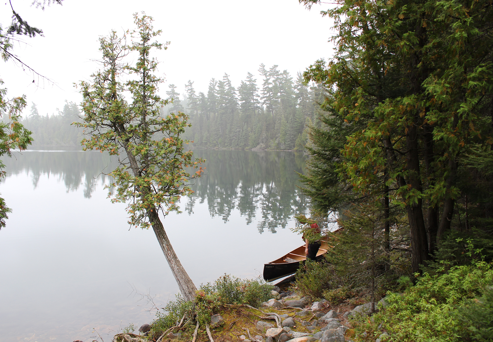


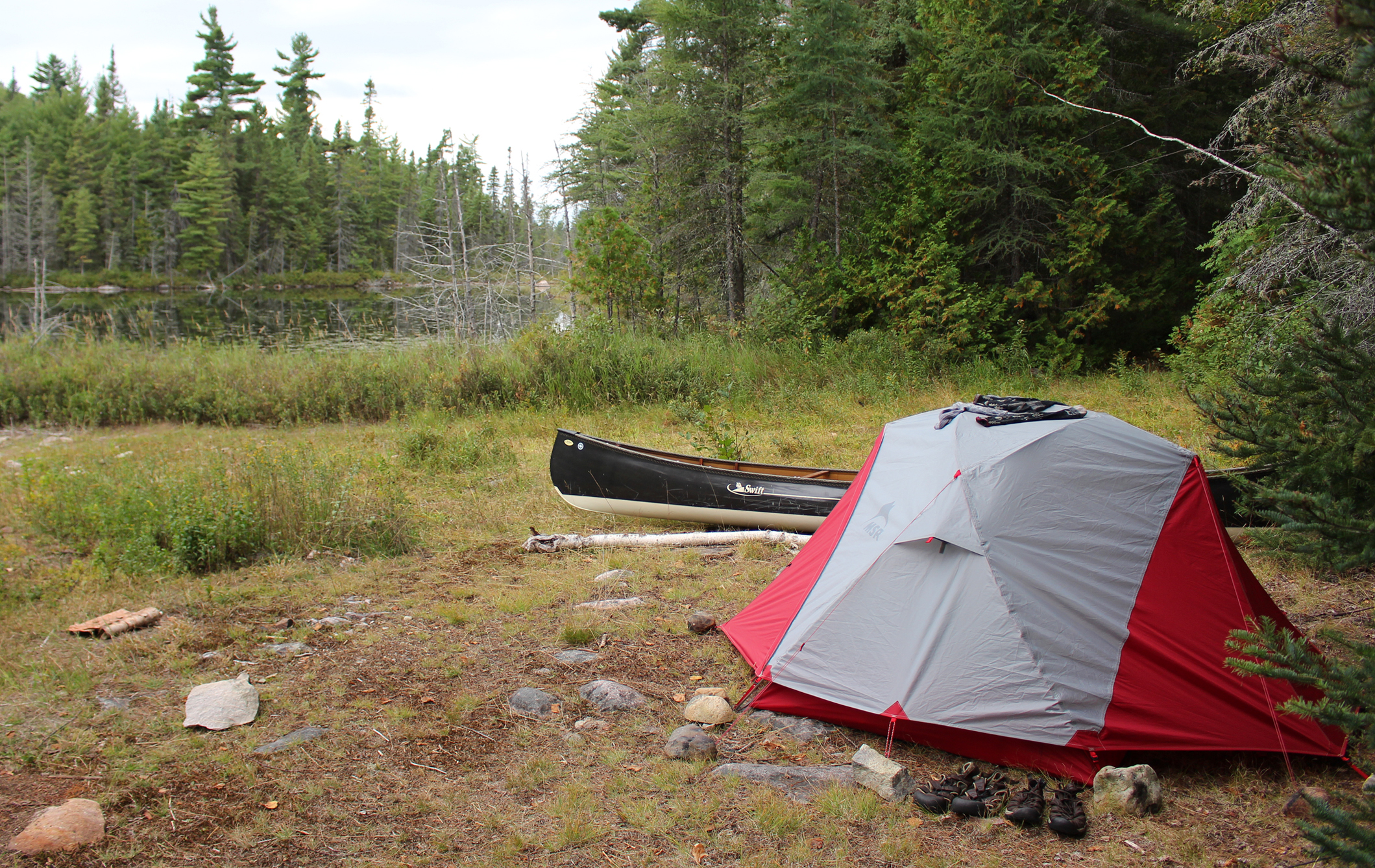
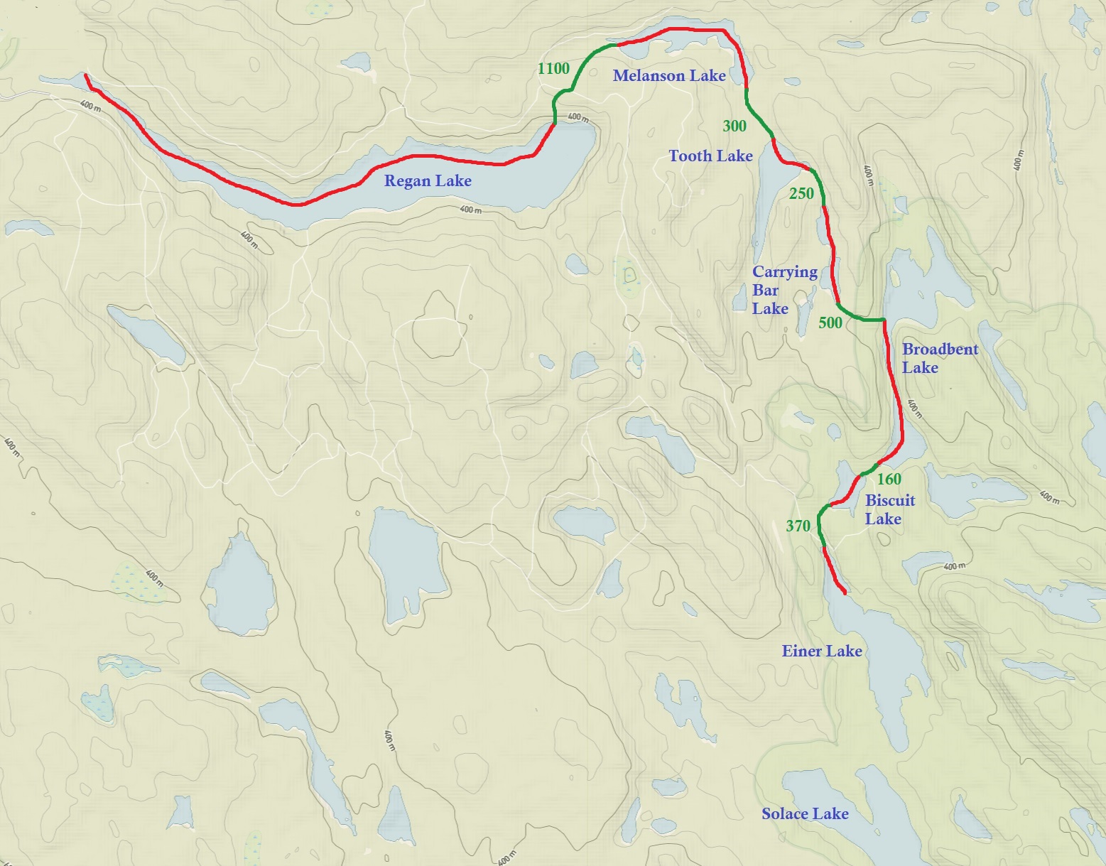


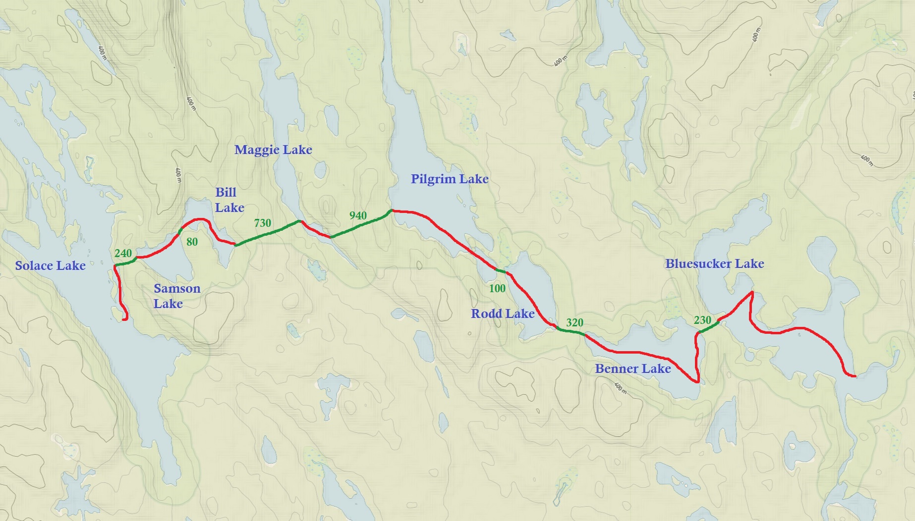


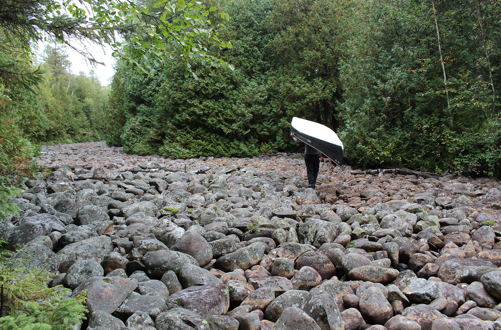
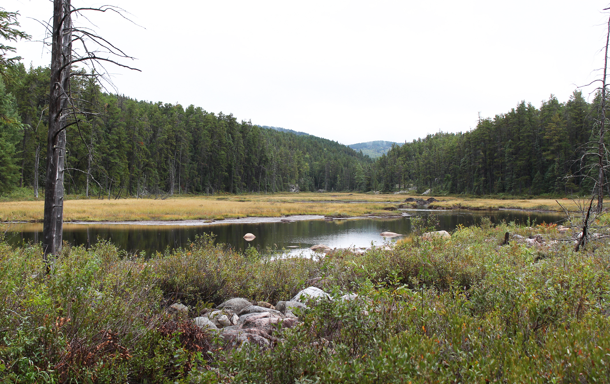
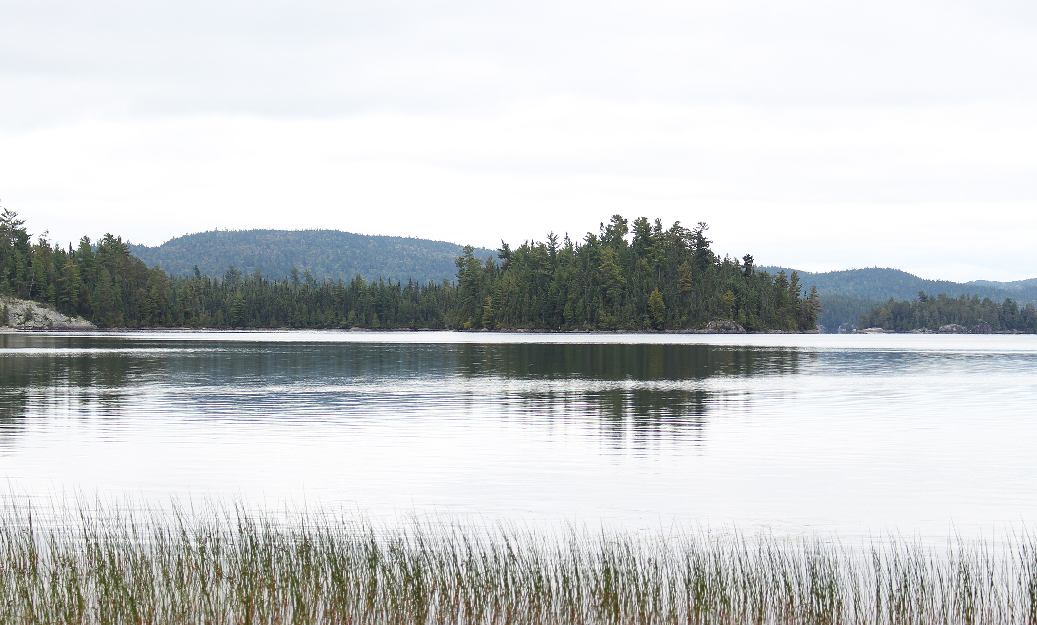
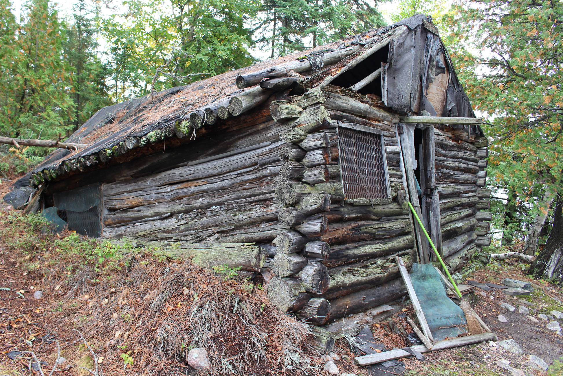

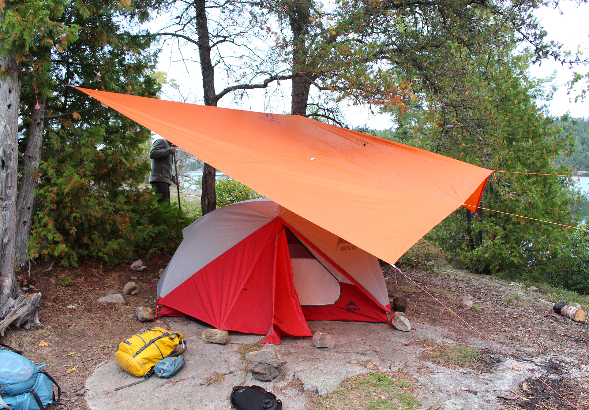


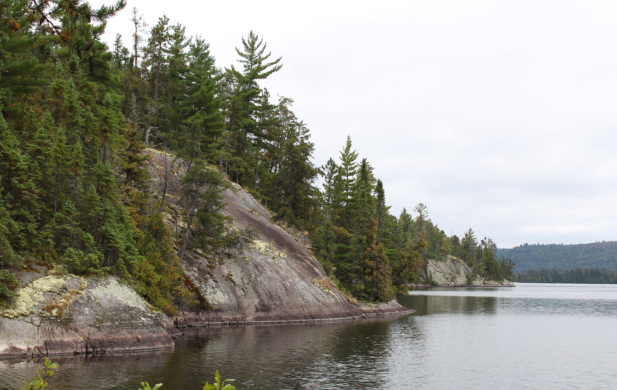


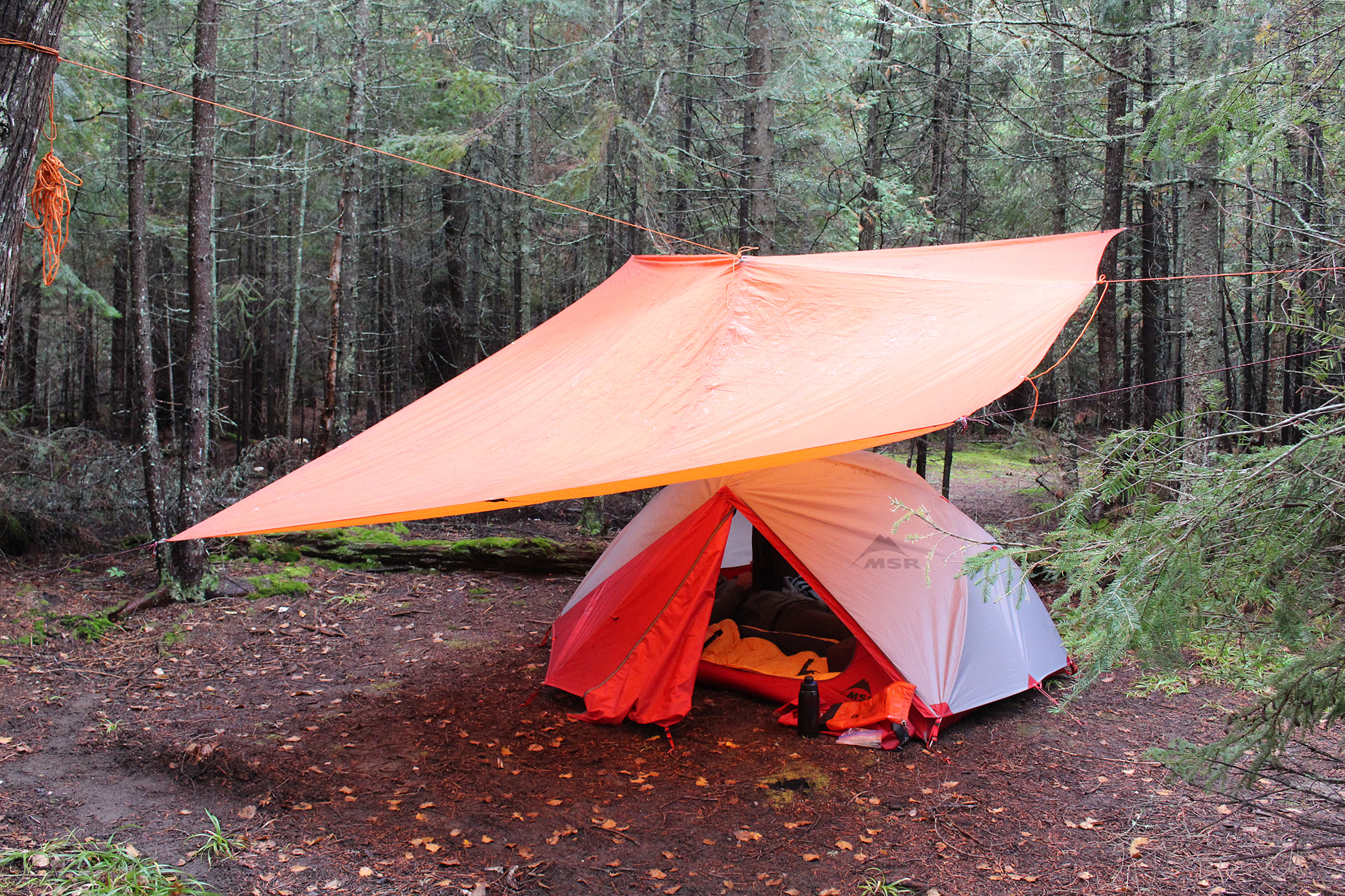

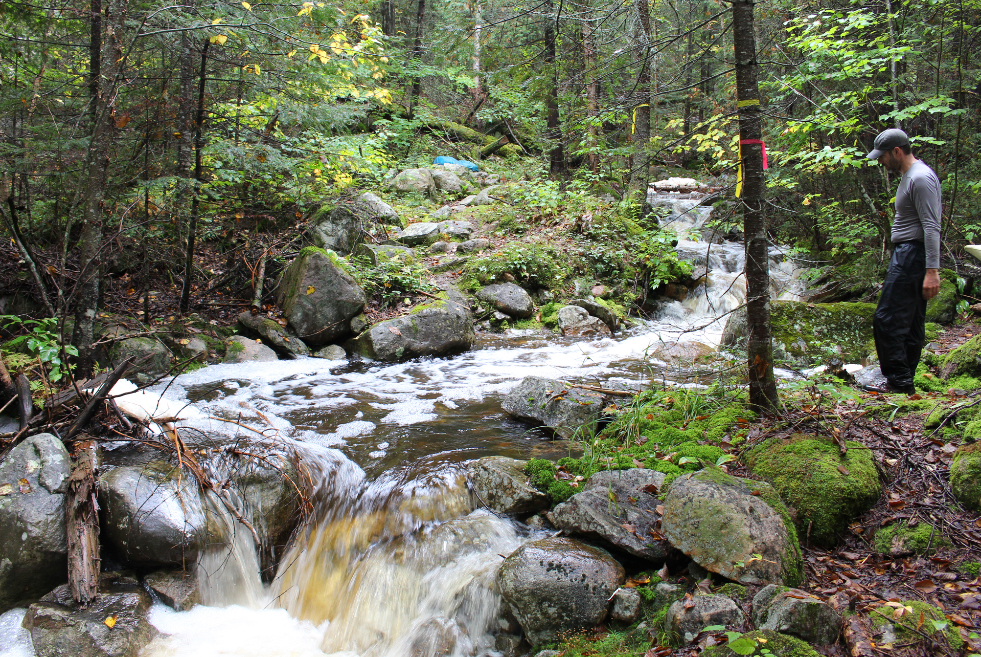


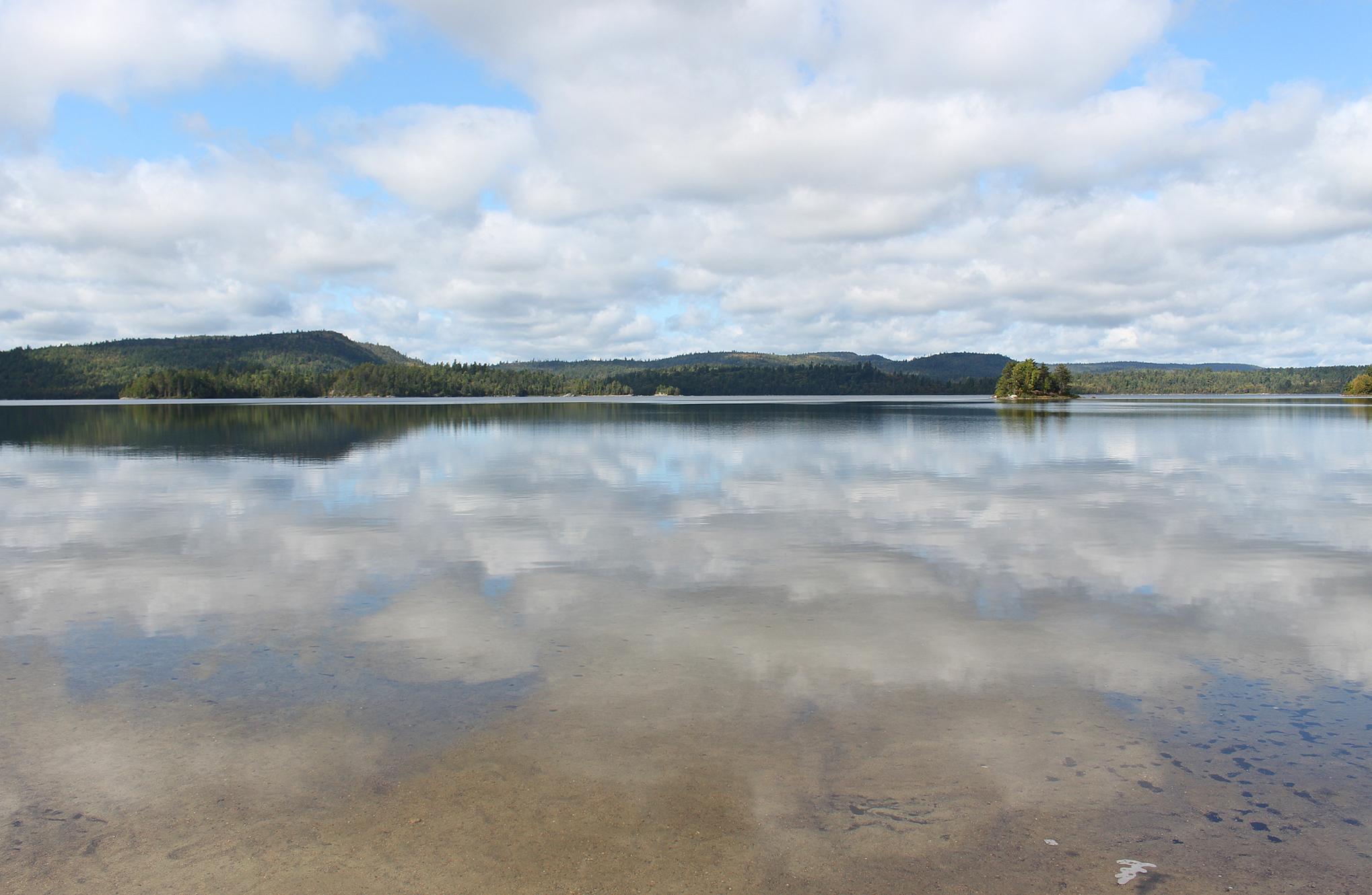


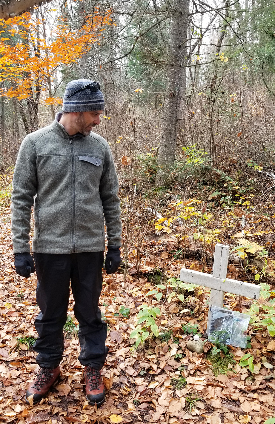


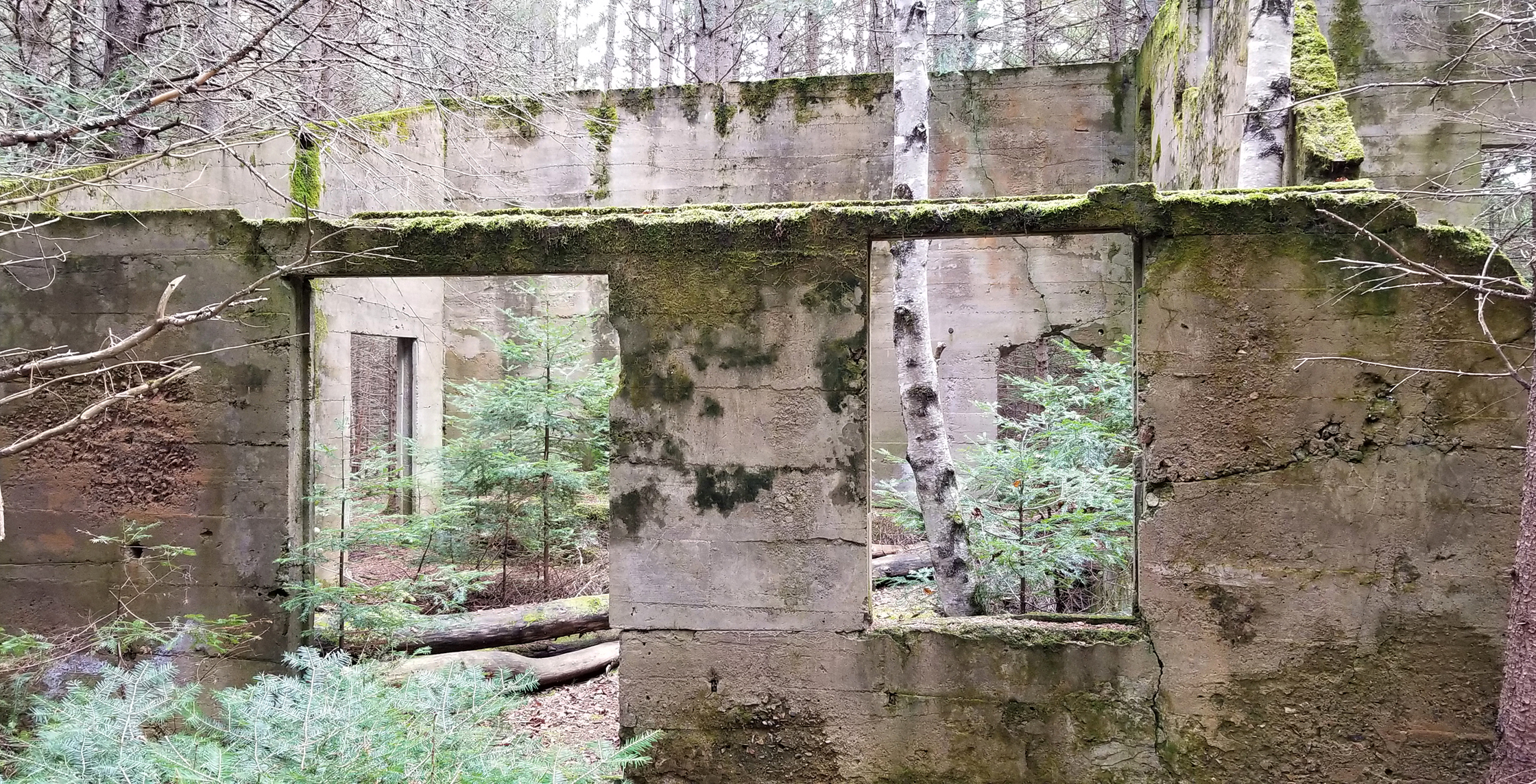


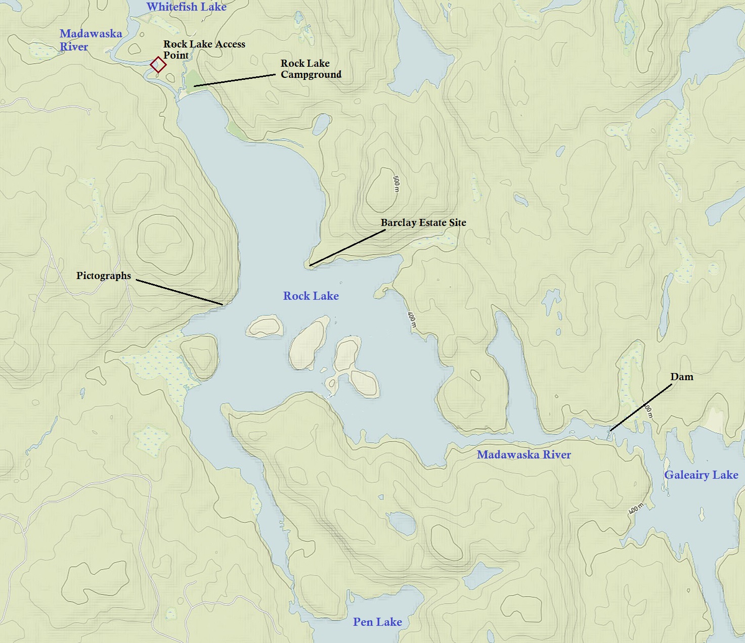

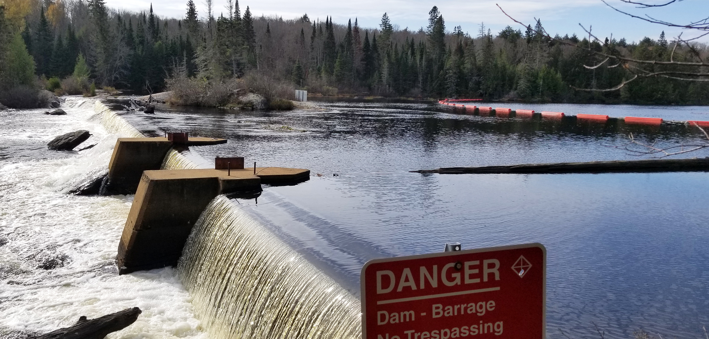

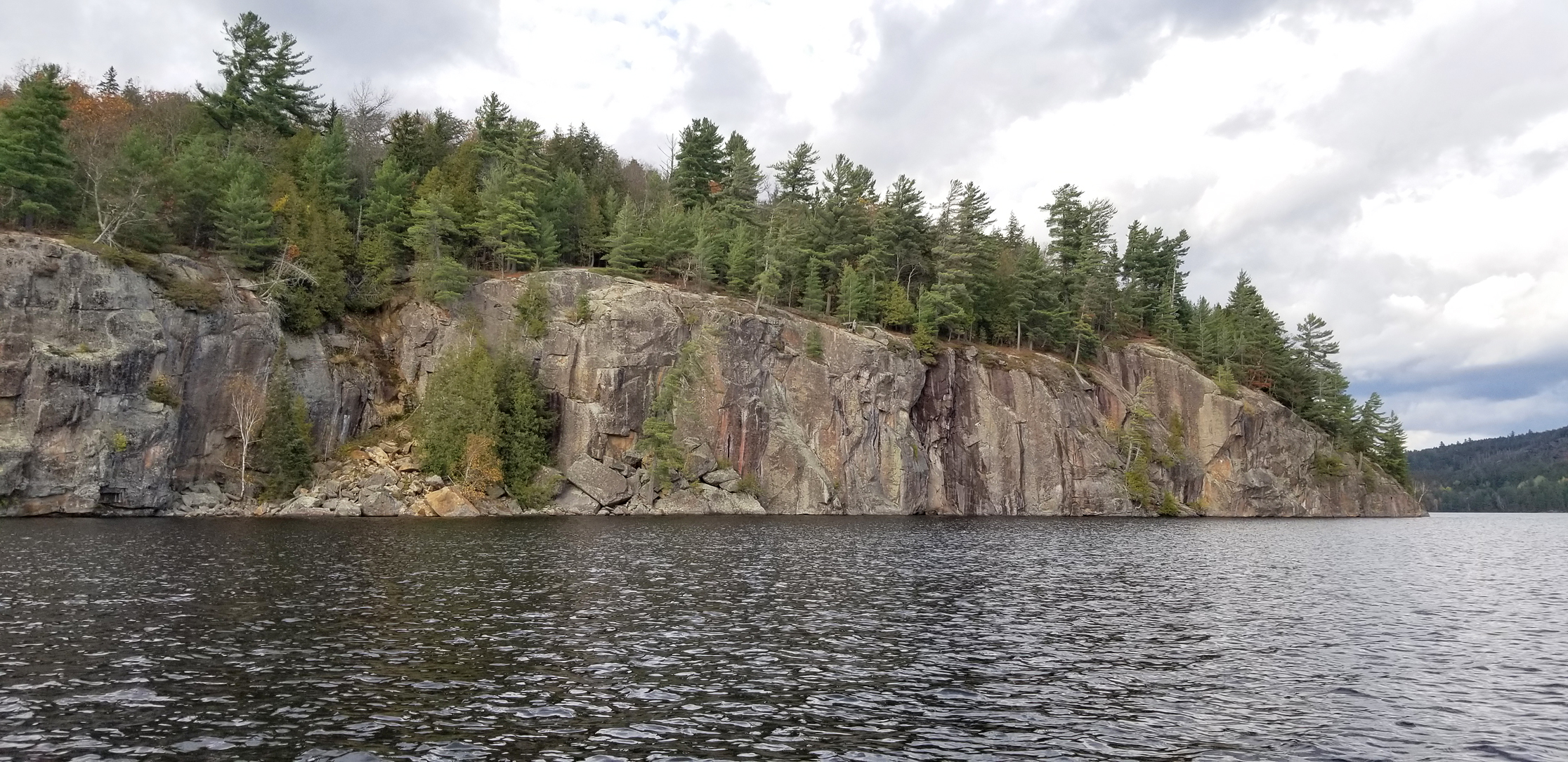


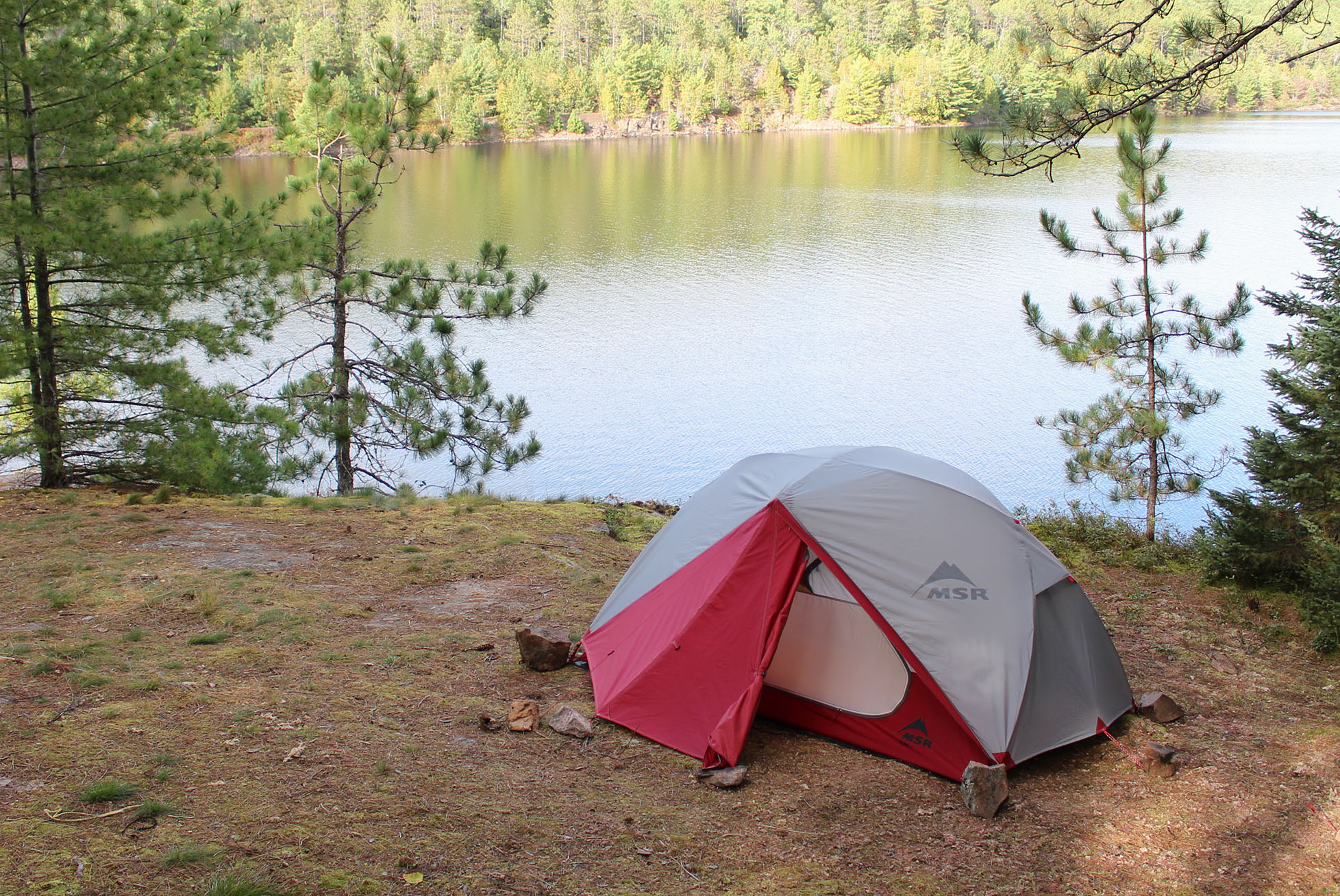
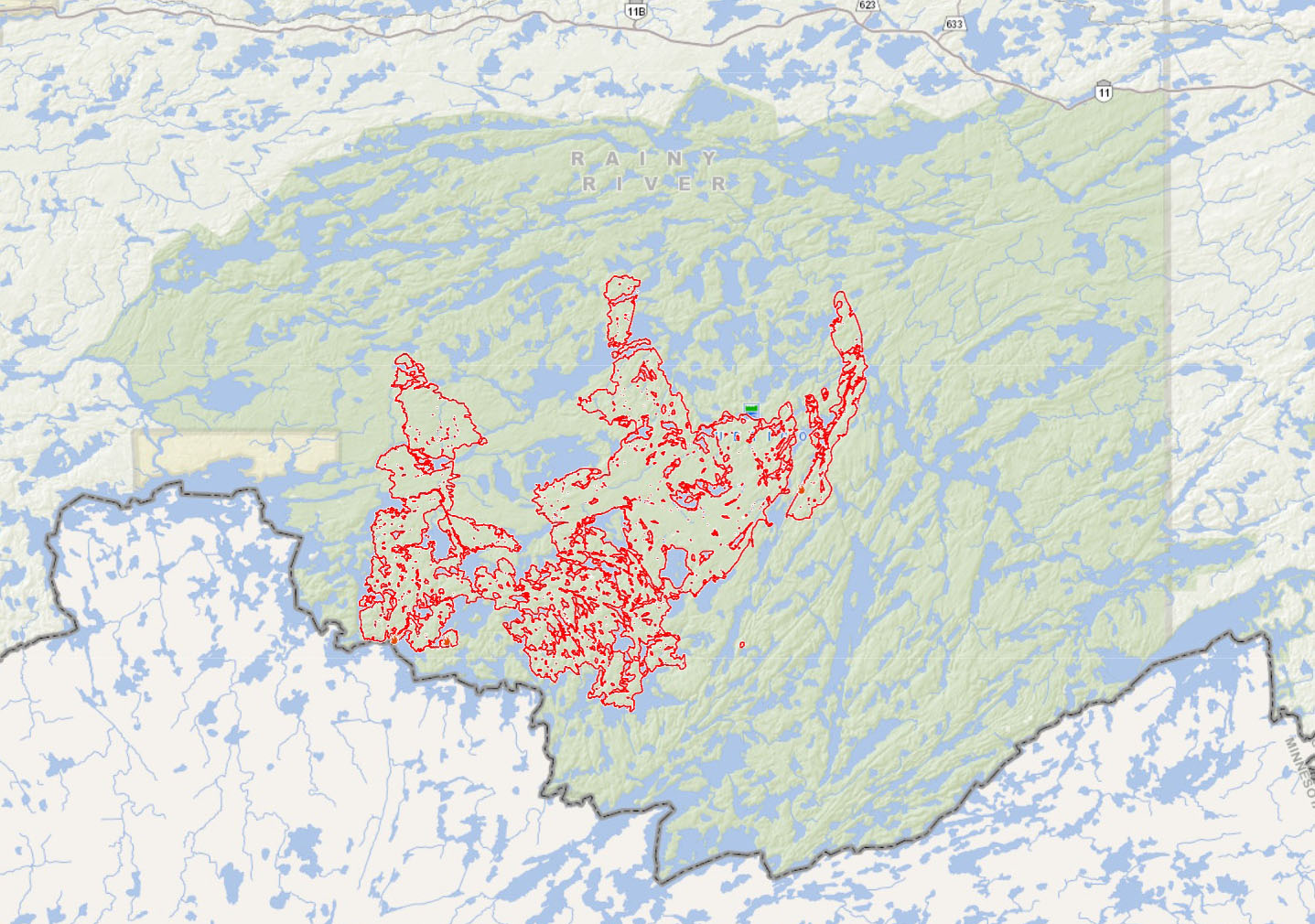
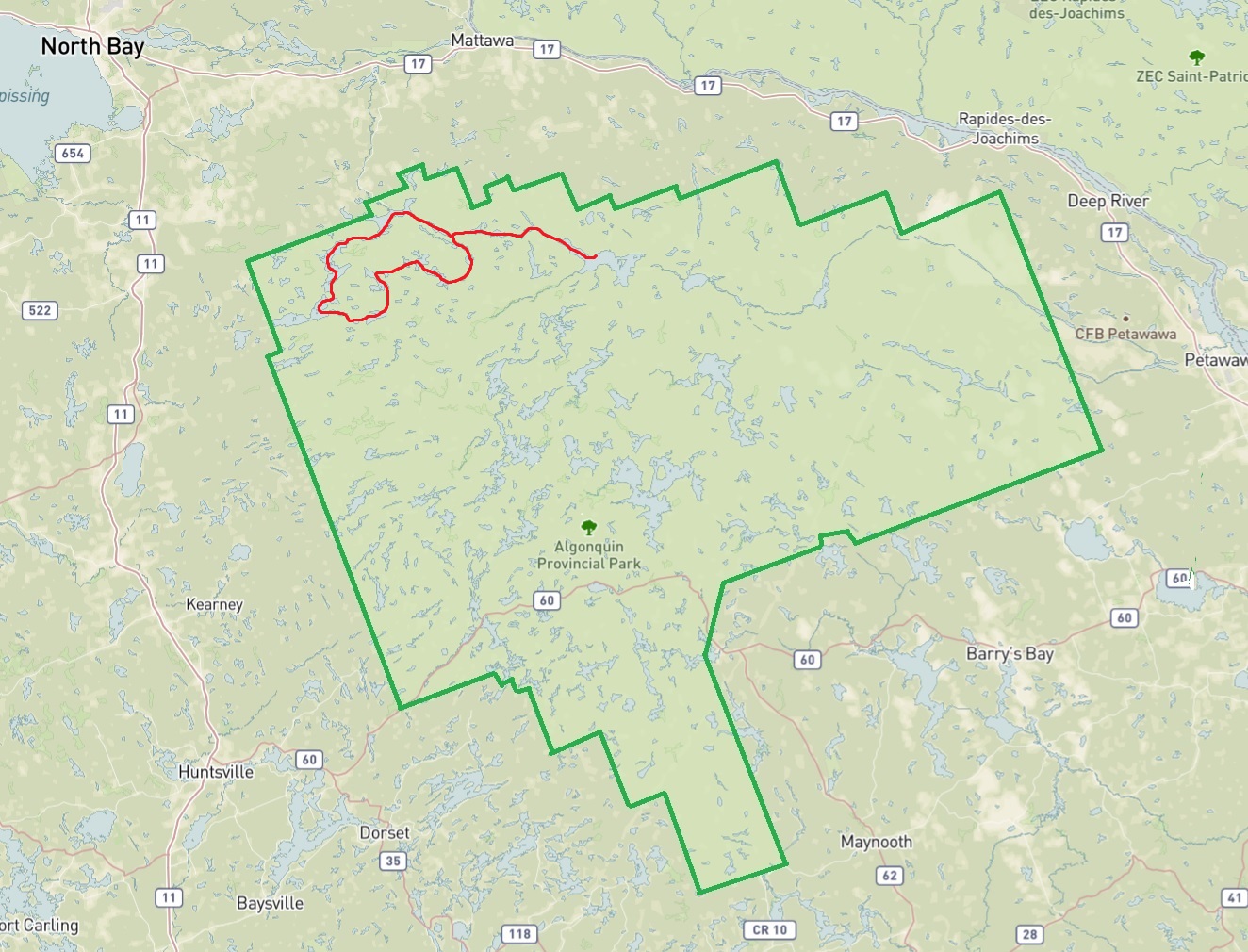
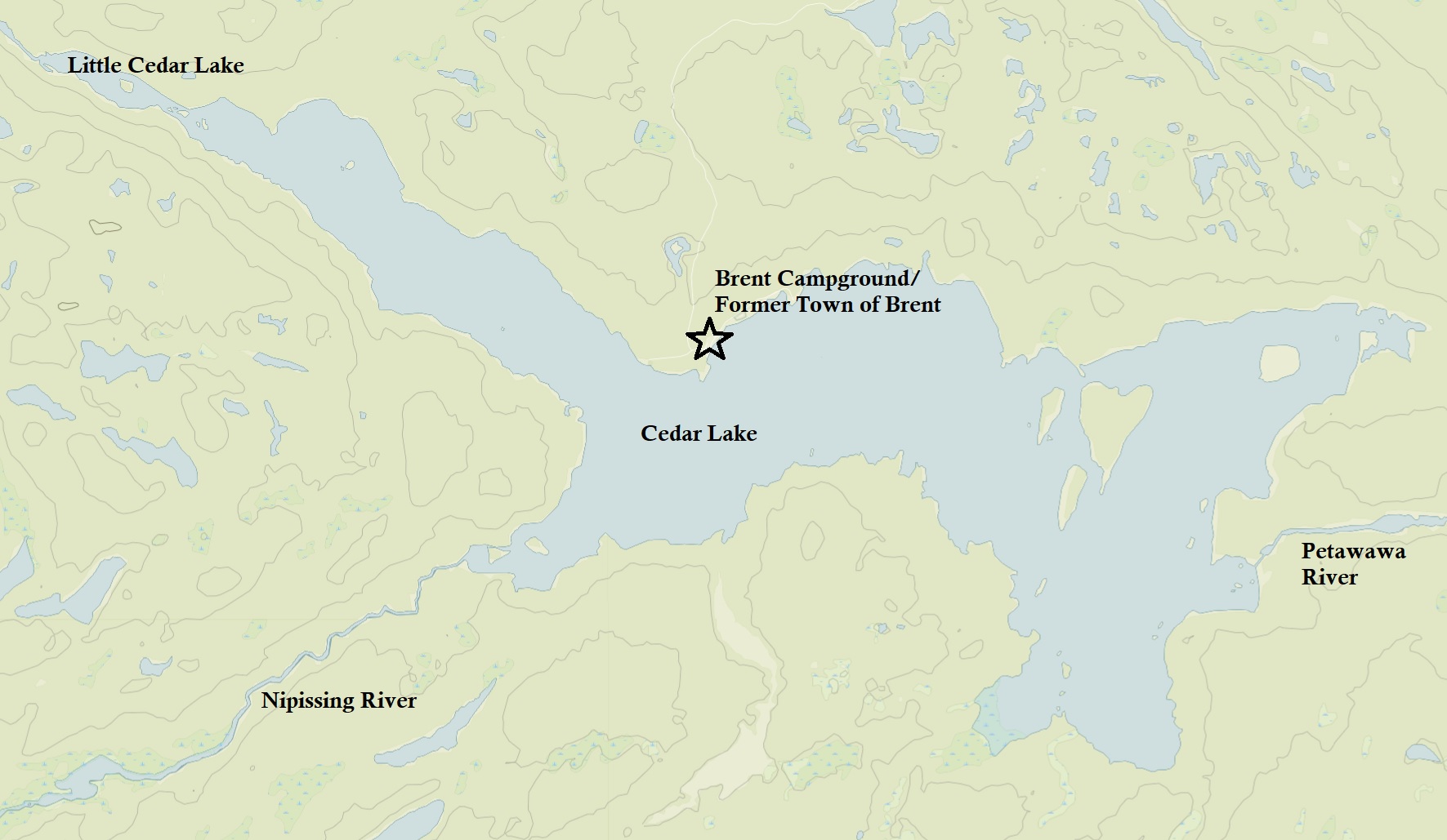
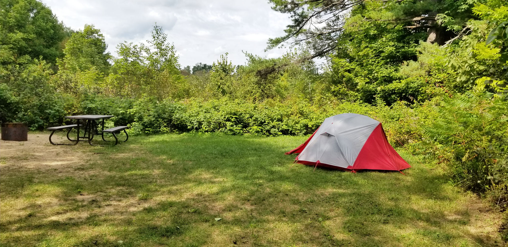
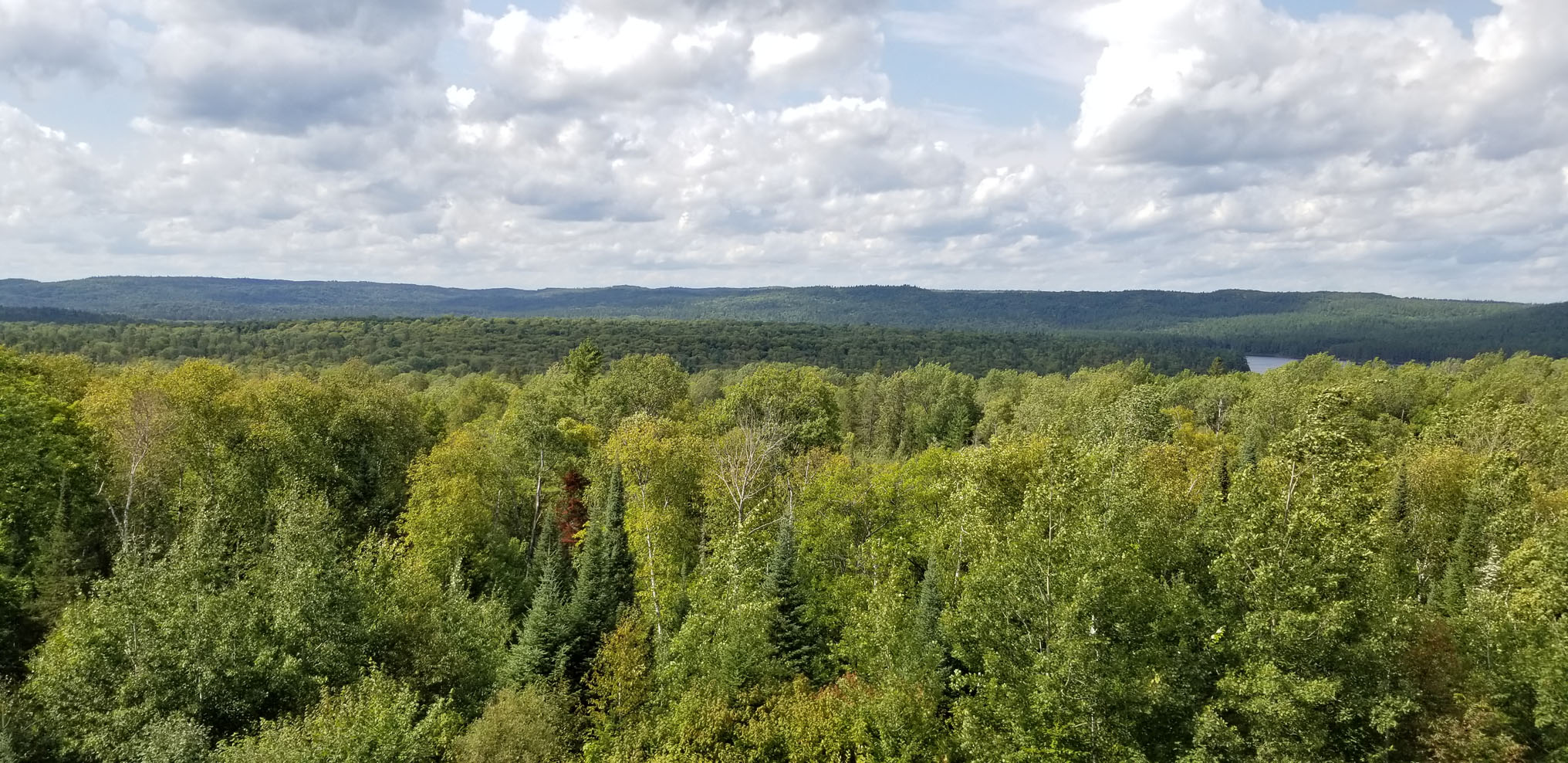
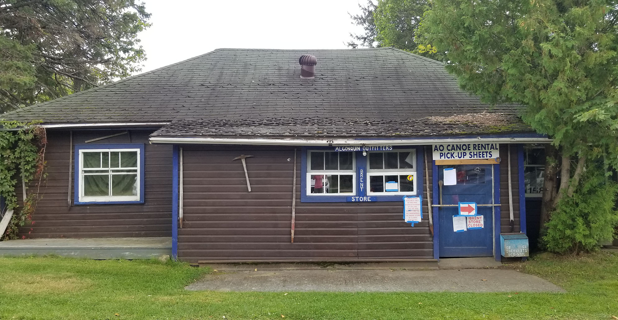
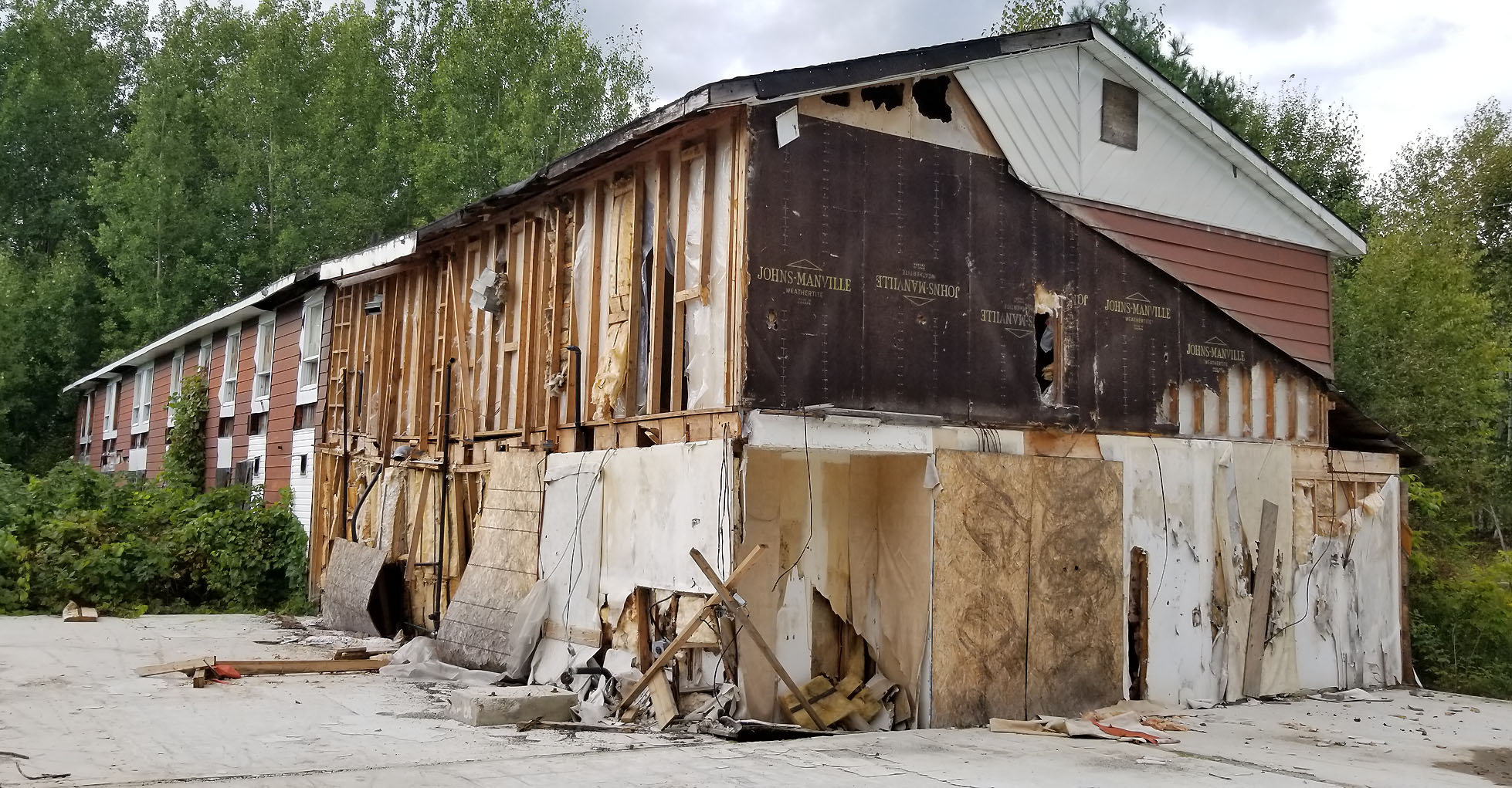
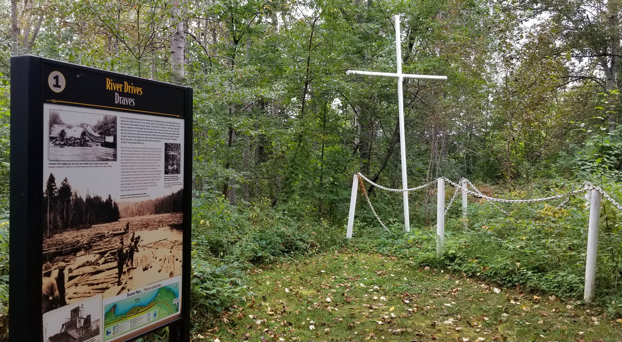
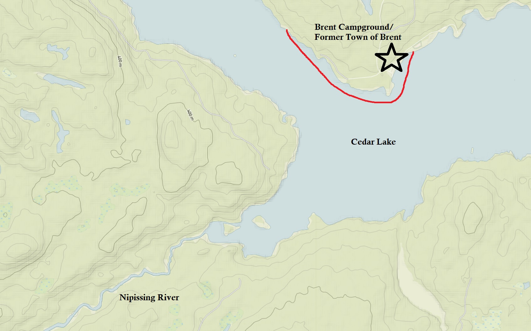
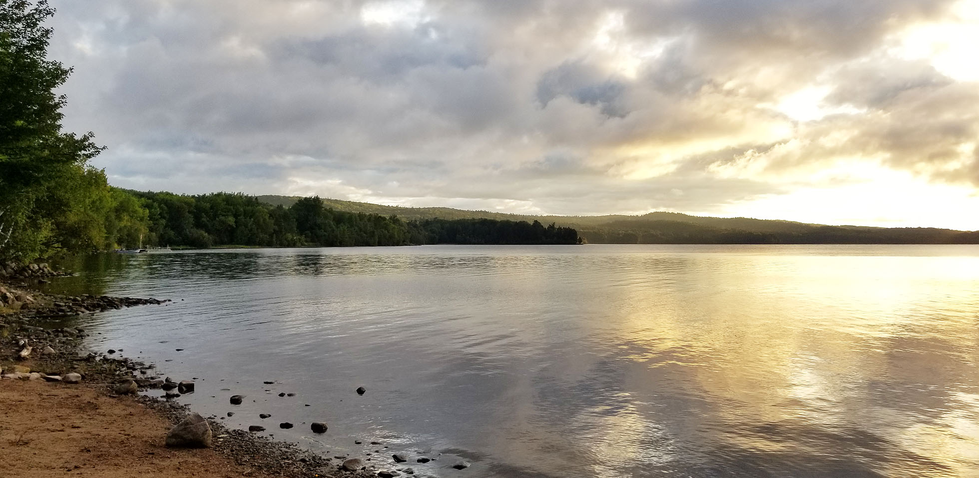
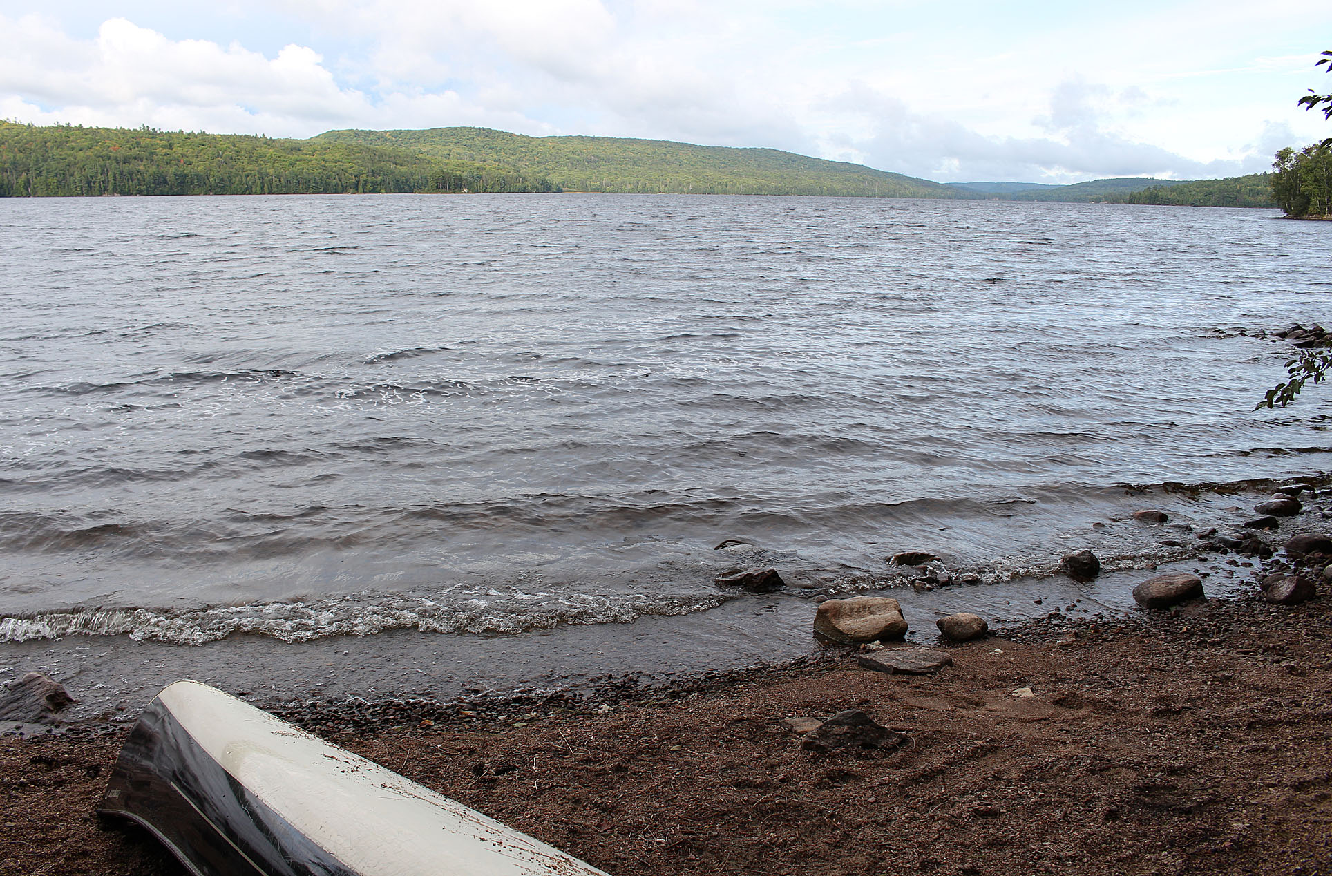
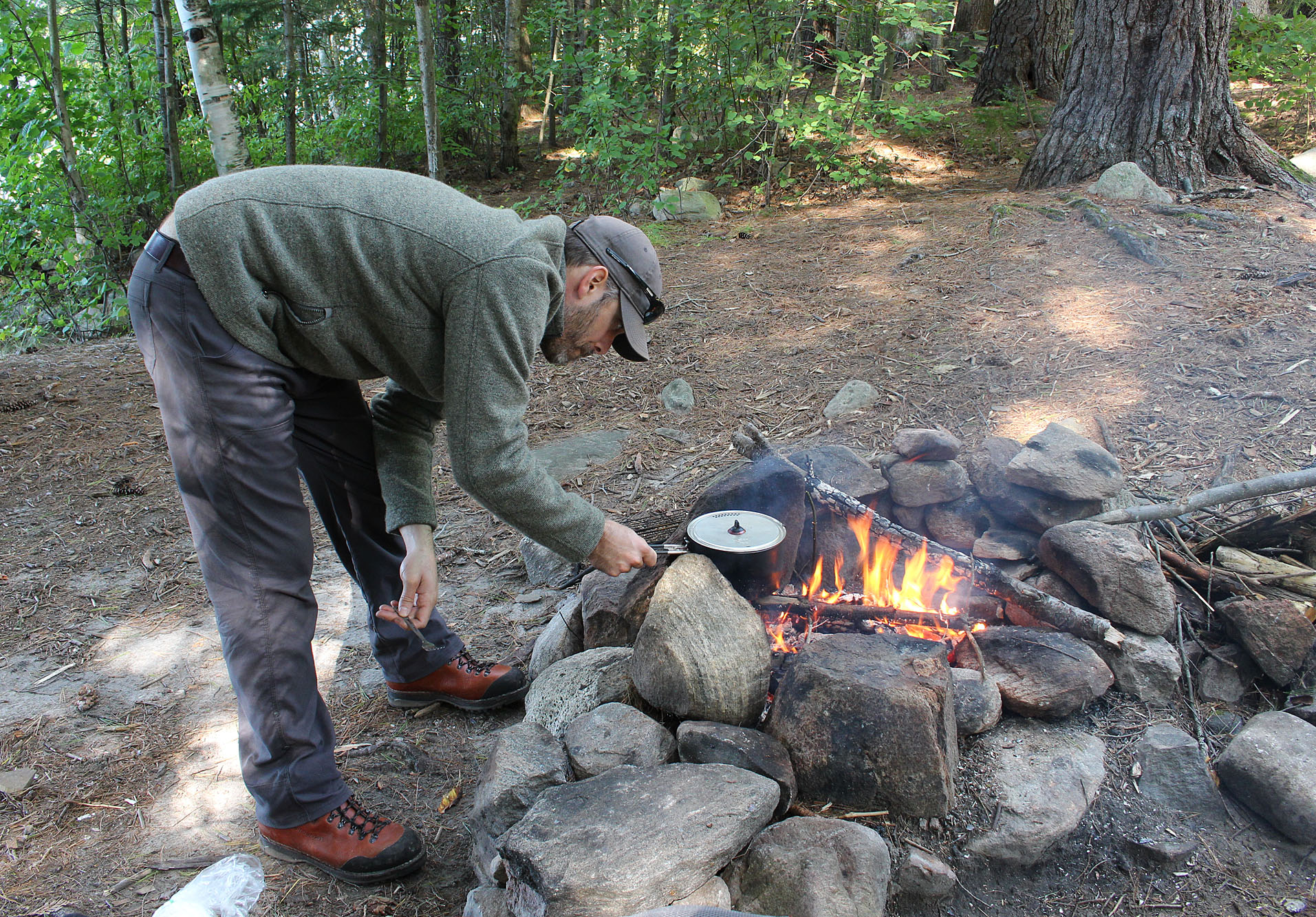
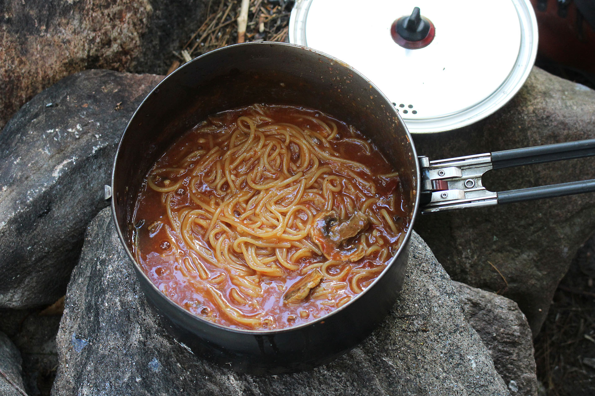
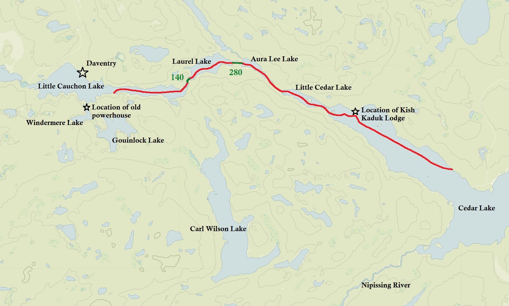
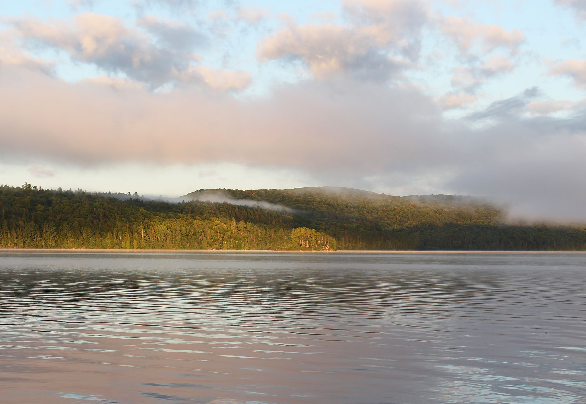
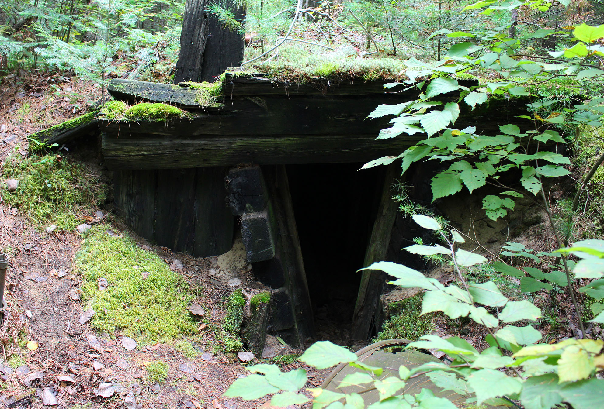
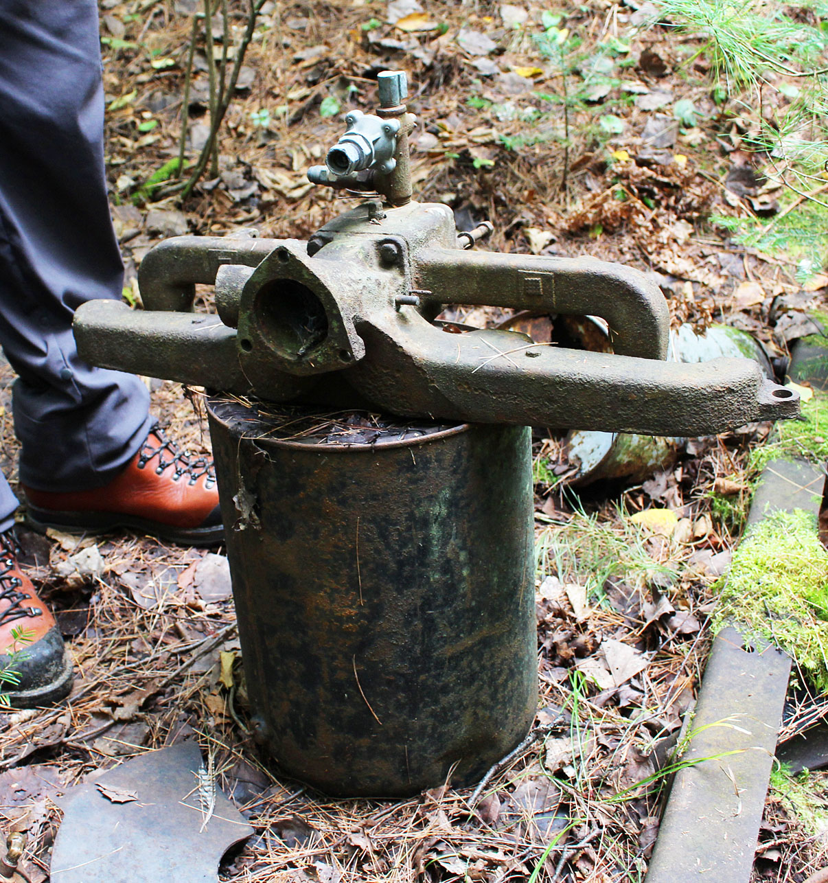
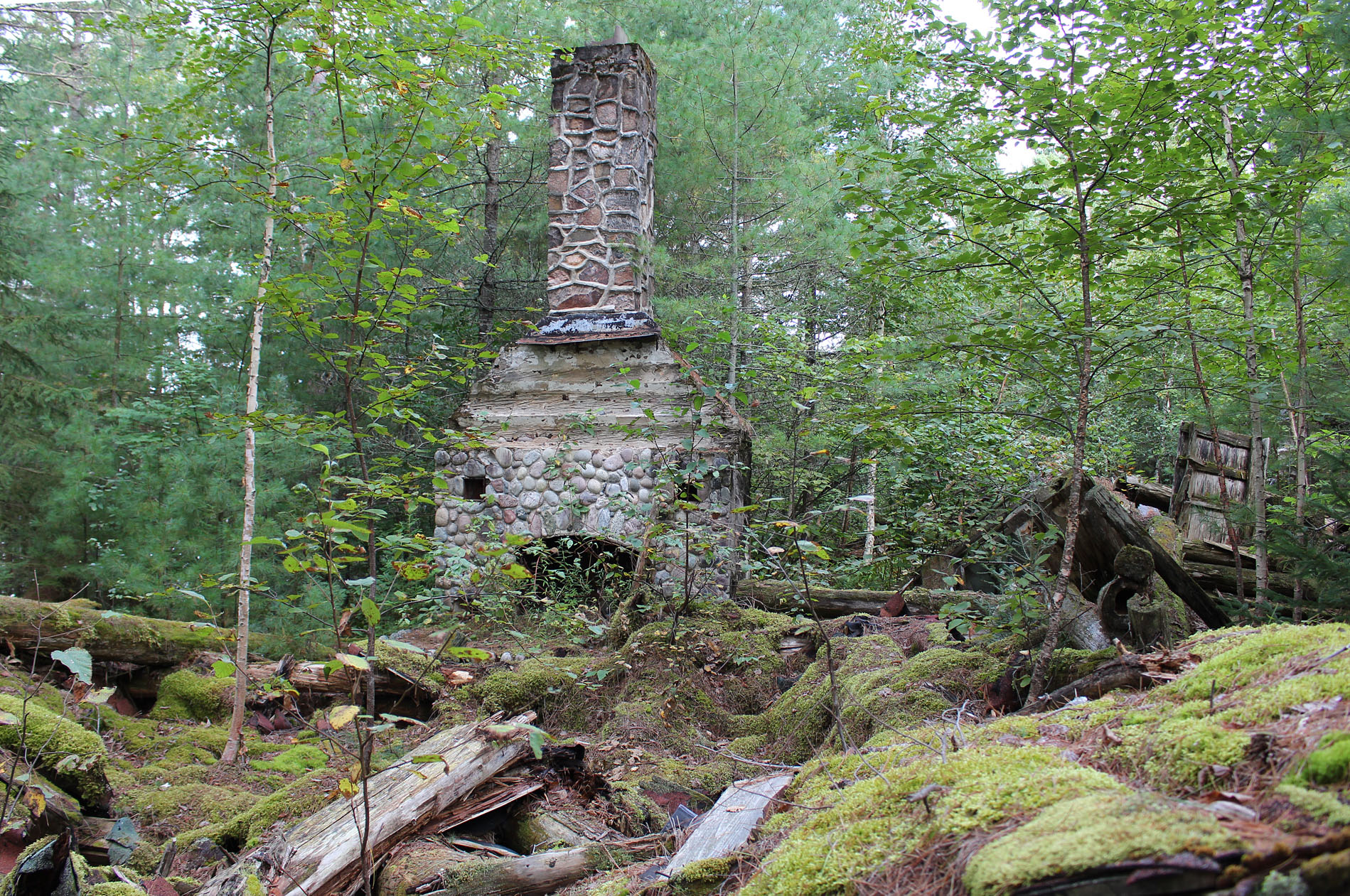
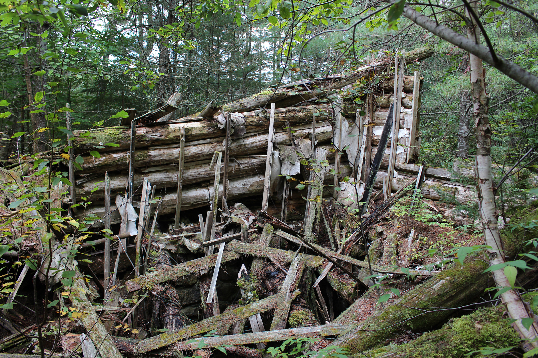
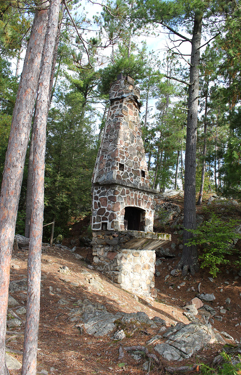
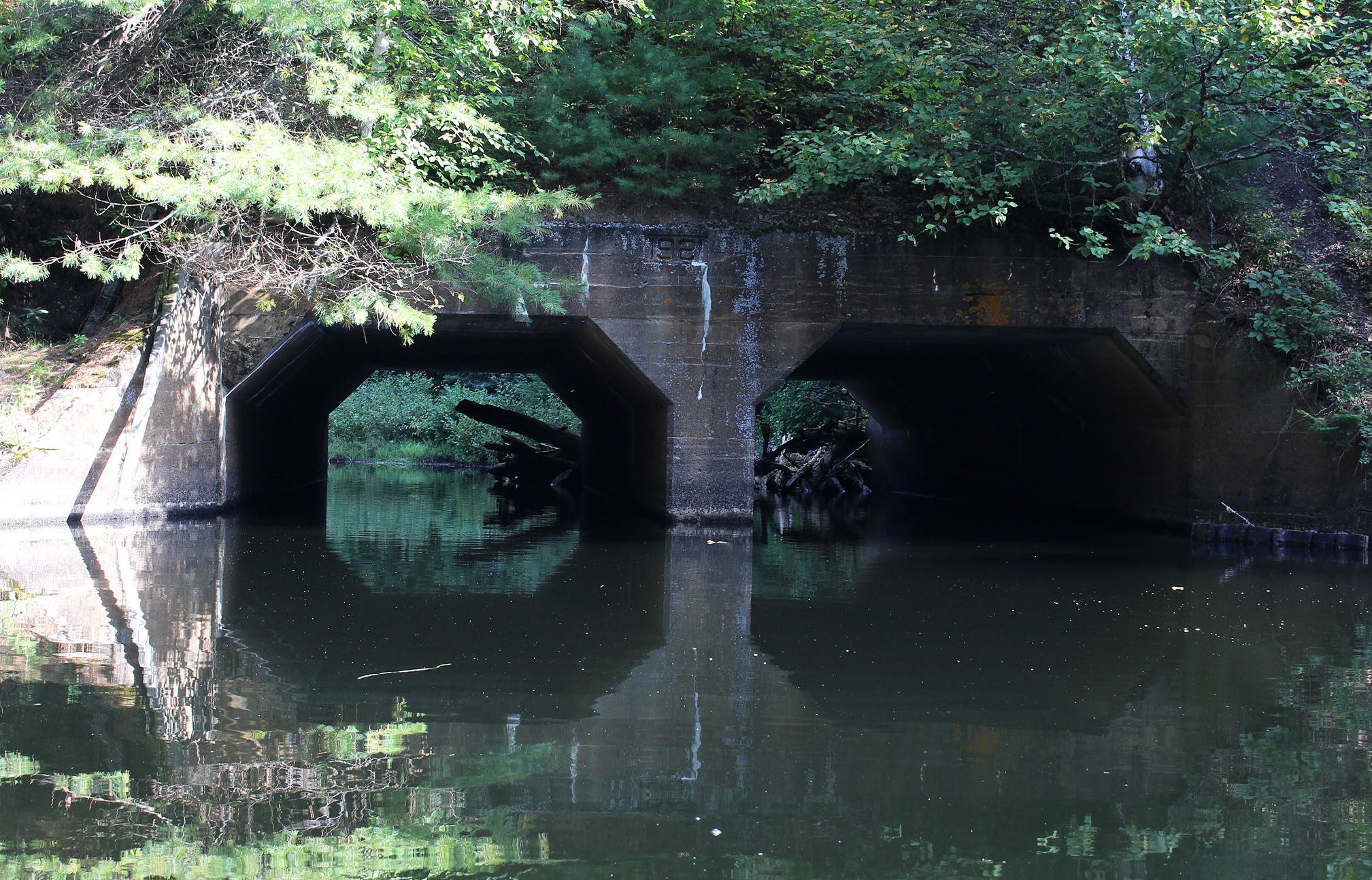
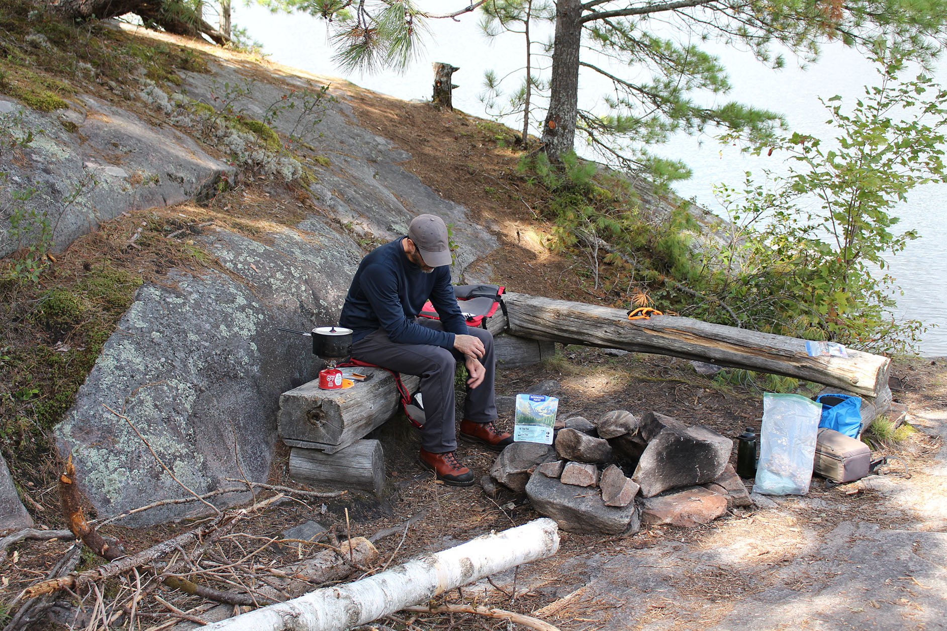
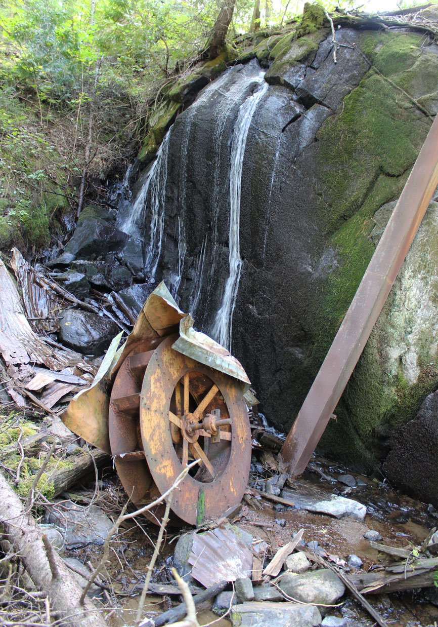
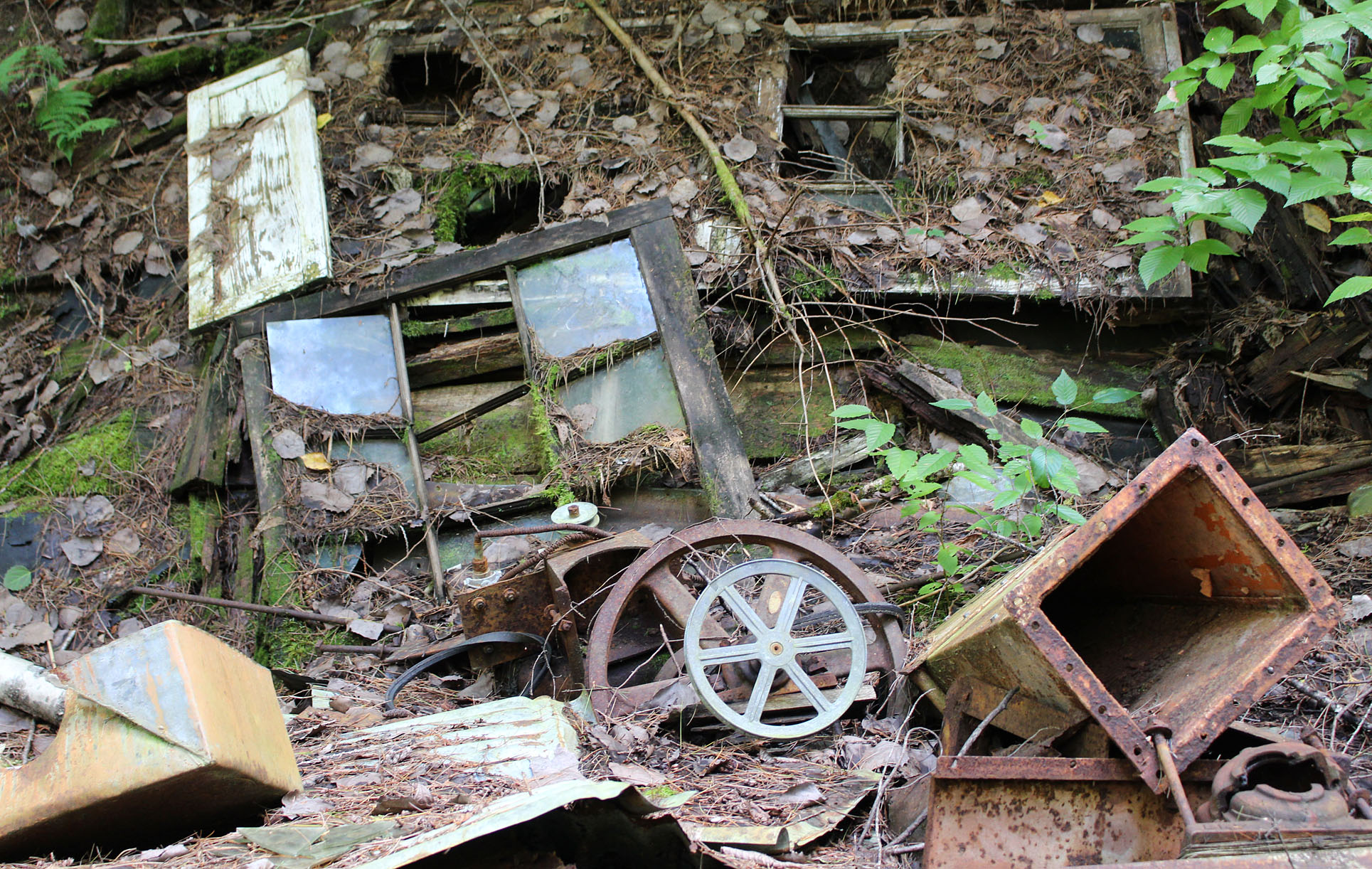
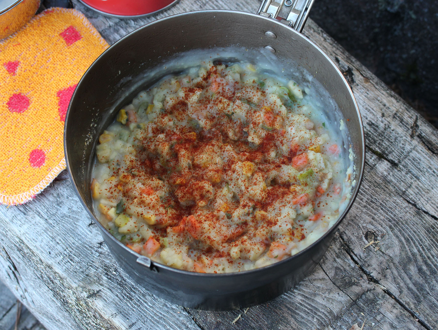


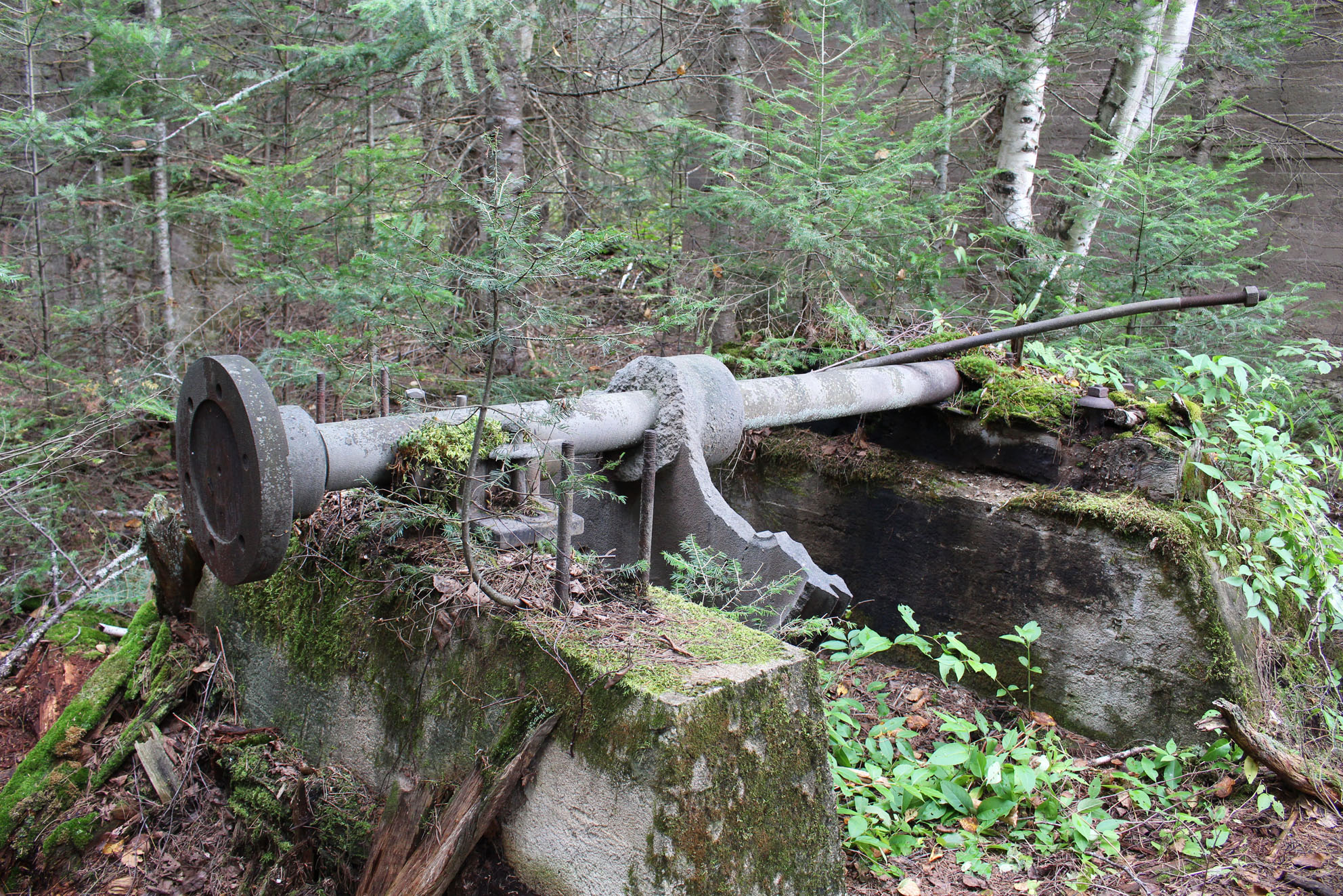
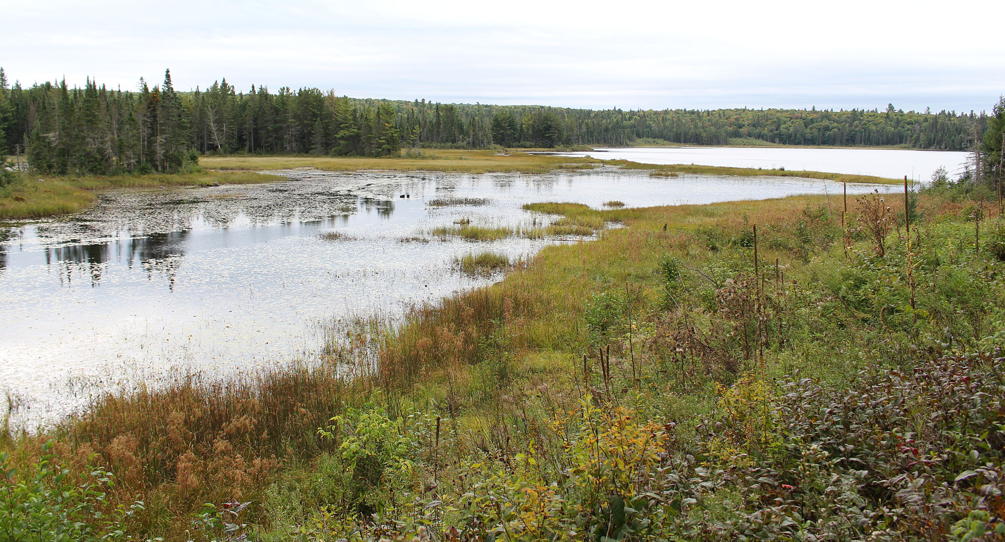
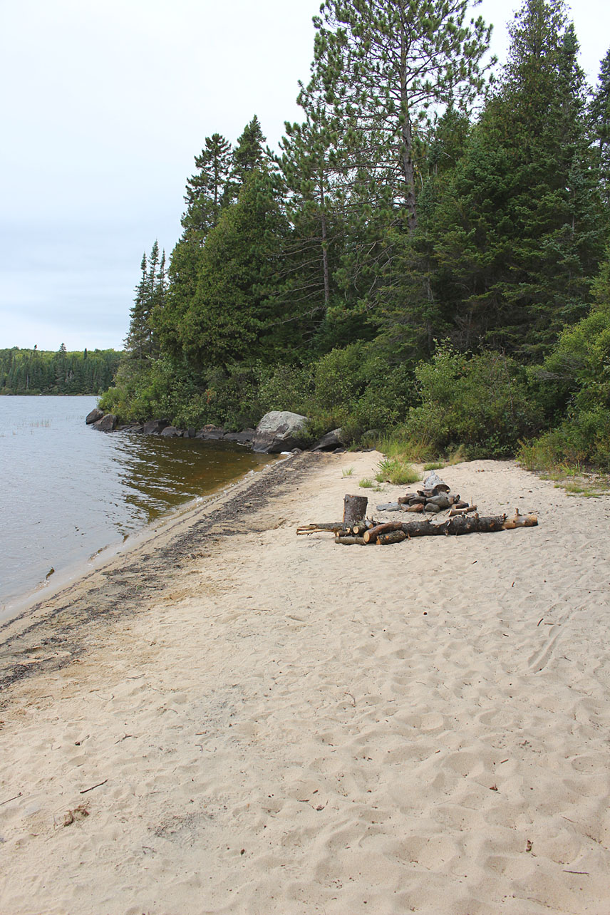
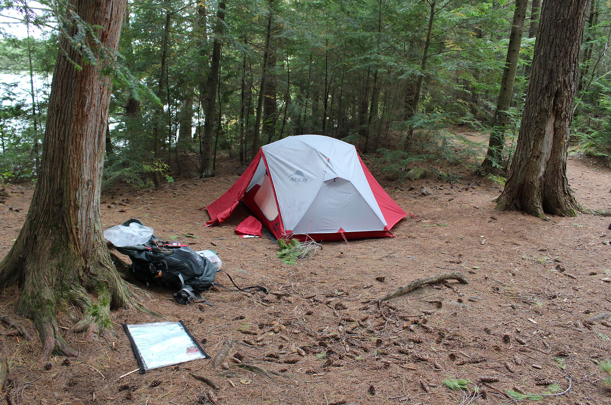
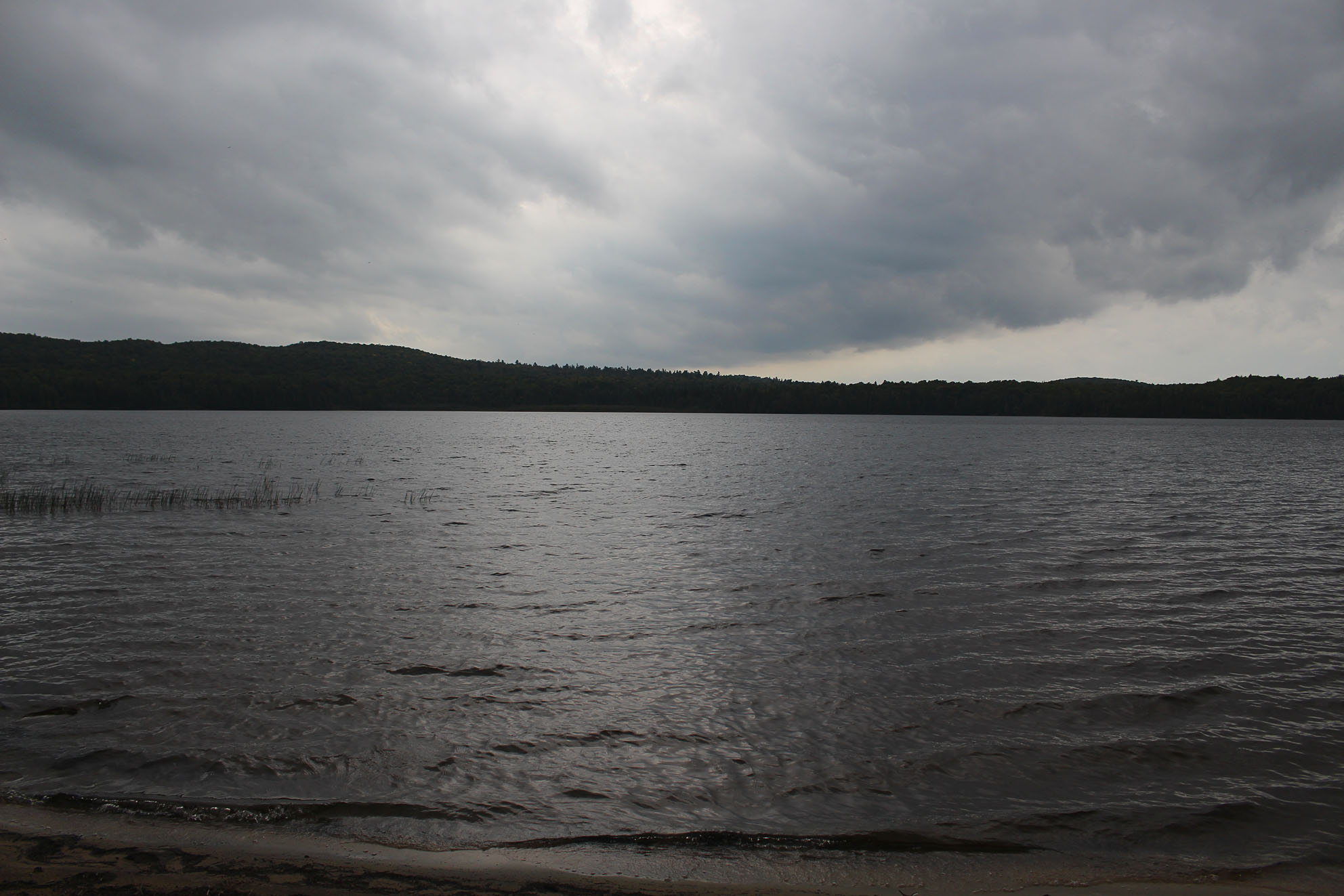
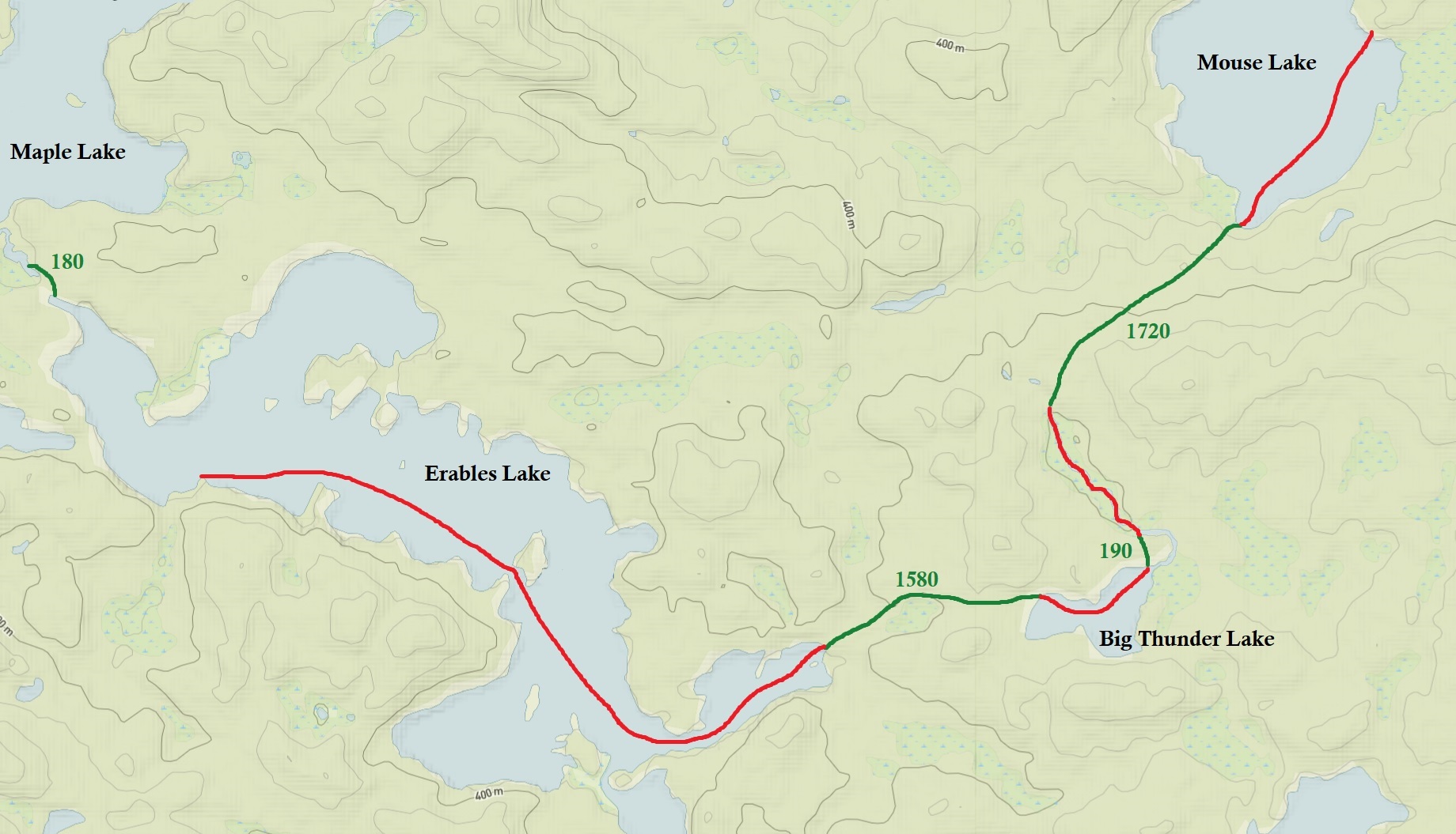

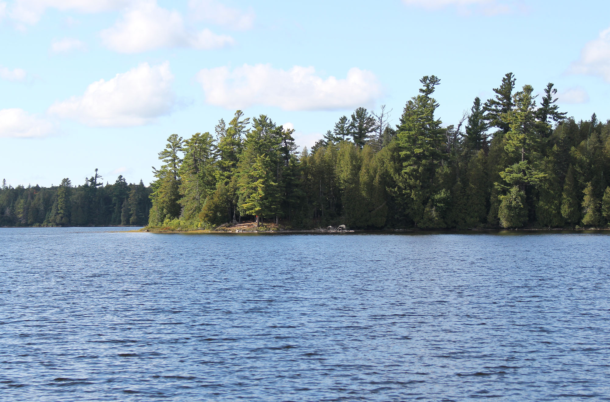
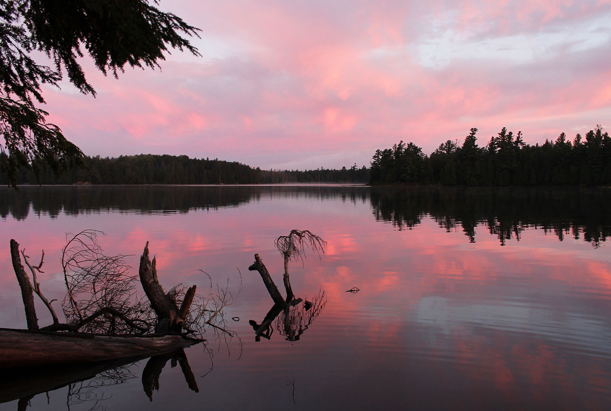
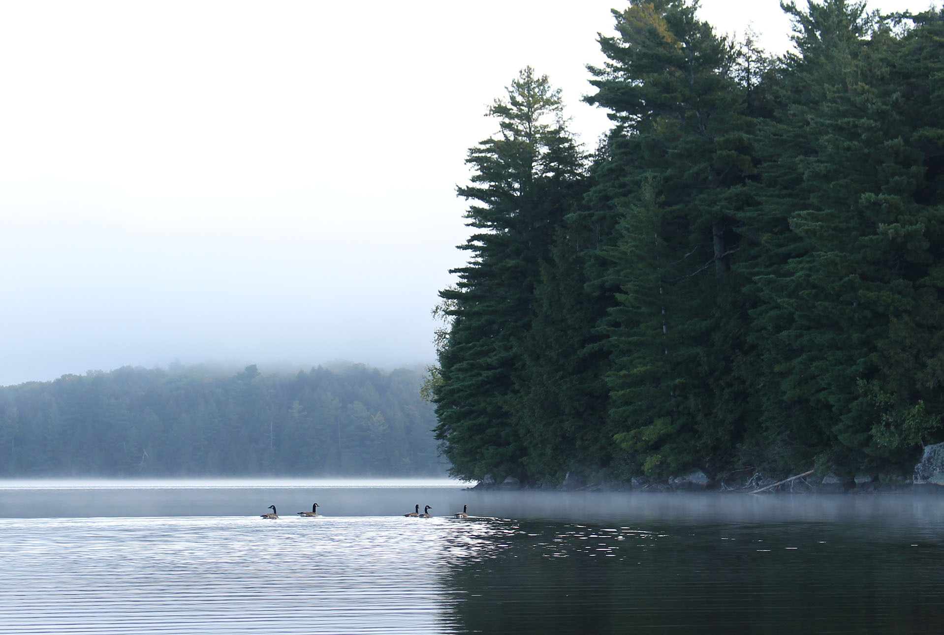
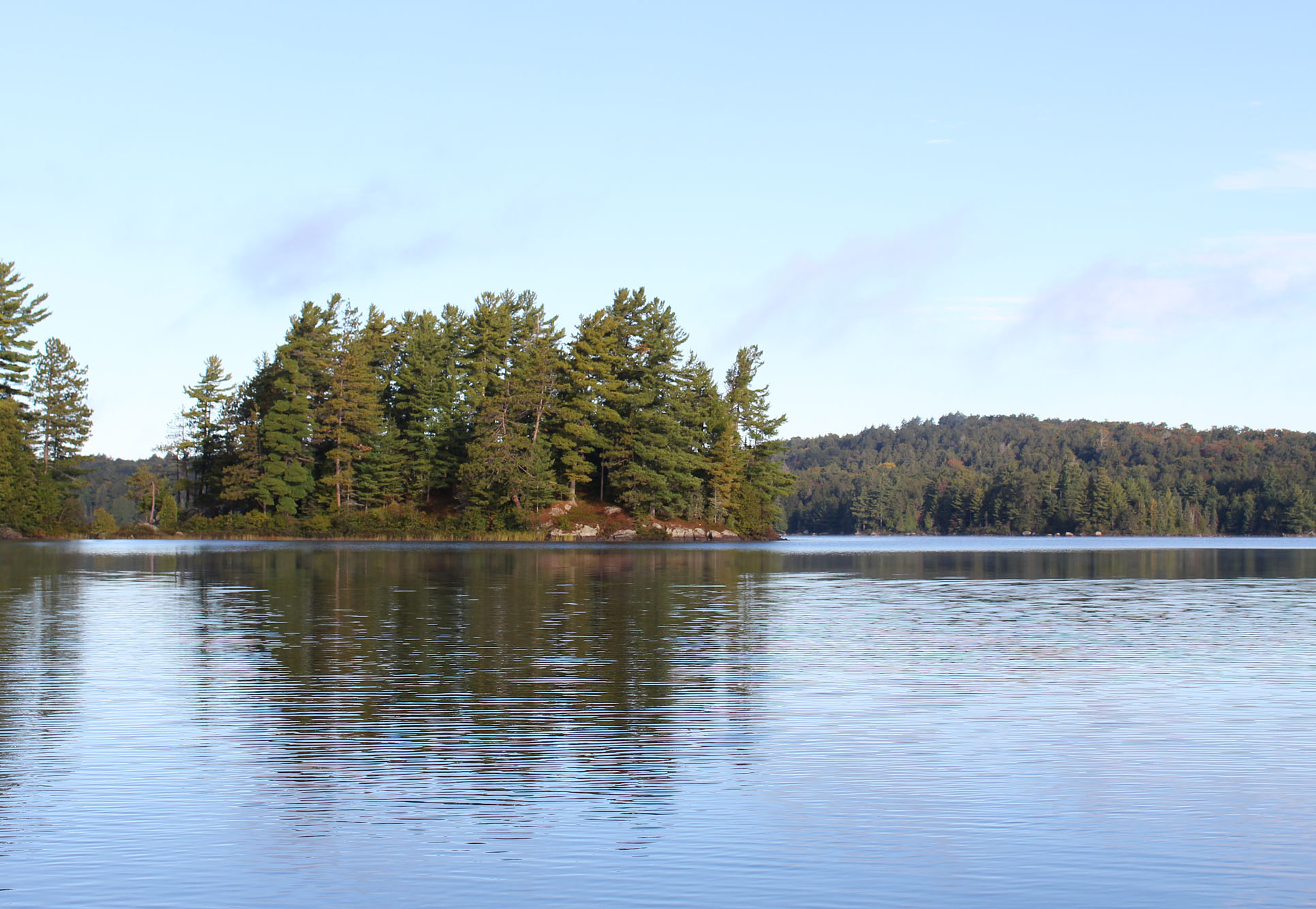
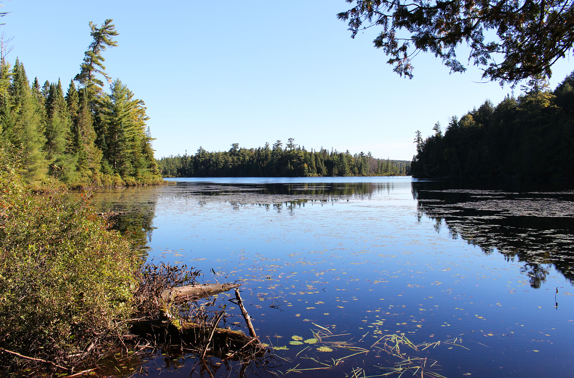
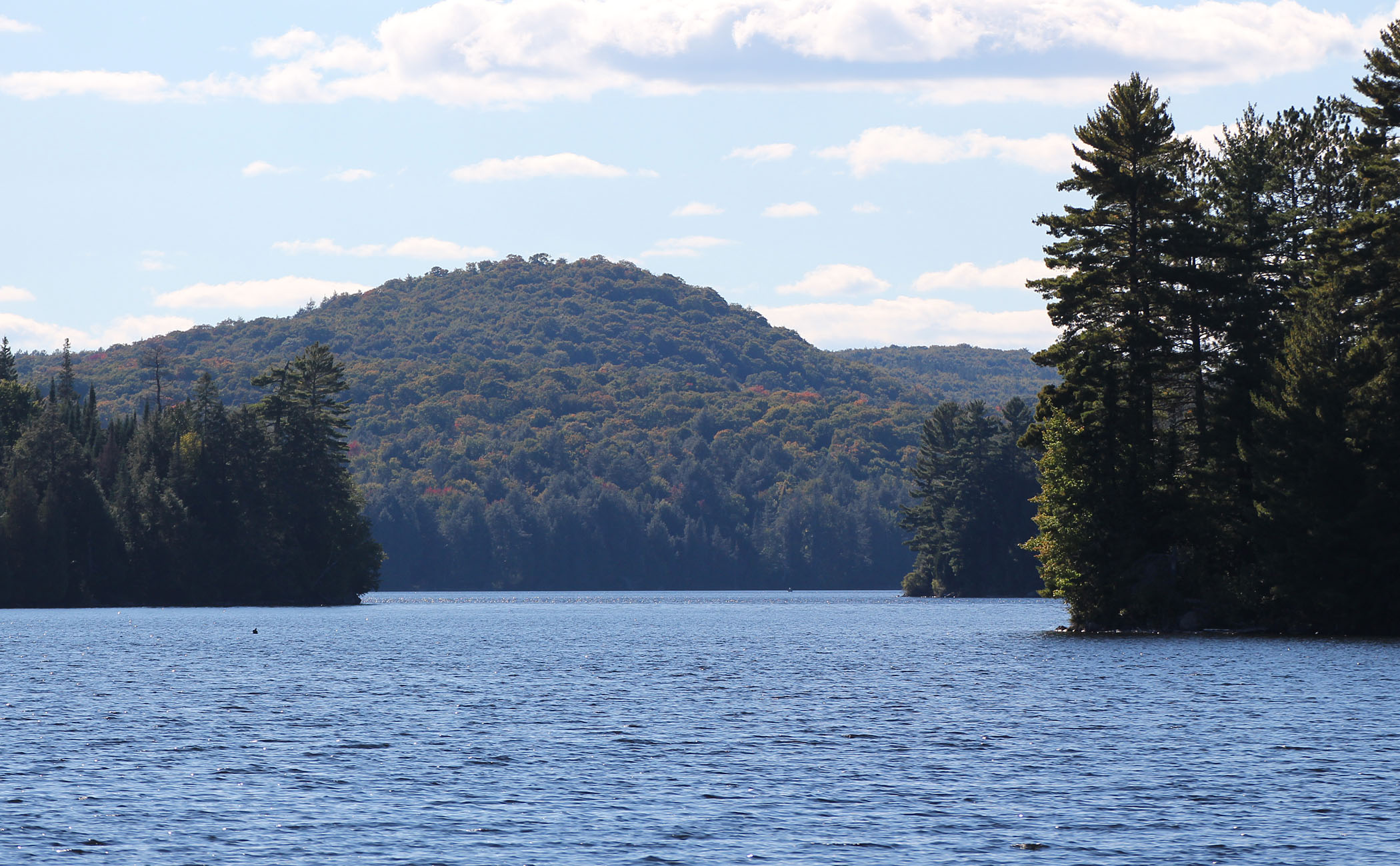
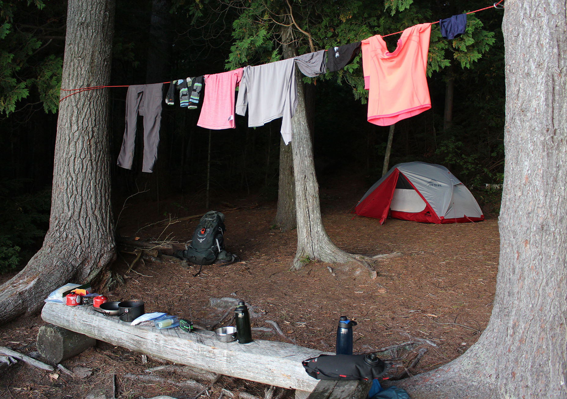
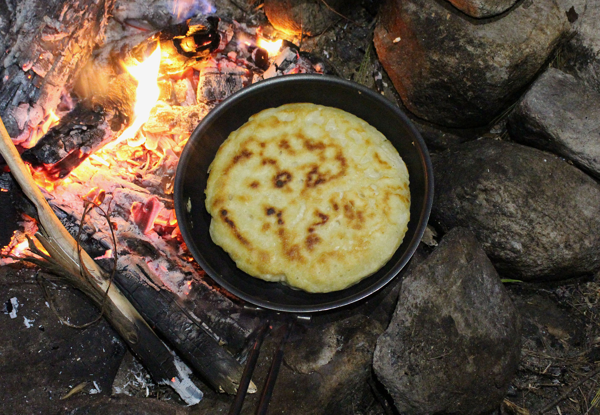


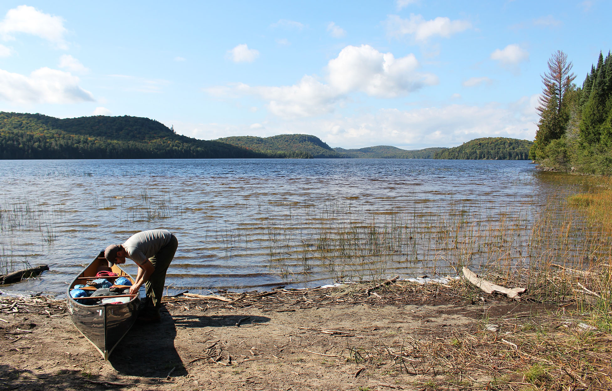
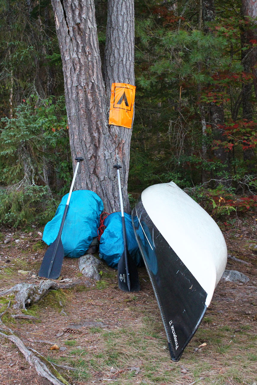

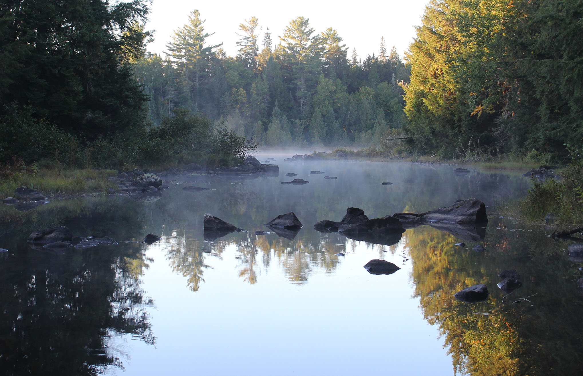
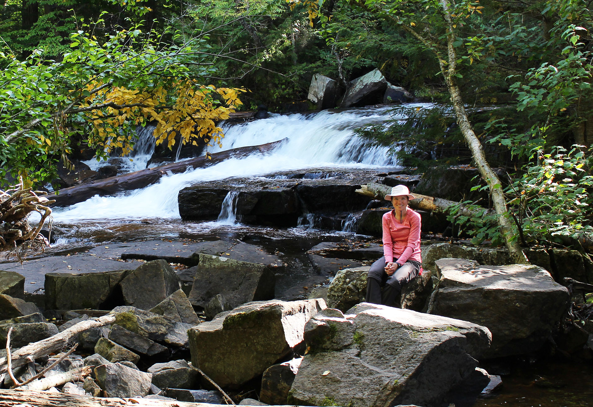
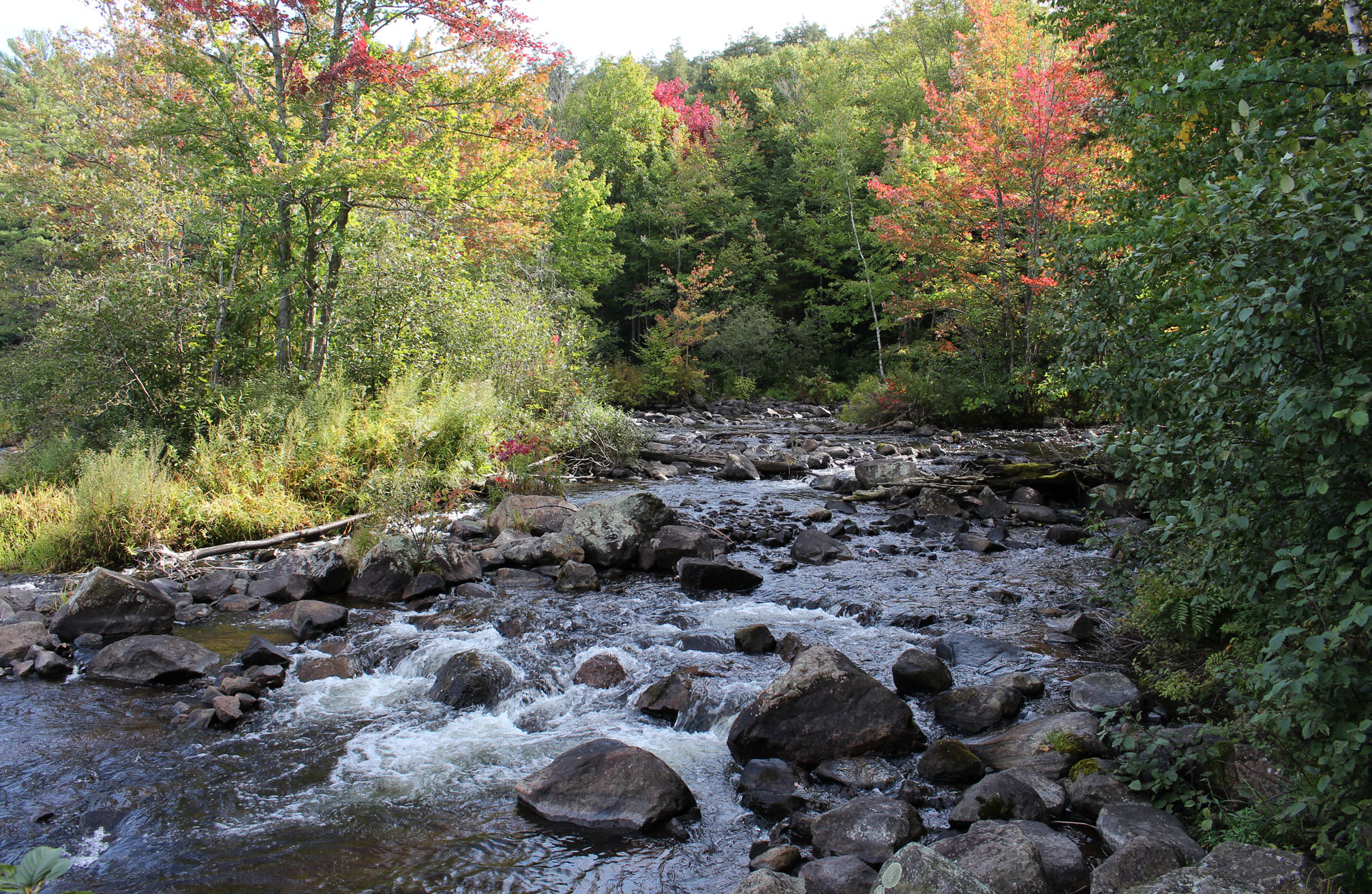
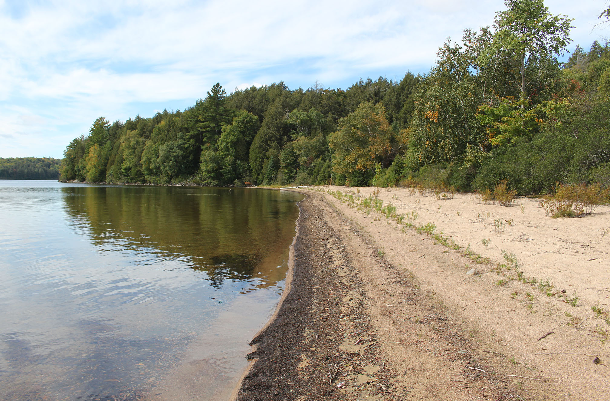
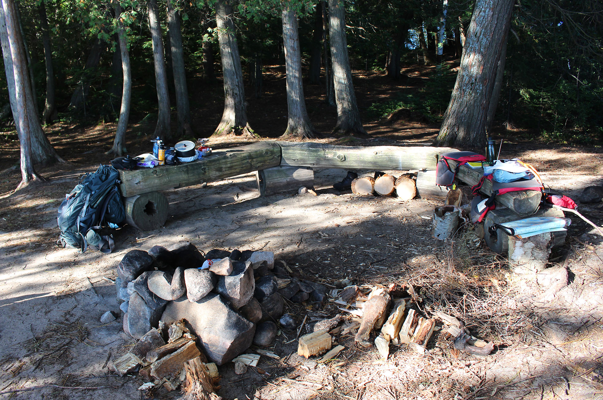
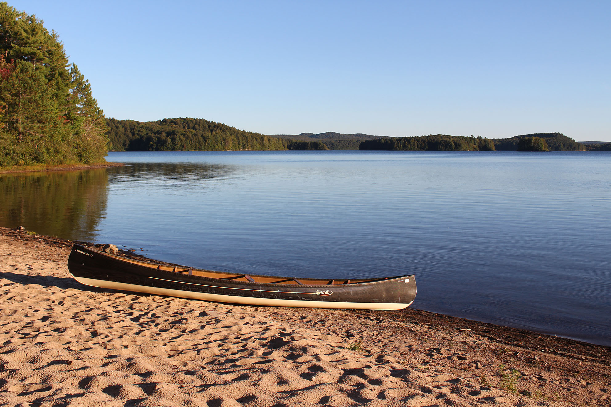
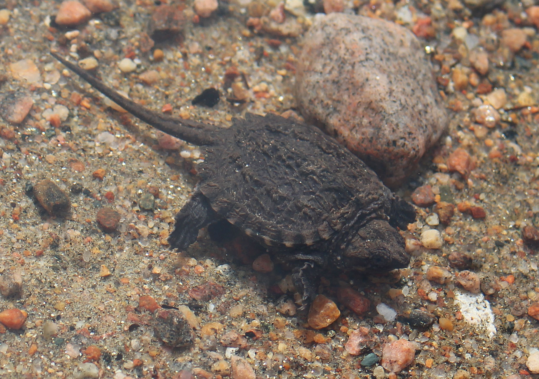
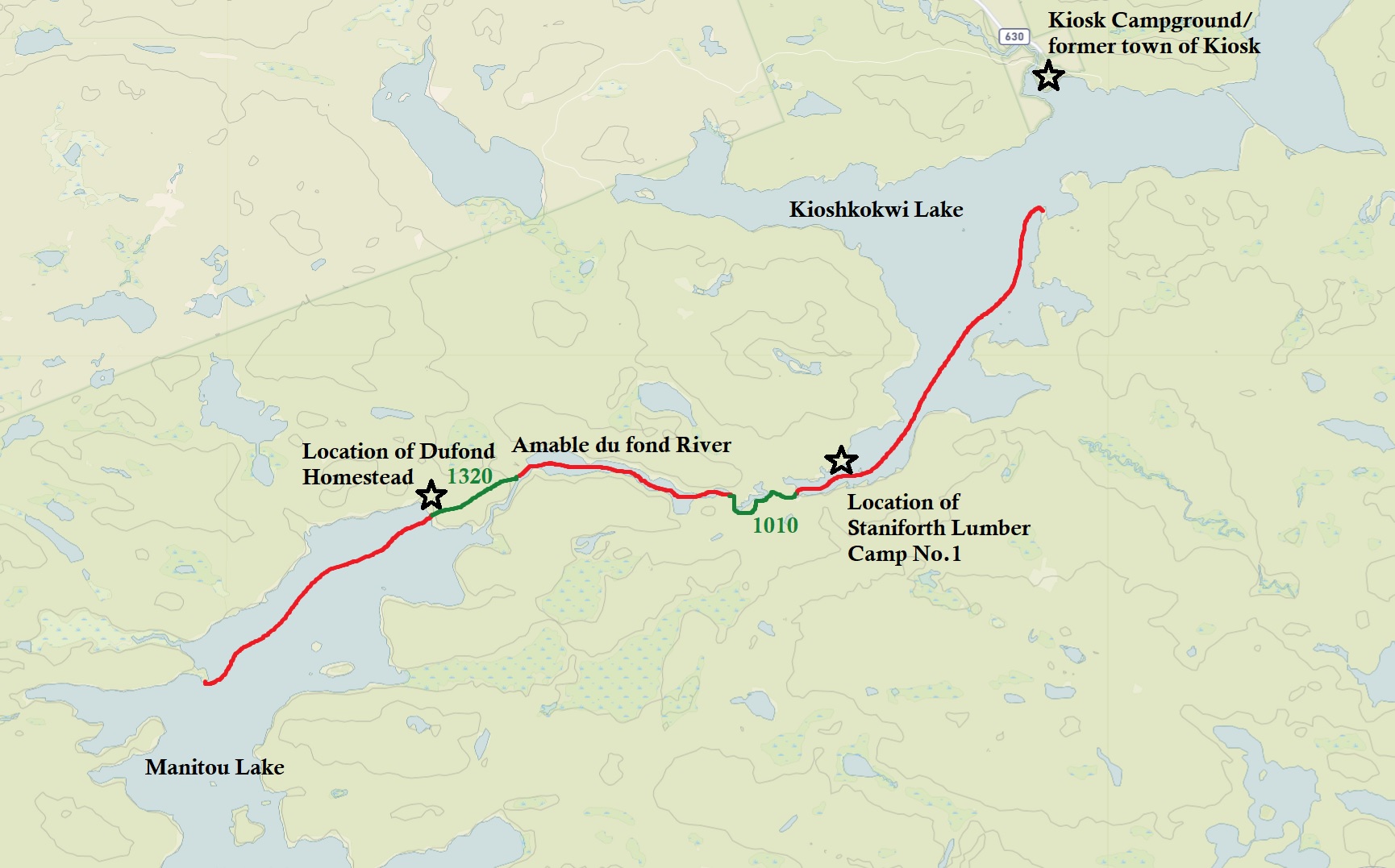
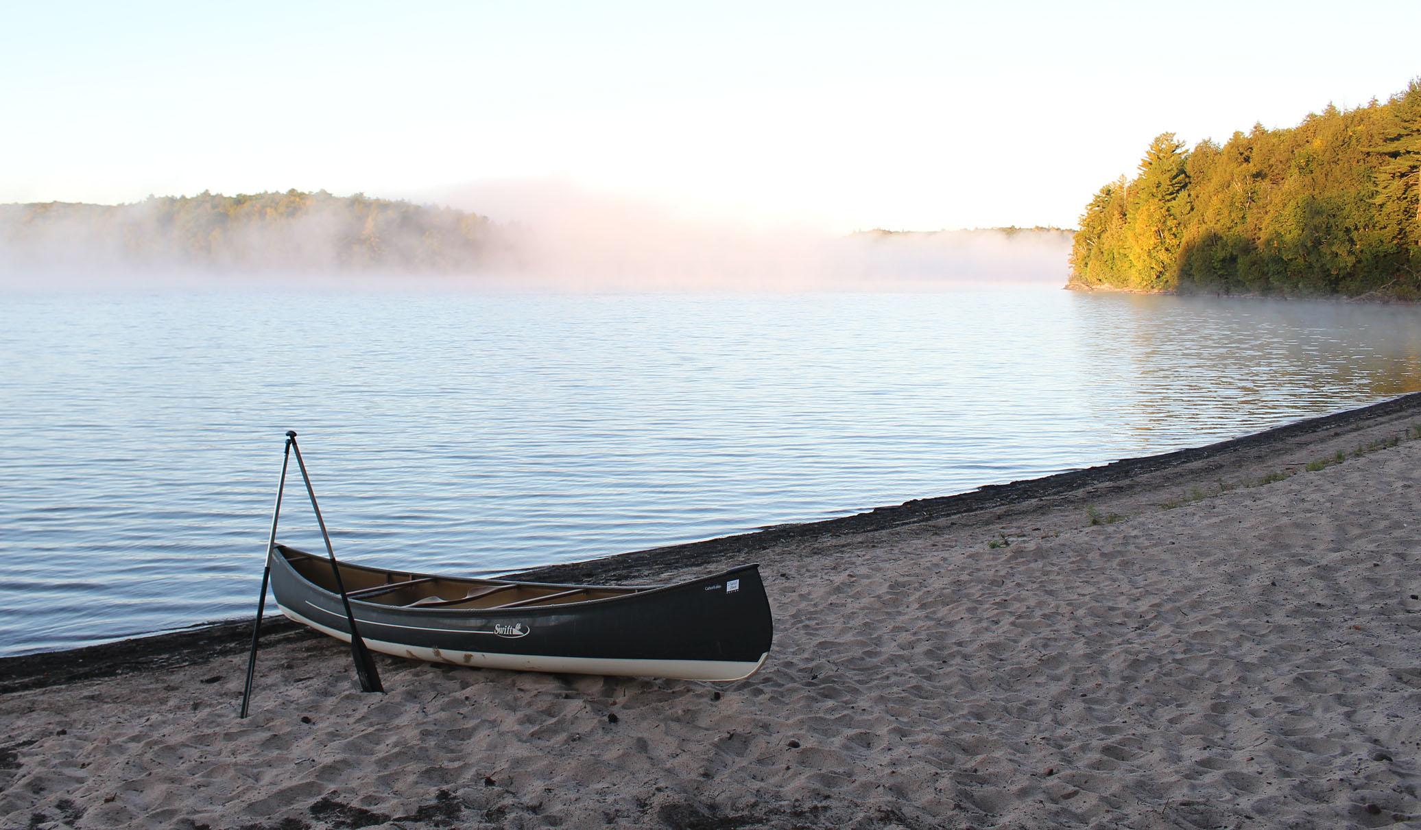
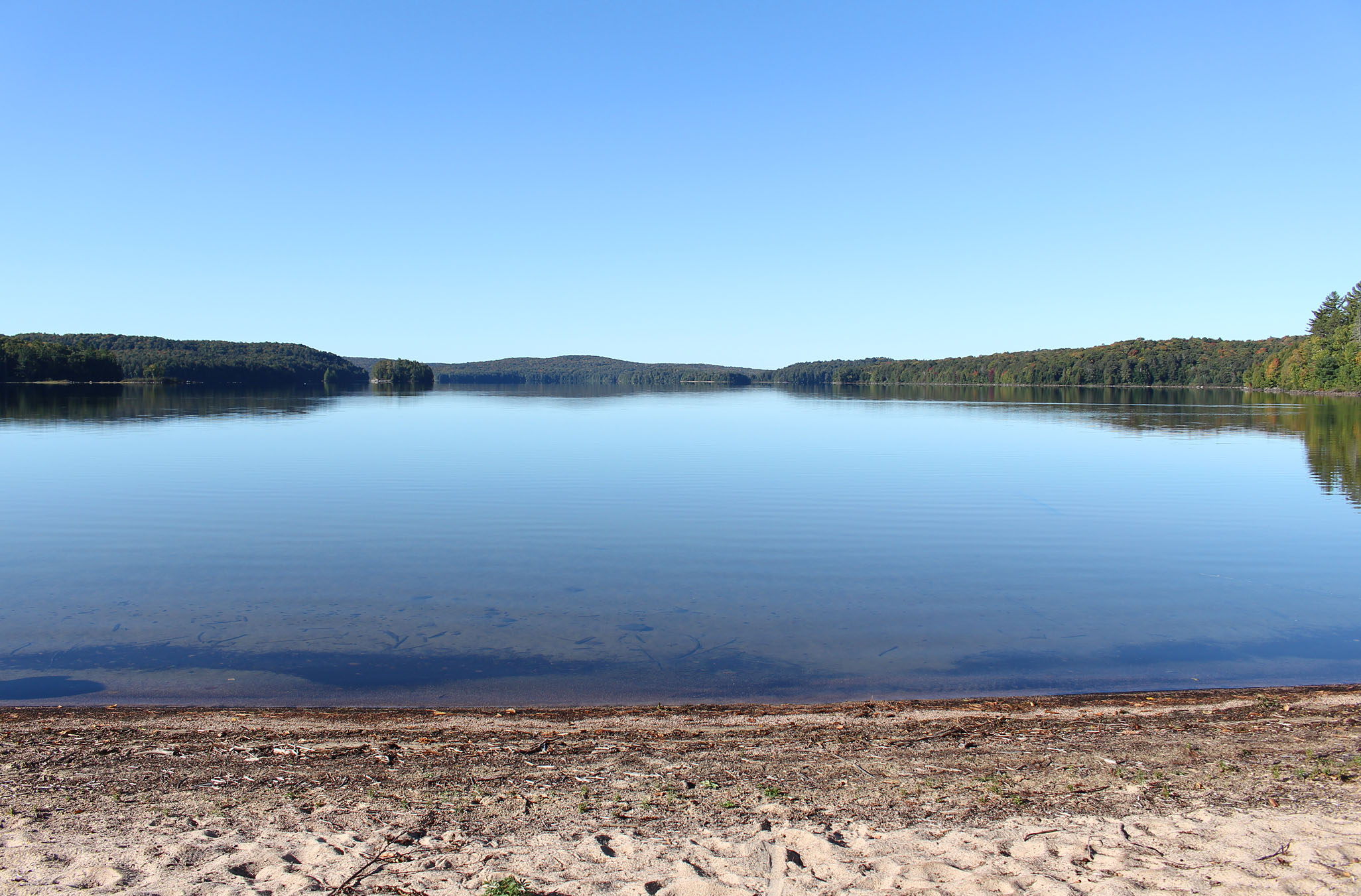
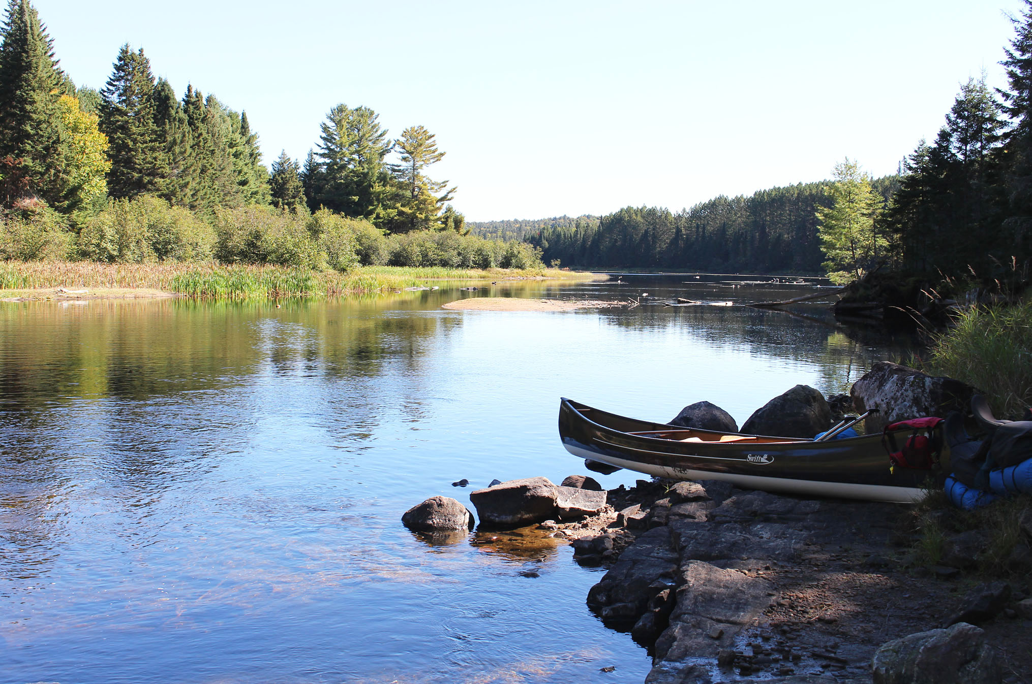
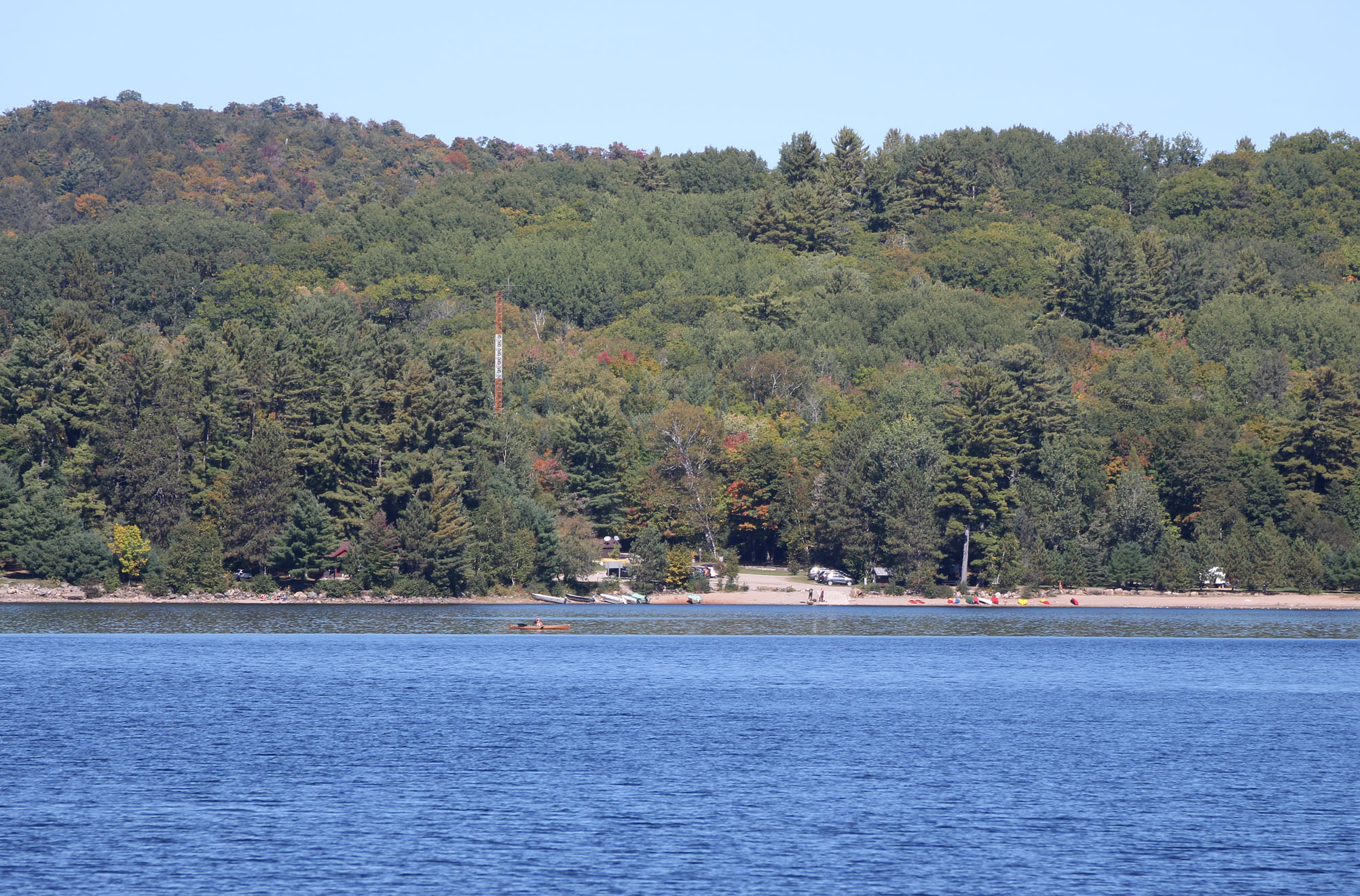
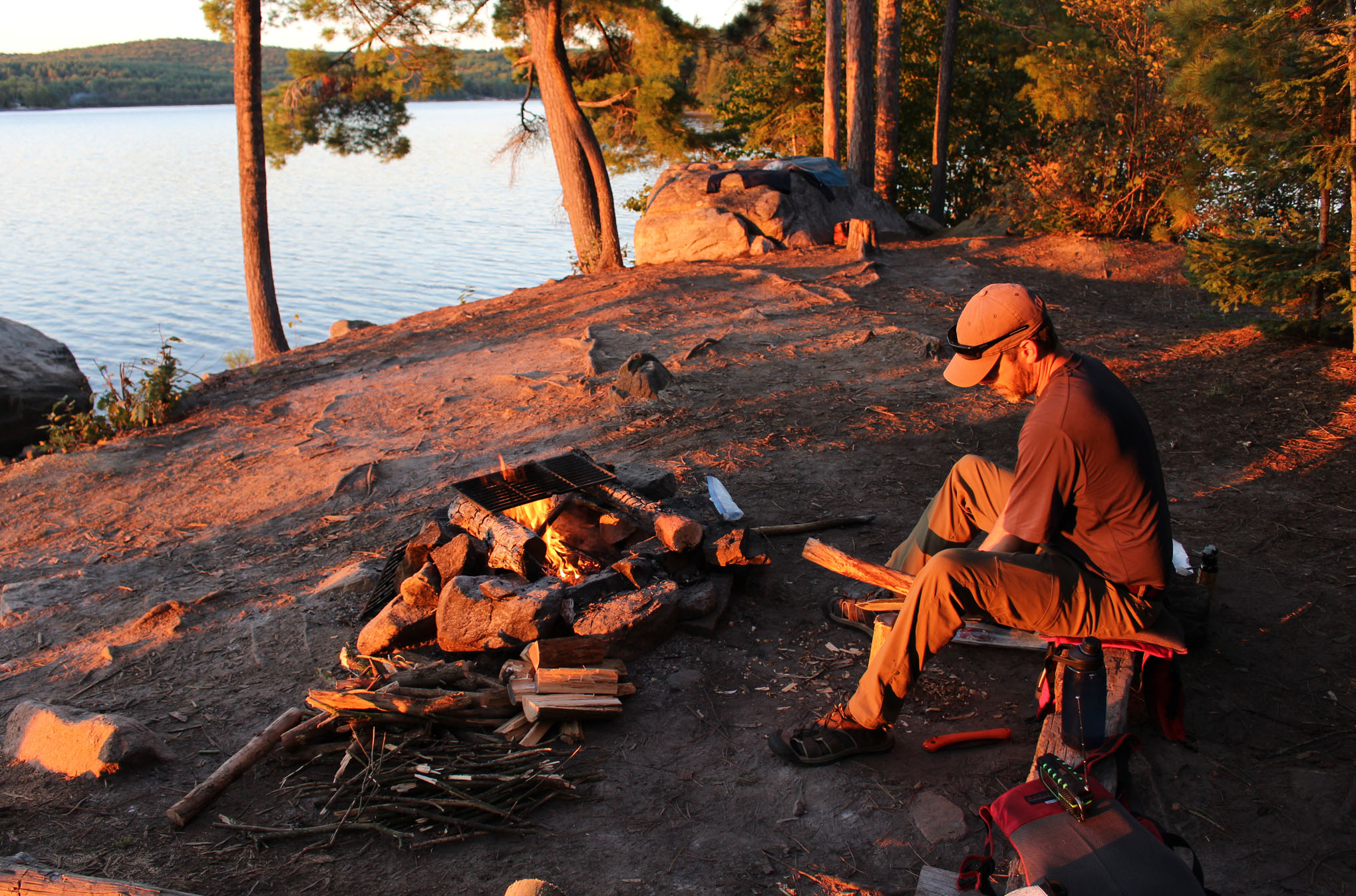
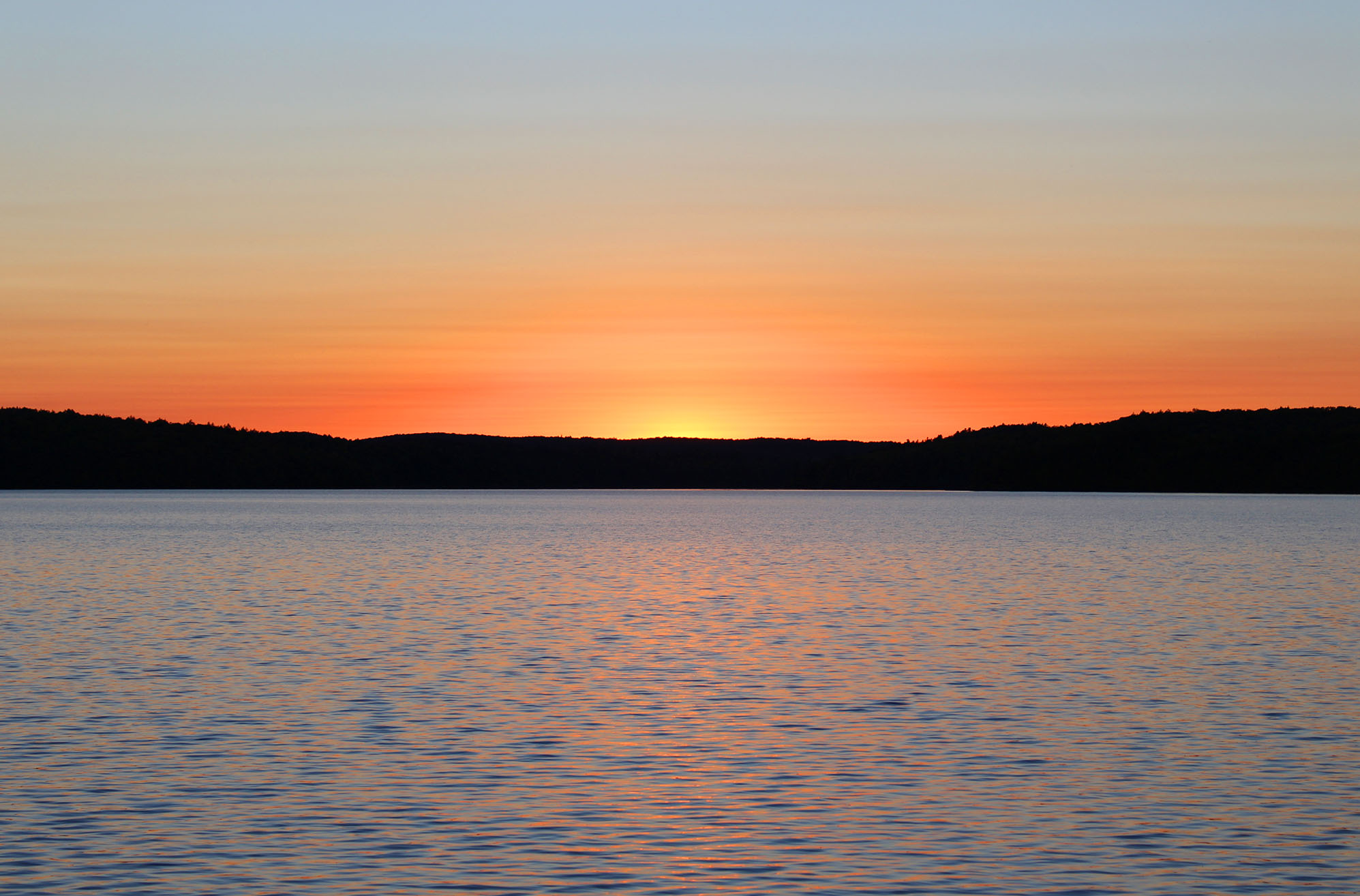
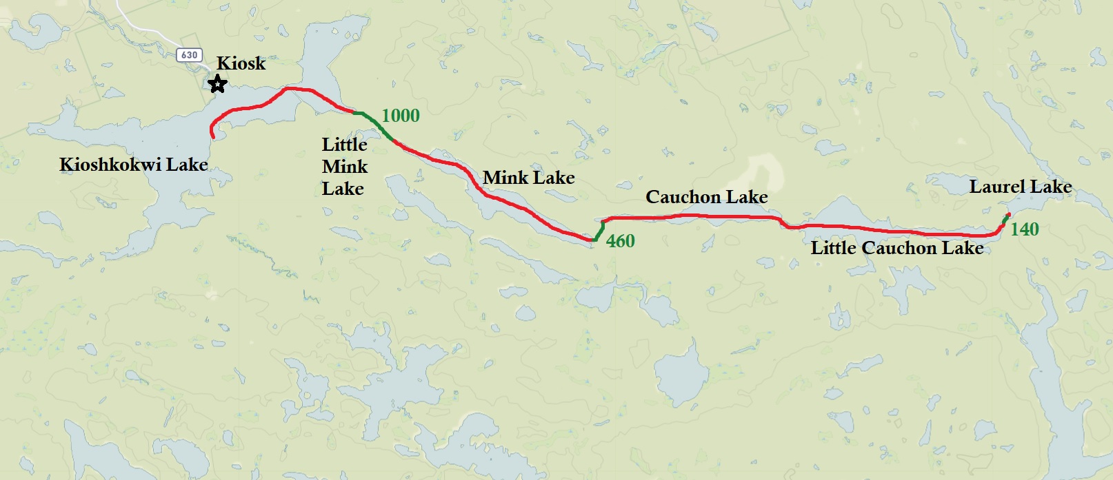
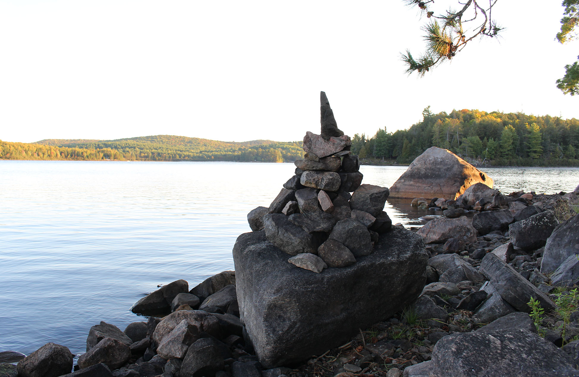
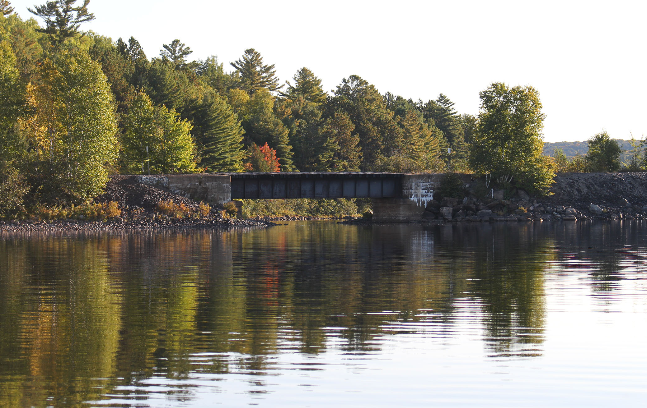

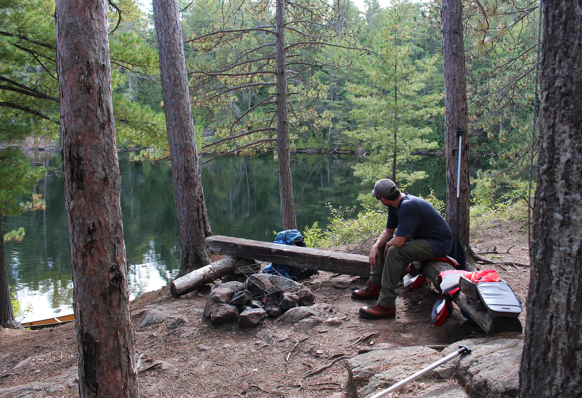
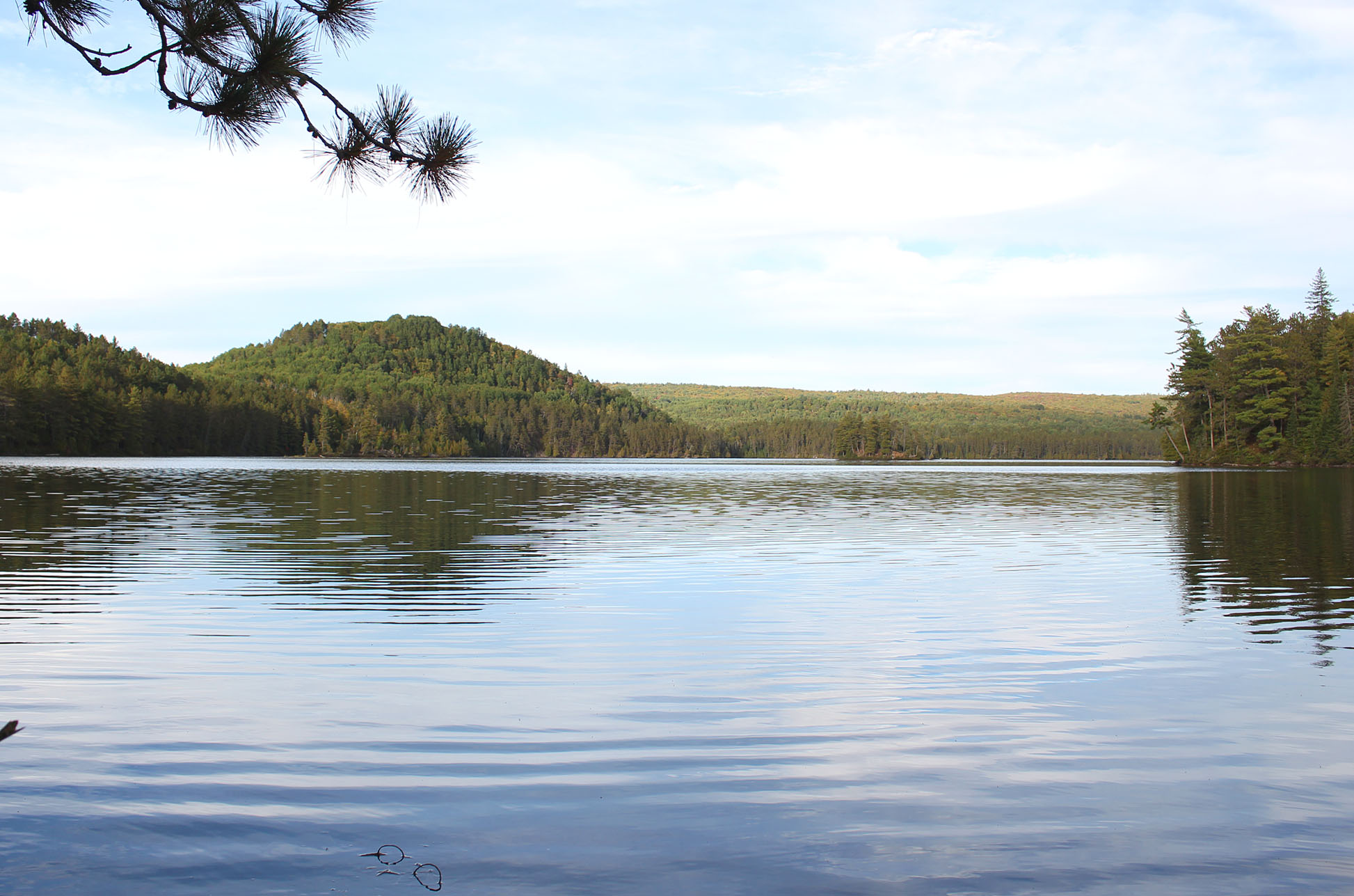

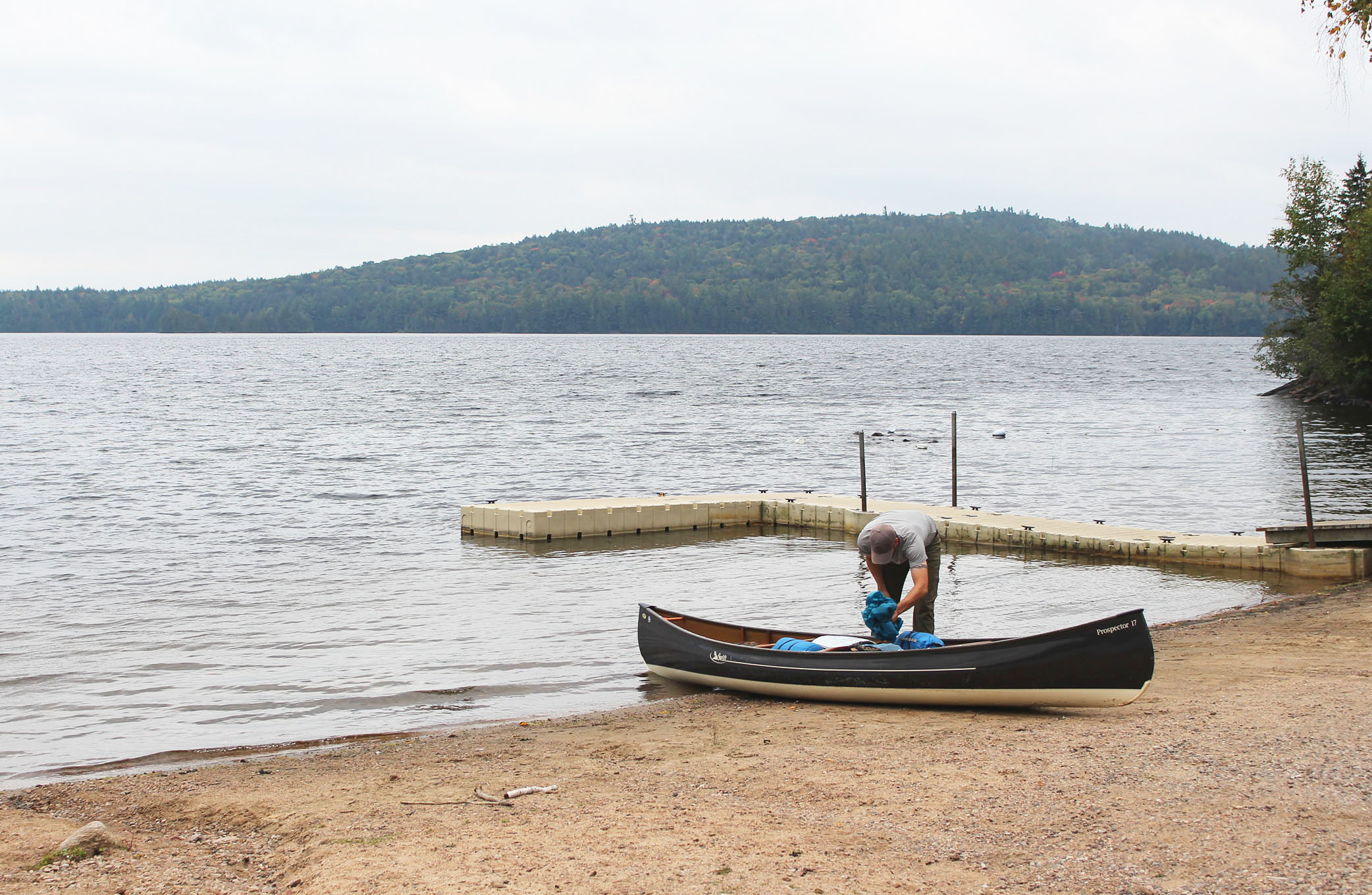
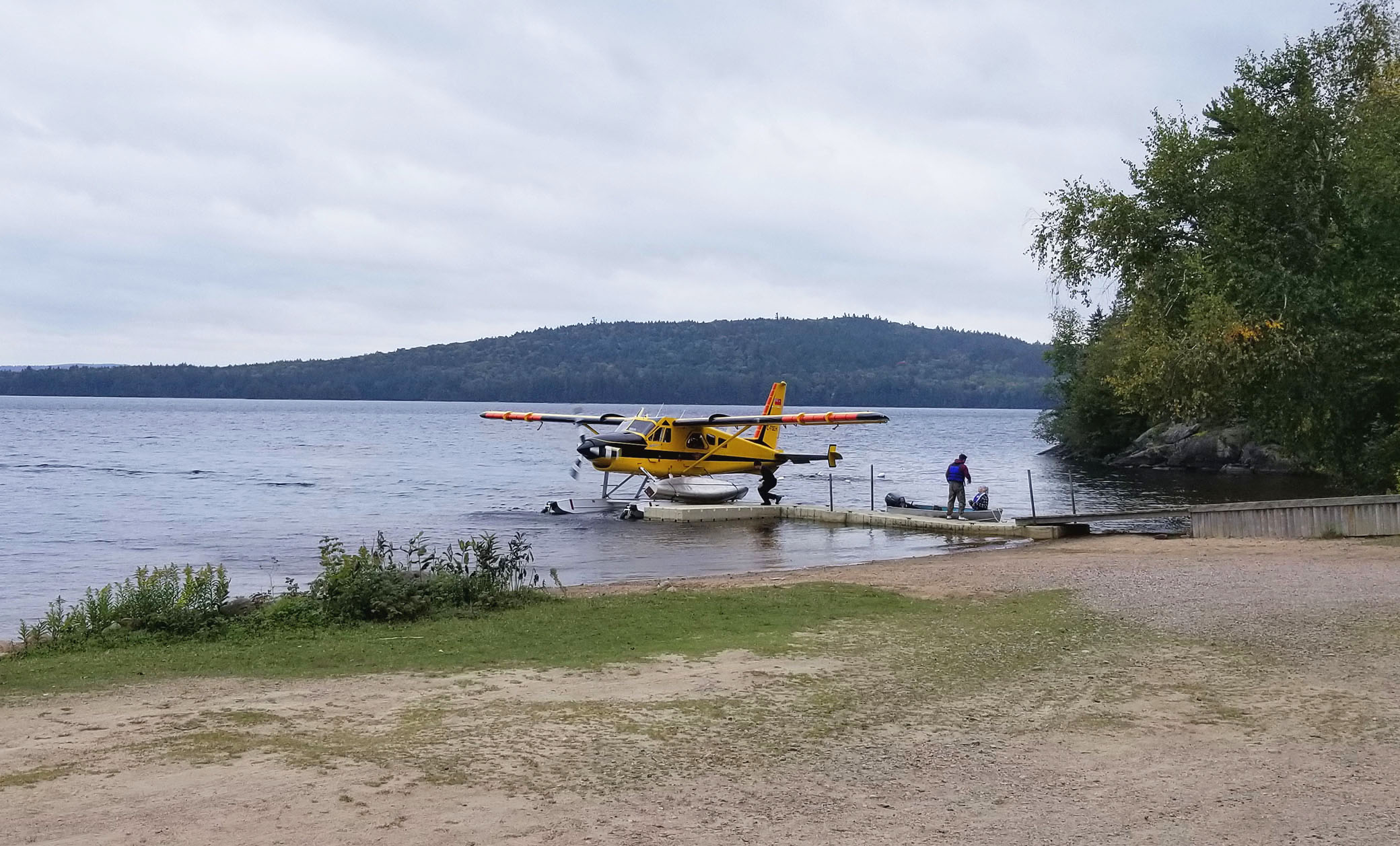
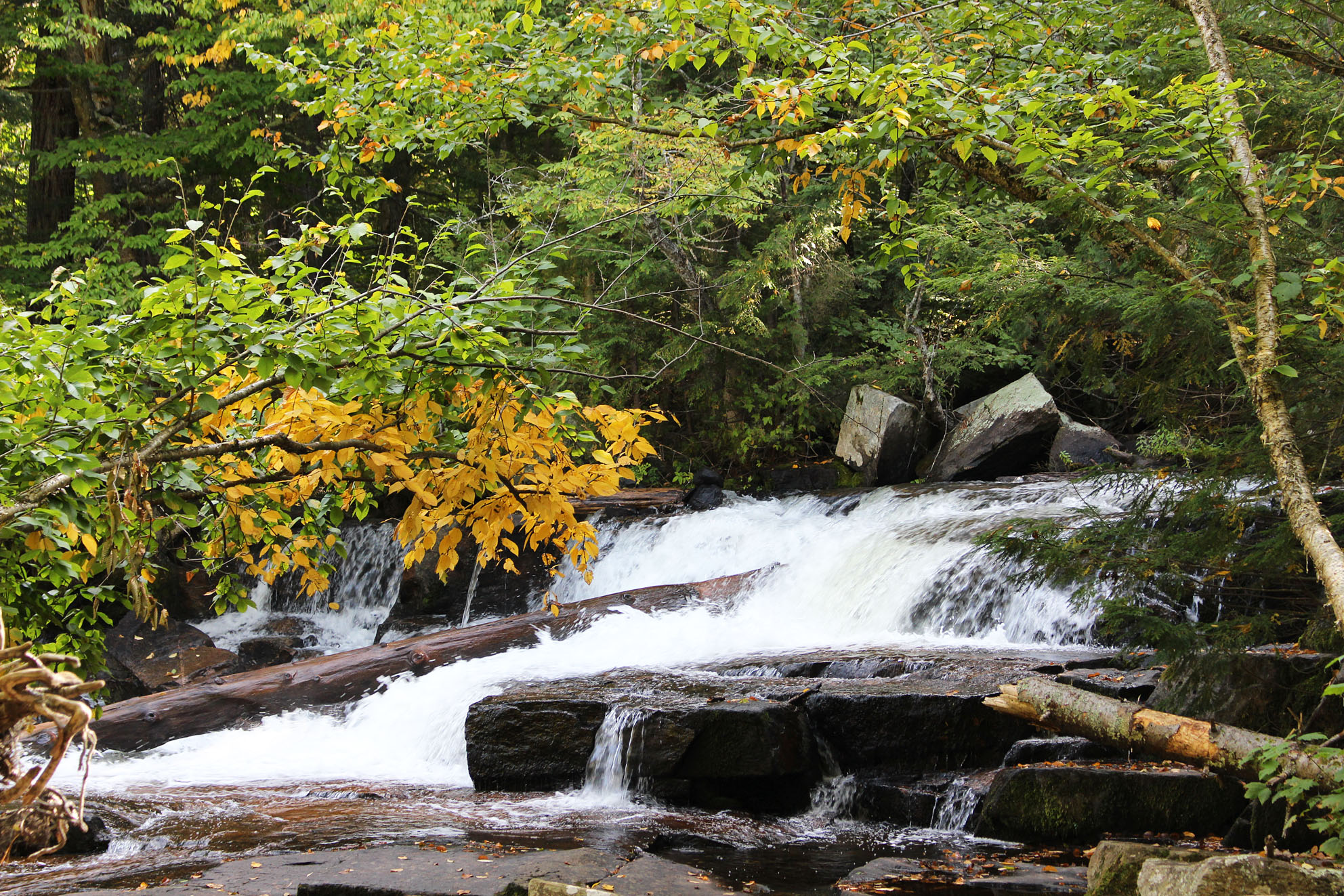


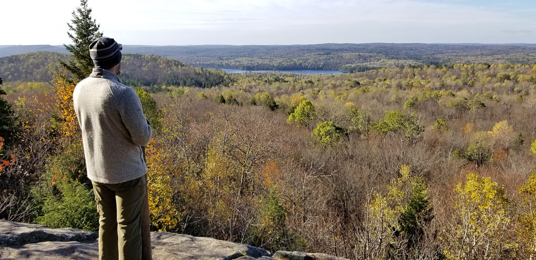


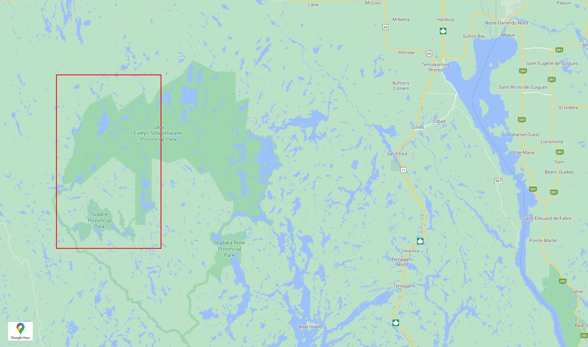


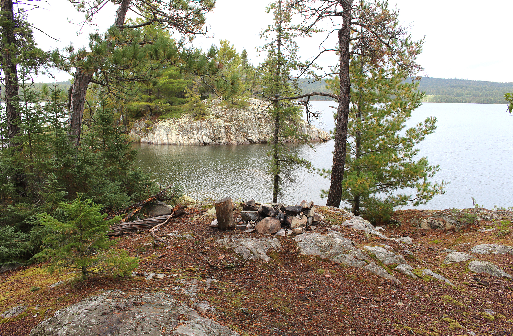


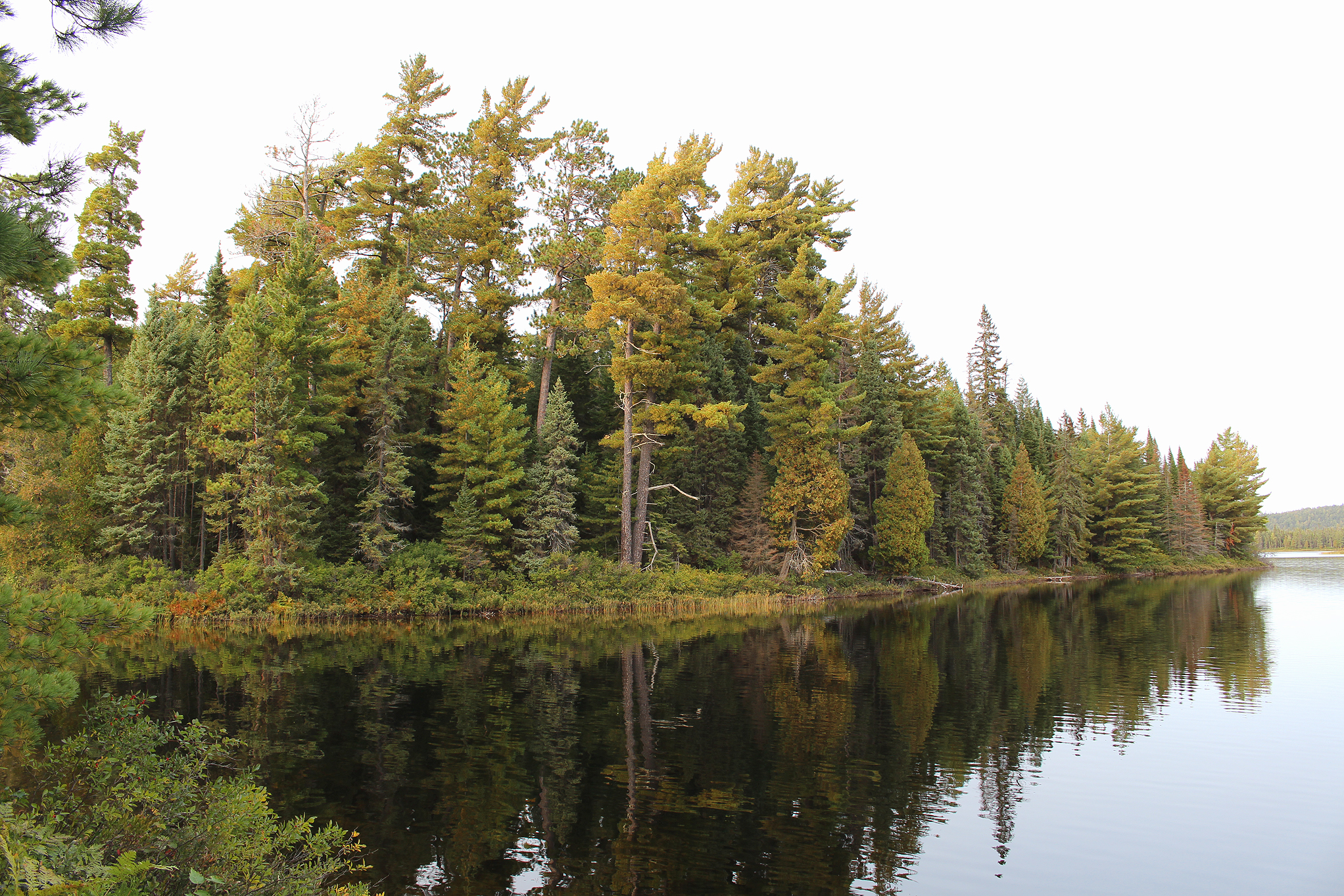


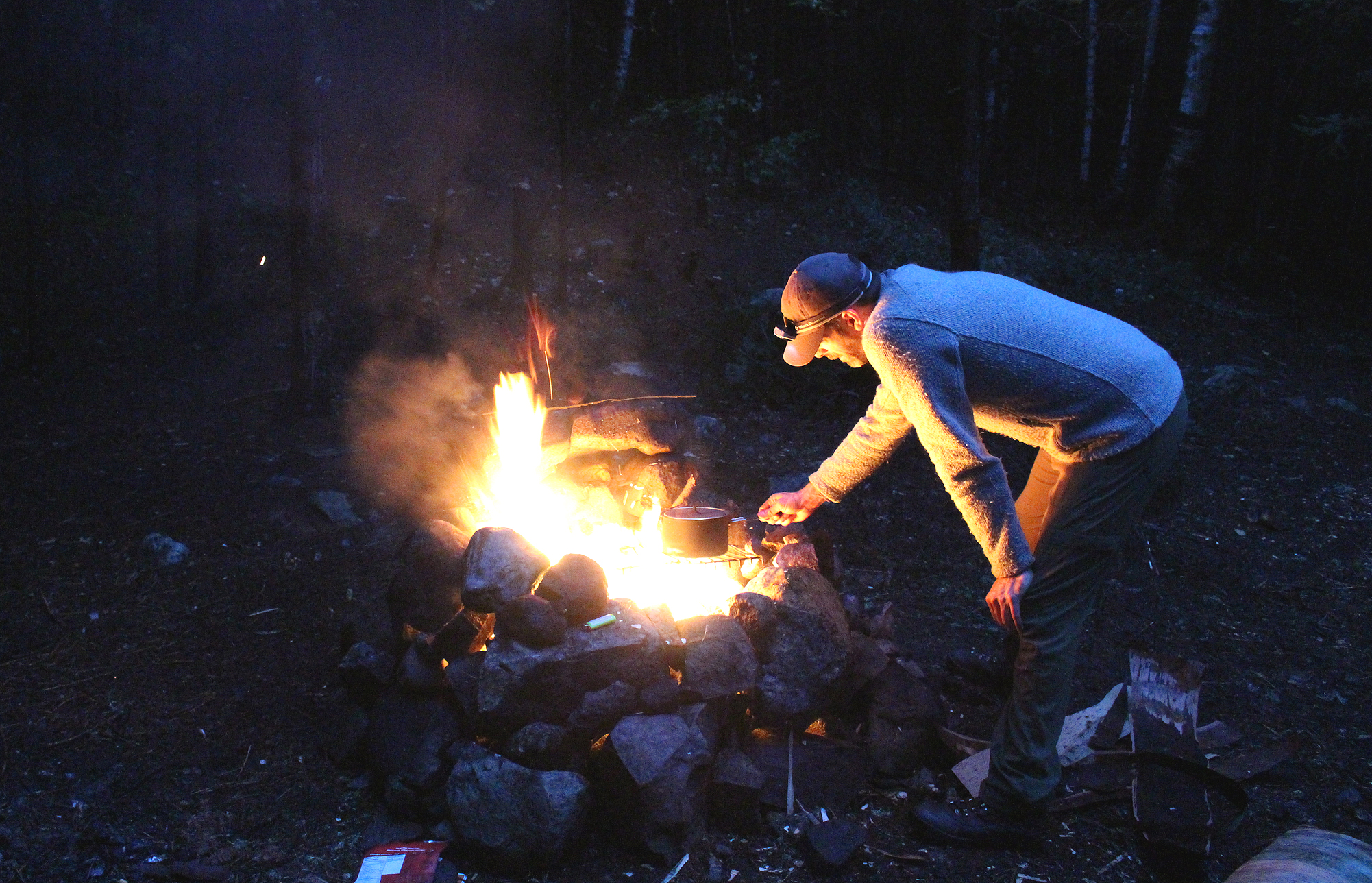


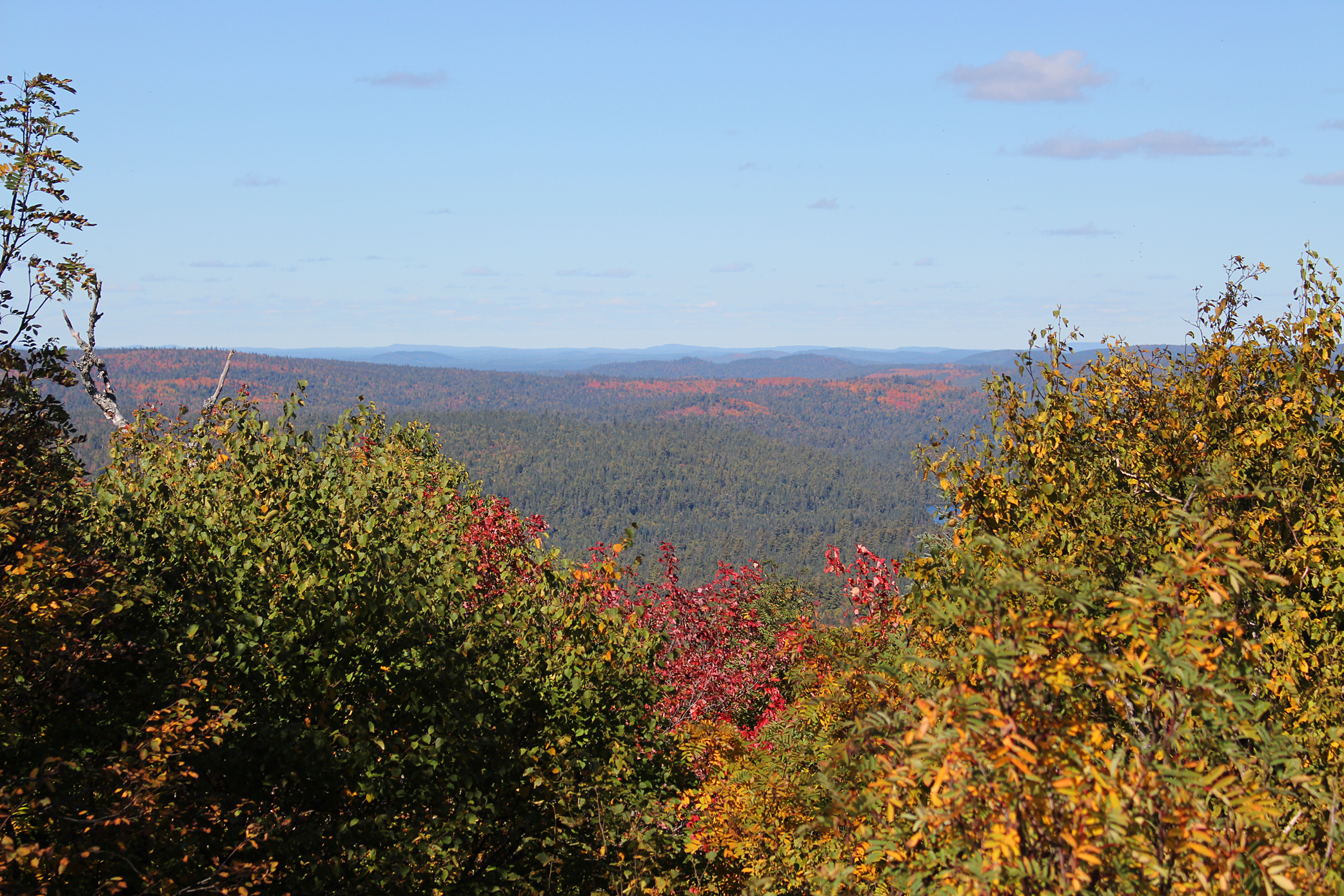


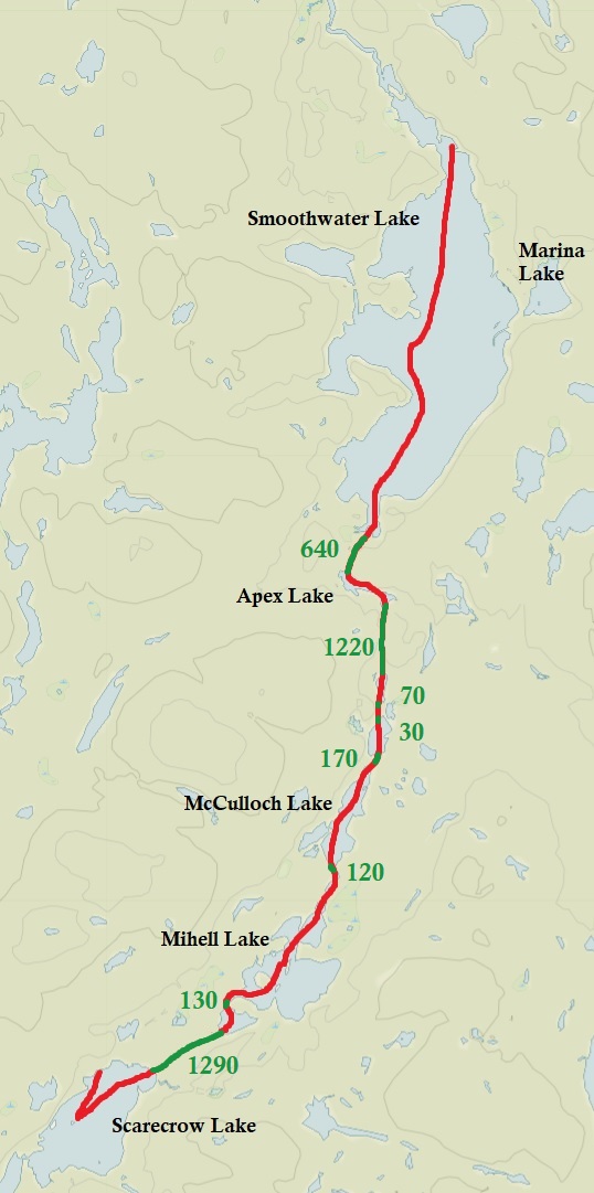

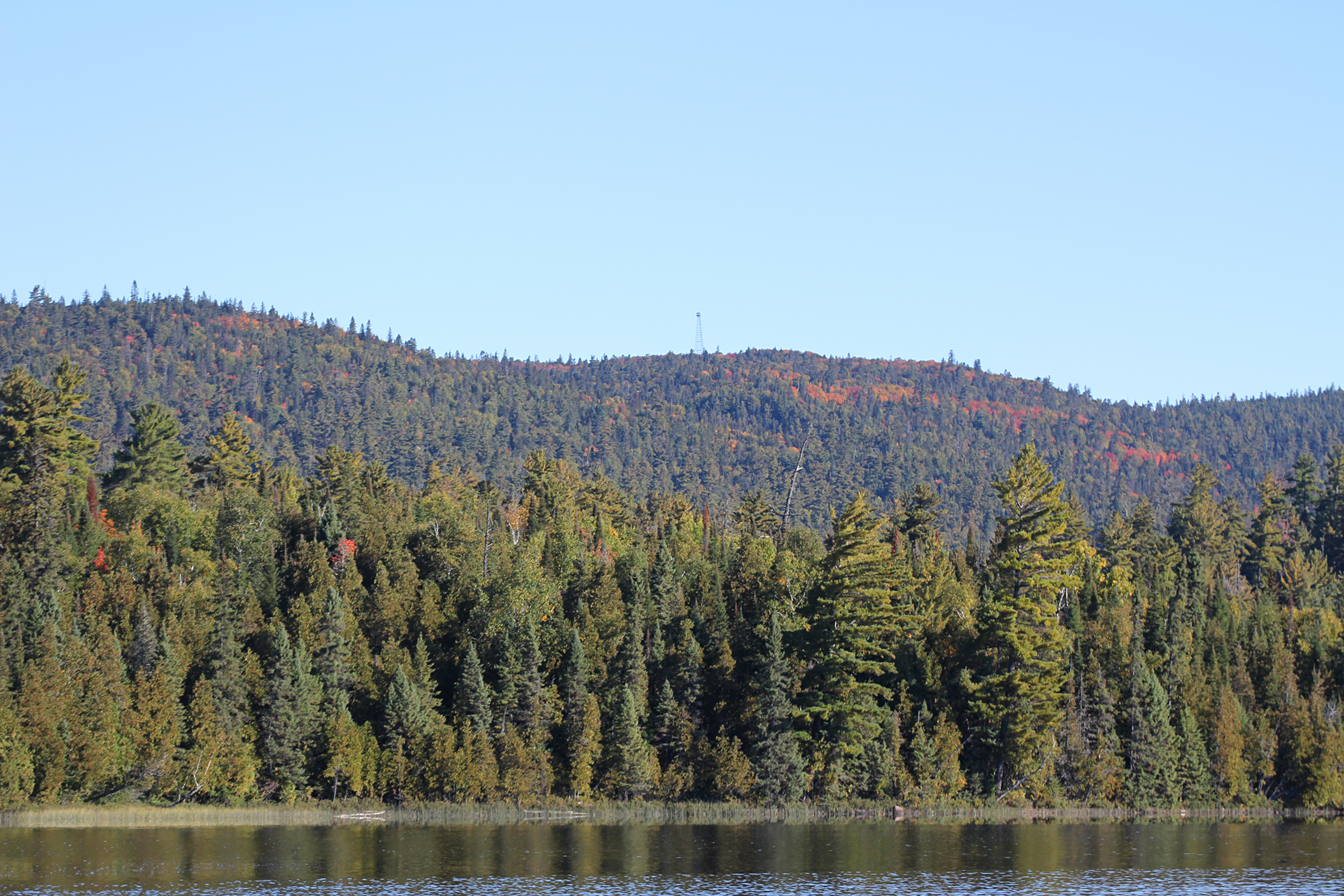


