
(WARNING: PICTURE HEAVY CONTENT AHEAD)
Aaron had a couple of surgeries this summer, so we had to forego our annual backcountry canoe trip for this year (first time since 2008!). When we debated where we wanted to go instead, the conversation quickly landed on what is arguably the most beautiful spot in the whole province of Ontario – The north shore of Lake Superior!
We have travelled the Trans-Canada/Highway 17 before but only to pass through, or drive by, the signs to Lake Superior Provincial Park, Neys Provincial Park, Sleeping Giant Provincial Park, and Pukaskwa National Park just to name a few. We were always on our way to Quetico Provincial Park for a backcountry canoe trip.
We had two full weeks in September, and with a cooler full of food we decide to travel to the north shore of Lake Superior through Ontario all the way from down here in Essex County. The most logical and time saving way would be to drive up through Michigan, as driving through Ontario adds five and a half hours to our drive each way. We were in no hurry however, and we didn’t want to deal with any potential border issues. In the end we came up with a loose itinerary that included the following stops for day hikes and camping:
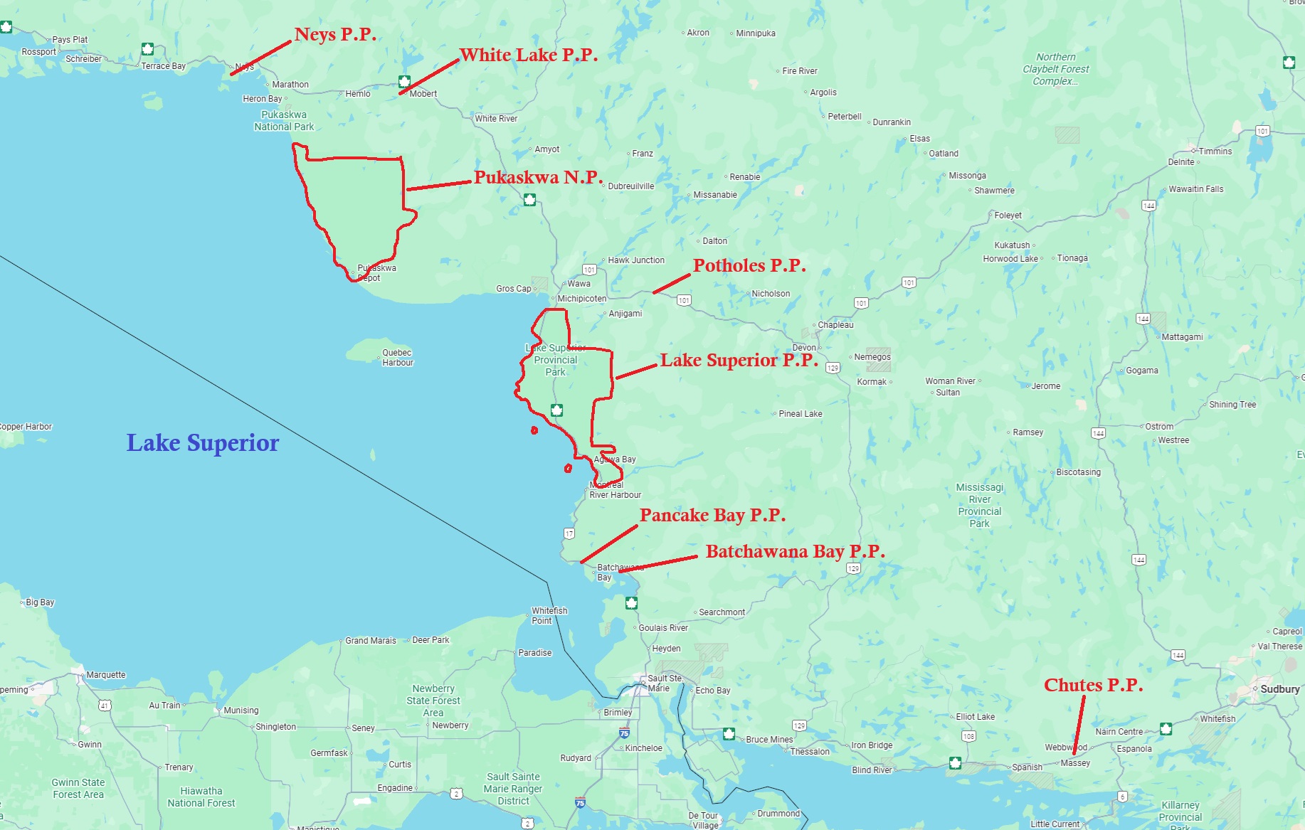
Chutes Provincial Park, Batchawana Bay Provincial Park, Pancake Bay Provincial Park, Lake Superior Provincial Park (camped), Potholes Provincial Park, White Lake Provincial Park, Neys Provincial Park (camped), Pukaskwa National Park (camped).
Unfortunately, we had to omit Sleeping Giant Provincial Park from our list which is a big shame! That’s okay though, it gives us a reason to tour this area again! The north shore of Lake Superior has a lot to explore, and even after 2 weeks we only scratched the surface of what this beautiful region has to offer!
We booked our campsites and day passes on the Ontario Parks website, while Pukaskwa National Park was on Parks Canada’s website. All sites were easy to book online, as long as you book 5 months in advance to ensure you get the site you want with Ontario Park’s. Unfortunately, the Ontario Park’s reservation page left out a couple of important notes in the “details” section in regard to the location of a couple of the sites we stayed at…More on that shortly.
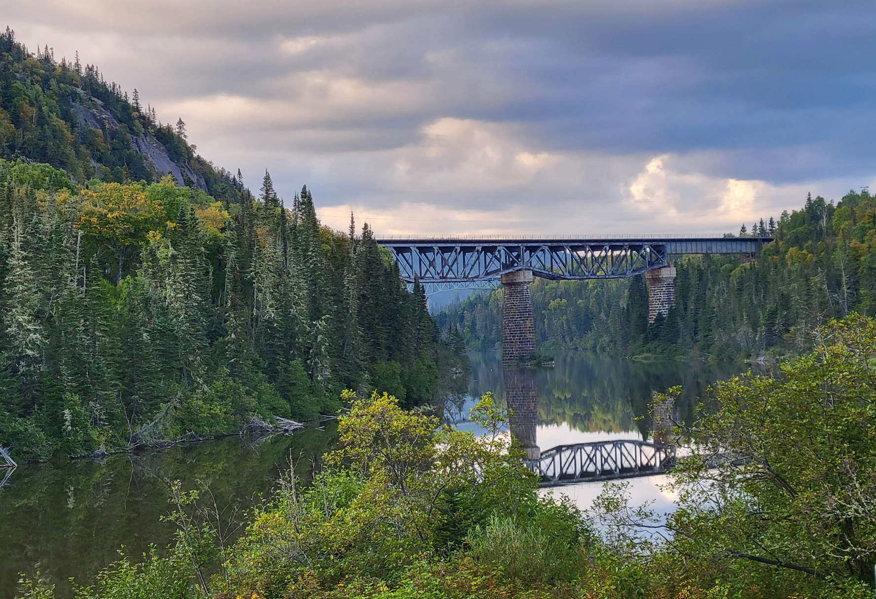
So how did we like 2 weeks of driving, hiking, and camping along the north shore of Lake Superior? It was fantastic! If you haven’t visited Lake Superior, especially if you are from Ontario, you really should! Unlike our other great lakes, Lake Superior is in a class of its own. “Gitchigami” as the name given by the Ojibwe and used in the famous song “The Wreck of the Edmund Fitzgerald” by Gordon Lightfoot, Superior is the largest freshwater lake in the world by surface area. Over 200 rivers empty into this massive body of water, while its +4,000 kilometre long coast makes it more like a sea than a lake. The average water temperature of Superior is around 5 Celsius, though waters near the shore can be tolerable in the summer months if you know the right spots to go for a dip. During times of strong gales waves are known to exceed over 20 feet! Kayaking along the coast is popular, though one should pay attention to the Marine forecast regularly as being windbound is to be expected and conditions can change quickly. Lake Superior is linked to the Canadian Sheild, which has some of the oldest rocks on the planet! Forest here is comprised of both the Boreal Forest and the Great Lakes St. Lawrence Forest. Black Bear, Moose, White-tailed Deer, and Wolf, are some of the larger mammals you may observe, with Canada Lynx and Woodland Caribou also being a rare possibility. Traversing along Superior’s rocky shoreline, sandy beaches, lush forests, wetlands, waterfalls, and rugged/rolling hills offers almost endless opportunities to observe plants and wildlife.
This is one of the few accessible areas in the province of Ontario that has had little change in the way of urban sprawl in the last 100 years. Conservation is always at the forefront when it comes to management and activities along the shore of Lake Superior, and there are many options for those into frontcountry and/or backcountry camping.
We are normally backcountry travelers. In fact, we can both admit that we have become “backcountry snobs” to the point that having another person within hearing range, let alone in view from our campsite, takes the shine off the “wilderness experience”. The sound of someone’s barking dog, screaming kids, and party goers are sacrilege in the backcountry to us, and over the last few years we have had to go deeper and deeper into the woods to find solitude.
So how did a couple of snobs manage frontcountry camping with the possibility of barking dogs, screaming kids, party goers, trailers with generators, and the sound of traffic? We actually managed okay and we even discovered a few pros to go along with some cons as listed below:
Frontcountry Camping (Pros):
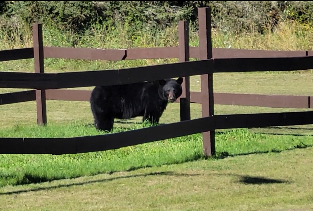
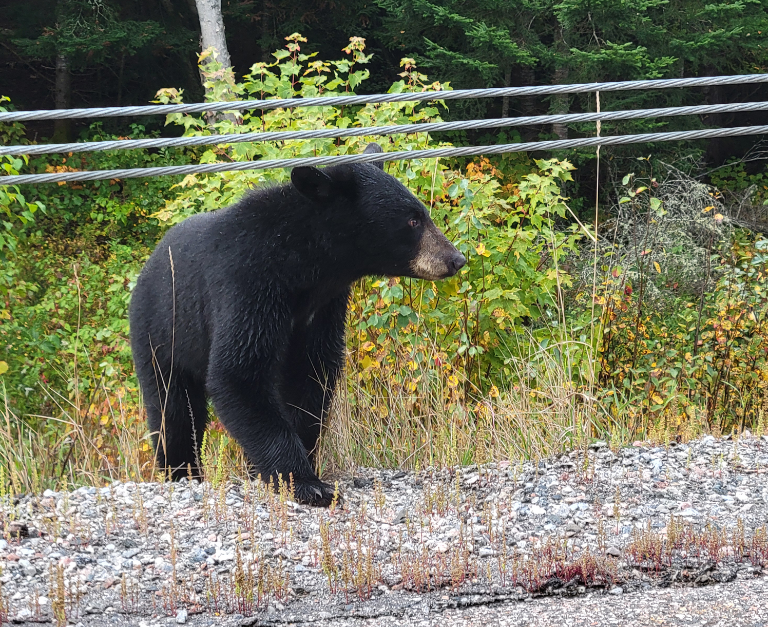
Showers: though jumping in the lake feels refreshing after a hard day of portaging, being able to shower with soap and warm water does make you feel a whole lot cleaner! The comfort stations at Lake Superior Provincial Park, and Pukaskwa National Park were nice and clean, while the comfort station at Neys Provincial Park had the added bonus of a very large Black Bear grazing on the grass adjacent to the park’s comfort station during our stay.
Being able to eat cold and perishable food on a daily basis: Having a cooler with the luxury of cold milk, and fresh fruits and vegetables is living the high life over those freeze dried/dehydrated meals we pack on our backcountry canoe trips.
More comfort items: Though we wouldn’t call bringing more stuff a good thing, it was nice to have some extra blankets in the tent, and to wear pajamas to bed. It was also nice to have a pillow in the tent as opposed to the clothing bag we usually use as a pillow.
Frontcountry Camping (Cons):
People: This is not to sound rude in anyway, but the whole reason we go backcountry camping is to be by ourselves, surrounded by nature as we try to blend in with its rhythm. This doesn’t include barking dogs, loud partyers, or screaming kids. We were very fortunate that out of those three annoyances, we had barking dogs on only one night out of all the days we camped! The privacy of the backcountry also means we can have conversations without having to worry about anyone overhearing, and walk around in as very few clothes as we want without having to worry about getting arrested.
Man Made Noise: When we booked our first site at the Agawa Bay Campground in Lake Superior Provincial Park, there was nowhere on the Ontario Parks reservation page that stated our site was right beside the Trans-Canada Highway… The online campground map showed a highway nearby, but under the description “Adjacent to” it only stated the “water tap”. As soon as we arrived at our site and put up our tent a semi-truck went by, to which we just stared at each other all bug-eyed and said at the same time “is that the highway!?” The highway was within view of our site. We did manage to sleep the nights we camped there, only waking up briefly and falling back to sleep as vehicles travelled the road both day and night.
Camping close to the Trans-Canada wasn’t bad, but camping just over 1 kilometre away from a train track is on a whole other level! At Neys Provincial Park our site was not only near the train track, but it was also one of the closest to the train track! Once again, on the Ontario Parks reservation page there was no mention of our site being beside the train track. In fact, it doesn’t even show the track on the reservation map! With up to four freight trains per night that can even shake the ground, we definitely would’ve booked a different site. The tradeoff was that the campground we were at (Area 4) had very few people, so we did have privacy. We also weren’t anywhere near that large Black Bear that was frequenting the comfort station at the other campground. In the future we will just have to do more research when booking a campsite by using Google Maps to see what’s nearby, such as a road or railway.
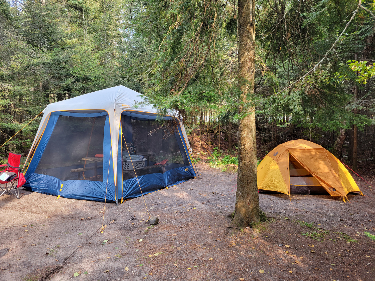
Too Much “Stuff”: You know when you go on a family vacation and you feel like half of what you have in your house is in/on your vehicle? You can’t even roll down the windows in the back seat as there will be stuff puking out the sides of the car, and good luck seeing out that rearview window! That is what this vacation felt like. Usually, it’s just our two backpacks, a small day bag, a camera bag and a small suitcase for the road. This trip was a cooler, two clothes baskets of groceries along with cutlery, a suitcase, a tent, two camping chairs, a shelter, two pillows, along with a few other miscellaneous items. We even had to go to a Canadian Tire in the town of Wawa to buy even more stuff in the way of plastic sealable containers to put some of our food stuff in as a mouse got into our car while we were at the Rabbit Blanket Campground in Lake Superior Provincial Park. The only good thing about that was that we got to explore the Canadian Tire in Wawa. It’s neat!
So, do the pros outweigh the cons? Depends on what you want, and what you can tolerate when it comes to either frontcountry or backcountry camping. Frontcountry is nice, but we still prefer the backcountry. To put this in perspective, we did smell a lot better during the duration of this trip, but we also have never seen this many bears in all of our backcountry trips as we did on this single trip while camping and travelling! Seeing Black Bears isn’t a bad thing, and there were a lot more bear sightings this fall than usual in the area. There was a sign up in Wawa at the tourist office stating a bear in the area, and we met a local in the town of Marathon who informed us that bears were recently roaming the streets. As for us, we saw a dead bear on the highway, a little bear along the highway, and two bears in Neys Provincial Park. That’s more bears that we saw on this trip than all the trips we have ever taken in the backcountry! While we were in Pukaskwa National Park we heard on our radio of a bear that entered a home and injured a couple in the nearby town of Nipigon when they let their dog out. The reason for so many bear sightings this fall was that with a poor summer berry crop they were now struggling as they search for food as they fatten up for the winter months.
Our main focus on this trip was to hike some park trails. We visited 8 parks altogether. 7 being Ontario Parks, and the other being a National Park. The following is our rating of each park and what we explored while visiting there.
Chutes Provincial Park: 8/10
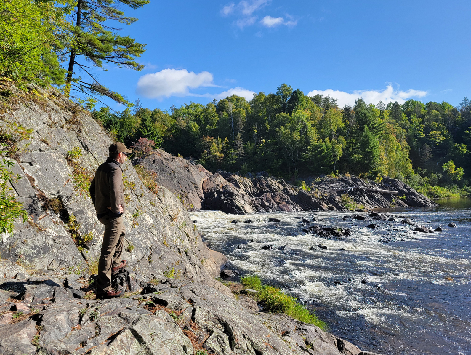
Beside the town of Massey, just off of highway 17, Chutes Provincial Park is a smaller sized park that surrounds the Aux Sables River. The Twin Bridges Trail offers great views along the river, while the campground within the park is pretty nice! In fact, even us backcountry snobs saw some sites that we would like to stay at for a weekend during the off season. The park is named after the large chute that went around the falls and rapids during the logging days a hundred years ago. The town of Massey is right next door to the park, and if we had more time, it would have been neat to explore the museum there to learn more about the history of the area.
Batchewana Bay Provincial Park: 5/10
Like Port Bruce Provincial Park in Southwestern Ontario, Batchewana Bay Provincial Park is a day use area that includes picnic tables and beach. The water here is some of the warmest in all of Lake Superior, so if you are looking for a day trip to go swimming and chill on the beach, this may be a good spot. There is a large parking lot, park office with a small store, and washrooms. For us, Batchewana Bay Provincial Park was a spot for a quick pitstop and to stretch our legs. Nothing else here interested us.
Pancake Bay Provincial Park: 6/10
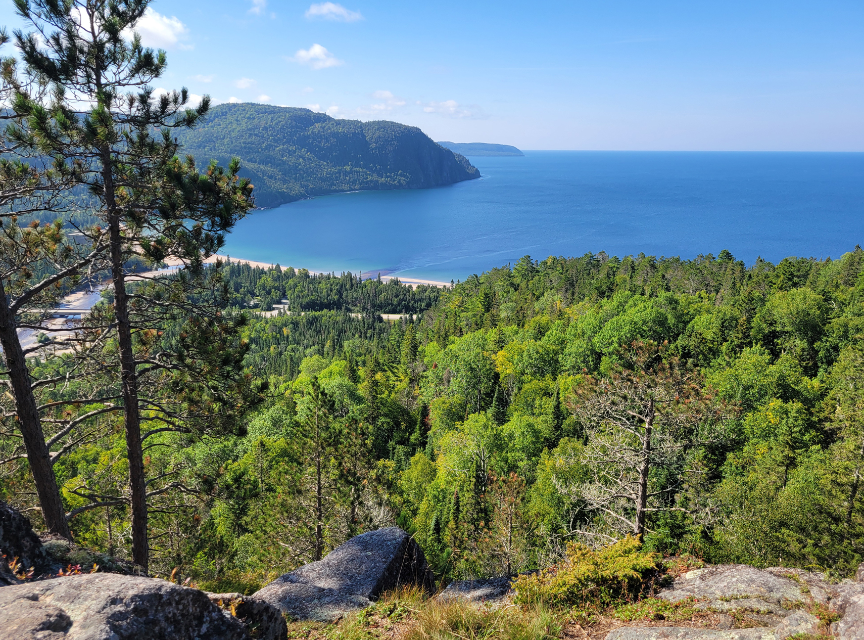
The campground at this provincial park is right beside the Trans-Canada Highway, and we mean right beside the highway! There are some sites so close to the highway that if a vehicle were to go wildly out of control we wouldn’t be surprised if it made it to a camp site! We were interested in a series of trails on the other side of the highway known as the Edmund Fitzgerald Trails. We hiked the Sentier Look Out Trail, which included a lookout over Lake Superior/Pancake Bay. This is near the location where the Edmund Fitzgerald met its fate on November 10th, 1975. We also hiked the Sentier Pancake Falls Trail which had views of the Pancake River Falls, and there was hike down a section of forest road. Pancake Bay Provincial Park is a nice day visit with a beautiful beach, but we can’t ever see ourselves camping a baseball’s throw away from the highway!
Lake Superior Provincial Park: 10/10
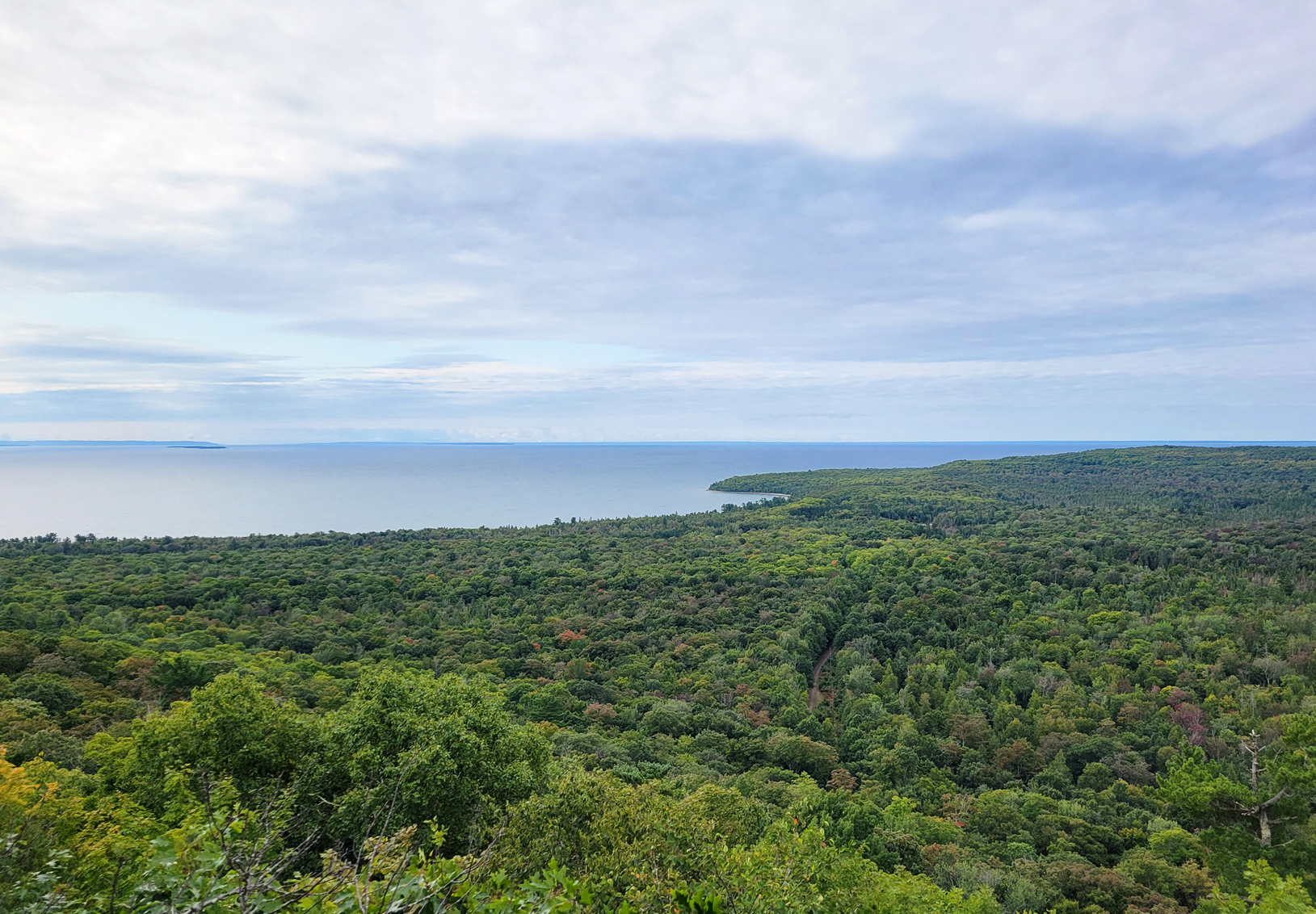
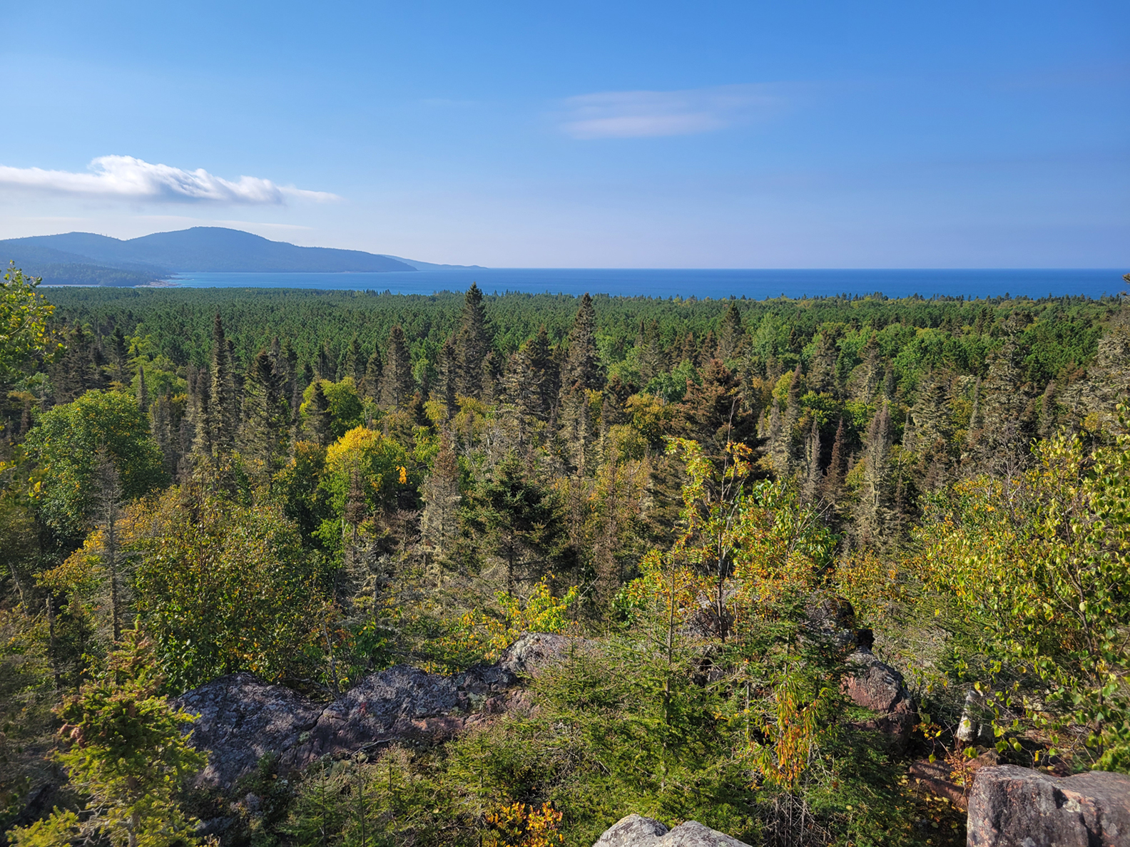
While we have Algonquin Provincial Park here in southern Ontario, northern Ontario has Lake Superior Provincial Park. Established in 1944, at 160,810 ha, this larger Ontario provincial park is like a smaller version of Algonquin with car camping, backcountry sites for both paddling and hiking, a beautiful visitor centre, good trout fishing, and many hiking trails ranging from easy to very demanding. We spent just shy of 4 days in this park, and we barely scratched the surface of what this park has to offer. The park lies in a transitional zone between the Great Lakes St. Lawrence Lowlands Forest and the Boreal Forest, so you can observe trees from both of these forest zones with certain areas of the park being dominated more by one zone over the other.
Our first two nights were at the Agawa Bay Campground. This is the same area where the park’s visitor centre is located. Some sites at this campground are close to the lake, though we chose a site further away from the lake so not to be as exposed in our two-person tent. The tradeoff was that we were pretty close to the Trans-Canada highway, so we didn’t sleep the greatest. It rained a bit while we were at this campground, and we wanted to visit the nearby Agawa Bay pictographs. The pictographs are located on a rockface right along the sloped rocky shoreline, and with the wind and rain we had to forego this little excursion as the pictographs should only be accessed on days with calm winds and no waves.
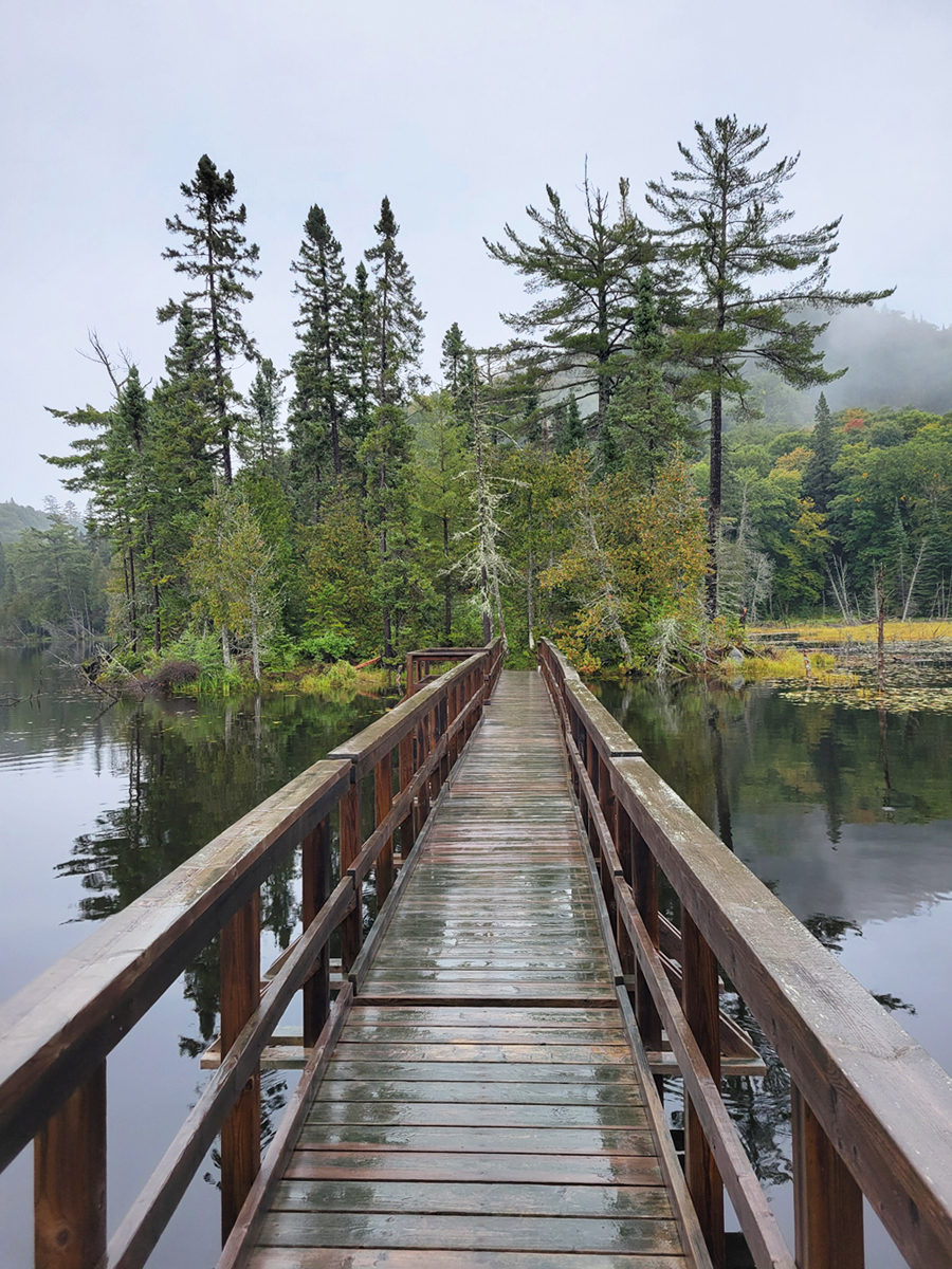
We originally planned to hike 5 of the 11 trails in Lake Superior Provincial Park. With the one rain day we had we only ended up doing 2. We hiked in the light rain along the Trapper’s Trail. This easy 1.5 kilometre loop along the shoreline of Rustle Lake included sections of floating boardwalk. There was a Momma Loon still feeding her clingy young offspring on the lake, and we saw some Ring-necked Ducks and quite a few Yellow-rumped Warblers.
The other campground we stayed at for two nights was the Rabbit Blanket campground. This campground is at the northern end of the park, and to us is the preferred between the two campgrounds as it is not next to the highway. Our site was pretty good for a front country site as it was barely within view of the neighbouring site, and you had to walk down some steps from your car to access the site, giving it even more privacy. The only downside of this site was the mouse that got into our car at night, breaking into some of our dry foods, and a dog at a nearby site that would bark whenever anyone walked by. Then there was the firewood that we bought from the park store. Ontario Parks is known to have really crappy firewood. The bag we bought was wet and we had a hell of a time burning it… at least the smoke kept the bugs away.
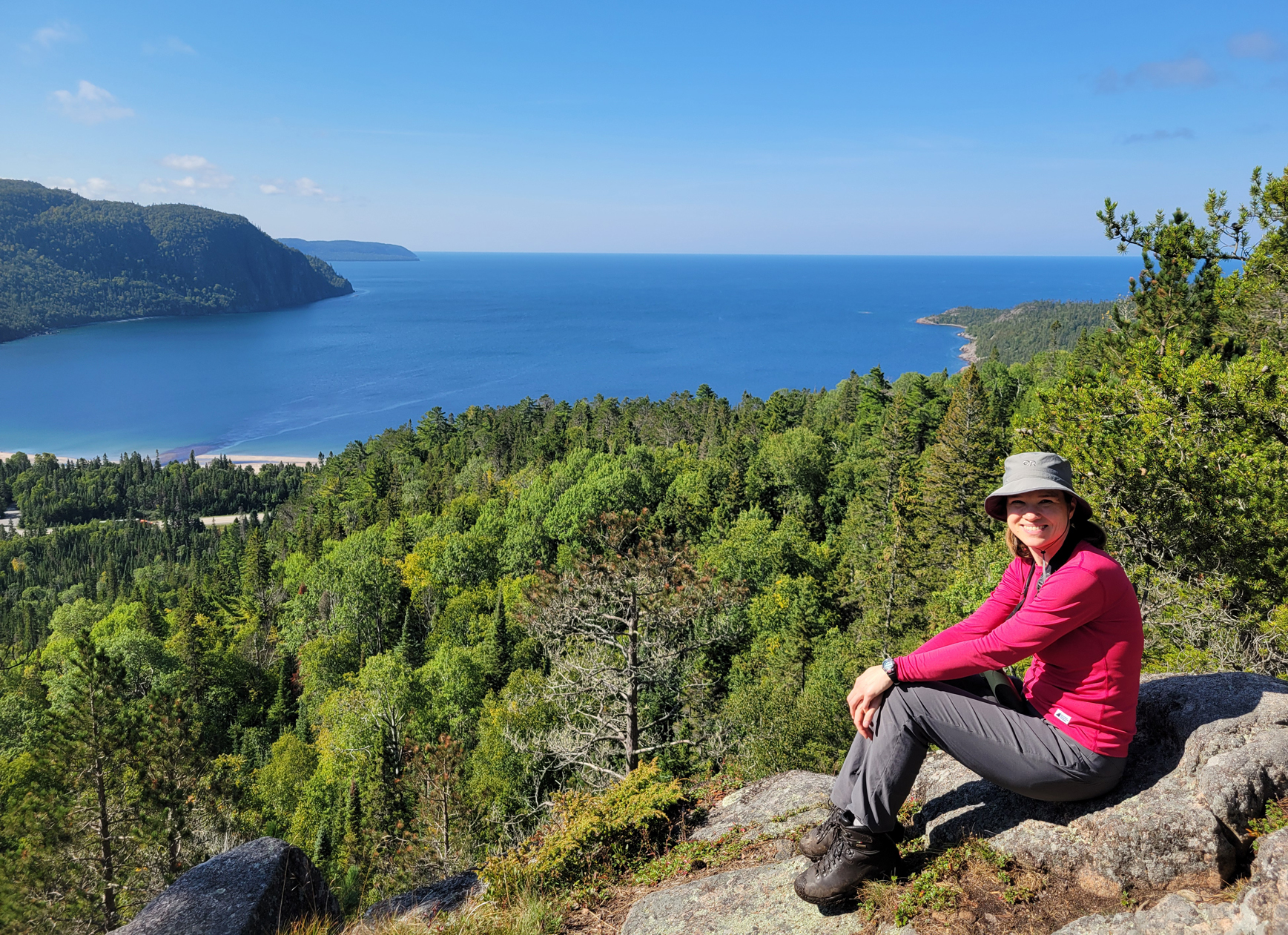
The other hike we did was the 5 kilometre Nokomis Trail. Access to this trail is at the Old Woman Bay day use area, a beautiful spot in itself and well worth the stop if you are driving through the park, though it does fill up fast. This trail through the Boreal Forest is fantastic with much to see in the way of flora, along with some scenic lookouts. The highlight is the view at nearly 200 metres above Old Women Bay.
After our four nights in Lake Superior Provincial Park it is clear that we will have to come back to hike some more trails! Perhaps some backcountry canoe trips will be in our future as well.
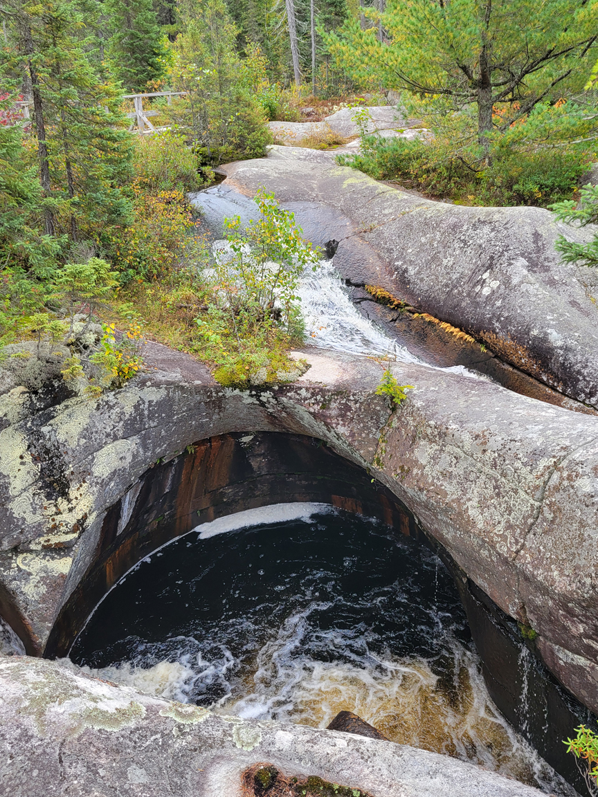
Potholes Provincial Park: 9/10
Located about a 40 minute drive east of Wawa along highway 101, this Provincial Park doesn’t even come up on a Google Map search when you type it in. Instead, it directs you to the now non-operating Shoals Provincial Park. This is not the same park and is not in the same location. All you have to do is drive on highway 101 east of Wawa and look for the Ontario Parks sign on the right side of the road and you have arrived.
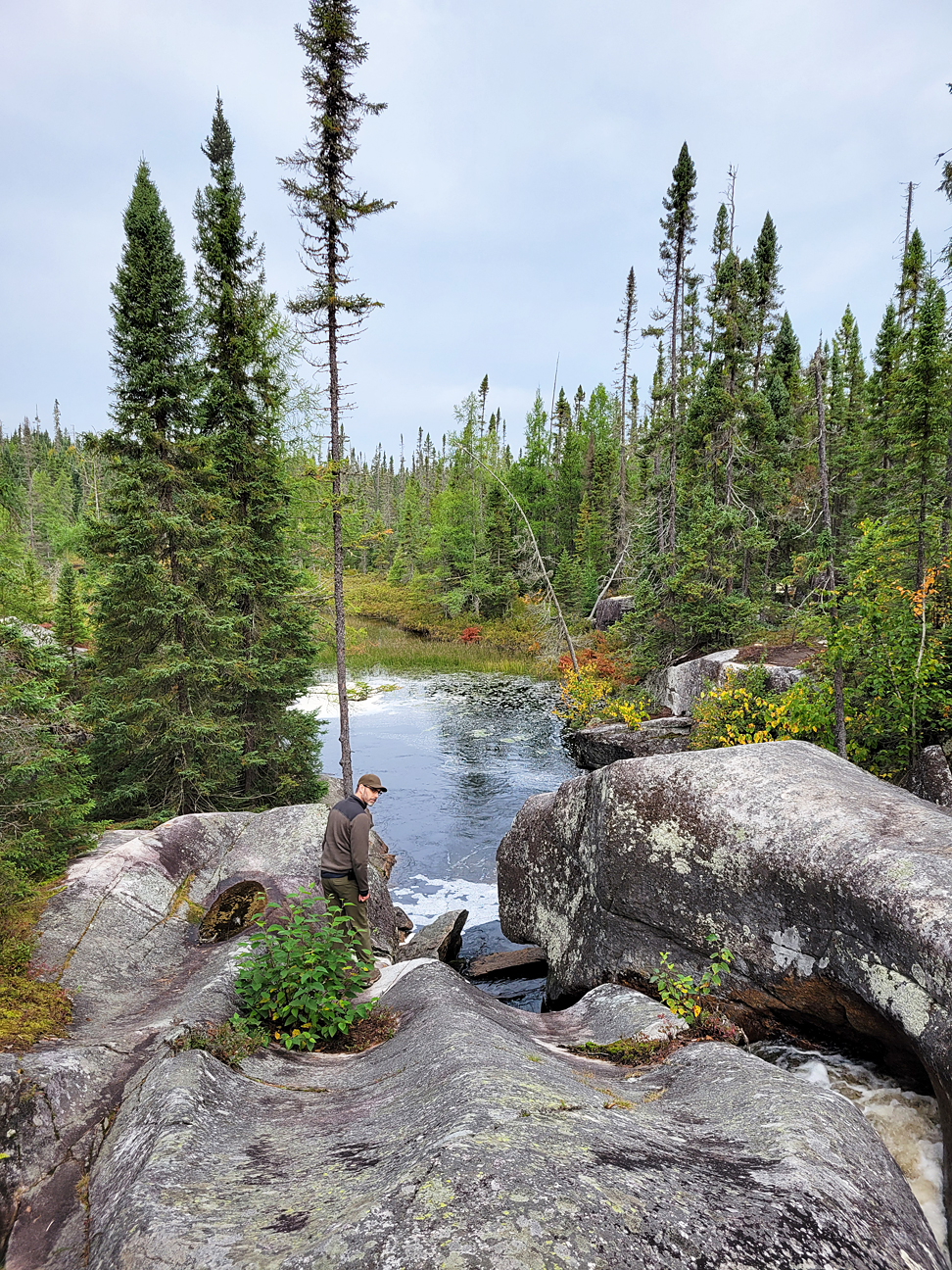
There were no other vehicles in the parking lot when we arrived, and there was no one there when we left. We had the whole place to ourselves! The claim to fame along the 350 metre hiking trail are the “potholes” that were formed in the bedrock by glacial melt that carried rocks and other debris, continually rolling them into the bedrock creating the round vertical caverns you observe where the Kinniwbi River continues to run through. The landscape is rugged Boreal Forest. There are no facilities at this Provincial Park, just a vault toilet. It is definitely worth the out of the way drive east of Wawa, and we even saw a small Black Bear just off the highway on our drive.
White Lake Provincial Park: 6/10
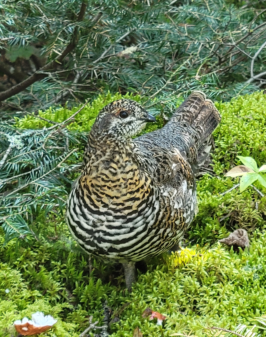
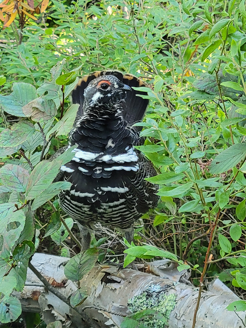
West of the town of White River, along the southern end of White Lake, this provincial park has trails and a campground with beaches. We hiked the Tiny Bog Trail at 4.5 kilomtres, and the Deer Lake Trail at 2.5 kilometres. Perhaps we were spoiled in Lake Superior Provincial Park, as we found these trails “okay” overall. For us it was a nice way to stretch our legs and go for a stroll through the Boreal Forest while observing our first Boreal Chickadee and Spruce Grouse for the trip. There is a separate road to the campground area in this park which we did not check out as we were on our way to Neys Provincial Park that afternoon.
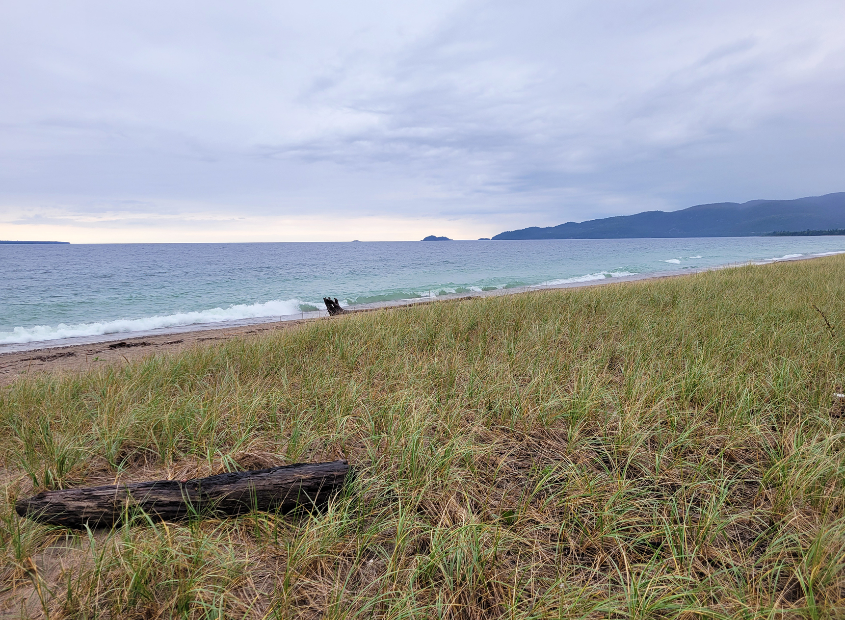
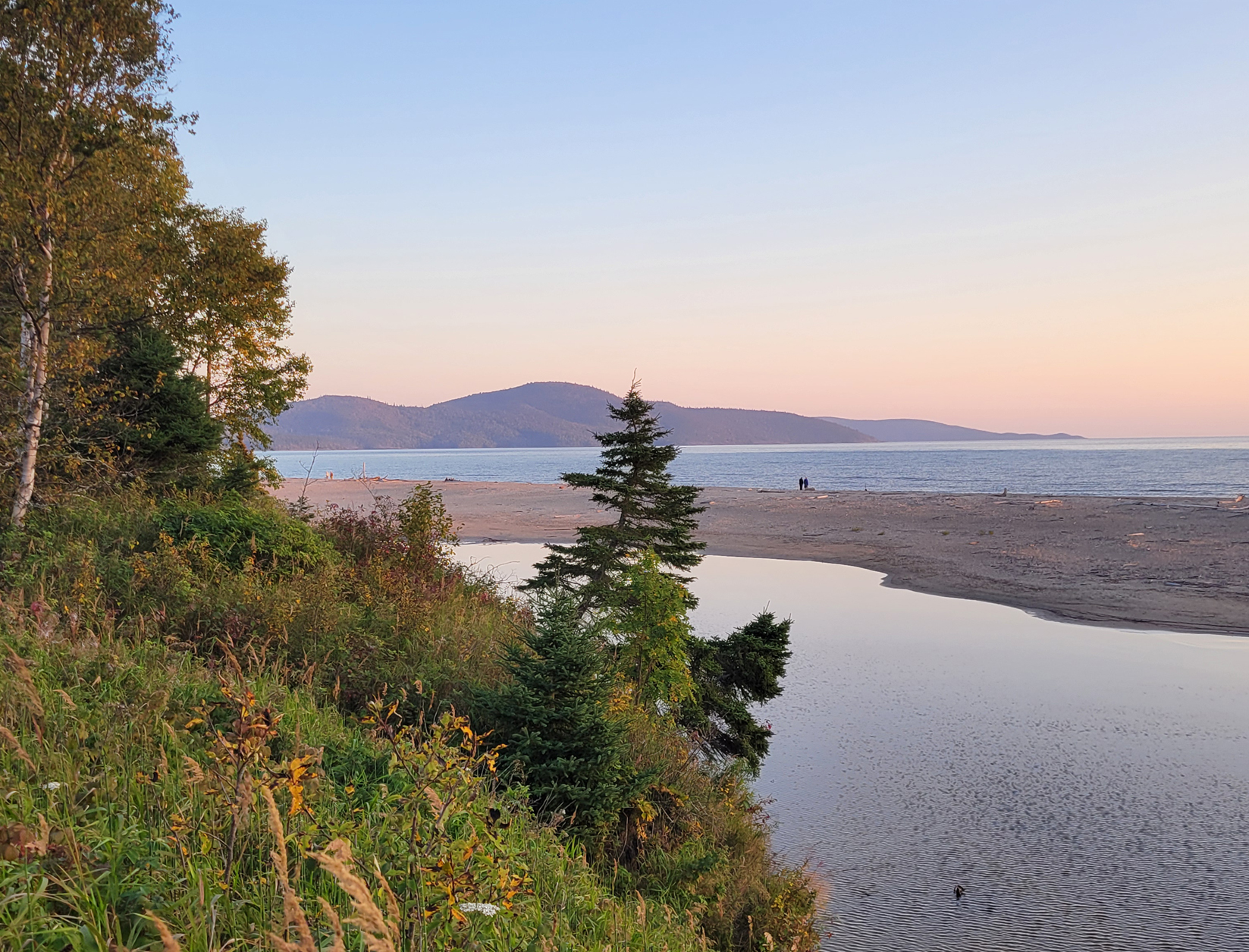
Neys Provincial Park: 8/10
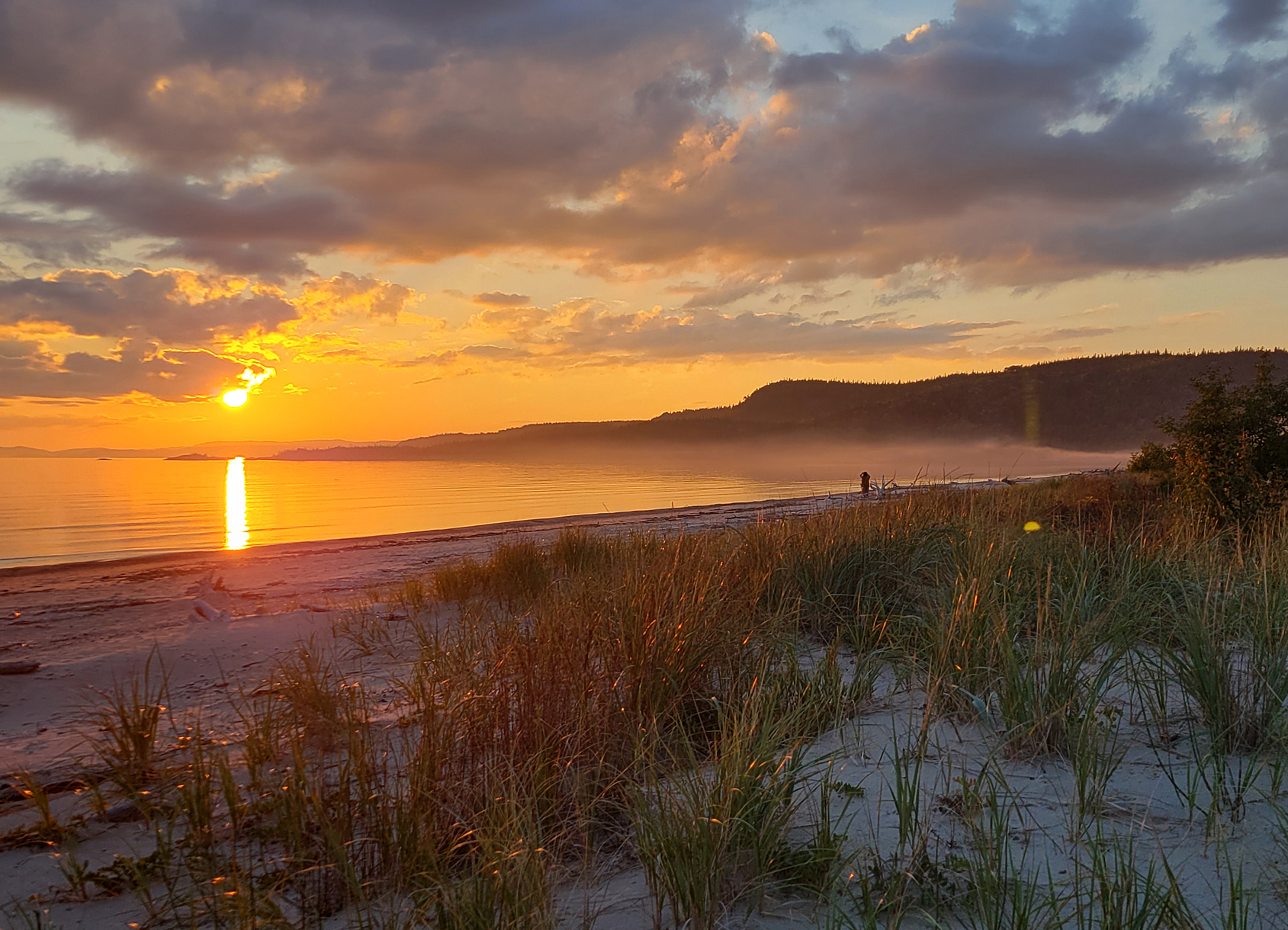
Neys Provincial Park was established in 1965. Like many areas along this side of Lake Superior, Neys boasts beautiful sunsets along a lovely sandy beach. One thing we noticed while travelling along the shores of Lake Superior is that ALL the beaches we visited had absolutely zero garbage! There were no dead fish, and not even the tiniest trace of the usual plastics! We are from the north shore of Lake Erie where plastic along the shoreline is just part of the landscape, so witnessing a pristine beach was a breath of fresh air! Here at Neys Provincial Park we buried our chairs in the sand and just watched the stunning sunsets.
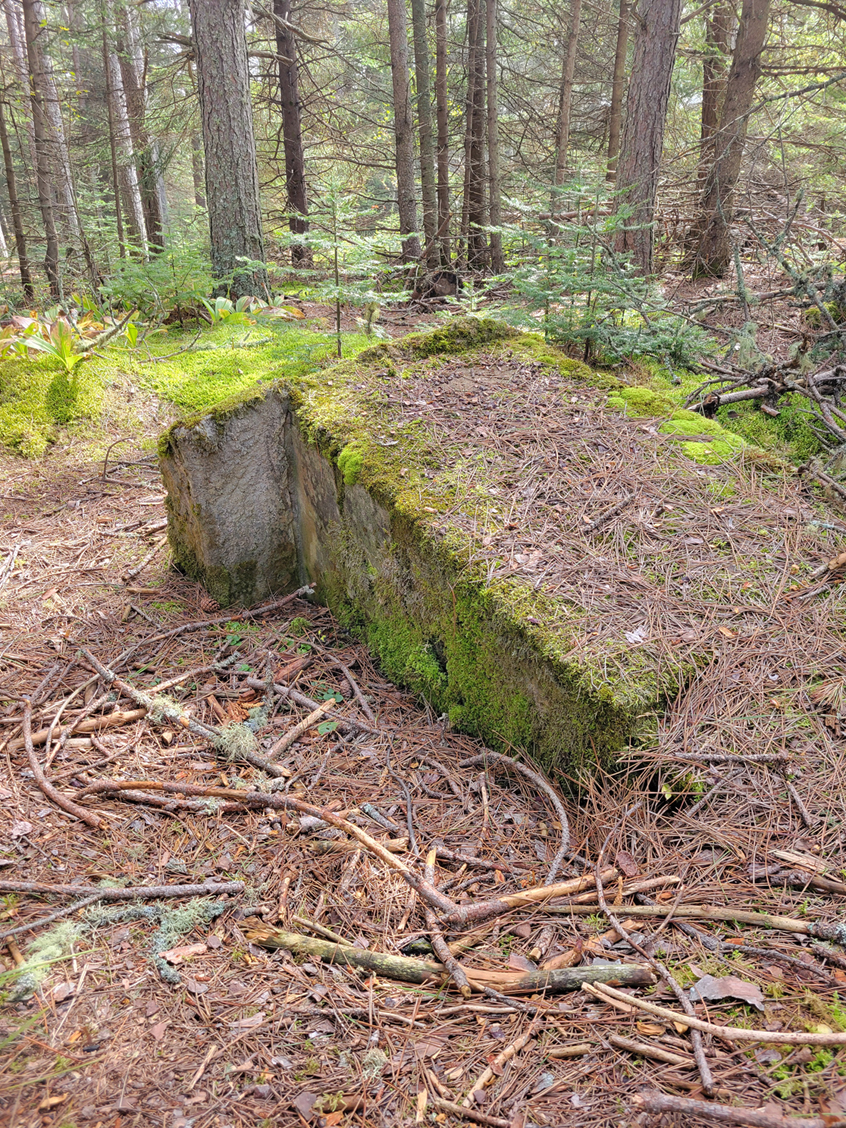
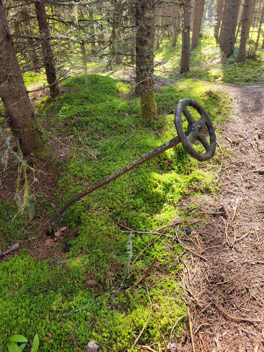
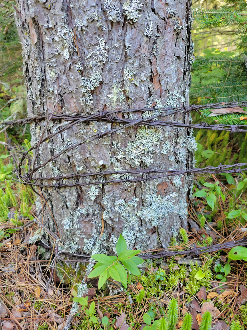
Perhaps the most interesting feature to Neys Provincial Park isn’t its flora, or it’s fauna, or even its geology, it may in fact be the human history, particularly during the Second World War. Today, now hidden underneath the plantation of towering red pines, slowly being swallowed up by forest floor is Camp 100. This was a POW camp that was originally used for German prisoners of war. In fact, there were a few POW camps in Ontario, as well as other parts of the country during World War II. To read a brief history of Camp 100, including a few photos, please click on the following link:
https://powsincanada.ca/pows-in-canada/internment-camps/camp-100-neys/
We were lucky enough to run into a gentleman that often visited Neys Provincial Park who showed us around where the remains of the POW camp once stood. Mainly foundations and some scattered small pieces of coal that was used to power generators.
We stayed at the Area 4 campground which were all non electrical sites. It was nice to be away from the more crowded electrical sites near Lake Superior, as well as the large Black Bear that was hanging around the comfort station in that area. We couldn’t even see any one of our neighbours, and the only people that ever went by were those on bicycles, or the occasional car. The firewood here was a huge step up from that of the Rabbit Blanket Campground, and we enjoyed a fire a couple of nights. The only drawback was the freight train track that was just over a kilometre from our site. It goes by any time of day or night, and you can even feel the rumbling of the train on the ground. We didn’t sleep well at Neys.
We hiked a good deal during our three days at Neys Provincial Park. Every day involved an evening at the coast, where Marianne saw a Least Chipmunk, and warblers were quite active as they fueled up before heading south.
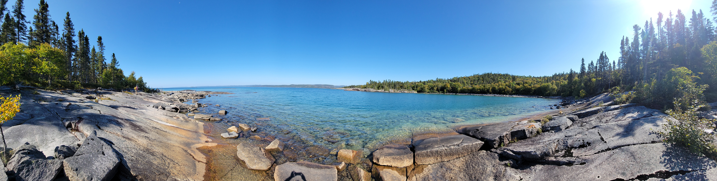
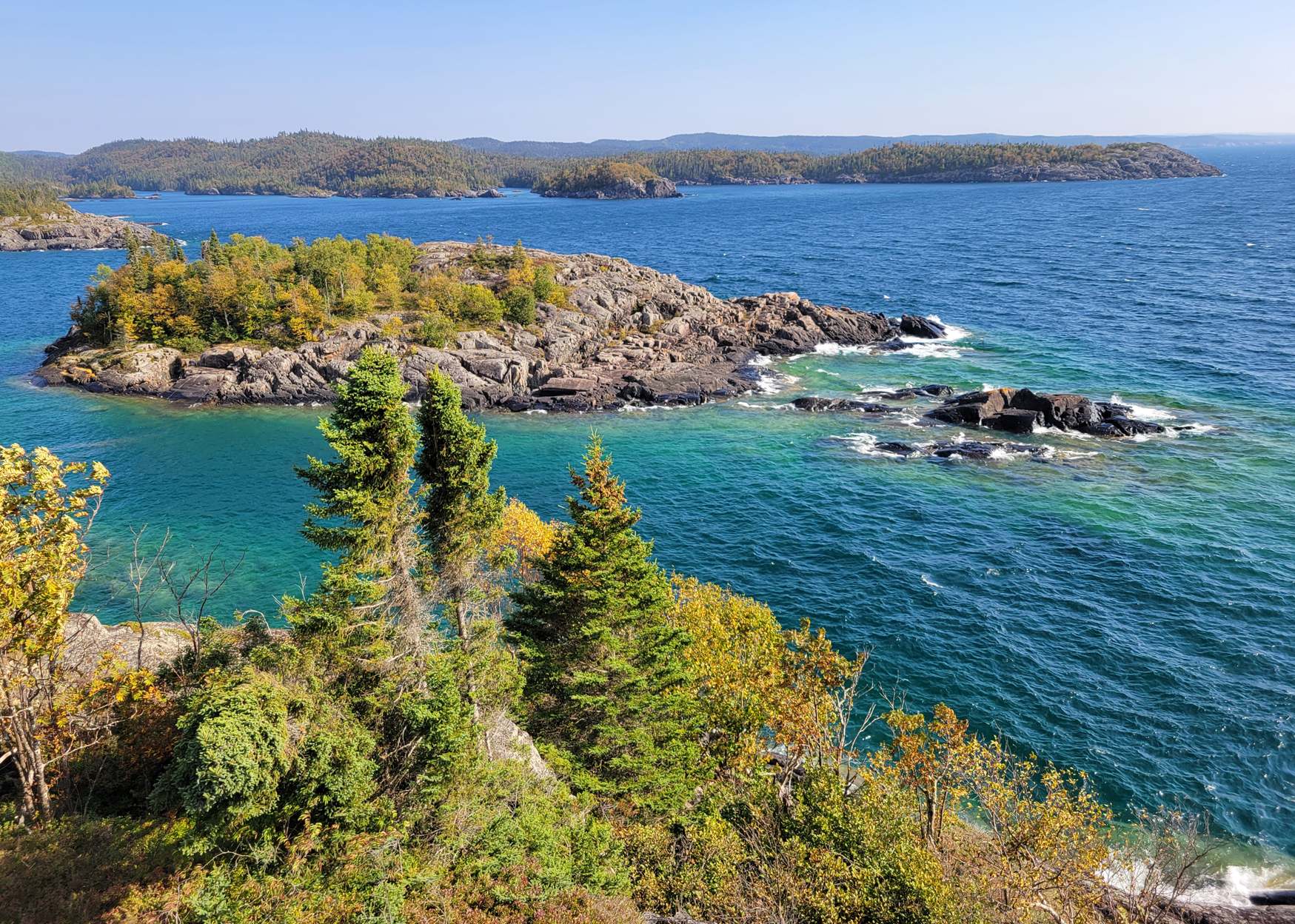
The 1 kilometre Point Trail and the 2.5 kilometre Under the Volcano Trail run along the coast of Neys Provincial Park once you leave the beautiful sandy beach near the campground. The rocks along here include eroded glacial striations, and leftover volcanic rock from an ancient magma chamber, evidence of a volcano several billion years ago!
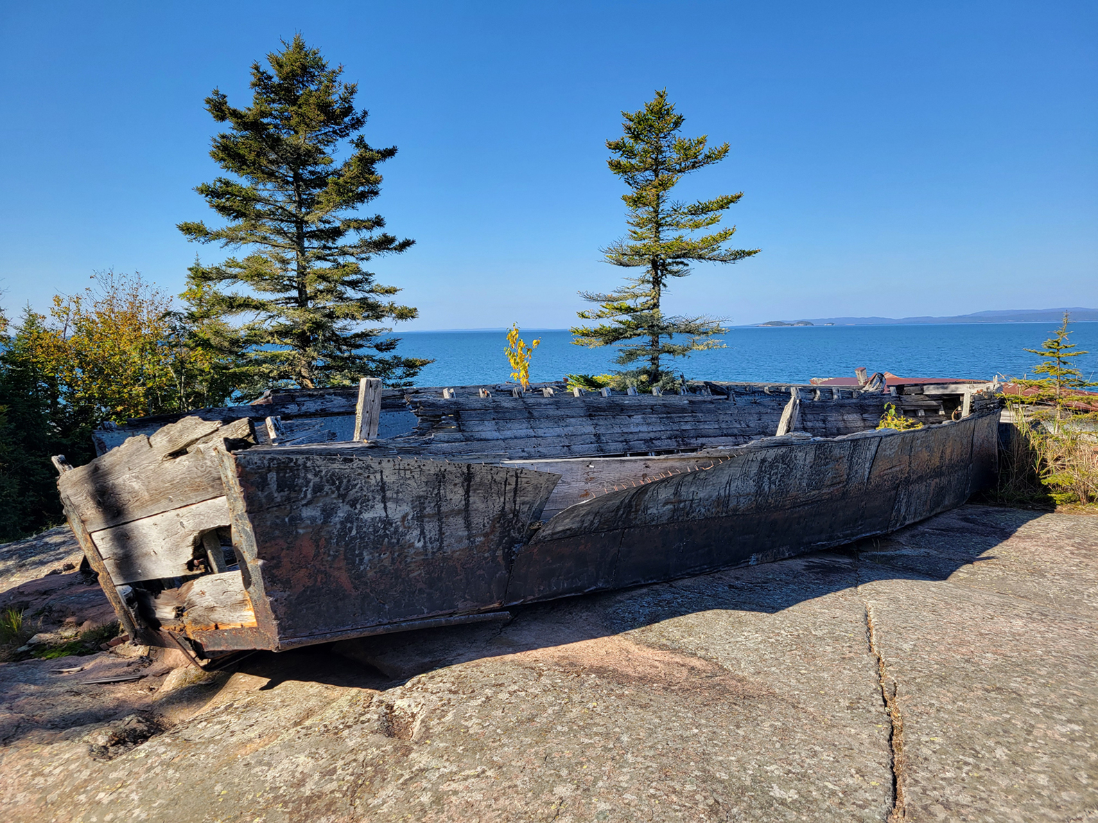
At the beginning of the Point Trail are the remains of some wooden boats. Located near Prisoner’s Cove, these boats were once owned by the Pigeon River Timber Company and were used in the mid 1940s to haul workers and supplies to the lumber camps up the Pic and Little Pic Rivers. Much of the labour for these lumber camps were from the POW camps in the area. Having paid work instead of just being stuck in the camp all day was probably a nice change for those in Camp 100.
Another trail we hiked was the 1.3 kilometre Dune Trail, which was a nice easy walk after breakfast as it was a relatively flat loop through the dune ecosystem of the park.
Right near our campsite was the Lookout Trail. This 1.6 kilomtere moderate trail had different elevations that included a couple nice lookouts, and we even got up to the railbed. There is a lookout where you can view Lake Superior as you look down at the park. You can easily observe where the trees were planted after the POW camp was taken down.
Out of all the Provincial Parks we camped at, only Neys felt like we accomplished much of what the park had to offer in one visit. A return in the summer months though may be a good idea for a return hike along the Under The Volcano Trail. Instead of focusing on the spectacular views along Lake Superior, it would be fun to piece together the over billion year old story of those ancient rocks! Along this trail (and along Lake Superior in general) are species of plants that you would normally find in the Tundra. Thanks to the Lake’s microclimate these plants continue to thrive along the shoreline. This includes the Bird’s-eye Primrose and Common Butterwort to name only a couple. It would be neat to see some of these disjunct arctic-alpine plants in bloom.
Pukaskwa National Park: 9/10
Pukaskwa National Park is 1 of only 6 National Parks we have in the province of Ontario. Established in 1978 the park was created in agreement between the Federal Government and the indigenous communities within the traditional territory of the Robinson Superior Treaty Group, who continue to work collaboratively in both park management and planning. The park covers around 187,800 hectares of Boreal Forest and Lake Superior Shoreline. For those visiting Pukaskwa there are three main areas of interest, all of them pretty much centered along the Superior coast. At the end of the only road into the park is the main campground at Hattie Cove that includes amenities of frontcountry camping, along with some day hikes. For the more adventurous there are overnight hiking trails that include the linear Coastal Hiking Trail (approx. 60 km) and the Mdaabii Miikna loop (approx. 24km). For those into paddling there is the 135 km Coastal Paddling Route. Backcountry reservations for overnight paddling and hiking trips here require a mandatory safety orientation before you start on your adventure. There are also shuttle services and guided trips available if you are doing the coastal paddling route. Remember Lake Superior is more like a sea than a lake so always include windbound days into your itinerary.
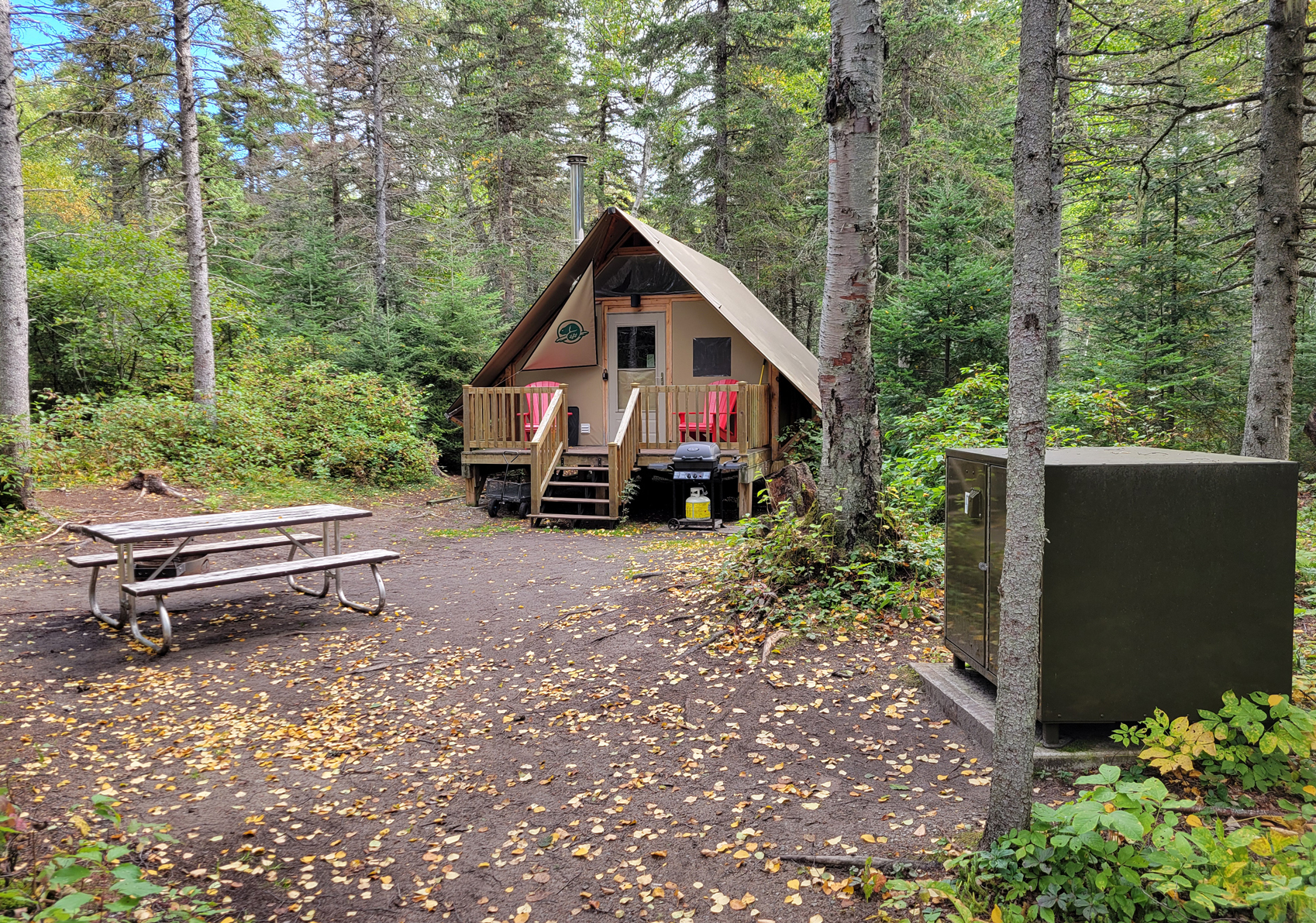
We only had 2 days in Pukaskwa, and since it was at the end of our trip we decided to try out one of the park’s oTENTiks. An oTENTik is like a beefed up yurt and the interior comes with electricity, bunk beds, a table with chairs, and a wood stove. There is a deck with plastic Muskoka style chairs right outside the door, a gas barbeque, picnic table, and a food locker to put your food in to keep out the bears. The oTENTik was a new experience for us, but we still prefer a tent.
With only two days we barely had enough time to hike the day trails here. There are four trails in the area that surround the Hattie Cove Campground. Ranging from 2 to 3.7 kilometres in length we chose the Manito Miikana Trail at 2.0 kilometres on the day we arrived. The trail starts at the Horseshoe Beach. It was a nice trail with views of lovely beaches to the north, beautiful Boreal Forest flora, a ravine, and spectacular views of the crystal-clear waters and the rugged shoreline of the Superior coast.
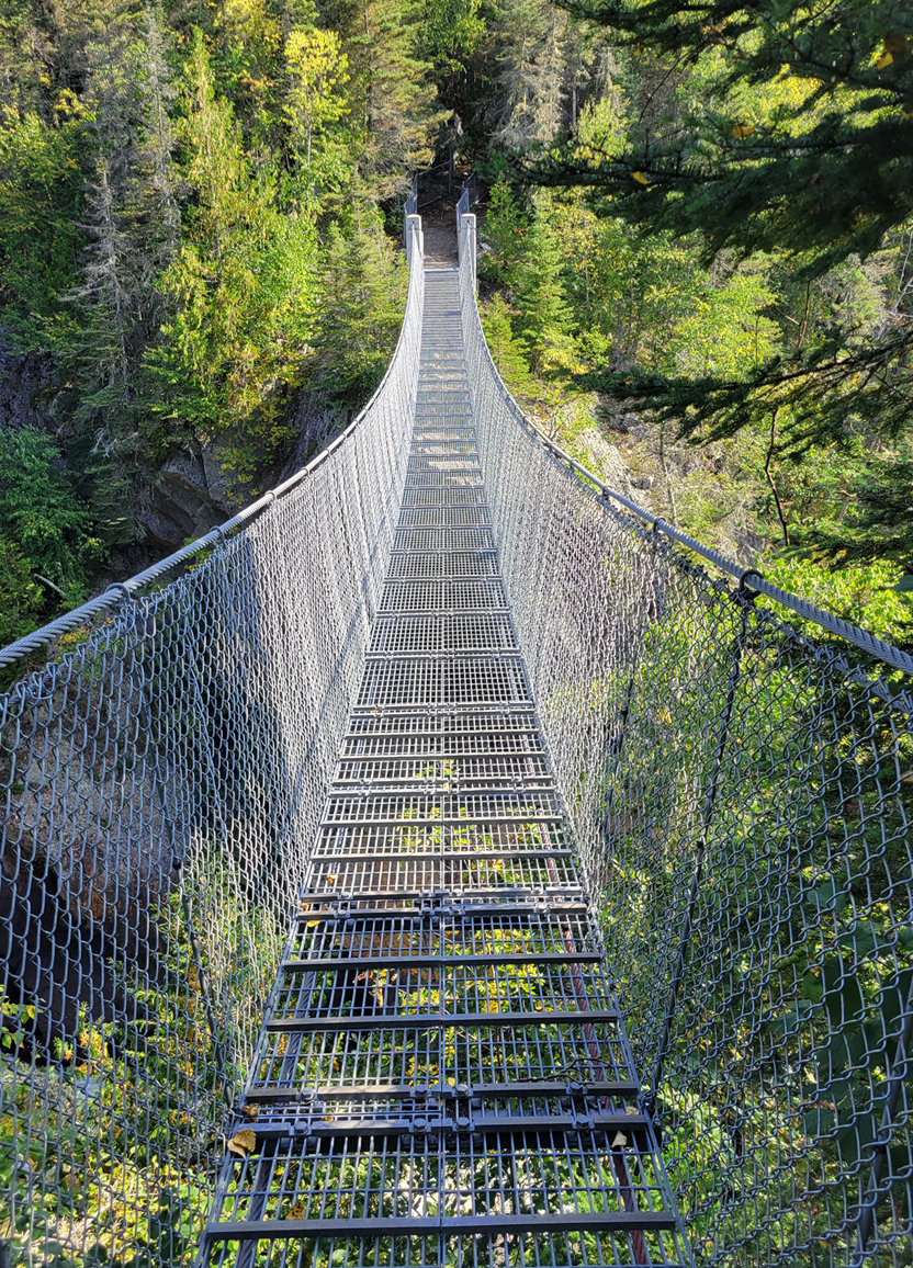
Our next full day was for hiking to the White River suspension bridge. This is a 9 kilometre LINEAR hike, so it is 18 kilometres in total. We started this hike just before 9 am. The trail is part of the near 60 kilometre coastal hiking trail. Near the beginning of the trail was a section where there was a prescribed burn. There is also a boardwalk through a marshy section closer to the beginning of trail. Here we observed our first and only Moose for the whole trip. It was in the distance on the opposite shore. We began to sneak quietly down the boardwalk hoping to get a better view until we heard some dumb moron from a rental canoe yell “OH MY GOD IS THAT A F@CKIN MOOSE!? A F@CKIN MOOSE!!! Here moosey moosey moosey…” So much for that……ahhh front country camping….ughhh….
The hike to the White River suspension bridge goes by a hike-in campsite, and we crossed paths with those on their way to the suspension bridge, and overnight hiking trips. One guy had a little dog off leash that he said was not fully trained yet….ummm is that a good idea out here? ….
Approaching Playter Harbour, we sat along the shoreline for a break. We were lucky that today was cloudy, as it was a warm 17 degrees Celsius out. The trail has some elevation to it, and we were glad to have some level terrain to cool off as we finally approached the suspension bridge.
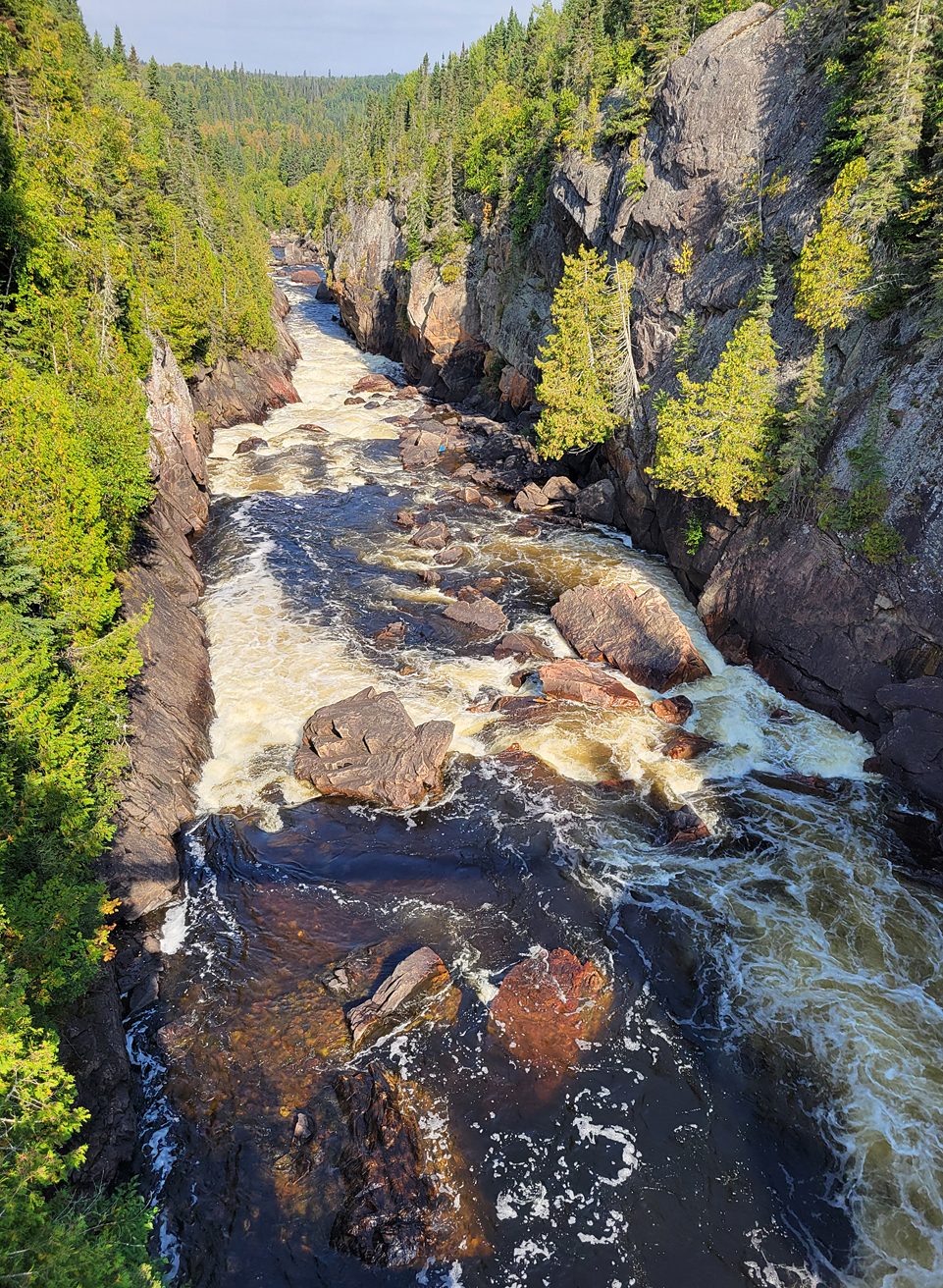
The bridge takes you across a 30 metre wide gorge and the height of the bridge is roughly 23 metres above the powerful rushing White River at Chigamiwinigum Falls. The sun came out here for a bit which lit up the area offering some good photo opportunities.
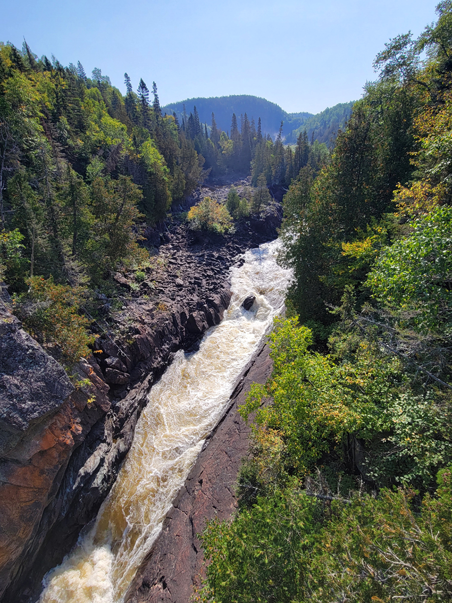
We probably spent a solid 15 minutes here before beginning the long hike back. We stopped off at Playter Harbour again for some Backpackers Panty freezed dried Pad Thai for lunch. Fog was now starting to come in at this point. The hike back felt longer than the hike in, and in the last two kilometres we could really start to feel it in our ankles and knees. We were a couple of sweaty hikers when we returned to our oTENTik, so it was off to the showers, followed by a celebratory whiskey. Our Lake Superior trip was coming to a close.
So would we do frontcountry camping again? If we do it would most likely still be in the month of September when campgrounds are less crowded by that time of year. Lake Superior Provincial Park is a must as there are many hikes we still haven’t done yet, and there are also some shorter overnight backcountry canoe trip opportunities there as well. For our next frontcountry trip we will probably return to Lake Superior Provincial Park for a few days, followed by a few days in Sleeping Giant Provincial Park to hike some of the trails there as well. We will definitely be back!
Click The Link For More Trip Reports:
