
After last fall’s disappointing canoe trip, and an even more disappointing hiking trip, we were ready for redemption in 2021! We debated over a repeat of our Temagami canoe trip with finally visiting the more remote Solace Provincial Park, or maybe go all the way to Quetico Provincial Park again? Unfortunately, three separate events happened during the course of 2021 that narrowed the selection down to one in a hurry. First and foremost was that the Covid-19 pandemic was far from over. Though a Quetico canoe trip was possible, the American border remained closed due to the pandemic which would save us 10 hours of driving crossing the bridge in Detroit and at Sault Ste. Marie. The final nail in the coffin for a Quetico trip was that there were fires in northwestern Ontario including Quetico Provincial Park, forcing that park to even close for a while.
We also wanted to complete our Temagami loop from last year since we only paddled/portaged about 25% of our planned route. Unfortunately Aaron pulled his shoulder out in spring, and by late summer it wasn’t completely healed. Perhaps going deep into Solace Provincial Park wasn’t the best option?
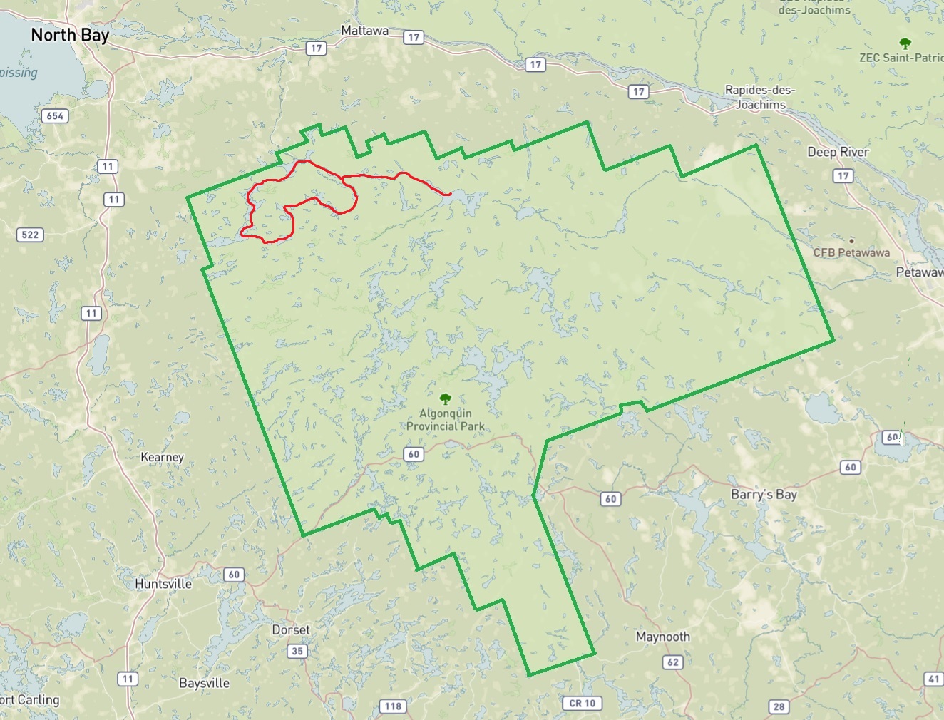
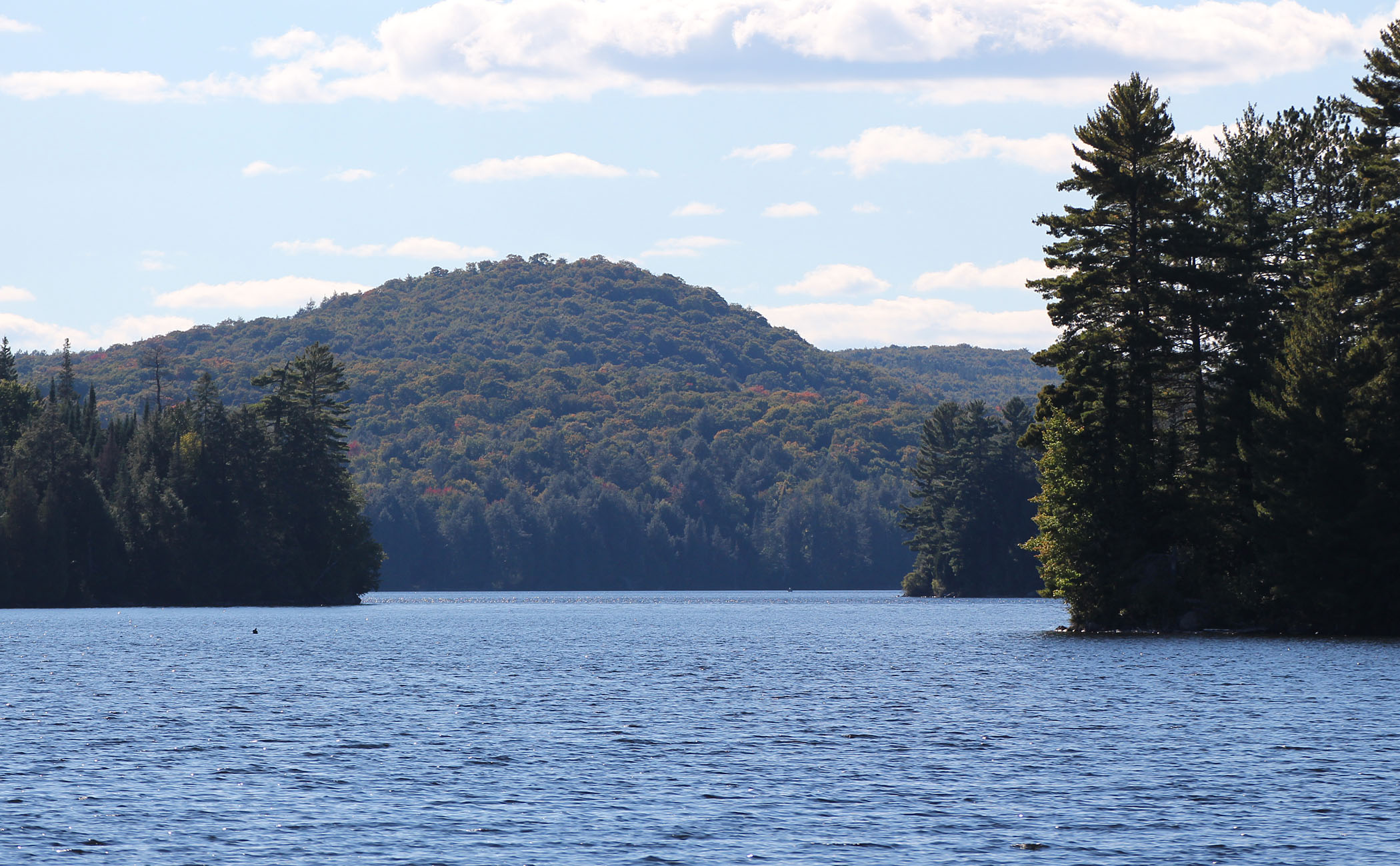
In the end we decided to stay closer to home and in an area we could paddle comfortably while not being as remote as we would be in Temagami. This of course is Ontario’s oldest provincial park, Algonquin. As usual, we wanted to be away from the more crowded highway 60 corridor so we took out the maps covering Algonquin’s north end.
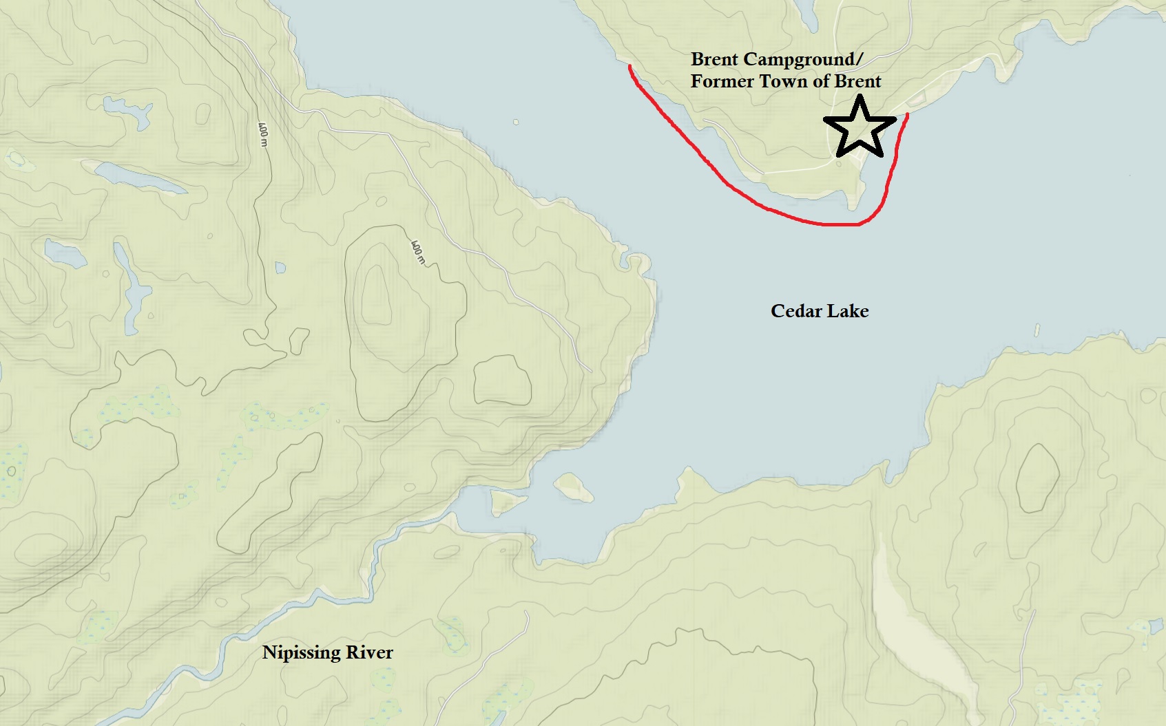
This was actually a hard route to plan. We have paddled a good chunk of Algonquin’s north, and trying to make a 2 week trip to explore new lakes and portages was actually a little difficult. In the end we decided to launch from Brent with a route that was a combination of new lakes along with some familiar ones. Finding old relics from the past was also a must and the park is full of neat human history! Before we knew it we had a route. It was a shorter route than what we were used to, especially the distances travelled each day, so maybe we would get some more down time at our site?
Route
Total Days: 10 1/2
Total Kilometres: 124 kilometres
Total Portage Length: 17.58 kilometres
Longest Portage: 1.72 kilometres (Mouse Link to Mink Creek)
Average Daytime High: 20.7 Celsius
Average Nighttime Low: 11.6 Celsius
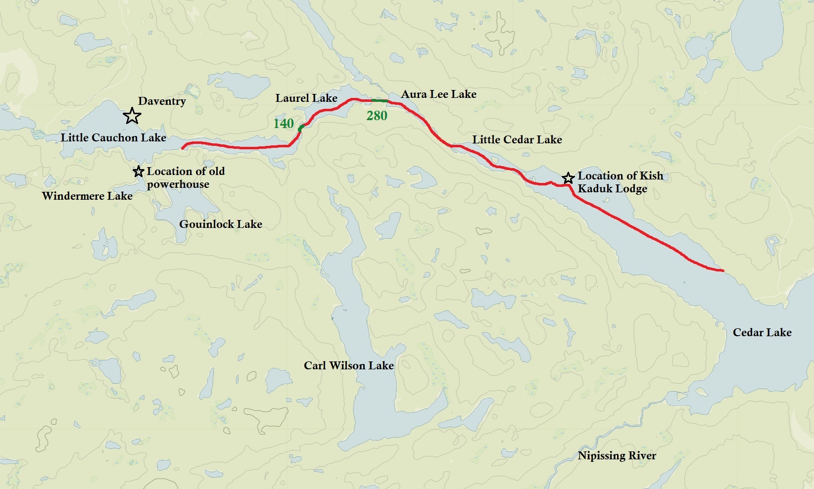
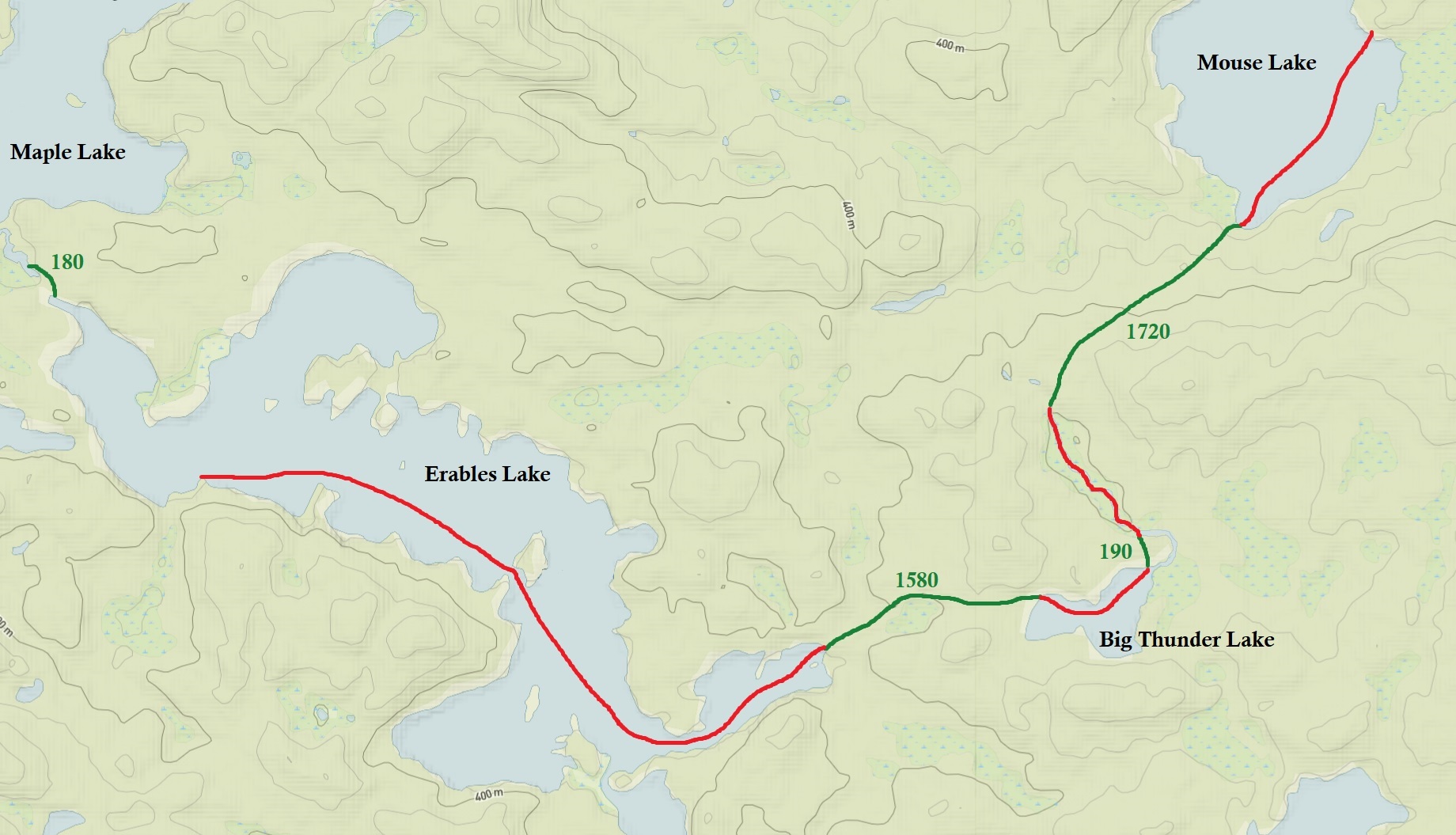
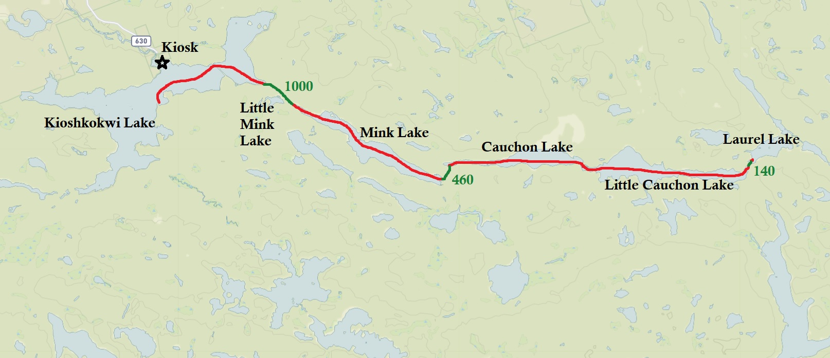
Route: Cedar Lake – Little Cedar Lake – Aura Lee Lake- Laurel Lake – Little Cauchon Lake – Cauchon Lake – Club Lake – Mouse Lake – Mink Creek – Big Thunder Lake – Erables Lake – Maple Lake – Ratrap Lake – Dahinda Lake – Boggy Lake – North Sylvia Lake – Three Mile Lake – Upper Kawa Lake – Kawa Lake – Sinclair Lake – Biggar Lake – Hornbeam Lake – Mangotasi Lake – North Tea Lake – Manitou Lake – Amable Du Fond River – Kioshkokwi Lake – Little Mink Lake – Mink Lake – Cauchon Lake – Little Cauchon Lake – Laurel Lake – Aura Lee Lake – Little Cedar Lake – Cedar Lake
Maps Used: Chrismar Algonquin 2 Northwest Map. Jeff’s Map – Western -. Friends of Algonquin Provincial Park Algonquin Park Canoe Routes.
Day # 1: Brent Campground
Weather: A mix of sun and clouds with wind in the afternoon. Showers and a brief thunderstorm in the evening. High: 23 C Low: 19 C
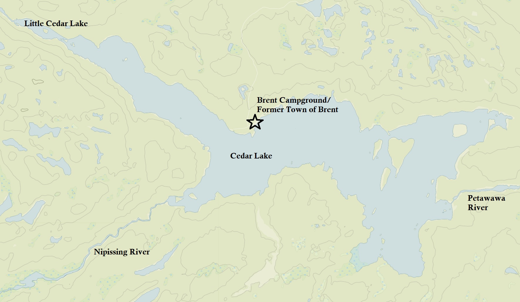
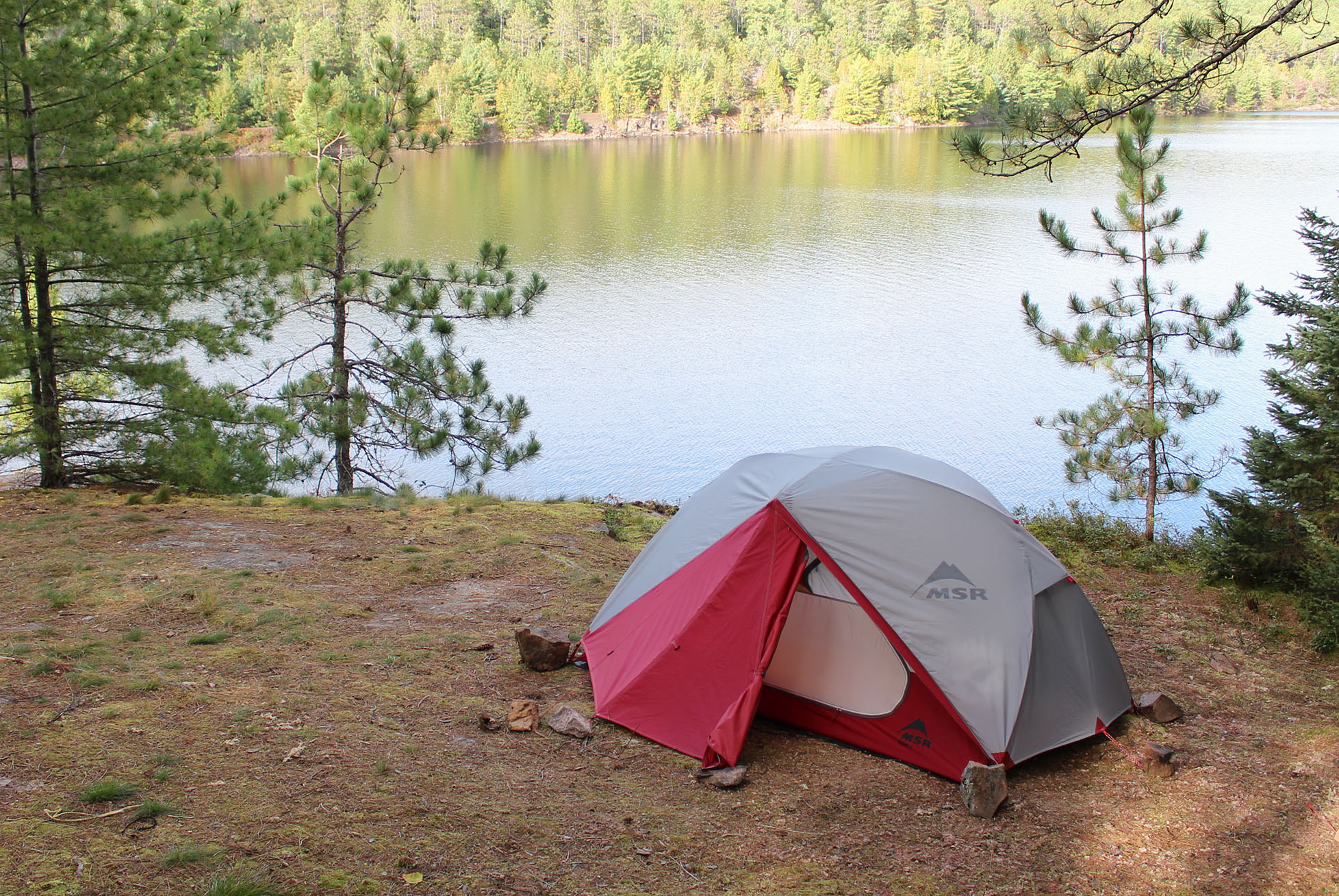
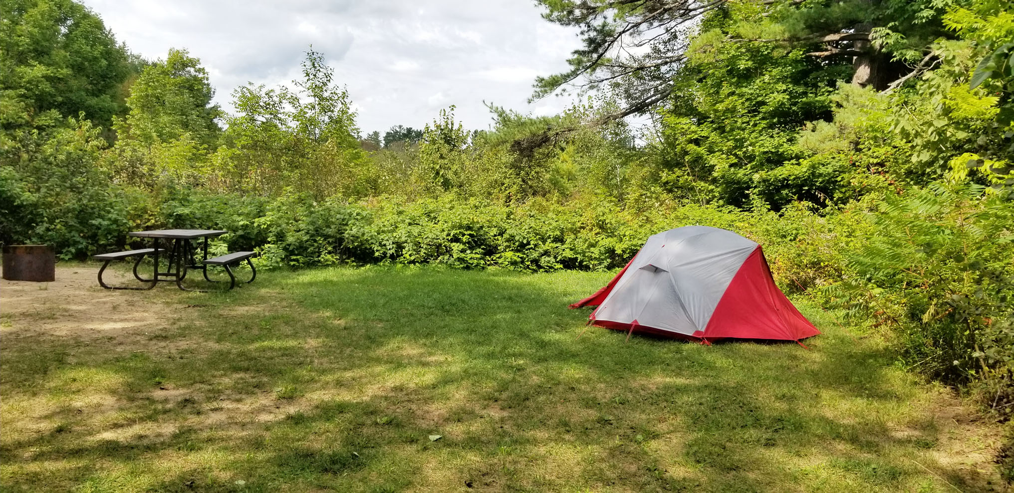
Turning down the Brent Road from Highway 17 we were both excited and also a bit nervous as you never know what to expect from this 40 kilometre gravel road that’s also used as a logging road. In the end it was a piece of cake with only a few washboard sections. We arrived at the Brent Campground around 11:30 am, too early to check in but we knew that rain was in the forecast for this afternoon so we wanted to get there as soon as we could. We also knew from looking online that both jump off sites were not occupied last night, while both were reserved for tonight so we got first dibs and picked site J2. J2 is the more isolated of the two jump off sites, though further away from the launch than J1. There are two jump off sites in Brent, though none of them are right at the water like at Kiosk where you can literally “jump off” to begin your backcountry canoe trip. Jump off sites are also only reserved for those who are backcountry camping, they are not a car camping site.
After setting up the tent and organizing some of our stuff we drove back north up the Brent Road to the Brent Crater Trail. The trail is an easy to moderate 2 km loop taking you down into the Brent Crater and Tecumseh Lake. The crater is the result of a meteorite that crashed into earth 450 million years ago. Hiking down the wall of the crater to Tecumseh Lake there is no feeling at all like you are walking down to where a huge meteorite smashed into earth. When you are at the lookout beside the Brent Road you kind of get the sense you are in fact looking at a large crater. It wasn’t until 1951 that the crater was even discovered so don’t feel bad if it only feels like any other nature trail.
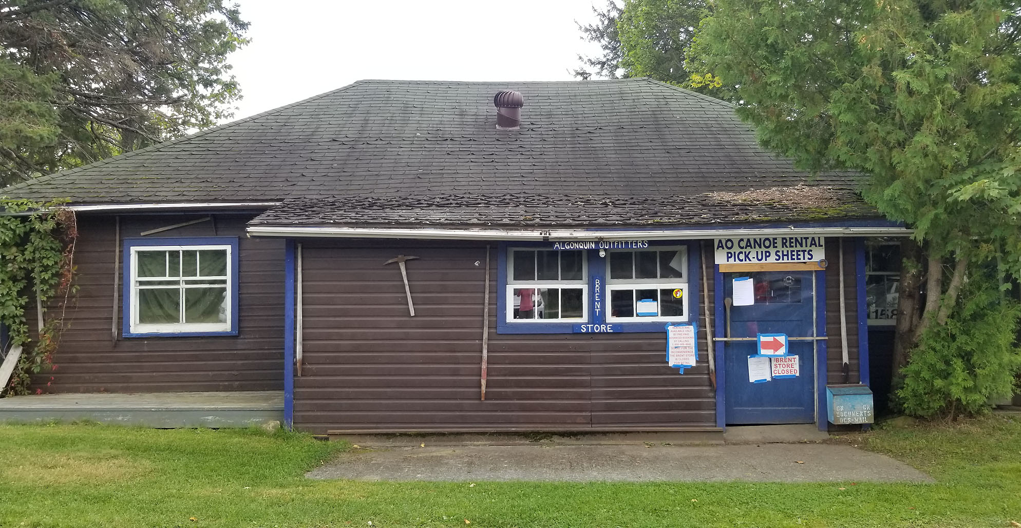
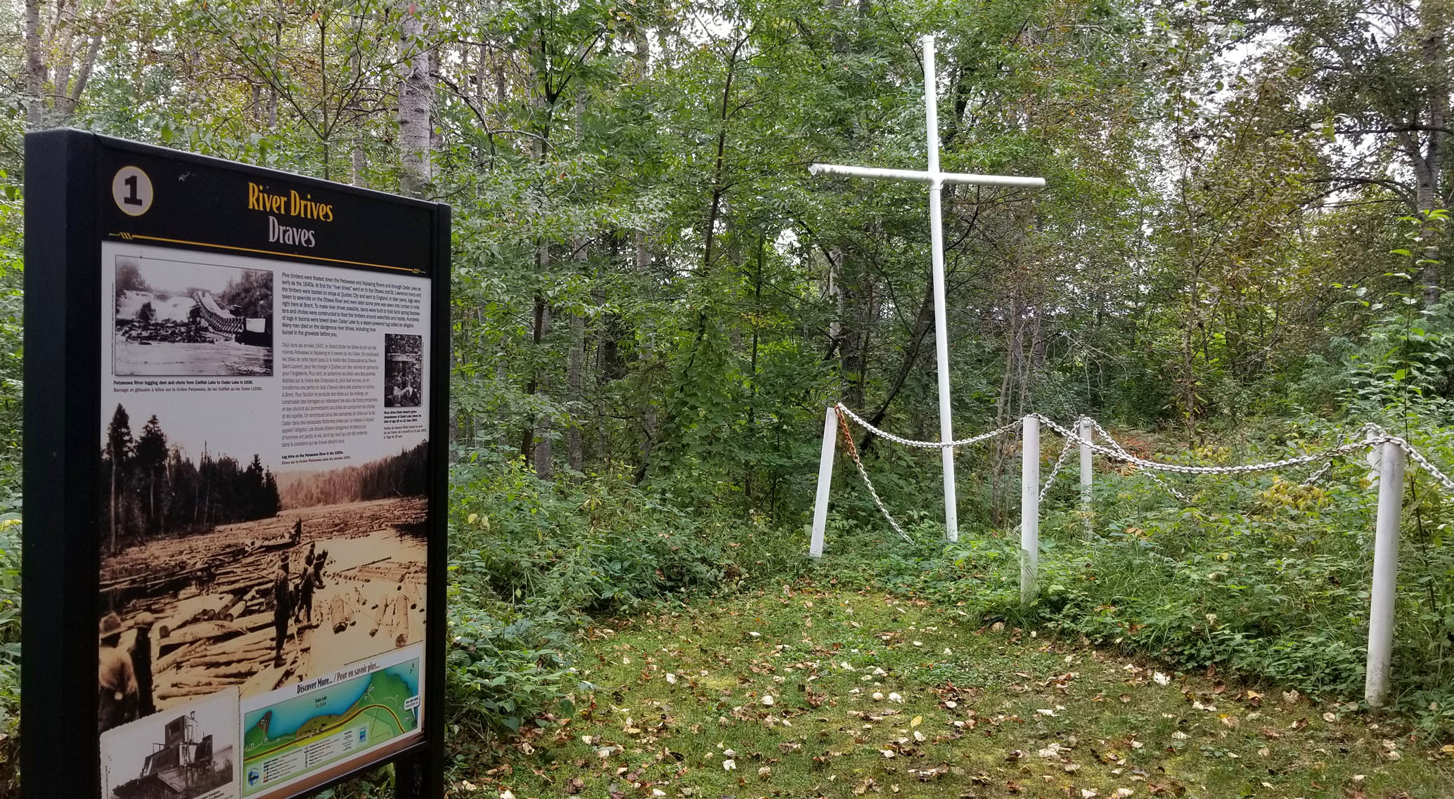
We had a mix of sun and clouds this afternoon, but as the afternoon wore on the clouds started to get those signature blue bottoms that looked like it could storm. We decided to go for a walk and check out the short Limestone Trail and what remained of the town of Brent. Like Kiosk to the west Brent is now a ghost town along the now abandoned Canadian National Railway that was built in 1915. Both these towns thrived during the logging era with lumber mills operating during the late 19th and well into the mid 20th centuries. The town of Brent was also a division point along the railroad. In it’s heyday with a population of nearly 300 Brent also had a sawmill, homes, general store, school and church. However just like Kiosk the later half of the 20th century saw dramatic changes for this remote town, and not in favour for the residents of Brent. The last train went through in 1995 and later the Brent Road, the only way out by land, was closed during the winter months. Today this now ghost town has no permanent residents. Buildings that remain include cottages under lease with the park, the Brent Store which is now run by Algonquin Outfitters, and an old non-operational hotel to name a few. Of course there is also the Brent Campground with its 30 non electrical sites, along with 2 ranger cabins that you can also reserve. There are no flush toilets, no showers, no hydro, and no cellphone service at Brent. If you like more of a quiet camping experience and don’t mind not having these few luxuries then give the Brent campground a try. Dogs are allowed here and boy were there a few yappie ones when we were there.
Around 6:00pm the winds shifted and we had a light drizzle. We made it back to our tent and thunder rolled in the distance around 7:30pm. We were ready for tomorrow and hoped that the weather will be nice for our first day!
Wildlife Sightings: Red Squirrel, Eastern Chipmunk, Common Raven, American Crow, Ring-billed Gull, Canada Goose, Common Loon, People, Mosquitoes.
Remember to: Check our Garmin InReach mini when we get back home. For some reason it’s at 47% battery life.
Day # 2: Brent Campground to Cedar Lake
Weather: Cloudy with sunny breaks. Windy. High: 18 C Low: 15 C
A hard rain fell sometime during the night though we did sleep okay for the most part. Breakfast consisted of little apple pies that we bought at the grocery store along with what was left in a carton of milk. Say goodbye to those luxeries!
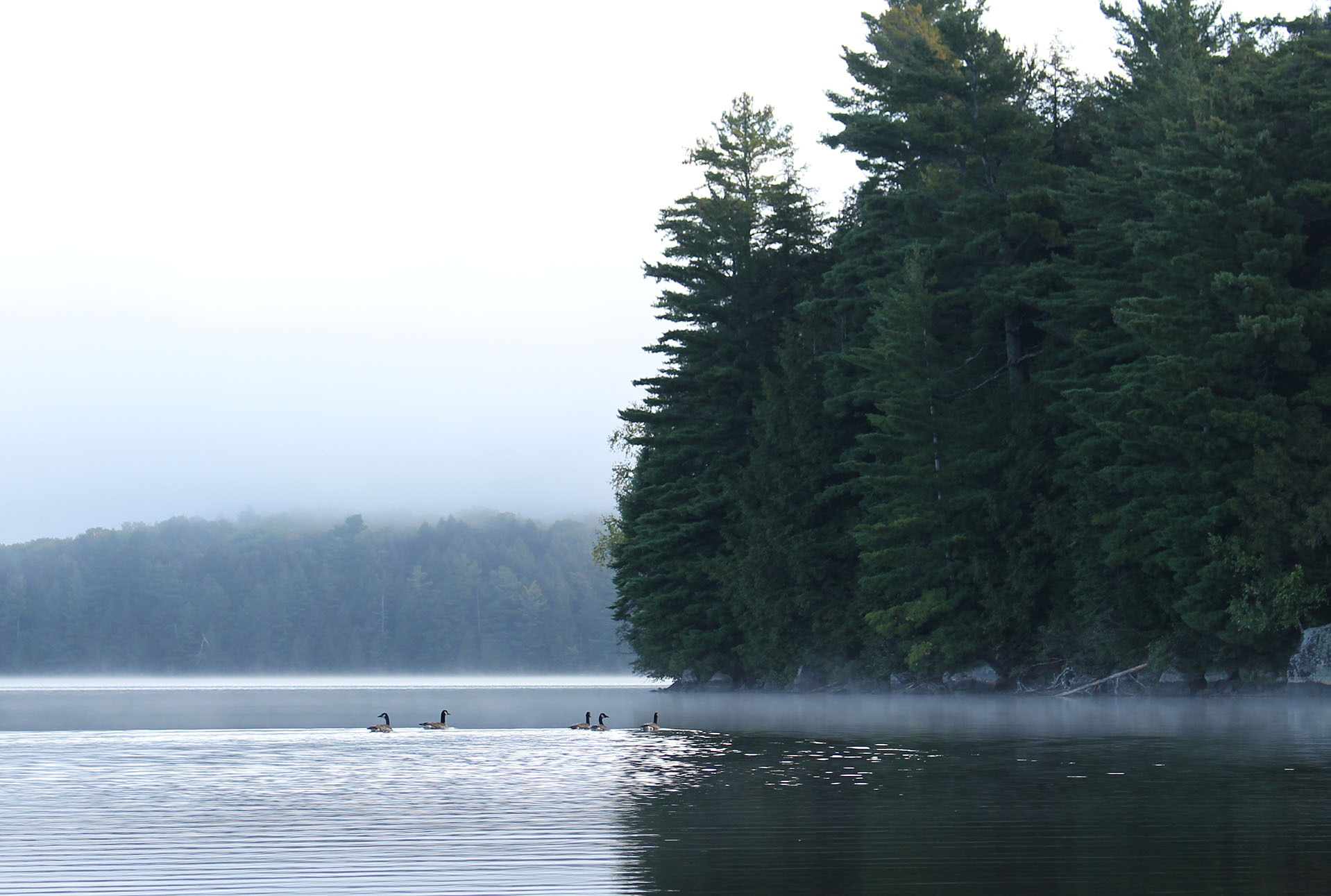
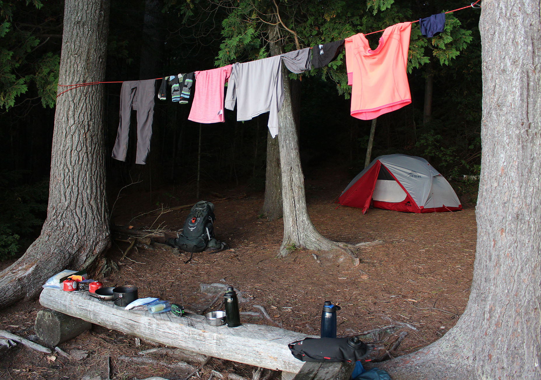
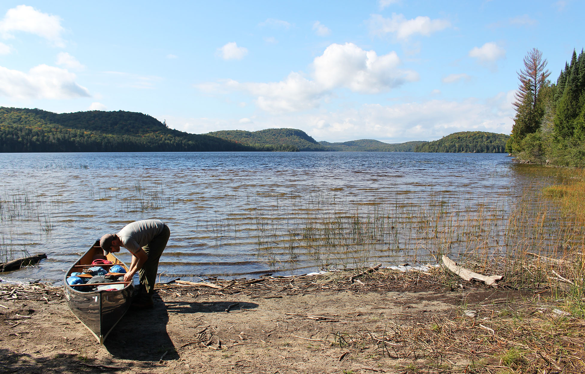
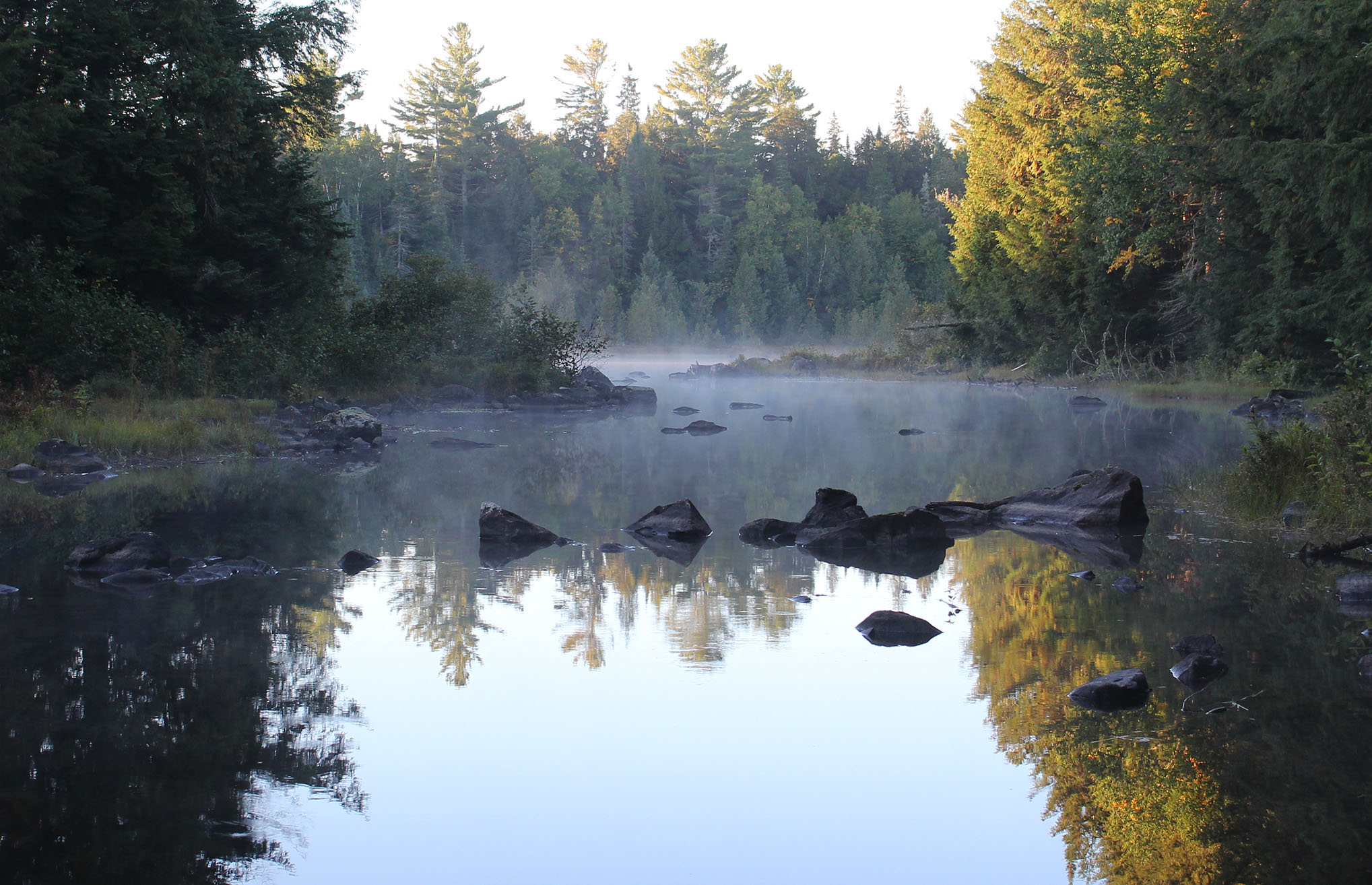
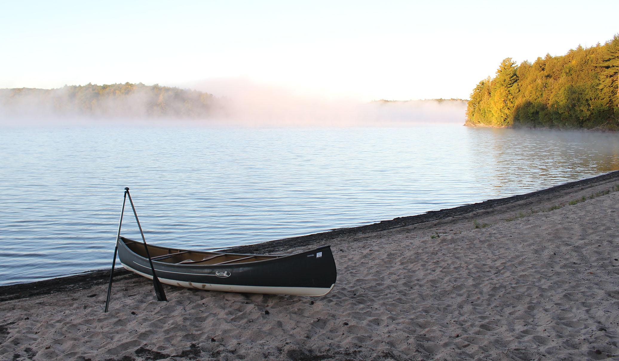
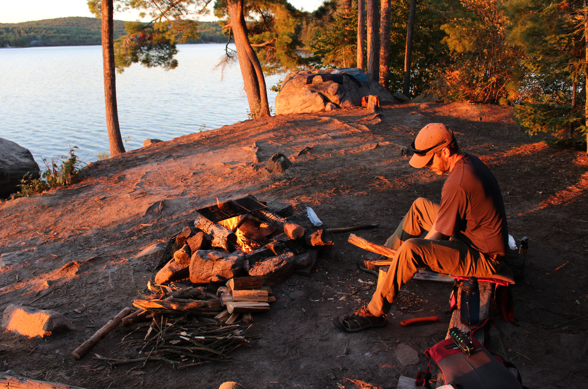
It’s been an unusually wet summer so we had the company of both mosquitoes and no-see-ums as we had breakfast, though they were just a minor nuisance. We got to the launch at Cedar Lake by 8:00am, sliding the canoe into it’s calm waters. We had a great paddle at first but as soon as we rounded the corner turning the canoe in a northwestern direction we ran into headwinds. This was not the way we wanted to start our first day! Cedar Lake is a big lake, well known for it’s big winds and we had this lake booked for tonight because of this. What we didn’t plan for was that we would be searching for a site only 20 minutes into our whole trip! We grabbed the first site along the shore just west of the Brent Campground and a small scattering of cottages. At only 8:30 in the morning today’s challenge would be to not get bored and nap all day!
Lucky for us it wasn’t raining and we pulled out the wet tent from last night to dry and began the process of searching for firewood. While exploring around the site we saw that someone left an old newspaper (the Ottawa Citizen) in a Ziploc bag next to the firepit. The firepit itself is okay by backcountry standards and there is a nice flat spot for the tent which is always a plus. There was a little bit of a breeze coming through the site off the lake so hopefully this would keep the bugs away for the duration of the day. Though the abandoned railbed was behind our site, closed in vegetation made it difficult to get to it so we didn’t bother. We wondered what it must have been like to camp at this site when the train used to go through. I’m sure someone out there must have woken up in the middle of the night with the ground shaking!
Exploring away from the site we did find old glass bottles and other old household items. Perhaps there was once a cottage located here, or people just dumped some of their old junk.
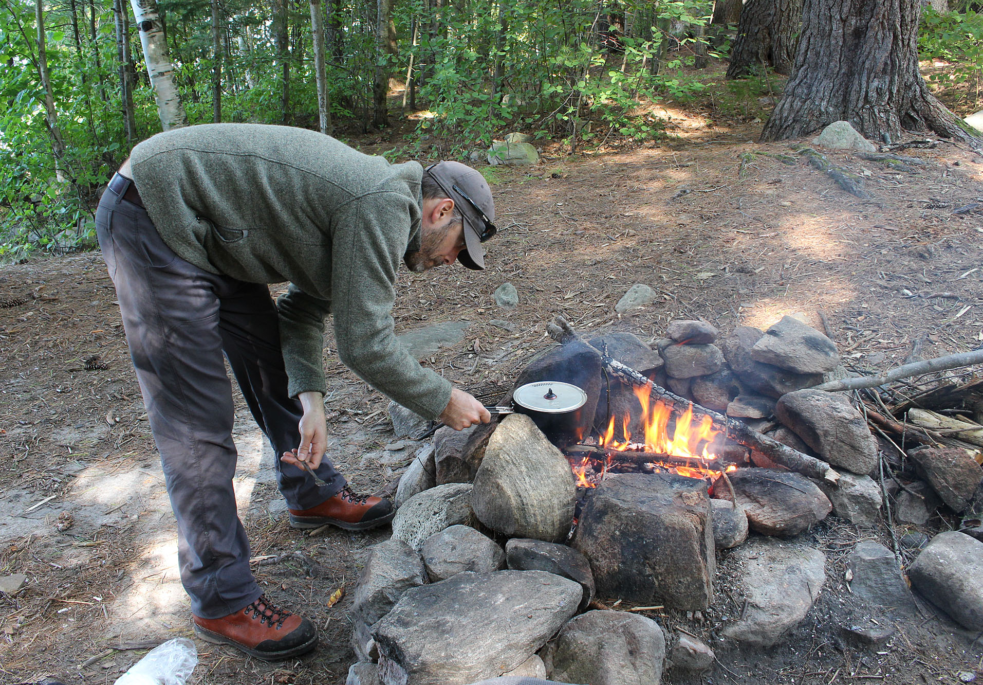
While Aaron took an afternoon nap, Marianne watched a couple of kayakers go by along with a boat with an outboard motor, both having the luxury of a tail wind. Outboard motors are allowed on Cedar Lake but only up to a maximum of 20 Horsepower. By evening the wind completely died down feeling like the nicest part of the day! We had lunch and supper over the fire and sawed up enough wood to have a relaxing night by the fire on our first night in the backcountry. By 9:00 pm the sky cleared with a nice quarter moon. Pretty chill for our first day!
Wildlife Sightings: Red Squirrel, Eastern Chipmunk, Black-capped Chickadee, Common Loon, American Crow, Common Raven, Ring-billed Gull, People, No-see-ums, Mosquitoes, Blue Jay, White-throated Sparrow
Remember to: No remember to today! YA!
Day # 3: Cedar Lake to Little Cauchon Lake
Weather: A mix of sun and clouds with a slight breeze. High: 20 C Low: 9 C
Last night we woke up to the sounds of chattering along with the “pitter pattering” of little feet as a group of critters made their way towards our site and even sniffed around our tent. A quick “Mwaa haa haaa” from Aaron made them scurry away in a hurry. We figured they were probably raccoons on their way to pub crawl around some cottages and the Brent campground. Perhaps these were the same bandits that were stealing shoes from Kiosk a couple of years ago when we camped there. Whatever it was they sounded like they were ready for a night of mischief when they came through.
As dawn broke, Cedar Lake looked like a completely different lake as it was nice and calm. Some sporadic low lying fog was in the area but it would not hinder us at all. After a bowl of honey granola cereal with a side of morale tea (Twinning’s Irish Breakfast Tea), we launched just after 8:00 am. We felt refreshed and ready to go exploring!
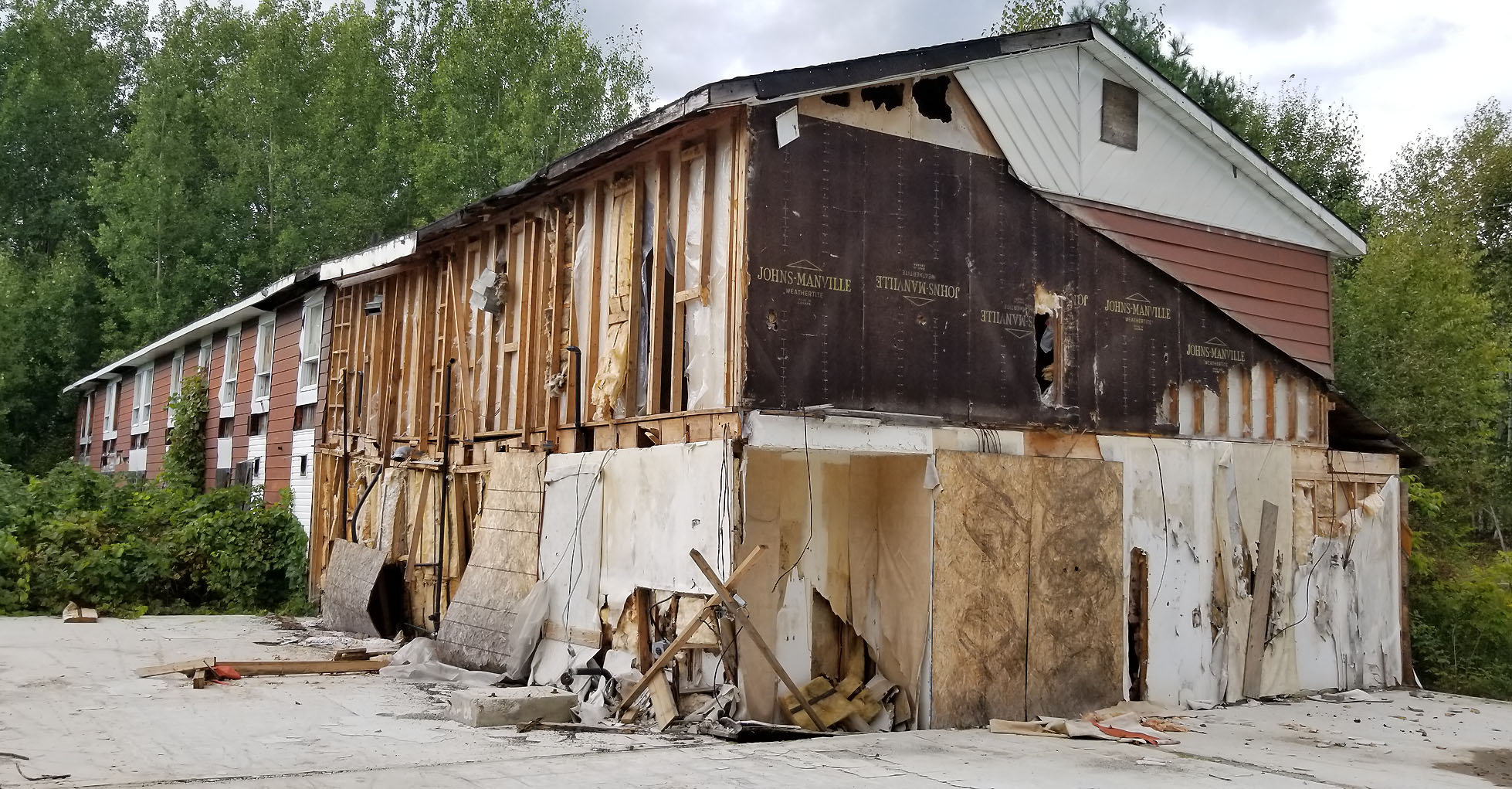
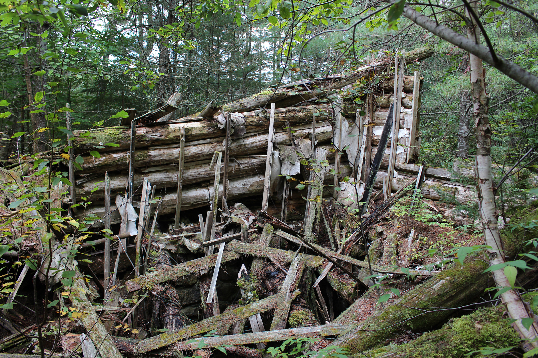
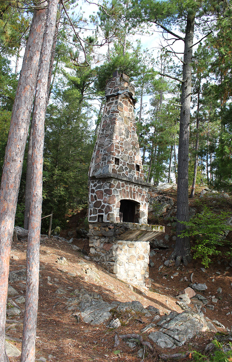
Paddling northwest we were on our way to find the remains of the Kish Kaduk Lodge. Two years ago we failed to find its location and only came up with a cold store and some old junk. This time we put the location into our GPS so it should be a go this time around. Luckily no one was staying at the site that’s the perfect landing spot to begin your search for the old lodge and we were a foot walking various trails. The first trail lead us to the cold store again. Walking down a different path we located the standing chimney. The rest of the lodge looked like it was slowly being swallowed up by the earth with vegetation growing out of its collapsed structure.
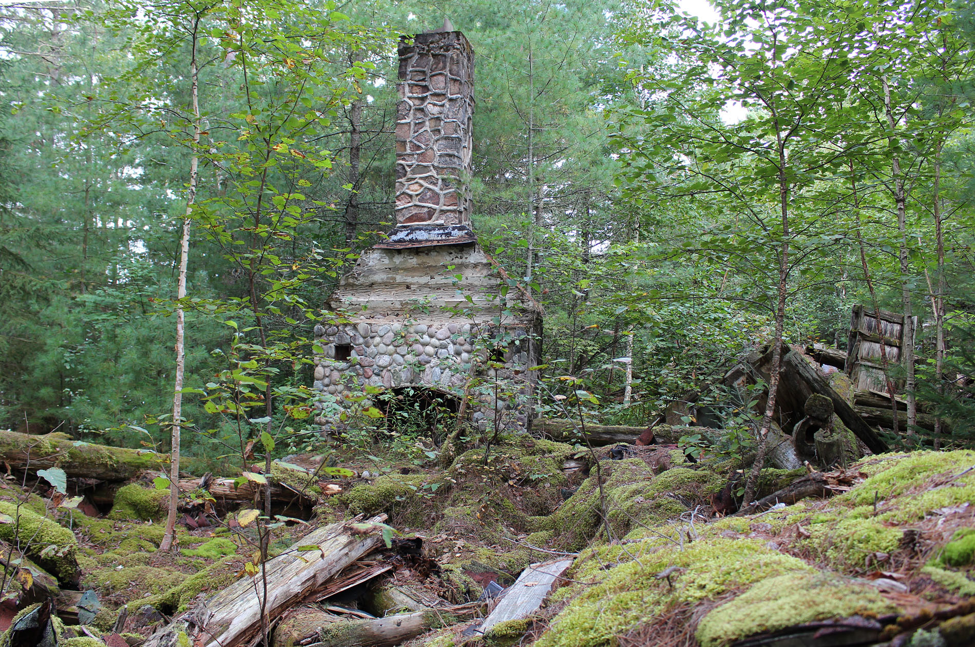
The Kish Kaduk Lodge was started in 1927 and was owned and run by the family of Edwin Thomas, who was employed by the CNR, for around 50 years. It was beside the Government Park railway station where tourists would be dropped off. With a quick online search you can find images of what the lodge looked like when it was up and running. Lodges were a common site in Algonquin after the railways were built. There was no road into the park at that time and lodges and hotels were nice accommodations for those getting off the train. When you think about it hotels and lodges were the beginning of a new era for Algonquin Provincial Park. Before then people came to Algonquin to work cutting down trees, now people were coming for leisure. Today both activities continue.
Returning to Cedar Lake we paddled to the island site that presumably had a cottage on it with only the chimney remaining. This site was also vacant and Marianne went to check it out and use the thunderbox. Though a chimney is a nice touch to have at your site, we would only ever consider this site if we knew it was going to be a calm day on a lake that is notorious for being windy.
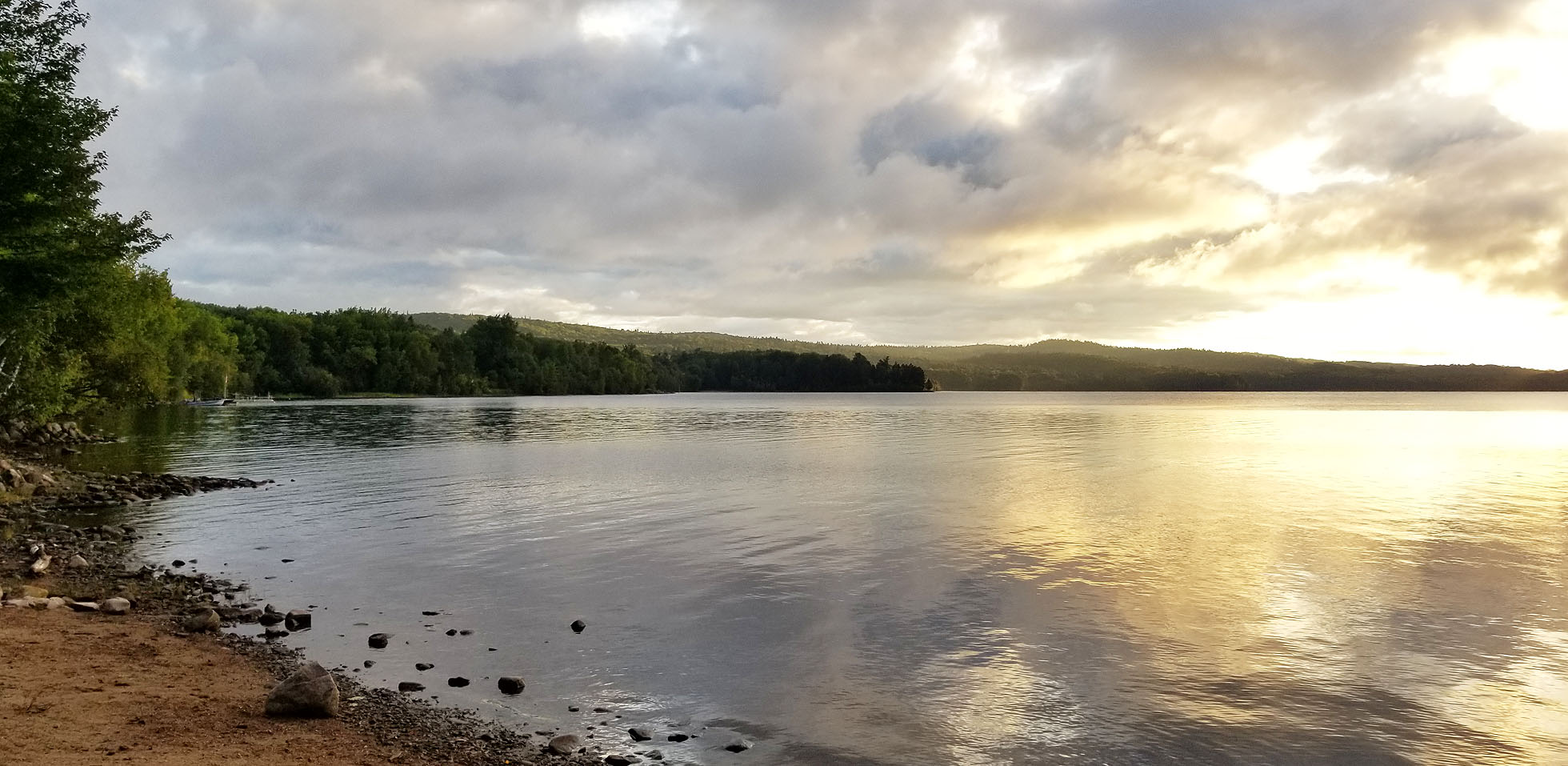
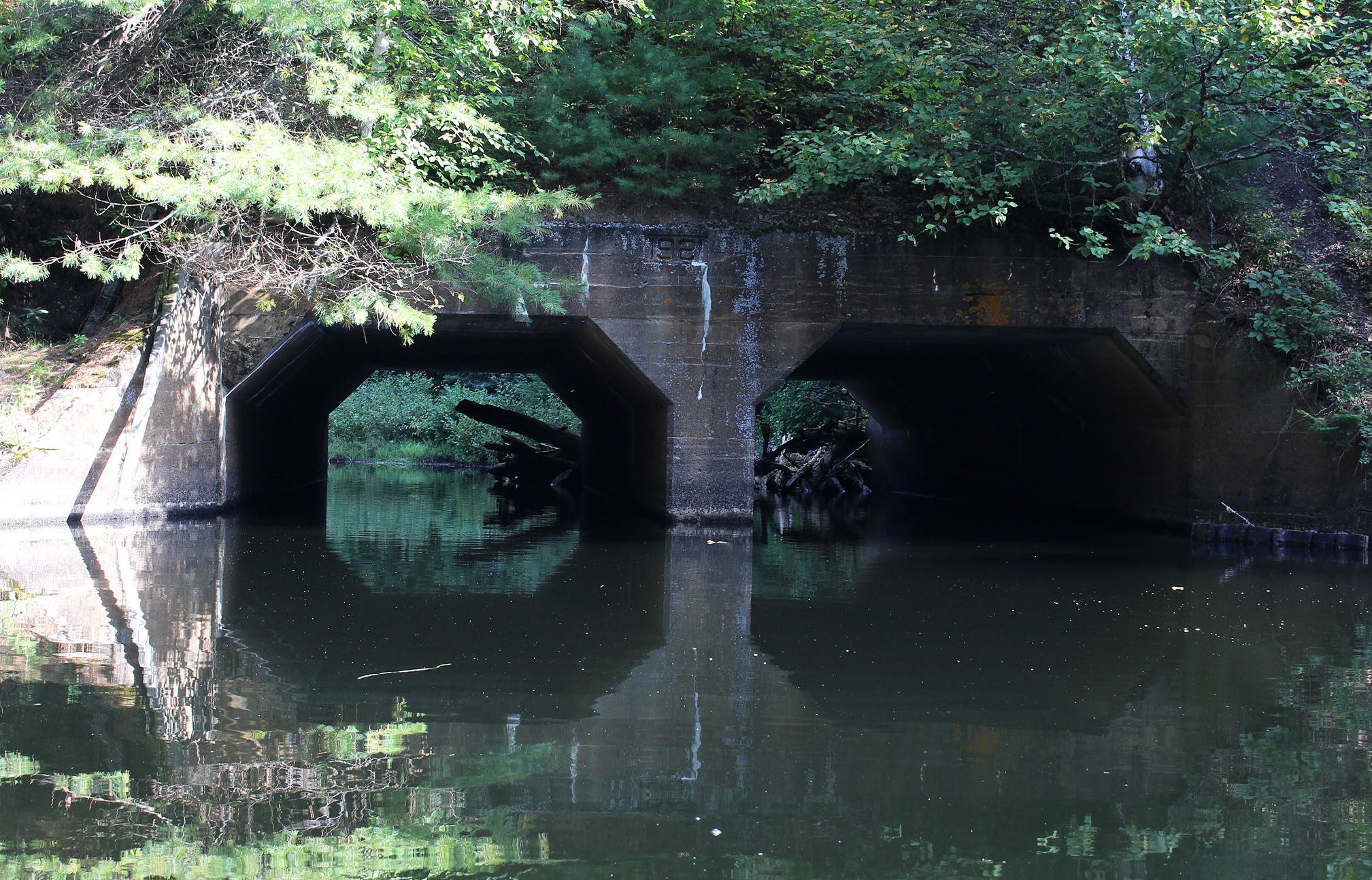
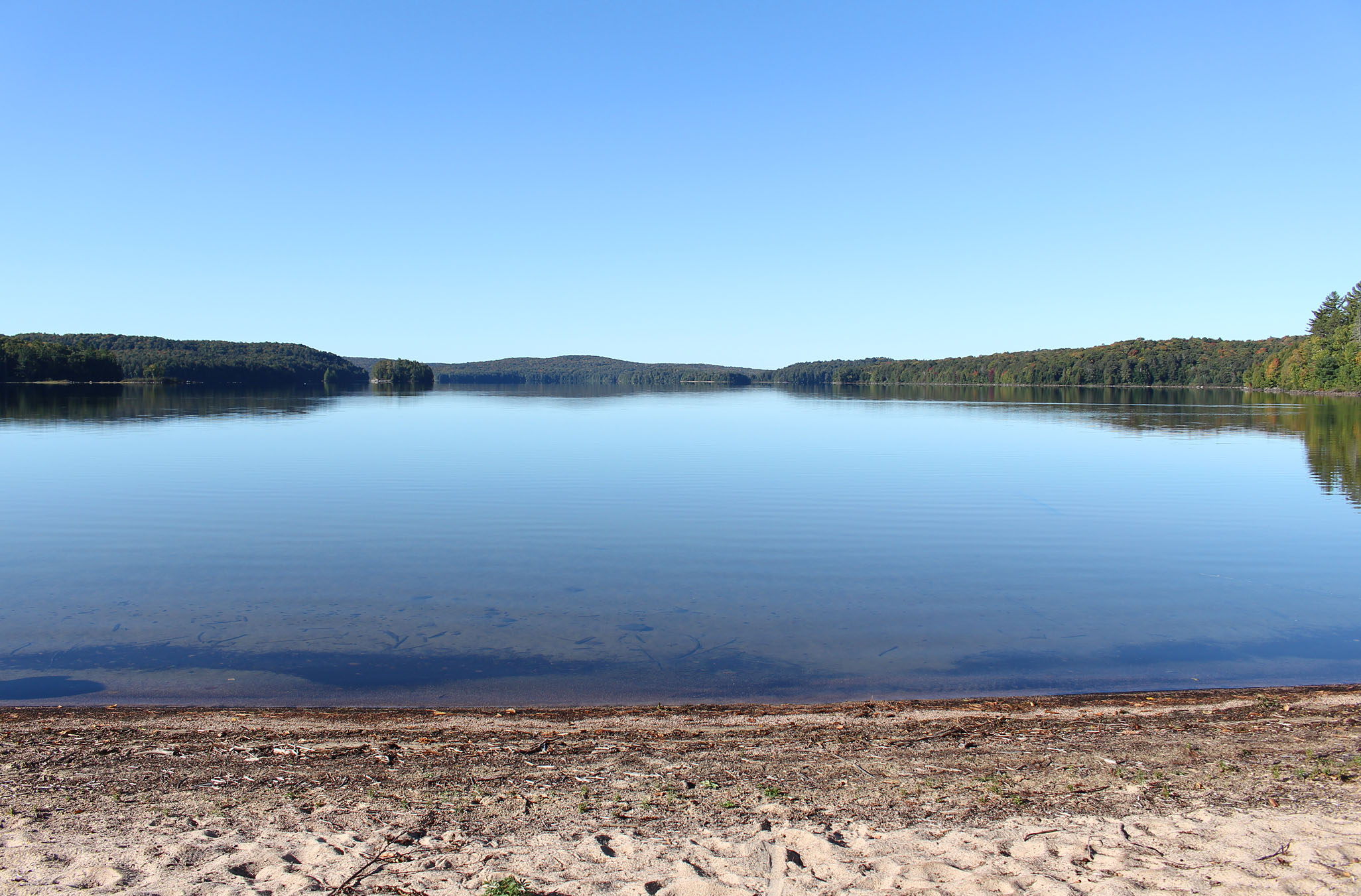
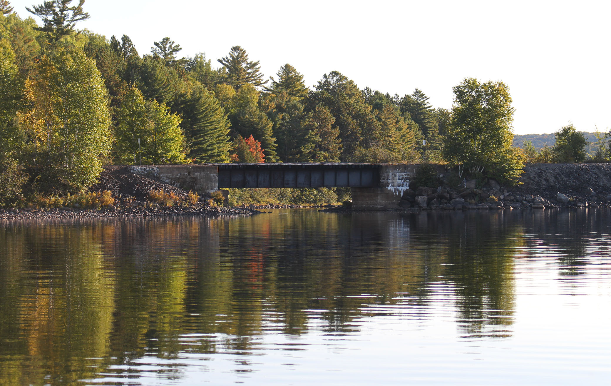
It was a chilly paddle this morning as the sun played hide in seek behind a mostly cloudy sky. Paddling out of Cedar Lake and into Little Cedar Lake we made it to Aura Lee Lake. Named after the Aura Lee Club, a boys club from Toronto that frequented the lake in the early 1900s, this neat narrow little lake has 2 sites. We soon paddled under the rail bridge that marked its centennial this year as it was built in 1921. We clambered up the side of its bank to stretch our legs at the top. We have never stayed on Aura Lee Lake but we did have it booked for our last night. We glanced at both sites as we paddled by to get a first look. From the lake they both look pretty small.
We soon arrived at the rocky take out at the 280m portage to Laurel Lake. This portage is pretty flat but there is a rocky section that requires you to watch where you are stepping. The put in at the Laurel end can be tricky in low water but lucky for us the water was a little bit higher than the last time we were here in 2019.
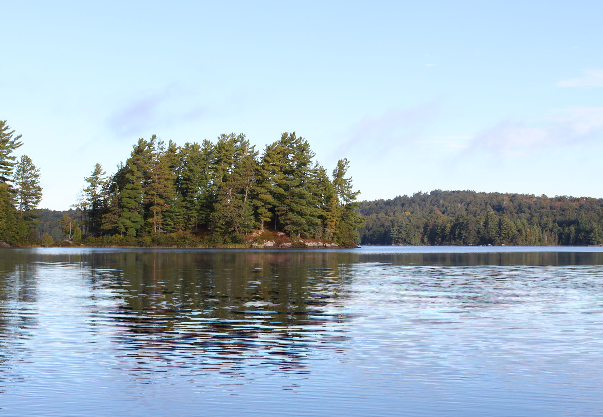
Laurel Lake is a nice lake with rolling hills. We viewed a couple of kayakers out for a paddle. There are 5 sites on this small lake with one being an island site that we stayed at back in 2010. It probably has the most scenic thunderbox in the whole park as it is pretty much at the highest peak on the island. Paddling past the island and to the end of the lake we made it to the 140m portage into Little Cauchon Lake. This portage is steep at the Laurel Lake end but given the short length it’s just a minor pain in the butt.
Going under the rail bridge yet again we entered Little Cauchon Lake and began to search for a site as we continued to paddle west. We settled for the one on a small point along the southern shoreline before the portage to Gouinlock Lake. There is a big sloping rock leading to the lake with the flat spot for our tent at the top of a hill. The only downside to the site was when we wandered back towards the thunderbox and found exposed toilet paper bombs with some “remnants” remaining. Part of this may be due to the fact that the thunderbox looks like it hasn’t been replaced since the 1970s and was completely covered in moss. Still if you are not going to use the thunderbox than at least bury your toilet paper, burn it, or pack it out!
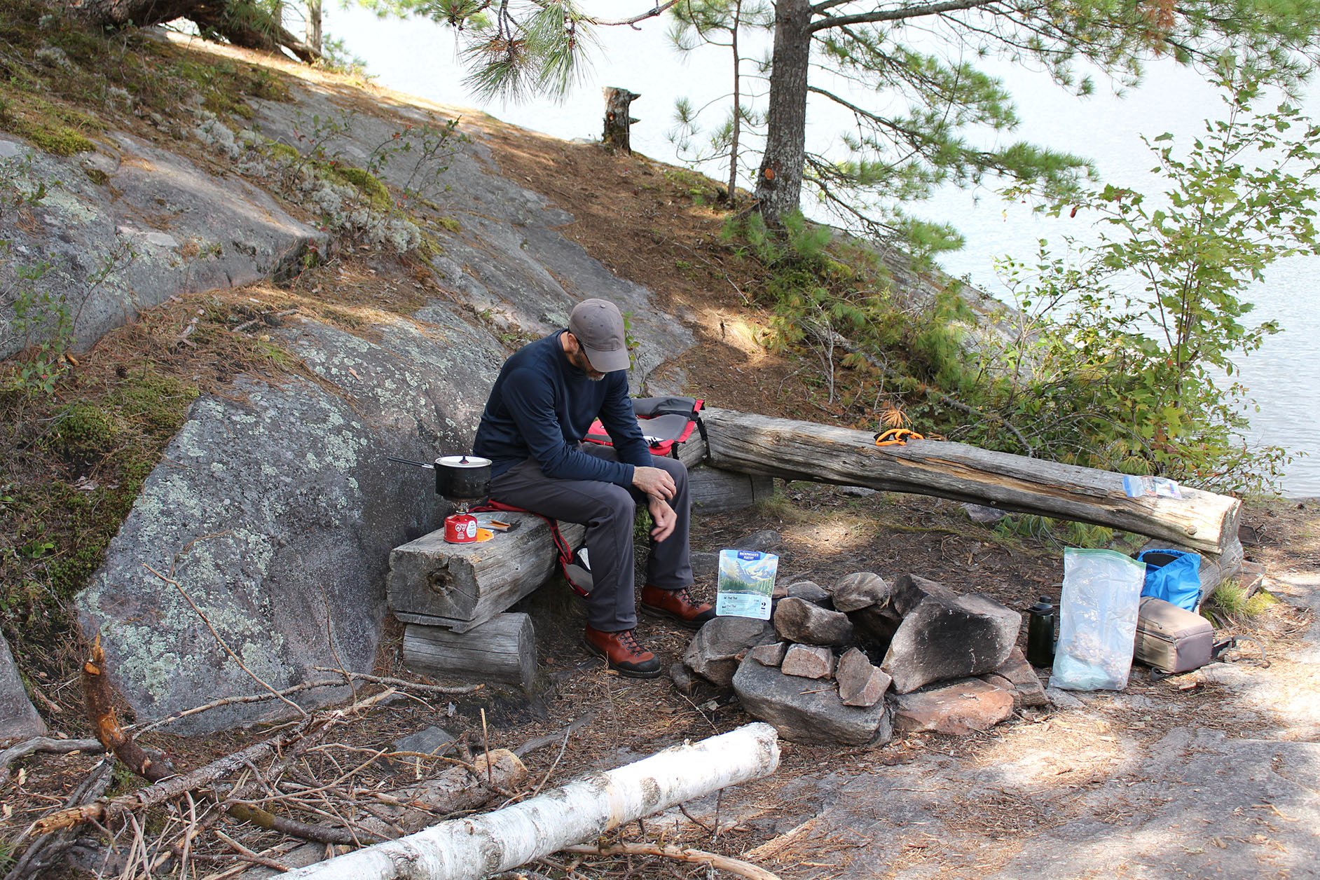
There were a few mosquitoes around as we enjoyed a quick lunch of our first freeze dried meal of the trip, Backbackers Pantry Pad Thai. This is one of the few freeze dried meals that actually feels like it serves two people, unlike the many others that states two servings but really just one real hungry person.
After lunch it was exploring time! We hopped into the canoe and made our way to the 330 metre portage into Windermere Lake on Little Cauchon’s southern shore. On the opposite shoreline we caught a glimpse of the former town of Daventry, hearing a generator and a pontoon boat with an outboard motor. Daventry is another station along the abandoned CNR railway. Like Kiosk and Brent, Daventry was once a thriving town along the railway benefitting from logging, the rail, and tourism. A couple of years ago we visited the rubble of a one room school house here. What makes Daventry different from Kiosk and Brent is that it doesn’t have an operating campground or a main road leading to the few cottages that dot the former town. The way to Daventry is down a rough road to the Brain Lake access point followed by a gate down another logging road. There is no public access past this gate. We have never been down the road to the Brain Lake access point but it sounds like Daventry may be one of the coolest gated communities out there!
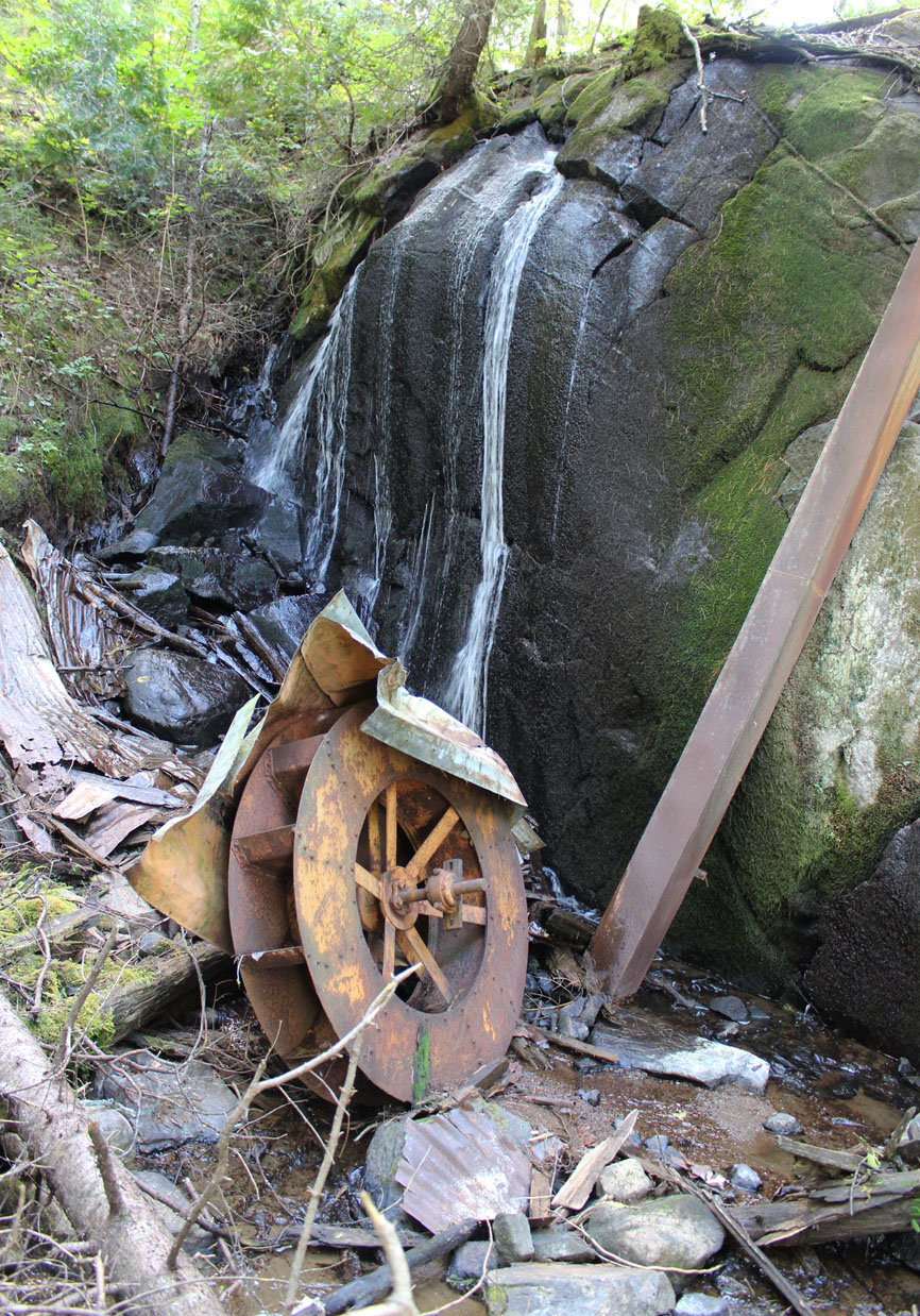
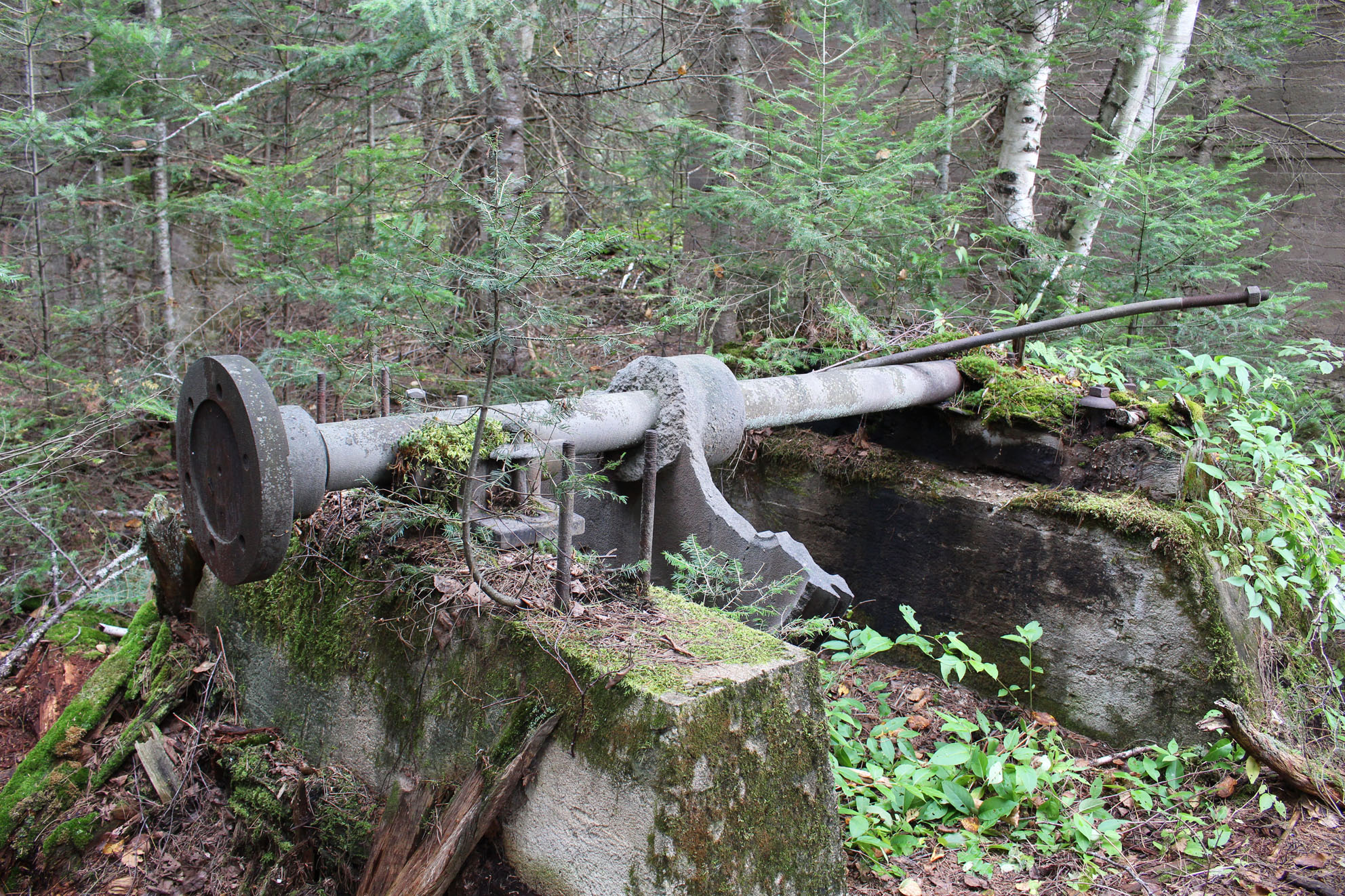
Beside the portage to Windermere Lake is a really nice cottage though it is a little odd that it has a front lawn. We land the canoe at the portage and hiked until we hear the sound of running water. We soon see a small waterfall and found what we were looking for, the remains of an old power generating house that has completely collapsed. It would have been really cool to see what it looked like while it was operating.
Back in the canoe we returned to our site and pumped water for tonight and tomorrow morning. At 20 degrees Celsius it felt quite warm and we see a group of people float by on a pontoon boat with fishing rods. Looking for firewood back behind our site we found more toilet paper bombs including some fairly close to our tent. We hope this is the only site for the whole trip that has this much poop.
Tonight’s meal is Sheppard’s Pie made from dehydrated ingredients over the campfire. We made a smoky fire tonight to ward of the mosquitoes and it worked pretty well.
Wildlife sightings: Red Squirrel, Eastern Chipmunk, Blue Jay, Golden-crowned Kinglet, Pileated Woodpecker, Black-capped Chickadee, Belted Kingfisher, Northern Raven, Barred Owl, Mosquitoes, People, Yellow-rumped Warbler, migrating Canada Geese, American Crow, Double-crested Cormorant
Remember to: Don’t bring anymore Love Good Fats bars with us. They crumble in our packs.
Day # 4: Little Cauchon Lake to Mouse Lake
Weather: Mainly cloudy with wind and some showers into the afternoon. Severe thunderstorms and wind in the evening. High: 20 C Low: 8 C

Calm waters with a bit of light fog greeted us as we got out of the tent this morning. After oatmeal topped with apples and strawberries we slid the canoe into the calm waters of Little Cauchon Lake at 8:15 am.

Within the hour it began to cloud over and the breeze picked up. Paddling under two more bridges we entered Cauchon Lake and the gently rolling hills that surround it. It’s these hills that win us over as we prefer Cauchon Lake to it’s “little” counterpart. Looking at the map however you’d almost think that Little Cauchon Lake may be a bit larger than Cauchon Lake….maybe?
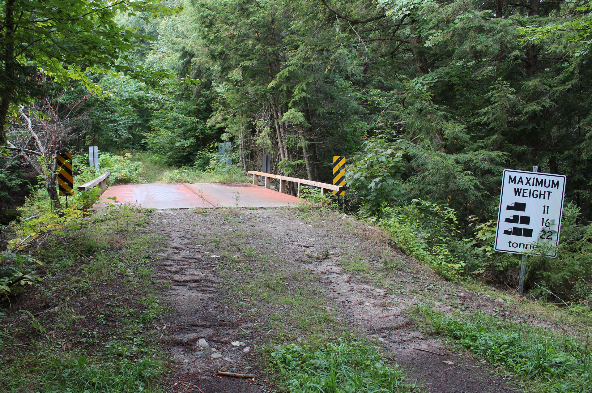
There is a really nice single cottage, perhaps the only one on the lake, located on Cauchon’s southern shore. As Cauchon Lake narrows we eventually arrived to the 460 metre portage into Mink Lake. This is a pretty straight forward portage and you go over the railbed. This will be the last time we play hide and seek with the railbed until we return in about a week from now.
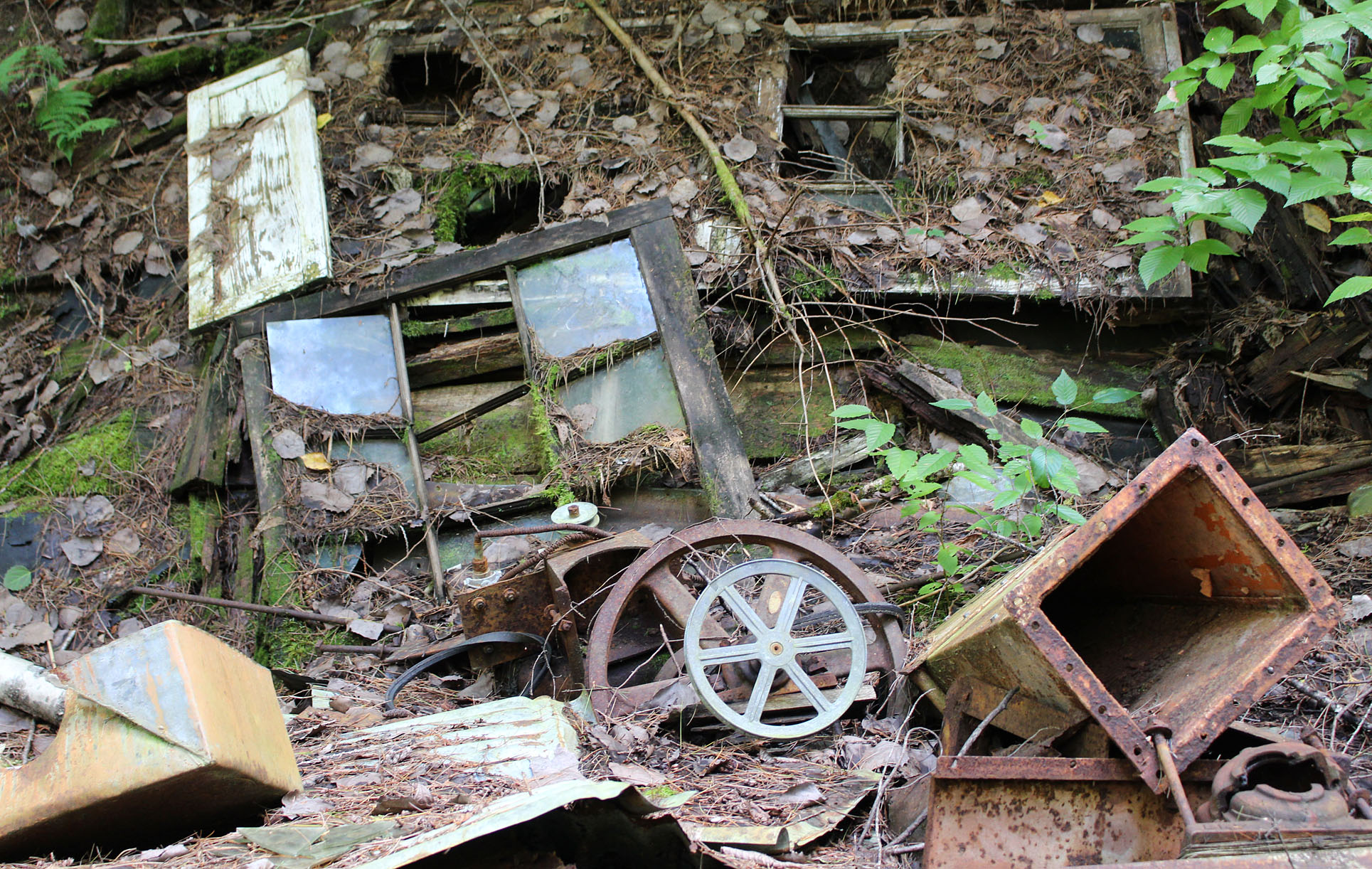
After a very short paddle along the southeast end of Mink Lake we arrived at our first new portage for the trip, a 1,150 metre into Club Lake. Though it was lengthy it turned out to be a nice morning walk in the woods. It was along here that we met Wayne, a soloist from Ottawa who was paddling Algonquin from west to east in about 20 days! We also meet another couple from Barrie who like us were heading to Mouse Lake for the night.
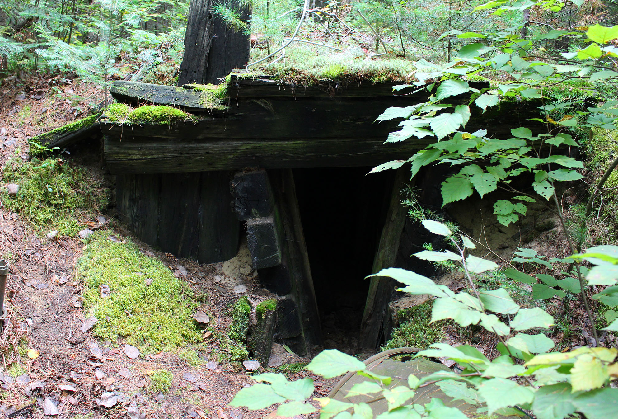
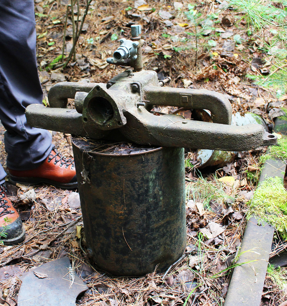
At the end of the portage we saw a brick and concrete building, or at least what was left of it, along with some mechanical devices including a drive shaft. The building was part of the Richie Brothers sawmill that operated sometime during the 1920s to around the time just before the Second World War. Apparently there was also a narrow rail line here that connected to the old CNR but if there was we couldn’t tell. We may have to come back here on a separate trip and explore more as there are other known structures and remnants of the sawmill around here. Unfortunately for us it was beginning to lightly drizzle and we knew that storms were in the forecast. It was time to get paddling.
Club Lake is an interesting lake as it feels like two separate lakes connected by a marsh. Maybe it once was two separate lakes until the beavers got busy? As we paddled Club Lake we searched for moose as Wayne mentioned he saw one earlier in the day here but we came up mooseless. We had one lift over on this lake which would actually be the only lift over for the whole trip!
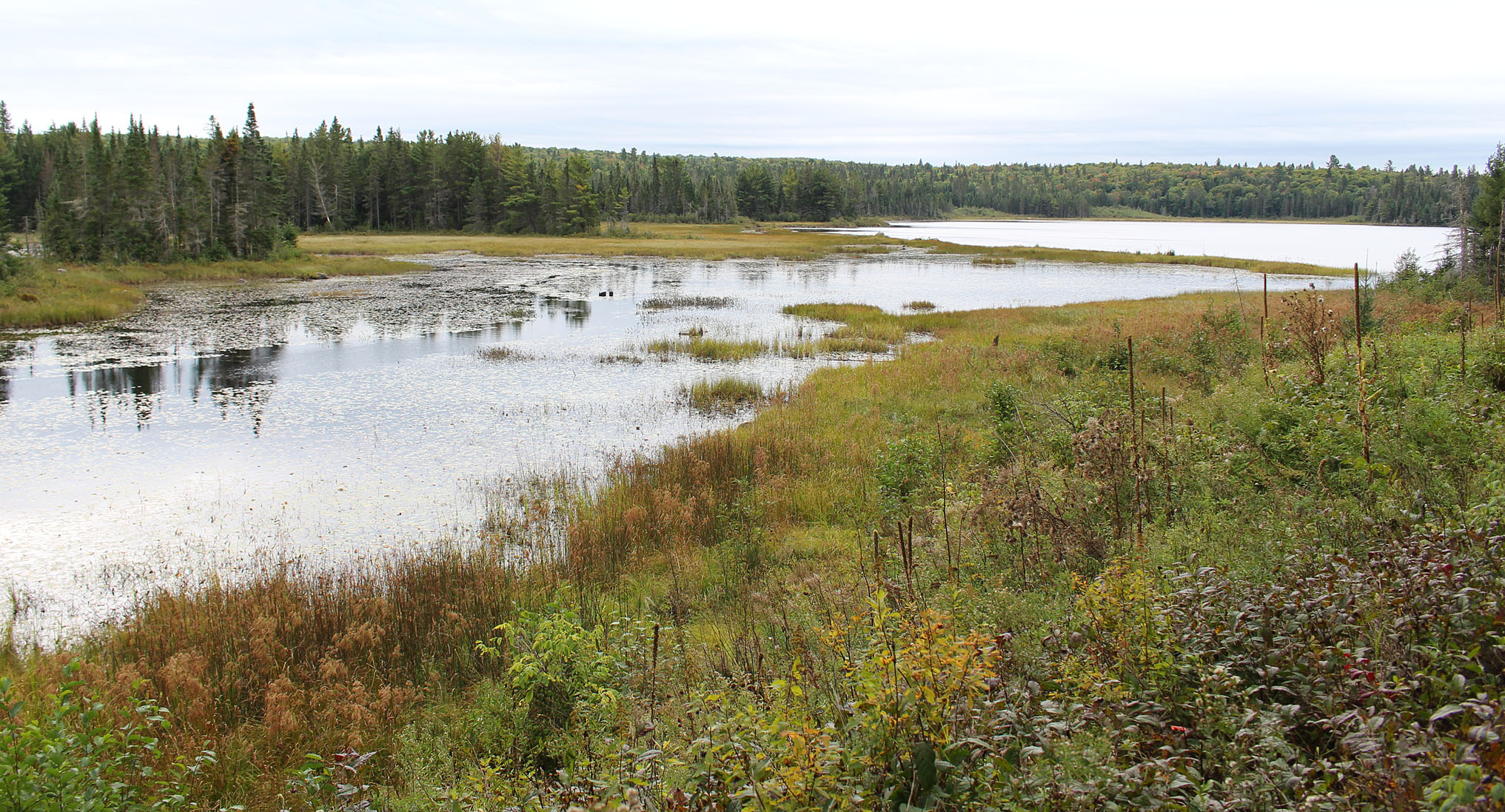
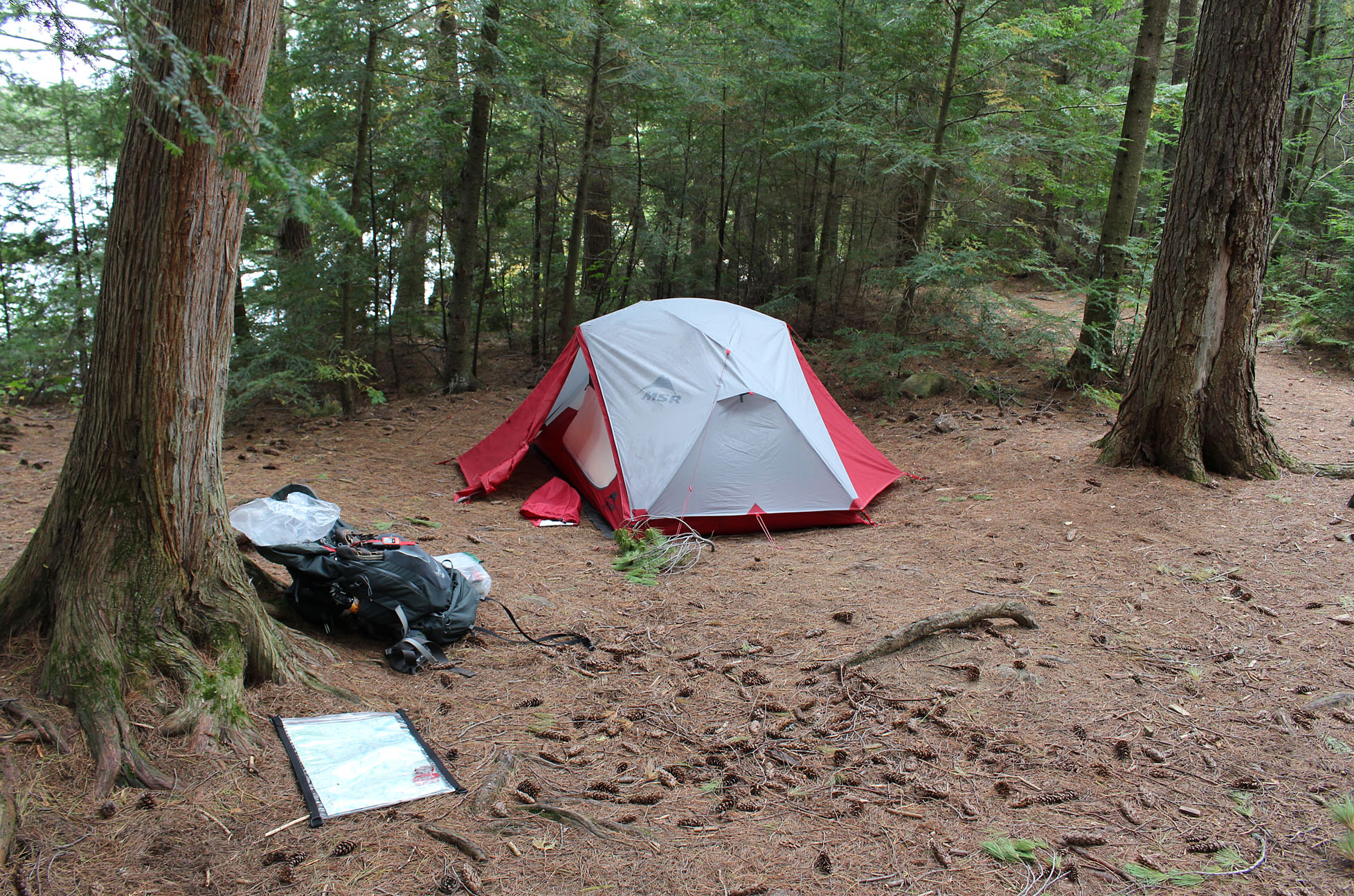
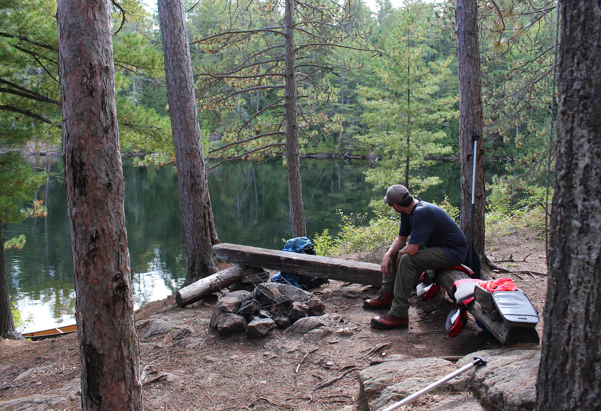
The 620 metre portage into Mouse Lake was easy and flat which is always a nice treat in Algonquin. Mouse Lake is a neat round lake! There are six sites in total on the lake and we picked the one on Mouse’s eastern shore that shared a beach with a neighbouring site. As with almost all beach sites there was a good landing spot and a good spot to bath. Our site is big but also quite protected with a flat spot for the tent.
We arrived quite early at just after 1:00pm which was a theme for this trip. We usually paddle until 4:00pm or 5:00pm so this half day of paddling is new for us and so far we were liking it! This also meant we could have a proper lunch instead of a quick meal (or just GORP) along a portage. Today’s lunch was rehydrated chili with blue Gatorade to help wash it down.
It was around 3:00pm that we heard the first rumbles of thunder in the north and we could see some dark blue sky towards the north and northwest. We had the tent already up by this point and we decided to take a quick bath in the lake before the storms arrived. After drying off we went in the tent and tried to get the weather band on our windup radio but we could not get a signal. We did get CBC Radio 1 and we were under a Tornado Watch! Time to tie down the canoe and place rocks on all the hooks around the tent. Aaron also took a strong stick to prop up the vestibule which would give the tent more support just in case shit hit the fan. While we were doing all this there was constant rumbles of thunder in the distance. We couldn’t remember the last time we heard such continuous thunder as it continued well after 5:00pm when we ventured back into the tent to lay flat on our backs to relax. Marianne tuned the radio to CBC again..
“BEE DOO BEE DOO BEE DOO…..Environment Canada has issued a Tornado Warning for North Bay, Powassan, Mattawa, West Nipissing – French River”………
WHAAAAAATTTTT!??!
Now we really weren’t sure what to expect but the constant rumbling and ever darkening skies clearly meant something was finally heading straight towards us. Luckily we picked a pretty sheltered spot with no widowmakers within range of falling on our tent.
As the storm approached we went out to the beach to view the clouds. A sharp clap of thunder soon told us we better get back into the tent. Supper over the fire wasn’t really an option this evening so we just had GORP. Around 6:30pm, after three and a half hours of constant rumbling, the storm finally arrived with lightning and heavy rain. Thankfully it didn’t get terribly windy. Our ground sheet did the trick and our tent didn’t flood though we did have standing water on two sides of it just outside. The storm continued until around 9:30pm with gusty winds. We were pretty sure we have never heard it thunder for 6 hours straight before.
Wildlife Sightings: Blue Jay, Black-capped Chickadee, Winter Wren, Hairy Woodpecker, Eastern Chipmunk, Red Squirrel, Ring-billed Gull, Common Loon, Canada Geese, Belted Kingfisher, People, American Robin, Brown Thrasher, Solitary Sandpiper, Bald Eagle, Dark-eyed Junco
Remember to: If there is the threat for rain cover the packs with rain covers while going back for the canoe at the end of a portage.
Day # 5: Mouse Lake to Erables Lake
Weather: A mix of sun and clouds. Breezy. High: 16 C Low: 13 C
By morning the winds from last night’s storm died down completely. We set our alarm early so we could have a nice relaxing morning of our favourite camping breakfast, pancake with peanut butter and jam!
We left our site around 8:30 am and made our way across Mouse Lake. Mouse Lake seemed to be the hang out for the local gulls as we saw them both yesterday and this morning.
The 1,720 metre portage out of Mouse Lake was our longest one for the whole trip and an interesting one. It had some uphill to it but overall it was relatively easy going. A bush/logging road crosses through it. We do own a map that illustrates these “roads” that criss-cross through the park. This particular road runs from Daventry to Kiosk.
We soon arrived at Mink Creek. It was wider than we expected given the thin blue squiggly line on our map and we actually had no lift overs!

After Mink Creek it was a quick up and then down a hill that made up the 190 metre portage to Big Thunder Lake. Big Thunder Lake is a nice small lake. Not sure how the lake got its name as even Mouse Lake is bigger and there are no cliffs surrounding it that would make thunder echo (Big Thunder)…?
Our last portage of the day at 1,580 metres was a meandering one that had more roots and rocks than the earlier longer 1,720 metre portage. Because of these few hazards the shorter portage actually felt longer! Along this portage we flushed a couple of Ruffed Grouse. On a calm morning their loud wingbeats can play mind games with you thinking that you flushed something big! At the end of the portage we met up with the couple from Barrie who weathered last night’s storm just as well as we did. We hope our soloist friend Wayne stayed dry as well.
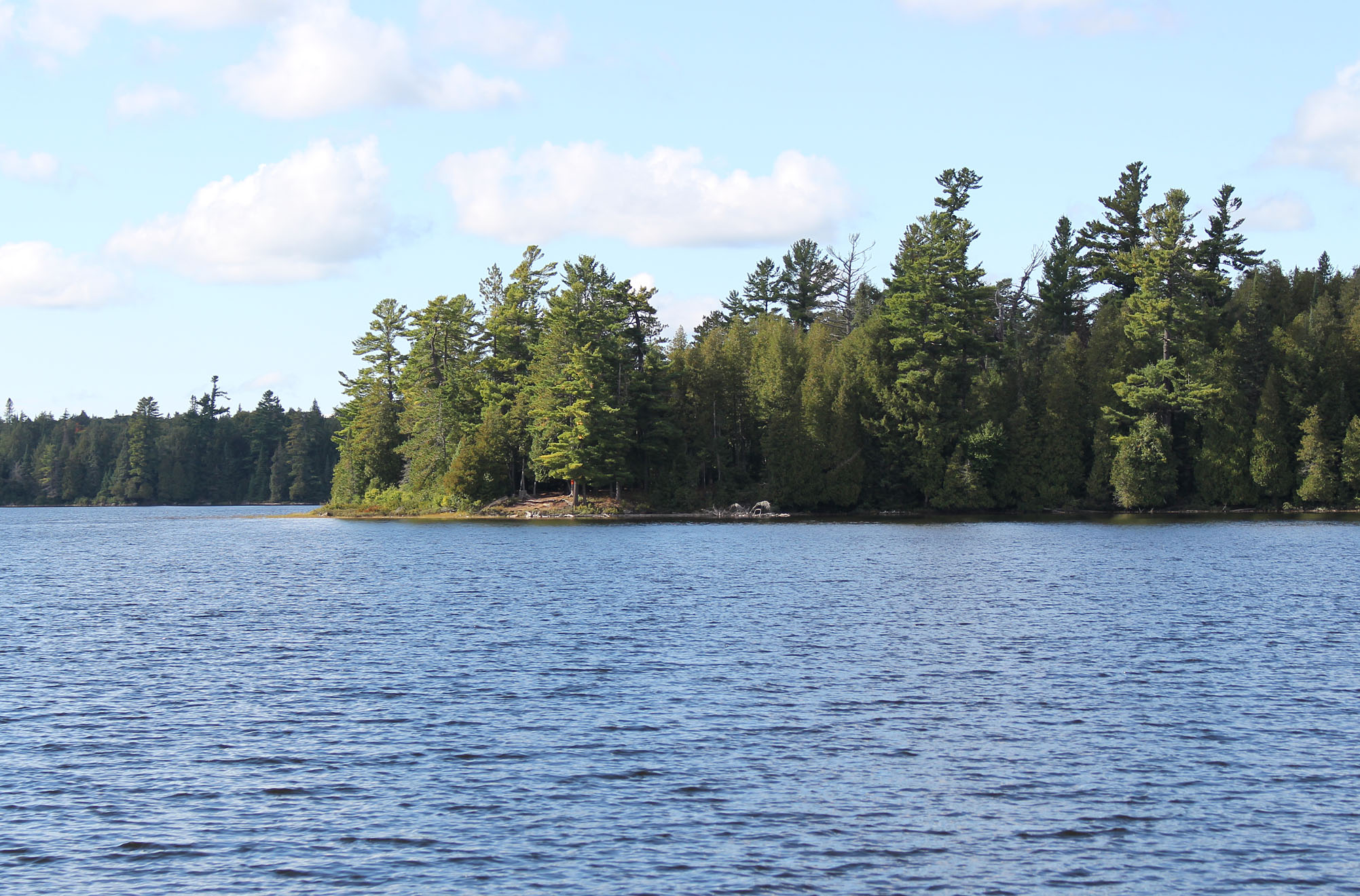
Erables Lake is a familiar lake to us and in our opinion one of the more beautiful lakes in Algonquin’s north. There are some nice island sites but with the breeze picking up we decided on a peninsula site towards the north end of the lake. For the most part we were out of the wind though we had a few light gusts come through. There is a poor landing at this site though the firepit has a nice seating area and there are 3 flat spots to pitch a tent. We could tell that people were here during last night’s storm as trenches were dug next to where there was a tent.
Arriving at our site just after 2:00pm we still had to pump water for lunch which was macaroni and cheese with dehydrated broccoli from our garden. Added to this was a vacuum sealed pack of tuna which we actually found in Canada! For some reason we have only ever found vacuumed packed tuna in the United States. Hopefully we find more in Canada because crossing the border (when it finally opens) for just tuna seems kinda silly.
A Red Squirrel spent most of the afternoon chattering away at us in protest that yet another camper has invaded it’s turf. The winds calmed down and we spend the rest of the afternoon looking for and chopping/splitting wood. We don’t bring a hatchet/axe with us into the backcountry as one slip up could be a very bad day and instead we use a collapsible saw that packs away very nicely. Not to say we haven’t had injuries with the saw, but a finger cut is better than an axe to the leg or a splinter in the eye.
Supper was a late one so we split a Mountain House Sweet and Sour Pork, pumped water for tomorrow, organized our packs, and had a nice sit at the fire as night fell.
Wildlife Sightings: Red Squirrel, Eastern Chipmunk, Red-breasted Nuthatch, Golden-crowned Kinglet, Common Loon, Double-crested Cormorant, Herring Gull, Ring-billed Gull, Black-capped Chickadee, People, Ruffed Grouse, Wood Duck, American Toads, White-throated Sparrow
Remember to: No remember to today!
Day # 6: Erables Lake to Three Mile Lake
Weather: A mix of sun and clouds. Slight breeze. High: 21 C Low: 12 C
Out of our tent by 5:30 am as we have a busy day of paddling and portaging ahead of us. Breakfast is “Super Awesome 2.0” which is Bob’s Red Mill Rice Breakfast. “Super Awesome 1.0” was the Bob’s Red Mill Mighty Tasty Cereal. We find that the rice breakfast cooks up quicker and doesn’t stick to your teeth, or the pot, as much.
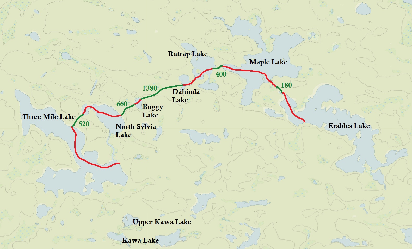
By 7:55am we were out on the water again. Today we were to explore another section of the park we have never visited before, but first a nice leisurely paddle through one of our favourite lakes in all of Algonquin Park, Maple Lake.
It was the perfect morning for a paddle! After we portaged a short 180 metres where we crossed the logging road again, it was sunny and calm. Fog hugged the lake in some sections but we had nothing but a nice clear view ahead of us.
Our favourite site on Maple Lake is an island at the lake’s north end though this time we turned west before we even get to that site and soon we arrived at the 400 metre portage to Ratrap Lake. All of today’s portages were pretty easy going with only a few climbs and some rocks to watch out for. Our longest portage of the day was at 1,500 metres between Dahinda and Boggy Lake and it turned out to be a really nice walk in the woods. For the third time we crossed the logging road and we flushed yet another Ruffed Grouse, this one being closer to the portage making Aaron jump.
Boggy Lake was not as “boggy” as we thought it would be. We were actually expecting more of what we saw a few years ago at Little Nadine Lake in the park’s interior which felt more like a bog instead of an actual lake. Both Dahinda and Boggy Lake have coniferous trees dominating making it feel more like lakes in Quetico.
At the end of the 660 metre portage from Boggy Lake to North Sylvia Lake we sat down for lunch which was a quick Backpackers Pantry Beef Stroganoff with Egg Noodles and Mushrooms. North Sylvia Lake is a small pretty lake with four sites on it. Paddling through North Sylvia we predict that the lake will look stunning in a few weeks when the fall colours peak. Unlike Dahinda and Boggy Lake, North Sylvia had more hardwood trees. Dipping our hand in North Sylvia’s waters it was actually quite warm!
The trickiest put in today was at Three Mile Lake after the 520 metre portage out of North Sylvia. It was very rocky with no real good way of getting in but as always we managed, though the canoe may have had a new light scratch on it.
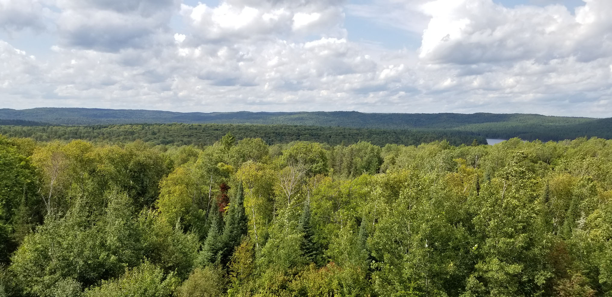
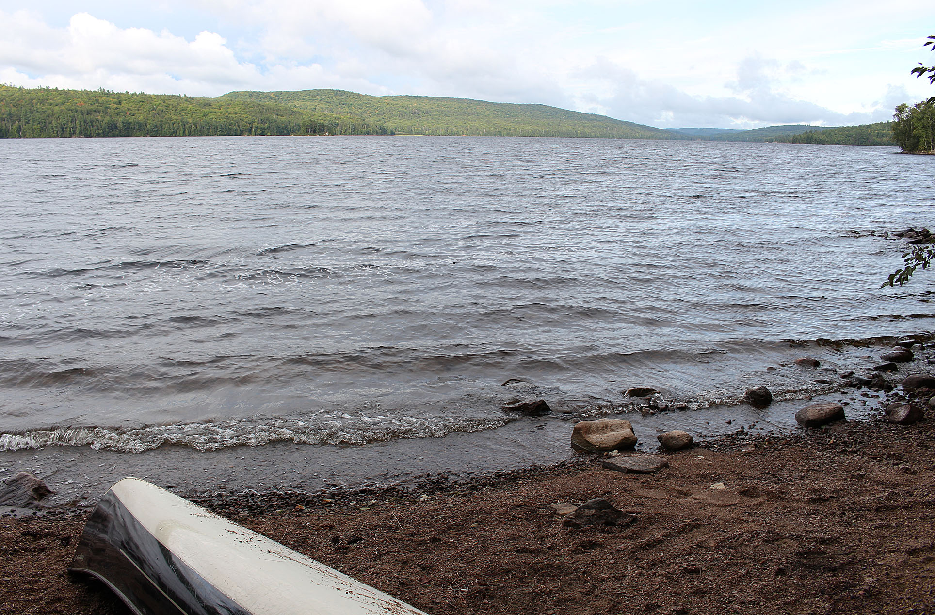
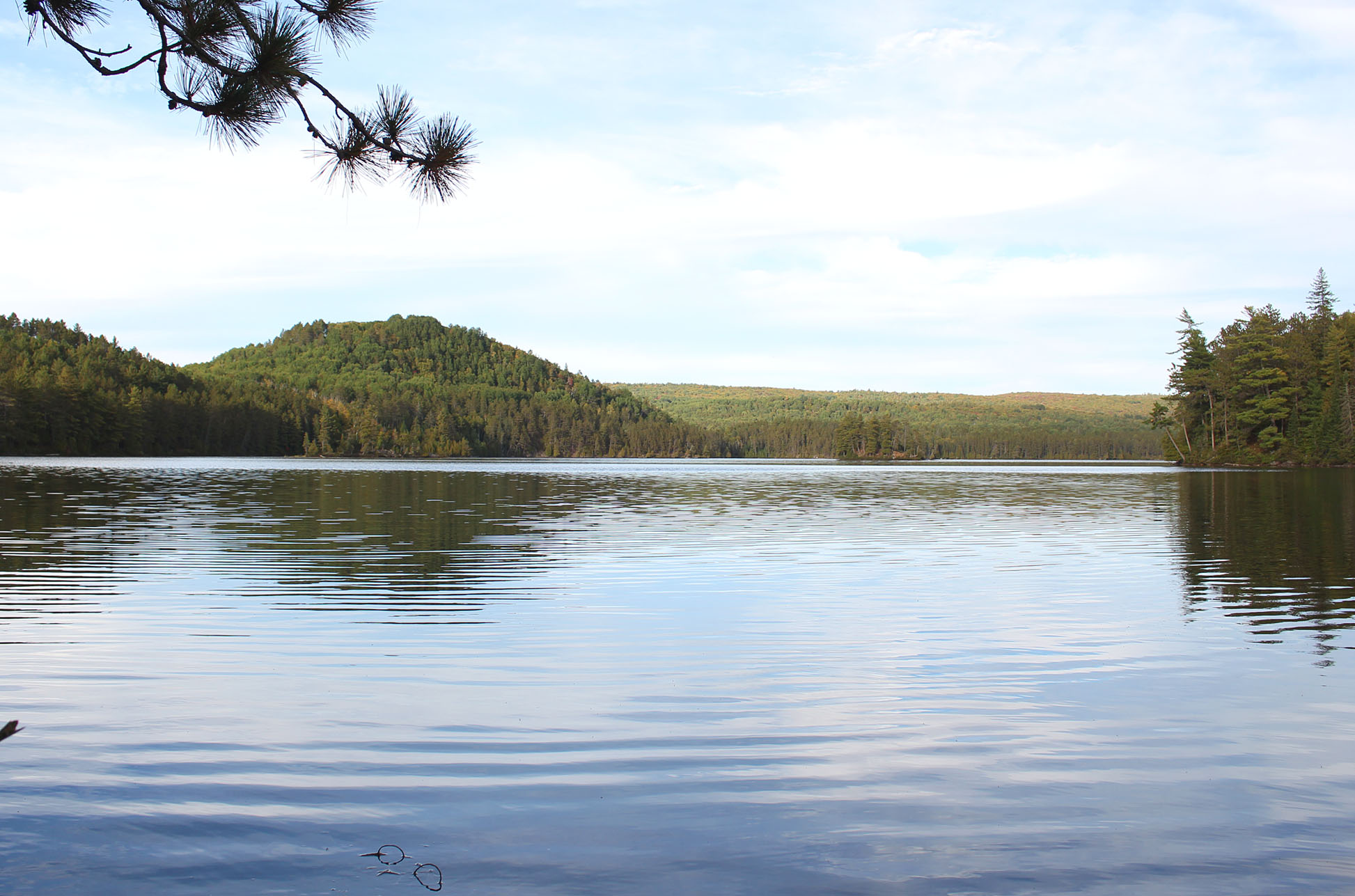
Three Mile Lake is a really nice lake! It was our first time here and as soon as we began the paddle we were impressed by its’ rolling hills.
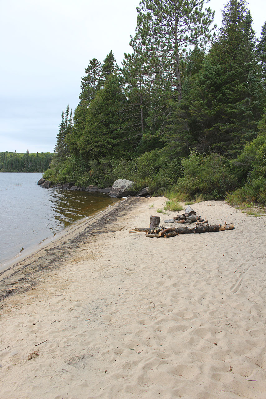
This seems to be a popular lake as we observed our first people today including three canoes and three kayaks. We had a little bit of a minor annoyance in the form of a headwind but we soon arrived at a nice beach site located south of North Sylvia Creek. Having the luxury of a beach we took full advantage of it and bathed right away, we also washed and hung our clothes on our rope/clothesline.
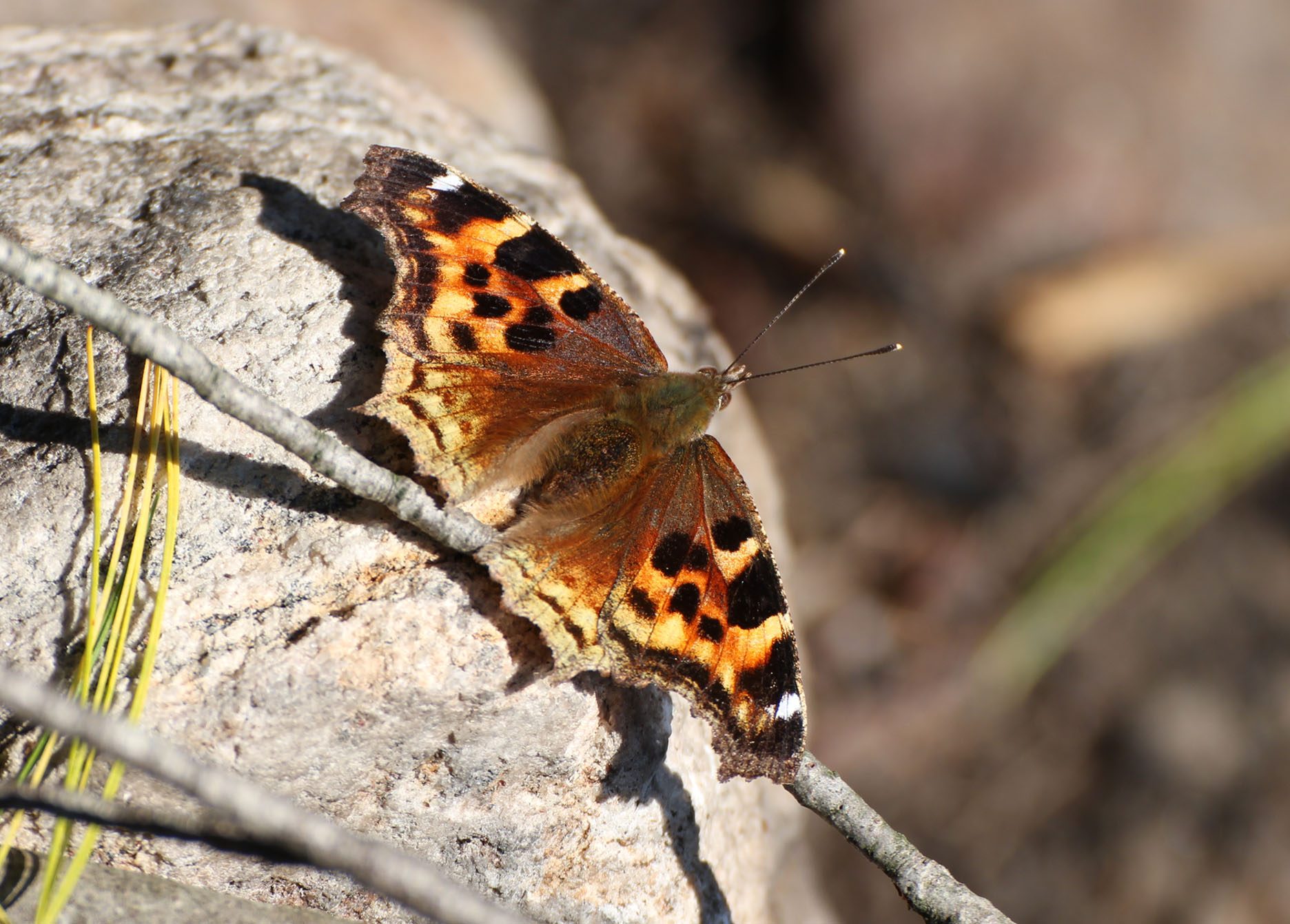
The site has a great seating area around a small firepit and a couple of flat spots for a tent. There were also a few Compton Tortoiseshell butterflies around our site and Marianne tried for some photos.
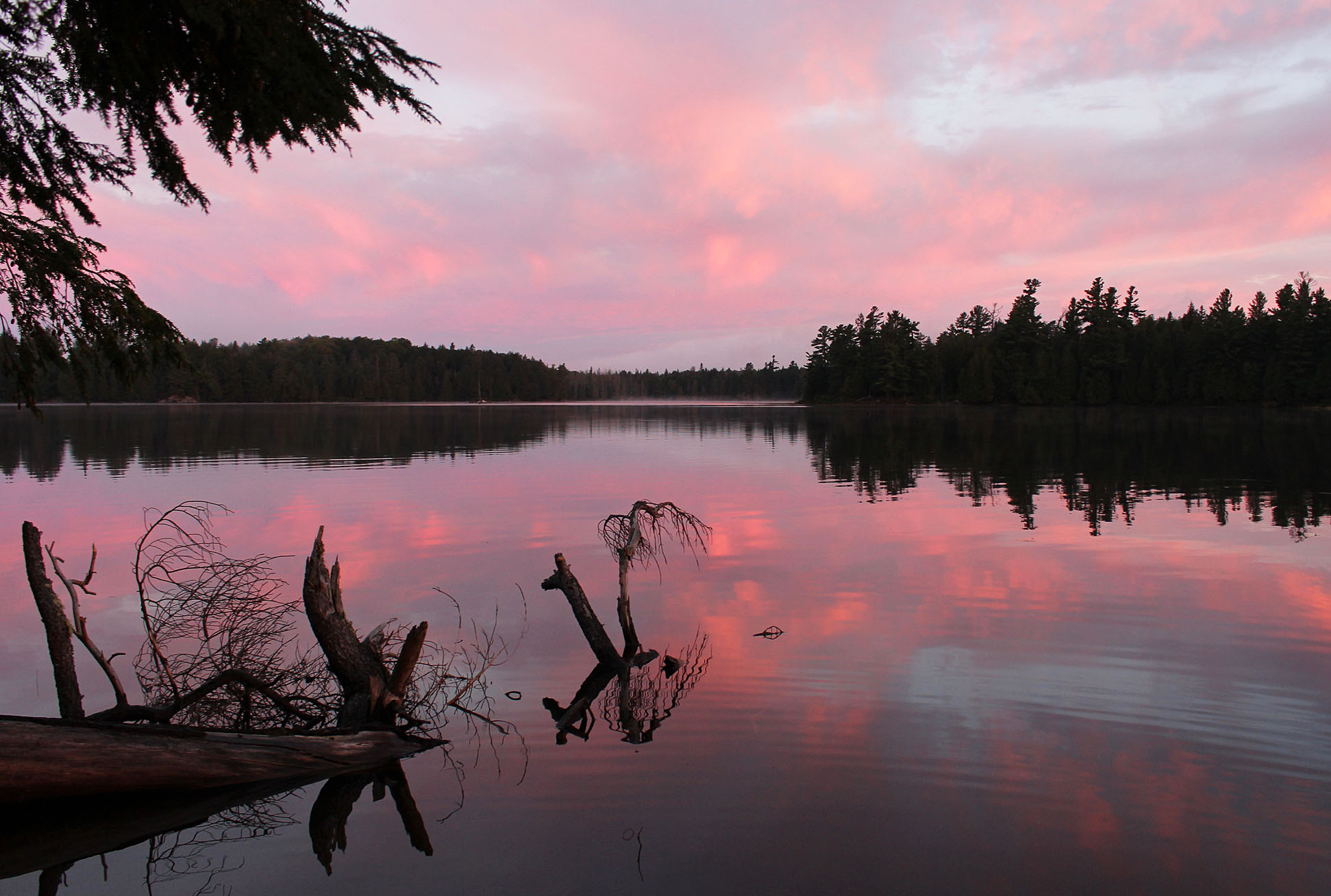
While looking for wood for tonight’s fire we found a few piles of moose poop. Tonight’s supper was bannock topped with our homemade dehydrated black bean hummus! We had a calm and clear night tonight, a stark contrast from last evening’s storms.
Today we had an excellent day of paddling!
Wildlife Sightings: Common Loon, Yellow-rumped Warbler, Red Squirrel, Red-breasted Nuthatch, Golden-crowned Kinglet, People, Brown Thrush sp., Hairy Woodpecker, Compton Tortoiseshell, Double-crested Cormorant, Common Raven, Ruffed Grouse, Bald Eagle, White-throated Sparrow, Great Blue Heron.
Remember to: We may have to buy a new map case. Ours got an ember on it from the fire. Hopefully just a minor fix.
Day # 7: Three Mile Lake to Bigger Lake
Weather: Mainly sunny with wind by mid day. High: 23 C Low: 13 C

Last night at around 2:00 am we were treated to the howl of wolves! They sounded like they were on the opposite side of the lake. This was the first time we have ever heard what is now known as the Algonquin Wolf in the park! The howling probably went on for about an hour? Hard to say because we fell in and out of sleep.

We entered Three Mile’s beautiful waters around 8:00 am. Today was our last day of mainly portaging as we make our way towards Biggar Lake. As usual we were the first people out on the lake.
Overall today’s portages were easier than yesterdays however the lakes were not as enjoyable as they all seemed the same and were somewhat boggy. Along the 510 metre portage from Sinclair Lake to Biggar Lake we flushed yet another Ruffed Grouse and observed some Black Bear scat, our first (and only) sign of bear this whole trip.
At 11:00am we arrived at Biggar Lake and boy was it windy! Just windy enough to be annoying while giving your arms a work out. Biggar Lake is a really nice lake, almost as nice as Three Mile Lake. Paddling into headwinds it was time to find a site. Unfortunately the site we wanted, a peninsula near the lake’s east end, was already occupied….shoot….Oh well, time for more head winds…
As we approached the narrow section of Biggar Lake we passed mediocre site after mediocre site. In the end that’s what we had to settle on, a very worn site along the north shore towards the western end of the lake. The seating area at the lake was pretty poor and it looked like the fire pit was moved, perhaps to an inappropriate spot near some tree roots. One tree root was actually sawed off…What is wrong with people!? We also got the feeling that Biggar Lake has too many sites for the size of the lake.
Lunch was egg noodles and veggies with some white cheese powder mixed in to make it creamy. Halfway through our trip now we spent some time dividing up the food evenly between our two packs. As the afternoon continued it got warmer, a little bit of a breeze through our site was much appreciated. As Aaron had an afternoon nap, Marianne sat by the lake watching canoe after canoe go by, all of them heading east. It’s a Friday afternoon and with this much boat traffic we must be in for nice weather this weekend! We haven’t been able to get the weather on our radio to know for sure and seeing so many people is a good sign!
As evening approached the local White-throated Sparrows began to sing, not with their full song of “Oh sweet Canada Canada Canada” but just little murmurings to communicate to each other. Perhaps they were already fall migrants. A Red Squirrel knew that winter was just around the corner and was busy gathering cones. It would climb up a tree, chew off a cone, and let it drop to the ground to gather later…..Except the ones that fell into the lake..
We were still full from lunch so we just had some bars and water for supper. We also had no fire so we had no smoke to keep the mosquitoes and no-see-ums at bay. Around 7:30 pm we retreated to the tent.
Calm and clear this evening. We hoped that tomorrow would be the same as we have two larger lakes to paddle being North Tea and Manitou Lake.
Wildlife Sightings: Ruffed Grouse, Red Squirrel, Common Loon, Double-crested Cormorant, Red-breasted Nuthatch, Golden-crowned Kinglet, American Robin, Yellow-rumped Warbler, Black-throated Blue Warbler, Clack-capped Chickadee, Blue Jay, White-throated Sparrow, Algonquin Wolf (heard), Dark-eyed Junco, Belted Kingfisher, Winter Wren, Hairy Woodpecker, No-see-ums, Mosquitoes.
Remember to: Buy a new ground sheet for the tent. Ours is beginning to split.
Day # 8 Biggar Lake to Manitou Lake
Weather: Mainly sunny with a slight breeze. High: 22 C Low: 12 C

We set the alarm for 5:05am this morning. We had some big lakes to cross and we wanted to get as far as we could before the possibility of the winds picking up after sunrise. Just 3 Kind Bars with a tea for breakfast (gotta have that morning morale!) and we left our Biggar site at 7:01am. We made our way to the 140 metre portage around some rapids, followed by some nice little falls at the 50 metre portage into Hornbeam Lake. After a 300 metre portage into Mangotasi Lake it was time to make the long paddle up North Tea Lake.
North Tea Lake is one of the more popular lakes in Algonquin Park and we observed people out on the lake fishing while others were just getting up to have breakfast. Paddling north into the lake’s east arm we had some minor headwinds. Have we had headwinds every day so far?
There are two portages into Manitou Lake, a 420 metre and a 580 metre. The 580 metre is supposed to have some nice falls and rapids so we decided on that one and we were glad that we did because they were great! There is a site along the portage beside the falls. Not sure if we would ever want to stay there as there would be a lot of foot traffic plus the roar of the falls all night.
At the end of the portage into Manitou Lake we expected more and probably stronger headwinds, but we were surprised and relived to see that it wasn’t bad at all! Hooray!!
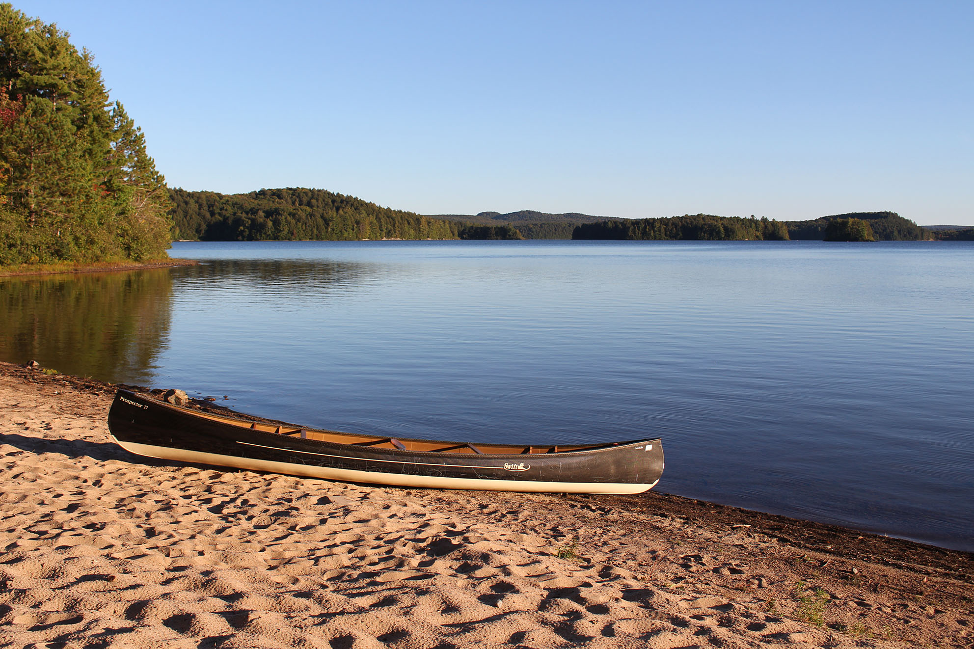
Manitou is a big gorgeous lake! There are island sites, beach sites, and we saw a boat with an outboard motor which is allowed on this lake. We hugged the west shore as to avoid any winds but in the end we probably didn’t have to take such extra precautions.. Better safe than sorry I guess.
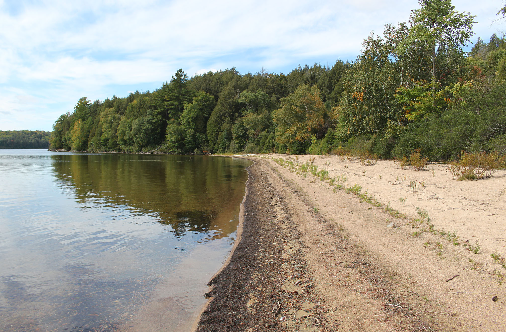
We made really good time today and even thought of making it further to Kioshkokwi Lake but the site we stopped for lunch along the north shore of Manitou Lake was way to nice to pass up! It was a beach site with a huge beach, one flat spot for a tent, and an excellent seating area!
As we were having a quick lunch of Backpackers Panty Pad Thai, five young girls ran around the corner. When they saw that we were occupying the site they apologized and went back. They were probably staying at the site around the other side of the peninsula we were on.
In the heat of the afternoon Aaron decided to go into the lake to have a swim, however after he stripped down the little girls came around the corner again, and this time they were in canoes! Aaron had to hide in our own canoe which was sitting on the beach until they left. When we could no longer hear any voices we both decided it was probably safe enough to strip down and take a bath. All the hazards of being in the backcountry I guess.
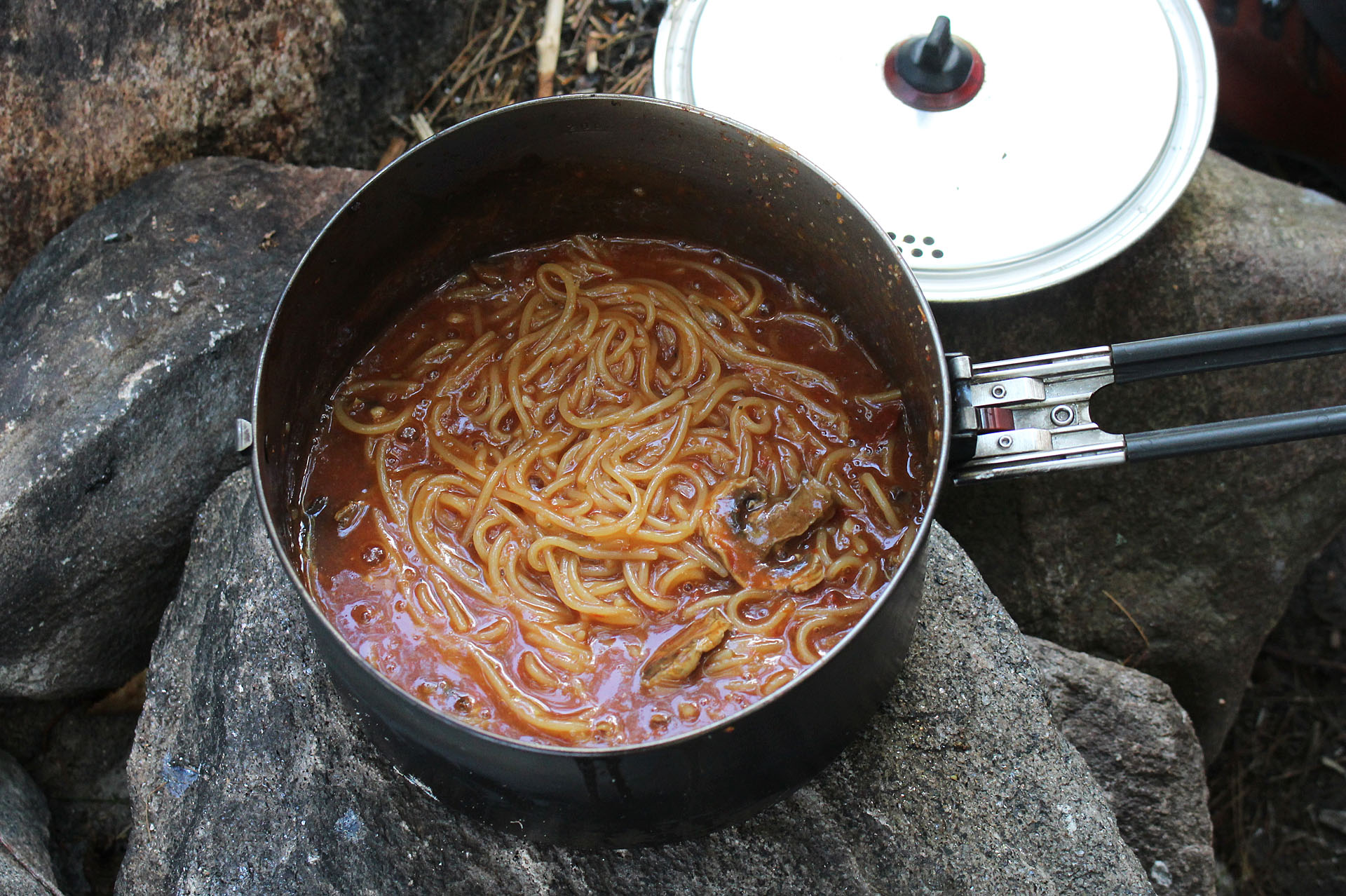
The rest of the afternoon was spent relaxing at our site. Looking around it was clear that almost all firewood has been picked clean. Luckily we found a downed cedar tree that would provide us just enough wood for tonight. There was some garbage in the fire pit so we burned it before cooking our supper which was spaghetti with a side of blue Gatorade to help wash down the rich tomato sauce.
Today was the first day of our whole trip that we got the weather band on our wind up radio. Looks like clear skies until Tuesday. We were treated with those clear skies tonight with a near full moon that lit up our site and even inside our tent.
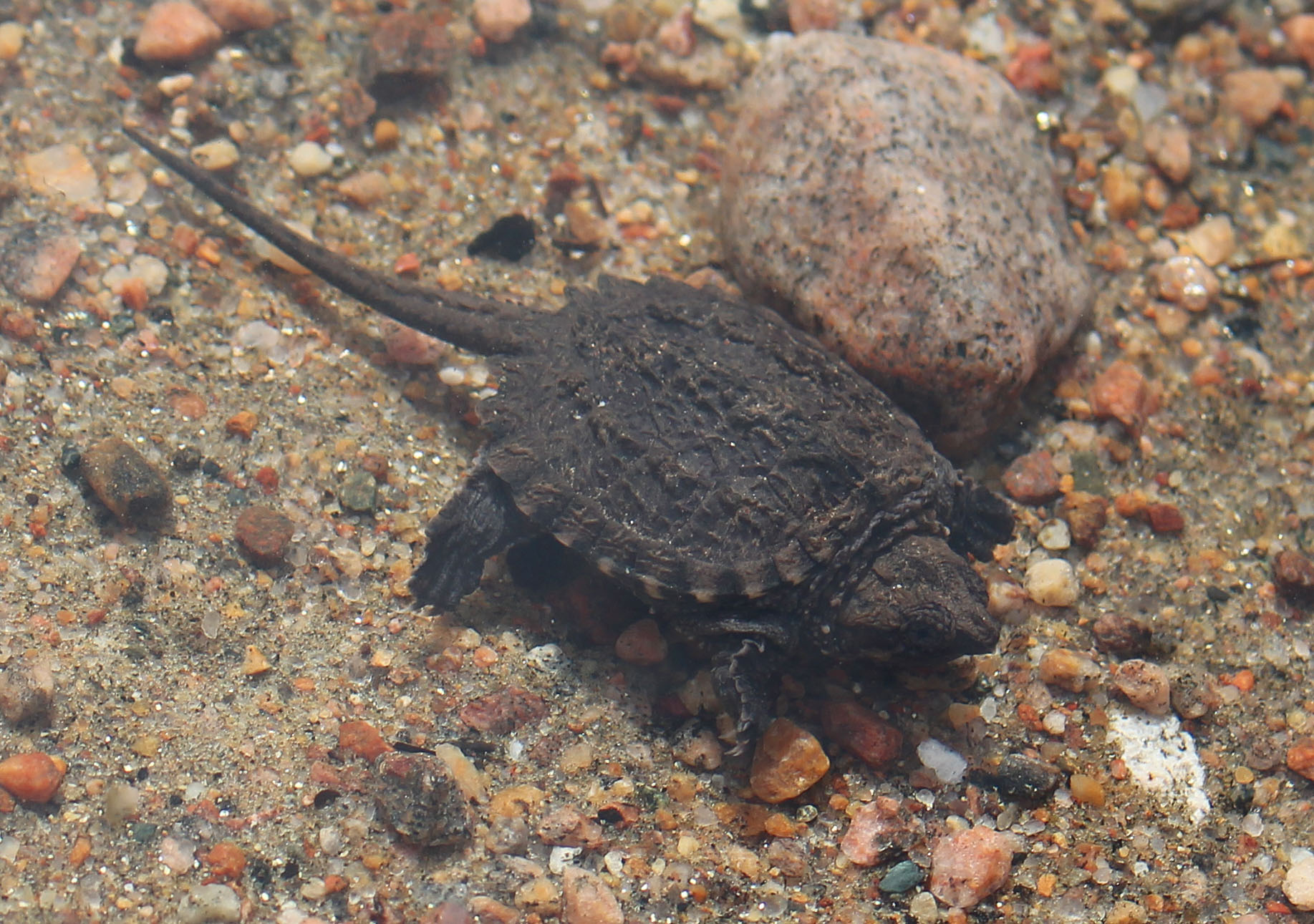
Wildlife Sightings: Canada Geese, Red Squirrel, Blue Jay, Common Loom, People, Belted Kingfisher, Red-breasted Nuthatch, Black-capped Chickadee, Golden-crowned Kinglet, Common Merganser, Ring-billed Gull, Double-crested Cormorant, Snapping Turtle.
Remember to: No remember to today! Ya!
Day # 9: Manitou Lake to Kioshkokwi Lake
Weather: Sunny with a slight breeze. High: 21 C Low: 7 C
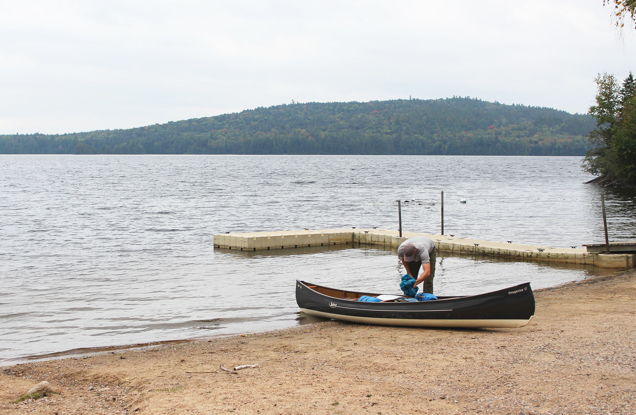
After a big oatmeal breakfast we launched from our private beach site. The bright morning sun was burning off the fog which was a delight to paddle through.
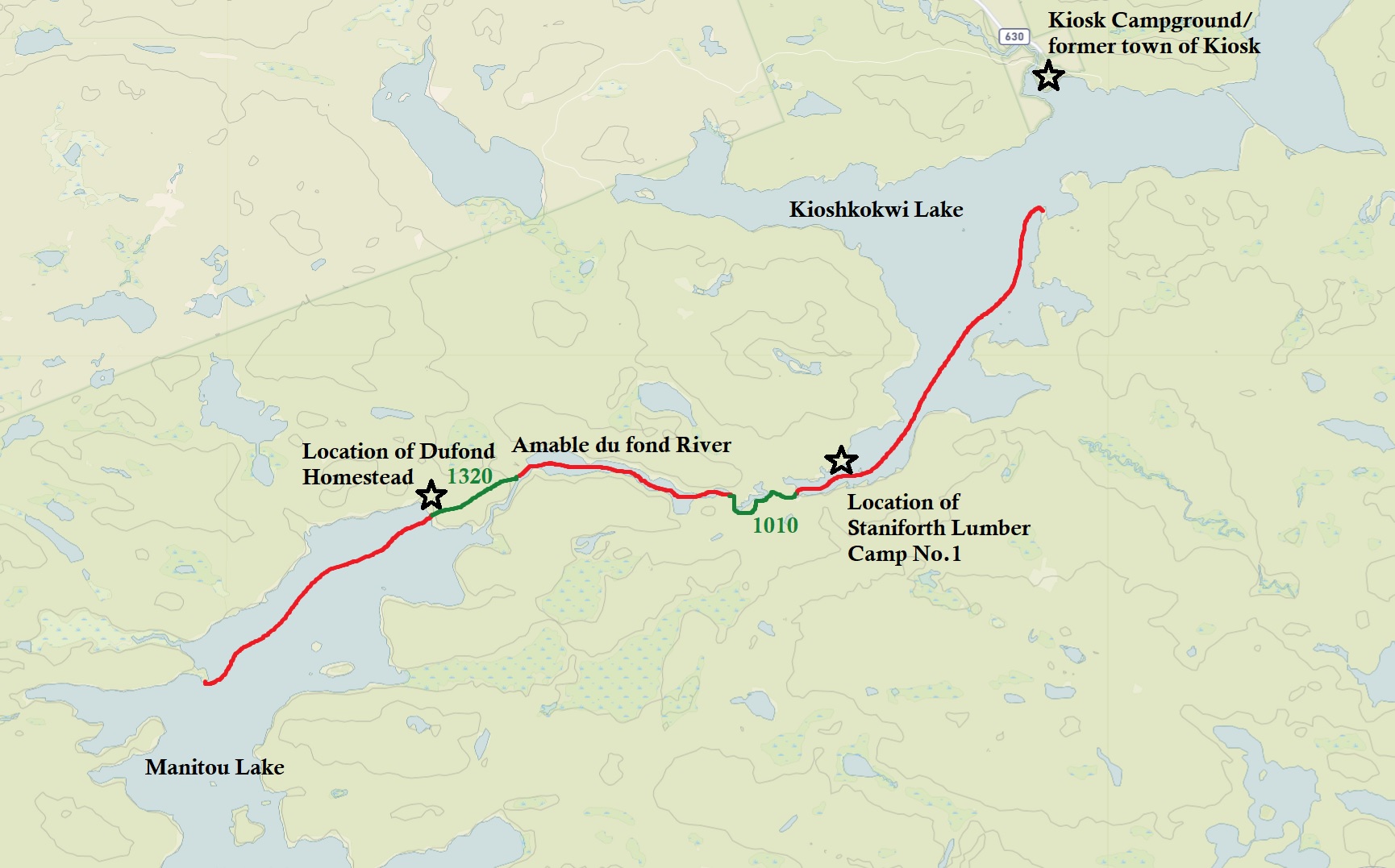
We had our last two longest portages for the trip today, a 1,360 metre followed by a 1,020 metre around the Amable Du Fond River. Our first portage at the end of Manitou Lake had a nice beach landing. We turned and gave beautiful Manitou Lake one last look. The lake is named after the great spirit Manitou which the descendants of the Dufond’s thought was in the body of a large water snake they observed when they first came to the lake.
At the beginning of the portage there is a clearing. This used to be the location of the Dufond Farm and homestead. The homestead was around from the 1880s to 1916. The Dufond’s were a large family of indigenous hunters and farmers that was first noted by the name Amable Dufond way back in 1829 by Alexander Shirreff. The reason Alexander Shirreff was in the park was to explore the land for a potential canal route between Lake Huron and the Rideau Canal, the later which was just being built. Amable Dufond was noted as having a hunting territory around Cedar Lake. The descendants of Amable Dufond had a homestead here at Manitou that had cows, horses and chickens. Perhaps the clearing we were looking at was where they used to grow crops including hay, potatoes, beans, root vegetables like turnips, and oats. Produce was sold to the lumber companies and it sounds like they had a pretty sweet sugar bush operation as well at Kioshkokwi Lake! Stepping things up even more they even had a mining claim back in 1888 somewhere here at Manitou Lake! Sounds like they had a pretty good thing going even before Algonquin became a Provincial Park! In 1916 the Dufonds were compensated for their land as the now established Algonquin Provincial Park didn’t want any permanent residents within the park boundary and the family eventually left.
The Amable Du Fond River is an 84 kilometre river that flows from Pipe Lake to Kawayaymog Lake, entering Algonquin Provincial Park into North Tea Lake, Manitou Lake, flowing into Kioshkokwi Lake, and then up to join the Mattawa River on the south end of Samuel de Champlain Provincial Park. Our first section of the river didn’t feel like a river at all as it got quite wide in this section with very little current.
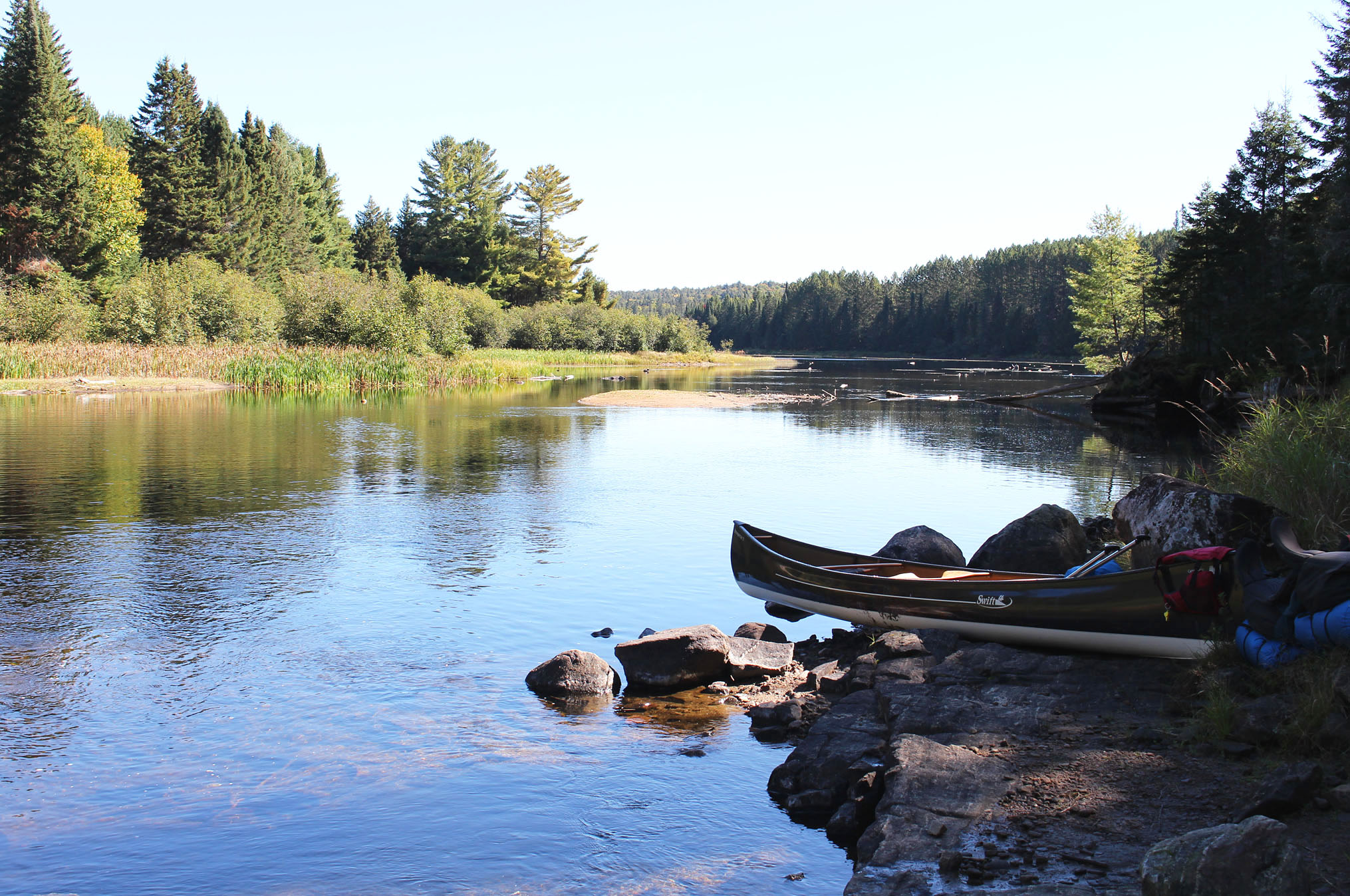
Finding the next portage was a little bit of a challenge. We couldn’t find the portage sign and there was a series of swifts around exposed rocks. We decided to get out and scout to see where we should paddle as we knew the portage was a little bit further downstream. The only way to go was through the swifts and it looked just wide enough for our canoe. We made it through a-okay with merely a scratch. Paddling upstream it probably would have a been a different story.
If the water is high enough, the 1,020 metre portage along the Amable du Fond River could be split into two shorter portages but that was too much of a bother to get out, onload all your gear, and then get back in again. This portage had some elevation to it and we had some nice views of the river along the way. Once again we crossed over a logging road.
Warm and sunny skies was the metrological recipe for the afternoon as we entered Kioshkokwi Lake and we observed some canoes on the water. A slight breeze was not annoying but a welcome cool off from the hot sun. Paddling east we saw these wooden cribs filled with rocks in the water, perhaps we were paddling a section of the water that may have once had a bridge? A little bit of research when we got home revealed it was in fact bridge foundations from the Staniforth Lumber Camp #1. We couldn’t find any information on when it would have been built though it seemed to be around 1940 at the earliest, around the same time the mill was established at Kiosk.
Paddling northwest on Kioshkokwi we headed for the peninsula site on the south shore we had two years ago, but unfortunately it was just snagged by a couple with their dog as we see them putting up their tent. Oh well. We ended up staying at a site across from Kiosk. It wasn’t a bad site, just a little bit worn as it was up on an eroded hill from so many people climbing it. The seating area was pretty crappy though there was alternate seating in the form of two big rocks. More importantly there was a good flat spot for a tent, two if you really needed it. The best prize that this site offered was a couple of grates that looked liked they were out of someone’s old barbeque. Definitely gonna use them tonight!
The rest of the afternoon was for relaxing while watching canoes go by. We observed what was probably a father fishing with his son from the shoreline, and we also saw those little girls again (with adults this time) paddling their way back to the launch at Kiosk.
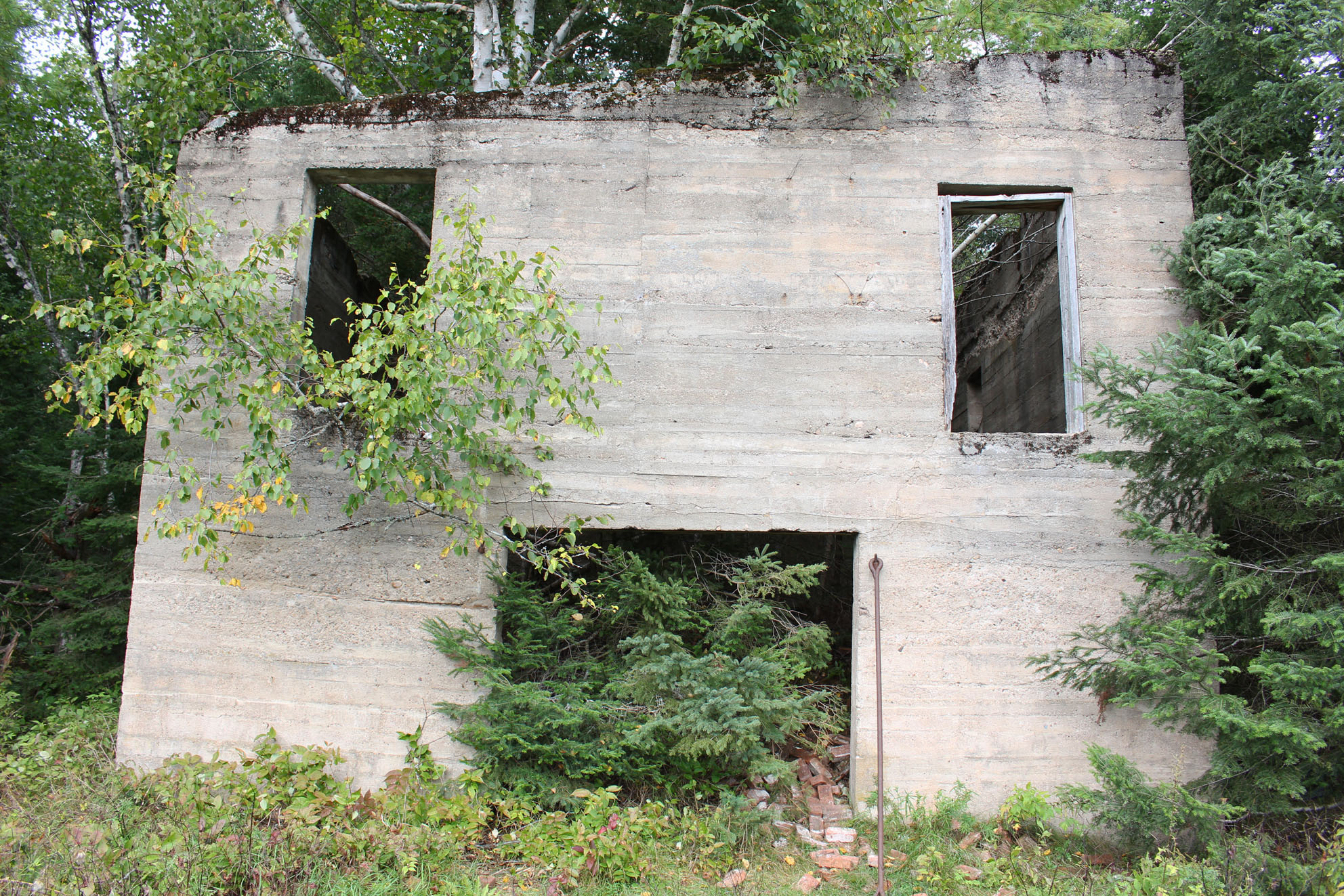
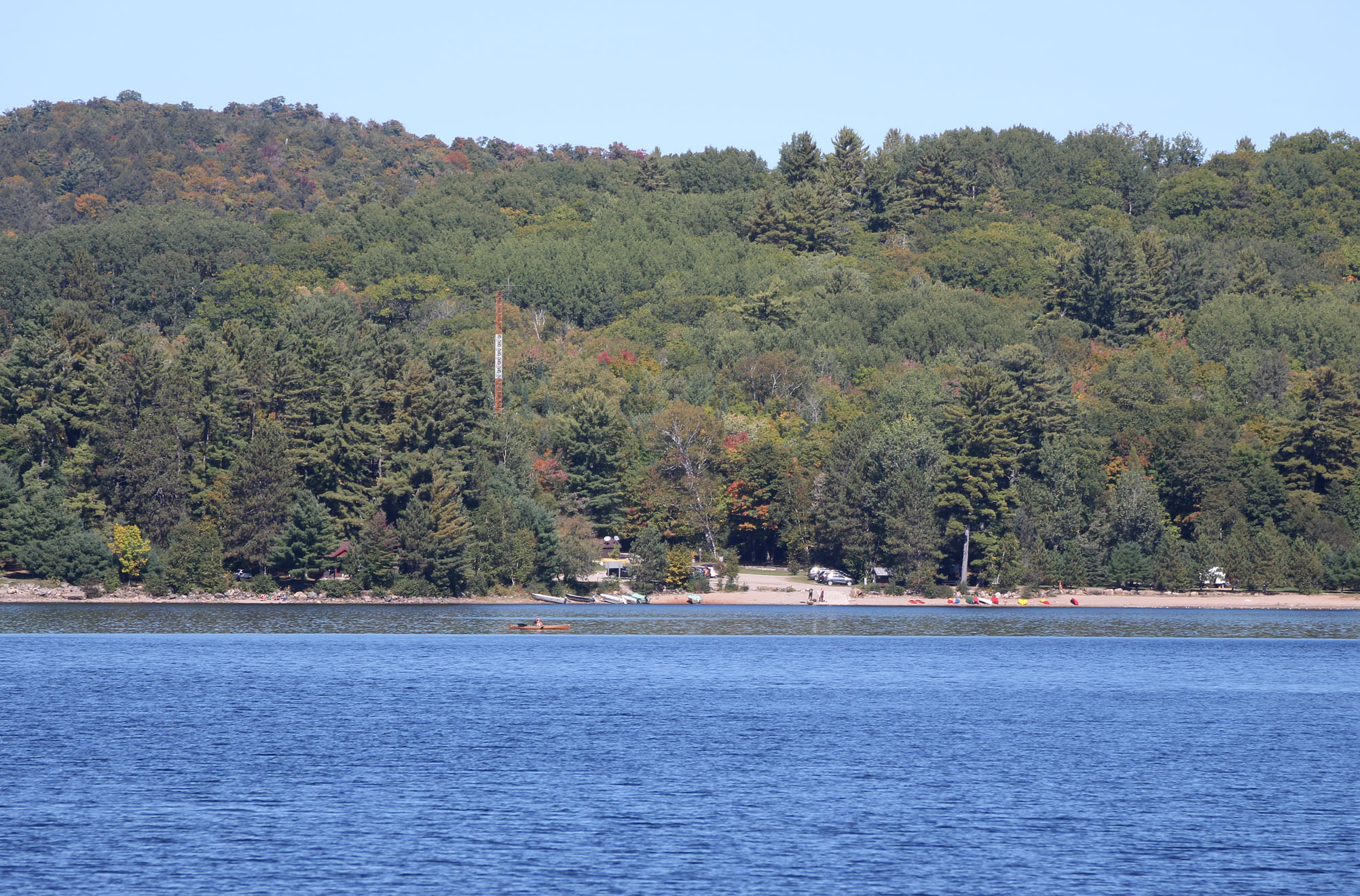
As mentioned earlier the Kiosk campground was across from our site and with binoculars we saw people taking canoes, kayaks, and boats with outboard motors out to enjoy this beautiful fall day! It’s actually hard to fathom that back in the 1970s this was a town of around 600 people with a pretty sizable lumber mill that employed over 200 in the town. Unfortunately a fire at the mill on the night of Friday the 13th, 1973 set in motion a series of events that would quickly turn Kiosk into a ghost town by 1994. Coincidence or not, (there was speculation that the fire was deliberately set) a year after the fire occurred Algonquin’s Management Plan came out and it stated that though logging would continue there will be no more lumber mills. As for the residents that called Kiosk their home the park wanted them gone and compensated them for their land. In 1995 the last train went through Kiosk and the railroad was ripped out a few years later. The town was gone with only a few cottages on lease remaining in the area.
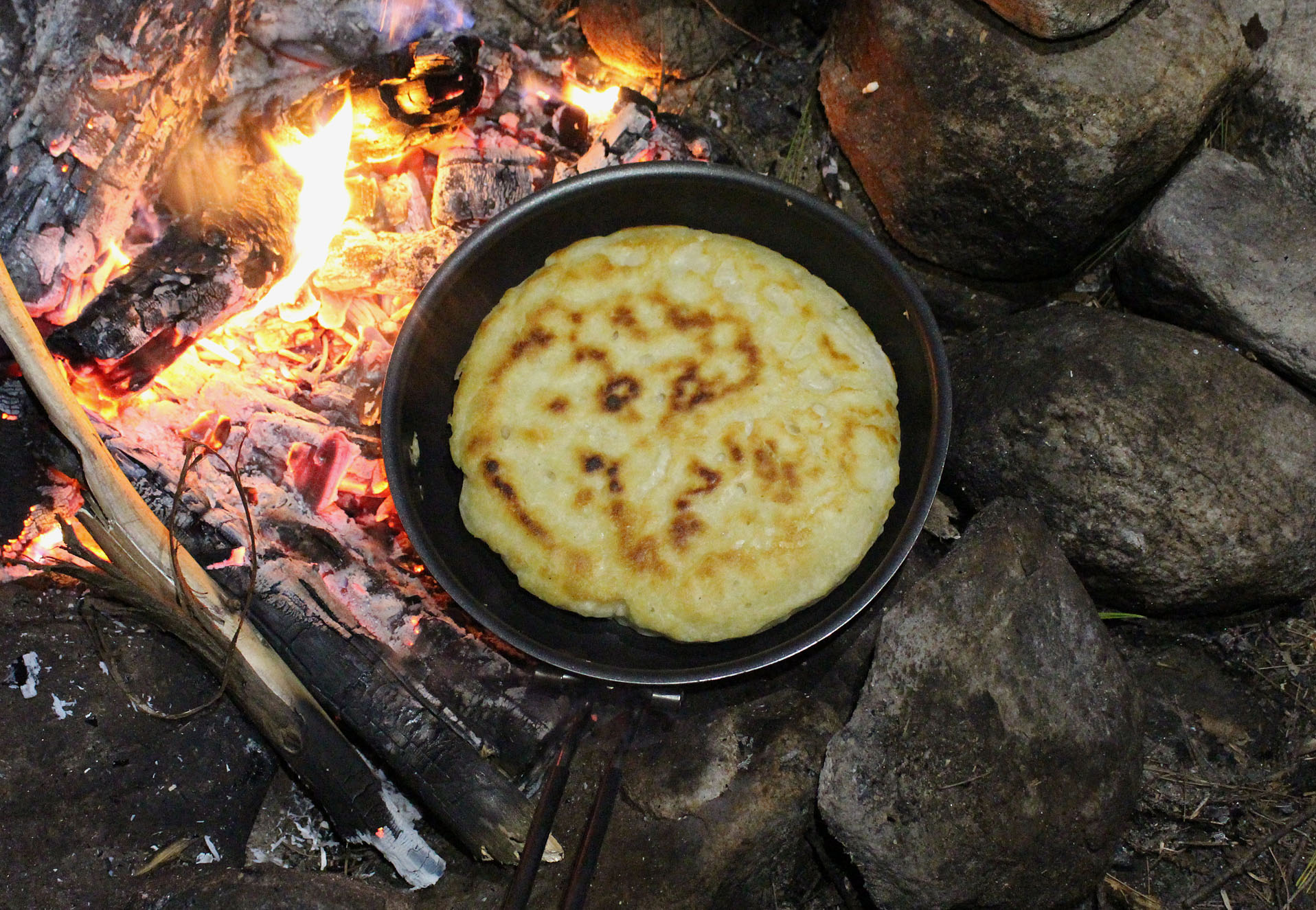
Later in the afternoon we gathered enough firewood to cook supper. Tonight is epic chili with bannock! Aaron even sprinkled some of the parmesan cheese powder on the bannock reminding us of Little Caesar’s Crazy Bread. It was so good! Wish we remembered to take a photo but we will definitely remember to do this again!
There is a large rock on Kioshkokwi Lake and we observed cormorants flying back to it to roost. Their croaking calls are probably one of nature’s least attractive in the avian world, though Marianne loves to imitate it much to Aaron’s disdain.
While enjoying the fire this evening we planned the rest of our trip. We were supposed to get back to Brent by Wednesday, but listening to the weather band it sounded like there was quite the weather system coming in later on Tuesday. It wouldn’t be so bad except that we had to cross Cedar Lake to get back to the launch. Should we bail out a day early so not to risk being wind bound on Cedar Lake? How many days would we be wind bound if we risked staying until Wednesday?
Wildlife Sightings: Red Squirrel, Blue Jay, Black-capped Chickadee, Red-eyed Vireo, Pine Warbler, Common Loon, Double-crested Cormorant, People, Common Raven, Palm Warbler, Dark-eyed Junco, American Crow
Remember to: Adding parmesan cheese powder to bannock is epic!
Day # 10: Kioshkokowi Lake to Laurel Lake
Weather: Mainly sunny with a slight breeze. High: 23 C Low: 8C
Having an awesome grill at our site called for an awesome breakfast so pancake with peanut butter and jam was in order! While Aaron was making the pancake, Marianne got the weather band again. No change in the forecast. It was go time!
We were supposed to stay on Cauchon Lake tonight but instead we decided to push on as far as we could without getting too exhausted, like to Laurel Lake or Aura Lee Lake. This would mean that all we would have to do tomorrow is get up early and hopefully paddle Cedar Lake before it gets too windy.
Around 8:00am we paddled our way past Kiosk and underneath the old rail bridge, making our way southeast towards the 640 metre portage into Little Mink Lake.
Instead of portaging the 640 metre into Little Mink Lake, followed by a 450 metre portage into Mink Lake, we portaged along the old railbed, making us skip Little Mink altogether. Walking along the railbed is nice and level but it’s quite noisy with the sound of loose slag. Here we met a soloist heading north back to Kiosk. Looks like many people prefer to do it this way.

Pretty descent headwinds when we arrived on Mink Lake and of course everyone else we met were heading in the opposite direction with those blessed tailwinds! Luckily after the 460 metre portage into Cauchon Lake the winds were lighter, probably thanks to the hills surrounding the lake. We saw a single motorboat on the lake, most likely a cottager getting in those last few days before it’s time to close up for winter.
We had a quick freeze dried meal (Mountain House Sweet and Sour Pork) at our Little Cauchon site for lunch. Judging by the firepit it looked like no one has camped here since we were here a week ago.
Around 3:15pm we reached the 140 metre portage into Laurel Lake. From the Little Cauchon end the portage is all downhill to Laurel Lake which is easier on the lungs but harder on the knees. There is a small waterfall at the Laurel Lake end which we paddled to for a closer look. At this point it was close to 4:00 pm and we decided that maybe this should be as far as we go. We grabbed the first site right across from the waterfall/portage. We could just hear the waterfall from the site which is kind of nice as the nights have been real quiet, the type of quiet that a mouse would sound as big as a bear if your imagination go the better of you. The site has a great seating area made up of old rail ties. There is one spot for a tent and it’s a small spot. If you climbed up a hill there is another potential spot for a tent but it’s not as level. The thunderbox was in what we thought an odd location. You would think it would be up the hill as well but surprisingly it was close to the water.
It should be mentioned that we are pretty strict when it comes to staying on your designated lake and we have been burned twice by squatters (in Killarney). Earlier we stated that we had Cauchon Lake reserved for tonight so clearly we were going against what you could call a code of ethics when it comes to the backcountry. If we could make an argument it would be that before our trip we went on the Ontario Park’s reservation site and saw that only one site was booked on Laurel Lake for tonight (there are 5 sites total) with the neighbouring lakes hardly having any reservations. Given the time of year, the date (it’s a Monday), and the forecast calling for crappy weather for the next 3 to 4 days, the chances of us interrupting someone else’s trip was next to none. Arriving at 4:00pm also helps. Most travelers have found a site by this point.
Having a nice take out/put in at this site we waded into the shallows and took a quick bath right before we saw a canoe in the distance. We wondered if they were paddling our way, either to look at this site or maybe head towards the portage? Instead they took a site on Laurel’s northwestern shore. Later in the evening we could just make out the sound of a guitar.
No supper or fire for us tonight, just some GORP and water. We tried our radio again but we cannot get the weather band and we just barely got CBC Radio 1 in. We actually had a Federal election today that was called only 6 weeks ago by Justin Trudeau and the Liberals. When we wake up tomorrow will Trudeau still be Prime Minister of Canada? ……Probably..
Wildlife Sightings: Red Squirrel, People, Common Loon, Common Merganser, Merlin, Double-crested Cormorant, Herring Gull, Red-breasted Nuthatch, Black-capped Chickadee, Dark-eyed Junco, Compton Tortoiseshell, Spotted Sandpiper, Belted Kingfisher.
Remember to: No remember to today! Yeah!
Day # 11: Laurel Lake to Brent
Weather: Cloudy and windy. 20 C

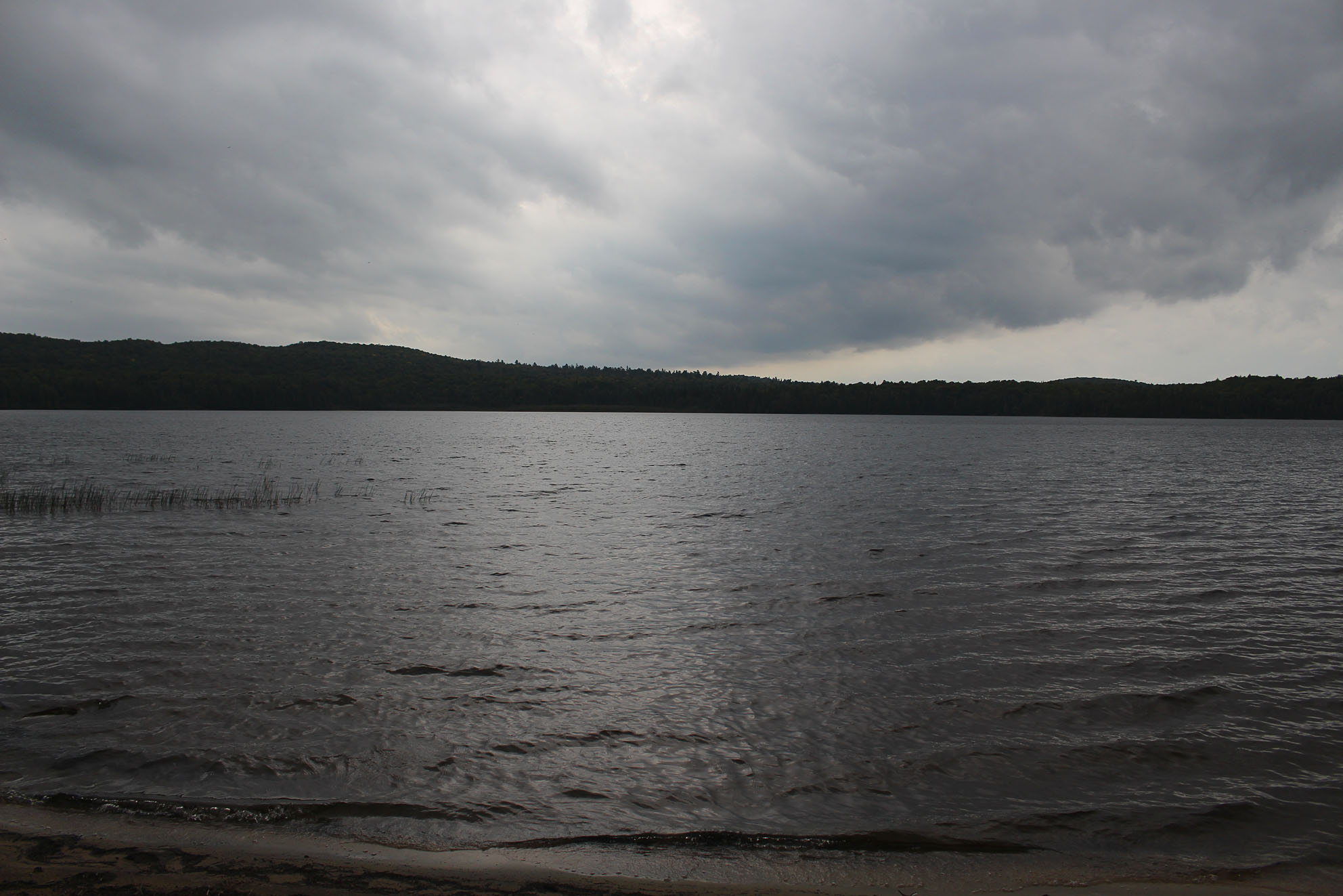
Up and out of the tent in the dark with honey oat cereal along with a tea by the light of our headlamps. It was very mild out and we could already hear a slight breeze. Clouds dominated the sky and we are under a rainfall warning.
In the predawn hours with our headlamps on we paddled the calm waters to the other side of Laurel Lake finding the 280 metre portage into Aura Lee Lake. It was still fairly dark out and we left the headlamps on for the first carry. We were glad the portage we were travelling was one we were familiar with as we just hiked it a week ago. We also made sure we were quite vocal this time so not to surprise any wildlife as we sang “Why can’t we be friends” by WAR. As a side note those are the only lyrics we know….or need.
Aura Lee Lake was also very calm. This was the lake we were supposed to camp on tonight, but not this time. Paddling our way into Little Cedar Lake we eventually got to where Cedar Lake opened up and held our breath. Boy were we lucky as it wasn’t bad at all! The winds were out of the southwest so the hills around Cedar Lake protected us as we hugged the west shore on fairly calm waters. In the eagerness of getting back to Brent it felt like a long paddle. As we approached the section where Cedar Lake opens up even wider we could see some waves, along with some white caps towards the direction of the Nipissing River.
After a short break at a site to pee and stretch our legs and arms it was time for the final slog into the waves. We had some swells to deal with which hit our canoe from the side. This made it difficult to get any forward momentum with Aaron doing all the steering and Marianne paddling as hard as her arms could manage. We made it back to the launch by 9:30am.
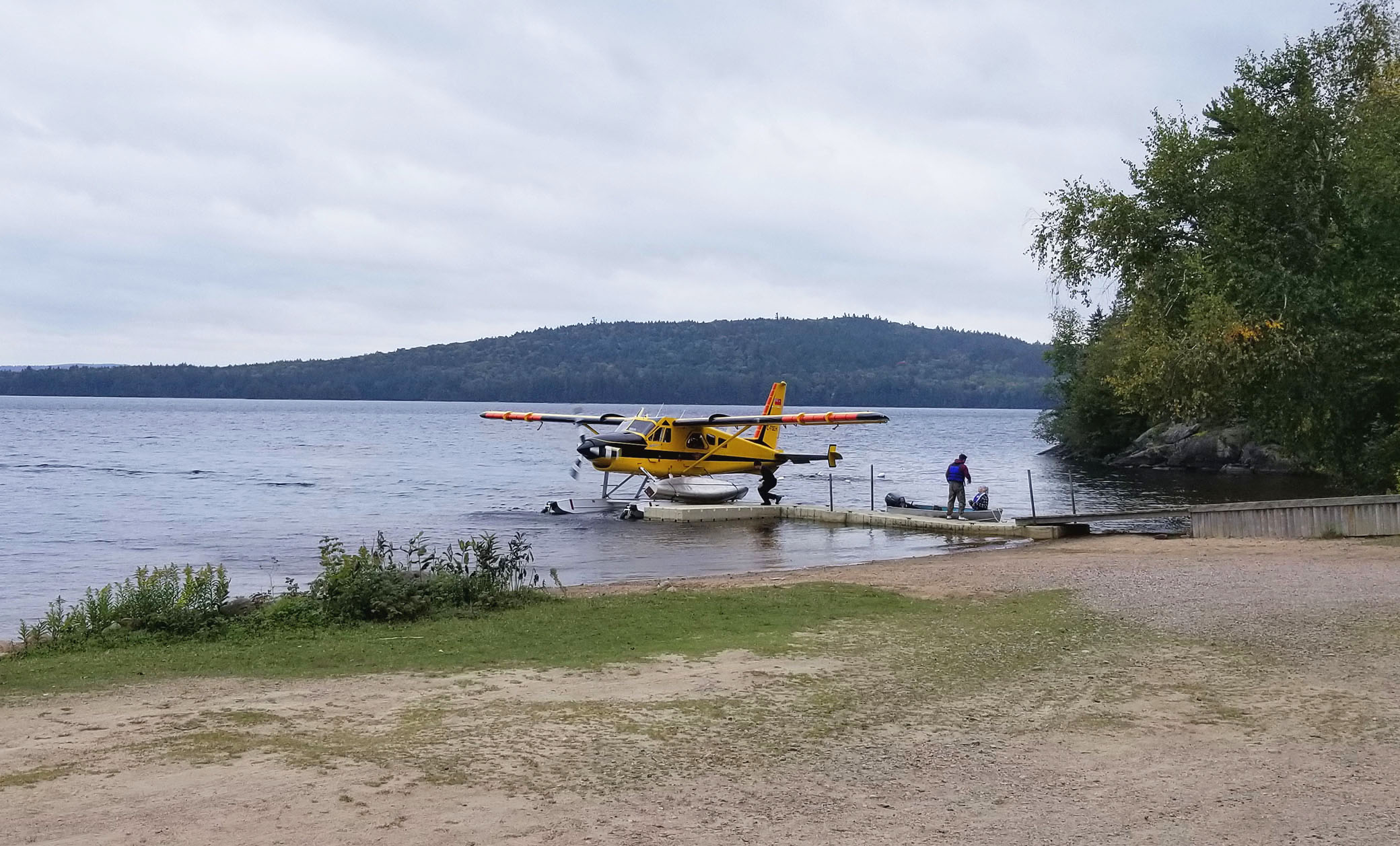
While packing our stuff back into the car a floatplane with a canoe attached flew in for a landing. A couple of park wardens were dropped off from doing some backcountry maintenance on Burntroot Lake. Wonder if they were getting out before the bad weather as well? Probably.
For us it was back down the 40 kilometre Brent road for a nice hot shower at Samuel de Champlain Provincial Park, and then back to the cottage to spend the rest of our vacation. Though we bailed out a day early we had an excellent trip! The rainfall warning was also no joke as it rained for 3 days straight starting the night we got out!
Though not our first choice for a backcountry trip we can always count on Algonquin Provincial Park for an enjoyable time in the outdoors! This was our 6th backcountry canoe trip to Algonquin and there are many lakes and portages we haven’t explored yet. We’ll be back again!
Wildlife Sightings: Common Loon, Bald Eagle, Canada Goose, People, Red Squirrel
Remember to: Come back to Algonquin again!
Click The Link For More Trip Reports: http://www.backcountrybalkwills.com

Thank you for posting the pictures and writing about your adventures!
LikeLike