
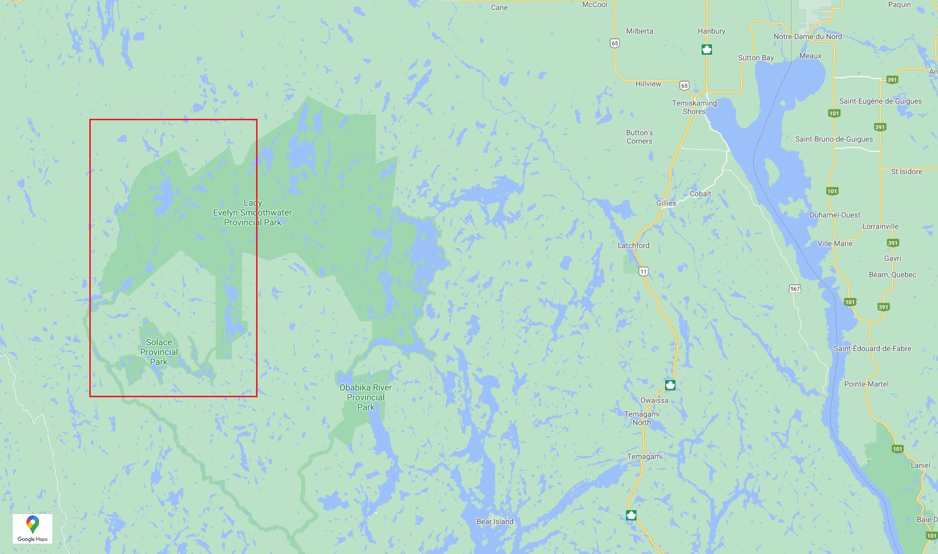
Planned Route
Total Days: 9 days (+2 max windbound days)
Total Kilometres: Approx. 127 kilometres
Total Portages: 37
Total Portage Length: 19.535 Kilometres or 19.105 kilometres
Longest Portage: 2.7 kilometres (Gamble Lake to Junction Lake)
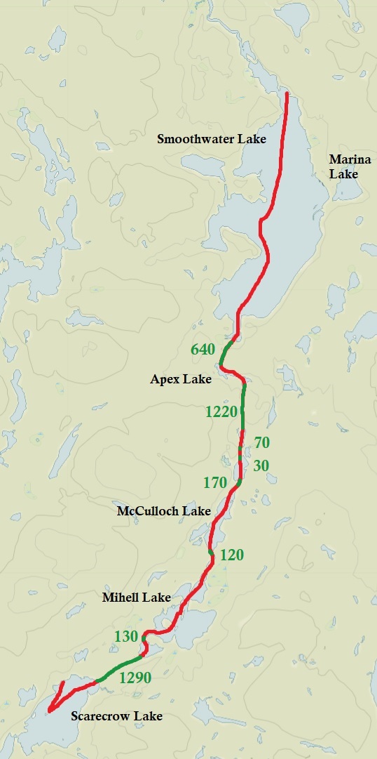
Route: Montreal River Launch – Montreal River – Lady Dufferin Lake – Montreal River – SMoothwater Lake – Apex Lake – No Name Lake – No Name Lake – McCollough Lake – Mihell Lake – No Name Lake – Scarecrow Lake – Woods Lake – Little Scarecrow Lake – Regan Lake – Melanson Lake – Tooth Lake – Carrying Bar Lake – Biscuit Lake – Einer Lake – Solace LAke – Samson Lake – Bill Lake – Pilgrim Lake – Benner LAke – Bluesucker Lake – Florence Lake – Florence River – Duff Lake – South Lady Evelyn River – Dees LAke – North Everlyn River – Chance Lake – Gamble Lake – Junction Lake – Sunnywater Lake – Wilderness Lake – Marina Lake – Smoothwater Lake – Montreal River – Lady Dufferin Lake – Montreal River – Motnreal River Launch
Actual Route
Total Days: 6.5
Total Kilometres: 59 kilometres
Total Portages: 16
Total Portage Length: 5.850 kilometres
Longest Portage: 1.210 kilometres (No Name Lake to Scarecrow Lake)
Average Daytime High: 12 Celsius
Average Nightime Low: 4 Celsius
Actual Route: Montreal River Launch – Montreal River – Lady Dufferin Lake – Smoothwater LAke – Apex Lake – No Name Lake – No Name Lake – McCullough Lake – Mihell KLake – no Name Lake – Scarecrow Lake – No Name Lake – Mihell Lake – McCullough Lake – No Name Lake – No Name Lake – Apex Lake -Smoothwater Lake – Lady Dufferin Lake – Montreal River – Montreal River Launch
Maps Used: Chrismar Temagami 4 (Northwest and Sturgeon River), Jeff’s Map Temagami (North), Ottertooth Maps (Smoothwater, Ishpatina, Solace, Upper Yorston, Florence, Tretheway), Hap Wilson’s Temagami: A Wilderness Paradise.

While we have visited Algonquin Provincial Park multiple times, almost paddled Killarney completely, and even drove the day and a half it takes to get to Quetico, the Temagami canoe area has always been at the bottom of our list. Why? Maybe it was because our first and only trip in mid June of 2013 was miserable as we almost got eaten alive by bugs. Even so that is no reason to never return to one of Ontario’s most epic canoe regions where both flat water and white water abound!
Located in northeastern Ontario the Temagami area is a combination of both crownland and provincial parks including Sturgeon River P.P., Lady Evelyn Smoothwater P.P., Marten River P.P., Obibaka P.P. and Solace P.P. If you are a Canadian resident overnight camping on crownland is free. To camp in one of the Provincial Parks (minus Marten River) it is a whopping $32.50 per night! This makes it kind of expensive for couples and especially for the solo paddler!
For reserving provincial parks in Ontario the standard rule of thumb is to book 5 months ahead of your start date, however for Temagami it is only 2 weeks prior to your start date. Wonder why it is different? For remoteness Temagami is comparable to Quetico, and when you look at the map Temagami may in fact be more remote in some locations. In parks like Algonquin and Killarney your chances of running into another traveler in the backcountry is pretty high, whereas in Temagami there are areas that you may not see people for days. Some sections are also pretty remote so this may be a trip you bring either a satellite phone or some sort of beacon just in case.
Let’s face it, the year 2020 hasn’t been a good year for most people. With the spread of the novel coronavirus Covid- 19, the whole province of Ontario was in lockdown by the month of March. This included not only backcountry camping in Ontario Parks but even on crownland! When the backcountry reopened we hoped that a 2 week canoe trip would be the one experience we could participate in with little to no negative outcomes. Keeping up with the theme of 2020 being a dumpster fire we couldn’t even finish a successful canoe trip. In a combination of crappy weather and failing gear our second trip to Temagami would be listed under the “attempted route” category, just like our first one back in 2013.
Our starting point would be from the Montreal River, located south of the town of Gowganda on crown land. We had three goals for this trip, the first was to hike Ontario’s highest peak, Ishpatina Ridge at 693 metres, the second was to paddle and portage through the more remote Solace Provincial Park, and the third was to camp on Florence Lake, a beautiful lake of virgin forest. We only accomplished one of these, and we did it twice.
Day # 1: Montreal River Launch on crownland to Smoothwater Lake, Lady Evelyn Provincial Park.
Weather: Light rain in the morning. Thunderstorm and winds in the afternoon, tapering off in the evening. High: 17 C Low: 10 C

After staying overnight at the Auberge Inn in Temiskaming Shores, we made our way through surrounding farmland followed by clear cuts of forest as we turned down Beauty Lake Road. After driving by a couple of logging roads we arrived at the public launch beside the Montreal River. Only 5 other vehicles were here when we slid the canoe in the water at 9:15 am. We had a nice leisurely upstream paddle and passed beside what looked to be the foundation of a bridge. Maybe there used to be a bridge to reach tracts of forest to be harvested.

A family of four River Otters played hide and seek with us in the water all the while making interesting chirping and hissing sounds that make up their repertoire. Wood Ducks and Common Mergansers were the most common waterfowl we observed. The Common Merganser, one of the most common waterfowl we encounter on any canoe trip, are entertaining to watch as they scudder in front of you instead of taking flight.
Continuing south the Montreal River widens and we entered the small but lengthy Lady Dufferin Lake. Visible on the eastern shore was a cottage. A brothel once stood here during the 1930s to 1960s and whether this is the same building, or someone who bought the property rebuilt here, we don’t know. The only entertainment we were to encounter on Lady Dufferin Lake was head winds though the forecasted rains mainly stayed away with only the occasional light drizzle.
After Lady Dufferin Lake we entered the Montreal River again and we paddled over the invisible park border into Lady Evelyn Smoothwater Provincial Park. Established in 1973, Lady Evelyn Smoothwater Provincial Park is a wilderness park protecting old growth forests including stands of white and red pine, is the location of Ontario’s highest peak, and has a combination of flatwater, whitewater, and scenic waterfalls.
We arrived at our first big lake for the trip, Smoothwater Lake. A campsite with a sandy beach is located where the lake and river meet and we got out here to stretch our legs and check out the site. It looked like someone was recently here as there was a dry imprint on the ground where a tent once stood.

We initially wanted to paddle to Smoothwater Lake’s eastern shore and stay at the more desirable beach sites, but with west winds and forecasted thunderstorms we decided instead to paddle the western side and aim for a site near this section of the lake.
Located on Smoothwater Lake’s eastern shore and visible from a canoe is a white cross among the trees. The only information we could find regarding this anonymous memorial is that it was erected in memory for three individuals who drowned on Smoothwater Lake.

Turning away from the memorial we began our nearly 2 kilometre paddle into the headwinds. A Common Grackle bolted out from the trees along the eastern shoreline with a Merlin in hot pursuit! Luck was with the Grackle and it out flew the mini falcon to the shelter of the trees at the lakes western shore. After witnessing this life and death struggle we soon encountered our own perils as the sky grew dark in the west and before we could even react, a storm was on top of us! It was a nerve-racking experience as we were practically out in the middle of the lake! The rain was pouring down, west winds made any forward momentum a challenge, and with lightening striking nearby we wondered if our names will be synonymous with a white cross if we didn’t find refuge soon! We managed to make it to an island and clambered onto the rocky shore, finding a little bit of shelter in the trees. We did have our rain gear on but it was still a miserable situation. Marianne must’ve been more frightened than she originally thought as her legs were shaking a bit, and Aaron tried to find the campsite that was supposed to be nearby. After Aaron located the spot and the rain tapered off to just light showers, we loaded the canoe again, paddled over to the island, quickly set up the tent, and hid inside. It was just after 1:10pm.

While taking her off her rain pants, Marianne noticed that her knee was wet. Her raingear was no longer as waterproof as it once was. As for our first site for the trip, it was small with a pretty poor landing. The spot for the tent was slightly sloped and there was no seating area around the firepit, which really didn’t matter as it was way too wet to burn anything. A brand spanking new thunderbox lit up the site with its fresh wood and shiny new chain!
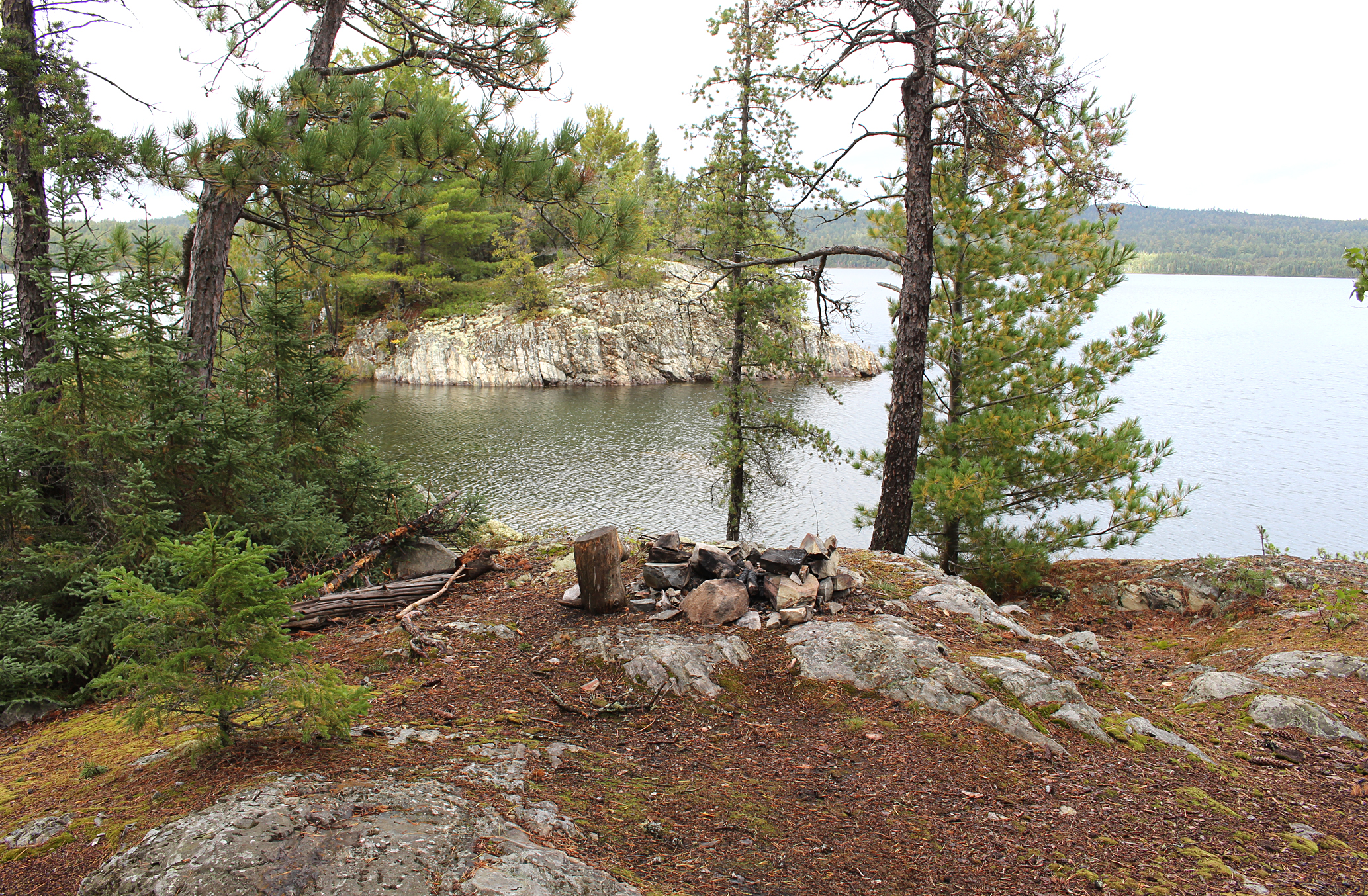
Eventually the rain subsided to a light drizzle and by early evening it finally quit, so we got out of our tent to grab some dry clothes out of our dry bags. The sun came out long enough to enjoy a supper of chili and black bean hummus. This supper, like many on our trips, included dehydrated vegetables from our garden. We hung up some of our wet clothes in hopes that they will at least begin to dry. We finally got the the chance to check out our island site, and though this may not be the most desirable site on Smoothwater Lake there was a great view of surrounding rolling hills.
Though we didn’t see any other paddlers today, we could now just barely see three canoes at the beach site on the far eastern shore. Tonight we were in bed before 9:00pm. We definitely had an interesting first day on our trip!

Wildlife Sightings: Ruffed Grouse, Belted Kingfisher, River Otters, Merlin, Common Grackle, Bald Eagle, Red Squirrel, Common Loon, Wood Duck, Mallard, Common mergansers, Mosquitoes, People, Herring Gull, migrating Canada Geese.
Remember to: no remember to today….really?
Day #2: Smoothwater Lake to Mihell Lake
Weather: Cloudy with some sun. Breezy. High: 13 C Low: 4 C

We had on and off winds last night with a light breeze dominating when we woke up this morning. The thermometer read 4 degrees Celsius so we wore many layers while having breakfast (oatmeal), pumped water, and took down the tent. We embarked around 8:50 am with a welcomed light tailwind as we paddled to the far south end of Smoothwater Lake.

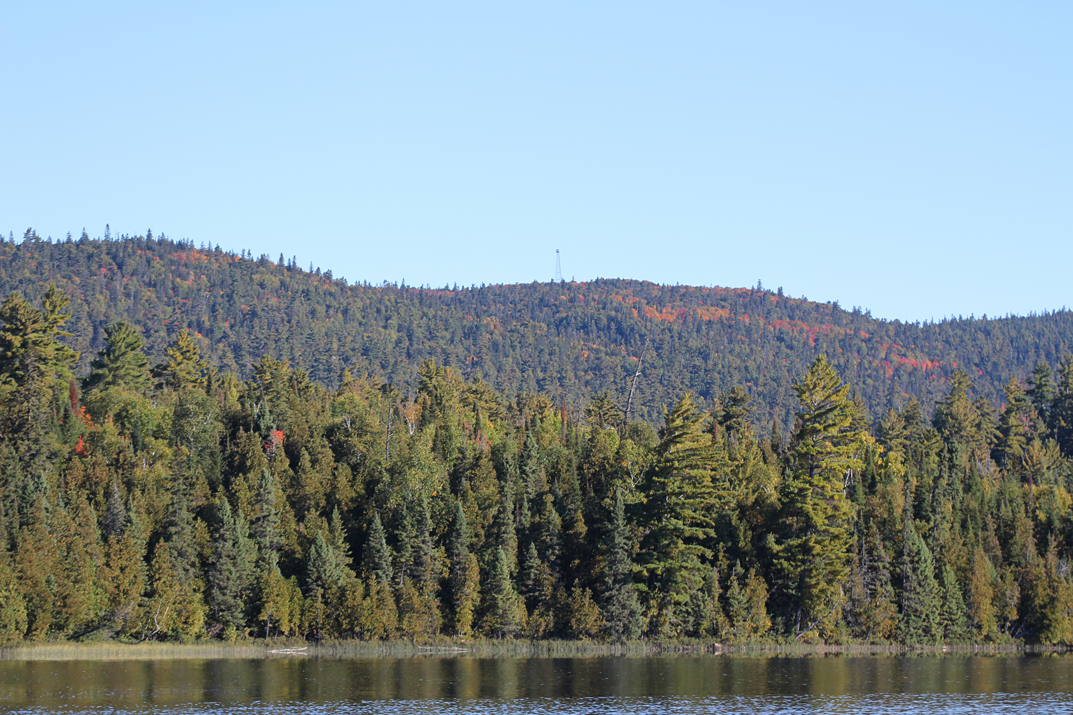
Our first portage of the trip was a 640 metre into Apex Lake. Overall it was a fairly easy portage with not much incline to it. After the tiny but scenic Apex Lake, a series of other portages lay ahead including a long 1,220 metre as we made our way towards McCullough Lake. The portages for the most part were relatively flat with the only obstacle being some mud to negotiate around. The 30 metre portage had what looked to be a natural archway to it which was pretty neat. After a 130 metre portage we entered Mihell Lake. Here we got our first view of the Ellis Tower, the decommissioned fire tower at the top of Ishpatina Ridge. This would be our destination tomorrow.

We checked out the site on Mihell Lake to see if it was worth staying at. We were thinking of saving the 1,290 metre portage into Scarecrow Lake for tomorrow if the site here wasn’t taken as well as met our credentials (like a flat spot for the tent). This is the only site on Mihell Lake and it was a large with an okay firepit close to the lake. Unfortunately there was a big dead pine tree near the firepit which made for a sketchy situation. Marianne walked up a small hill past the firepit and found a nice flat spot for the tent with plenty of room to sit nearby. No thunderbox to be found so there was the odd toilet paper bomb way at the back of the site, thankfully away from the tent.

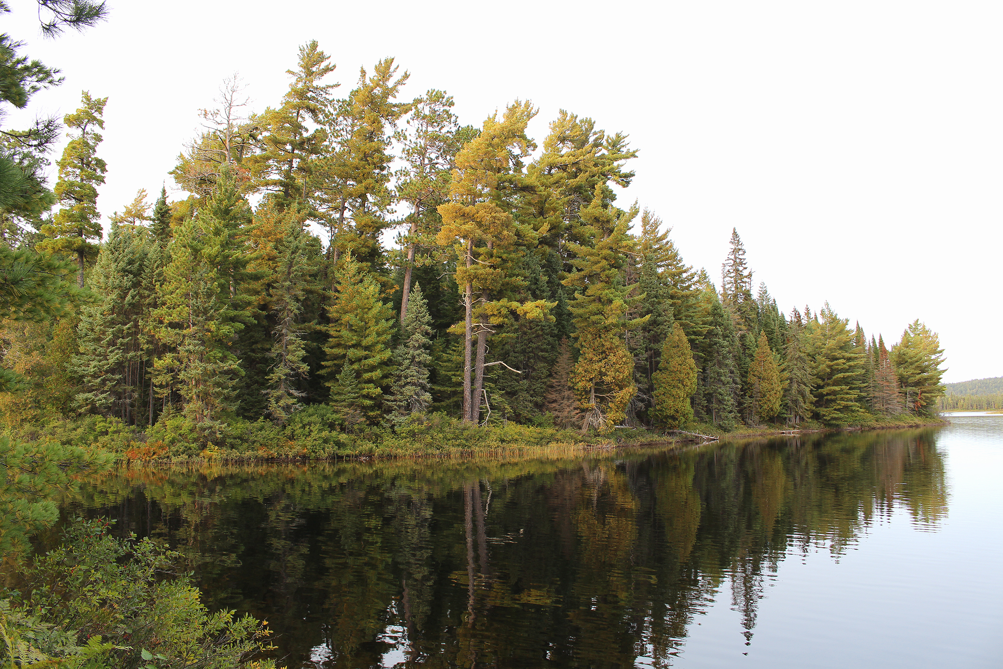
Besides Mihell Lake, most of the lakes we paddled today were quite clear, perhaps due to the effects of acid rain as they had little to no vegetation and no signs of fish. We tried to bath at our site this afternoon but the lake water was so cold that it hurt! Looking across the lake it was clear that coniferous trees pretty much dominated including some large pines. In fact we really didn’t see a deciduous tree within our line of site. While pumping water Aaron observed an inquisitive mouse checking out what he was up to.

As 5:30pm rolled around the temperature dropped. The last time we checked the forecast it was supposed to drop to 2 degrees Celsius overnight. We didn’t encounter any other canoeists today as we make our way further into beautiful Lady Evelyn Smoothwater Provincial Park.
Wildlife Sightings: Red Squirrel, Blue Jay, Common Loon, Common Merganser, mouse species, Belted Kingfisher, migrating Canada Geese, Golden-crowned Kinglet, Mallard
Remember to: Buy and sew flannel sheets to replace our light cotton ones.
Day # 3: Mihell Lake to Scarecrow Lake
Weather: Rain with wind and a thunderstorm. High: 10 C Low: 5 C

We wanted to get a head start on the day so we set the alarm for 6:00 am. Our plan was to climb Ishpatina Ridge, the highest peak in Ontario at 693 metres. As we left our site just after 8:15 am it began to rain which already put a damper on our plans. After a 120 metre portage into an unammed lake we arrived at the 1,290 metre portage that would take us into Scarecrow Lake. As we approached the portage we observed three canoes and later six guys in total that were out for four days. They told us that all but one day of their trip consisted of rain, and lucky for them that was the day they climbed Ishpatina Ridge. We began to wonder ourselves if we were going to get this climb in today or not.
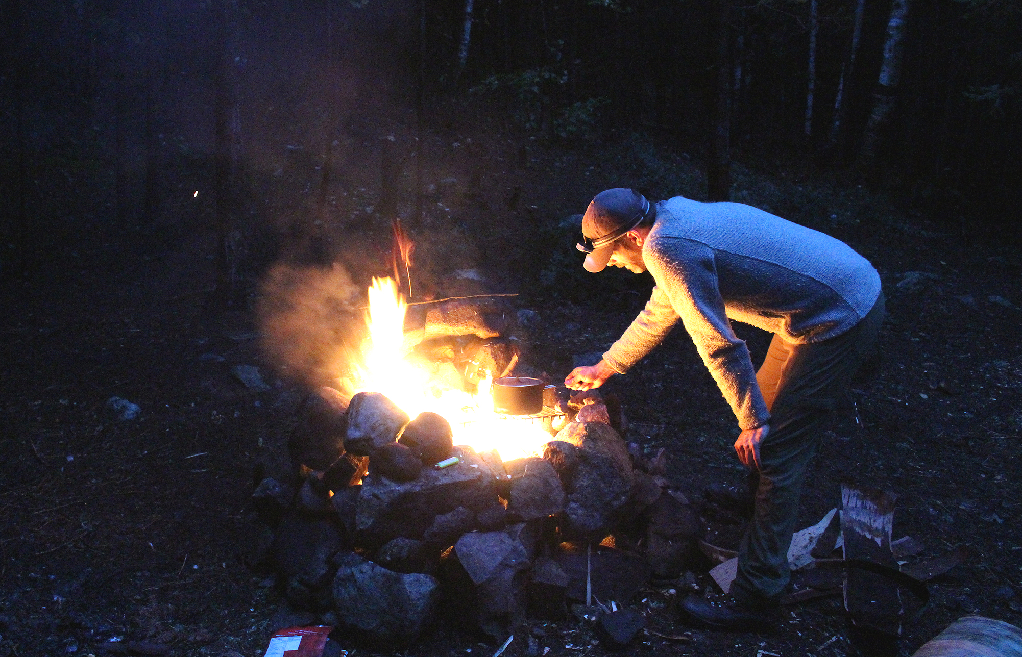
The 1,290 metre portage was long but quite flat, making for a nice walk in the woods once the rain let up. We dropped off our packs at the end of the portage and went back for the canoe as the rain let up. As we approached the end of the portage again with the canoe we heard rumbles of thunder in the distance. We decided to wedge the canoe in-between two trees, cover it over with our tarp, and hide ourselves and our gear underneath to wait out the storm…and wait we did….for 2 and a half hours. A little chilled we took out our pot and made some tea to warm us up while giving us some much needed morale.

After what we figured were the last rumbles of thunder, we entered Scarecrow Lake in the light rain. We contemplated heading towards the island site as the group of guys from earlier said they left a lot of firewood there, but with increasing winds we opted instead for the site at the base of the trail to Ishpatina Ridge. This site was the towermain’s cabin site from 1930 to 1968 and you could still see signs of the old foundation. The site has a good landing and a good seating area around the firepit, though the firepit did have garbage in it. There was a great flat spot for the tent which we quickly set up to hunker down from the rain and wind. As for Ishpatina Ridge, we will have to attempt it tomorrow. Getting caught in the rain started to get old for us and we tried to get the weatherband on our windup radio but it wouldn’t come in. One of the guys we met earlier said he did get a cellphone signal up a the the top of Ishpatina Ridge and the weather forecast for tomorrow looked promising for our hike.

Around 6:00 pm we ventured out of the tent and hung up a few clothes on a clothesline that was conveniently left here. We also took the time to wander around and collect firewood to have our first fire for the trip. Luckily there was a lot of fallen birch trees and their stripped bark is always a good fire starter. While looking for wood we also found the thunderbox up the hill and far out of view of the immediate site which is always a plus. What wasn’t nice around our site was that you could tell people hacked down young trees, presumably to make a fire. This action has always been a head scratcher for us as green wood doesn’t burn well at all. Aaron fixed up the fire pit and once we got a fire going we warmed up with Sheppard’s Pie and instant stuffing for supper. The rain held off while we had supper and the wind died down as well. We managed to get a local radio station in and it sounded like there was the chance for showers tomorrow. Hopefully they stay away from our immediate area.
Wildlife Sightings: Red Squirrel, Black-capped Chickadee, Common Loon, Canada Goose, White-throated Sparrow, fish sp,. Common Raven, people.
Remember to: (1) Get two more tent pegs. (2) We are noticing our rain pants are not as waterproof as they once were. (3) 1 pack of powdered potatoes and stuffing makes two servings.
Day # 4: Scarecrow Lake
Weather: Rain in the morning, with mainly cloudy skies in the afternoon. Light rain in the evening. High: 14 C Low: 10 C

Around 6:30 am we unzipped the tent to cloudy skies yet again. We gathered birch bark and wood to make a fire just big enough to heat up water for tea. Listening to CBC Radio North showers were in the forecast for today. Though the conditions were not ideal, we decided to make the climb up to Ishpatina Ridge in hopes that the rain will hold off long enough to give us a descent view from the top. We also wanted to check the extended forecast on our cellphone while at the summit as we can get a signal up there.

We grabbed our day bag and began the hike up. As far as hikes go this one was a moderate climb with level areas, a few steep climbs, and some mud to be negotiated. We flushed a couple of Ruffed Grouse with one that showed off its black ruffs, while a Black-throated Blue Warbler also greeted us in song. There was even a stream we had to cross over that was not difficult. The hike included three small lakes, with the first one having a rock boardwalk along the shoreline that was built by fire rangers. The last lake near the top, called Dick Lake, we can only assume is Ontario’s highest lake. Believe it or not we couldn’t verify this with a quick search online for “Ontario’s highest lake”.
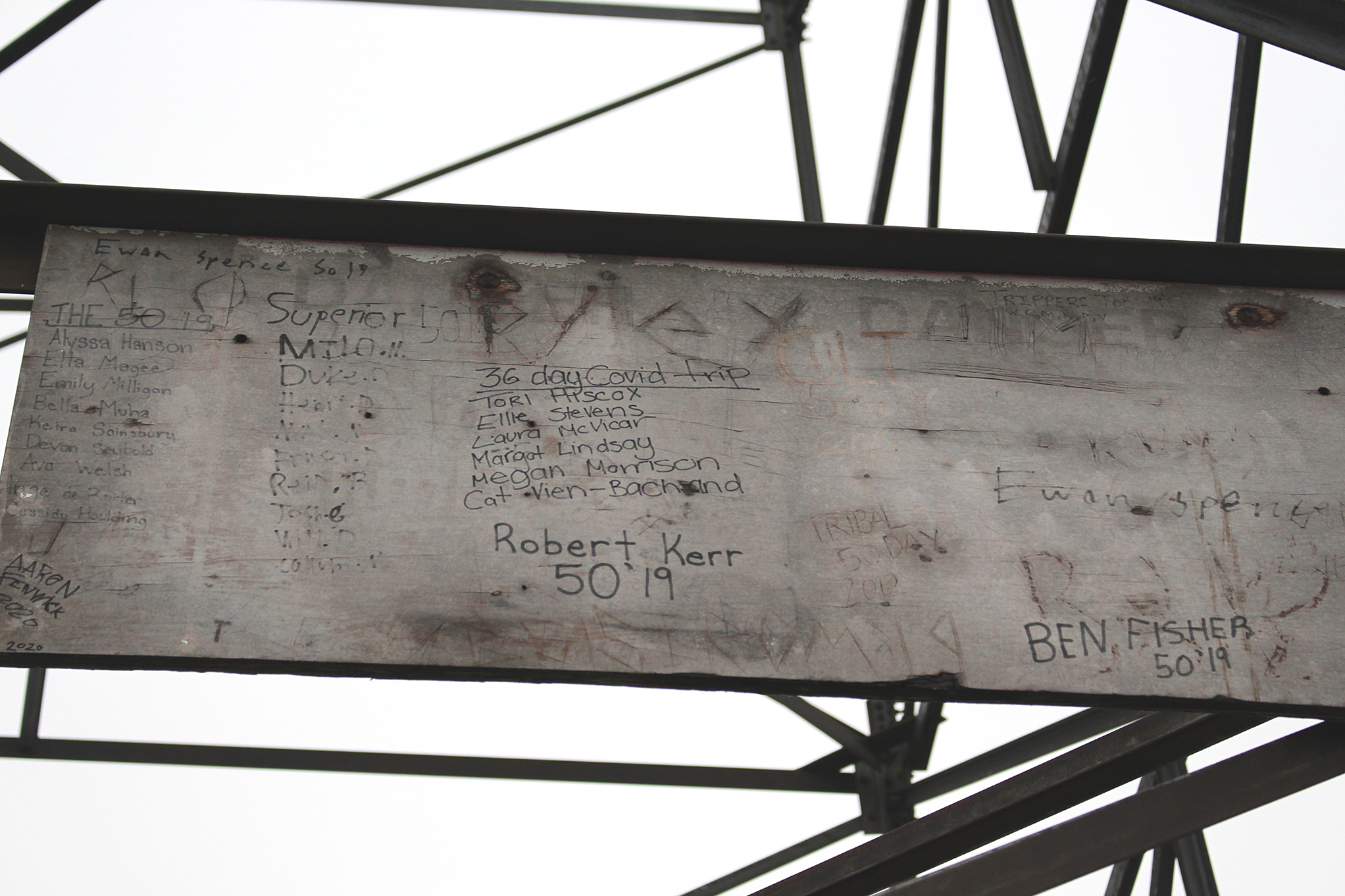
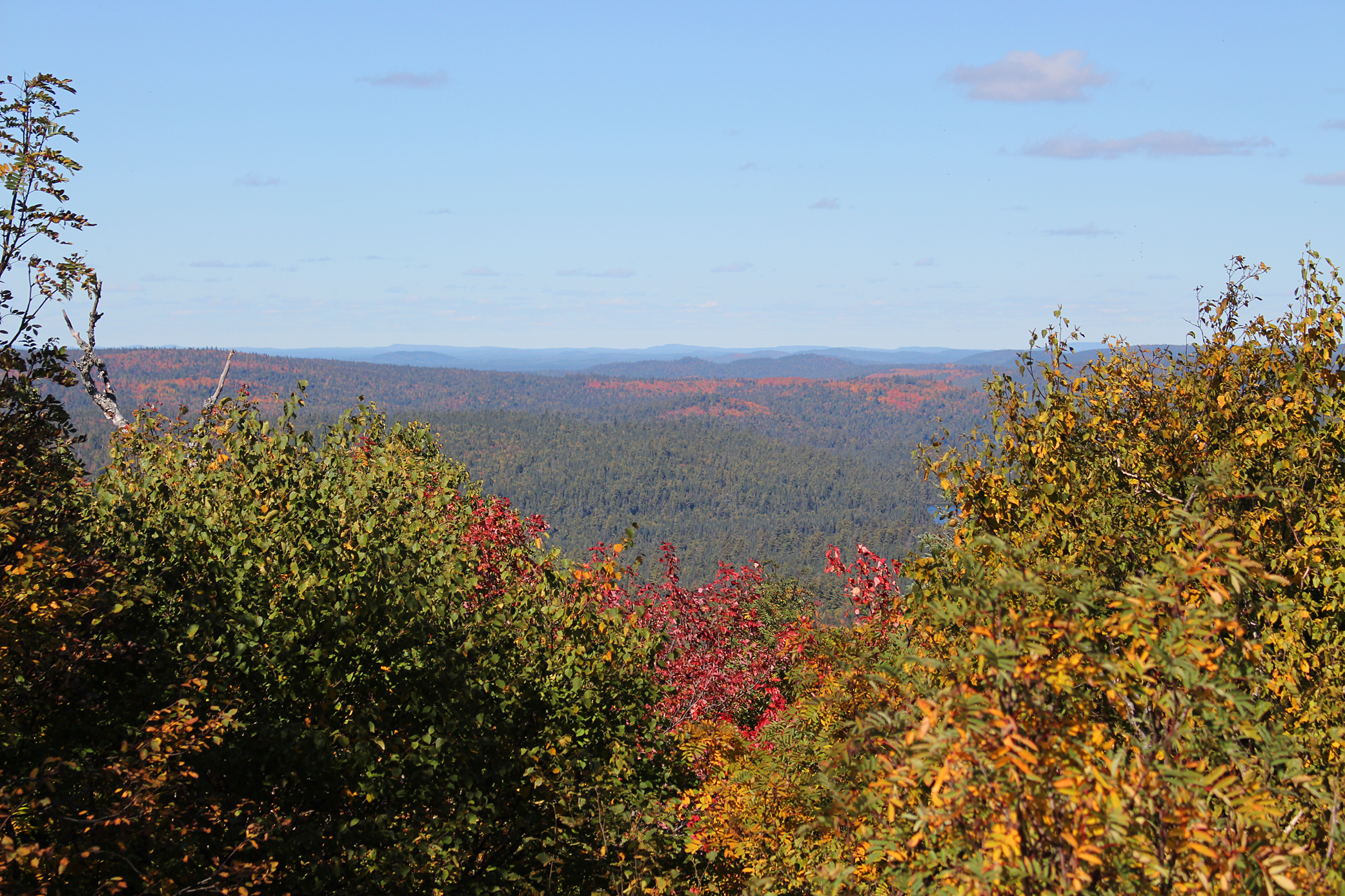
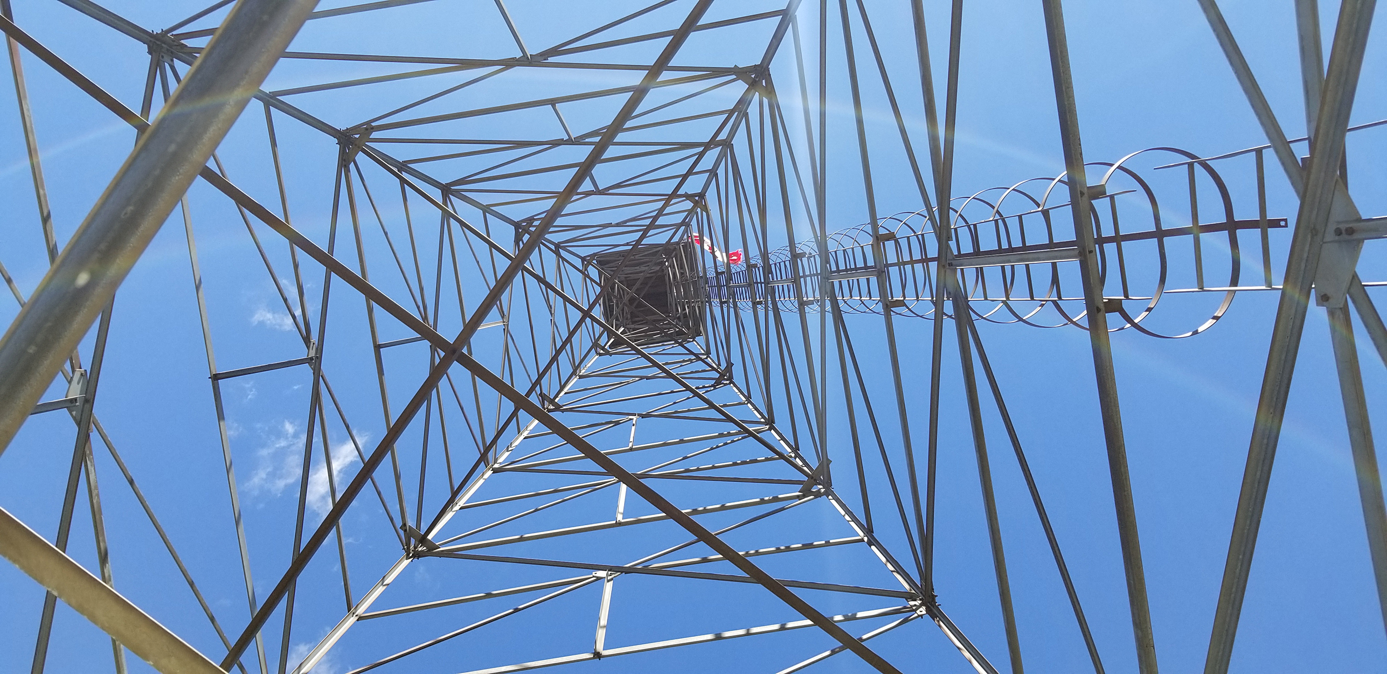
You would think that the fire tower would be in view as you near the summit, however you don’t see it until you are pretty much at the top. When we arrived at the summit it was quite foggy with a light rain as we gazed up at the decommissioned fire tower. Even though the bottom section of ladder has been removed from the tower someone had the guts to climb and place a Canadian flag in the nest box. The tower, known as the Ellis Tower, is 100 feet tall and made of steal. It was used between 1930 and 1968 to scan for forest fires until this was replaced by the less romantic use of aerial detection that continues to this day.

Albeit the fog we had an okay view of the North Peak to the northeast, which is the third highest peak in Ontario. Exploring around the tower site we located the remains of the old 80 foot tower that was taken down in 1930. The current tower isn’t in the best of shape either with the foundation beginning to crumble and the supports at the base of the tower were flexible enough to shake the tower with one hand. Probably due to liability issues it sounds like all of these decommissioned towers will be dismantled which is really a shame. Aaron also found an ammo bin that contained a notebook, waterproof matches, a small white container, and a photo of someone. There were also two water bottles full of notes that people left for those who made it to the top. Unfortunately there was no pen so we couldn’t write our own message to add to the bottles.
After attempting some photos and checking the forecast on our phone we began the descent down. It rained a little harder on the hike back and we had to huddle underneath a tree, our rain gear still damp from the storm on day one. Aaron also discovered that his hiking boots we no longer as waterproof.
Once we got back to camp we hid in the tent until the rain let up, then we were out and about gathering fire wood for a late lunch. Once we got a fire going we attempted to dry Aaron’s boots as well.

For the rest of the day we scoured the area for any deadfall as we really wanted a pancake for breakfast tomorrow. The sun also made a brief appearance so we stripped and ran down to the lake to have a quick bath, all the while keeping an eye out for leeches, including the 6 inch long monster that Marianne saw yesterday! It looked like we were going to have a day without seeing another paddler, but around 6:00 pm we observed two soloists and a dog heading south. They were probably aiming for the island site.
As for the weather forecast that we got from the summit it looked pretty good with sunshine for the next few days, though we were supposed to have some cold nights.

Wildlife Sightings: Red Squirrel, Common Merganser, leeches, Common Loon, White-throated Sparrow, Ruffed Grouse, mosquitoes, toads, Black-capped Chickadee, Red-breasted Nuthatch, Black-throated Blue Warbler, Golden-crowned Kinglet, Common Raven, people, dog.
Remember to: Aaron’s boots are no longer waterproof. He needs to buy new ones.
Day # 5: Scarecrow Lake
Weather: Sunny skies with a few clouds. High: 11 C Low: 0C

The alarm went off at 6:00 am and we could feel that the temperature dropped last night so we were not that eager to get up. We also made the tough decision that we will not paddle and portage into Solace Provincial Park, or even Florence Lake as the rains have left too many of our clothes damp, most importantly our rain gear and Aaron’s hiking boots. The below freezing temperatures that were forecasted wouldn’t do us any favours either. In the end we decided to climb Ishpatina Ridge again today, and then starting tomorrow we would slowly make our way back to the launch. We may even spend a couple of days at the beach site back on Smoothwater Lake and maybe do a day hike into Sunnywater Lake. Sunnywater Lake is known as a “windex lake” as it is a clear blue acidic lake and is part of the area in Temagami that has the highest elevation for both portage and canoe traffic.

First thing on the agenda for today was a camping pancake with peanut butter and jam melted on top! We also brought a new beverage with us on this trip, a coffee substitute called Inka. We actually never bring coffee, or alcohol for that matter, when backcountry camping. Our go to hot beverage is Twinnings Irish Breakfast Tea, a black tea that gives us our morale. In fact this is even stated in the SAS Survival guide that tea should be in your emergency pack for that very reason. In the end Inka wasn’t bad, but by no means will replace our tea which warms us to the core.

While we were having breakfast, a pair of canoes docked at the trailhead to Ishpatina that lies in a little bay just north of our site. By the time we tidied up our site, pumped water, and gathered more firewood, the two solo canoeists returned and even stopped by our site to have a chat. We had the feeling that they wanted to camp at our site tonight as they asked us how long we were staying. Aaron had an interesting encounter with nature this morning while pumping water. A chipmunk chased and caught a grasshopper near the shoreline, chewing the insect the same way it would if you gave it a whole peanut.
Around 11:30am we packed a lunch in Marianne’s hiking pack and began the climb to the Elis Fire Tower again, though this time it was under sunny skies! At the top we had excellent views all around us! Marianne took photos while Aaron prepared lunch which consisted of one of our favourite freeze dried meals, Backpackers Pantry Pad Thai.


We also brought a pen this time so we could add our names with all the notes in the water bottles. Marianne explored inside the ammo box this time and Aaron remarked that the white container held the ashes of the person whose photo was also in the box. We carefully placed the box back to where it was sitting before, at the highest little spot here at the summit. We figured that this individual must’ve had a special connection to this area.

After relaxing in the sun’s glorious warmth we eventually made the descent down and returned to our site around 3:30pm. The rest of the afternoon involved organizing our packs and picking out tonight’s supper and tomorrow’s breakfast. Around 6:00pm while preparing the coals in the fire for bannock, a couple and their dog paddled to our site and asked if this was a group camping site? Not wanting to be rude we stated that there may be another spot to put up a tent, or there was also the island site just to the south. They said they would try for the island site and began the paddle south, though later we saw them paddle back north. We wondered where they were staying for the night as there were no other sites between us and the last portage.
As for us we had bannock with homemade black bean hummus that we prepared over the coals of the fire which was wonderful! The fire also felt great as you could feel the temperature dropping. Tonight it was forecasted to go down to freezing and we wished we brought our toques to wear to bed.
Wildlife Sightings: Eastern Chipmunk, Red Squirrel, Common Raven, Golden-crowned Kinglet, Red-breasted Nuthatch, Black -capped Chickadee, Common Loon, Mallard, Belted Kingfisher, People, Garter Snakes, Mourning Cloak, Compton’s Tortoiseshell, Comma Sp.
Remember to: (1) Switch out the USB cable on the windup radio to charge our cell phones for our next trip. (2) “Morale tea” is superior to Inka in the backcountry.
Day # 6: Scarecrow Lake to Smoothwater Lake
Weather: Mainly cloudy skies. High: 8 C Low: 0 C
It was -1 Celsius on a cold clear morning when we got out of the tent. To keep ourselves warm we put on all our layers and kept ourselves busy by moving around. Once we got morale tea in us it got a lot easier. After oatmeal with rehydrated strawberries and apples, we broke camp and left our site on Scarecrow Lake at 8:45 am.

We paddled south to check out the island site and it was occupied by a couple and their dog which barked at us. Turing back north we began the paddle back to the 1,210 metre portage with the Ellis fire tower visible to the west. While trying to locate the portage we also saw the couple and their dog from last evening. In the end they found a flat spot to spend last night along the shore near the portage. They were just packing up when we paddled past.
We must’ve been the first human travelers along the portage this morning as we flushed a Spruce Grouse that flew up to a branch just above our heads. Spruce Grouse seem to be a lot less wary than the more common Ruffed Grouse. After dropping off our packs at the end of the portage and going back for the canoe we met the island couple and their dog. They were on their way to Smoothwater Lake for the night. It was a chilly morning and with the clouds now coming in it felt even colder as we hiked back to grab the canoe and the day bag. As we approached the end of the portage with the canoe we saw another couple gathering their gear to begin the portage. Marianne noticed that the lady was clutching something in her arms. It was a cat! A tabby cat! We had a chat with the couple and met Gary the cat who has become accustomed to being outdoors on a leash and even being in a canoe! They were heading to Scarecrow Lake and Ishpatina Ridge today. Would Gary be the first cat to reach the highest peak in Ontario?
Paddling north we met a slight breeze which gave us a bit of a chill and we left our warmer clothes and gloves on. We could also see that the fall colours have progressed since the last time we paddled through this section a few days ago. We were also convinced that the 1,100 metre portage into Apex Lake is actually way longer than the 1,210 metre into Scarecrow Lake.
Still under cloudy skies we arrived at Smoothwater Lake around 4:00pm. Even though it was 8 Celsius a north breeze left us slightly chilled all day. With the forecasted low of -3 Celsius for tonight we debated whether we should just paddle out today. Also, where the hell were the sunny skies we were supposed to have today? We can’t remember the last trip we had that was so damp and grey!
Headwinds met us on Smoothwater Lake as we paddled north. Even though grey clouds were all around the beauty of the fall colours lifted our spirits. As we paddled close to the western end of the lake we hid behind two peninsulas to allow our arms a break from the headwinds. An hour and fifteen minutes later we arrived at the mouth of the Montreal River at 5:15pm. It was definitely too late in the day to paddle back to the car so we went to the site we checked out on our first day, the one with a beach landing where the lake met the river.
The site itself was an average. A sandy beach landing is always welcome along with a level spot for the tent. No seating area at the mediocre fire pit but there was a new thunderbox quite a ways back from the site. Another bonus was that the site was sheltered.

The sun finally made an appearance and we took full advantage of the last bit of daylight to gather firewood, pump water, and start a fire. A beaver swam past our site and slapped it’s tail on the water. Sitting on the ground next to our little fire we cooked up some pasta with rehydrated veggies and we even tried a new dessert, Backpackers Pantry Creme Brule. We were a little skeptical with this one but it was actually really good! The only downside was that it was a sticky in our bowls while the pack the sugar bits came in required a knife to rip open.

We had a chilly night and we hoped to sleep well. We also contemplated heading back to the car tomorrow since we were so close to the launch.

Wildlife Sightings: Spruce Grouse, Red Squirrel, Red-breasted Nuthatch, Winter Wren, Common Loon, migrating Canada Geese, Black-throated Blue Warbler, Beaver, people, dogs, a cat.
Remember to: (1) Buy new dry bags for our clothes as Marianne’s is no longer as waterproof with slightly damp clothes in it. (2) Check all our gear at home.
Day # 7: Monteral River to launch
Weather: Clouds with light rain showers. 3 C

Around 7:00am we got out of the tent, not to the forecasted sun but instead to a blanket of grey clouds. Our thermometer read 3 Celsius and probably thanks to these clouds it didn’t get down to the forecasted -3 Celsius last night.
We got another small fire going and we enjoyed a big pot of oatmeal and tea which made us warm and happy. What didn’t make us happy were the light rain showers that began to fall as we took down the tent….What the heck is up with this weather?!

We left our site wearing our raingear and our packs covered as we paddled north on the Montreal River. We met the couple with their dog again from the Scarecrow Lake island site who also stated that they were not impressed with this weather. Paddling out of Lady Evelyn Smoothwater Provincial Park we returned to Lady Dufferin Lake and view another fire tower off to the far northwest. This is the Donovan Tower that is located near Okiniada Lake and from afar it seemed like another 100 foot steel tower. Continuing our paddle north we got really close to a group of Common Mergansers that eventually scurried away. Before too long the showers let up and the sun tried to peak out from behind a cloud, though a veil of rain was just to the west of us. When the sun did manage to kick a cloud out of the way the fall colours of reds and oranges brilliantly popped against the drab backdrop of low dark clouds. We really didn’t want to leave but being this close to the launch we were well beyond the point of changing our minds.
Arriving back to the launch we saw some people getting ready to fish and another gentleman with a gun looking for grouse. After unlocking the car we discovered that the toilet paper and tissues in the back seat were shredded with mouse poop also found! We are going to have to clean this up when we get back to civilization.
We were a little disappointed that we bailed out early on our trip though we’re glad that we discovered what gear needs to be replaced before our next trip in October which will be a backpacking trip in Killarney Provincial Park. We will definitely return to Temagami again! The area is beautiful and rugged and we have to have at least one successful trip here!
Wildlife Sightings: Belted Kingfisher, Red Squirrel, Common Loon, Common Merganser, People, dog, Golden-crowned Kinglet.
Remember to: Put anything that a mouse would shred in your vehicle in a container, and set up traps. This is the second time we have found mice in our car when coming back from the backcountry.

Click The Link For More Trip Reports: http://www.backcountrybalkwills.com
