

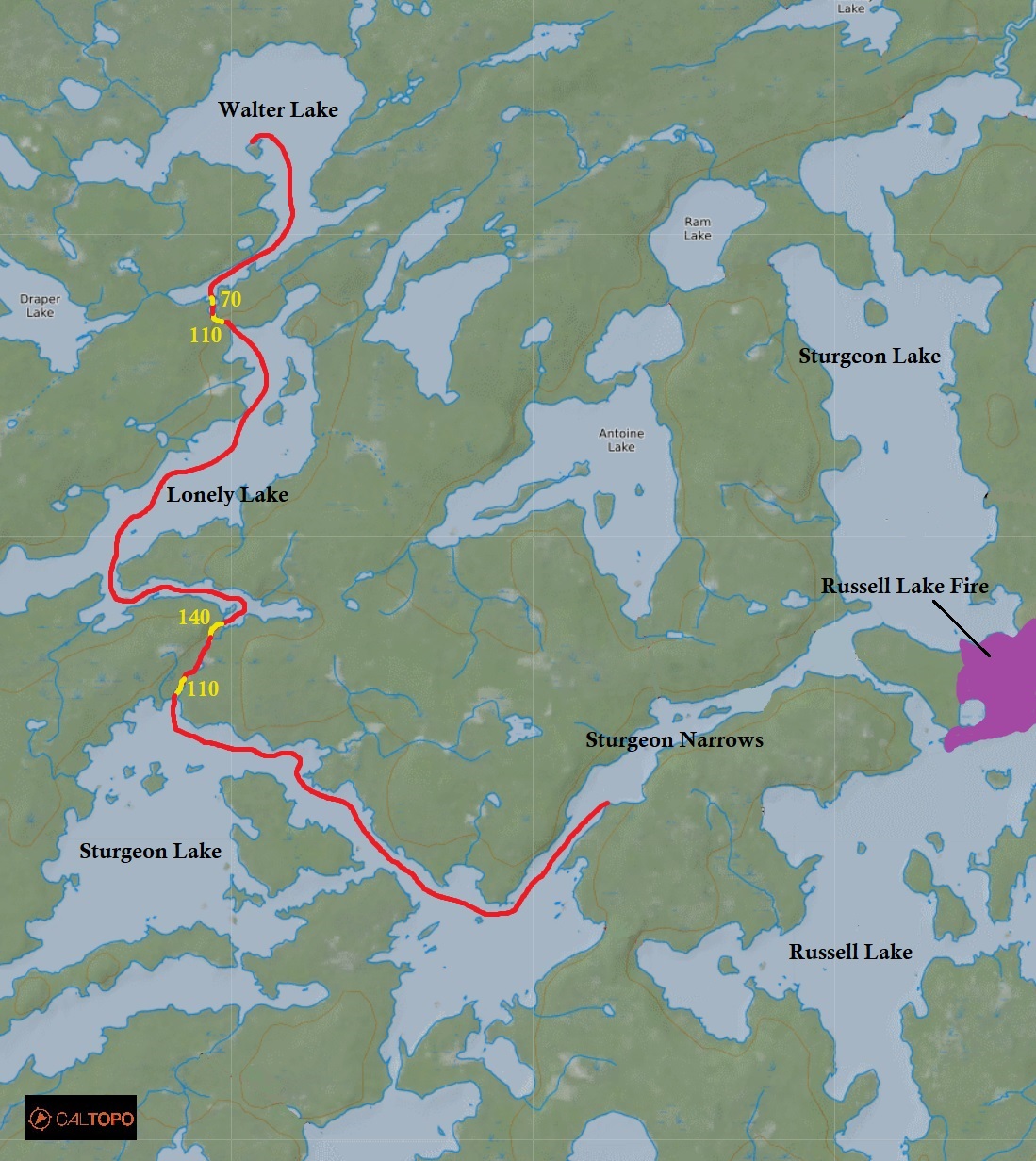
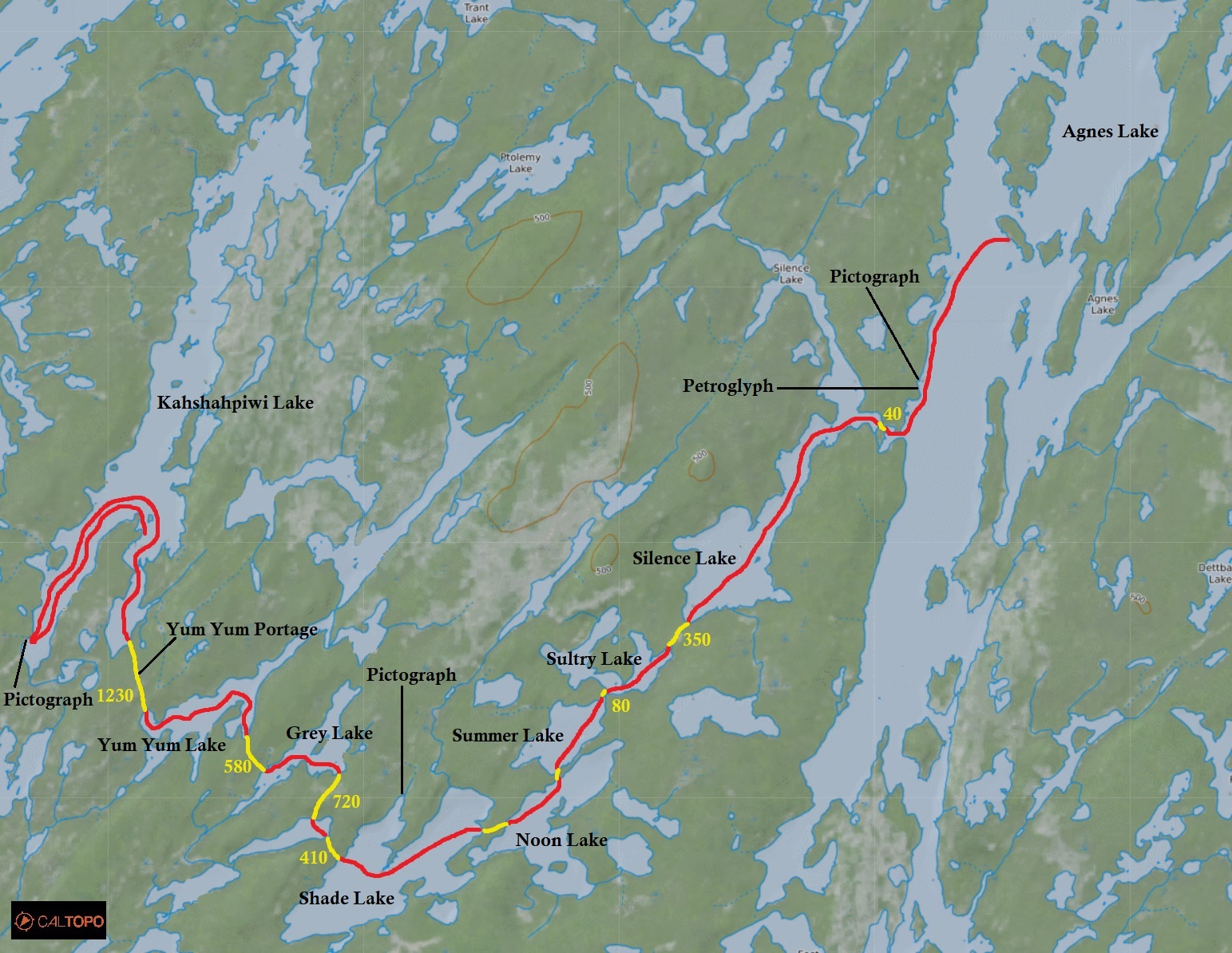
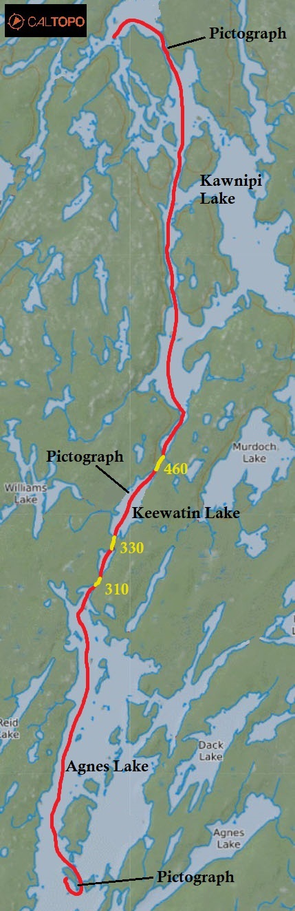
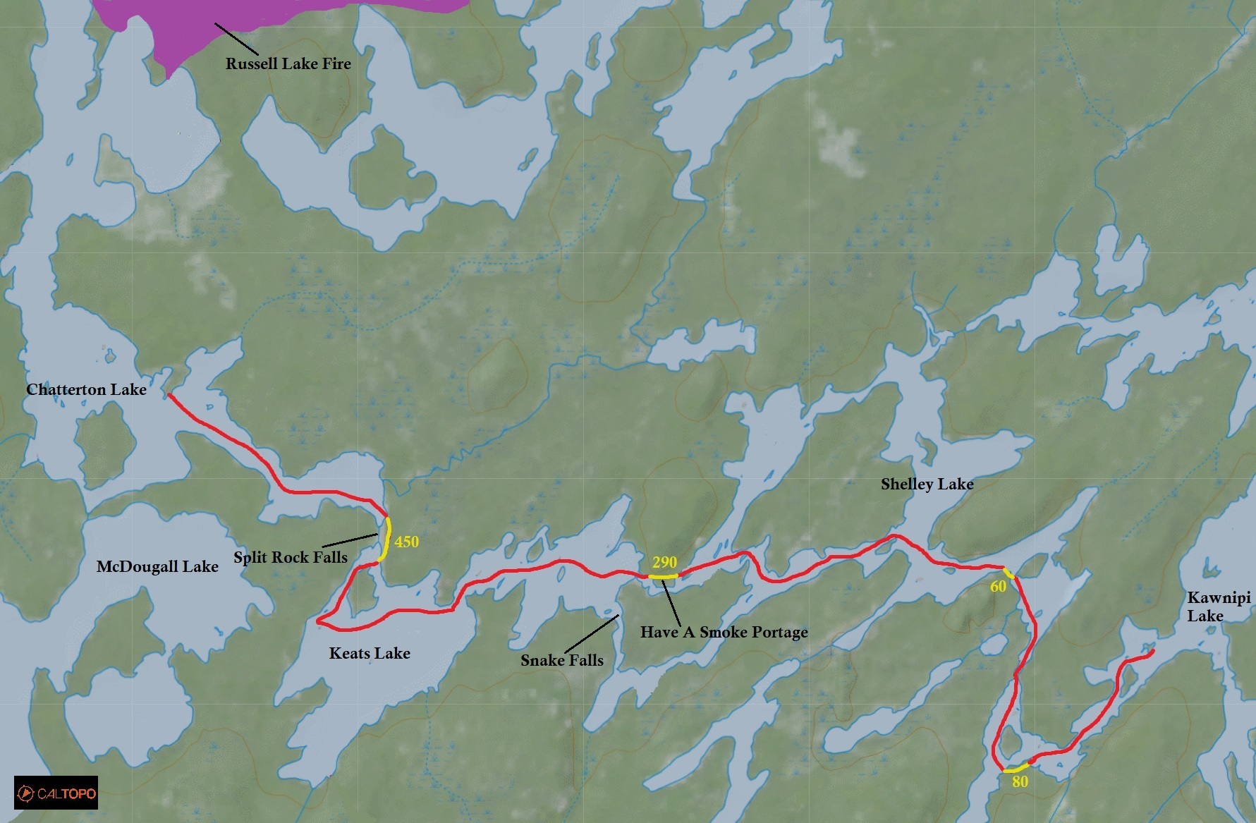
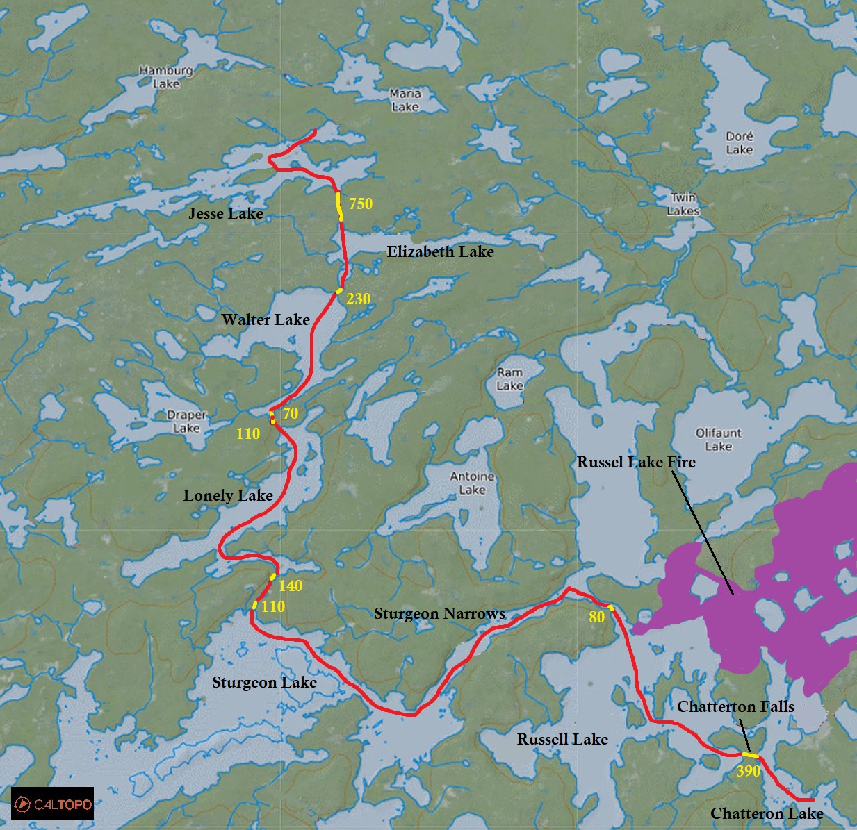
Route
Total Days: 10.5 days
Total Kilometres: 206 kilometres
Total Portage Length: 14.74 kilometres
Longest Portage: 1.23 kilometres (Kahshahpiwi Lake to Yum Yum Lake)
Average Daytime High: 20.8 Celsius
Average Nighttime Low: 13.4 Celsius
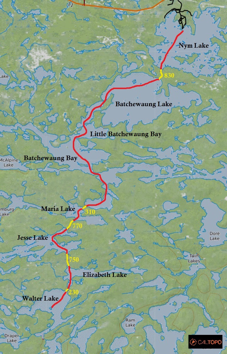
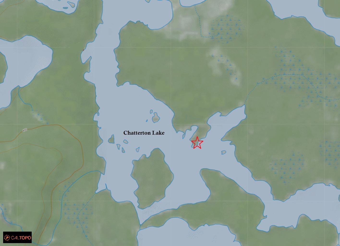
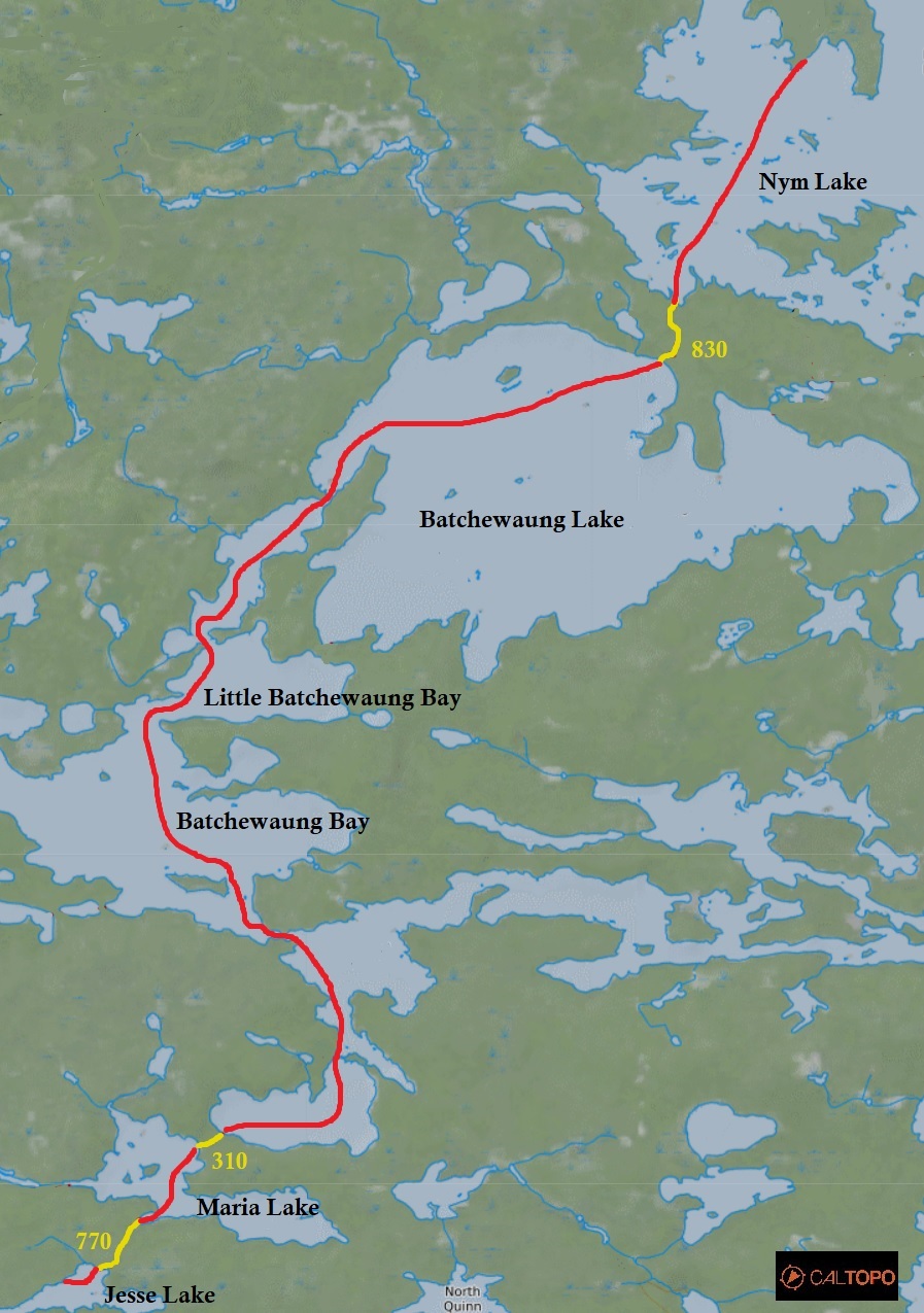
Route: Nym Lake – Batchewaung Lake – Little Batchewaung Bay – Batchewaung Bay – Marian Lake – Jesse Lake – Elizabeth Lake – Walter Lake – Lonely Lake – Sturgeon Lake – Russel Lake – Chatterton Lake – Keats Lake – Shelley Lake – Kahshahpiwi Creek – Heronshaw Lake – Cairn Lake – Sark Lake – Keefer Lake – Kahshahpiwi Lake – Yum Yum Lake – Grey Lake – No Name Lake – Shade Lake – Noon Lake – Summer Lake – Sultry Lake – Silence Lake – Agnes Lake – Keewatin Lake – Kawnipi Lake – Kahshahpiwi Creek – Shelley Lake – Keats Lake – Chatterton Lake – Russell Lake – Sturgeon Lake – Lonely Lake – Walter Lake – Elizabeth Lake – Jesse Lake – Maria Lake – Batchewaung Bay – Little Batchewaung Bay – Batchewaung Lake – Nym Lake
Maps Used: Chrismar Quetico Provincial Park map. Fisher Maps F10, F11, F18, F24, F25, F29
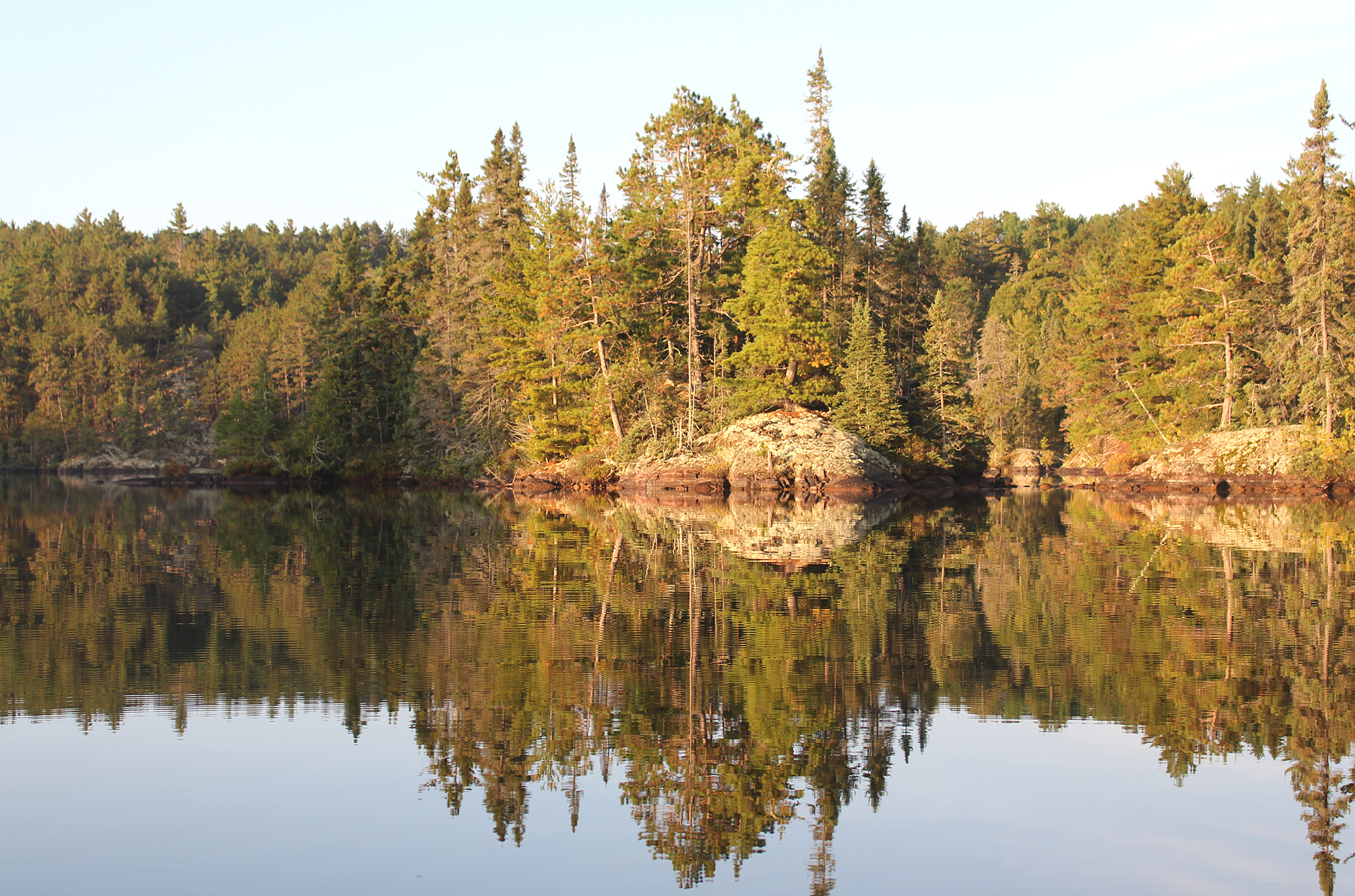
Is there any other Ontario Provincial Park that offers as many opportunities for the flatwater canoeist, fisherman, or backcountry camper than Quetico? If there is we haven’t discovered it yet!
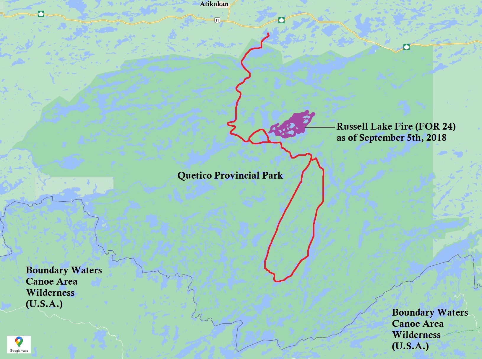
Larger than Killarney but smaller than Algonquin, Quetico’s abundance of lakes and portages gives you so so many options when putting together an itinerary. If an unexpected obstacle such as a forest fire blocks your planned route, there are spaced out access points by road and by air so you can divert away from these areas. At 4,719.42 square kilometres, Quetico Provincial Park is large enough to not abandon a trip entirely due to a few closed routes and portages.
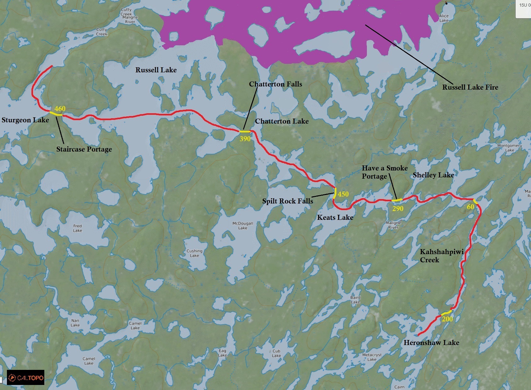
On July 29th on the north shore of Russell Lake, a lightning strike started a forest fire. At first the fire was only a mere 80 hectares and looked like it wasn’t going to spread that much, but conditions changed and it grew to 2,800 hectares a couple of weeks before our canoe trip. The fire lead to lake closures including the “B-chain” of lakes (Bisk, Beg, Bud) which was part of our itinerary for our first and last day launching from Stanton Bay. As we approached the week of our canoe trip we decided to modify our route a bit by launching from Nym Lake, paddle west to Sturgeon Lake, and head east to Russel Lake via the 460 metre “staircase portage”. Unfortunately, the easier “Russell Rapids Portage” into Russel Lake was also closed due to the fire.
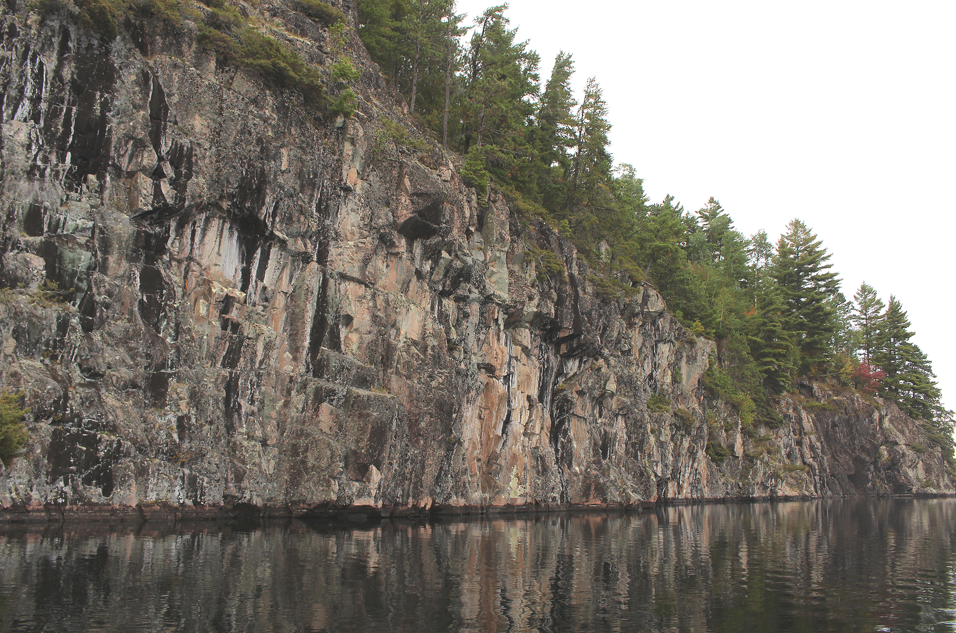
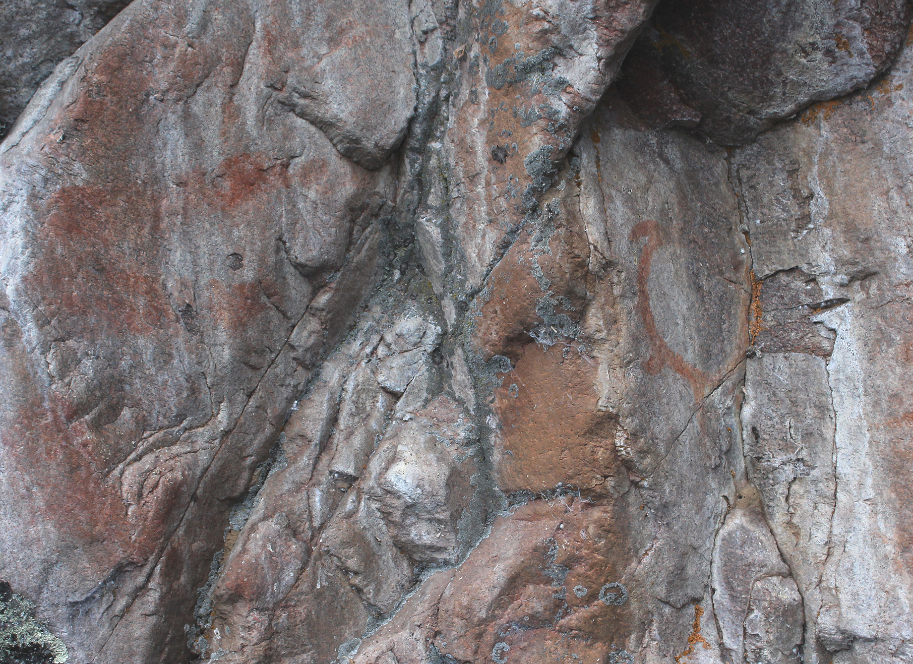
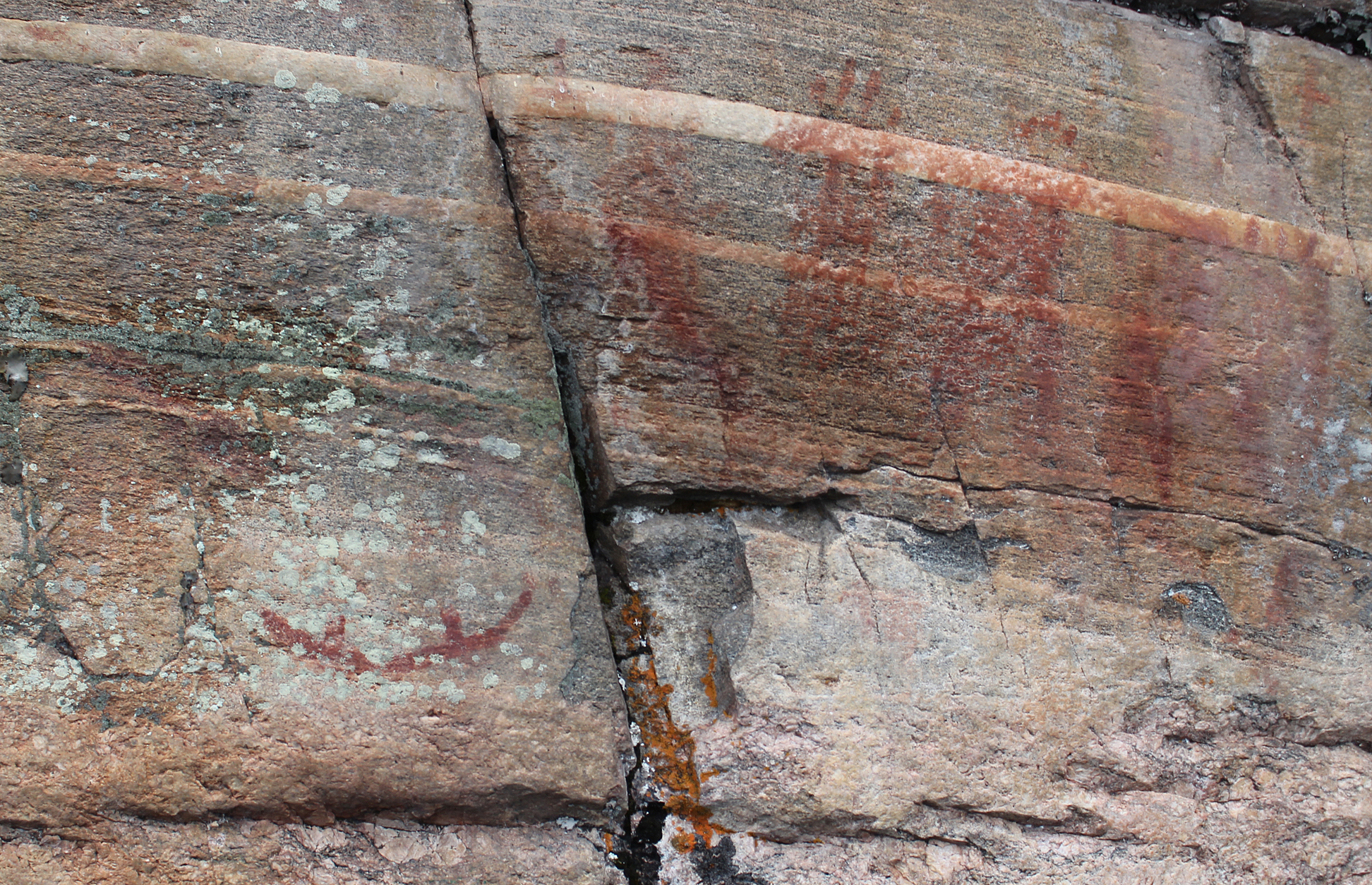
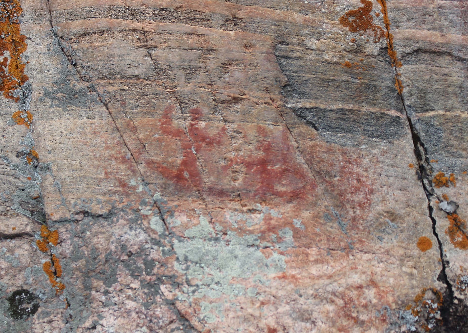
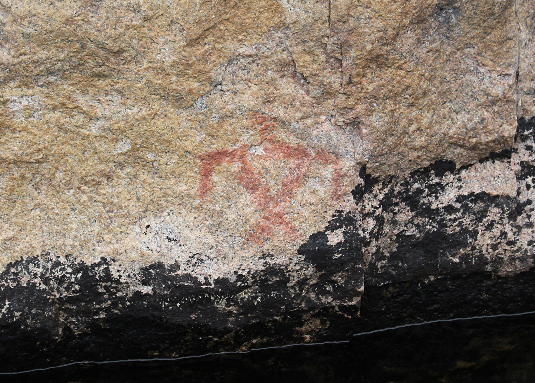
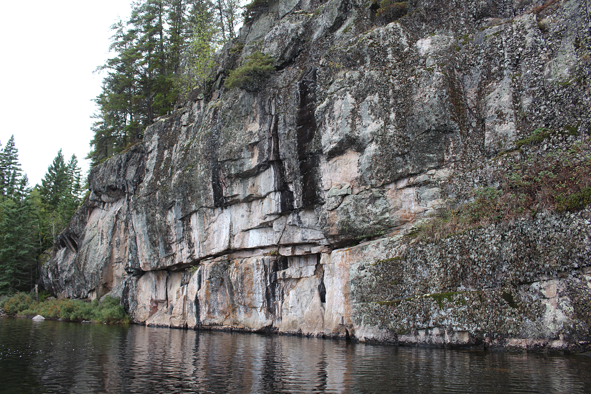
Besides visiting new lakes and portages, our main objective was to find as many indigenous pictographs as possible. Quetico Provincial Park holds some of the highest concentrations of indigenous pictographs in all of North America. Made with red ochre, pictographs on rock faces are scattered throughout the park. Some are incredibly faded while some are quite vivid. While some of these pictographs are thought to be over 500 years old, others such as an image of a man shooting a gun on Darkwater Lake, are more recent.
Even after changing our route due to the forest fire, we had to modify it yet again during our actual trip due to high winds. Here is our completed route: (map)
Quetico Provincial Park is classified as a “wilderness park”. Expressing that wilderness feel is the lack of portage and campsite signs making trip planning a lot more fun as you pour over maps and online resources to locate campsites and the conditions of portages. Forest fires are also left to burn in the park unless structures are at risk. Fires are monitored and alerts for portage and lake closures are posted on the Ontario Park’s website.
After two days of travel, stopping overnight in both Sault Ste. Marie and Thunder Bay, we arrived at the Dawson Trail Campground off Highway 11 in the park to pick up our permit. We received a couple of garbage bags, and chatted with park staff regarding closures due to the fire, problems with human waste at some campsites, and a report of no nuisance bears this season. We then drove up to the White Otter Inn in Atikokan where we had a bed and a nice hot meal.
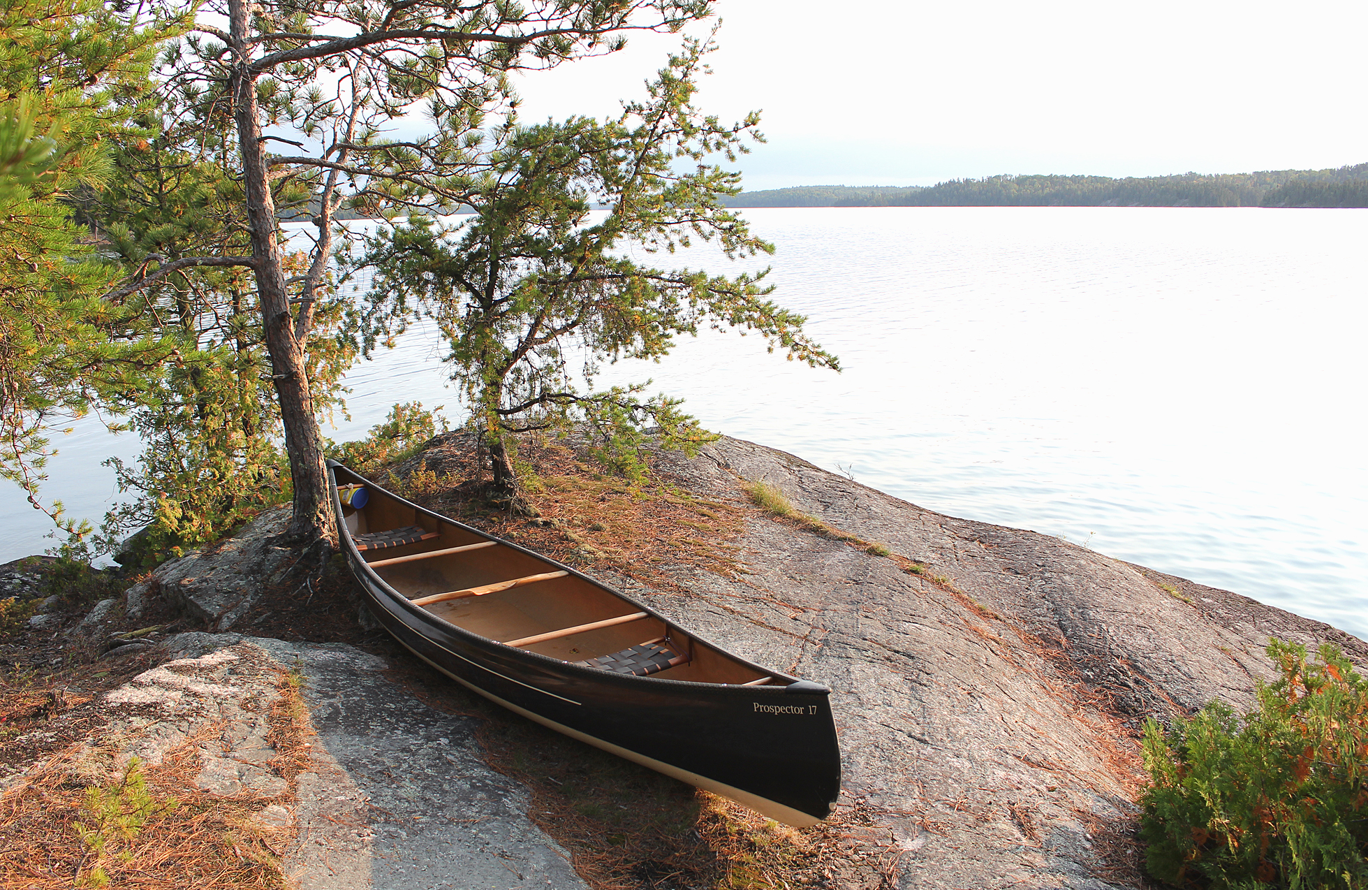
Day # 1 Nym Lake Launch to Walter Lake
Weather: Partly cloudy. Windy. High: 21 C Low: 6 C
We got up early and had our last “real” breakfast at the White Otter Inn before the 15 minute drive down to the Nym Lake launch. Listening to the local weather report we knew that headwinds would be on the agenda today. There was already a light breeze when we launched at 7:50 am.
Nym Lake is not part of the park and we spotted a few cottages as we headed southwest. A light wind out of the southeast carried the faint smell of burning wood which made sense as the fire was to the southeast of us, though we couldn’t see any smoke.
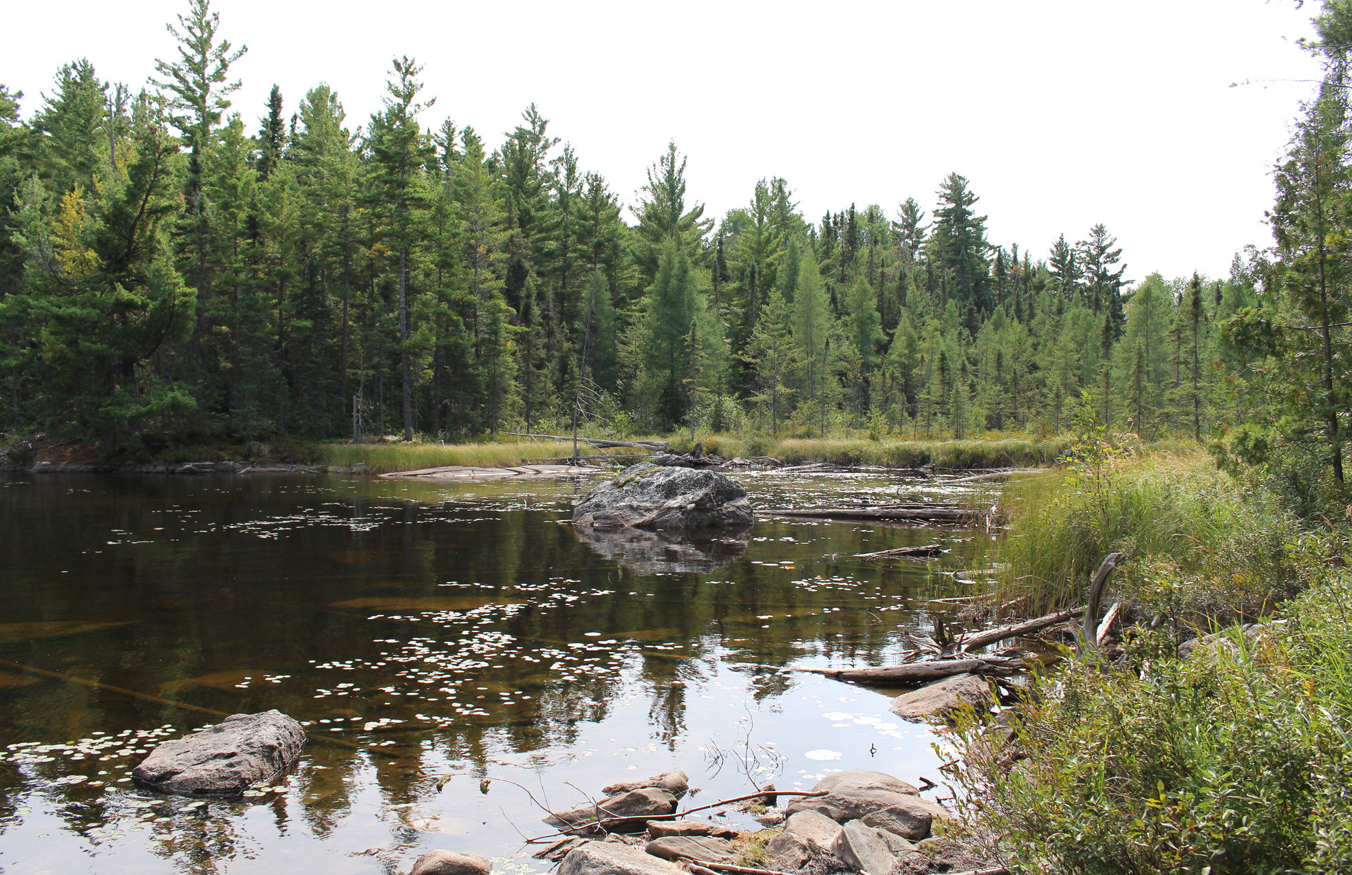
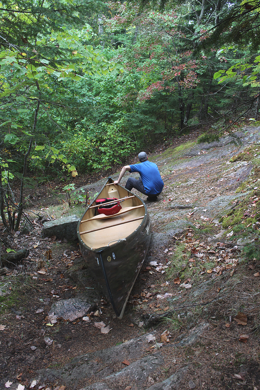
After the 830 metre portage we entered into the expanse of Batchewaung Lake and into the park where Quetico greeted us with a slap in the face with even stronger headwinds. The first day of our trip was not going to be a day at the beach and our arms got a good workout! After a 160m portage into Little Batchewaung Bay there was a little bit of a reprieve from the winds, though once we rounded the corner into Batchewaung Bay it was a workout again.
The 310 metre portage into Maria Lake was pretty easy going and we observed three Ruffed Grouse. The next two portages of the day, a 770 metre into Jesse, and a 750 metre into Elizabeth was your typical portage that included some rocky sections. Logs were placed down along both these portages so we assumed they can get quite muddy. Lucky for us (or at least in this regard) it has been a hot and dry summer, so we had no issues with muddy portages this whole trip. Our last portage of the day, a 230 metre into Walter, had a lot of huge blowdowns that had been recently cleaned up. There must have been one hell of a storm to bring down so many large trees!
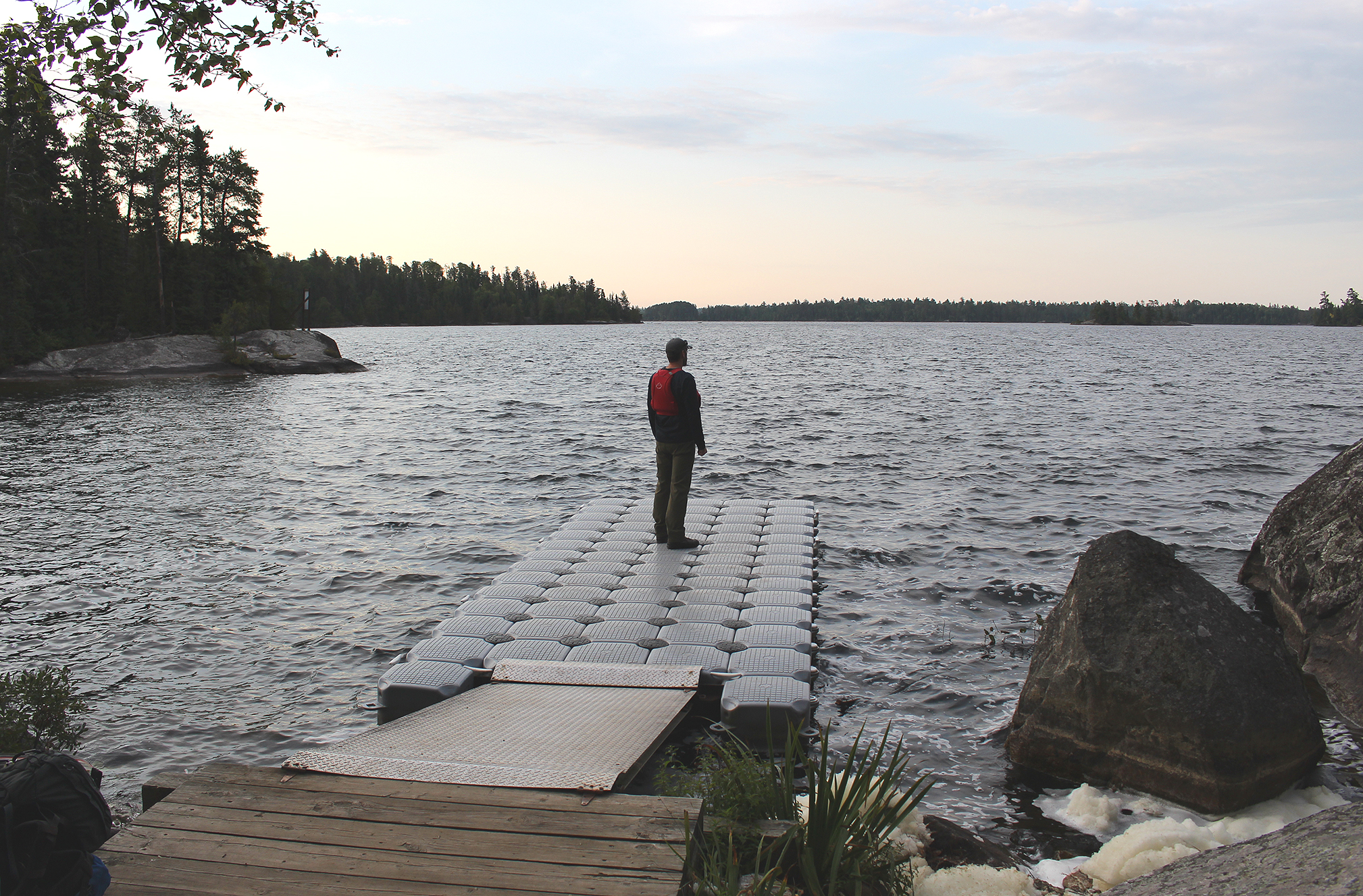
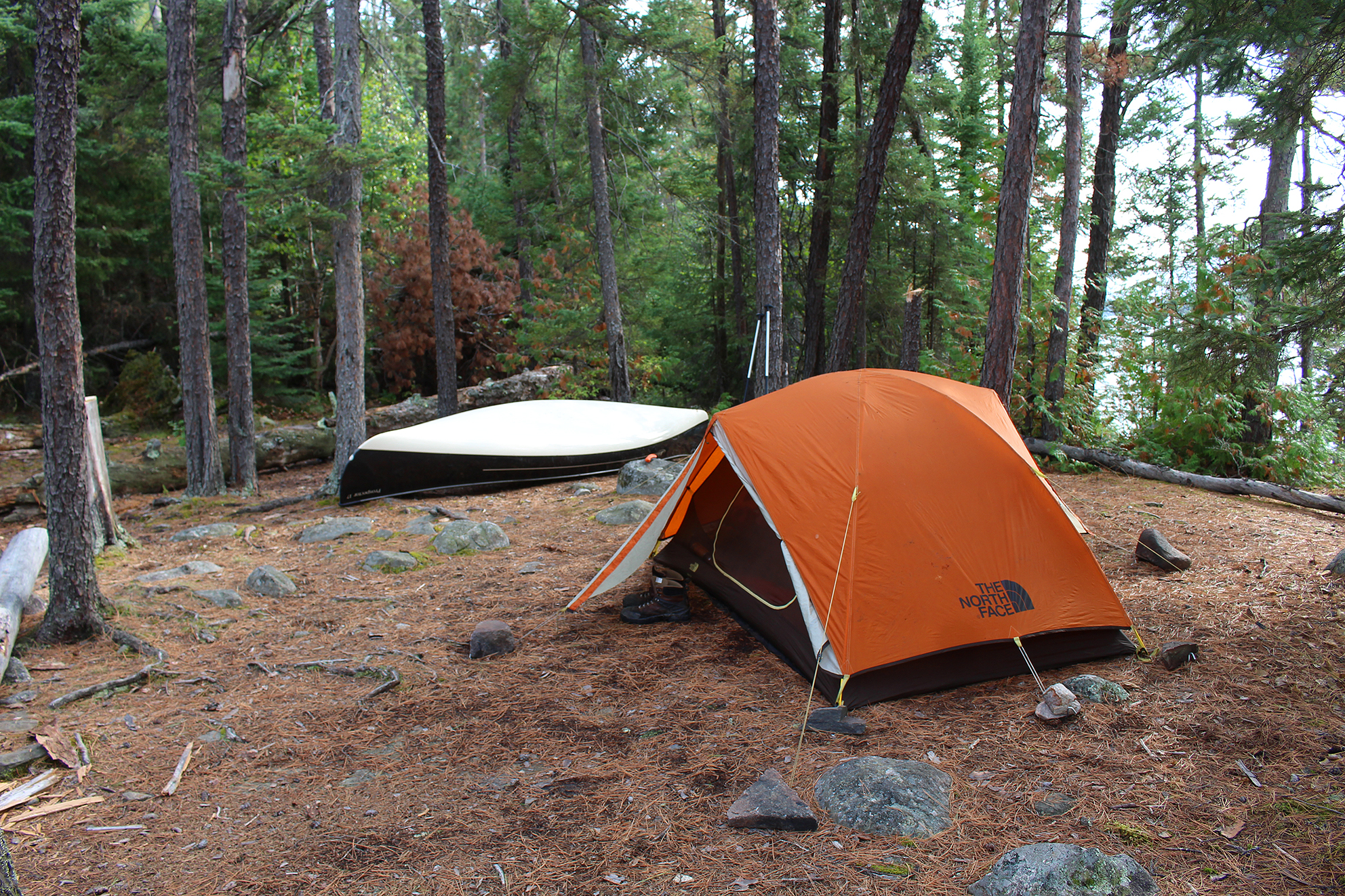
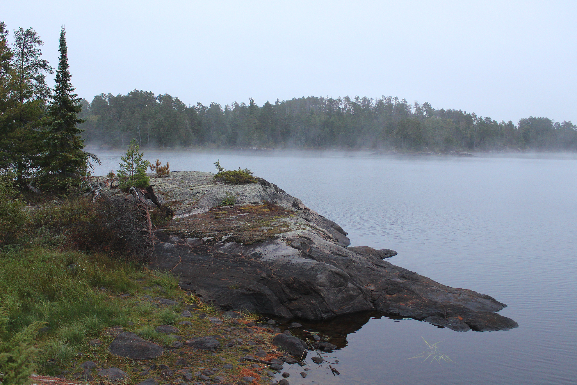
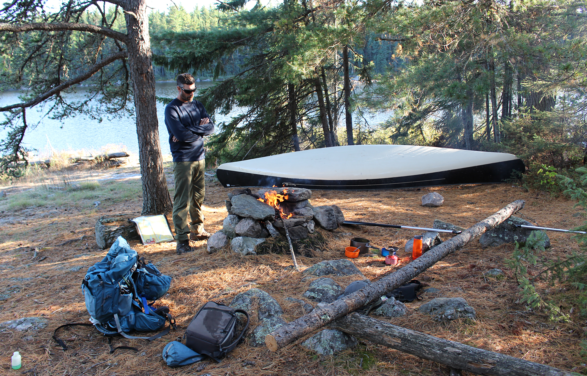
One last struggle with headwinds on Walter Lake and we arrived at the large island site later than we expected at 5:15 pm. This is the only island site that we know of on Walter Lake. The site was mainly out of the wind, with a nice flat spot for a tent, and a large smooth rock for an easy launch with the canoe.
We had enough daylight to relax, pump water, and have a fire big enough to burn our garbage. We saw around 10 people today, which sounds about right since we were only a days paddle from one of the primary launches into the park. Luckily we were also far enough into the park that our site didn’t have any signs of garbage such as toilet paper, a known problem at sites closer to the access points.
Tomorrow we head towards Russell Lake. We wondered if we will smell or see the fire.
Wildlife Sightings: Common Loon, Red Squirrel, Ring-billed Gull, Common Raven, Black-capped Chickadee, Yellow-rumped Warbler, Red- breasted Nuthatch, Ruffed Grouse, Pine Siskin, Blue Jay, People, Bald Eagle
Remember to: No remember to today! Yeah!
Day # 2: Walter Lake to Sturgeon Lake
Weather: Mix of sun and clouds. Windy. High: 23 C Low: 13 C
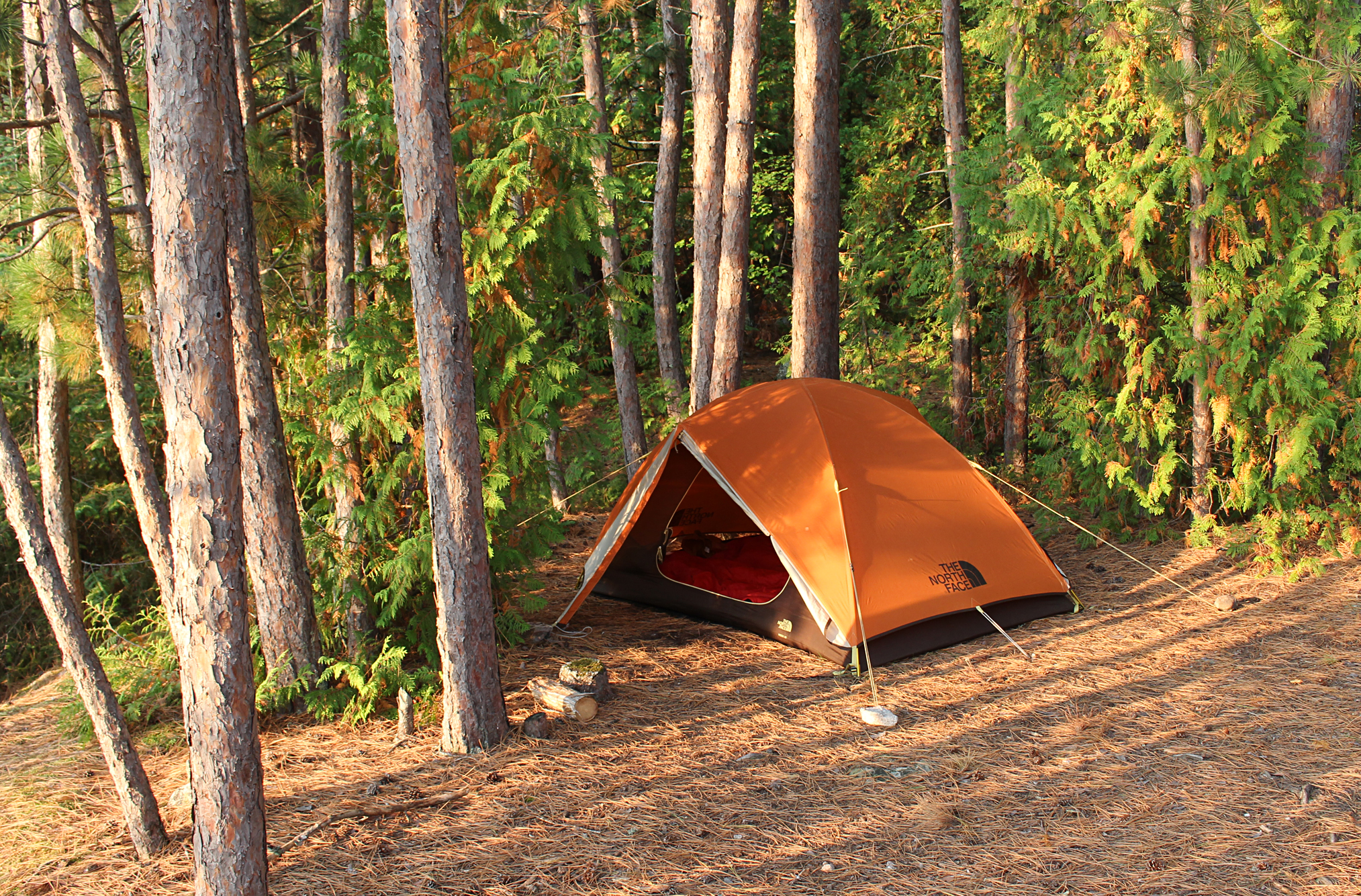
Around 5:00 am we woke up to a thunderstorm that thankfully stayed mainly to the north of us. Light rain continued at 7:00 am when we ventured out of our tent, grabbed our cooking supplies, and made oatmeal under the vestibule. We also discovered that our tent was no longer as waterproof as it once was as we could feel the faint spray of rain coming in. Our tent is about ten years old now and we are anxiously awaiting for North Face to release the next generation of the Rock 22.
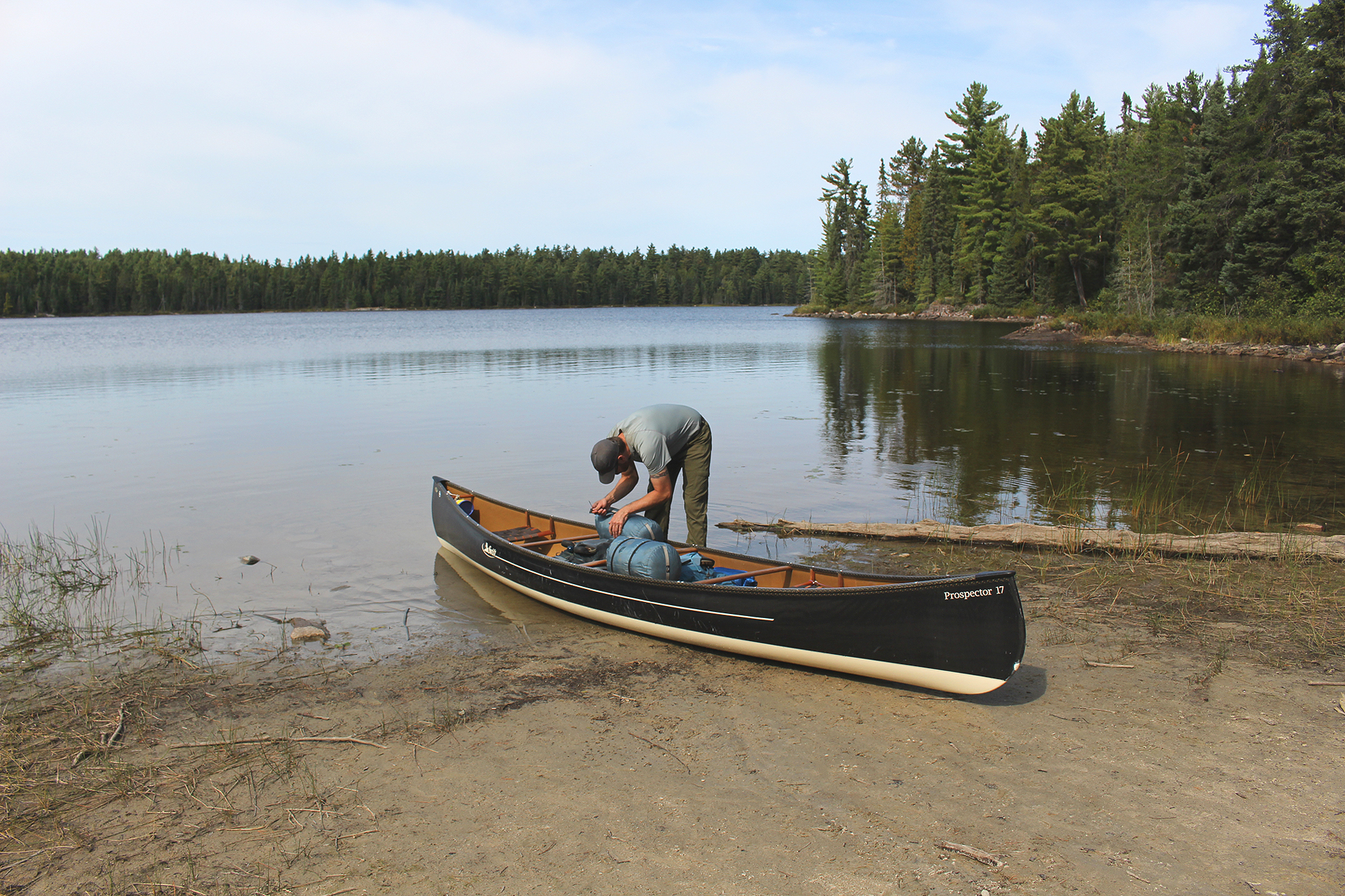
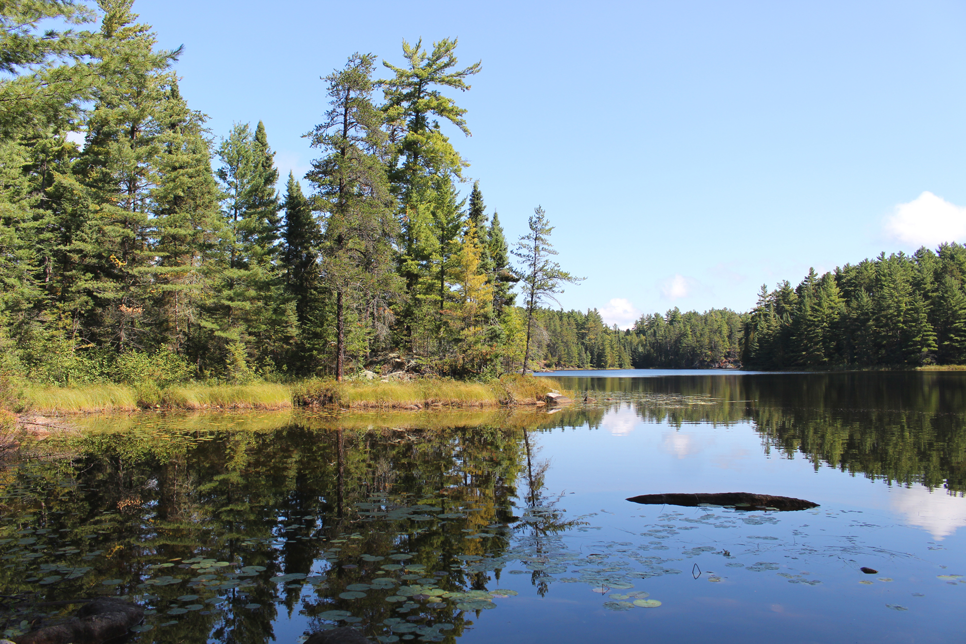
We had a late start at 9:15 am and made our way south on Walter Lake. The rain stopped shortly after we launched and after the 70 metre and 110 metre portage into Lonely Lake it was sunny again! When we entered Lonely Lake we encountered today’s edition of “The Headwinds” (sounds like a name for a lame backcountry soap opera) and so begun another slog. Even while paddling the creek between Lonely and Sturgeon Lake we experienced headwinds. Two small portages, along with three beaver dam lift overs gave us a chance to stretch our legs before we entered the open waters of Sturgeon Lake.
Sturgeon Lake is one of our favourite Lakes. It’s a larger lake with a lot of character including hills, islands, and even a sandy beach. It can also get some pretty wicked waves when windy. As we entered Sturgeon Lake and turned the canoe eastward, we also got to experience sideways winds. Though not as slow going, the sideways winds were harder on Aaron’s shoulders as he steered from the stern.
Our original plan was to get as far as McDougall or Keats Lake, but it was already 3:00 pm when we arrived at the Sturgeon Narrows. Paddling up the narrows we found a site on a small point along the eastern shoreline. It was an average site with three dangerous widow makers, while the seating area around the firepit was also in need of some work. If we were to stay here for more than a single night we would have taken the time to fix it up.
We are now three kilometres away from the Russell Lake fire. We can’t smell anything and hope that last night’s rain helped contain it more.
Chili was on the menu for tonight’s supper, and we had a few mosquitoes as unwelcomed dinner guests. After sunset a small swarm of mosquitoes hung around and we retreated to the tent while we listened to their high pitched whining for blood on the other side of the tent.
Wildlife Sightings: People, Canada Goose, Boreal Chickadee, Red Squirrel, Red-breasted Nuthatch, Yellow-rumped Warbler, Common Loon, Bald Eagle, Red-tailed Hawk, Belted Kingfisher, fish species.
Remember to: Our tent is no longer as waterproof as it once was. Probably time to invest in a new one soon.
Day # 3: Sturgeon Lake to Heronshaw Lake
Weather: Partly cloudy. Windy. High: 24 C Low: 12 C
As we poked our heads out of the tent this morning we were greeted with beautiful calm skies. For breakfast we had warm granola cereal with dried cranberries, dehydrated apples, and brown sugar. A hot tea is always a must for us first thing in the morning.

We left our site at 8:00 am and made our way to the 460 metre “Staircase Portage” into Russell Lake. Unfortunately, the easy 80 metre “Russell Rapids Portage” at the north end of the Sturgeon Narrows was off limits due to the fire. This was the second time we have done the “staircase”, the first time back in 2014 when we did the Hunter Island Loop. The portage itself isn’t that bad with the steep slippery rock section at the Sturgeon Lake end, and it was certainly slippery this morning!
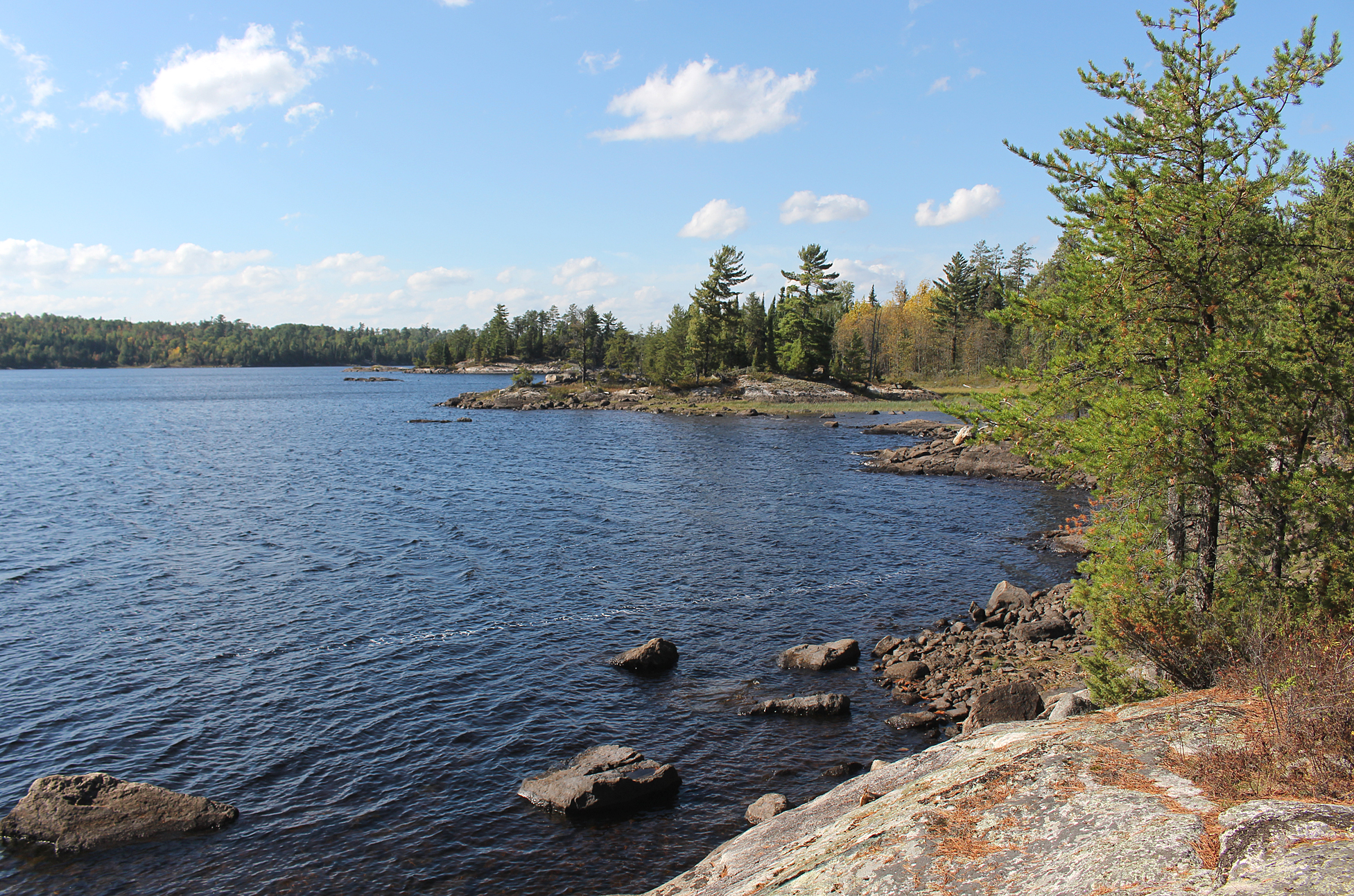
It was a sunny and calm paddle as we crossed Russell Lake. A nice sandy beach met us at the 390 metre portage into Chatterton Lake. While doubling over we met a group of guys that were just arriving at the portage from Russell Lake as well. Two of them were from Chicago and their friend was from Australia. With the forecast calling for wind today we decided to forego viewing Chatterton Falls which was just around the corner at the put in into Chatterton Lake. We will be back through this section in about a week so we will check then out then.
As we began to paddle Chatterton Lake, an over the shoulder look to the northwest revealed charred trees along the far northern shore, but no smoke. Perhaps the forest fire is just smoldering now?
The forecasted winds began to pick up from the south while we were on Chatterton Lake. At the 450 metre “Split Rock Falls” portage we met four more people. They were a group of guys that were flown into Cache Bay and were being picked up at the Nym Lake launch at the end of their trip. The Split Rock Falls portage is neat with ascending and descending sections. There is also a spot where you have to almost jump from a huge rock to another huge rock as you make your way to the put in above the falls. Adjacent to the falls there was a couple of spots to put in the canoe and we chose the spot furthest away from the strong current.
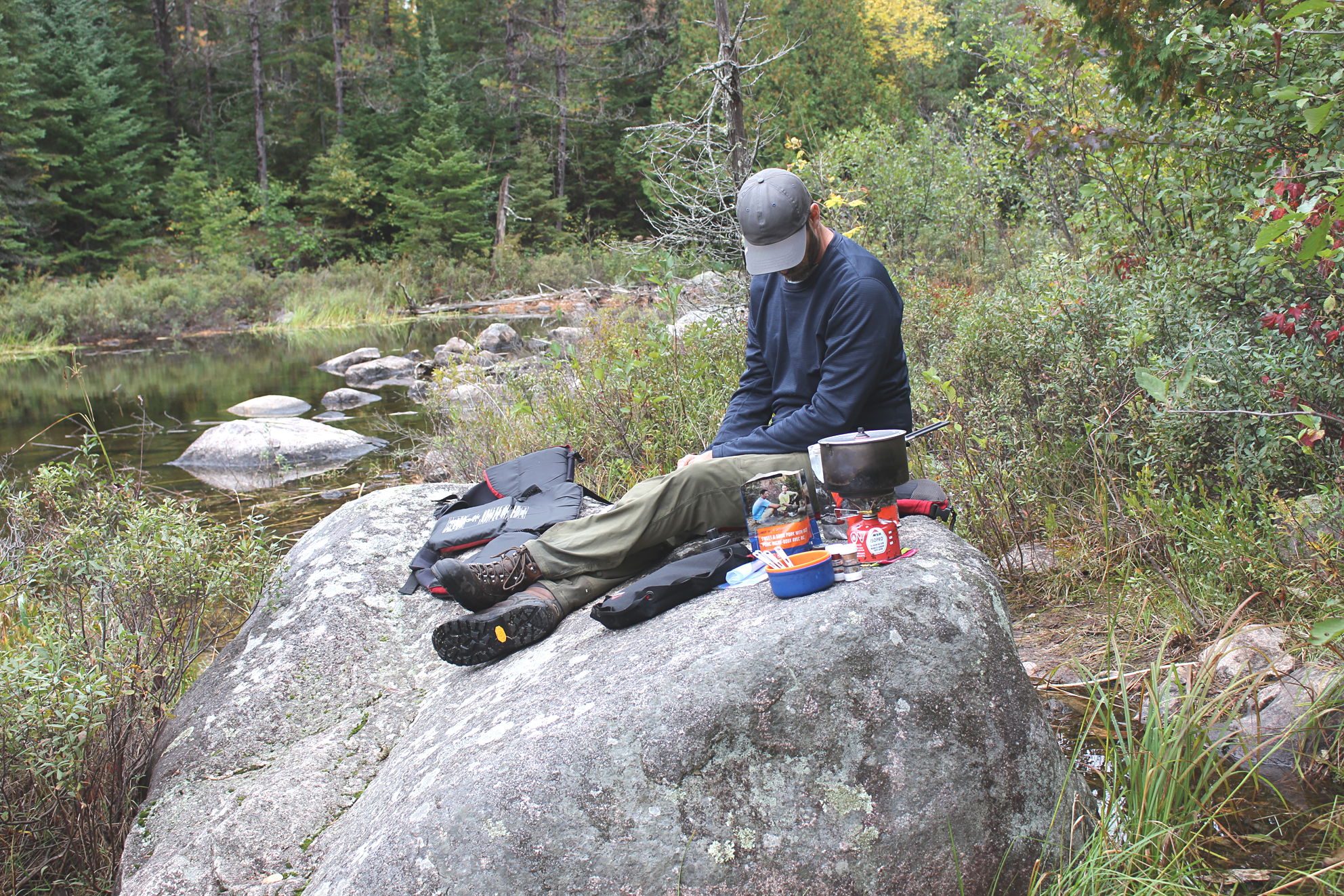
As we made our way east on Keats Lake we heard and later observed Snake Falls, while beside it to the north is the 290 metre “Have a Smoke Portage”. The landing was very rocky here so Marianne got out from the bow of the canoe and pulled it ashore. We have yet to find out how the “Have a Smoke Portage” got it’s name. The only suggestion we have come across online is that it is okay to have a smoke here as it is an open area with so many rocks around. We both don’t smoke so we didn’t bother.
Strong winds met us on Shelley Lake and Kahshahpiwi Creek was a wind tunnel! It was already past mid afternoon when we were met with the challenge of finding the portage into Heronshaw Lake. We knew the portage was labelled wrong on the Fischer Map, and standing in the rocky shallows of Kahshahpiwi Creek it was difficult to tell how far down the creek we actually were. With low water levels we carried everything further south until it was deep enough to paddle again, and soon we located the portage that was around a corner. The portage itself was an easy 200 metres and it probably took us just as long to portage it as it did to find the darn thing!
The headwinds were relentless as we entered Heronshaw Lake and would be the worse headwinds we were to experience for the whole trip. We wanted to get to Cairn Lake by this evening but these winds were getting downright dangerous! We slowly made our way to a swampy island which we thought was the location on the map where Marianne labelled a campsite, but when Aaron turned on the GPS (we try to use this as little as possible) we were off by just one island. We arrived at our island site around 6:15 pm which gave us just enough time to put up the tent, pump water, have a couple of Kind Bars, bath, and brush our teeth. After sunset it was still windy, but luckily our tent was sheltered amongst the trees with no widow makers nearby. Listening to our windup weather radio we were also under a severe thunderstorm watch. We really hope the storms stay away!
Wildlife Sightings: Bald Eagle, People, Common Merganser, Boreal Chickadee, Red-breasted, Common Loon, Belted Kingfisher, Northern Flicker, fish sp., Pileated Woodpecker, Pine Siskin, Spotted Sandpiper
Remember to: No remember to today. Yeah!
Day # 4: Heronshaw Lake to Kahshahpiwi Lake
Weather: Sunny and cloudy in the morning with increasing clouds and a thunderstorm in the afternoon. High: 24 C Low: 18 C
Strong winds continued all night, though by morning we were pleasantly surprised that they calmed down completely.
It was very still when we got out of the tent and we located the firepit at the highest point of the entire site which was a great spot as long as it wasn’t windy. We were a little behind schedule so it was a quick breakfast of Kind and fruit bars with tea, and by 8:00 am we were off again paddling south.
This morning Heronshaw Lake was so calm compared to yesterday’s strong winds. We felt like we were at a totally different lake as nothing was familiar to what it was a mere 8 hours ago.
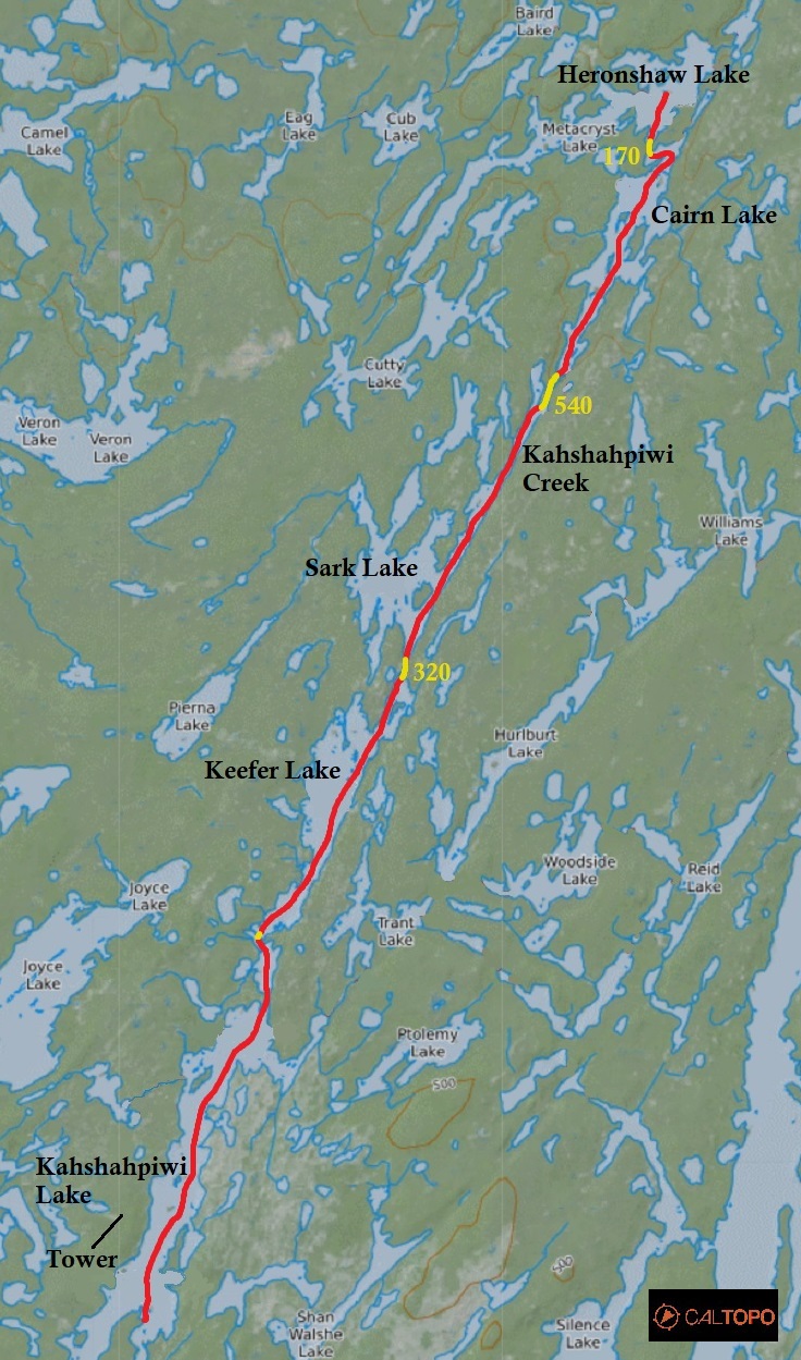
After a 170 metre portage we soon entered Cairn Lake and WOW was it ever a beautiful lake! In fact, all of today’s lakes as we entered the heart of Quetico were picturesque with views of rocky islands. Another trip is in order to spend more time exploring this section of the park!

The sun played hide and seek with the clouds this morning, and later dark blue and soon to be ominous looking clouds began to dominate the sky. It continued to get warmer as we entered Sark Lake, followed by Keefer Lake, and the air was also very still which is a good recipe for severe storms.
Along our travels today we met a group of canoeists from Iowa, and a soloist from Minnesota heading to Kawnipi Lake that was out for a whole three weeks! For us a three week trip anywhere would be a dream, but to do it solo….I don’t think either of us have the constitution to do so.
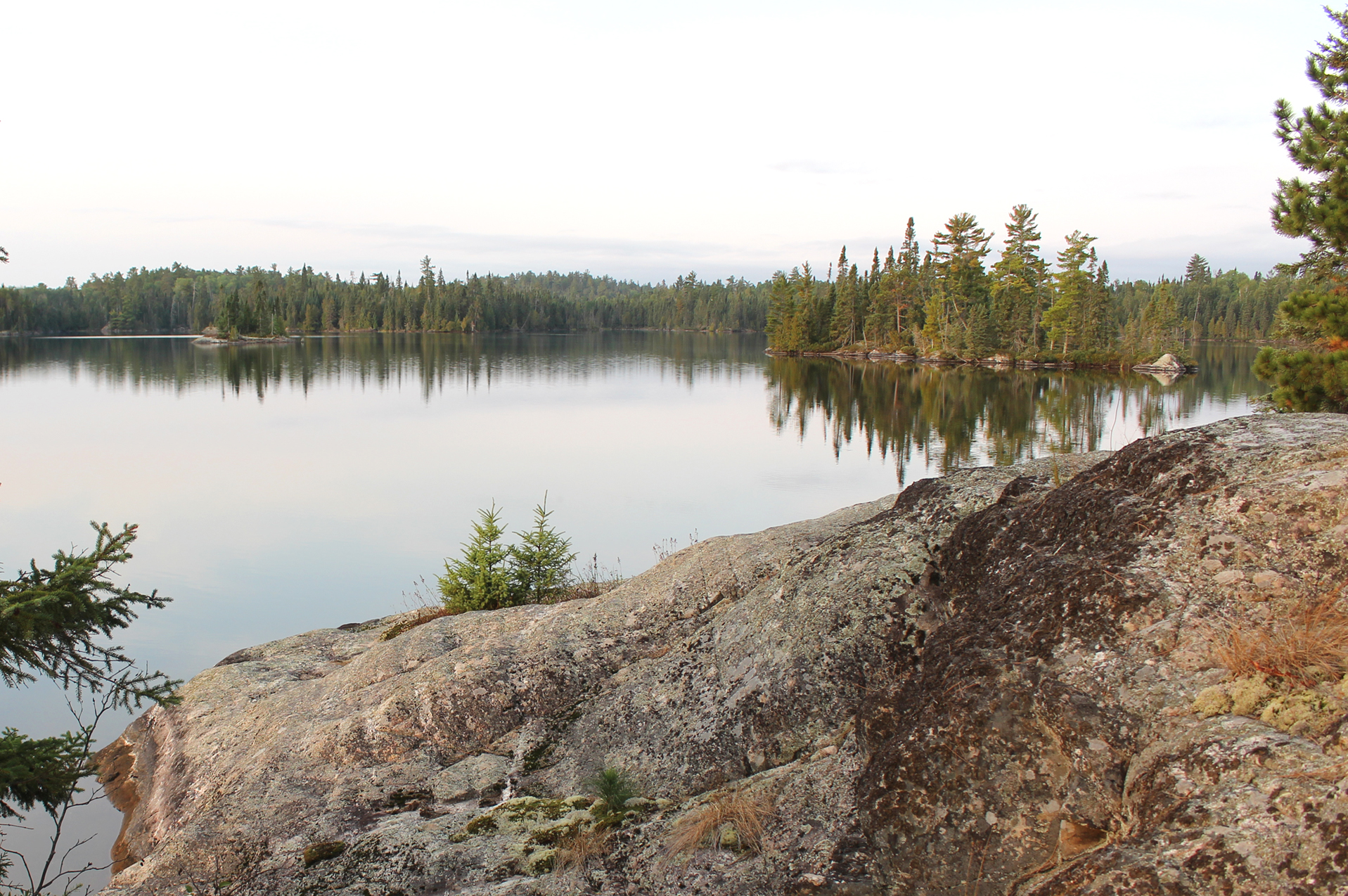
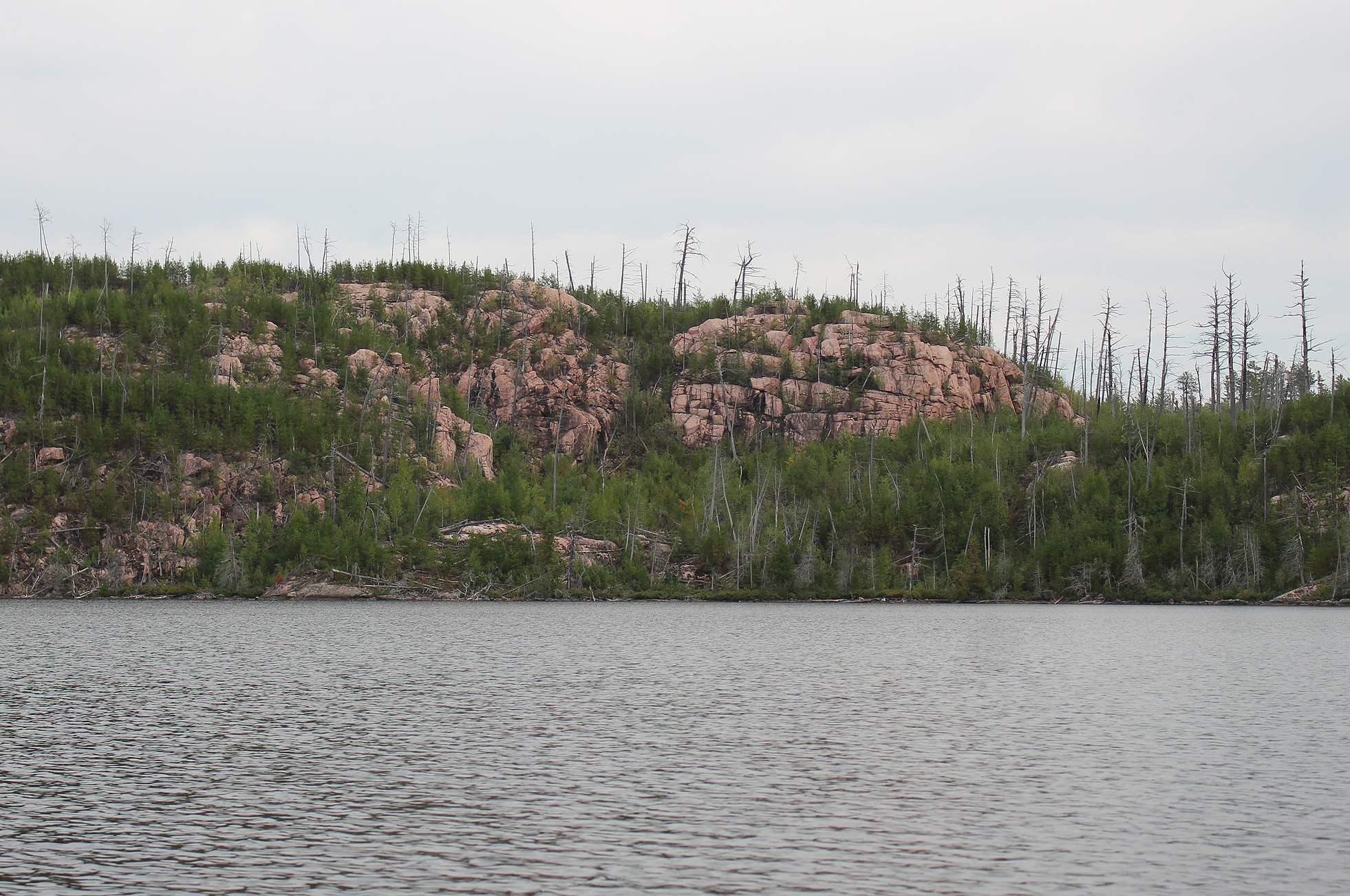
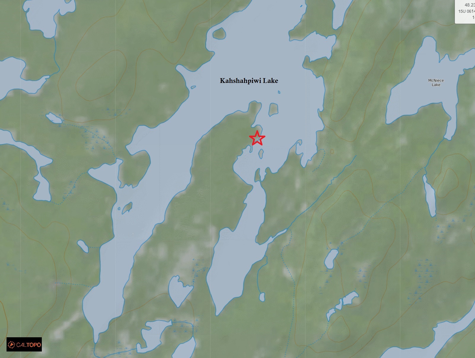
Our last lake of the day was Kahshahpiwi Lake. The name Kahshahpiwi comes from the Ojibwe meaning “the lake that flows continuously” which makes sense as the route paddled and portaged goes right through the Hunter Island area. As we paddled south we could see that there was once a fire along the eastern shore (from we believe 2006) with new growth already filling in the gaps of scorched earth. We also saw an old fire tower far up on the western shore on the opposite side of the lake which is now apparently a communications tower.
We made it to a site on a large peninsula around 2:30 pm. The site had a nice spot to bath and launch and an okay seating area at the fire. As soon as we arrived we quickly put up the tent as the skies continued to look ominous. It was quite humid now and we took a quick bath to cool ourselves and wipe the stink off. While Marianne was bathing she felt a couple of quick stabs on her toe. Looking down she saw a crawfish that was apparently not impressed with us invading on its turf.
We were thinking about paddling around the corner to look for the pictographs located on the lake’s southwestern shore but rumbles of thunder boiled over in the distance, so instead we gathered our things and retreated to the tent. It didn’t take long before the thunderstorm was right on top of us with lots of lightning and sometimes very close thunder! It lasted for about an hour and we were happy that no strong winds were associated with it. We were also thankful that it rolled through leaving us just enough light to have a real supper of Sheppard’s pie with stuffing. YUM!

After pumping water we played the card game war in the tent as night fell. We actually had a hard time even finishing the game and had to quit after an hour because neither of us could get rid of all our cards!
Wildlife Sightings: Black-backed Woodpecker, Boreal Chickadee, Canada Jay, Crawfish, Common Raven, Herring Gull, Common Loon, Northern Flicker, Red-breasted Nuthatch, Belted Kingfisher, People, Bald Eagle, Fish species, Red Squirrel
Remember to: No remember to today! YEAH!
Day # 5: Kahshahpiwi Lake
Weather: Partly cloudy. Windy. High 23 C Low: 18 C
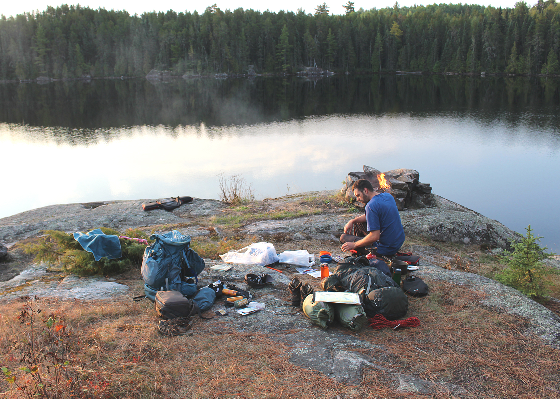
Probably one of the most essential items we use on any backcountry camping trip is our windup solar powered radio. Not only is there some unique local stations such as NPR and CBC to listen to, but the weather band can literally dictate our next move. 50 kilometre per hour wind gusts were predicted for today, so we decided to make today a wind bound day, the first of two we allotted for ourselves for the whole trip.
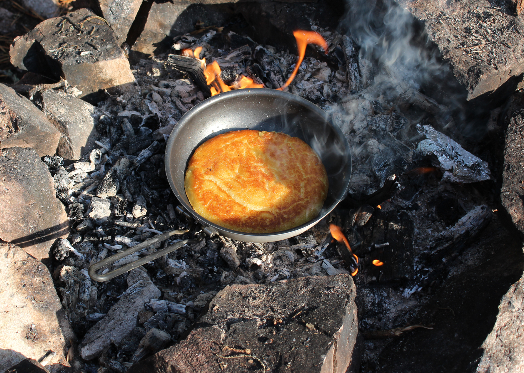
We began our lazy day by preparing hot coals on the firepit for a pancake. As with almost all of our backcountry pancakes, this one would be topped with peanut butter and jam! The entire morning consisted of chilling by the lake out of the wind while listening to NPR radio.
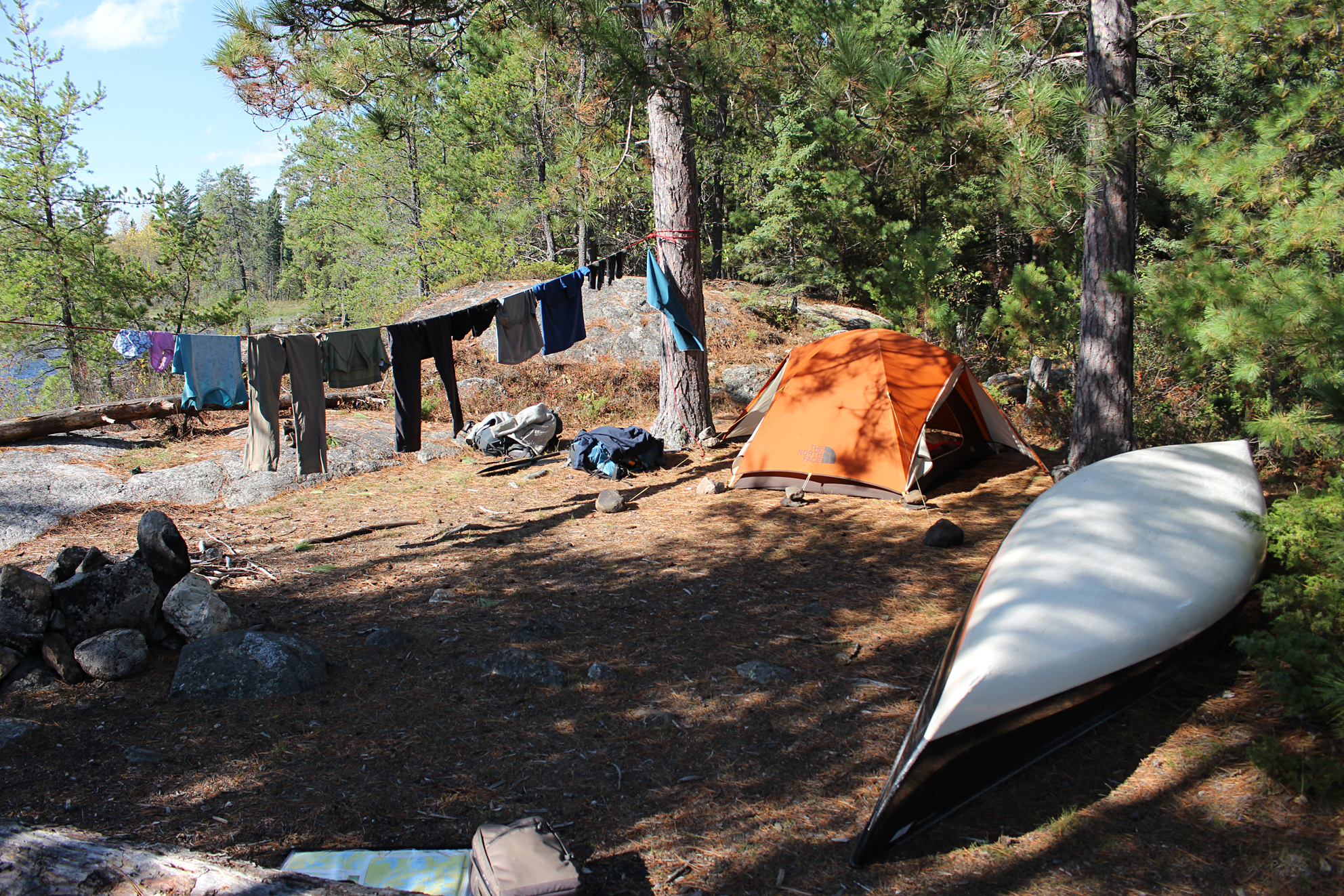
Today was also laundry day so we washed our clothes and layed them in the sun to dry, moving them every so often as needed to keep them in the sun. Around noon we saw a low flying float plane and we wondered if they were looking for someone or maybe picking someone up.
Exploring behind the site, Marianne flushed a Ruffed Grouse, and saw a Black-backed Woodpecker working on one of the dying trees. Aaron chilled in the tent and read the SAS Survival Guide. After a couple of Mountain House meals for lunch, we looked over our route on the map. These past windy days, with this one in particular, has left us a little behind schedule. We decided to shave off some kilometres to our route by taking a shortcut into the middle of Agnes Lake via Noon Lake to Silence Lake, instead of heading south all the way to Burke Lake and entering the Agnes Lake from the south. Unfortunately this would mean missing Louisa Falls which is too bad because the falls have a natural jacuzzi, and in these warm temperatures would have been lovely!
Though it was another warm afternoon the winds kept it feeling a little cooler. We were lucky that most of our site, tent included, was protected against the strongest winds. We took another quick bath in the lake and got our gear ready for tomorrow. We placed tomorrow’s food in our little travel backpack so we don’t have to dig into the main packs at first light tomorrow.
A homemade rehydrated meal of spaghetti with tomato sauce was in the pot for tonight’s supper. No thunderstorms today which was a nice change.
Wildlife Sightings: Common Loon, Dark-eyed Junco, Northern Flicker, White-throated Sparrow, Golden-crowned Kinglet, Red Squirrel, Ruffed Grouse, Black-backed Woodpecker, Common Raven
Remember to: Mark known campsites on adjacent lakes, not just those on our planned route, just in case we have to reroute our trip.
Day # 6: Kahshahpiwi Lake to Agnes Lake
Weather: Light showers in the morning with a mix of clouds and sun in the afternoon. High: 25 C Low: 21 C
This morning we got up by 5:30 am to get a head start on the day. We were on the water by 7:30 am and made our way to the southern most end of Kahshahpiwi Lake to check out the pictographs along the cliff. Though there was supposed to be two sets of pictographs along this cliff we were only able to locate the one that had an image of a turtle.
After heading back around the peninsula we made it to the longest portage of the trip, the 1,230 metre “Yum Yum portage”. As with most named portages, this one had some character to it. The Yum Yum portage is rugged, steep, and even has a huge slab of rock on a 40 degree angle that requires you to push the canoe down first and then slide down on your butt afterwards. It was a workout for sure and we got our sweat on. We had a little bit of light rain this morning and we were happy that the rocks along this portage were not particularly slippery because if they were the portage would have been a lot more difficult!
So what is so yummy about the Yum Yum Portage and the adjacent Yum Yum Lake? Well nothing actually. Yum Yum is the character in a play called “The Mikado” and Yum Yum was the name of one of the characters in the play. There is also a character named Koko (Koko Falls is part of the Falls Chain in Quetico), and another character named Poohbah, another lake name in the park.
The next portage, a 580 metre into Grey Lake actually felt longer than the following 720 metre from Grey into the unnamed lake. Perhaps this was because it was more rocky which slows you down a bit.
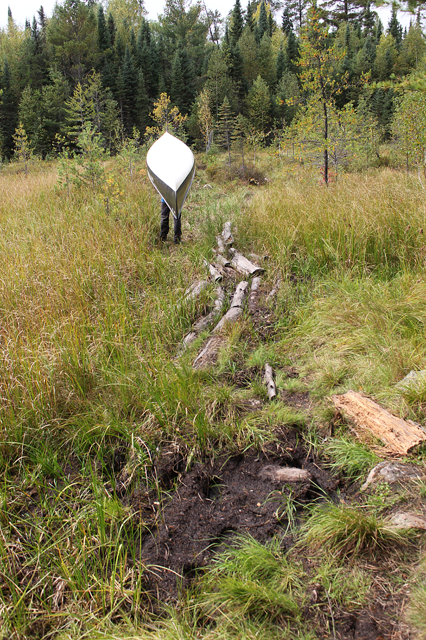
The 720 metre portage from Grey to the unnamed lake has gained some fame of its own as you have to go through close to a hundred metres of boot sucking bog in the middle of the portage. Logs are placed down in the middle of the bog to walk on but apparently they are not always stable, and people have slipped off only to land up to their waists in muck! We knew this going in, but thanks to a hot and dry summer we could actually walk beside the logs only sinking an inch at most.
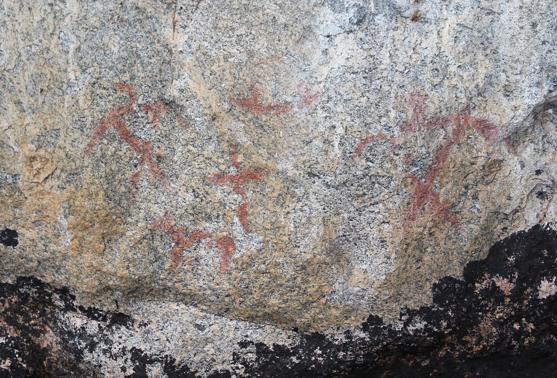
Another lake we will have to return to on a future trip is Shade Lake. We paddled past a few campsites and from the canoe they looked really nice! We took a quick detour to check out some pictographs which were symbols of thunderbirds. Interestingly they were quite high up form the waterline.


Along the portage to Noon Lake we met a couple of young canoeists and another two paddling on Noon Lake. Both were coming from Reid Lake on their way to Shade Lake for the night. Reid Lake is named after Paul Reid, a pioneer in Canadian aviation who flew forest fire detection patrols in Ontario, mapped some of the northern frontier in Canada, and survived twice when others gave him up for dead. Why is this even mentioned when we haven’t even visited this lake?, because Marianne’s maiden name is Reid so she had to boast.
Back to our actual trip it was also around this time, after meeting these two groups of guys from Reid Lake, that Marianne realized she hasn’t seen another girl since day one of our trip. After a few more short portages through Summer, Sultry and Silence Lake, we entered Agnes Lake. Before entering Agnes Lake we turned around and saw a wall of grey clouds creeping up behind us from the west, so rain on it’s way yet again. Paddling up the western shoreline of the large Agnes Lake we found the park’s only known petroglyph, which depicts either four caribou or deer. A short 50 metre paddle north of that and we saw another pictograph. This one was an image of two rabbits, though only one of them is recognizable.

Paddling north and east we approached our large island site at around 6:00 pm. Today was a long and successful day! We set up the tent, quickly bathed, pumped water, and had a homemade dehyde of veggies, egg noodles, and parmesan cheese. A pair of Canada Jays investigated our meal but they were not interested in any handouts.
Just after sunset we got a small fire going with thunderheads in the south, now glowing pink from the sunset, travelled from the west to the east. After sunset the clouds turned a darker shade of blue and once in a while we saw lightning dancing from cloud to cloud with very distant rumbles of thunder. We were glad they remained to the south.
Wildlife Sightings: Common Loon, Red Squirrel, Chipmunk species (either Least or Eastern), Canada Jay, Boreal Chickadee, Bald Eagle, Ruffed grouse, Canada Geese (migrating south), frog species, Pine Siskin, Yellow-rumped Warbler, Black-capped Chickadee, Red-breasted Nuthatch, Common Raven, People.
Remember to: No remember to today! Yeah!
Day # 7: Agnes Lake to Kawnipi Lake
Weather: Light rain in the morning with clouds the rest of the day. High: 20 C Low: 14 C
BOOM! At 2:30 am a thunderstorm rolled through with lots of thunder, lightning, and heavy rain. We did not get much sleep that night.
Light rain continued at 7:00 am when we got out of the tent to have a hot breakfast of “Super Awesome”(Bob Red Mill Mighty Tasty Hot Cereal) with dried cranberries and brown sugar on top, and a hot tea. Finally by 10:00 am the rain stopped and we slid the canoe back into Agnes Lake.
Just around the corner from our site is another great pictograph site. This one had a bear, an abstract shape, two people in a canoe, and two Maymaygwayshi in a canoe. The Maymaygwayshi to the Ojibway people were short hairy-faced mischievous little men who lived along the waters of rivers.
Our original plan was to take a short side trip to Ahsin Bay on Payne Lake to check out those pictographs as well, but a late start to the day made us skip this side trip. We actually didn’t see anyone during our whole time paddling Agnes Lake which we thought was somewhat strange.

Our portages, which were three in total (at 310 metres, 330 metres, and 460 metres), were relatively flat but quite rocky. While silently paddling north on Keewatin Lake Aaron spotted three River Otters who came to the surface periodically making interesting chirping noises. Also on Keewatin Lake we saw two sets of pictographs which included a fat moose and some thunderbirds.

After the 460 metre portage we entered Kawnipi Lake. Here the forest had more deciduous trees with some fall colours beginning to show.
We paddled to the far northwest end of Kawnipi Lake without seeing a single soul since we began our day. According to our Fisher Map there were supposed to be some pictographs around this area but we couldn’t locate them nor the campsite that was supposed to be right beside them on the eastern shoreline. We continued to paddle northwest on Kawnipi Lake to look for a site at the more shallow end of the lake. The first site we examined wasn’t to our liking so we paddled to a small site on an island next to a shallow marsh. This site was also mediocre with lots of downed trees and it was completely infested with mosquitoes! Today was the first day we had to break our the bug spray.
The mosquitoes did not deter us from getting some hot coals going in the firepit to make bannock with rehydrated black bean hummus pooped on top for flavour. After pumping water it was a quick rush to the tent and murder any incoming mosquitoes. While playing cards by the light of a hanging headlamp we heard the distant rumble of thunder to the north, though we just got a few sprinkles of rain.
Wildlife Sightings: Common Raven, Common Loon, Bald Eagle, Yellow-rumped Warbler, River Otter, Pileated Woodpecker, Red-breasted Nuthatch, Red Squirrel
Remember to: Mountain House Pasta Primavera tastes better than Back Packers Pantry version.
Day # 8: Kawnipi Lake to Chatterton Lake
Weather: Mainly sunny. Windy in afternoon and into the evening. High: 25 C Low: 15 C
BOOM! At 1:00am another storm rolled through with lots of rain and lightning. This is by far the most thunderstorms we have ever had on a canoe trip! Maybe even all of them combined!
This morning we woke up at 6:30 am, and in a hail of mosquitoes we quickly took down the tent, packed up our stuff, and got the hell off of that island! The mosquitoes hung out with us in our canoe to almost our first portage, an 80 metre back into Kahshahpiwi Creek. We are now beginning to retrace our route.
As we continued west we returned to the 290 metre “Have a Smoke Portage” and took a small break to take photos of the falls.
Continuing west we looked back at Snake Falls. Our plan was to camp on McDougall Lake but the 290 metre portage out of Keats Lake was way too steep and looked like it hasn’t been used lately, so we headed north to the 450 metre “Split Rock Falls” again. It was along this portage we noticed that the forecasted winds were beginning to pick up. We continued northwest and said “screw you winds” giving up on McDougall Lake altogether and settled instead for a site on lower Chatterton Lake. This site was another one that Marianne discovered online and drew a dot on the map. We arrived around 2:00pm and it was a really nice site! It’s on a peninsula with a nice flat spot for a tent and at the shoreline are large flat rocks to stand on while you rinse off in the lake. We were just south of the “No travel/camping” area due to the forest fire which was about 3 kilometres to the northwest of us.
Taking advantage of the warm sunshine we bathed, washed our clothes, and hung them up on a clothesline. The winds were getting quite gusty and as a minor inconvenience every so often we had to pick up a piece of clothing that fell off the clothesline. For the rest of the windy hot afternoon we retreated to the shelter and shade of the tent and played a round of UNO before we had supper which consisted of homemade rehydrated chili with a cool and sweet side of Gatorade.
The winds finally died down in the evening and while Aaron was pumping water, Marianne spotted two guys in a canoe heading west right before sunset. They probably had to wait out the headwinds and were paddling until dark.
Wildlife Sightings: Osprey, Bald Eagle, Frogs, Black-capped Chickadee, Red-breasted Nuthatch, Common Loon, Red Squirrel, Belted Kingfisher, Garter Snake, People
Remember to: Without having breakfast, it takes an hour to break camp.
Day # 9: Chatterton Lake
Weather: A mix of sun and clouds. Windy. High: 14 C Low: 13 C
Around midnight we woke up to the sound of wind. Aaron quickly went out of the tent to add rocks to the canoe to prevent it from rolling over. From that point on we didn’t have the most restful sleep.
When we noticed dawn was approaching it became painfully apparent that we were not going anywhere today. The temperature also dropped and for the first time this trip we felt a little chilled in the tent. We finally got out of the tent around 10:00 am and had honey granola with rehydrated apples for breakfast, along with a nice hot tea.
A couple of paddlers were out on the water this morning and lucky for them they had a pretty nice tail wind to help them to their next destination. We have yet to experience that kind of luck on this trip.
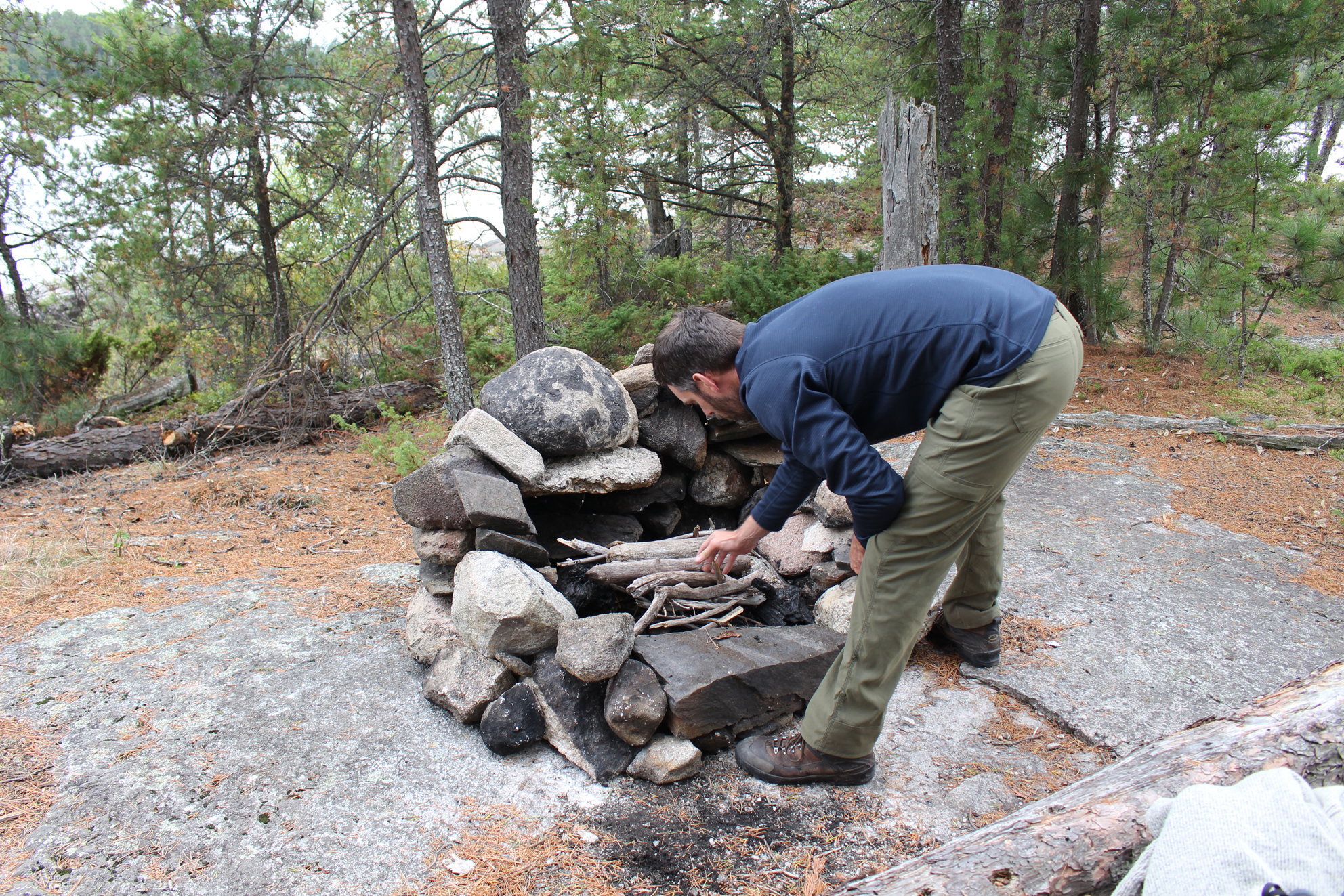
We just chilled around the site today. We moved and rebuilt the fire pit in a more appropriate spot on a bare rock where it looked like it used to be until someone else moved it. We also improved it even further by gathering more rocks to build a back wall. Most of the rocks were close to the lake so we got our daily exercise when we lugged them up to our site from the shore.
Towards the late afternoon the winds finally settled down a bit, though too late in the afternoon for us to paddle. Far to the west in the distance we spotted a solo paddler making his way towards us. Marianne grabbed her binoculars and saw that it was the same solo paddler we met prior that was out for three weeks. Upon seeing Marianne he came to shore and we had a good chat. He ended up spending a few days on Kawnipi Lake and checked out the Falls Chain. He was in very good spirits as he still had a whole week left on his trip. He also gave us some valuable information that the Russell Rapids was opened again for travel as the fire subsided enough to allow passage through that area. This was great to hear as we wouldn’t have to do the dreaded “Staircase Portage” again.
A flock of Yellow-rumped Warblers hung out around our site for most of the day, possibly fueling up before they begin their fall migration. Speaking of fall migration, it appeared that the avian floodgates were now opened as we saw at least five lines of Canada Geese throughout the day. This was the first day we observed migrating geese, no doubt due to the change in temperature.
As night fell we had nice big fire in our epic fire pit. Overhead in the distance we heard more geese migrating. It was then that we realized that our trip, and summer for that matter, was almost over.
Wildlife Sightings: American Crow, Yellow-rumped Warbler, Palm Warbler, Golden-crowned Warbler, Black-capped Chickadee, Red Squirrel, Canada Jay, Red-breasted Merganser, Yellow-bellied Sapsucker, Common Loon, American Robin, Belted Kingfisher, Canada Geese (migrating south), Bald Eagle, People
Remember to: No remember to today!
Day # 10: Chatteron Lake to Jesse Lake
Weather: Foggy in the morning. Partly cloudy skies for the rest of the day. High: 15 C Low: 8 C
Go time this morning! All rested we got up at 5:30 am, had a quick tea with some Kind Bars, and were back on the water by 7:15 am. It was a calm and foggy morning and the air was a lot cooler than the water as we could feel warm air rising off of it. We paddled northwest to the 390 metre portage into Russell Lake. The morning fog created a damp mist which left us slightly chilled as we paddled.
Along the portage from Chatterton to Russell Lake we viewed a huge 100 foot, 4 metre in diameter pine tree. Entering Russell Lake we had a pretty descent view of the bottom of Chatteron Falls, but once again we decided to skip checking out the top of the falls. Maybe next trip? Paddling northwest on Russell Lake we saw a tent on an island site and we paddled past the site we stayed at in 2014 when we did the Hunter Island Loop.
Soon the unmistakable scent of burnt wet wood reached us as we headed very close to where lightning struck back on July 29th on the north shore of Russell Lake. In the far distanced through the fog and mist we saw charred trees. We decided not to go out of our way for a closer look and continued towards the Russell Rapids portage.
As we approached the portage we saw a sign saying that it was still closed. Maybe no one had a chance to take it down yet? Sign or no sign we could clearly see we were not in any danger so we portaged the easy 80 metres while the Russell Rapids babbled beside us.

Sturgeon Narrows was delightful and calm as we made our way south. The continuing mist left us a little damp and chilled, but not enough to bother with the rain gear. When we came out of the narrows and entered the wide expanse of Sturgeon Lake we remarked that we have probably never been on this lake when it was this calm before. When we were here a few days ago we battled sideways winds, and now it felt like a new lake for the trip as it looked a lot different. We continued to paddle west, not straying far from the north shore so as not to miss the marshy area to a creek that heads back to Lonely Lake.
A single lift over a beaver dam, along with two more between Lonely and Walter Lake, we entered Walter Lake and paddled past our island campsite from earlier which appeared unoccupied. Returning to the 230 metre portage between Walter and Elizabeth Lake, through the section of huge blowdowns, we wondered how long it took park staff to clear up what may have been impassable at one point.
We decided to camp on Jesse Lake with our sights set on an island site. For the first time on this whole entire trip the site that we wanted was actually occupied. We then turned and headed towards the site closest to tomorrow’s portage. This site had smooth rock all away around the water’s edge that made for an easy take out. However, the rocks were incredibly slippery with a layer of organic matter making bathing anywhere really difficult. To pump water to drink we had to go out in the canoe away from the shore as to not clog up the filter.
Tonight we chilled at our site and listened to some CBC Radio. Another flock of geese migrated over. Supper this evening was Mac n’ Cheese with some vacuum packed tuna that Aaron picked up while in the United States.
Wildlife Sightings: Red Squirrel, Boreal Chickadee, Black-capped Chickadee, Canada Jay, Black-backed Woodpecker, Hairy Woodpecker, Pileated Woodpecker, Bald Eagle, Common Loon, Ruffed Grouse, Frog sp., fish sp., Red-breasted Nuthatch, Golden-crowned Kinglet, Canada Goose (migrating), American Pipit (migrating), Turkey Vulture, People, Dark-eyed Junco
Remember to: Pink Lady apple variety can stand two weeks of being in a backpack with hardly any bruising.
Day # 11: Jesse Lake to Nym Lake Launch
Weather: Foggy with sun and clouds in the morning. High: 15 C Low: 9 C
Aaron woke up cold this morning as we were not yet climatized to real fall temperatures. We exited the tent around 6:00 am, had the last of our tea, along with the last of our honey and granola cereal topped with strawberries we dehydrated from our garden back home.
We launched into the fog around 8:00 am. We were very fortunate that we had calm cloudy skies. In fact, we had calm waters for the whole morning! On Batchewaung Bay we met the only other couple out on a canoe within our sites, and we passed another couple just getting ready to take to the water themselves at the site on Mosquito Point.
While on Batchewaung Lake we both had to take a quick pitstop to stretch our legs. We decided to check out what we were told was a 5 star campsite. No one was there and as we got out and looked around we could see why this site had 5 stars! There were multiple spots for tents, a pretty nice fire pit, and a gradual slope to the lake. It was probably one of the nicest sites we have ever seen! As we got to our last portage, from Batchewaung Lake to Nym Lake, thus taking us out of the park, we took one last look and waved goodbye to Quetico. We really didn’t want to leave, but a nice hot shower was beckoning.
Entering Nym Lake the landscape changed immediately with cottages and a few homemade lighthouses dotting the shoreline. Entering Nym Lake from the portage on a clear day it is possible to vaguely see the green Ontario Parks sign that guides paddlers back to the launch on the lake’s north shore.

As we returned back to the launch and climbed up the stairs to the parking lot we saw fewer cars than when we started with most from the United States. A trio of Canada Jays foraged along the parking lot as we loaded the canoe on the car and phoned/texted our contacts that we made it out okay.
Back to the town of Atikokan and the White Otter Inn for supper. On the drive back to the Trans Canada Highway we flushed our first Spruce Grouse of the trip. Before checking into the Inn (we were a bit too early), we stopped in at Robin’s Donuts for some apple fritters and a coffee.
If there is one thing Quetico Provincial Park teaches us every time we go is that the winds will always dictate the outcome of a trip, especially on the larger lakes. Luckily Quetico has enough lakes and portages to make an alternate route possible if you have to suddenly change your route mid trip.
This is truly a paddlers paradise and we will be back again as we have A LOT more lakes, pictographs, and portages to discover!
Wildlife Sightings: Canada Jay, Common Raven, Bald Eagle, Common Loon, Common Merganser, Turkey Vulture, Boreal Chickadee, Black-capped Chickadee, Hermit Thrush, American Robin, Golden-crowned Kinglet, Canada Geese (migrating south), Spruce Grouse, Pepople, White-tailed Deer (Atikokan)
Remember to: Return to Quetico again!
Click The Link For More Trip Reports: http://www.backcountrybalkwills.com
