

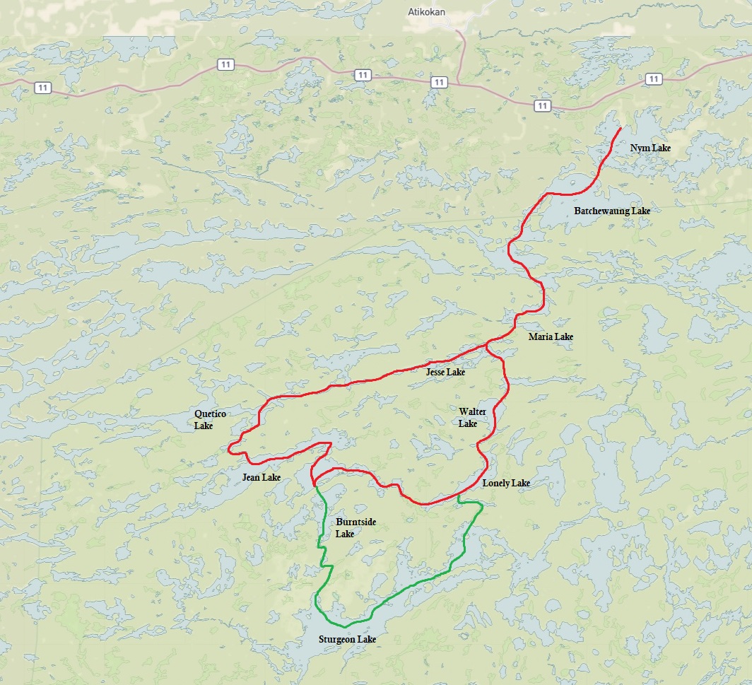
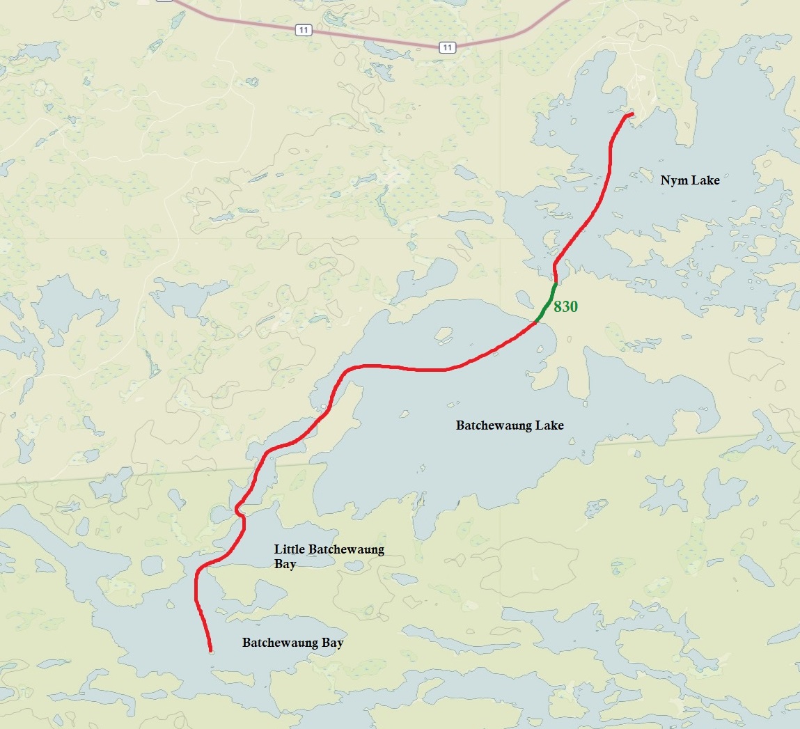
Planned Route
Total Days: 5.5 days
Total Kilometres: 98 kilometres
Total Portages: 25
Total Length of Portages: approx. 7.768 kilometres
Longest Portage: 705 metres (Maria Lake to Jessie Lake)
Route: Nym Lake – Batchewaung Lake – Little Batchewaung Bay – Maria Lake – Jesse Lake – Oriana Lake – Quetico Lake – Conk Lake – Jean Lake – Burnside Lake – Rouge Lake – Sturgeon Lake – Lonely Lake – Walter Lake – Elizabeth Lake – Jesse Lake – Maria Lake – Batchewaung Bay – Little Batchewaung Bay – Batchewaung Lake – Nym Lake
Actual Route
Total Days: 4.5
Total Kilometres: 79 kilometres
Total Portages: 20
Total Length of Portages: 7.807 kilometres
Longest Portage: 1.425 kilometres (Yeh Lake to Lonely Lake)
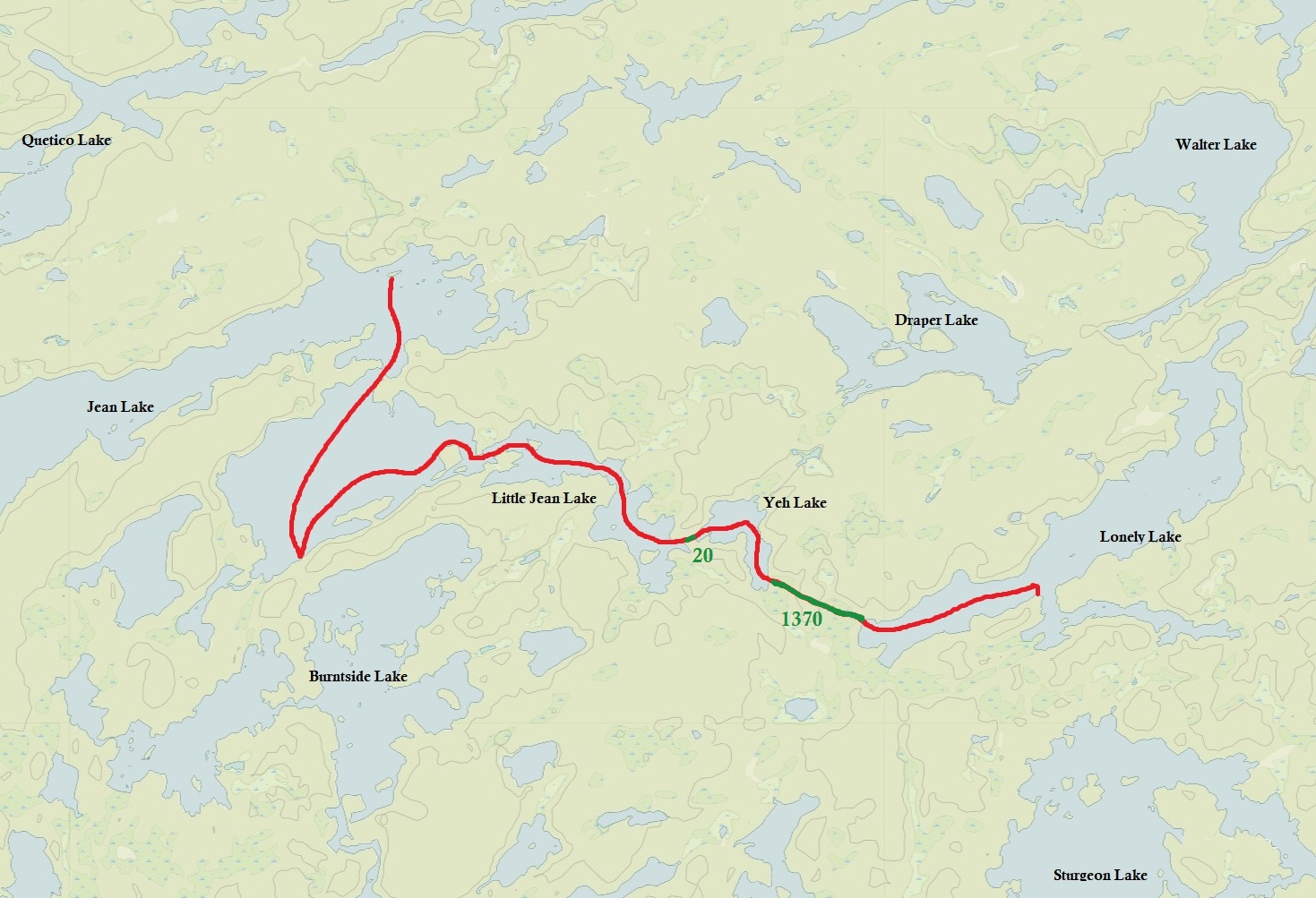
Route: Nym Lake – Batchewaung Lake – Little Batchewaung Bay – Batchewaung Bay – Maria Lake – Jesse Lake – Oriana Lake – Quetico Lake – Jean Lake – Little Jean Lake – Yeh Lake – Lonely Lake – Walter Lake – Elizabeth Lake – Jesse Lake – Maria Lake – Batchewaung Bay – Little Batchewaung Bay – Batchewaung Lake – Nym Lake
Maps Used: Fisher Maps (numbers F-29, F-24, F-28)
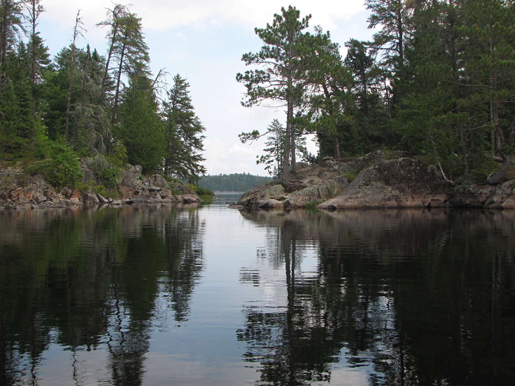
Quetico Provincial Park is around a two and a half hour drive west from Thunder Bay, Ontario. Like Killarney Provincial Park, Quetico is set up as a “wilderness park” though unlike Killarney, there are no signs indicating portages or campsites. Back when we did our route we had to buy the Fisher Maps as those were the only maps we knew that actually indicated known campsites and labelled portages in rods. Since our trip in 2009, Chrismar has also produced a map covering Quetico with portages in metres, while the internet has tons of info including sites taken from the knowledge from other paddlers.
DAY #1: Kingsville, Ontario to Lake Superior Provincial Park, Ontario
We left just before supper on September 10th, and after a two hour nap before Sault Ste. Marie in Michigan along Interstate 75, we crossed back into Ontario and headed north on Highway 17. After a short drive we decided to pull off in Lake Superior Provincial Park for another nap until sunrise. Not an exciting time, just a lot of driving.
DAY #2: Lake Superior Provincial Park to Atikokan, Ontario
We woke up wishing we were already sleeping on the ground instead of in the car which was really uncomfortable. We continued to drive northwest on Highway 17 that included a stop for a late breakfast in Wawa, a stop to stretch our legs in Marathon, and supper in Nipigon at the Husky House. We made it to Atikokan, known as the “Canoe capital of Canada”, in the early evening and checked in at the Quetico Inn for a bed to sleep in.
DAY #3: Nym Lake to Maria Lake
Weather: Sunny. High: 23C Low: 18C
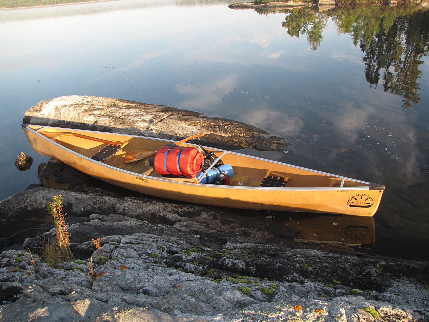
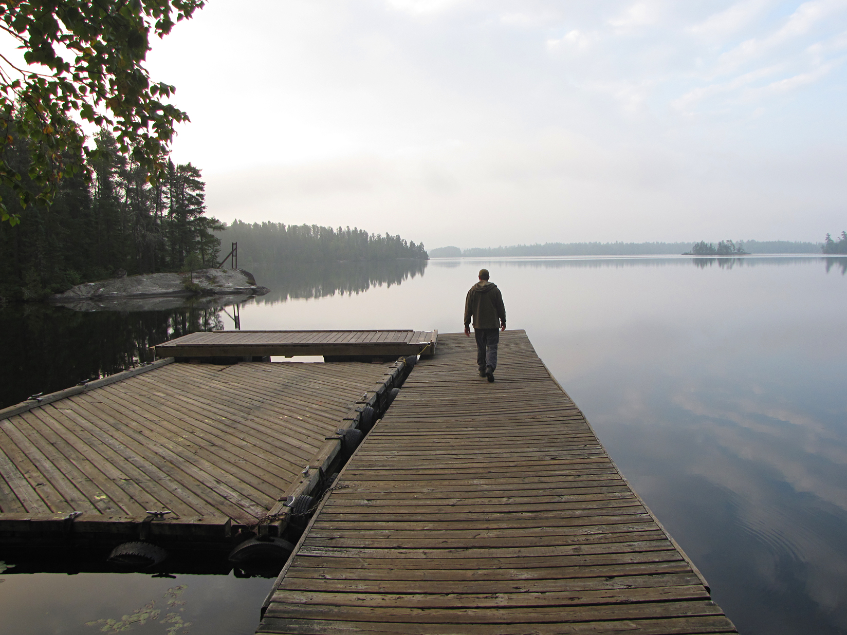
We got our permit this morning at the ranger station located in Atikokan, and also picked up our canoe. Our canoe this year is a Souris River Kevlar Quetico 16. We had it delivered to the Nym Lake launch from the outfitter which was handy.
The Nym Lake launch is not in Quetico Provincial Park. We actually had to paddle into the park, but of course nature knows no boundaries and you would never be able to tell the difference between the Crown Land and the park itself….except for the cottages on the Crown Land.
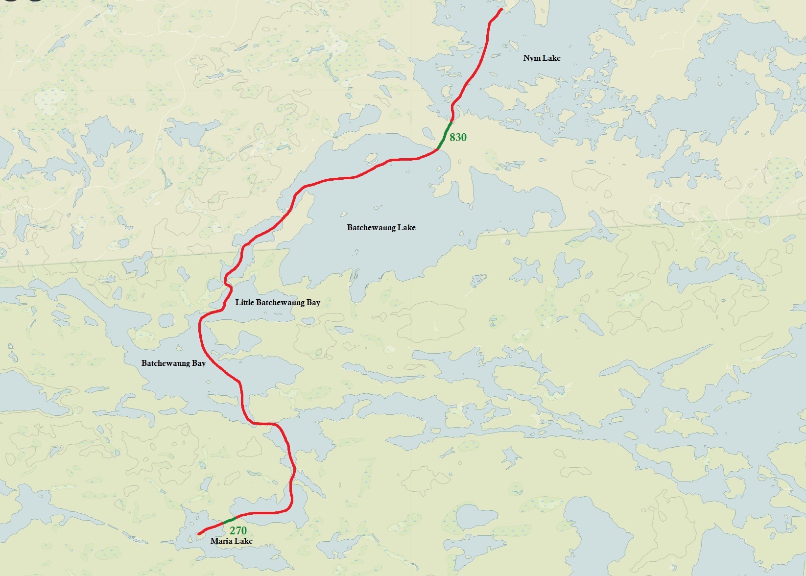
It was a cloudy morning and one of the first things to greet us was a pair of Common Loons. Today we had 2 portages, the first was a 830 metre from Nym Lake to Batchewaung Lake, while a 270 metre after that lake lead us into Maria Lake.
On our way to Maria Lake we remembered reading about a set of rapids that you had to line your canoe through. We braced ourselves (and more importantly our gear) but it ended up being a light current. Maybe in the spring there are rapids?
We arrived at a nice island campsite on Maria Lake, however their was the faint scent of human feces when the wind was in the right (or rather wrong) direction.
Before supper we decided to hop back in the canoe and paddle around looking for firewood as the island was pretty much picked clean. Marianne found a nice log and tossed it in the canoe, but unfortunately it was kind of rotton and it exploded on impact. Aaron flipped the canoe to dump out the shattered log, but in the process he hit the yoke off a rock and broke it. We are off to a great start! Aaron fixed the yoke with a stick and duct tape (never leave home without it) and we collected some wood to bring back to our site. After some freeze dried meals we sat and enjoyed our first night in the park.
Wildlife Sightings: Black Bear (seen on the drive along Highway 17 the day before), Red Squirrel, Common Loon, Black-capped Chickadee, Red-breasted Nuthatch, Northern Raven, Garter Snake, Green Frog, Magnolia Warbler, American Redstart, American White Pelican, White-throated Sparrow, Swainson’s Thrush, Ruffed Grouse, People.
Remember to: Bring our Gatorade crystals (we forgot to bring it! There goes a tiny bit of moral)
DAY #4: Maria Lake to Jean Lake
Weather: Sunny. High: 25C Low: 18C
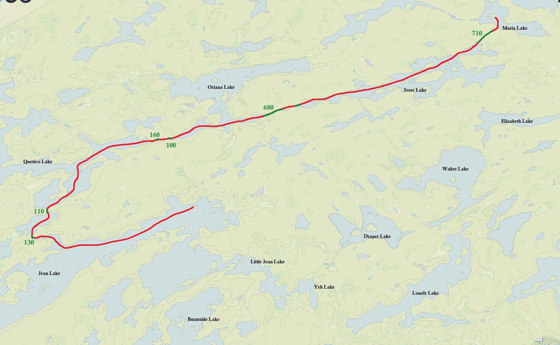
After cleaning up camp we set off into the fog. It was a nice peaceful morning. Our first portage was 710 metres into Jesse Lake. Jesse Lake is a longer narrower lake than the others we have seen so far. We broke for lunch in a marsh. Marianne went exploring, only to end up to her knees in marsh muck, leaving her hiking boots not as waterproof as they once were. We had a difficult time finding our next portage which was 680 metres near a waterfall on Oriana Lake. It ended up being on the opposite side of the waterfall than what was indicated on the map. The information on our Fischer Maps were taken from a 1979 survey, so perhaps the location of the portage has changed.
After a couple of shorter portages (100 metres and 160 metres) we paddled a short section of Quetico Lake. Another 110 metre and a 130 metre portage later we headed south into Jean Lake. It was approaching later in the afternoon and we still had the length of Jean Lake to paddle to get to the island campsite that we had in mind. We finally arrived at the lake’s east end just before sunset. After setting up camp, we had supper, a camp fire, and went to bed exhausted.
Wildlife Sightings: Yellow-rumped Warbler, Dark-eyed Junco, Common Loon, Ring-billed Gull, Red Squirrel, Garter Snake, Green Frog, Crayfish, Grey Jay, Northern Raven
Remember to: Canoe less. (nice to stretch your legs once in a while even if that means more portaging).
DAY #5: Jean Lake to Lonely Lake
Weather: Sunny. High: 25C Low: 17C
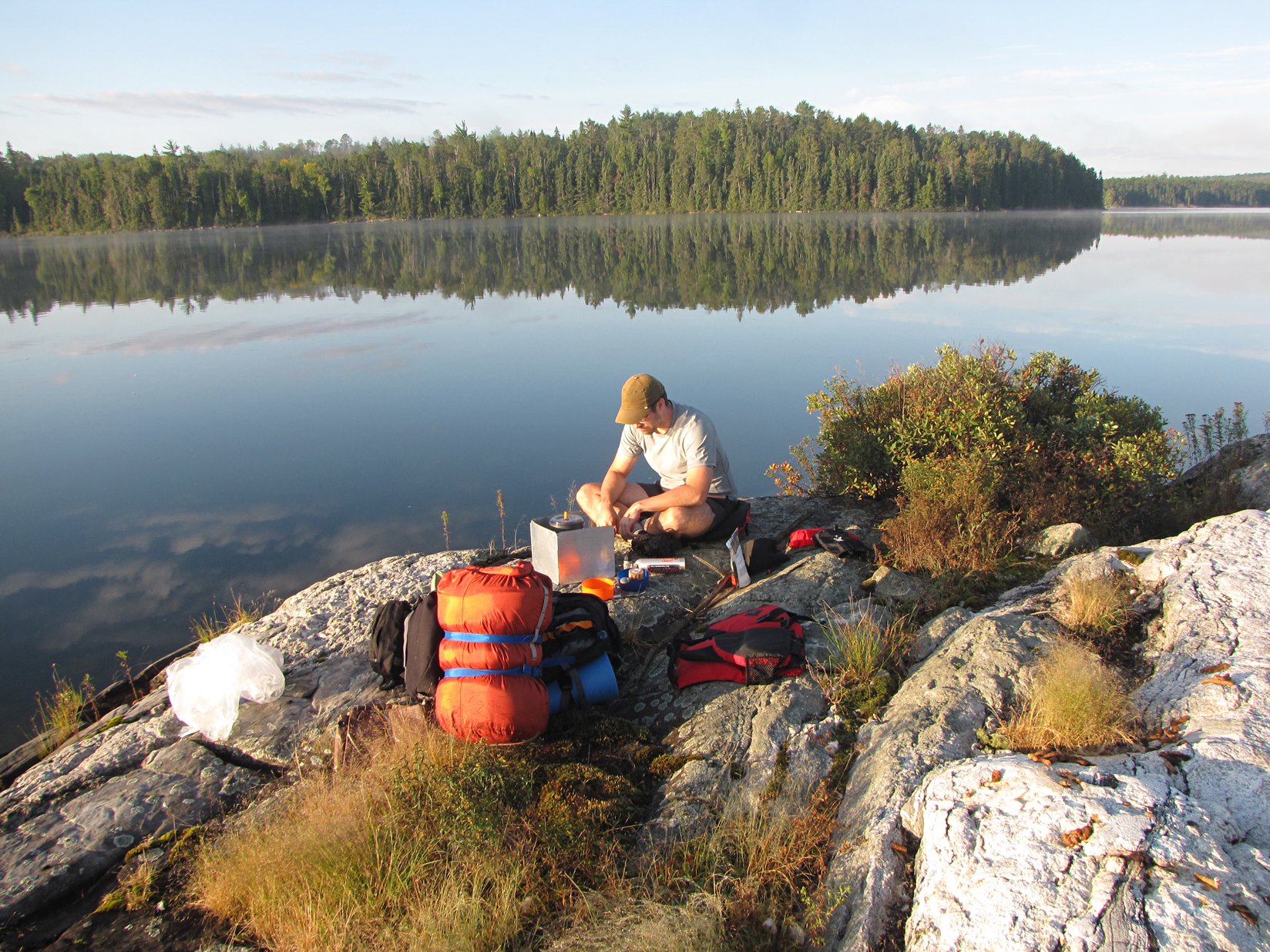
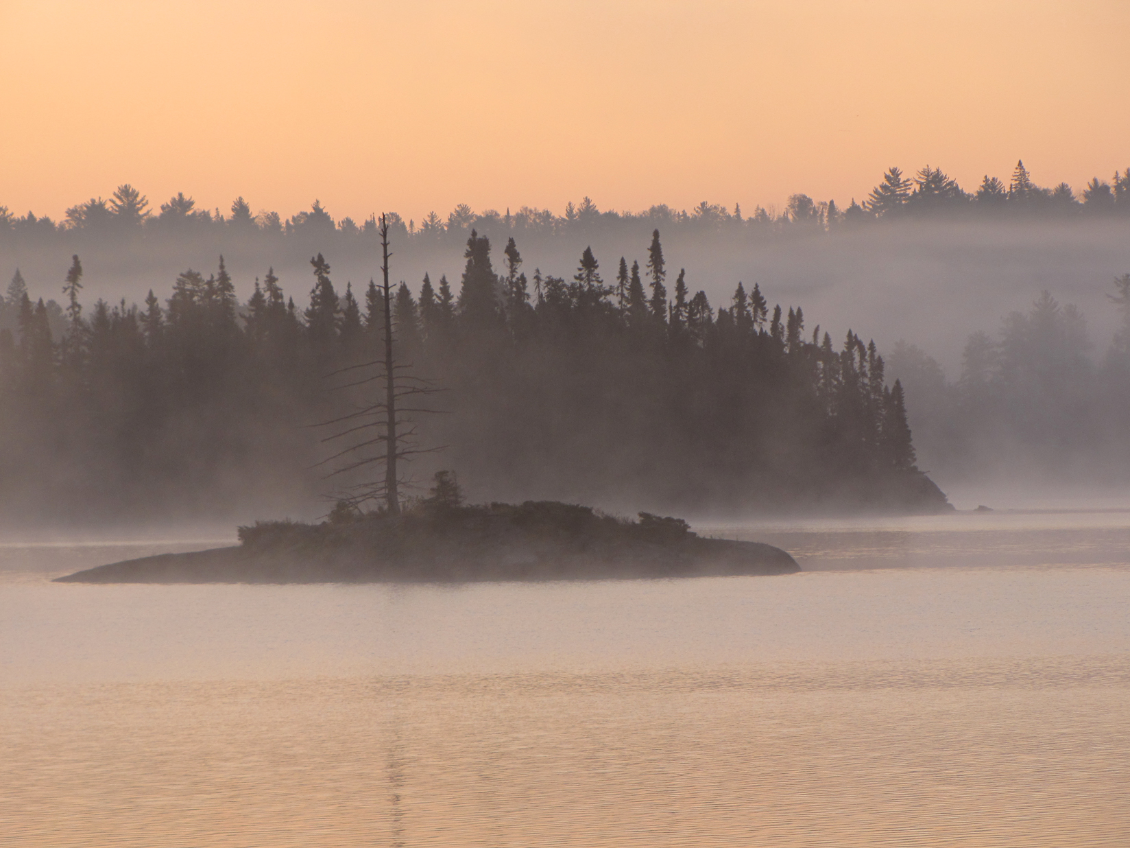
After we cleaned up camp, we decided to have breakfast out on a flat rock that was a short paddle away from our site. The morning was bright and very calm as we slid the canoe into the glass like water. It was so calm that we could actually hear our ears humming as we sat on our small island. If it wasn’t for seeing the mist rising off the water, we could have sworn that time had stopped! It was a humbling experience.
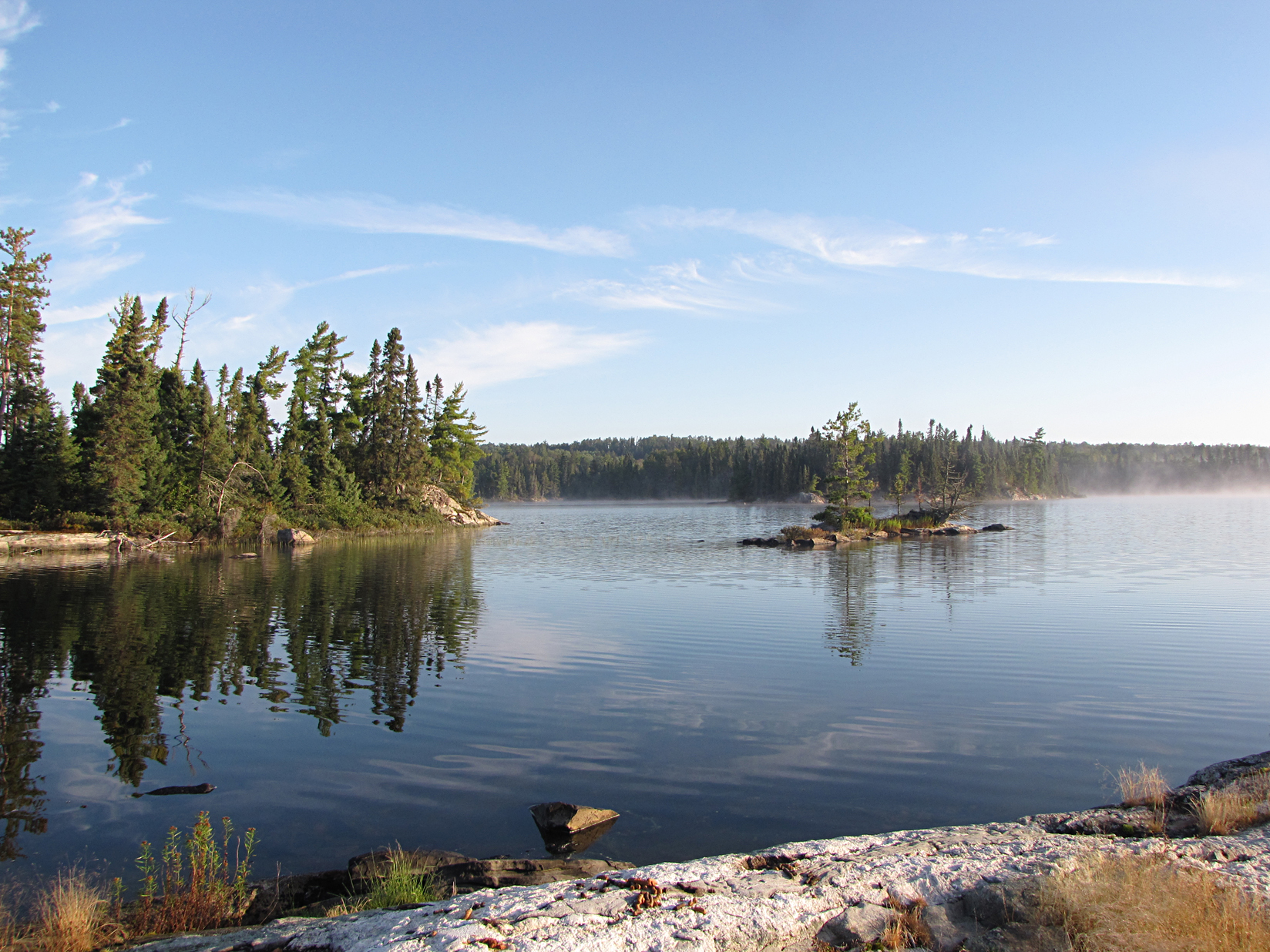
Breakfast was the highly recommended Backpacker’s Pantry Cinnamon Muesli and Milk. This pre packaged meal actually serves 2 people! We noticed that with most freeze dried meals that state “Serves 2” really only serves 1 hungry person. Our flat rock also seemed to be the local hang out spot for Canada Geese as poop littered the island, though not enough to deter us.
We had a route planned out for today. We were to paddle down Jean Lake into Burntside Lake, followed by a few portages after Rouge Lake that would bring us into Sturgeon Lake. From there we would paddle Sturgeon Lake, and end the day at Lonely Lake. A pretty solid day!
We arrived at our first portage of 400 metres at the southern end of Jean Lake, or at least it should have been right there. We looked up and down the area we thought for sure was the location of the portage. After a solid half hour it was getting to the point that if we kept this up we wouldn’t have enough daylight for our planned route! In the end we decided to back track and head east into Little Jean Lake, followed by a small 20 metre portage into Yeh Lake. After Yeh Lake we were faced with what was now our longest portage of the trip. As we approached the portage it was a little odd as there were logs apparently blocking it. Maybe it just wasn’t cleared so we attempted the portage anyway with just our packs while we left the canoe at the shore. This “portage” was brutal as it went through a swampy area and we really had to watch our footing. As we made it to what we thought was the end we breathed a sigh of relief. However, as we glanced to our right we saw our canoe resting on the shoreline only 100 metres away! The only thing we accomplished was making a U-turn! We then turned around and slogged back the way we came, put our packs back in the canoe and paddled further down the shore to find the real portage. Luckily we found it though it was a challenging 1370 metre portage of hills, and a swampy section which required walking on some placed down logs as we made our way from Yeh Lake to Lonely Lake.
We arrived at our site on Lonely Lake with time to relax and enjoy the rest of the afternoon. After a late lunch we moved the fire pit as a 40 foot dead tree with a broken limb was leaning over the original spot. We also felt pretty gross so we decided to jump into the cold lake which is always a heart pounding experience, but man do you ever feel refreshed when you dry off in the warm sun!
We enjoyed a nice evening and didn’t see any other paddlers today.
Wildlife Sightings: Red Squirrel, Ruffed Grouse, Boreal Chickadee, Northern Raven, Garter Snake, Slugs, Blue Jay, Northern Flicker, Downy Woodpecker, Black-capped Chickadee, Red-breasted Nuthatch.
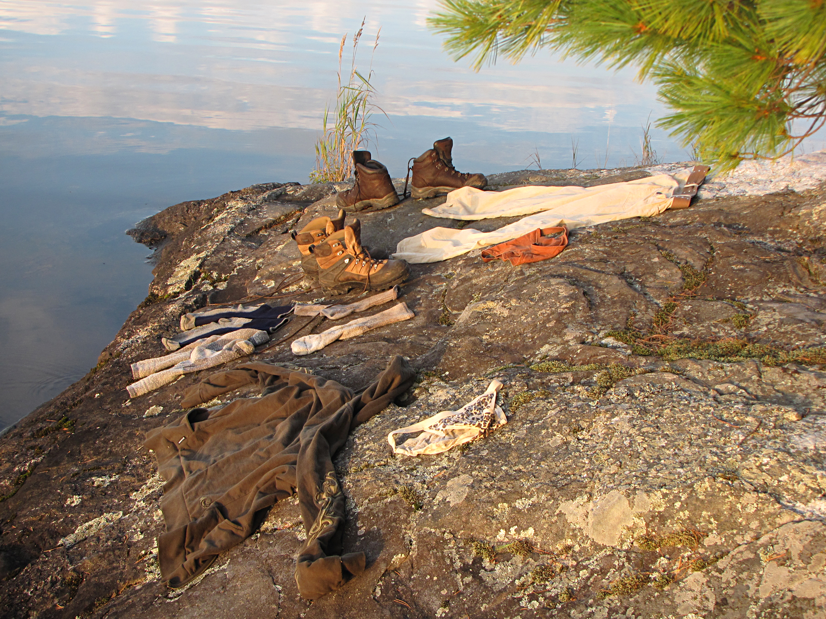
Remember to: Clothes don’t dry overnight, they take all day to dry
DAY #6: Lonely Lake to Batchewaung Bay
Weather: Sunny and windy. High: 25C Low: 18C
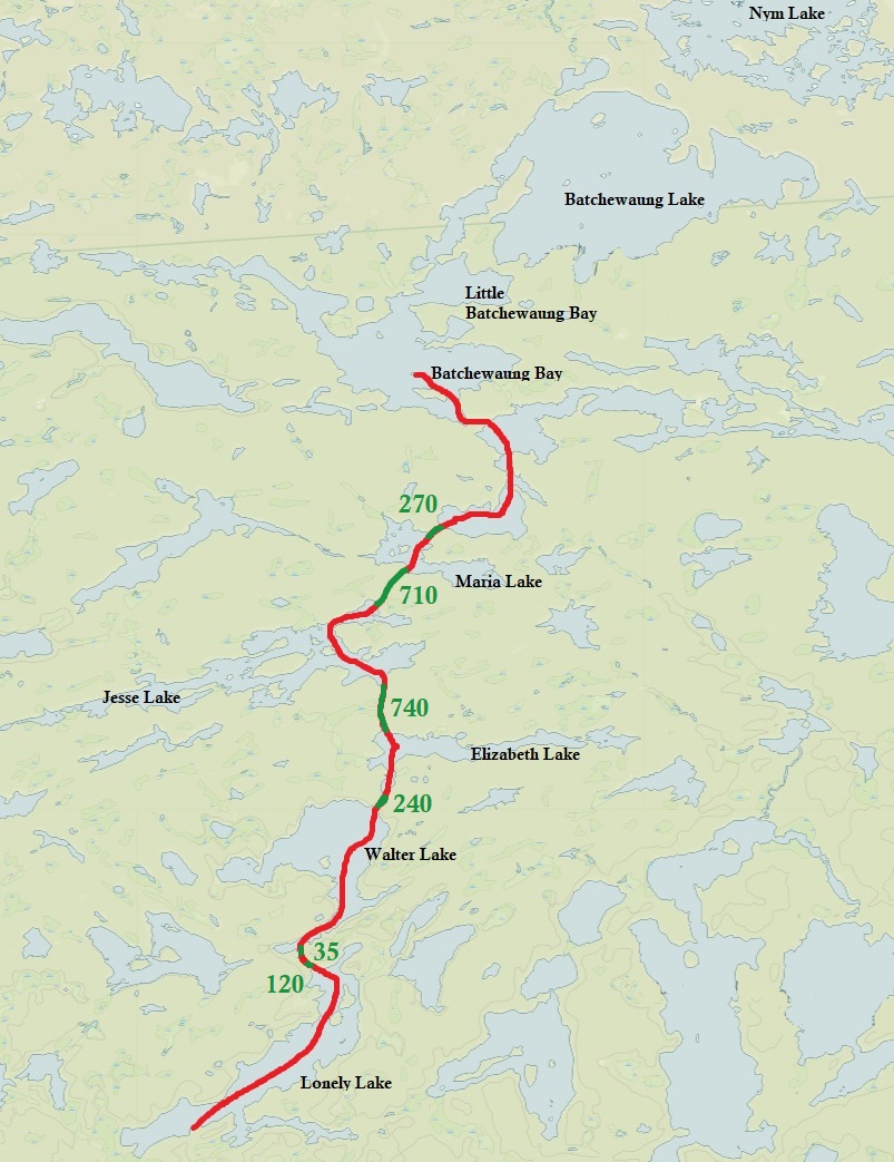

After a big bowl of oatmeal we began to paddle north, slowly making our way back to the launch. We had some portaging to do today including two short portages to Walter Lake, a 740 metre portage from Elizabeth Lake to Jesse Lake, and then back to the familiar 710 metre to Maria, followed by the 270 metre portage back to Batchewaung Bay. Along some of these portages we observed moose tracks. One of today’s highlights while paddling was hearing a big snap followed by a CRASH as we saw a tree fall in the forest near the shoreline. (how poetic). When we arrived back on Batchewaung Bay the dreaded winds that can plague the larger lakes in Quetico began to pick up and we were met with headwinds, sideways winds, and even a lovely tail wind.
Our site tonight on Batchewaung Bay was a tiny island that we could easily see from one end to the other. It was still windy after we arrived and we managed to make a fire for our last night in the park. Tomorrow we paddle back to the Nym Lake launch. We don’t wanna go home!
Wildlife Sightings: Common Loon, Red Squirrel, moose tracks
Remember to: Bring clean clothes for the drive home (we just remembered that we didn’t bring any clean clothes and will have to drive home in our body odour infested camping clothes.)
DAY #7: Batchewaung Bay to Nym Lake launch
Weather: Sunny and windy. High: 20C Low: 15C
This morning was the chilliest morning of our trip. Marianne woke up to a surprise find of shredded toilet paper in her pack that she left partially unzipped.
Breakfast was Mountain House brand scrambled eggs and bacon, and we both agreed that rehydrated freeze dried eggs wasn’t our cup of tea. Our other rehydrated meal was Natural High raspberry granola and milk which tasted a lot better than the eggs. After cleaning up camp it was time to make our way back to the launch.
When we arrived on Batchewaung Lake the north winds met us head on as we paddled this, our last lake in the park. As we arrived at the last portage, at 830 metres into Nym Lake, we took one last look over the open waters and Quetico. Paddling in the headwinds we slowly made our way to the Nym Lake launch, arriving back to the car by 11:30 am.
Quetico Provincial Park was a challenging step up from our first trip in Killarney. We learned a few things while on this trip, and we actually returned home somewhat defeated that we couldn’t stick to our original route. We will return some day to Quetico hopefully with some different, more practical gear, and more preparation.

Wildlife Sightings: Common Loon, Red Squirrel, Northern Raven, Wood Duck, People
Remember to: Make our own dehydrated food for future camping trips as the pre packaged ones are too expensive and take up too much room in a pack. Also, carry less weight for future camping trips. Lastly, 1 double roll of toilet paper is plenty for a week long trip.
Click The Link For More Trip Reports: http://www.backcountrybalkwills.com
